 bNomadic
The following is a page entry from On Road through the trans-Himalayas. To read complete travel memoirs and trip report, please visit here.
Chapter 8 of 22

“Highest inhabited village in the world”
Like every morning, having started the day with Yoga and overjoyed with the activities of the previous day and also of the fact that we had done our bit to get acclimatise with the high-altitude, we checked out of the Kaza-guesthouse after consuming a heavenly breakfast. The plan was to visit the ancient Ki monastery, take the road to reach Kibber, said to be the highest inhabited village in the world and take the narrow link-road to reach Kiato. However, after a mandatory re-check that I conducted with the help of a local taxi-driver at Ki monastery, the plan warranted a change. This was due to the bad condition of the bridge connecting the Kibber and Chicham village over the Parilungbi Canyon. Now we had to turn all the way back after Kibber and reach Losar taking the usual road passing through village Rangrik located on the right bank of the Spiti just next to Kaza. This however meant an additional 30 km almost.

View towards the windswept Tud region; captured on way to the Ki Gompa. Please visit Flickr for more pics
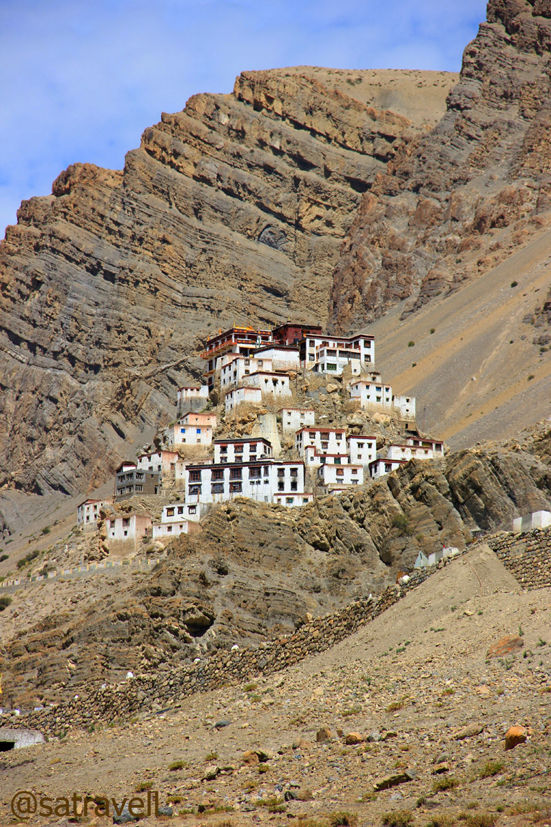
The attractively perched ancient monastery of Ki
Driving on the true left bank of the river, past the iron-bridge that goes to the opposite bank, we steadily climbed on a neatly tarred narrow road to reach Ki village. The attractively perched ancient monastery of Ki, on a rocky hillock just above the village, was visible from the road itself. Within no time we reached the gompa and I was not surprised to see it thronged by both foreigners and domestic tourists. Both were found to be equally eager to photographically-capture various viewpoints the monastic life of Gelugpa sect had to offer. But the perspective appeared to be making a difference which was apparent.
Agriculture fields of village Ki. Fore more images of the region, please visit bNomadic in Spiti
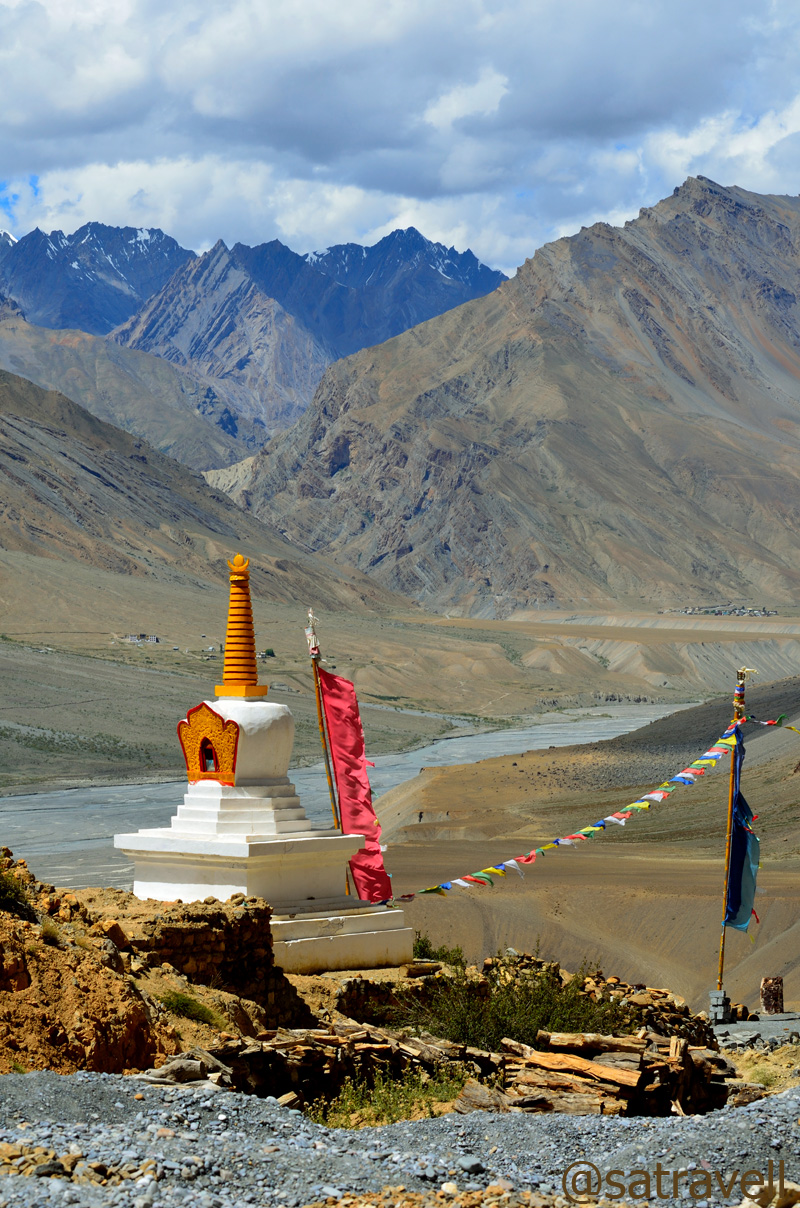
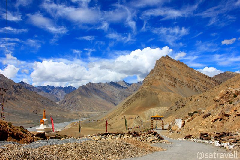
A chorten in Ki complex overlooking the Spiti Valley; Gyundi Gorge is also visible in the frame
Foreigners observed and captured whatever angle the place offered. Ours posed and asked the monks, without any knowledge of their internal hierarchy, to model either with them or depict the essential elements of their routine life such as prayer wheel, robes, tea cups, performing daily chores, etc. The view from the terrace was splendid including that of the colourful formations in the river basin courtesy the Spiti River meandering through various channels. Observing and without bothering about other visitors, I quickly wrapped up my activities at the monastery and continued with our climb to Kibber village. One of the most important learning centres for Buddhists in India, Ki monastery is house to over 400 monks, rare thangkas and artefacts including olden music instruments.
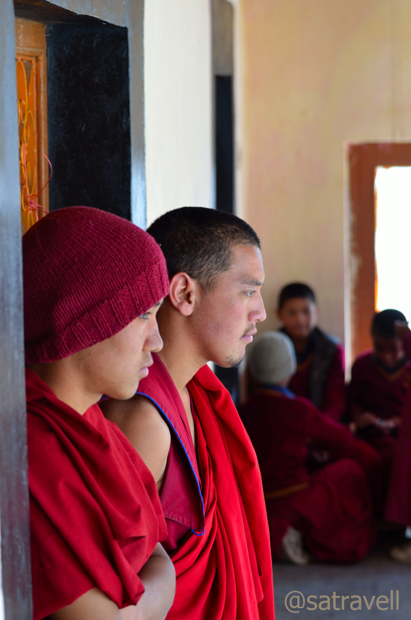
Monks on terrace of the Gompa. Visit Flickr for more

Terrace-view towards Ratang Gorge. Please visit Flickr Photostream for more pics of the region.
Leaving Ki Monastery complex. Please visit Flickr Photostream for more photographs
The tarred but potholed road to Kibber climbed in a series of easy hairpin bends and loops. Like most valley roads, this one was narrow too and was etched on a vertical face of rock. The village Chicham was visible across the other side of the deep canyon. Claimed to be the “highest inhabited village in the world connected by a motorable road and with a voting ballot”, Kibber (4210m) is a friendly village comprising stone-built-houses, with typical dusty contracted paths, located on a picturesque topography. Although lacking the market-comforts of Kaza, Kibber is any day a better place to put up than Kaza. Situated just at the village entrance, Norling Guesthouse is the place to stay and offers good food as well.
Village Chicham separated by the Parilungbi Canyon. Please visit Flickr Photostream for more pics
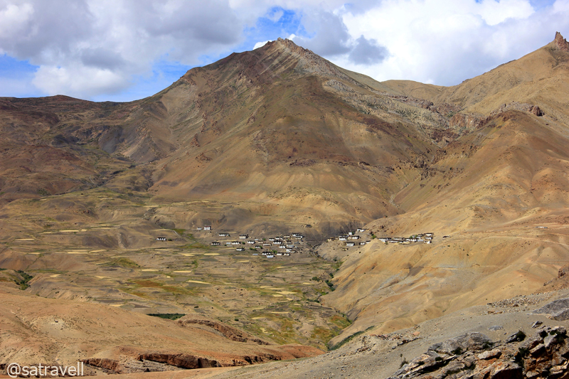
I took a few photographs of the landscape from the village entrance, visited the village gompa – Yaktin Chuling – and subsequently asked for ginger tea at the guesthouse. The highlight of the landscape included the majestic Kanamo peak, pasture country, deep gorge, Chicham village, etc. Sipping the hot tea, we began to dissect the claim of Kibber being the “highest inhabited village in the world connected by a motorable road and with a voting ballot”. Having visited Langza the previous day, much higher in altitude as well as connected with a road, half the claim was clearly off beam. Not only Langza but the nearby village Gette (above 4350m) also enjoys road-connectivity. As regard the issue of voting ballot, almost every village in the country today enjoys such a provision at home. As I wrote this blog, situated above 4400m on a ridge connecting Langza and Komic, village Hikkim was officially declared the highest polling station in the state registering a record 81.14 poll percentage in the recently concluded state assembly elections 2012. So wonder why the tourist-agencies still sell this claim!

Village Kibber. Please visit bNomadic in Spiti for more pics of the region

The 5974m holy Kanamo Peak as visible from Kibber village. Please visit Flickr for more pics
The answer possibly lies in the definition of “inhabited”. With over 350 people staying, the village is provided with a school, post office, civil dispensary and some other departments by the government.
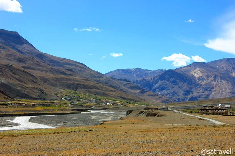
Keeping an eye on a bearded vulture gliding high in the sky, I left the spot but ended up rekindling the desire of possessing a 600mm. Soon we were on our way to village Rangrik (3730m) through the same road. Visible from Ki, Rangrik looked like a tiny patch painted green on an uninhabited river-basin walled by high mountains. Circumambulating the long mani wall, as per the tradition, past the bridge across the river, we reached Rangrik in less than an hour.
Landscape at village Ki. Please visit Flickr Photostream for more pics of the region

Landscape at village Ki comprising agriculture fields and unnamed 6000-ers of Gyundi Valley
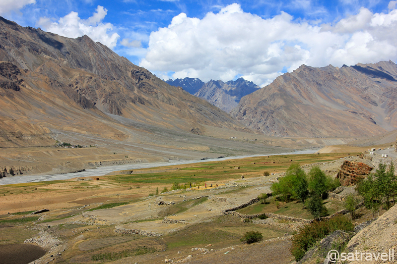
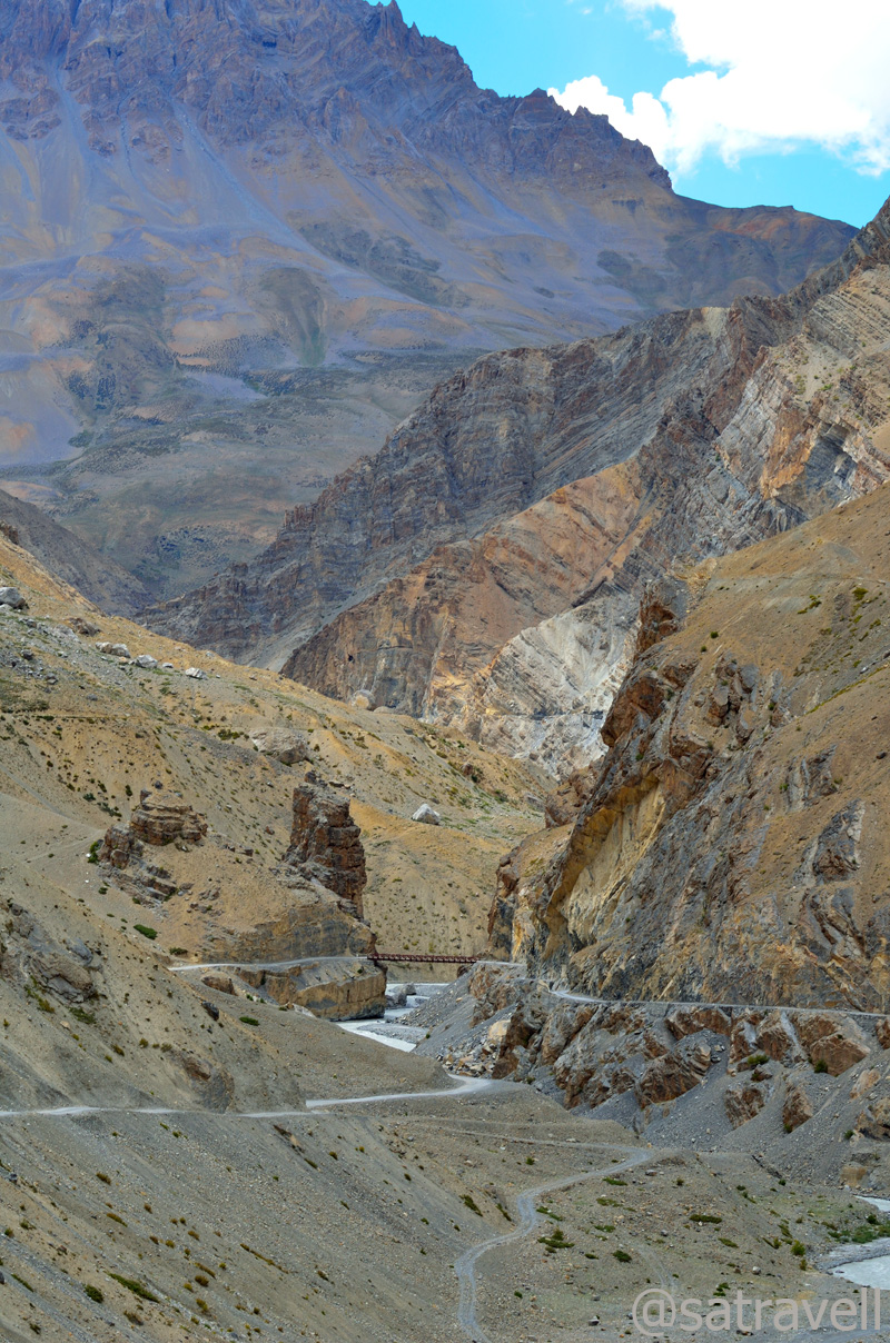
The weather after Rangrik started revealing its cloudiness, bit by bit, for the rest of the trip. Until now what we came across was the bluest sky that we could imagine. Passing through the settlements of village Sumling (3790m), Sherab Choeling monastery at Morang, Hull (3890m) as well as the Gyundi nala, we climbed to reach Pangmo (3950m) where it started drizzling albeit a light one. This windswept upper valley region Tud of Spiti is the least populated of the four regions – Sham, Bhar, Pin and Tud.
The Gyundi Gorge

Final view towards the Bhar region. Please visit Flickr Photoset for more pics of the region

The landscape comprising Chau Chau Khang Nilda captured from near Morang. Visit Flickr for more pics

Landsape at windswept Pangmo flats. Please visit Lahaul & Spiti Flickr Photoset for more pics
Even though we reached Pangmo by 1400hrs, the drizzle made us rethink about our plans to cross the mighty Kunzum La, later in the evening, where weather can get real nasty at times. A typical Spiti afternoon included headwinds, growing in velocity as the day progressed, and sunrays piercing into the skin. The valley receives very little rain round the year and monsoon spells are mostly dry. We didn’t want to take any risk and planned to call it a day at village Losar still a couple of hours away.

Wind-carved hoodoos a little before Kiato. The SH 30 is also visible in the frame. Visit Flickr for more pics
With dark clouds sluggishly making their way into the dry valley, the fabulous landscape at Pangmo encompassed every shade of nature. Past the Chomo monastery, the road scrolled through poplars, pea and potato fields to enter the yellow-coloured moonscape of hoodoos and ascended over loops to cross the other bank of the river and reach village Kiato (3960m). A little further the village Hansa stretched out in the cultivated fields amidst poplars. The village housed quite a few tin-roofed administrative structures as well as a few shops, dhabas, etc.

Approaching modern Hansa village. Please visit Flickr Photoset for more pics of the region

Landscape above Kiamo village in the Tud region. Please visit Flickr Photoset for more pics
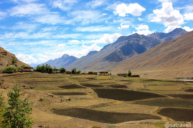
Intermittently descending and ascending to cross a few nallahs, the road to village Losar (4110m) followed the Spiti in an expansive glacial valley. Just before the village, the road crossed the Spiti River to reach its right bank as well as the Dongrimo nala or Suvita Lungpa. The last and final village of the Spiti valley towards the Kunzum La, Losar houses a couple of guesthouses, just a few shops, mud-brick houses painted white, etc. It is even possible to score the Chhang from the guesthouses of this village situated amongst cultivated fields, streams and poplars. Approaching from Hansa, the location of the village made for an extraordinary landscape.
Approaching the uppermost inhabited region of the main Spiti Valley. Visible in the frame are villages of Chichong, Losar and Kholoksar. Please visit Lahaul & Spiti Photoset on Flickr
Without taking into account the government-run rest-houses, the places in the Spiti valley where a night halt could be easily negotiated included Sumdo, Tabo, Shichling, Dankhar, Kaza, Rangrik, Ki, Kibber, Pangmo monastery, Losar, etc.
View and read more on the region at the Lahaul & Spiti Photoset on Flickr
You may also like to subscribe to the email updates, of the remaining chapters, by entering your email id in the sidebar.


Pingback: On Road through the trans-Himalayan Region | bNomadic
the pictures are mesmerizing! like a painting…nice post chief 🙂
Thanks brother for visiting and showering with appreciation. Hope you’d continue to encourage me.
amazing shots!
Thanks for visiting my blog and for the feedback. Hope you’d visit again.
Those villages are beautiful, Especially the clouds in the photographs are really awsome! 🙂
Thanks for visiting my blog and for showering with appreciation. Hope you’d visit again.
Satya
I am sure you have enough beautiful pics for a coffee table book. I love the pics and the description.
Hehe. Thanks for showering with appreciation Madconnect. It was a try. There’s more in the pipeline. Hope you’d continue to encourage me.
Wow..simply loved the images and the description…very beautiful!!!!!!!!
Thanks Sfurti for visiting my blog and for the encouragement. Hope you’d visit again.
Wow!!! What a place to live!!! Thanks for your lovely post with beautiful pictures………
Thanks for showering with appreciation Debopam. Indeed one of the most serene places to live. Hope you’d continue to visit my blog.
Wonderfully narrated and the pictures are beautiful!!
Thanks for visiting my blog magiceye and for the feedback. Hope you’d visit again.
wow, wonderful golden picture gallery of landscapes with colorful clouds.
The village is so much beautiful to live.
Thanks admin for visiting my blog and for the feedback. Spiti is very much an exciting region to stay put. Keep visiting.
Beautiful!!!! In love with your pics 🙂
Thanks Deepti for appreciating the effort. You should definitely plan a visit to the area sometime soon.
The post leaves an impression on the mind with its beautiful pictures of Nature. A great job.
Thanks maveric for appreciating the effort. Hope to improve with each post.
That’s interesting! Love the pics…
Thanks for the feedback admin. Your visit to my blog is deeply acknowledged. Hope you’d visit again.
Very Nice. . .
Thanks. Keep visiting.
beautiful and thanks for sharing
Thanks for visiting and the feedback. Hope you’d visit again.
Great informative post with excellent pictures.
Thanks manish for the feedback. Appreciate your visiting on my blog.
Pingback: Climbing up the slope of Bhar pastures | bNomadic
Pingback: The majestic Bara Shigri and night-drive by the Chandra River | bNomadic
Pingback: The sliding Darung Drung in Zanskar | bNomadic
Fabulous pix! Keep roaming out there, brother, and I am sure that we will run into each other at some point. All the best–
Thanks admin for dropping by. I sure look forward to. Keep visiting.
This is a very good tip particularly to those new to the
blogosphere. Simple but very precise information… Appreciate your sharing this one.
A must read article!
Wow this is simply incredible, what an amazing place to experience! Great post (:
Thanks admin for stopping by and for the feedback. Keep visiting bNomadic for more posts on the region
nice images
Thanks. 🙂 Keep visiting.
Thanks for visiting and liking my blog. your photos are very beautiful
Thanks for the appreciation. 🙂
What a landscape! Great travels. What are you doing to your images? For my money, some of those skies just look a bit too saturated.
Thanks for the feedback. Keep visiting. 🙂
An awesome report – thanks for an enriching read!
Thanks for stopping by. Hope you’d want to visit again. 🙂
This is just out of the world! AMAZING photos and an interesting travelogue. Loved the post.
Thanks Moon. The trip was way more interesting than what I have been able to portray here. Also, the Kailash Mansarovar post we discussed previously is now alive on this blog. 🙂