 bNomadic
The following is a page entry from On Road through the trans-Himalayan Region. To read complete travel memoirs and trip report, please visit here.
Chapter 14 of 22
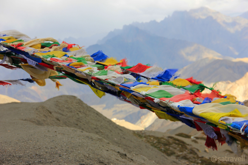
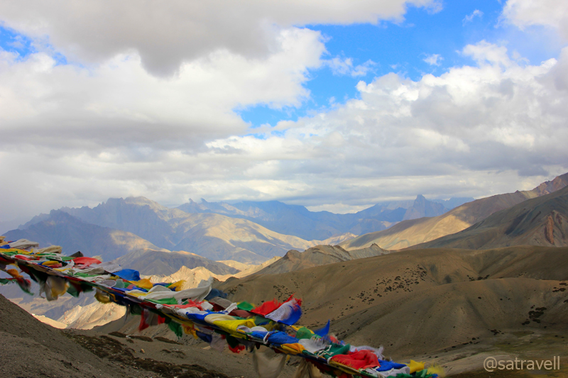
For centuries, Tibetan Buddhists have tied these flags at places of spiritual importance for the wind to carry the divine vibrations across the countryside. Prayer flags are said to bring happiness, long life and prosperity.
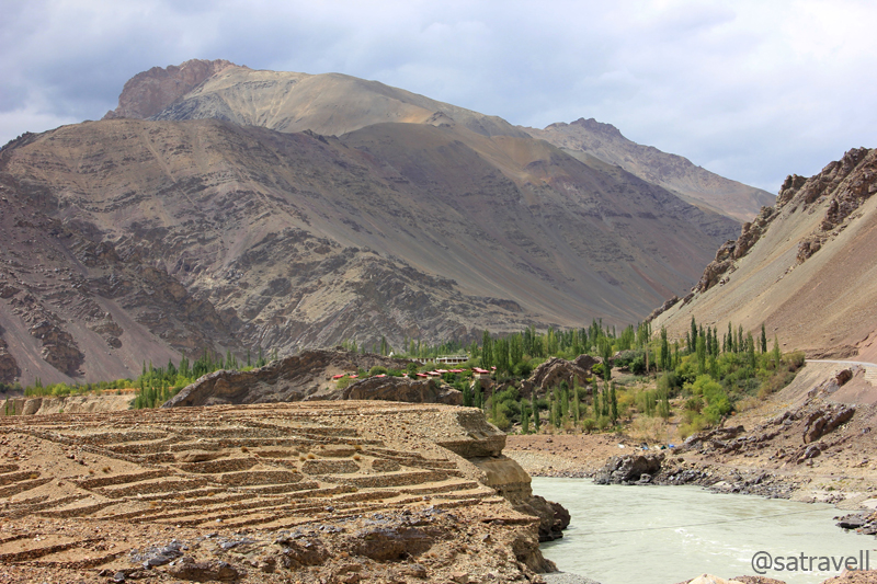
The following morning, we were again on the Treaty Road after crossing the Indus at Saspol. From the Alchi bridge the neatly tarmacked NH 1D is a fanciful drive passing through multi-coloured rock-debris slopes alongside the green-blue Indus River. Crossing Wuleh and Akheur nalahs to reach village Nurla (3019m), the highway is alertly secured by the constant Army movements. Set besides a roaring Dangdong Tokpo, the eateries of the village are a good place to relax and munch on to stuff for the day’s adventure ahead. The village is also a road-head for the popular Likir – Tamesgan trek, an erstwhile trading route.
Landscape near village Nurla on The Treaty Road. For more pics and info on the region, please visit Flickr Photoset

An important landmark at the forked junction at village Khaltse on The Treaty Road
Ahead the road meanders on the same bank to reach the forked junction of village Khaltse (3088m). Marked by old houses, chorten at the roads-junction, a police check post, the historical village houses many ancient rock-carvings as well as inscriptions dating back to first or second century. Crossing Khaltse, we enter a region where influence of Buddhism begins to fade away giving way to Islam.
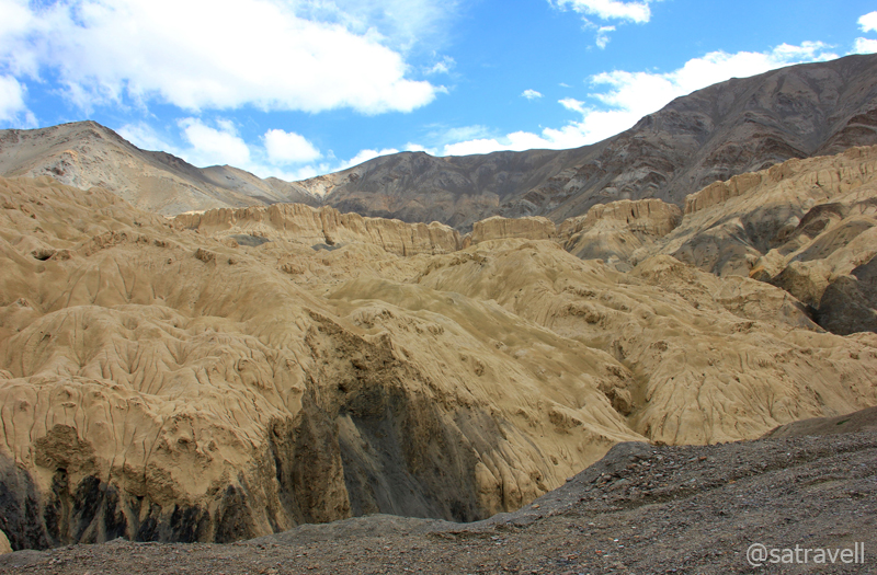
Famed moonscape, comprising alkaline soil, of Lamayuru. For more pics of the region, please visit Flickr Photoset
The right-hand road leads to Dah-Hanu, a little-visited area of Dards that requires Inner Line Permit for foreigners. The left one meanders through a small boulder – strewn valley before partying ways with the Indus, which heads off for Pakistan (POK). The NH 1D turns alongside the Wanlah River when the popular Jalebi bends also called Hangro Loops comes into view high above on the mountainside. From the diversion ahead, the bear left passes through the fabulous characteristic sandstone moonscape, which Lamayuru (3540m) is famous for, and reaches the village tea shops. The right turn, the original as well as longer route to Lamayuru, climbs over a series of 23 bends through an extraordinary landscape of a mountain-face of buttery-yellow sandstone whittled by the elements into vortexes and mounds, rivulets and caverns.

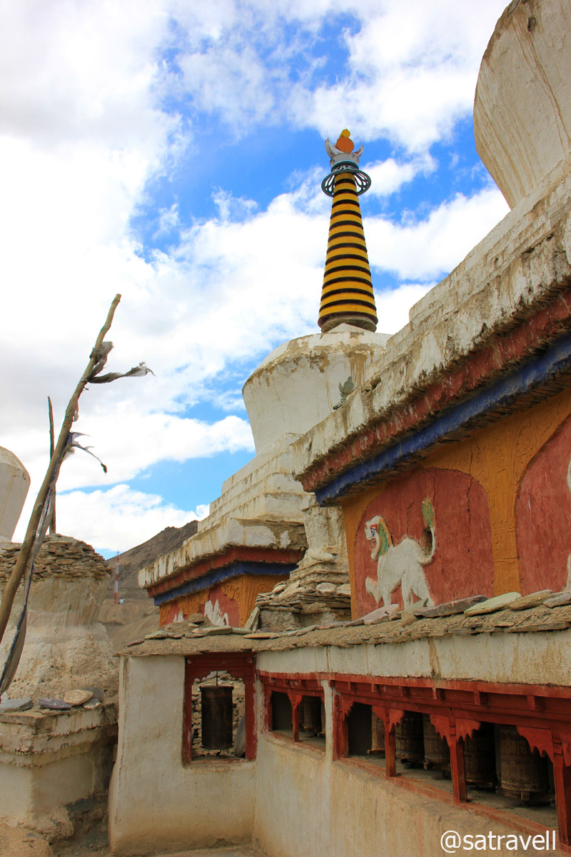
Today’s Lamayuru Gompa belongs to the Drigung-Kargyudpa, a red-hat sect. More of Lamayuru at Flickr Photoset
Founded in eleventh century, the Lamayuru Gompa – splendidly perched upon a hilltop – gazes down the village spread out on the slope around the highway. The entry ticket for the monastery was priced at Rs20 for domestic visitors. “May all sentient beings are quells of obstacles and fulfils all the desires and happiness”, read the message on the printed-ticket. Claimed to be one of Ladakh’s oldest religious sites, Lamayuru is also known as Yung Drung (meaning swastika) and was a centre for the pre-Tibetan-Buddhist animist Bon faith.

Lunarscape from the terrace of the Gompa. More of Lamayuru and the region at Flickr Photoset

In the courtyard of Lamayuru. More pics and info on the region at Flickr Photoset of Ladakh

Inside the cave which the Naropa (1016 – 1100) used as his place of meditation. More at Flickr Photoset
It was still an early afternoon when the ferocity of the chilly wind made it tough for us to remain outside and roam around the area. Nevertheless we spent some useful time around the monastery area as well as olden chortens. From the windows of the monastery, the moonscape appeared like a human brain (eeek!). Interconnected with a footpath, a few guesthouses, homestays and restaurants are interspersed within the village that suits different pockets. From the village, a mule trek leads to Padum in Zanskar and takes approximate ten days to cover the distance.

Lamayuru Village
Ancient chortens and prayer wheels at Lamayuru

View towards Fotu La from the terrace of the Monastery. More from the region at Flickr Photoset

View towards Lamayuru captured en-route to Fotu La
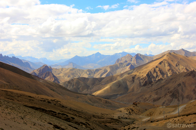
From Lamayuru, the spectacular 15km ascent to the highest point of The Treaty Road, the Fotu La (4108m) coils up through a barren terrain of plump mountains and rocky outgrowths. Both Lamayuru and pass are visible in opposite directions from the neatly tarred highway. Atop the pass, there is a Prasar Bharati television relay station as well as fluttering prayer flags tied from the BRO board. The ranges observable from the pass on both sides are the forerunners of the Zanskar Range.
Southwards view from the Pass. More of the region at Flickr Photoset of Ladakh
Bearing witness to numerous clashes between Baltis and Ladakhis, the Northwards view from Fotu La. Visit Flickr
The highway on the other side leads past a beautiful gorge into the cultivated valley of the Kanji River or Sangeluma Chu. The 38km stretch of the NH 1D between the Fotu La and the Namika La passes through the village Hiniskut (3654m), Bodh Kharbu (3458m) and Khangral (3489m) alongside the Kanji. Apart from the views, the ruins of an ancient fort spread over a cliff while descending the pass are worth noticing.

Not to be missed, the motivating BRO signboards. More of the region at Flickr Photoset
Reflective of cultural transition, all through this valley the differing faces point towards divergent ethnic groups including the slender, bearded, hazel-eyed Kashmiris and the shorter, broader cheek-boned Ladakhis. The all-in-one expression Jullay feels unexpectedly out of place and it is around here when Islam starts gaining an upper hand in terms of follower-count. Not only that even the architecture point towards the same as most homes are bare instead of whitewashed mud brick and Urdu is often noticed scribbled on walls. Often misleading, the road-signs are a luxury to source information from. Don’t be surprised if you get chased by children asking for toffee or pens.

Landscape near village Bodh Kharbu in the Kanji Valley. More information of the region at Flickr Photoset
Literally meaning Pillar of the Sky Pass, the Namika La (3828m) lies at a distance of 10km from Khangral past the police check post. Although, the potholed stretch near the top posed some minor troubles, the climb was as serene as the drive through the valley. Noticeable from the top, the landscape all around comprises smooth-edged plump hills marked by rivulet-linings as well as a random mild coat of vegetation contrasted by the jagged peaks and spires of the Zanskar Range immediately behind. Moving ahead, the descent into the Wakha Valley was a smooth affair as the neatly tarred highway snaked on the slopes of rippling sub-ranges.
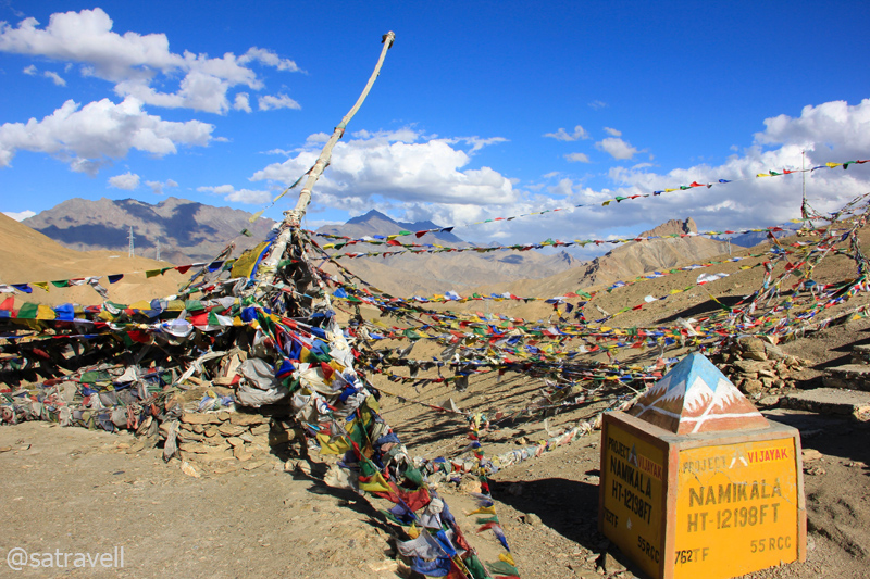
Fluttering prayer flags atop the 3828 m Namika La. For more pics and info of the region, please visit Flickr Photoset
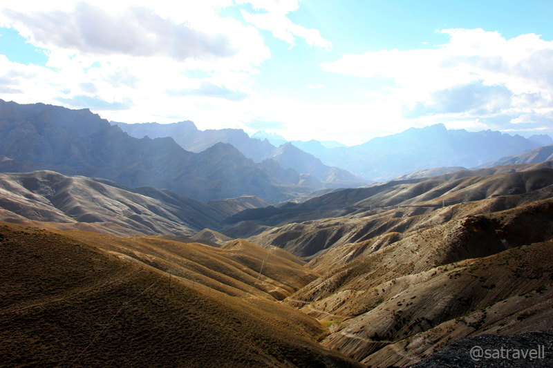
Descending into the Wakha Valley from Namika La; notice Zanskar outliers. For more pics, please visit Flickr
Descending the pass, we reached the tail-end of the Buddhism on the road to Kashmir valley from Leh. Famous for its eighth-century rock-carved Maitreya Buddha, the historical village Mulbekh (3304m), 16km from the top, marks the cultural boundary after which the Islam is the predominant religion. The ancient rock – carved Buddha is located alongside the highway marked by poplar greenery and tea shops, restaurants and guesthouses. Reached by a steep footpath 200m up from the highway are the twin-gompas – Serdung of the Drugpa Kargyud order and Gadentse of the Gelugpa order; both situated in the Palace compound of the erstwhile rulers of Mulbekh.
The view from the monastery comprises the Wakha River zigzagging through the fields against a backdrop of russet mountains crowned by rock-structures. The village houses are located a few metre ahead of the statue. However, in the recent times, Mulbekh has gained popularity for its Maitreya Buddha, rock-carved in the pre-Tibetan Buddhist style prevalent in the region during those times.

The Maitreya Buddha at Mulbekh

Coming from Leh, Mulbekh also serves as the tail-end of Buddhism on The Treaty Road. More at Flickr Photoset
Ahead, the 40 km stretch of the highway descends alongside the pretty vegetation-rich narrowing Wakha valley to reach the main-market of Kargil (2728m) past the village Shargole, Pashkum (2903m), voluminous army encampments as well as crossing Suru River. Located 5km ahead of Mulbekh, a small but ancient Gelugpa-monastery – Shargole is visible from the highway itself. Tucked in an alkaline-sedimentary mountain-face, the monastery houses some interesting frescoes, an icon of Avalokiteswara as well as three images of Tara. The cantilever architectural quirk makes it an object of curiosity among natives too.

The Monastery of Shargole. More at Flickr Photoset
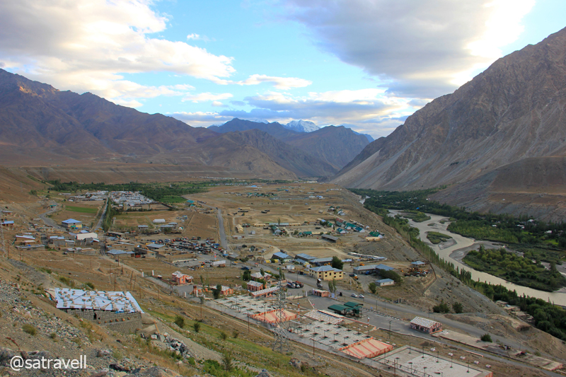
The mountains rising 10 km to the North, as the crow flies, also known as Kargil Heights are the site of the 1999 Kargil War with Pakistan. While the people on streets talked of Islam, the surroundings and the mountains boasted of a Buddhist background. It took some effort to fix an accommodation for the night as most of the available options either appeared fishy or were overpriced. Immediately after checking into a hotel, which exceeded our budget, I headed out to explore the market. Marked by a huge military presence, crowded streets, women with headscarves walking in groups and fumes emitted by vehicles amidst minaret’s muezzin-call, the market comprises tea, bakery, kiryana, meat, vegetable, fake-electronics shops, etc. manned by owners sitting cross-legged and watching the world go past. Even though Kargil is the region’s second-largest settlement, it is clearly far poorer than Leh and offers very limited and most basic tourism facilities. The state-owned Jammu & Kashmir Tourism Development Corporation (JKTDC) is often a shoddy affair giving out signs of distrust.

The second-largest settlement of Ladakh region: Kargil. More of the region at Flickr Photoset
After dinner, I headed towards the market to enquire about the status of the route ahead to our next destination – Padum, the headquarters of Zanskar Valley. With only a trekking map in hand and lacking any catalogued tourist/ traveller-information, taxi-stand, I thought, would be the best source to procure information. As I began chatting with a mature-looking taxi-guy, a few taxi-union guys instantly popped up and surrounded me. Each had his own opinion to present. A hired-taxi would charge almost Rs 11,000 for a return trip from Padum. A few suggested me to carry a minimum of 30L extra fuel for a rounded trip to Padum, as the only fuel-station in the area was in Kargil. Connected with an unmetalled and rocky motorway, the distance between the two stations is 237km. Some of them advised not to go in an Innova, because of its low ground clearance, and hire some other vehicle instead. As per the Union’s directive, a Leh taxi is not allowed to venture into Zanskar valley and similarly a Kargil taxi is not allowed to roam into the areas beyond Leh. I patiently listened to what they had to say and analysed each of the viewpoints later on before going to bed. Up there, factors like road conditions, distance as well as time depend on whom you talk to and the only way to find out is to go and physically examine.
The modern and military township of Kargil. More pics and info of the region at Flickr Photoset
Likewise, it is quite likely that at some point in the trans-Himalayan region, you may come across rumours related to landslides, washed-out bridges, closure of the road ahead, etc. Similarly, you may bump into teams blasting the mountainside to carve or widen the road. Such team-members usually carry a red or white piece of cloth tied on a stick to communicate across a distance. Always make it a point to double-check and get reassured before believing in them. Unskilled as they are, somebody might just be waving a wrong coloured flag.
In the meantime, the cousin carried on with his routine affairs in the room. Excited as we were about the next day’s journey through the copper land, sleep was hard to come. The room here was equipped with a TV and by way of news we did not miss the opportunity to catch up with the world that seemed even more materialistic and greedy.
View and read more on the area at the Ladakh Region Photoset on Flickr
You may also like to subscribe to the email updates, of the remaining chapters, by entering your email id in the sidebar.


Pingback: The oldest surviving Monastery of Ladakh | bNomadic
Pingback: On Road through the trans-Himalayan Region | bNomadic
Excellent write up and images!
http://www.rajniranjandas.blogspot.in
Thanks Niranjan for visiting my page as well as for appreciating the content. Hope you’d find it useful.
wonderful images and good insight for my future travels to this region 🙂
http://www.myunfinishedlife.com
Thanks admin for revisiting my page and for the feedback. Hope you’d find the contents to be of some use too.
bro when are your revisiting .. ?? how much funds do I need to arrange ??? I will go mad if I keep visiting your posts .. I want to experience this trust me
I have not really finalised anything as of now but I plan to be there as early as possible. Do not bother much about funds. You could do this trip on your own in less than 10K for three weeks. Will shout whenever the plan gets finalised.
better be with someone acquainted with the terrain
Looking forward to meeting you soon.
🙂 me too
You left me breathless after this trip to heaven. When are you organising a trip , I am coming. I was planning to do the Chadar Trek in winter and after this, I want to move bag and baggage there. Please get t his account published. Simply marvellous, I read them all…
Thanks Sangeeta for visitg my page and showering it with appreciation. I am glad you liked my posts and sincerely hope you’d find them useful too. Thanks for reading, writing in and encouraging me to write ever more.
These prayer flags never fail to cheer me up. Can I also add that I am so jealous of you! 🙂
Hehe. Thanks for the encouragement. Glad you liked them. Hope you’d want to visit again.
You are very welcome! And no I have never been to this part of Himachal / J&K! If you plan a trip with fellow travel enthusiasts, please include me too. Have been day dreaming about exploring more of Himachal and Leh Ladakh since ages now. But a bit amateur to venture out on my own. 🙂
Sure will do. Always and ever available for any kind of travel-related help. Keep visiting. 🙂
After looking at your pics I am sure I will revisit Ladakh. Spiti too 😀
Thanks Mridula. I am glad you liked the post. Hope you’d find the updates useful too.
Nice Post and Good Clicks. . . 🙂
Thanks for visiting and for the feedback.
Sounds a famous pilgrimage destination! all pictures are beautiful and attract to visit. thanks for sharing your experience with us through this great article.
here my other main blog,
http://travelagent-india.blogspot.com/
Thanks for revisiting my blog. Hope you’d find the content to be some use to you. Keep visiting. Thanks for the encouragement.
Amazing 🙂
Thanks Swati.
The Wakha Valley looks amazing! I need to start planning a trip soon.
Thanks for visiting my blog admin. Hope you’d find something useful on this blog and would want to visit again.
colorful and beautiful 🙂
Thanks for visiting and for leaving with a feedback.
Pingback: Driving alongside Glaciers in Copper Land | bNomadic