 bNomadic
The following is a page entry from On Road through the trans-Himalayan Region. To read complete travel memoirs and trip report, please visit here.
Chapter 18 of 22

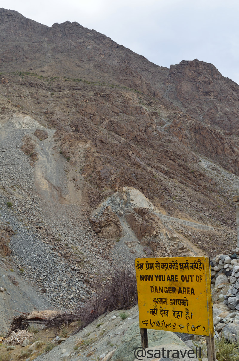
Caution: You are under enemy observation; the closet NH1D brushes the LoC. More of the region at Flickr
The traffic on the Zoji La is managed by the local police in association with the administration. The time earmarked for the vehicles to cross the pass from Kargil-side is in the morning from 0500 to 0800 hrs after which the movement depends upon the road traffic. In peak season one may have to wait for over five hours to get a permission to move to the other side. In this way, unlike other trans-Himalayan gateways from plains such as the Rohtang La, the Zoji La is better managed. The Srinagar-bound taxis usually start from Kargil early in the morning around 0200 hrs to be able to cross the pass within the specified timeframe and avoid any rush. Moreover, the Zoji La is, thankfully, devoid of any mad tourist rush like that on the Rohtang La. The vehicles plying on this section of the Treaty Highway chiefly comprises defence, administration, transporters ferrying supplies, travellers or tourists, etc. Up till the Zoji La, the entire stretch of the highway is dotted with army encampments, bunkers or war memorials.
BRO Signboard on NH1D
Even if the traffic-movement on the pass is better managed, crossing this gateway to Himalayas may prove to be a tricky affair. Frequently changing weather, landslides, melting snow, falling stones, slippery slushy motorway, etc. collectively make the Zoji La (3548m) one of the most treacherous passes to cross. Although, it might have been a risk, we deliberately started from Kargil after the sunrise at 0700hrs just so we could admire the beauty of the terrain. The distance between Kargil and Drass is just 60 km.

Landscape near Dhandal and the Drass River. More of the region at Flickr Photoset
Ahead of Kargil, the highway passes alongside the left bank of the Suru, which confluences with Drass River, past the Silkchey check post near village Kharul, forming the Shingo River that flows across the Line of Control (LoC) to merge with the Indus. Past the confluence, the heavily-guarded NH1D climbs upstream along the azure Drass River on its right bank. A few kilometres ahead, the green-patch of the valley, marked by poplars and willows on both sides of the river, is the closest the highway brushes the LoC. Here onwards, the nicely tarmacked road gradually ascends, on the slopes of the Great Himalayan Range, in the shadow of the enemy bunkers and outposts.
Topographically, the desolate Drass valley is a featureless desert wedged between sedimentary mountain-rocks as well as peppered by groves of willows and poplars. Past the confluence of the Drass with its tributary Shiga River, which rises from the western heights, the highway passes through village Kharbu (2825m) as well as village Shimsha (2876m) after which it crosses over to the opposite bank and passes through village Thasgom (2912m), Yashgun, Dhandal (3008m) as well as Thusgo (3116m) to reach Drass (3250m) in about three hours. A few kilometres after village Dhandal, a kilometre-long trek will take you to stones said to be associated with the Pandavas.
Nearing the settlement of Drass; average winter temperature still hovers around -40 deg C

Greens of Drass against the backdrop of Tololing Range, alone responsible for a majority of the total casualties
Drass Warriors; the war heroes memorial is profusely advertised all along the NH1D. More at Flickr Photoset
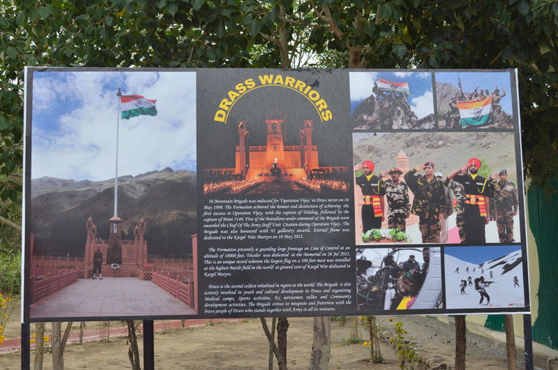
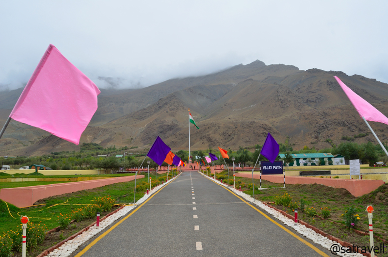
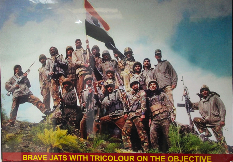
Ahead of Dhandal on the highway itself, nestled in the lap of Tololing Range lies the Kargil War Memorial, so profusely advertised all along the NH1D. Commemorated in honour of the brave soldiers who sacrificed their lives to regain the command of the winter-vacated high-outposts which had been occupied by Pakistani intruders, the memorial is a major tourist attraction nowadays. Lasting over 60 days in the summers of 1999, the war resulted in heavy casualties on both sides including 527 Indians and 453 Pakistanis. Codenamed as Operation Vijay, the war that posed significant logistical complications for both the sides, proved to be an eye-opener for India in many ways. The aftereffect of the wakeup call given by the sudden high-altitude warfare meant newer as well as better roads, superior equipment for defence personals, regrouping of defence deployments, newer airstrips and hoards of other strategic measures to effectively keep a check on enemy’s activities.
Vijayapath in commemoration of Operation Vijay reflects a saga of Raw Courage and Supreme Sacrifice

शहीदों की चिताओं पर, लगेंगे हर बरस मेले
वतन पर मिटने वालों का, बाकी यही निशान होगा।
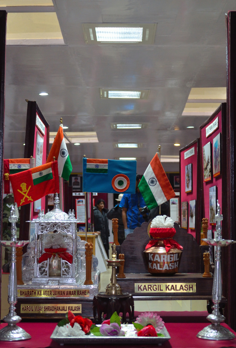
Constructed with chitter-stone, the memorial (3117m) at Drass consists of every facility a tourist would need including ATM, wash-rooms, cafeteria, parking, lush green lawns, war museum, souvenir shop as well as names of the soldiers, who lost their lives fighting the enemy, inscribed on an imposing memorial-wall. Greeted by Agnipath, a motivating poem by renowned hindi poet Sh Harivansh Rai Bachchan, at the entrance of the war-museum, which showcases pictures of soldiers, war documents as well as recordings, equipment as well as gear seized by the Indian Army from the enemies and other war-related information, serves as a touching testimony to the sacrifice made by young soldiers of the Indian Army.
…And how can man die better than facing fearful odds, For the ashes of his fathers, And the temples of his Gods
From the Tiger Hill Café of the memorial-complex, grabbing a few hygienically-cooked bread pakoras, which made for a time-saving brunch alternative, we moved ahead to Drass. A couple of kilometres ahead, an under-construction motor-trail to Sankoo, over the Umba La, diverges the highway towards the river side. Ahead the NH1D is dotted with army encampments as well as sarv dharm pooja sthals before reaching the market of Drass.
Enveloped in dark clouds, is the Tiger Hill (Pt 4660 m). More of the region at Flickr Photoset
Consisting of a few shops, basic restaurants and tea shops on the highway as well as a slovenly JKTDC tourist bungalow-cum-office, the town has recently become surprisingly popular for war-tourism. In a dim hope of procuring a state map, I entered into the JKTDC office. My opinion about the pitiable state of affairs at a state tourism board’s property got another endorsement immediately as I entered the dilapidated office with ages-old information wall-hangings and untidy furnishings. Even after spending close to fifteen minutes in trying to figure out the era-old map hanged by the cabin of the concerned official, I failed to discover any human presence responsible for managing the office.

The Main Market of Drass. More pics and information of the region at Flickr Photoset

The “deserted” JKTDC Office at Drass. More from the region at Flickr Photoset
Known to be descendants of the Dards, the beleaguered Aryan clans who are said to have left the Gilgit area under some mysterious circumstances, the Drass valley is inhabited by Drokpas or the Dukpas. Despite their current religious affiliations, the Dukpas, who worked as porters over the Zoji La in the olden times, are still very mindful of their Aryan ancestry. The region is said to have converted to Islam in the fifteenth-century but some Buddhist stone sculptures are still sited on the Treaty Road just before the town.
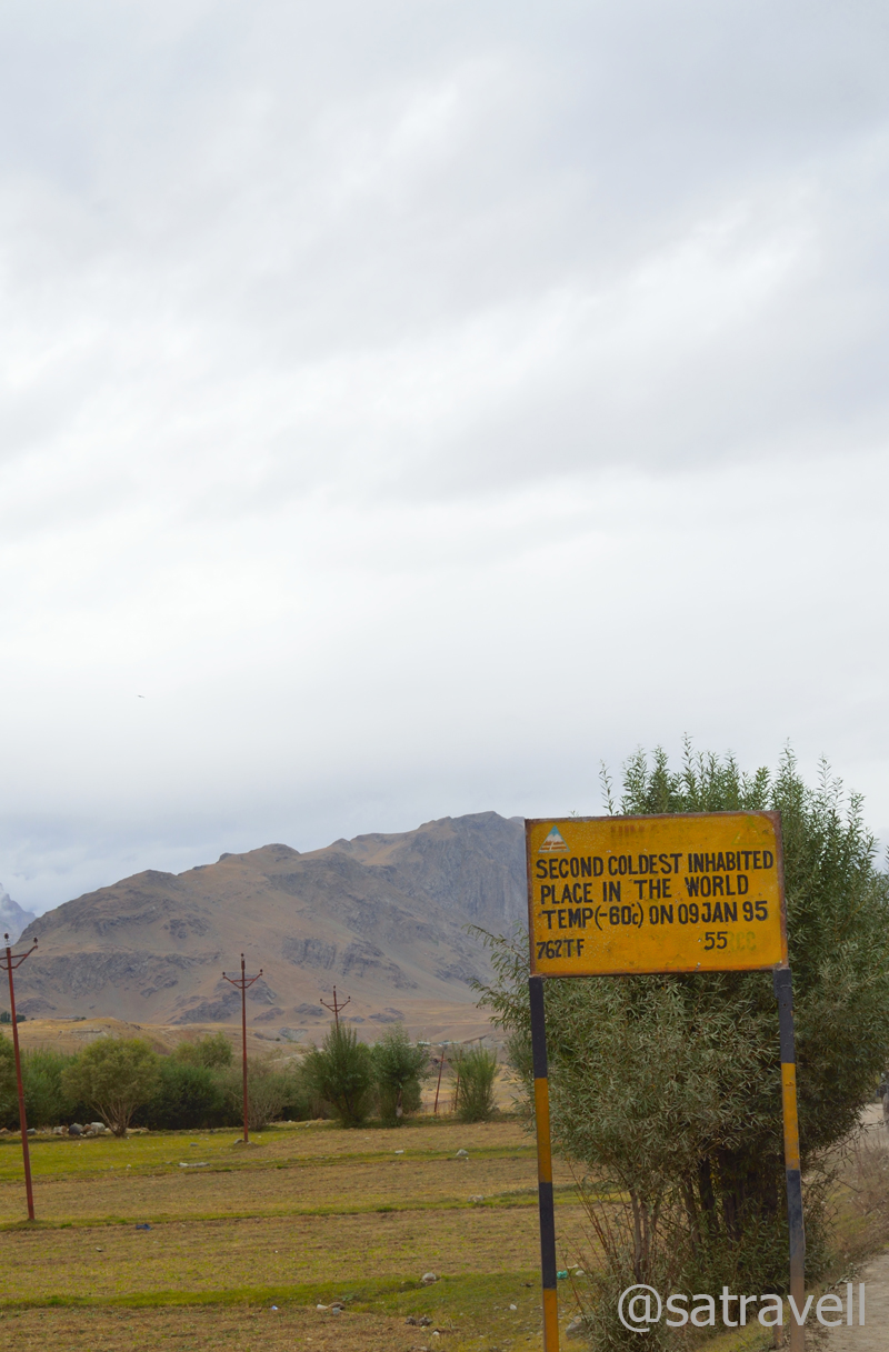
The main settlement of Drass, in the valley, is spread on an elevated ground on the left bank of the river. Claiming to be the second coldest inhabitation in the world, as marked by a board, after facing extreme temperature of -60 degree C in January 1995, the average winter-temperature still hovers around -40 degree C. Otherwise, the town garbs a pleasant look in short summers. Apart from occasional willows and poplars, the valley-land is generally unfertile. The people, therefore, have limited options to procure their supplies, including fuel-wood, which they gather from across the passes.

An Army cavalcade ahead. More pics and information from the region at Flickr Photoset

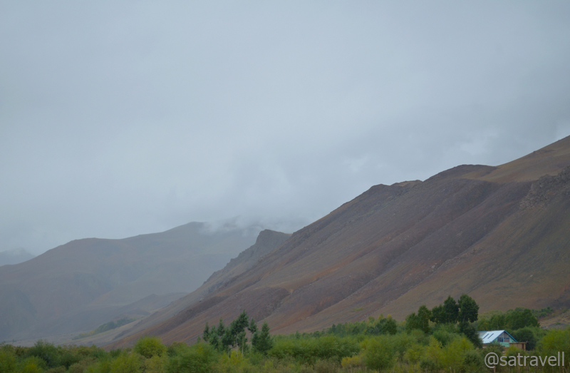
View towards Chiskam Valley
No sooner we left Drass than it started drizzling and the weather became overcast. Ahead, the road continues its gradual ascent alongside the same bank of the Drass River. Past the diversion for the glaciated Mushkoh valley, Kargil Battle School as well as the Army Rock Climbing School, the NH1D passes through an area that had witnessed the 1948-war fought to wrest the Zoji La from the clutches of Pakistan. Swinging in a wider glacier-scoured stretch of the valley, the highway passes through small villages of Machoi (3220m), Pandares and Matayen (3271m) to enter picturesque expansive pastureland braided by glacial streams. Forming the extreme western region of Ladakh in the Indian territory, the Drass valley opens in the north-eastern direction from the Zoji La along the turbulent Drass River, which originates from the Machoi glacier located near the pass.

Through the Gamru Valley. More pics and information from the region at Flickr Photoset
The tarmacked motorway gets reduced to bumpy as well as slippery road after the Police check-post at Minamarg (3280m). The next check-post is stationed at Gumri Army Camp (3482m) along with a few teashops. Although, the distance between the pass-top and Drass market is 40km, we still took couple of hours in covering the distance. Already moving at a snail’s pace in deteriorating weather, a huge Kargil-bound military convoy coming from Pathankot further stalled our progress on the highway. Even though the weather disallowed photography, the visible grassy slopes were surrounded with peaks as well as glaciers.

A Black Kite Imm. More at Flickr Photoset
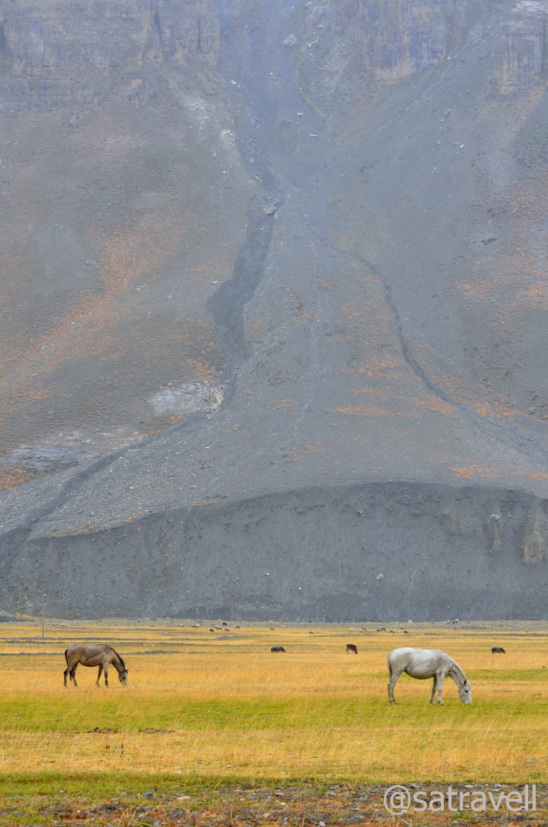
Pasture lands near Matayen
Due to inclement weather as well as heavy snowfall on higher reaches in long winters, the pass is declared open for traffic only between June and November but locals cross this pass on foot round the year as they have done for centuries. Following the Union Government’s sanction of Rs 5500 crore, the authorities have recently (Aug 2012) commenced work to construct a six kilometre long tunnel across the pass to allow round-the-year movement of traffic.

No sooner we left Drass than it started drizzling and the weather became overcast. More at Flickr Photoset

Approaching the crest of the Zoji La. More pics and information from the region at Flickr Photoset
As of now, attributable to frequently changing weather, the crossing is as dramatic as that on the Rohtang La though the road condition here has recently been improved by putting cemented slabs on the motorway. Past the information board on top of the pass, the road bifurcates to ease the traffic movement. The one going steeply downhill in switchbacks is narrow, slippery and bumpy but offers a shortcut to descend the pass. Although wider, the right one is less bumpy as well as slippery but passes through a live stone-fall area.
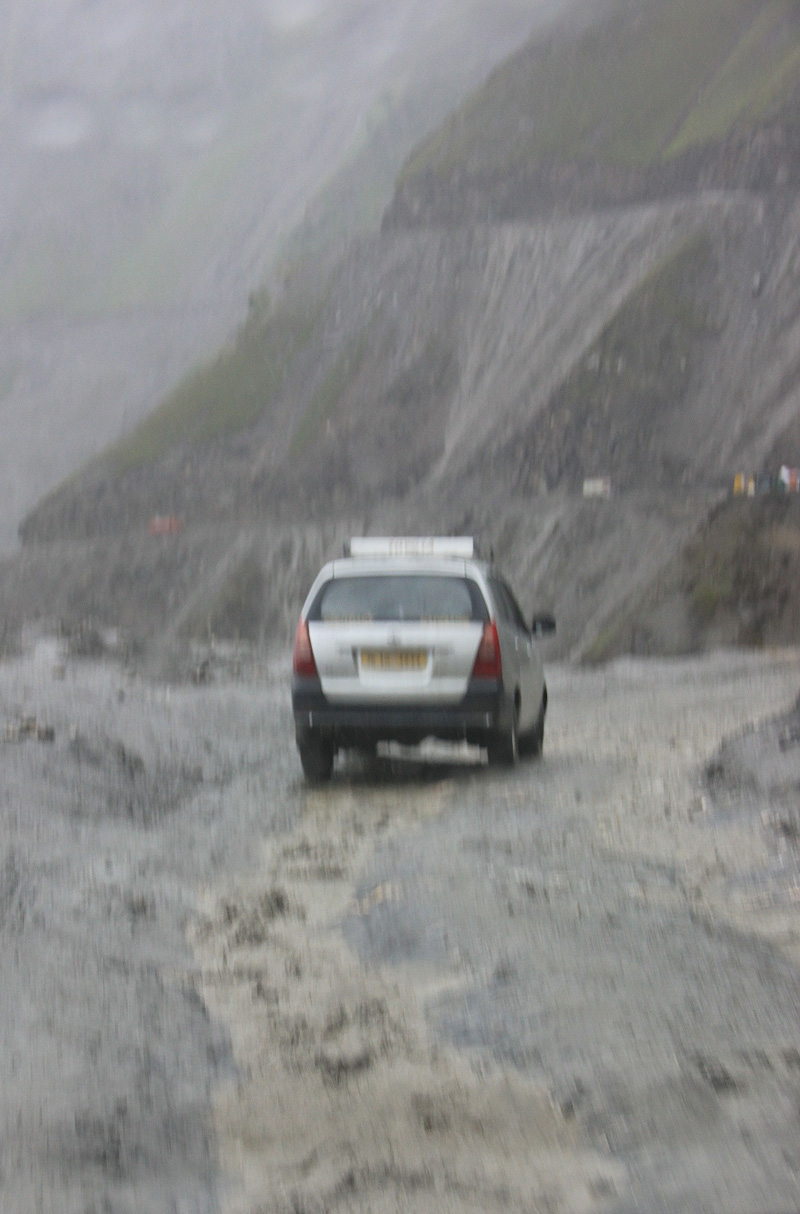
The condition of highway ahead

Captain’s bend; Baltal down below. More from the region at Flickr Photoset
A traffic jam on the descent; Zoji La
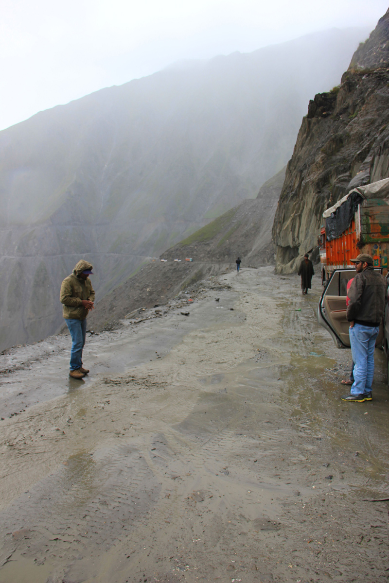
With a LED flashlight in hand to signally communicate from a distance, I positioned myself on the left downhill narrow road and rallied around to pilot the vehicles in the line, led by ours, looking to take the shorter route. Running ahead of the vehicles past a couple of sharp bends on the slippery motor-track, down below I spotted a string of trucks struggling hard to climb the pass, thereby, causing traffic jam. Accordingly, I signalled the vehicles to stop. There was no alternative other than to turn back and take the longer route. In the light drizzle, I helped the vehicles return to the forked junction. Thereafter, the road camaraderie continued to blossom and we were now guided, by a Srinagar-bound local taxi from Kargil, through the stone fall area. The driver seemed to know the motorway well. At every troublesome mountainside, he would park his vehicle to safety and helped us watch out for the falling stones. Passing through yellow mountainside, the smooth highway descended to a vegetation-rich countryside.

Notice the traffic jam on the lower motor-trail; Machoi Glacier enveloped in clouds. More at Flickr Photoset
Ahead, the highway sloped above the famous Baltal camping grounds located by the Sindh River at the base of the Zoji La. Offering a high-altitude shorter trekking route, the Amarnath Cave is just at a day’s march from the camping grounds. Literally meaning “a meadow of gold”, a popular trekking destination of 1980s Sonmarg (2748m) is located just 10km from Baltal.

By the infant Sindh River; near Baltal

View towards Durin Valley. More at Flickr
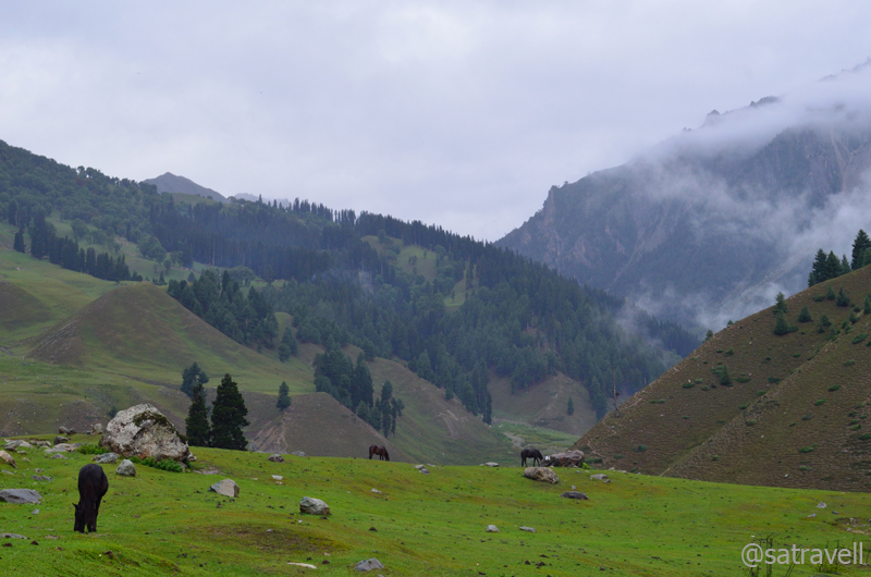
Ahead as we entered the Sindh valley in Sonmarg, the weather showed some improvement though it was still unfit for photography. Apart from sheep as well as horses grazing afield, another common sight is locals attired in the pheran, a body-length robe worn by Kashmiris under which they tuck a kangri, a wicker-basket full of hot coals placed in dust, in winters to warm themselves. Worthy of being a must-visit hill-station, Sonmarg nowadays has been sadly reduced to a popular tea-stop for vehicles heading to the pass. Even though the town offered plenty of options, across all budgets, to holiday but owing to terrorism and the hill-station’s strategic location along the highway, one would come across more soldiers and policemen occupying the properties than tourists.

The trek by the infant Sindh near Baltal leads to the Amarnath Shrine. More at Flickr Photoset
Historically, Sonmarg has been referred as a gateway on ancient silk route leading to Ladakh and Gilgit connecting Kashmir with Central Asia as well as Middle East. Sipping hot tea at a roadside stall as we chatted, the emerging popular options to sightsee the area included short walk to nearby Thajiwas glacier, which was enveloped by clouds that evening, river-rafting, trout fishing and trekking up to nearby glacier-lakes. Leaving the explorations to some other day next season, we moved ahead on the nicely tarmacked highway to Srinagar.
Rain-washed greenscape near Sonamarg. More pics and information from the region at Flickr Photoset

Also a good seasonal grazing ground. More at Flickr Photoset

View towards the Thajiwas Glacier (4856m) from Sonamarg. More from Kashmir at Flickr Photoset
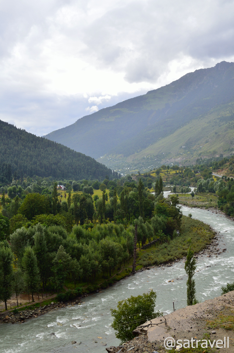
Past the picnic-cum-fishing spots marked along the right bank of Sindh, the largest tributary of the Jhelum River in the Kashmir Valley, the NH1D passes through wonderful vegetation-rich fir-clad hillsides. As of now, due to heavy snowfall and frequent avalanches, Sonmarg remains inaccessible in winters but the situation may change once the tunnel across Zoji La gets constructed. Here onwards, the highway alongside the right bank of the Sindh is dotted with vigilant presence of armed personals.

The touristy Sonamarg. More pics and information from the region, please visit Flickr Photoset

The highway by the Sindh River. For more pics and information from the region, please visit Flickr Photoset
Landscape near Kulan. More at Flickr

Bakarwals en-route to the Vale of Kashmir
The 84km distance between Sonmarg and Srinagar could easily be covered within a driving time of couple of hours. Sourcing supplies or even fuel for that matter would not be a problem after crossing a settlement called Gund (2141m), 23km ahead, on the highway. Past Gund, the highway is dotted with dhabas, fruit vendors as well as Amarnath Yatra-signage histrionics. Passing through harvest-ready yellowscaped paddy fields wedged between Harmukh and Zoji hills of Pirpanjal, the road ahead meanders on the slopes and cross numerous settlements, including Kangan (1836m) and Mangan (1711m), to reach Srinagar via Ganderbal (1629m). Minus the dust and crowd, this stretch reminds one of the Kullu-Manali sections on NH21. Ahead of Mangan, as the road bifurcates exiting the Sindh valley, the bear left heads directly to Dal Lake in Srinagar. The broad Vale of Kashmir can be observed stretched ahead after crossing Mangan.

Landscape near Gund. More pics and information at Flickr Photoset

Through the Sindh Valley; Sindh is the largest tributary of Jhelum River in Kashmir. More at Flickr
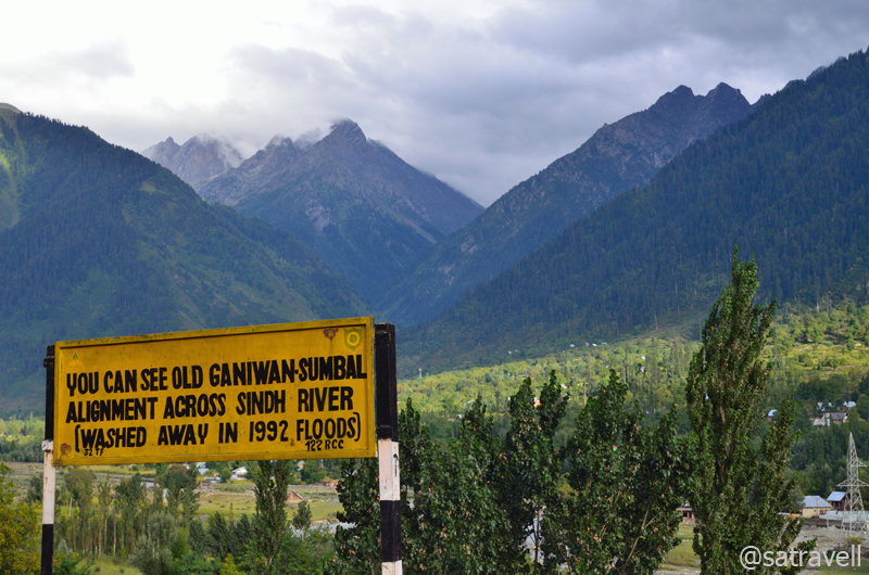
Ganiwan–Sumbal stretch on the Treaty Road to Srinagar; also Pk Deo Masjid (4440m). More at Flickr Photoset

The highway to Srinagar
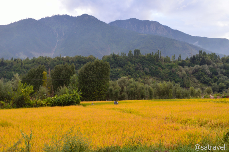
The ready-to-harvest crop in the Vale of Kashmir. More from the region at Flickr Photoset
Crossing Nageen Lake on our right, we headed towards the Dal Gate where we hoped to get a decent lake-facing accommodation on the Boulevard Road. Almost every street and road in Srinagar city was marked with alert military presence where armed with light artillery guns, paramilitary personals frequently roamed around the streets. Howsoever tempting the houseboats might be we preferred to stay at a hotel or guesthouse just so we could ensure a safe parking for our vehicle. On the road, a significant number of hotels were occupied by the paramilitary staff; still our search did bring result. Having fixed an accommodation, we stepped out of the hotel-room to take a walk on the pavement of the Boulevard Road along the bank of the Dal Lake. In the evening, the soft reflections of lights of lined houseboats added to the alluring charm of the lake; a nightscape that worked as an ideal balm for the day’s drive from the wind-blasted as well as dusty passes of trans-Himalayan region.

A refreshing late-evening stroll by the Dal Lake. For more pics and info from the region, please visit Flickr Photoset
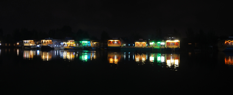
Dal nightscape; an ideal balm for wind-blasted trans-Himalayan Region. More at Flickr Photoset
View and read more on the area at the Ladakh Region / Kashmir Region Photoset on Flickr
You may also like to subscribe to the email updates, of the remaining chapters, by entering your email id in the sidebar.


Pingback: Butter Tea at the ancient Karsha Gompa | bNomadic
Pingback: On Road through the trans-Himalayan Region | bNomadic
Wow! what a stunning experience you have had… I’m sure it was life changing…
Thanks admin for stopping by my blog. Sure it was an exp of a lifetime. Hope you’d want to visit again.
Lovely as usual. Have often heard of what they have in Kargil and Drass but seeing is believing. Am leaving for Sonmarg next week, to trek along the lakes. Keeping fingers crossed for sunny weather.
That is really great. You are going to have a good time, I sure. And mostly because the weather has been superb these days. The trek is a pretty scenic one minus the tourist noise. Wish you all the best. 🙂
What lovely landscapes once again! Have not done the Srinagar Leh bit, and as you said Rohtang pass can be a nightmare while coming back from Keylong or Leh! The last reflection is also so pretty.
Thanks Mridula. I would say that Srinagar-Leh is a more viable option than Manali-Leh. Also it is more scenic. Not only the terrain but the socio-economic/ cultural aspects change after every few km on the highway. Just be sure about the J&K political situation before venturing on this highway.
Breathtaking pictures!! Some of them got me feeling quite patriotic…
Thanks Surya for stopping by my blog. Hope you liked the content and found it entertaining as well. Keep visiting.
Jai HIND ! captured the images like a true patriot !! amazing as always !
Thanks Aziz bhai. Patriotism to fullest. Srinagar to Leh is my personal favorite for all these reasons.
Thanks for stopping by. I posted another post recently
Regards
Great. I posts are a treat to read. Always look forward to reading your updates.
Again another great entry in detail. I haven’t heard about these places and reading them here gave me much information of the same
Thanks Uma for taking time to check my blog. Hope you’d want to visit again.
Looks like a Nice place with lovely pics, A like for ur post and Have a Nice Day. . . 🙂
Thanks admin for stopping by my blog. Keep visiting.
Wow, what the wonderful experience of the amazing land! such a great tour. thanks for sharing with lot and important information… your picture series looking just unique..
Hugs
Ajay Kumar
Thanks Ajay for stopping by my blog. Hope you’d find the content informative and useful as well. Keep visiting.
Pingback: The floating village and hanging gardens | bNomadic
Loved the post! It’s like from another world really (well, compared to what I experience in Europe) and the photos are top quality – landscapes are dramatic. Great blog!
Thanks for stopping by the blog. The experience of the Himalayas can surely never be replicated elsewhere. Keep visiting bNomadic for more such stories 🙂