 bNomadic
The following is a page entry from On Road through the trans-Himalayan Region. To read complete travel memoirs and trip report, please visit here.
Chapter 20 of 22

Shikaras lined up on the shores of Dal Lake. More pics from the region at Flickr Photostream
Bidding adieu to the Dal Lake as well as the Hari Parbat in its backdrop, next morning we checked out from the hotel after morning yoga as well as breakfast and headed towards the Lal Chowk on the Ganderbal Road. A popular symbol of political activism from the time when partition was held, Lal Chowk, despite having been decidedly reduced to just a clock tower, nowadays, still continues to be one of the most talked about city squares in India. Not only activism, the Lal Chowk is also famous for the market surrounding it, which as the locals claim, stores anything to everything. I was particularly interested in a few particular books on the region as well as a detailed trekking map.

Gul Gulshan Gulfaam. Remember!. More from the region at Flickr Photostream
The bandh situation had improved from the previous day and the market did seem to return to normalcy but the old city as well as mosques area was still out-of-bound for visitors like us. We bought some handicraft items, as souvenirs, from the stores located in the main market of Lal Chowk. Typical handicraft items from the region would include papier mache articles, shawls (pashmina, semi-pashmina), carpets, rugs, embroidered cloths as well as wall-hangings, pheran, wicker-crafted articles and wood carved items, etc. However, the best place to source such objects are from the workshops located in the labyrinthine lanes of the old city. For wooden carved furnishings, the market of Budshah Chowk and Polo View consists of wider options.

Secured away from land, one is dependent on Shikara rides to move between houseboat and the lake-shore.
Brought to the region in the fourteenth century, the Persian artistry work – Papier Mache, as we call it today – got frequently modified through ages including aligning to the interest of French traders, in nineteenth century, who after finding its huge demand back home in Europe established trade pacts with the Kashmiri artisans. Even replacing the traditional name of the craft with “papier mache”, the French influence had its own downsides including sacrifice of the traditional designs as well as colour schemes. Today, the production of this craftwork is largely confined to Shia community within Srinagar, a majority of who are gradually shifting to other occupations. Quite opposite, the manufacturers of other craft items like carpets, gabbas, namdas as well as pashmina articles, embroidery, crewel, willow, wicker and wood-carved products have economically grown by leaps and bounds. Shopping these products at the Lal Chowk market, be at your best in bargaining as most of the products are overpriced here.
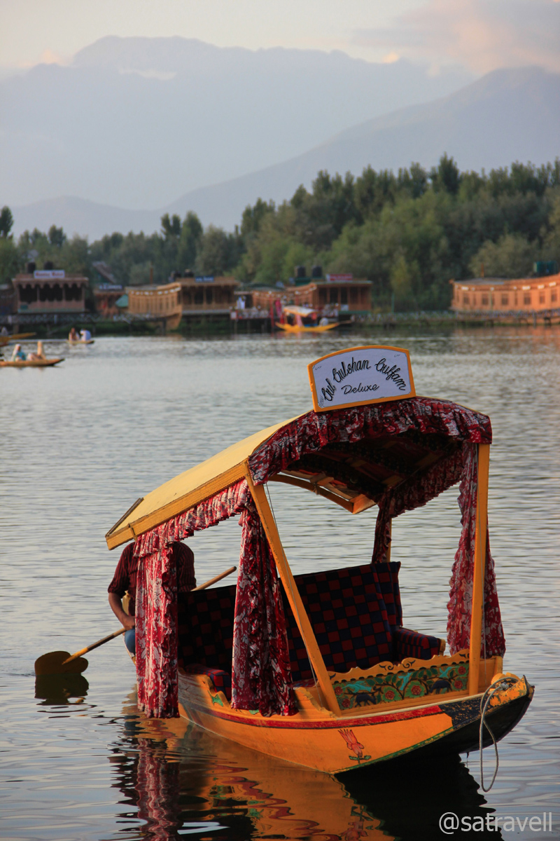
A Shikara titled Gul Gulshan Gulfaam
Despite spending a considerable time in the existing book shops in the market, I failed to get the desired books and the map. Past the Mughal Darbar restaurant (also a guest house now) on right, the road ahead (Residency Road) running parallel to the Jhelum River merges with the National Highway 1A (NH1A) connecting Uri with Jalandhar, covering a total distance of about 663 km. The lunch time at the restaurant starts after 1230 hrs but the thirty six course meal, Kashmiri Wazwan, seemed too heavy a meal for both of us. Refreshing our supplies with some fruits and packaged juices, we headed to the NH1A. Immediately as we left the Residency Road, we were greeted by a massive traffic jam near the Bypass intersection. From the poise of the capital city of gardens, lakes, shrines as well as protests, we were finally nearing the down veracity of grinding life of plains.
The stretch of the NH1A, for the next 80 km at an average elevation of 1600m, passes through an enormously vast flat vegetation-rich terrain, alongside river Jhelum in the Kashmir valley, till Qazigund, a few kilometres before the Jawahar Tunnel on the Pirpanjal Range. Right after the saffron town Pampore, the highway crosses a dense forestation of willows dotting both sides of the road called Green Tunnel. Past Awantipura (housing a few eighth-century Hindu temples that we failed to locate), the stretch famous for its bat manufacturing small units dotting both sides of the highway cruises towards the diversion of Pahalgam at Anantnag, the commercial and financial centre of the Kashmir valley.

A Kashmiri Willow Bat manufacturing unit. More from the region at Flickr Photoset

The local bat industry provides bread and butter to thousands. More from the region at Flickr Photoset
Spread on the NH1A on both sides of Anantnag, the cricket-bat manufacturing belt, providing bread and butter to thousands, comprises villages of Bijbehra, Charsoo, Hallamulla, Sangam, Pujteng, Mirzapor and Sethar, etc. With slabs of willow wood lying stacked in the open to dry, by the highway, at first I mistook it to be some furniture market. A few metres ahead, fully refined and ready-to-use bats displayed as wall-hangings around the workshops brought the reality out in the open. We excitedly stopped at a roadside teashop to end our curiosity. Kashmiri willow-wood is regarded to be one of the best materials for designing a bat that suits all forms of the game.
After partition, a majority of the craftsmen, mostly Hindu, migrated from Sialkot in Pakistan and resettled themselves in Jalandhar, Meerut, etc. With increasing demand, already famous for its quality wood, the Kashmiri willow crafting industry received the much-needed push. Close to 300 such small manufacturing units are currently on the go in southern part of Kashmir valley. Sitting cross-legged on a carpet of willow shavings spread on floor of his workshop, the craftsman minutely carves the slabs cut mechanically from willow logs. After finishing, depending upon the quality of the design as well as material, the bat is procured by middlemen as well as companies engaged in marketing sports goods. Even if the government is trying hard to save the monopoly of the region in manufacturing bat, the units, pegged at USD 20 million, suffer heavy losses during frequent insurgency operations. However, at this time villages were alive and kicking as some NGO had placed a collective order with them to manufacture one lakh bats to be used in the forthcoming Gujarat assembly elections.
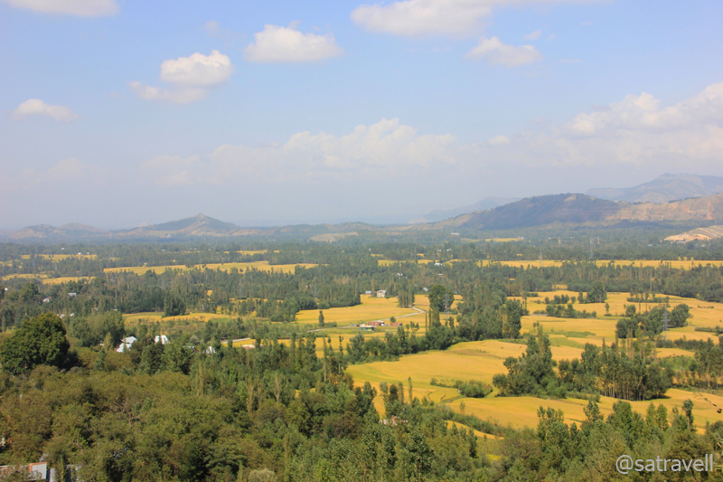
Vale of Kashmir; as viewed from the “Titanic View Point“. More from the region at Flickr Photoset
Vigilantly patrolled by paramilitary personals, the NH1A is regularly peppered with fuel-stations as well as teashops, small dhabas, wicker-workshops, bat manufacturing units, fruits shops, bakery shops, etc. Past the diversion for Shopian, a little before Anantnag, we slowed down to give the apple vendors, a once-over, who were preoccupied with packaging the produce. Sourced from the famous apple basket of Shopian, the apples were being sold to the middlemen at dirt-cheap prices. I at once asked for 50 kg of apples and got them packed in two boxes. Surprisingly, the apples were in perfect condition by the time I reached my hometown in Haryana. Contrary to our Zanskar venture, the in-cabin pleasantly smelled of fresh apples now (instead of the pungent fuel-smell).

The 2531 m long Jawahar Tube from inside
The highway ahead turned right near the administrative offices of Anantnag, located at a comfortable 55 km distance from Srinagar. Literally meaning “abode of springs and lakes”, Anantnag is claimed to be an ancient place that came into existence as a market-town (said to be around 5000 BC) making it one of the oldest urban human settlements in the world. The town houses many ancient monuments as well as temples, most of which are now in ruins, looked after by the Archaeological Survey of India (ASI). As pointed out in Zanskar memoirs, a major hurdle to successfully self-navigate in Jammu & Kashmir is the absence of sign-boards marking the way to such sights. We heavily counted on my Garmin handheld GPS device. The cousin strictly opted, I think rightly so, not to ask for directions, other than leading to the main highway, from a bystander. Adhering to our Kashmir-specific travel-principals, we failed to access the lesser-visited off-route sites.

A rare road-info board ahead. More from the region at Flickr Photoset
The valley that has beheld immeasurable vicissitudes and experienced countless upheavals from time to time, all through ages, including the on-going militants-led tussle warranted a cautioned movement on our part. It is always advisable to check with local travel agencies or tourism offices with respect to the latest travel advisory to the region. Thanks to the vigilant security network set up by our paramilitary as well as defense forces, the travelling environment has improved figuratively as compared to that of the previous decade. On top of the lethargic JKTDC authority that has not contributed much in the overall development of tourism, even now a little organised-information is available on the region.
Ahead the highway passed through cultivated stretches marked by pretty shades of agriculture crop in the valley. The highway continues on the same average elevation till Qazigund, after which it ascends gradually over round hairpin bends on green hills. A few kilometres ahead of village lower Mundha (1880m) on a steep switchback, the last and final views of the Kashmir valley could be had. Marked by a BRO board – Titanic View Point – is situated 34 km ahead of Anantnag. We stopped by a small tea stall, which served beverages as well as snacks, where we were greeted by a small paramilitary outpost. With the help of a binocular, I futilely tried to figure out the origin of Jhelum River, the largest of the five rivers of Punjab, formed by merging of many smaller tributaries as well as springs in the southern part of Kashmir. Just six km ahead of the View Point on the highway lays the famous Jawahar Tunnel (2531m).
Evening Landscape captured from a point near Patnitop. More from the region at Flickr Photoset
The 2.4 km-long-tunnel that serves as the only road-link between Jammu and Kashmir valley was constructed in 1956 under the avalanche as well as landslide prone Banihal Pass (2832m) on Pirpanjal Range. Providing round-the-year access to Kashmir valley, the Jawahar Tunnel (or Banihal Tunnel) is heavily guarded by military round-the-clock prohibiting any photography. The stretch of the NH1A up to Jammu is looked after by the BRO. Apart from a railway-tunnel, the authorities are in the process of tunneling passages across the Pirpanjal, the largest range of the lower Himalayas, to support the proposed four-lane highway that will reduce the distance between Jammu and Srinagar.

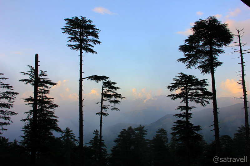
A Pine and a Deodar Tree. More at Flickr Photoset
Exiting the tunnel, the tarmacked-highway gradually descended the slopes of Banihal Pass, graded into several zones according to the magnitude of avalanche as well as landslide proneness. This stretch of the highway is known to have remained blocked for days during peak winters. As the highway descended gradually, the outside temperature increased, reaching its peak at a town called Ramban (1163m), situated 50 km from the tunnel on the right bank of Chenab, where we withdrew some money from a State Bank of India ATM. Moving forward, the road again started to gradually ascend passing through several settlements including Batote. Just before Batote, dhabas (Mansa Ram dhaba run by Sharmas) located on Peerah Morh are famous for freshly-cooked servings of Rajma(sh)-Chawal along with ghee and anaardana chutney. A personal favourite finger-licking quick meal option which we consumed at this very place was relished till the last grain of rice. Ahead the NH1A steeply climbed, one last time, over hairpin bends to reach a popular hill-station of the Jammu region, Patnitop.
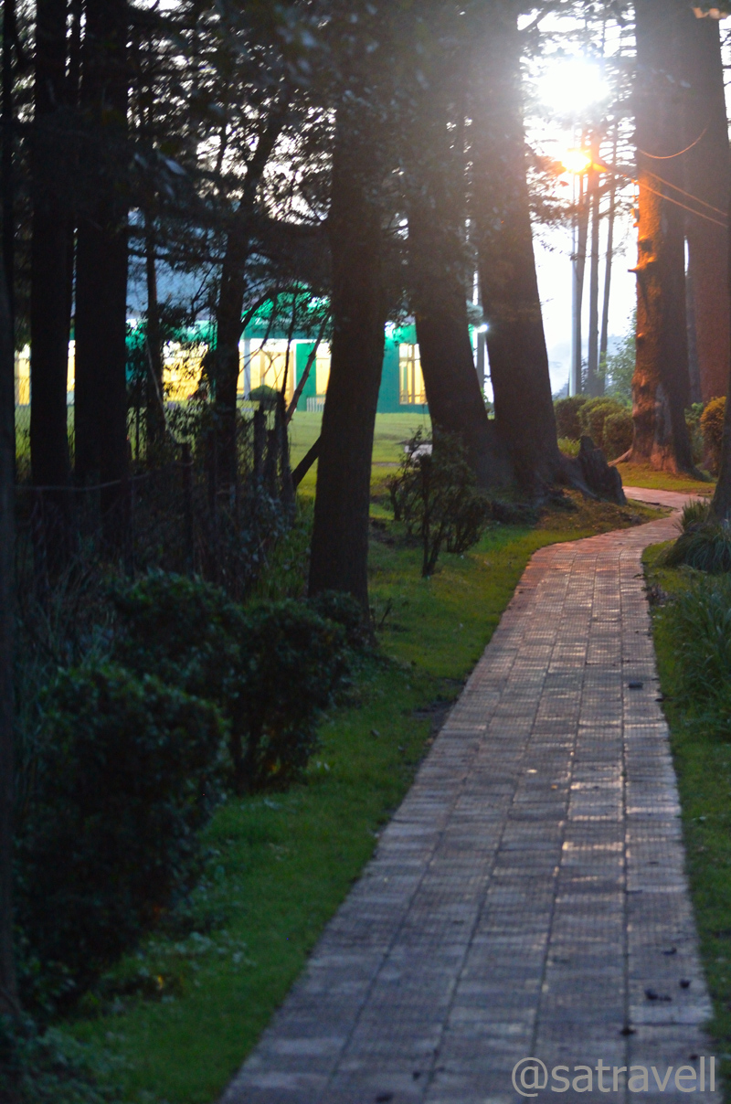
Patnitop is an ideal destination to take wooded walks
Situated on a picturesque Shivalik ridge, at an elevation of 2105 m above sea level, Patnitop is blanketed by thickly wooded tall deodar and pine trees. Commanding all-encompassing views of surrounding landscape, on both sides of the ridge, including that of the Chenab basin, the hill-station is thronged by tourists both in peak summers and winters. In winter, the snow-crazy tourists crowd the region to ski on the snow-covered meadows and observe snowfall. Originally named Patan Da Talab implying “Pond of the Princess”, Patnitop, said to be a popular sojourn-destination of royal families, got its name changed over the years.

Patnitop: …the air is cool and still, and the hills are high and stretch away to heaven. More at Flickr Photoset
An attractive picnic spot, Patnitop offers peaceful walkways, leading through lush green meadows and dense woods, interspersed by JKTDC holiday huts, a few resorts, refreshment stalls, shopping stalls housing Kashmiri stuff, etc. Indeed for its economical pricing as well as the location, we settled in for a JKTDC property to spend the night. Although superior, other stay-options were located slightly away from the greenery besides food was overpriced. The manager at the JKTDC property offered us an additional off-seasonal discount. That evening we took a long (6 km) walk encircling the green belt looked after by the state forest department. A majority of the hotels and guesthouses are located outside this green-belt marked by dense cover of trees and shrubbery. Being an off-season, the virtual absence of tourists in the hill-station ideated Thomas De Quincey’s quote, “Old grieves shall be forgotten today; for the air is cool and still, and the hills are high and stretch away to heaven.”

Typical of a Touristy Destination
To be fair, all our demands were reasonably attended by the hotel staff. The wooden interiors of the room were maintained and the furnishings seemed old but beddings as well as towels were kept clean. The building looked as if timeworn in which the bathroom, though clean, merited a renovation. Surprisingly, the manager failed to provide me with specific information related to other destinations in the state. Later in the evening the caretaker, after serving dinner, disclosed that this was among the few profitable properties of the JKTDC in the state.
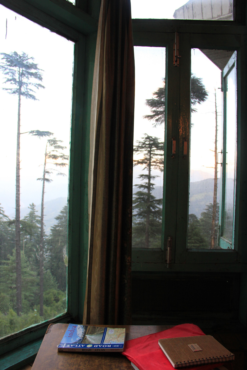
Room with a view (Map Book was a waste of money!)
View and read more on the area at the Kashmir Region Photoset on Flickr
You may also like to subscribe to the email updates, of the remaining chapters, by entering your email id in the sidebar.


Pingback: The floating village and hanging gardens | bNomadic
Pingback: On Road through the trans-Himalayan Region | bNomadic
This is a lovely post with nice narration and photographs of the shikaras.
http://rajniranjandas.blogspot.in/2013/09/masinagudi-amidst-wilderness.html
Thanks Niranjan. And for taking time out to visit my blog. 🙂 One of the best experiences, I would say.
Informative post ! Love your images too
Thanks Uma for dropping by my blog. Hope you’d want to visit again.
Nice post
Thanks for dropping by. Hope you would like to visit again.
Hilton Kashmir ? lol wonder if they have a Taj or MGM Grand also there. Great post as always. Regards 🙂
Thanks Swati
Free! Free! Free! Ab Lux cozy ke saath Mozze free!
Not as free.
Pingback: Maa Vaishno Devi | bNomadic
Nice picture with detail information thanks for this.