 bNomadic
The following post is a part of the “Kailash Mansarovar Yatra” Blog Series Into the Sacred Space. To read complete travel memoirs and trip report, please visit here.
I woke up to a sound of thunder in the middle of my sleep. I reached for my watch. It was still three am in the morning. I could hardly complete four hours of sleep. The lack of it was mostly due to the excitement regarding today’s schedule of activities – of finally crossing the Nathu La (4310m). By the time the mobile alarm announced four o’clock; I was up and about and was already packing my luggage. It was chilly outside. The water inside the thermos was still steaming. With the last remaining tea-pouch from the stock I had so fondly bought from Gangtok, I made myself some tea.
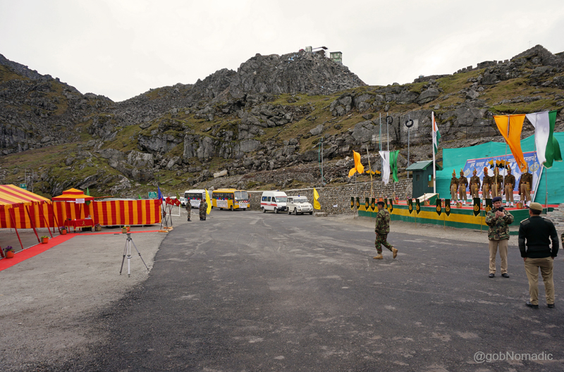
After completion of some more formalities at the customs check post, we had to report at the border gate at 0700hrs IST. At the break of dawn the group gathered at the parking lot. The luggage committee dutifully made a recheck of the entire individual as well as group luggage. Everything looked to be in order. A loud holy cry of Har Har Mahadeo was raised by Babaji after which we all got on the bus and occupied our respective seats. As incipient rays of the morning sun filtered in through the windowpanes of the bus; we left for the Nathu La.
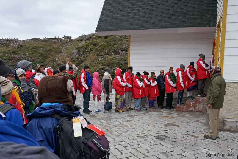
Queued up at the customs check post to complete the final formalities before crossing the Nathu La
From Sherathang, the approach to the Nathu La is very gradual on a broad tarred-road. Before the road got built, the neighbouring Jelep La was always the preferred alternative to enter the Chumbi Valley located north. Within less than half-an-hour we reached the Customs check post positioned some 100 metre before the pass. Southwards; mist and clouds had masked the valley up which we had just climbed. The group members queued up in the order of their listing in the group visa. The custom officials took no time in completing the remaining formalities after which we pushed off towards the pass where the stationed unit of the Indian army had also organised a High Tea for us. In the meantime, our luggage got transported to the Tibet-side where it got loaded in a truck after initial screening. For personal exigencies, two co-travellers had to go back after the culmination of formal activities at the India-side of the pass.
At the Nathu La; Kolkata is approx 700km from the pass. More images at Flickr Photoset

A Bofors 40mm/ L60 Air Defence Gun used in the World War II on display at the Pass
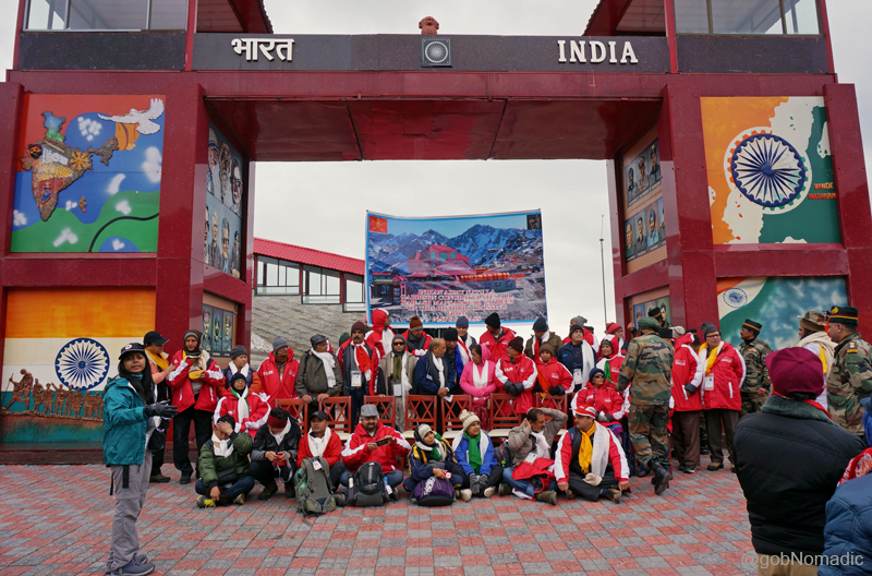
Getting ready for a Group Photo at the pass. Please visit Flickr for more images of the region

Joined by senior officers and Sh Taurn Vijay, the enthusiastic group members during the photo-shoot

And getting noticed with incredible fanfare. Please visit Flickr for more images
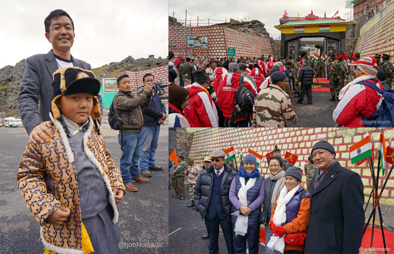
Clockwise from left: A young well-wisher who came to see us off; Lining up to cross the border; Sikkimese travellers occupied the centre-space throughout the Journey
Down the road we had just climbed; Please visit Flickr Photoset for more images of the region
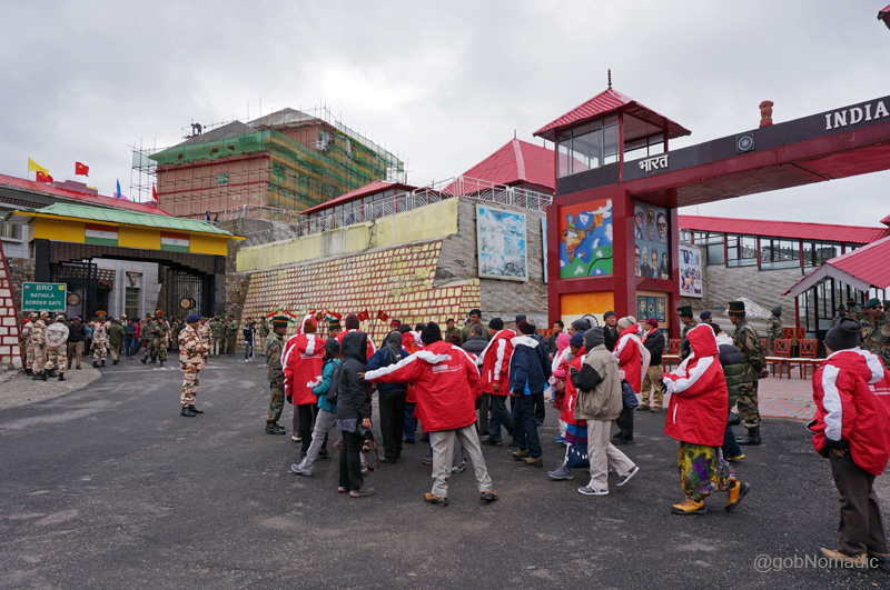
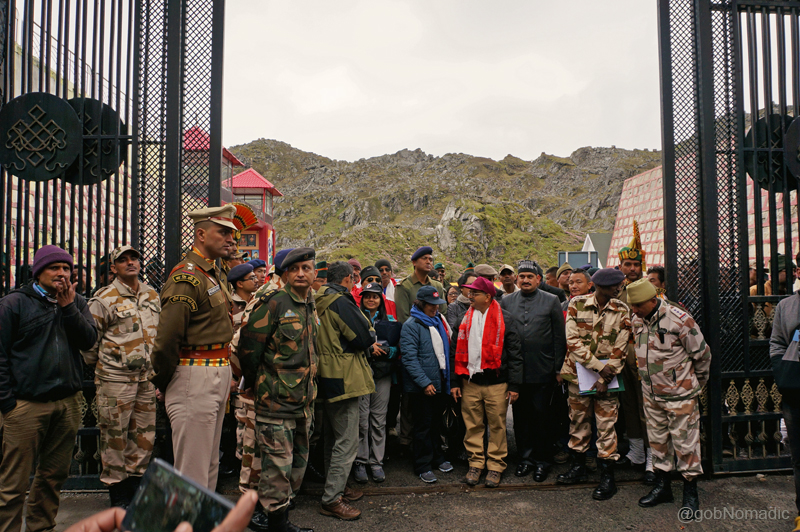
As we lined up on the no man’s land, a light drizzle came and spattered the crest of the pass; not more than 40 metre in length. The whistling wind that accompanied the light rain swept us cold, as we stood chatting with the Indian Army and ITBP soldiers. The Tibet-gate opened at 0730hrs IST sharp; equivalent to 1000hrs China Time. Another holy cry was raised and this time the response was louder and even more energetic; the soldiers had also joined. Once across the border, the formalities and quarantining procedures finically took more time to get over. Being the first batch; a whole lot of extra formalities including speeches and thanksgiving bestowed upon us. The main speakers included Chinese Ambassador to India Mr Le Yucheng, Mr Dong Ming Jun, Vice Chairperson of the Tibet Autonomous Region (TAR) and Sh Tarun Vijay, Member of Parliament who represented India viewpoint. With watery eyes due to cold; applauding whenever we needed to, we stood still as spectators for almost two hours.
Standing upon the no man’s land of the friendly border pass Nathu La. More images at Flickr

Clockwise from top left: Yours truly awaiting his turn at the passport verification-cum-quarantining kiosk; Chinese Ambassador to India sharing China’s perspective; just before we boarded the bus; Sh Tarun Vijay, MP presenting India’s viewpoint

The lengthy proceedings at the “Nai Dui La” left the elderlies completely exhausted. More at Flickr
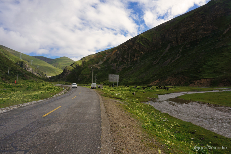
Before we could get acquainted with our trip-guides and language-translators, we were requested to board the buses. The view into Tibetan side from the top of the pass was remarkably much greener than most of us had possibly expected it to be. Down below, with small settlements spread on both sides of the Amo River, the pine-clad ridges of inhabited Chumbi Valley rippled one after the other; as far as the eyes could see. Called as Nai Dui La in Tibetan, the Nathula literally implies a place where the “snow is deepest and the wind strongest”. Shielded by the crags of the range through which Nathula provides a passage, around this side of the pass, the wind had reduced to just a gentle breeze. A signboard in local parlance read Lhasa is 480km from where we stood. Awestruck by the beauty of the Chumbi Valley, we started the descent into Southern Tibet in complete silence. The road ahead – as if some giant serpent had creeped along the mountain-face – was a succession of loops. Our next halt was at the customs check post-cum-trading mart of Rinchengang; just seven km below the pass. Colourful prayer flags marked the entry into the historical trade outpost of Rinchen where all our documents, passport, luggage and baggage including our body temperatures got verified and examined. The truck carrying our luggage had already reached here. After receiving a go ahead from the Chinese authorities, a few basic apprehensions had gone and everything else unheeded as we thought of the Tibetan marvel that lay ahead.
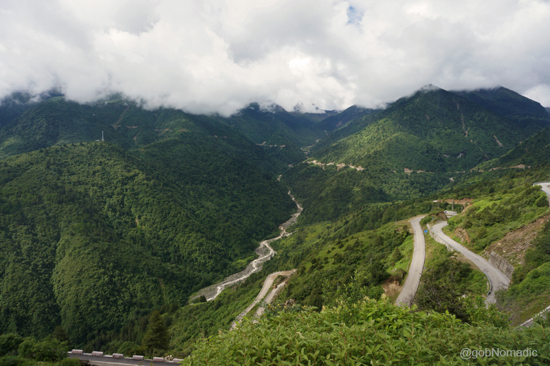
The road climbing down in loops to reach the green Chumbi Valley floor at Yadong. More images at Flickr
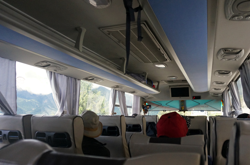
Equipped with a host of features like AC, GPS, Video, CCTV cameras, supplementary oxygen, etc., the twenty-seater tech-savvy buses were actually very comfortable
The new Yadong (referred as Shiasima in olden trade-records), the chief centre of the Chumbi Valley, was still 30 km away. Escorted by Chinese militia and authorities in their official vehicles, we began the descent with great pomp in the shape of a convoy. Sandwiched between the Himalayan watershed of Sikkim and Bhutan, the valley is one of the most fertile regions under the administration of TAR. The terrain had all the hints of a material well-being and comfort there. Apart from being a commercial, cultural as well as a Buddhist centre of note, the region possesses extraordinary natural beauty. The town of Yadong, then a village, was once a flourishing terminus on the ancient silk and tea trade route connecting the modern-day Yunnan Province with Bengal in India. It was through these established horse trails that the British military expeditions of early twentieth century overran a portion of Tibet. A few years after that, in the 1912-upheaval of Tibet, HH the thirteenth Dalai Lama is said to have been smuggled up the Jelep La, with the British assistance, through this route to meet Sikkim heads and British envoys in Kolkata for help. More recently in 1958 when trading still prospered on the Sikkim – Tibet highway, Pt Jawaharlal Nehru stayed here for a night; visiting the key monasteries on his way to Bhutan.

The renovated Gargyul or Gajiu Monastery, originally constructed in 1747; overlooks the Sikkim-Tibet highway and is the closest one to the Indo-Tibetan border. More images from the region at Flickr
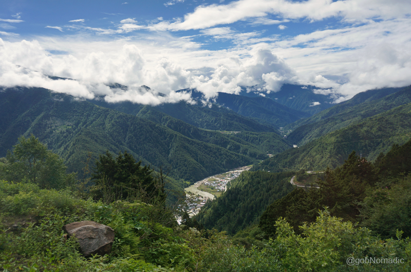
The settlement of Yadong; and the Amo River visible down below towards the valley floor. More at Flickr
The locals, it seemed, were already mindful of the start of the Kailash Mansarovar Yatra through Nathula, which was once so dear and friendly to them. Descending more than 1,000 m in altitude, as we snuggled into the settlement of Yadong, spread on the valley floor, its residents, shopkeepers, pedestrians and almost whoever saw us came out on streets to greet us and wave. Meandering through the markets, streets and corners of the town, our convoy made its way to a multi-storey hotel for a prearranged lunch. The houses here were well-built with stone and cement, often multi-storeyed and surrounded by fertile patches as well as orchards. We halted at the hotel for more than an hour; where many of us got their US Dollars exchanged into the local currency of Chinese Yuan. From the lobby of the hotel a near-view of the torrential Amo Chu could be obtained. In Tibetan language, Yadong means “rushing deep valley” and now we saw its manifestation from a close range. The weather became overcast as we snacked the local vegetarian delicacies with much bemusement.
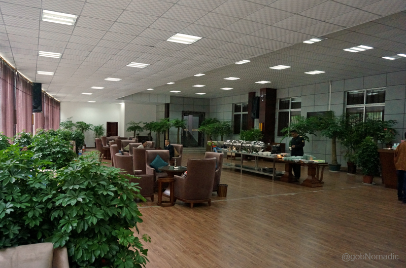
Lobby of the hotel at Yadong where we had our lunch. More images from the region at Flickr
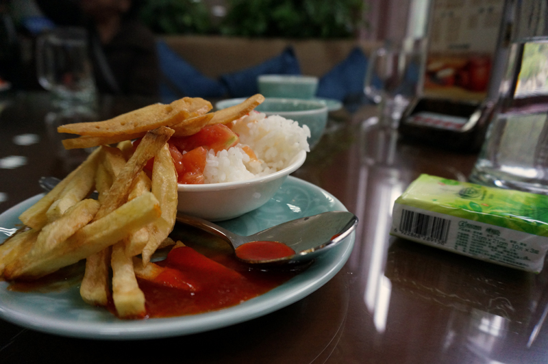
That was my meal; potato finger chips, tomato ketchup, tomato stew with some boiled rice

Surprising! Isn’t it? Ah well, that was quite normal up there

A residential complex by the tamed Amo Chu. Please visit Flickr for more images of the region
A calmer stretch of the Amo River. Enveloped by lavish primitive forests, the Yadong Valley is known to be a paradise for wildlife. Photo-Credit: L Wu. Please visit his Flickr Collection for more
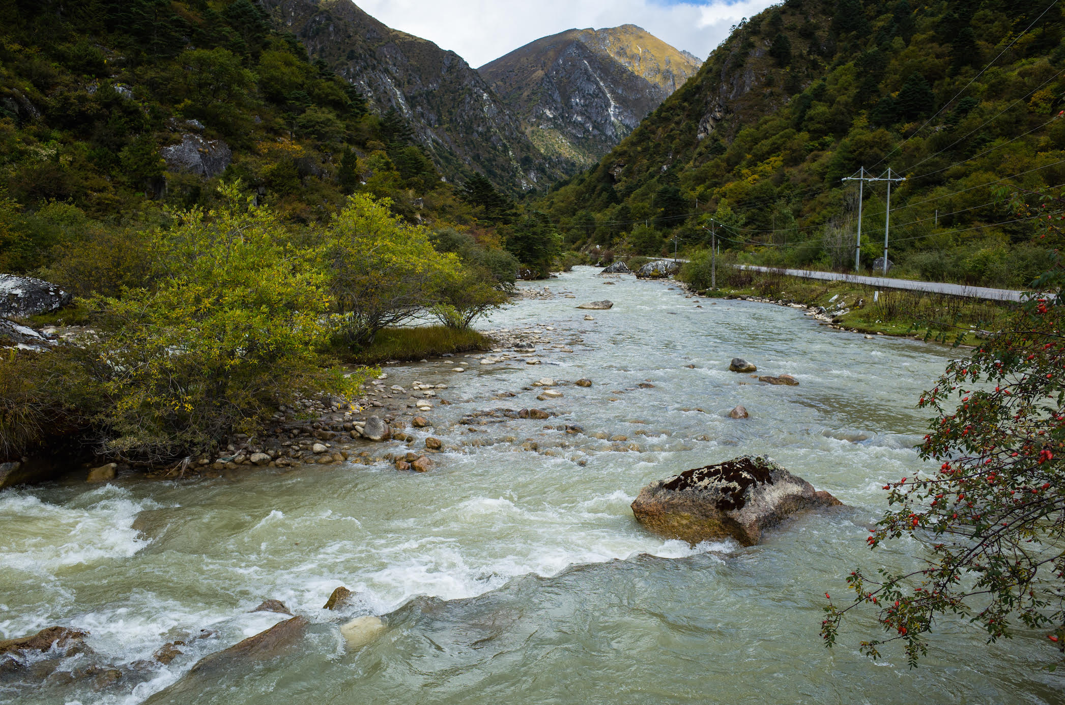
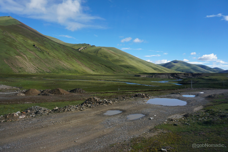
Before we left the hotel, the guide reminded everyone that it was practically the last option on the day’s journey to have filtered water filled in their bottle or a thermos. Besides leading to plastic wastage, up here packaged water is actually very costly. Ahead the road climbed steadily in loops and sharp hairpin bends following the torrent upstream for most part until we reached a treacherous terrain bare of colour, life, sound, vegetation or even rock. Such was the nature of road infrastructure that we didn’t realise the transformation of tricky nature of the terrain. A dark cover of mist enveloped the valley as the terrain changed from sylvan green hills to plain brown alluvial deposits; with barren lifeless hills shooting up on either side. From the windowpane, I could distinctively spot vibrant wildflowers smeared in a riot of early spring colours – blues, reds and pinks.
Green carpeted and intersected by the meandering infant Amo Chu greedily collecting the last traces of winter’s snow from a higher corridor that opened up to the tableland of Tibet. More at Flickr
Near the olden township of Phari. The nearest Bhutanese town is just a few kilometre from this town
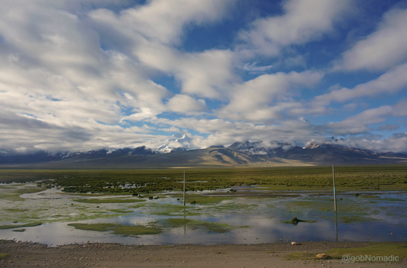
The sky was almost constantly overcast. From gaps in clouds, I saw barrenness leading up to the snowy peaks; noticeably the conical shaped sacred Chomolhari (7326m), or the abode of the lady goddess; the guardian deity of Chumbi Valley and the adjoining Tibetan tableland. We were now crossing Phari settlement (4300m), 47km from Yadong, green carpeted and intersected by the meandering infant Amo Chu greedily collecting the last traces of winter’s snow. The nearest Bhutan town is only a few kilometre away from Phari. The windswept desolate plain opened out further after we crossed an even higher pass, Tang La at 4760, typically marked by cairns and fluttering prayer flags along with a board.
Landscape a little ahead of Tang La; Mt Chomolhari is only partially visible
Ahead, as we descended; a broad straight road stretched up till horizon. The view was partially obscured by the clouds. With an overwhelming feeling of entering a dream, we stopped for a short break some distance ahead of Tuna; by the magnificent Dochen Tso. The weather opened a bit but distant view was still cloudy. I got down from the bus and made just a few photographs in the vague hope of finding a clear weather on my way back. Agile marmots popped up from their burrows to enquire about the disturbers of their peace; only to nip down again with disinterest. Save for the sighing of the wind or murmur of co-travellers, the quiet was unbroken. A distant looking waterbody had lost its sheen under the leaden sky. The solitude offered by the landscape was indescribable.

By the Dochen Tso; the weather opened a bit but distant view was still cloudy. More images at Flickr

The Welcome Gate to the Kangmar County. Please visit Flickr for more images of the region
Unperturbed by the desolation, the bus kept moving. Inside the bus I kept myself glued to the outside panoramic display of godly colours of the fast changing dreamscape. More wetlands emerged. More snowy peaks announced their presence. Reaching the settlement of Gala, at an altitude of 4,604 meters; another distant looking turquoise waterbody appeared on our left: Gala Tso. As the landscape changed, I mused over the sight of ruins at Qumeixiong, marked by a red-coloured board as historical; we had crossed a while back. The countryside that looked appealing to me now was once a venue to a fierce battle between the natives and the British led by Francis Younghusband more than a century ago. Situated adjacent to Dochen, the tranquillity of Qumeixiong Valley was once blown apart by the sound of British artillery and firearms. The British expedition had completely dismantled many a shrines and buildings including that of the Phari and Qumeixiong fortress. Still dotted with bullet holes, a few of such ruins retain the same state as had been left when the British had attacked them. I made a mental note of trying to make a better snap record of the sight on the way back.

Landscape near Galaxiang (Gala, Kala) in the Kyangmar County. More images from the region at Flickr

The sight of ruins at Qumeixiong; more than a century ago, the Younghusband military expedition had completely dismantled many a shrines and buildings here. Photo-Credit: L Wu
The settlement of Kangma (4175m), our stopover for the night, was still almost 100km away. We were comfortably cruising at over 60kmph; the road traffic, I observed, was habitually attentive to the prescribed speed limits and general traffic rules. The altitude had dropped to 4,000 m after which cultivated patches of agriculture land surrounded by hillocks began to appear; mainly growing highland barley, potatoes, Chinese cabbage, radishes, peas and wheat, etcetera. After the settlement of Samada, the villages of Gebai, Nabushi and the stretch from Gelong to Yuekang were particularly better in agriculture. Almost all the popular settlements had schools, ATMs or banking facilities.
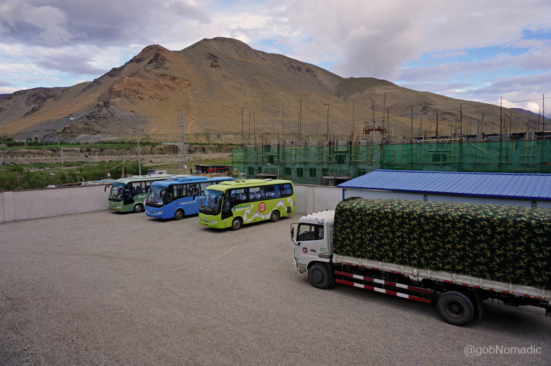
At the Kangmar residential complex; our vehicles and the luggage truck. More images at Flickr
A couple of hours later we were at the settlement of Kangma. Our accommodation was situated across the other side of Nyang Chu, a tributary to Yarlung Tsangpo, the mighty Brahmaputra. The accommodation centre faced the junction of provincial Riya highway to Shigatse and the roads to Beidahuang as well as Shiongzang; near Kangmar bus station ticket office. Immediately after checking into a room allotted to me along with two others, I headed towards the river bank to take a walk. The guide had stubbornly asked me to not carry the camera along. Alongside the bank, the alpine choughs were collecting their evening meals. I lost interest to carry on any further and headed back after the guide alarmed for the evening briefing meet. Back at the complex, it was sad to see a young and active lady going back to her homeland in Sikkim from here after she showed symptoms of AMS. The night drew on, dismally cold.
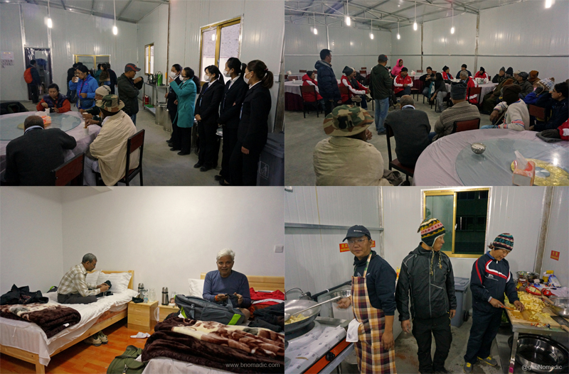
Clockwise from top left: The support staff at the residential complex; Evening briefing in progress; the accomplished mountaineers-turned-cooks inside the kitchen; at the room, Sh Noratmal a survivor from 2013 Kedarnath tragedy and Sh BK Chaturvedi from Delhi occupied with their phones


Pingback: Into the Sacred Space | bNomadic
Pingback: The Legend of Soldier Saint Baba Harbhajan Ji | bNomadic
What a detailed post and stunning captures.. too good..
Thanks for stopping by the blog and for the feedback. Keep visiting bNomadic for more such travel stories.
Its really a lovely post as i love Tibbet and their people… bNomadic i am fond of you with this post…
Thanks:) 🙂 Keep visiting bNomadic for more such travel stories
So sure bNomadic…. I am your regular reader…
Roads and rivers, that’s where lies my heart. Keep sharing.
Not far from Delhi 🙂 Thanks! Keep visiting bNomadic
Wonderful post and amazing pictures 🙂
Thanks for dropping by Swathi. And for the feedback. Keep visiting bNomadic for more 🙂
Amazing photos of your journey – incredible landscape. I want to go to Nathula Pass but have recently read that foreigners are not allowed to enter the area except Indian nationals. I was disappointed when I read that 😦 But am pretty sure there are other areas I can visit – can’t wait to see these spectacular sceneries!
Thanks for the feedback Kat. Yes, you will require permit from the authorities to visit most border destinations within Sikkim. That said, permits can be easily managed from the check-posts/ and tourism authorities. Keep visiting bNomadic for more such travel stories 🙂
Thanks for your tip 🙂 I believe I can arrange for the permit from Darjeeling.
Rangpo is the place where you could easily get your permits. Darjeeling is in West Bengal. The local Sikkim Tourism office at Darjeeling will help you to plan out your itinerary and arrange permits for you
Thanks, really appreciate it 🙂
Love border crossings. They are always exciting. Lovely read!
Thanks for stopping by the blog Niranjan!. And for the feedback. Keep visiting bNomadic for more such travel stories 🙂
The landscape is just amazing! It must be very nice to hike here.
The landscape is truly amazing; suited short hikes. Keep visiting bNomadic for more such travel stories 🙂
Wow!
Great trip and awesome photos!
Thanks for stopping by and for the feedback. Keep visiting bNomadic for more such stories 🙂
Pingback: Getting Shepherded through Tibet | bNomadic
Pingback: The Legend of Soldier Saint Baba Harbhajan Ji
Very well written travelogue. Excellent Photography and language. Want to ask you three things here. I too wish to do this trip solo on bike. I know the xenophobia of Chinese and difficulties so much so that it is almost impossible. Still, I want to try at least. Now my questions.
1. Whats your opinion on the idea of making this trip on bike, solo?
2. If I am not wrong, you must be able to see Mt. Everest from the road that you traveled. Is that so or is it that I must take deviation to EBC (Tibet side).
3. Can you throw more light on inner Kora please?
Your input would be valuable however insignificant it might sound.
Thanks once again for the travelogue.
Khagesh
Thanks for stopping by the blog Khagesh ji. Sending you a response to your queries through email. Keep visiting bNomadic for more such travel stories 🙂
Just left a message, dont know if you got it.