 bNomadic
The last week of September found me driving up the slopes of Chanshal Pass (3784m) in eastern Himachal Pradesh. Keen to explore the settlements and folkways of the enigmatic Dodra Kwar villages, I set out for a sojourn in the beautiful Rupin Valley. The road to the Rupin over the Chanshal is very recent and was made operational less than a decade back. Lunching at the HPTDC Rest House of Rohru, the waiter unconcernedly informs me of the road condition and distance between various settlements on the way. Even though, he hails from Chirgaon, the last major settlement after Rohru (1560m) on way to the Chanshal but has never been to the hidden Dodra Kwar cluster. His advice ‘don’t underestimate the surprises on the way’ proved very encyclopaedic and the first difficulty I find myself dealing with is finding a bed to crash anywhere alongside the road.
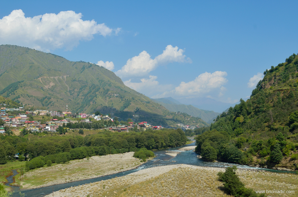
Situated by the Pabbar River, Rohru is famous for apples and trout fishing. More images at Flickr
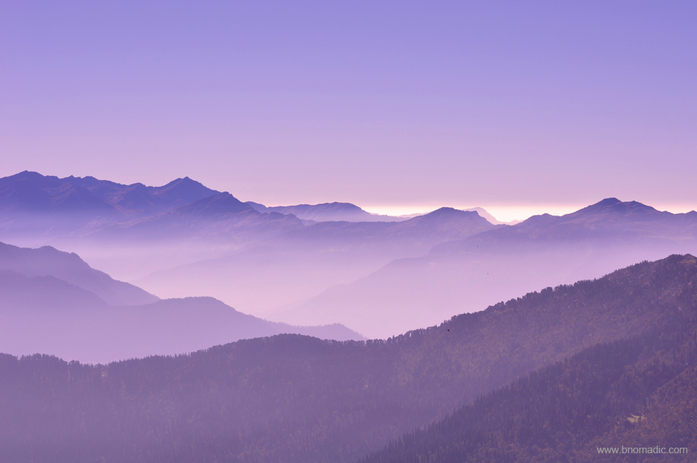
Morning hues atop valleys below Chanshal. Please visit Flickr for more images of the region
For the next 14 km, the road follows the right bank of the Pabbar upstream as the river cascades down the broad valley. Eager to get away from the traffic and noise of Rohru as quickly as possible, I rush towards the Chanshal hoping to find some accommodation at Larot, the last village on the way. Unable to establish any contact with the caretaker, I still have the scenically perched Forest Rest House in mind. “Just go and get the possession of the room”, the Rohru DFO had advised me over the phone today morning. Repaired in patches, the road to Chirgaon is potholed as well as narrow with some exposed sections. Descending from heights, trucks and pickups overloaded with apple boxes make the traffic movement onerous. I make steady progress till the narrow one street market of Chirgaon where a bottleneck has halted the traffic completely. A pickup carrying apples has broken down in the middle of the road. Daylight has started to fade as the vehicle gets towed away. Just a few meters ahead of the market, another traffic jam, under the watchful eyes of Himachal Police, on the bridge above Andhra Khad – a tributary to the Pabbar – has added to my misery of not finding a suitable accommodation before the day is over.
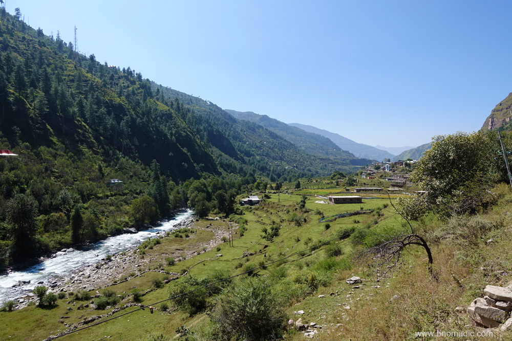
The Pabbar descending towards Chirgaon. Please visit Flickr for more images of the region
“Time is running out, wise to arrange something at the first available opportunity”, I tell myself. The road condition has started to become progressively worse after Chirgaon, the last village en route to the Rupin Valley where the mountain-luxuries of supplies, fuel pump, tyre and vehicle mechanics, etc. are available. Meandering along the Pabbar on the same bank I reach Sandasu (1770m), a small settlement just 2 km ahead of Chirgaon and located on the opposite bank. Compared to the number of houses in the village, I am rather surprised to see an elaborate colony of government offices and a hospital on the right bank of Pabbar. A ray of hope flashes in my mind. Next minute I am standing in front of a HPSEB field hostel by the road. The local BDO, his reader as well as the caretaker of the Rest House are sipping tea in the courtyard. Some minutes of negotiations and a room is made available for me. Given the area and terrain I am in, the room is a total luxury. The bathroom even has a bathtub! I settle for a homely cooked simple meal in the evening. The caretaker hails from a nearby village and has been working with the same property for over four decades now. He is able to clear the air about the road condition ahead and confidently tells me that just three hours to the top.

The road by the right bank of Pabbar, a tributary of Tons River. More images from the region at Flickr
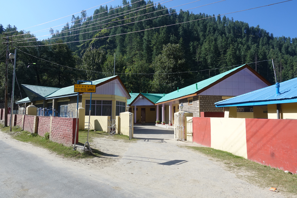
The HPSEB Field Hostel at Sandasu is situated by the right bank of Pabbar. More images at Flickr
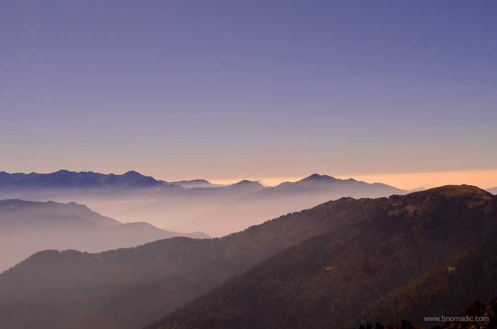
Morning inspiration from the Himalayas! Please visit Flickr for more images of the region
The last few years has seen an increase in the traffic to the Chanshal. The decade old road has been a boon to the residents of the Rupin Valley. The residents, especially farmers, of Dodra – Kwar could now transport their produce to Rohru in the valley of Pabbar which is fairly accessible through roads. Before the advent of the road, it took three days of hiking for the residents of Dodra – Kwar to reach the road head at Tikri. Even now the Rupin Valley remains cut-off from Rohru in winters as the road opens only for a few months after the snow is cleared off the Chanshal Pass. The near 50 km climb to the 3750m high pass is formidable. Given the remoteness of the region, reaching the Chanshal is considered as an achievement in the motor-biking and adventure lovers’ circles.

The road to Tikri by the Pabbar. Please visit Flickr for more images from the region

The road to Chanshal
After several months of planning and dreaming, I was finally on my way to get an access into the mysterious world of Dodra Kwar. Even though, the valley falls directly on the traditional Sangla – Rupin Pass – Netwar trail that links the Baspa Valley of Himachal Pradesh with Tons Valley of Uttarakhand, the region remains a mystery to the outside world. Legend has it that the valley was once a part of the kingdom of Tehri and was presented in dowry to the King of Rampur Bushahr. The villages, their temples and many unique houses are remarkable example of art and wood craft that still flourishes in the region. The valley is famed for the countless wild flowers as well as medicinal herbs it offers. Streams, wooded forests and fauna add to the natural beauty of the valley enclosed by high hills and rocky peaks. The road connectivity is very recent and the region still retains much of its pristine beauty.
It is for fascinating reasons like these that I have the feeling of contentment of finally being on the road to climb the Pabbar Valley. This blog series is an outcome of my travels to the enclave of Dodra Kwar villages, a hidden pocket which is absolutely full of history, interest and significance. The following posts are an endeavor in capturing the aura, beauty and rawness of Dodra and Kwar. I hope you’d enjoy reading about my journey and experience it through my eyes.

The morning hues of the Pabbar Valley. Please visit Flickr for more images of the region
Getting There
Rohru is a small town situated by the river Pabbar in Shimla district of Himachal Pradesh. Rohru is nearly 112 km from Shimla via Kharapathar and Hatkoti. The Chanshal Pass is nearly 50 km from Rohru in district Shimla. The distance between Chanshal and Kwar is 42 km. Separated by the Rupin, Dodra and Kwar are 22km from each other.
Average Altitude: 2500m
Best time to visit: Autumn
Travel Lure: Heritage, panoramic views and sylvan charm
Accommodation: Very limited at Kwar, Dodra, Larot and Chirgaon; HPTDC at Rohru


Seems really remote and mysterious 🙂 Your photos lend the place a magical touch!
Thanks Prajakta! Glad to know you liked the photo records. Watch this space for more posts of the Dodra Kwar series 🙂
The blissful morning hues. Awesome photographs and a good narrative as always. 🙂 I feel like recreating them mountains into digital art.
Thanks Tikuli! Glad you liked the description. Watch this space. Much more in the series. Keep encouraging! 🙂
Pingback: Dodra Kwar Diary: Climbing the Chanshal Pass | bNomadic
Pingback: Dodra Kwar Diary: Sojourn in Kwar | bNomadic
Pingback: Dodra Kwar Diary: Temples of Pujarli | bNomadic
Pingback: Dodra Kwar Diary: The Devtantra at Dodra | bNomadic