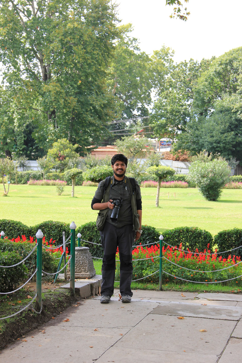
bNomadic
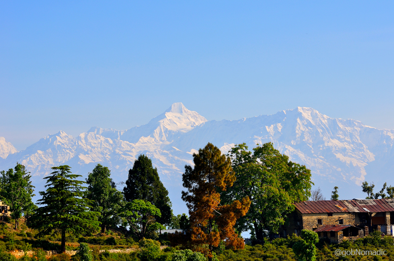
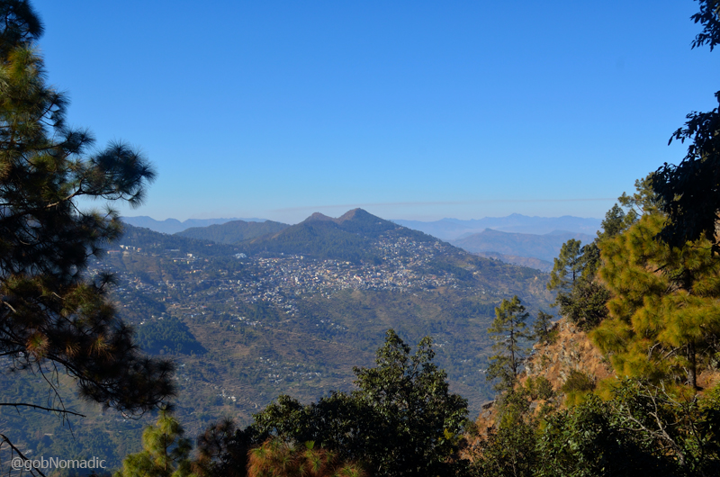
Kumaon Diary; The Himalayan Showground at Chaukori

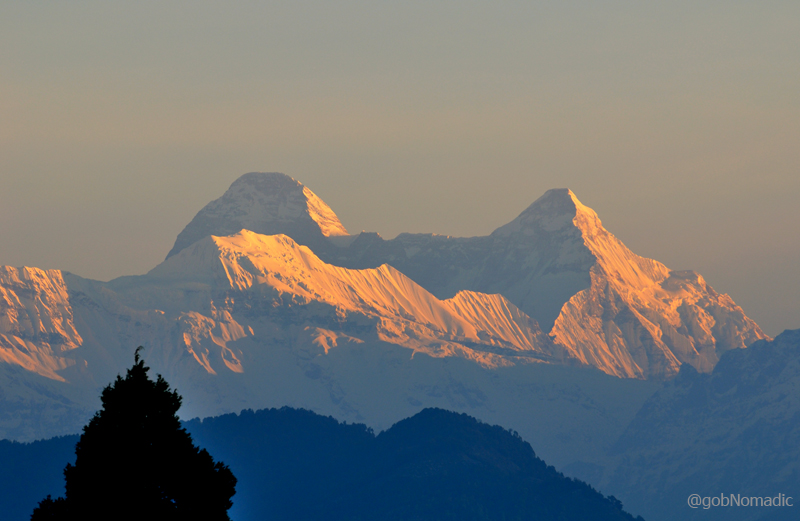
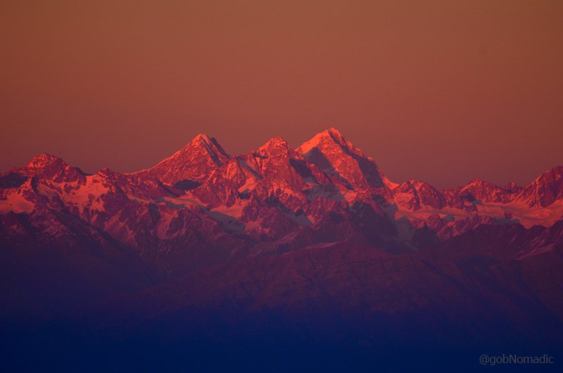
The twin peaks of Nanda Devi. Nanda Devi (7816m) to the left and Nanda Devi East (7434m) towards the right. Photo Credit Sarabjit Lehal
The Himalayan state of Dev Bhoomi Uttarakhand is the most perfect setting to experience the deific relationship between the extremities of beauty and grandeur. For me, the chance to shadow-walk the established ancient trade route arteries of Kumaon division, in the mountain state of Uttarakhand, arose later last month when the time window allowed an escape to the erstwhile trade region of Munsiyari.
The current Himalayan spree proved to be far more than just an escape from the summer heat of north India plains. As they say, “No road is long with good company”, accordingly the hilly road travel of more than 1500 km spanned over a week seemed like a doddle.
Before last season I had been to the forests of Jandidhar (Binsar) when the sheer plenitude of the Himalayan effect had initiated me into the White Range from a deeper perspective and forge an eternal harmony. Each and every time there is an indescribable pleasure in looking up the gigantic holy pinnacles and soaking in the pure mountain air.
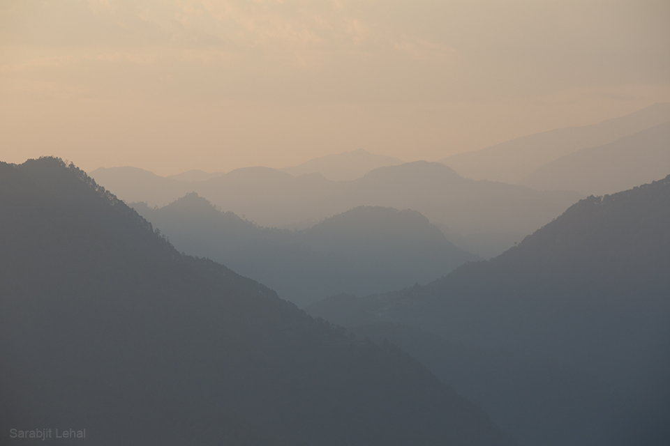
Captured near Kanda. Photo Credit Sarabjit Lehal
Having cooled off our engines at Nainital from the previous night’s long drive through the plains, we set off for Chaukori via Almora, Binsar and Bageshwar. Although, the route through Bageshwar (182 km) is a little longer than the Almora – Sherghat – Berinag highway (174 km) but is more scenic as well as appealing. In between the eight hours long travel, the markets of Bhowali, Khairana, Almora and Bageshwar were typically full of local produce including seasonal fruits and necessary travel-supplies.

Mountainscape near Kanda. Photo Credit Sarabjit Lehal
Ahead of the wide Sarju valley at Bageshwar, where in the midst of fertile fields the flat-roofed houses seemed like prudently placed matchboxes, the drive became even more pretty. As the vehicle inched up the motorway to Chaukori, our halt for the night, we had our first ‘provoking’ view of the Great Himalayan Range. Although, our momentous bliss was partially disturbed by the evening haze, the vividness produced by the golden crop in the shadow of high snows smeared the landscape in consistency with the putative belief that Kumaon offers the best snow views. The incredible last stretch of 16 km between the tiny hamlet of Vijaypur (1820m) and Chaukori (2015m), in the waning light, premeditated our thoughts for the night.
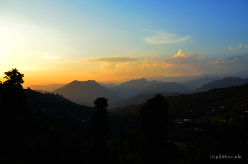
Setting sunscape near Vijaypur on the Bageshwar – Chaukori motorway. More at Flickr

Early morning view at Chaukori. Photo Credit Sarabjit Lehal
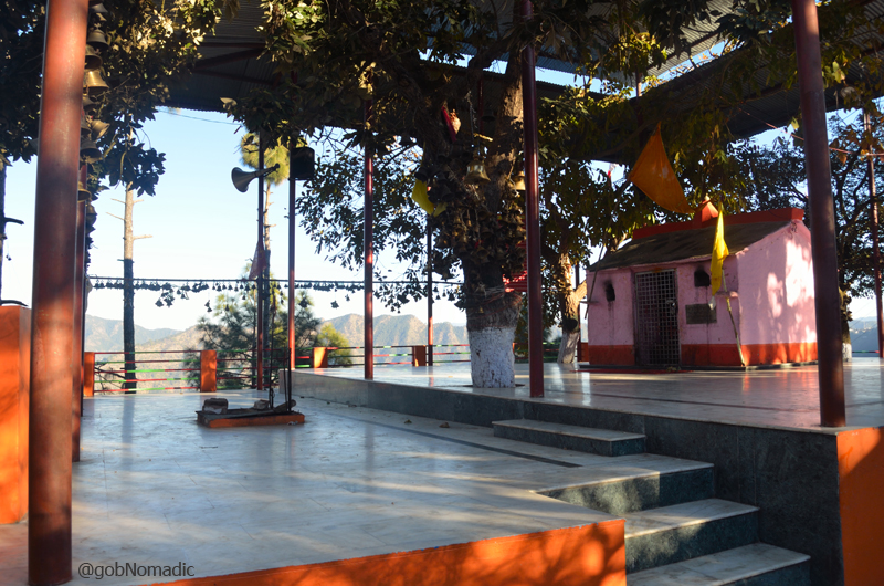
Out of the limited number of accommodation options at Chaukori, only a few enjoy north-faced setting. We preferred the state government run KMVN property positioned just perfectly. If only the management could improve in its services, the properties of KMVN (or GMVN) would be the most popular tourist spots in the state. The key lure attached to this particular accommodation is the uninterrupted Himalayan spectacle dominated by the mountain Goddess Nanda Devi.
As we sit down in the open lawn (which occasionally doubles up as a helipad) of the complex and soak in the cold hilly breeze downing our share of Himalayan poison and noshing on the accompaniments, our addiction with the Himalaya clearly got aroused anew. We lay under the starry night sky and marvelled at the snowy screen that was preparing to unveil on the other side of darkness. That night had a meaning.
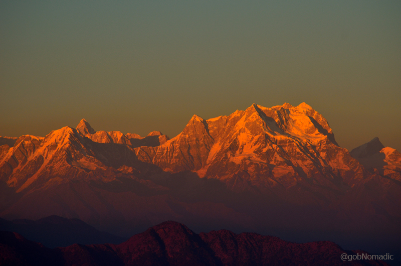
At the break of dawn, cameras were ready and tripods were set. Three anonymous photo artists began capturing their story of Himalaya. The emerging temperate rays of the sun produced a scintillating morning show. With each passing moment, the refining intensity of light proclaimed the presence of heavenly rocks.
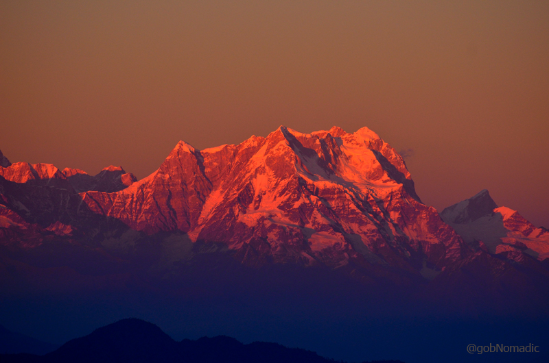
“And there she was! Cresting the ragged rocks casually scattered” – CS Houston. In the frame, the Nanda Khat (6611 m) is just below the Nanda Devi summit. More from the region at Flickr Photoset
With the showstopper lying towards the western horizon of the frame, the morning ritual climaxed at the supreme Nanda Devi, the fountainhead of inspiration, reveries and visions as well as patron Goddess of both Kumaon and Garhwal. Both my crime-partners instantly vanished into the wilderness around, with their cameras ready, in search of a better frame. I opted to laze around in the compound.

The southern outliers of Nanda Devi Biosphere Reserve captured from a point in Chaukori. L to R: Mrigthuni (6855 m), Maiktoli (6803 m), Sunderdhunga Khal (5520 m), Panwali Dwar (6663 m), Nanda Khat (6611 m), Nanda Devi (7816 m), Nanda Devi East (7434 m), Lamchir (5662m), Changuch (5322m) and Nanda Kot (6861m). Photo Credit Sarabjit Lehal
The drowsy azure created by the numinous snows, around the Nanda Devi, that was leisurely waking up from its winter slumber, summoned mysticism from far and wide. Only a painter or a poet could do full justice in expressing the view.
Facing north, a riotous chunk of rocks, wooded ridges, deep valleys, mountain ranges inconsistently rippling one above another and producing dark blue hues against the heavenly backdrop of holy snowy peaks of the great Himalaya. He who has absorbed this scene primed by the stunning Nanda Devi, may have fulfilled his yearning to witness one of the most astoundingly inspirational worldly sights.

View towards Nanda Devi twins from Chaukori. Photo Credit Sarabjit Lehal
Spread above the tea gardens of Berinag region, Chaukori offers an angled view, partially foreshortened by the prominence of Nanda Khat, of the twin peaks of Nanda Devi providing a wonderful unimpeded outline of the mountains in the South Nanda Devi Sanctuary. The view in the southern outliers is dominated by the magnificent snow drape of Nanda Kot. East of Nanda Kot, the key peaks include Dangthal, Rajrambha, Panchachulis and up to Annapurna on a clear weather day. For views towards Trishul and Mrigthuni, one needs to walk a bit and cross the first ridge in the west direction.
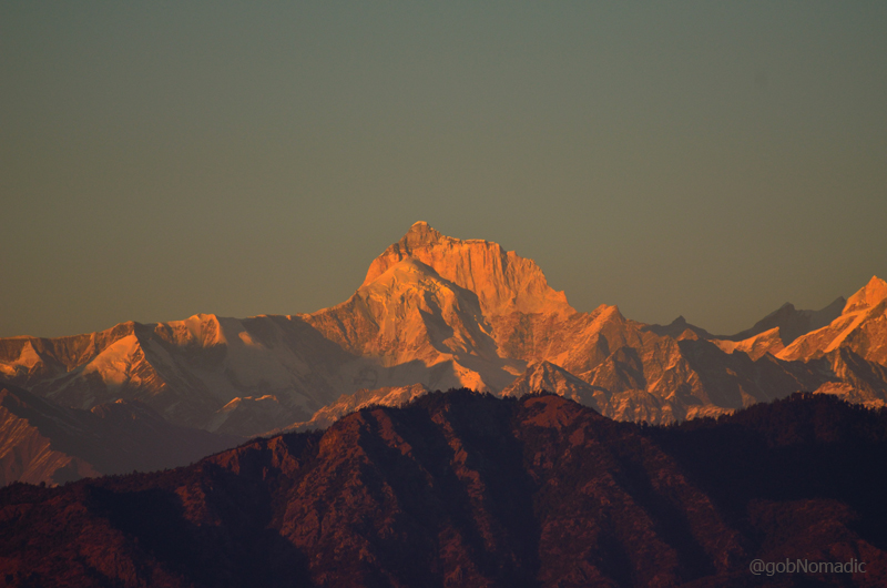
Nanda Kot (6861 m) and Dangkhal (6050 m) as visible from Chaukori. More at Flickr Photoset
Shadowed by the towering Himalayan peaks and blessed with forests of pines, oaks and rhododendrons, Chaukori makes for an idyllic Himalayan holiday destination. The fresh air, tea shrubs, orchards and the dense woods add to the comforting charm of the hill. One of the tea-gardens here was once owned by the hunter-turned-conservationist Jim Corbett. Of the many interesting walks, the three km hike to the musk deer breeding farm is one of the popular options. The walkway to the farm leaves off the main road in the direction of Vijaypur. Just remember photography is not allowed inside the caged premises of the breeding farm. The nearest marketplace is Berinag (10 km). Other popular “Nags” villages nearby include Dhaulinag, Kalinag, Feninag, Bashukinag, Pinglenag and Harinag. Famous temples nearby include Nag Devta and Tripura Devi.

View from the KMVN Chaukori. More from the region at Flickr Photoset
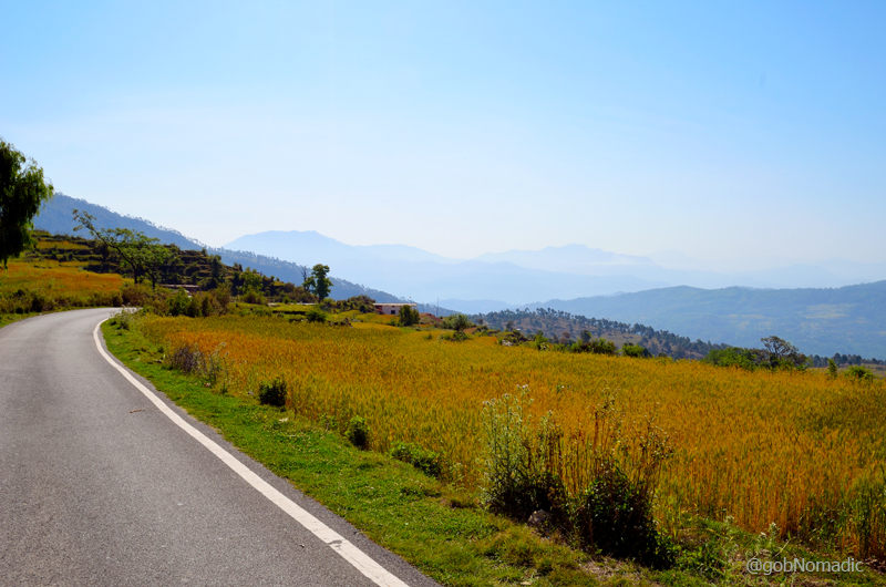
Golden wheat along the motorway near the tea estates of Berinag; view towards hills of Pithoragarh

View towards Pithoragarh hills. Photo Credit Sarabjit Lehal
Average Altitude at Chaukori: 2000m
Best time to visit: October to April
Famous for: Sylvan charms and Himalayan views
Accommodation: Limited but mostly available. KMVN offers the best views
Garhwal Diary; Lesser exploits in the Himalayan Balcony at Pauri

Incipient sunbeams creating mystical profile of gleaming Hathi Ghori Peaks. More at Flickr

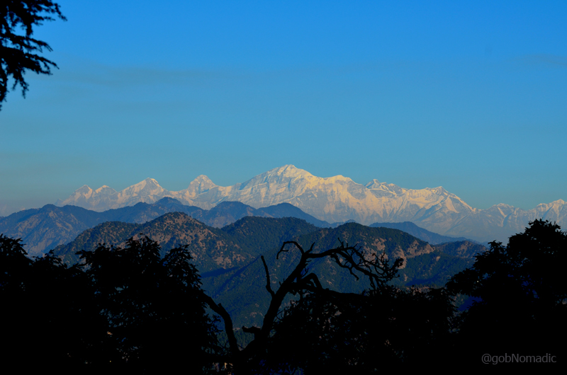
The shining Central Himalayas in the morning. More from the region at Flickr Photoset
The inchoate beams of the sun, next morning, unveiled some more features as well as divine aspects of the holy snow-clad screen. With the morning light producing silhouettes over the gleaming icy pinnacles, the awakening of senses reverberated with the mystical reflections off the snows in the vast Himalayan amphitheatre. Peaks as far as Dunagiri, Nanda Devi and Mrig Thuni towards the eastern horizon were clearly visible. Collecting my senses from the previous night’s slumber, I sat by the window pane and arranged my camera.
Not just aesthetically admired but the peaks of the Great Himalayan Range visible in Garhwal or Kumaon are revered as their guardian deities by the locals where the inspired ones usually begin their day by bowing in reverence for the Himalayan Gods. In Pauri, the centre stage is occupied by the Badri Vishal. The spirituality associated with the Himalayas finds a much deeper significance down below in the plains. The Ganges fed by the central Himalayas is in actual fact the lifeline of north India, grain bowl of the country.

The Hathi Gorhi Parbat massif above Khirsu woods. Please visit Flickr for more images
L to R: Nanda Ghunti (6340m), Roung Tee (6370m) and Trishuli (7120m). More at Flickr
The locals, particularly the priests, are generally well versed with the nomenclature of this part of the Himalayas and would happily point out the peaks and directions for you. The issue, however, is the relative topography as well as its latest terminology. With a hope of finding a latest relative map of the state or the region, I futilely checked at the bookshops of the main market located on either side of the main road or “The Mall Road” as referred to by the locals.
A panoramic view captured near the Deputy Commissioner’s residence. More at Flickr
With amiability in their attitude, the inhabitants of the political capital of the Land of Gods are profoundly religious as is reflected by the thriving historical temples dotting the town. The popular ones are Kandoliya Devta, Laxmi Narayan, eighth-century Kyunkaleshwar Mahadev, Hanuman Mandir and a temple dedicated to Nag Devta. Nearby, other places of interest which could also double up as picnic spots include Ransi ground, Khirsu and Adwani forests, etc.
Horse-shaped Pauri town. More images from the region at Flickr
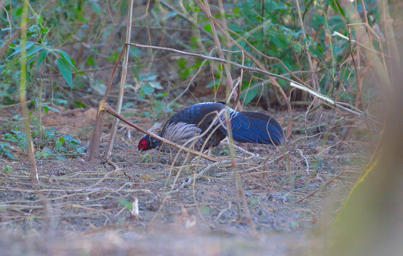
Kalij Pheasant (White-crested) spotted near Khirsu
The view towards the Trishul, from Pauri, is partially enriched by the wooded ridge of Khirsu. Enticed by its sylvan charm, I hoped to get a better view of the mountain from the ridge, basically an extended right ridge-arm of Pauri that can be reached in about 30 drive-minutes. The approach offers some splendid Himalayan vistas as well as photogenic access to raw flora and fauna. In fact, the government has long been planning to develop the small hamlet of Khirsu into a hill station but the actual progress reflects the sad state of affairs.
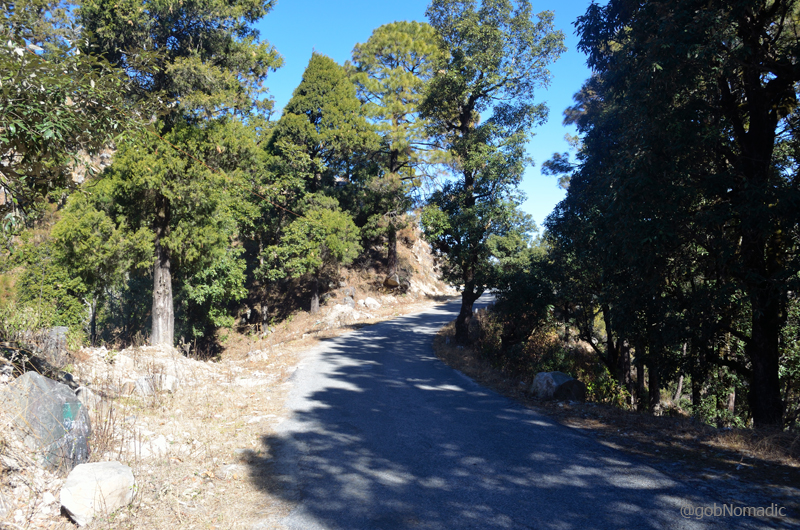
The narrow dreamy road to Khirsu. More of the region at Flickr

The terraced fields of fertile Nayar Valley. More images from the region at Flickr

Mountainscape as viewed from the GMVN property at Khirsu. More images at Flickr Photoset
The accommodation options at Khirsu are limited to a few guesthouses including a spacious GMVN property and a FRH that promotes camping. Even though, I was disappointed by overall management of the quiet hamlet including the GMVN property, the densely wooded ridge not only offers some refreshing trails to take a walk but allows distinct views of Chaukhamba. At 1800m, the tranquillity of wooded Khirsu gets broken by chirping of birds or occasional clamour of monkeys. The ancient temple of Ghandiyal Devta is also located nearby.

Chaukhamba massif captured from Khirsu; Satopanth and Kumling are also in the frame
I budgeted a day to visit the popular temples of Pauri. Encircled by evergreen deodars, the Kandoliya temple, situated just above town, is dedicated to the local deity Bhumi Dev and allows some quiet moment with eternal Himalayas. The Himalayan Gods, who superficially live on mountains in trees and streams, are innumerable. Every valley or village has its own deity but the most venerated one throughout Uttarakhand remains to be the Nanda Devi.
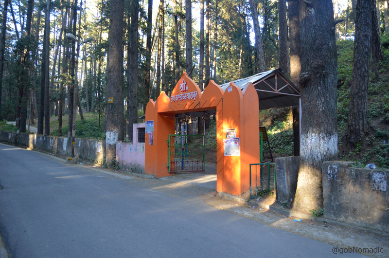
Entrance to the Kandoliya Mahadev Temple at Pauri. More images from the region at Flickr
It takes about 10 min to climb the stairs to reach the Kandoliya Mahadev Shrine
Later in the day, following a thoughtless guide book, I trekked all the way up to the Kyunkaleshwar temple, from the CH, only to discover that it can now be reached through a narrow motorable road. Situated a little above the settlement of Pauri, the temple offers some fascinating Himalayan vistas. Said to be belonging to the eighth-century, the temple is dedicated to Lord Shiva and still practises the age-old Guru-Shishya ritual in its Gurukul.

A Havan Kund inside the Kyunkaleshwar temple complex (taken from smartphone device)
The Gurukul students or staff would gladly guide you through the historical memorials located within the temple compound. If you are lucky enough, your walk to the temple could be rewarded with a remarkable presence of wildlife as well as birdlife including wild pheasants. I luckily spotted a Himalayan Fox couple. One more temple dedicated to the Nag Devta could best be reached through a 45 min trek starting near the Superintendent of Police’s office.
The Golden Chaukhamba massif. More images of the region at Flickr Photoset
Average Altitude at Khirsu: 1800m
Best time to visit: October to April, avoid monsoons
Famous for: Sylvan charms and Chaukhamba views
Accommodation: Limited but mostly available
Garhwal Diary; The Grand Balcony of Himalayas at Pauri
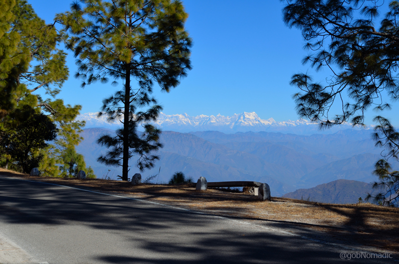
The poetic highway NH 119. More pics of the region at Flickr Photoset
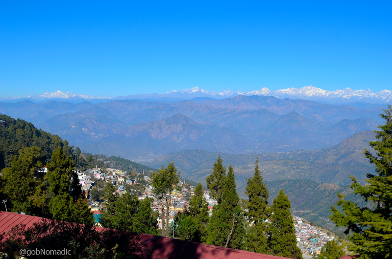
Very often, our notion of the perfectness of a hill station collectively comprises the quality of the mountain-scape it offers to its visitors. In the Himalayan state of Uttarakhand, the flavour of landscape switches to a newer angle with every rising ridge or changing hillside but the prime focus of the show remains the snow-capped curtain of central Himalayas stretching roughly over 150 miles from Swargarohini in the west to Panchachuli group of peaks in east. Nonetheless, such an innocuous desire to be able to savour the picture-perfect grand Himalayan spectacle gets verbalized by supportive weather conditions prevailing at that point in time. I would say that I was very fortunate indeed to have been blessed by a near-perfect view of the glowing snowy screen which Pauri Garhwal is famous for.
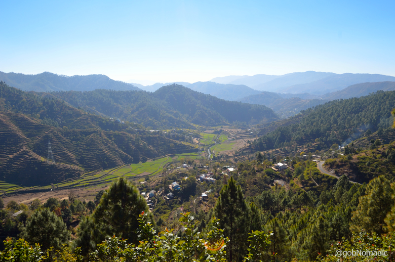
The fertile Nayar Valley. More from the region at Flickr Photoset
Descending the Lansdowne ridge, the nicely tarred NH 119 takes about 150 comfortable-minutes to reach Pauri, the administrative headquarters of Pauri Garhwal district of the state. Looping an exposed hillside, the narrow highway passes through Gumkhal and Satpuli just as the white curtain disappears from the scenery giving way to the Nayar Gorge. Spread on both sides of the highway, the small trade centres of Gumkhal and Satpuli comprises, typical of a small Garhwal town, matchbox-sized shops many of which still retain their wooden framework. Ahead of the confluence point of Western Nayar with Eastern Nayar at Satpuli, the road gradually ascends and the narrow gorge opens into the richly fertile Nayar valley comprising one of the most scenically terrace-shaped agriculture fields. The delight of passing through the multi-shaded green landscape immediately got fructified at a bend near Buwakhal when the shining snowy screen made an instant appearance. Passing through dense woods, the remaining six kilometres till Pauri presented a short intro to the Great Himalayas where one by one each major peak announced its presence.

The vantage offered by Pauri ranges from the far-flung hills of Mussoorie to Chamoli regions.
Previously known as the British Garhwal, Pauri has always been an important trading centre and was a staging post during the silk-route days. Spread on the terraced northern slopes of Kandoliya Range, at an average altitude of 1750 m, Pauri has gradually become the political nerve centre of Garhwal region. Possessing a rare scenic beauty and scintillating surroundings, the settlement of Pauri comprises a fusion of recently constructed houses as well as olden ones bearing signs of traditional architecture and a market that fulfils most needs of the region. Unlike most other hill stations developed by the British, Pauri has retained very little from the colonial past. In its place, Pauri is a confused manifestation of an expanded village gradually germinating into a Himalayan town. The character of the landscape shifts from being milder to a more rugged one as one enters the side valleys to reach snows.

L to R: Kirti Stambh (6510m) and Kedarnath (6940m) in the centre. More at Flickr

The 6351 m Sumeru Parbat continues to be one of the most difficult and less attempted peaks of the region. More peaks and nomenclature of the region at Flickr Photoset
The visitor profile to Pauri includes pilgrims who are either on their way to the famed Char Dham Yatra or visitors to the ancient temples of Pauri. Though, in the recent times, Pauri has been gaining popularity with adventurers, trekkers and para-sailors. Owing to the avenues generated by an influx of tourists, over the past few years, a few guesthouses, restaurants, eateries and a couple of ‘resorts’ have come up. I always say the state-run GMVN property could have been managed better. The best aspect of staying in Pauri is that almost every accommodation offers a splendid view of snow-capped Himalayas. However, the best views can be had from the Deputy Commissioner’s residence.

Literally meaning Tail of a Monkey, the shining Bandarpunch massif. More at Flickr
Fortunately, I was welcomed at the conveniently located Circuit House (CH). I particularly liked the accommodation for the views it commanded and the sumptuous home-cooked meals dished out by the cook. In winters, during the daytime, the open lawns of the CH complex would become favourite haunt of the neighbours who would spend their afternoons taking the sun. As the locals were gearing up to receive the first spell of snowfall of the season, the exceptional sunny afternoons were possibly their best bet to socialise.

Morning view from the lawns of the CH. Please visit Flickr Photoset for more images
Having offered a tea, I could not think of a better way to soak in the views of the Garhwal Himalayas. Barring a few inquisitive eyes, my presence was generally discounted by all. The region consists of a succession of gentle mountain ridges divided from each other by deep glens and climaxing at the snowy Himalayan canvas. Excluding the helm of Srinagar, the pasture of Panai on the banks of Alaknanda and the submontane tract, there was no level land visible from Pauri. The vantage offered by Pauri included the far-flung hills of Mussoorie, Chamba, Tehri, Rudraprayag, Srinagar, Karnaprayag and Chamoli regions. The panoramic view of enamouring snowy range included the peaks of Swargarohini, Bander Pooch, Gangotri Group, Kedarnth, Sumeru, Chaukhamba, Neelkanth, Hathiparvat, Nandadevi and Trisul etc. My eyes remained fixed on the spectacularly arresting mighty Chaukhamba massif. What more a Himalayan devotee like me would desire for than a noise-free civilised space and time to savour the holy glittering rocks?
Ranging from 6854 m to 7138 m, the mighty Chaukhamba Massif. More at Flickr
The 6596 m Neelkantha (Badrinath) towards right. More peaks at Flickr Photoset
The golden 6904 m Mt Thalay Sagar. More images from the region at Flickr Photoset

The glittering Kharcha Kund 6613 m. More peaks from the region at Flickr Photoset
The mystic sunlight in the morning and evening exhibits a glittering rebellion of colours on the sharp snow-clad rocks. The blue hues seamlessly merging into a shade better, ridge after ridge, produce a hypnotic effect during the two extremes of the day. The magnitude of habitation could feasibly be assessed in the night when the countless sparkling lights jeweling hillsides are viewed under a starry nightscape. I would regrettably say that no ridge or no corner as visible is spared from construction or the destruction.

The glittering Gangotri Group as observed from Pauri. More from the region at Flickr
Given the nature of the mountainscape, there can be little doubt that Pauri should be visited in a haze-free weather. The climate of the region is generally pleasant in summer, very cold in winter and heavy rainfall in monsoon. Apart from providing a considerate environment to a poet or an author or a photographer or a painter, Pauri offers some pleasing walks through dense woods full of flora and fauna. Such frivolous details would be covered in the next post.
Do not forget to load your photography gear with a wide-angle lens. In my case, sadly, my chief moped at the last moment.
Average Altitude: 1700m
Best time to visit: November to April, avoid monsoons
Travel Lure: Himalayan views
Accommodation: Mostly available
Kullu Diary; the flowing Ridge of Kothi
Northern arm of Bara Banghal Range captured from Kothi Ridge. Please visit Flickr for more images
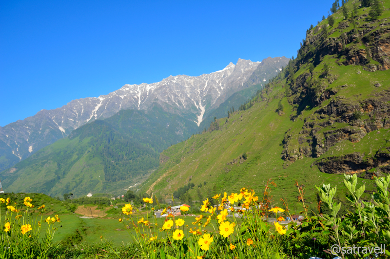
Situated a little more than ten kilometer from the fine spreading of enormous deodars jacketing the touristy Manali, Kothi makes for quite a visible delight. At 2552 m, almost placed at the foot of the mighty Rohtang La, since time immemorial, Kothi has been an ideal camping ground or base for several popular treks including the traditional crossing over of the pass to reach Lahaul.
Having crisscrossed the Kothi ridge, several times before, it was in the summers of 2013 when opportunity knocked the humdrum of daily life and presented with a window to travel in the Godly Kullu Valley. I immediately grabbed the offer made by my dearest advocate brother and directed myself towards the head of the fertile Beas Valley.
I would not vacillate in calling this place as one among the few remaining idyllic hideouts offered by the Beas region. Retaining its own poetic charm, the splendidly attractive ridge offers plentiful of vistas ranging from green Deodar cover to raging stream and finely shaped snow-capped lower Himalayas to alpine pastures.
View towards the Beas Valley. For more pics, please visit Flickr Photoset
Possibly deriving its name from the bungalow, now occupied by the PWD of the state government, the Kothi-ridge has always been among the favourite halting spots for trans-Himalayan bound travellers. Although basic facilities like small shops, a few Guest Houses, restaurants, etc. have sprung up on the ridge, still commanding its grand old charm, the PWD Rest House continues to be the landmark building of the ridge. It was not difficult for me to recognise the PWD RH from the Check Post, for Rohtang cross over, stationed just before Kothi as one crosses the narrow deep Beas Gorge.

View towards the Rohtang Range. For more pics, please visit Flickr Photoset
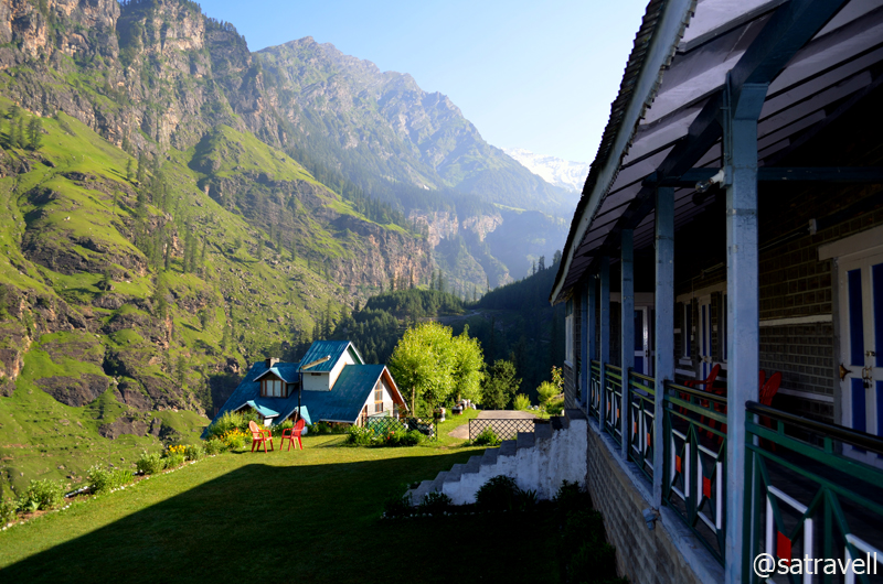
As the morning sprang up to life the next day, I could not but minutely observe the splendid canvas of nature. Opposite the bungalow are the fine-girt precipices which line the southern foot of the Rohtang range, while south of them stretches an inimitable vista of the valleys, the wide forestland and the snow-sprinkled ranges that makeup northern sentinels of Kullu. The RH itself is positioned on a grassy slope at the lower edge of the immense forests of pine and chestnut, which were once the favourite haunt of both red and black bear as per the earlier records maintained by travellers. However, on a highly unfortunate note, currently there isn’t much left in the immediate surroundings for a wildlife lover except for the flying scavengers who occasionally glide through thermals coming off the rocky edge.
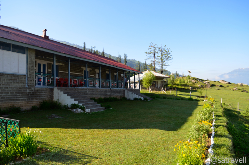
The Kothi Bungalow (RH). More images from the region at Flickr Photoset

View from the corridor of the RH. The mobile tower is positioned in Palchan; the Gorge and the small settlement of Kothi towards the lower-right of the frame
View towards Rahla. The bungalow, part of this frame, belongs to a bigwig from Haryana.

A Himalayan Bulbul. More at Flickr
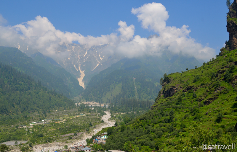
Just as one slopes down, one of the mighty natural wonders of Kullu lay bare before your eyes. The head of the valley is marked by a mighty crack, as if some natural upheaval had happened in the times gone by. The gorge, more than 20 ft wide, is walled by sheer cliffs. More than 100 ft below at the floor of the gorge, the Beas races and surges with an unceasing roar displaying its free fall momentum from the crest of Rohtang. Down below it is joined by the voluminous Solang Torrent before it gets codified into the Beas River.
Right from the earliest recorded travellers including Col Bruce or Moorcraft and Trebuck in their expedition of 1820, everyone made a special reference to Kothi, its splendidness and the challenge which this Gorge posed to be crossed. As for me, it will continue to attract and inspire me to remain forever attached with Himalayas.

The snow-capped Rohtang Range captured in the morning. More from the region at Flickr
View towards the Halindi and Sarai Nala Valleys. More from the region at Flickr Photoset
Average Altitude: 2500m
Best time to visit: Avoid monsoons and winters
Travel Lure: Himalayan views and refreshing walks
Accommodation: Very limited
Postscript to my trans-Himalayan Stroll
The following is a page entry from On Road through the trans-Himalayan Region. To read complete travel memoirs and trip report, please visit here.
Chapter 22 of 22

Nun-Kun in Suru Region. More from the stroll at Flickr Photostream
The following morning, I chose to ignore the otherwise routine morning activities, which includes yoga or a morning-walk. Without breakfasting, we checked out of the hotel and having bought prasad, from the market, for family, we set out towards the Jammu city (308 m). Without any stoppage on the way, we lunched at the famed Haveli on NH1 past Jalandhar. The cruising affair of The Faithful continued non-stop till Karnal where I spent 10 min in unloading cousin as well as his belongings. The distance between Karnal and Jind was covered via Panipat. This way I reached my home at around 2230 hrs after picking my better-half and the kid from her parental house in Jind itself.
Even more enthusiastic about the Indian trans-Himalayan region and having gained some first-hand knowledge, I spent the remainder of the night in recounting the experience as well as key highlights of our sojourn on the rugged edge of the world. While describing the happenings of the trip, I could almost pinpoint the key regions where I could not manage to travel this time on the dream journey. Certainly, there is all the more to look forward to on my next visit in the coming seasons.


Even though, it is all the more preposterous vainly trying to give inkling to what you consider to be your quest. Still, chronicling travels is a vital aspect of a wanderer’s objective. The current journal is my first ever attempt in the aforesaid direction. In the due course of writing, I got introduced to as well as discovered the various measures a writer needs to take while travelling. All such measures have been integrated with the thinking as well as planning process for all prospective journeys. In future, I do wish to get a chance to travel and visit a similar area for a longer duration to be able to grasp as well as analyse the realities and present them in a more useful manner.
The description, as mentioned in this journal, is a creation of knowledge on the area accumulated, over a period of time, by gaining first-hand experience as well as reading numerous books and write-ups which I so far came across. The finest of the accounts, as mentioned in this journal, would be those which are able to reproduce the soul as well as create a precise imagery of place. The description may seem below mark and perhaps thoughtless but anyone who has been to the trans-Himalayas would endorse the specifics and may like to supplement it with words which are even more beautiful. The memories of red, yellow-billed alpine choughs calling against the backdrop of rocky cliffs and wind-blasted afternoons are forever etched in my mind.
“He who travels far will often see things
Far removed from what he believed was Truth.
When he talks about it in the fields at home,
He is often accused of lying,
For the obdurate people will not believe
What they do not see and distinctly feel.
Inexperience, I believe,
Will give little credence to my song.”
–Anonymous