 bNomadic
A weekend at Puducherry

Just as Chennai and its suburbs are recovering from incessant spell of rains, I am on my way to Puducherry for an extended weekend. Ready to precipitate anytime, dark grey clouds follow me as I drive south of Chennai along the Coromandel Coast on the East Coast Road (ECR) to reach the heritage town of Puducherry. The day is about to end as I reach my pre-booked accommodation at the coastal town that was once French India.
Even though, this is going to be my first visit to Puducherry, the allure of colonial era still retained by this town on the east coast of India has been stirring my imagination from much earlier. Not many places in India can cast as magnetic a spell on you; especially by sheer virtue of not only their geographical location or colonial antecedents, as this indistinctly populated, multicultural town located on a cyclone-ravaged coast of south India.

By the Bay of Bengal; the largest in the world. Please visit Flickr for more images of the region
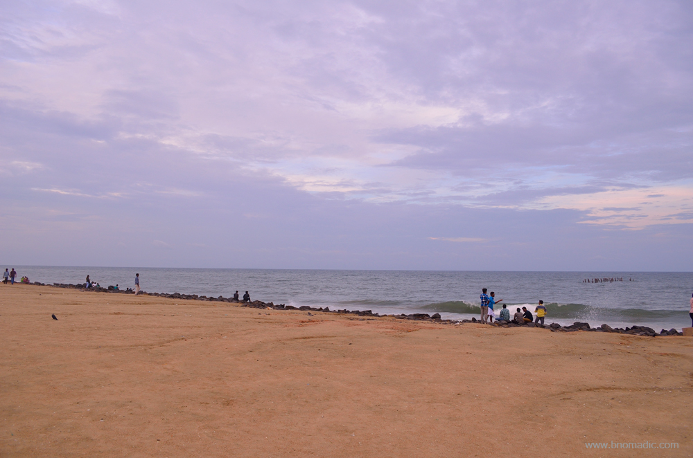
Morning by the sea!; Notice the remains of the iron pier poking out of the water in the sea towards the right of the frame. The 240 m long jetty was destroyed by a cyclone in 1952. More at Flickr

An overcast morning at Puducherry
Having polished off a sumptuous evening meal at the popular South Indian restaurant Surguru, located just next to the multi-storeyed hotel where I am staying, I retire early, exhausted. I wish to devote the next two days in exploring the lanes and streets of the pleasantly peaceful and harmonious Pondy. In spite of the linguistic overabundance at Puducherry, home to natives from 55 different language speaking regions and that Tamil, Telugu, Malayalam, French and English are the five official languages of this Union Territory, there exists absolute cordiality. Almost all streets of the town are dotted with precincts of a temple or a colourful church or a mosque. Many temples in this heritage city are multiple centuries old even as a few churches date back to the end of the seventeenth century. Irrespective of their origin or religion, people from all walks of life join the conversations and festivals which are recurring all through the year. For reasons like these, the town has been growing into a repository of art as well as culture.
Next morning, I pick up a city map from the hotel lobby and set out for a daylong excursion through the streets of oval-shaped Puducherry. When exploring the spirit of a city like Puducherry, it becomes all the more important to take a walk through the main streets of the town including the olden part and closely observe its architectural traditions. Over the course of next two days, I clock more than 20km of walking distance. The sunflower-coloured streetscapes of the town indeed have a unique appeal that enthrals the travellers. Even the numbering of houses is a peculiarity here; with odd numbers on the one side and even numbers on the opposite side, I face no issues in reaching the lesser frequented heritage destinations.

Dedicated to Lord Shiva, the Vedapureeswarar Temple at Puducherry was destroyed by the French in 1748 only to be rebuilt 40 years later by public contribution. More images from the region at Flickr
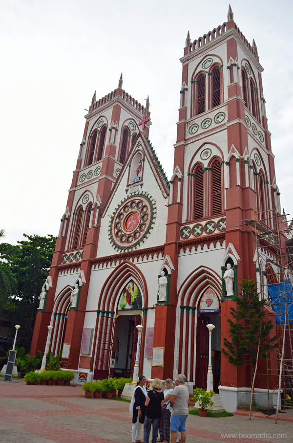
Constructed in 1902, the Basilica of the Sacred Heart of Jesus Church

Immaculate Conception Cathedral was built on the ruins of the older church in late eighteenth century
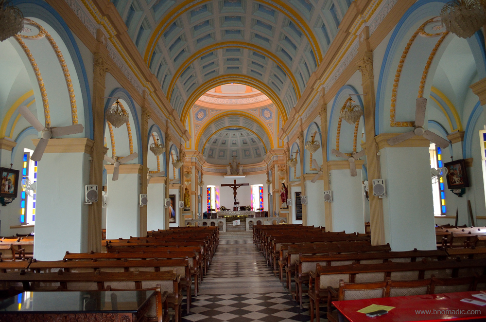
Constructed in mid-nineteenth century, inside the church of Our Lady of Angels that faces the Bay of Bengal
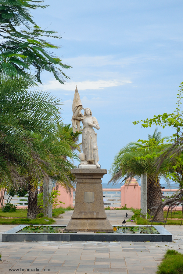
The statue of Joan of Arc against the backdrop of Sea; “erected in 1920, it has political significance as it bears witness to the rallying of the Church of France to the Republican regime. In Pondy, standing tall alongside British India, she is given the importance of a patron saint.”
The prevailing architecture of Pondy town is an ensemble of French and Tamil houses. Intersected by a storm water canal, the town is bisected into French and Tamil quarters. Facing the sea, the French quarter, earlier called the White Town, has structures in the European classical style; whereas the buildings in the Tamil quarter, called the Black Town, are in the vernacular style of Tamil Nadu. Influenced by each other, today many structures – especially the newer ones – in both parts of the town are a harmonious blend of European and Tamil architectural patterns. A few NGOs are engaged in restoring the traditional houses, especially the Tamil ones even as the olden part of Pondy facing onto the Bay of Bengal retains much of its traditional French character. The 1.5km long chief promenade of the town, Goubert Avenue runs parallel to the sea alongside the French section.

The French Consulate General building has a fascinating history of its own. More images at Flickr
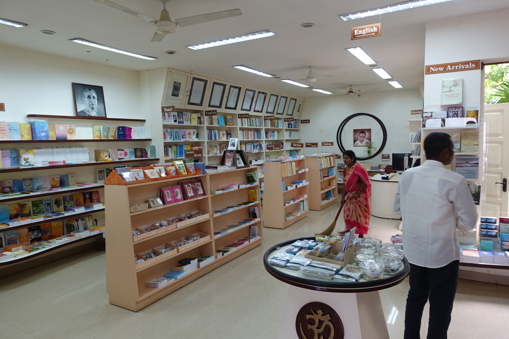
The bookshop of the Sri Aurobindo Ashram. Please visit Flickr for more images of the region

My energy drink; every year cyclones or winds consume a substantial chunk of coco trees around here

A traditional entrance of a Tamil House; notice the rangoli, called kolam which womenfolk draw with rice flour every morning in most parts of Tamil Nadu

The promenade beach in the evening; a great place to relax or take a stroll at almost any time of the day.

The promenade; late in the evening. In fact, the best time to take a walk would be early mornings or late evenings when the administration closes the road for vehicular traffic. More images at Flickr

Daybreak at promenade. Please visit Flickr for more images from the region

Usually evening is the time when fishermen are free to relax and catch up on gossip over mending nets as they prepare for the next day. Please visit Flickr for more images of the region

Just a funeral procession

A street of French Quarter, the White Town; Up to the 1920s, the focus of the French authorities was the White Town, the Black Town saw hardly any development. More images from the region at Flickr
Testimonials of the previous architecture; gates to mark the heritage city. More images at Flickr
In order to try and understand the evolution of streets and the important landmarks of Pondy, it becomes paramount to have some basic knowledge about the history of the town. An employee of the Legislative Assembly of Puducherry, Balaji, who is also associated with INTACH as a volunteer, is my associate and guide for the day. Initially, it sounds a little boring but as we proceed on the streets, making mental note of the landmarks we come across, curiosity increases manifolds. The town was previously called Pondicherry, the French interpretation of the original Tamil word Puducherry, which means a new village. Just a few kilometres from the town is the historical site of Arikamedu, where proof of trade with Romans that flourished in the first century exists. During those days, the trade included dyed textiles, pottery and semi-precious stones, many of which are on display at the Pondicherry Museum. Centuries later, Pondy became a part of the Empires of Pallavas, the Cholas and the Pandyas till fourteenth century; after which it came under the Vijayanagar Empire, followed by the Islamic rule. In sixteenth and seventeenth centuries, the region was occupied by the Portuguese, the Dutch and the Danes for the purpose of setting up of textile trade.
The flourishing trade then attracted the French, who secured land for a trading post in 1674 from Ali Adil Shah II, ruler of Bijapur, who at the time controlled this part of Southern India. Pondy was then again occupied by the Dutch in 1693 after which it subsequently changed hands between the British and French no less than nine times in the course of the eighteenth century. The removal of fortifications as the British razed down many of Pondy’s finest buildings in 1761, led to flattened ramparts that form the boulevards of Puducherry today. During the French regime, which got established after The Treaty of Paris, the trading post grew into a prominent fortified town and an important port. By the end of eighteenth century, much of the old town of Pondicherry, as we know it today, had been laid out and rebuilt on its former foundations under the planning of Jean Law.

The foyer of the Pondicherry Museum, which is located in an erstwhile Law Building. The museum has a collection of rare bronze and stone sculptures from the Pallava and Chola dynasties as well as excavations from Arikamedu.

The museum also has church relics and French furniture brought from various mansions that dot the city
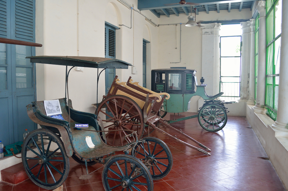
Transport mechanisms of the days gone by that often required attendants. More images at Flickr

Furnishings from a French dining room
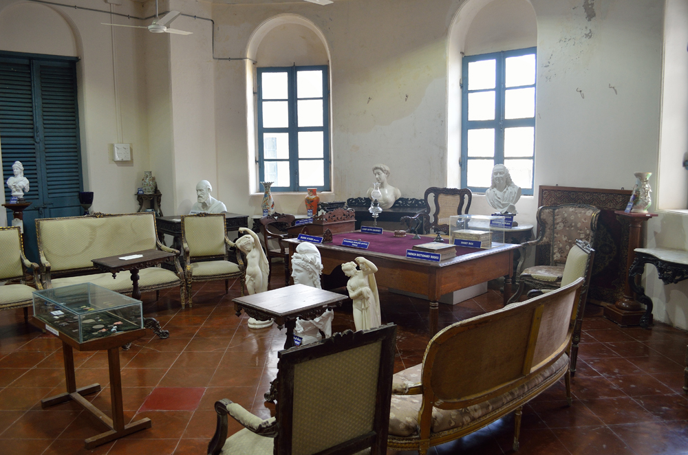
Each item is suitably marked inside the museum. More images at Flickr
All the important streets from the Black Town lead to the Goubert Avenue, the main promenade through the White Town. A 284m long jetty, now abandoned, marks the southern end of the promenade. Now shifted elsewhere, a distillery earlier marked the northern tip of the promenade which is lined with flowery-coloured edifices and colonnaded balconies of the French quarter. Midway along a broad Marina – the Goubert Avenue – running beside the ocean, stands the 4.25 m tall statue of Mahatma Gandhi which is arced by lofty monolithic granite pillars that are more than 11m high. Built in 1836, the 27m-high Lighthouse, which is now abandoned, stands nearby. Balaji tells me that the road or streets are called Rue in French and Salai in Tamil; and most of the streets were initially named after French generals or commanders.
Facing the waves of the Bay of Bengal, the debris of the Town Hall, once known as Hotel de Ville and Mairie, lies scattered just next to the war memorial constructed by the French to commemorate the Pondy soldiers who died in the First World War. A favourite haunt of couples, the shady Government Park that has the famous Pondy memorial, whose pedimented facades are crowned by an urn, lies just behind. Along with this memorial which many consider an amusing surprise, a few columns that were brought from Gingee to Puducherry after the capture of its Fort in 1751 add colours to the Park. Being one of the most photographed landmarks, the monument is a revelation for it is built in commemoration of a harlot, whose charity had made the direct supply of water to the town possible.
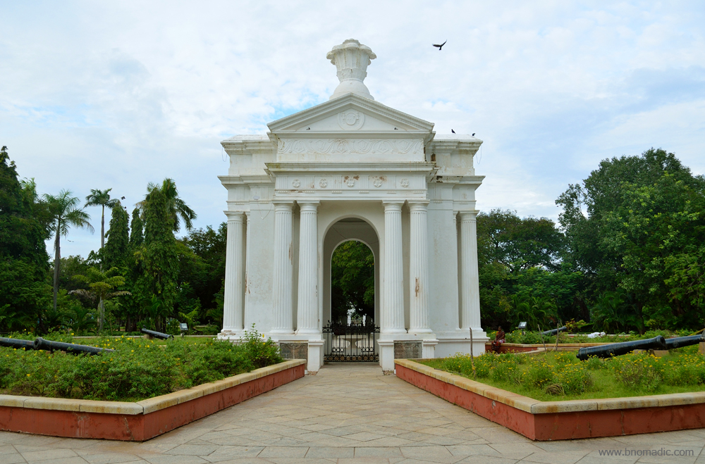
Aayi Mandapam; it was built in sixteenth century in Greco-Roman architectural style during the reign of Napolean III, the emperor of France, commemorating a courtesan named Aayi. The Government Park in the centre of which it is built is surrounded by many stately buildings like Raj Niwas, Museum, Art Gallery, etc. More at Flickr

The heritage building of Puducherry Legislative Assembly. Before Independence, the building was a private residence. Please visit Flickr for more images of the region
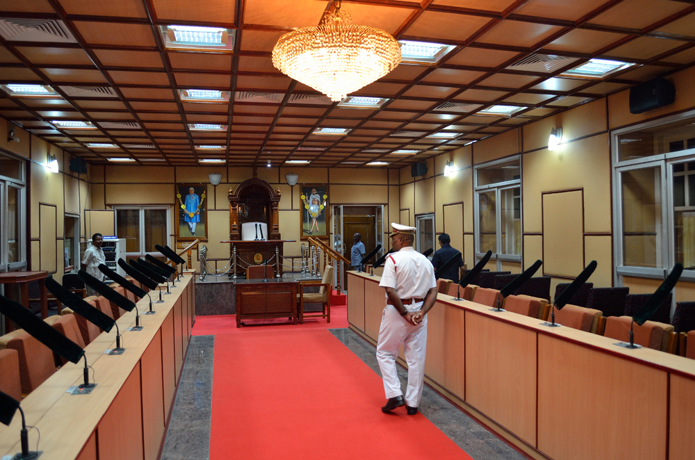
The main Assembly Hall; the Puducherry Assembly has 30 seats. Please visit Flickr for more images

The French War Heroes Memorial constructed by the French to commemorate the Pondy soldiers who died in the first World War. Please visit Flickr for more images of the region

The Kargil War Heroes Memorial. Please visit Flickr for more images of the region

Located by the waters of the Bay of Bengal, Le Café is the only waterfront joint on the promenade. The café was once the port office when a railways track ran along the promenade from the South Boulevard. More at Flickr
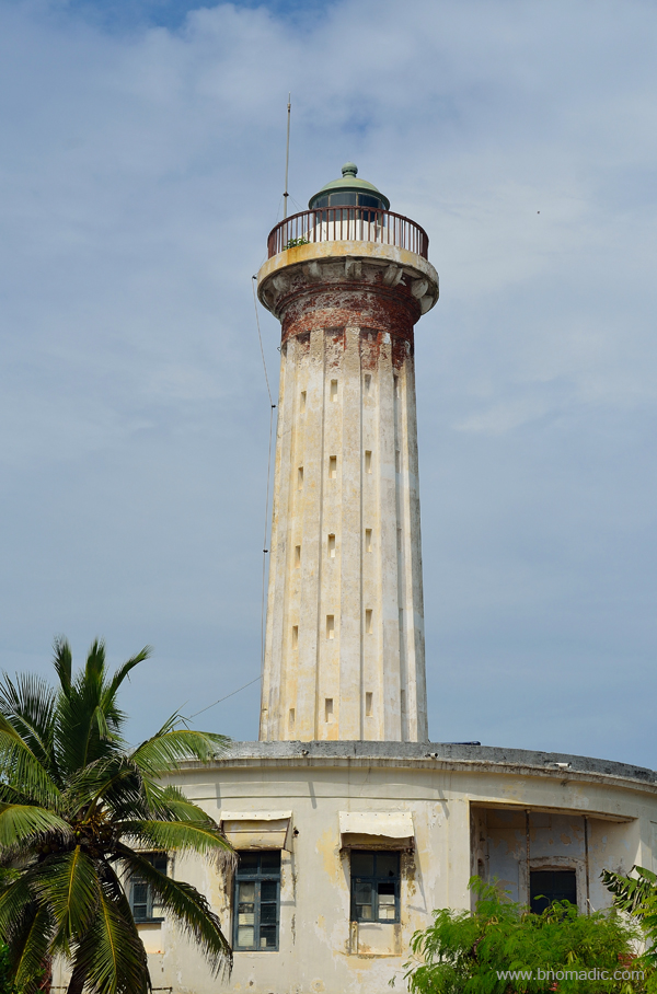
Built in 1836, the 27m-high Lighthouse, which is not in use any longer. More images at Flickr

Arced by eight lofty monolithic granite pillars, the statue of Mahatma Gandhi. More images at Flickr
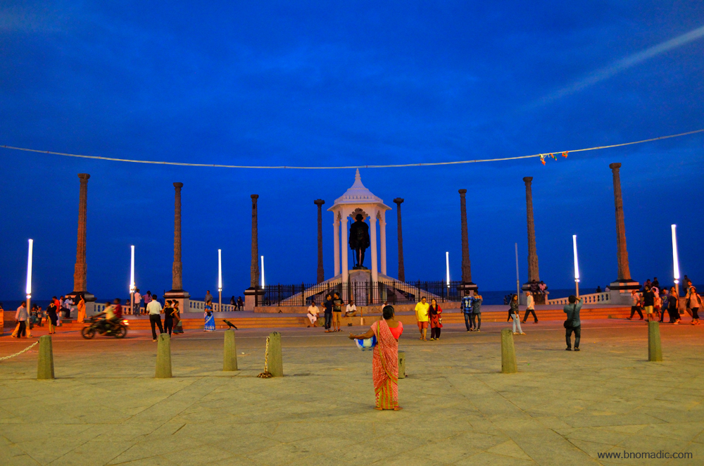
The Mahatma Gandhi statue glittering in the late-evening streetlight. More images at Flickr

Ayi Mandapam towards the end of the day. More images from the region at Flickr
The good thing is that most of the landmarks of the town are located almost adjacent to each other just as the numerous eateries, bakeries and café that dot the streets. The neo-classical Raj Niwas is towards the north of the park. Next door, on the other side of Rue Louis, is the Puducherry Museum where the management grants me the permission to make photos inside but without any use of flash. Apart from the findings of Arikamedu, the museum displays stone and metal sculptures from the Cholas and later periods. The upper storeys are stocked with furniture, paintings and other items assembled from various mansions in Puducherry. Many of such mansions and villas have now been converted into research institutions, department offices or hotels and guesthouses, etc.
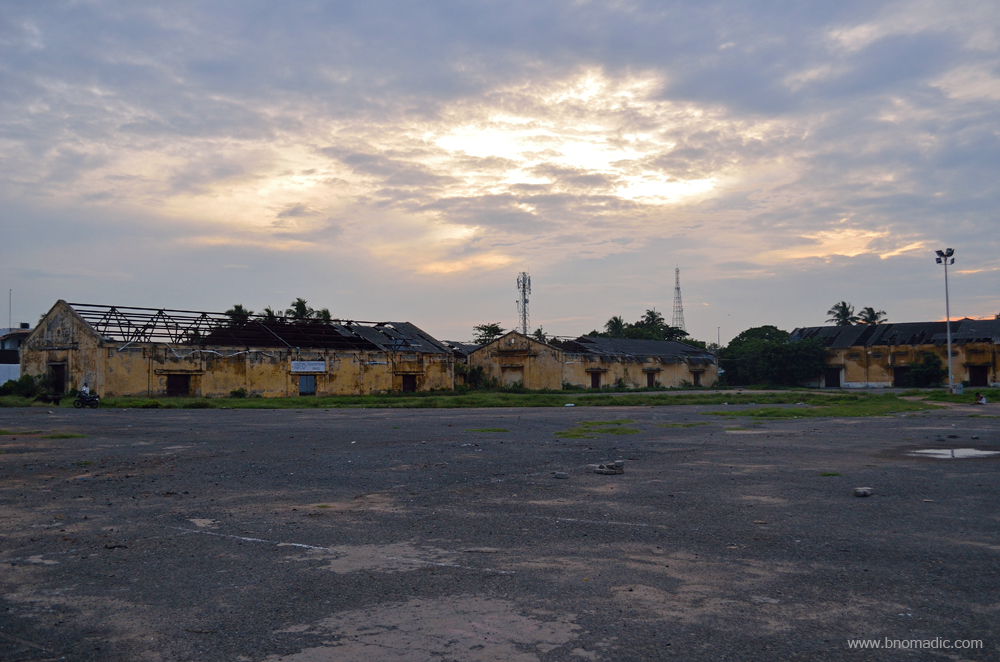
The old port offices and godowns. Please visit Flickr for more images of the region

For over three centuries, this gateway witnessed the busy trade of spices, beautiful textiles, woven cloth and later peanuts in return for a steady flow of gold, silver, weapons, merchants, priests, soldiers and adventurers
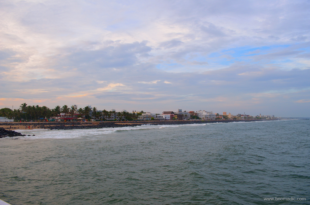
The Goubert Avenue and the beach from the waters. Please visit Flickr for more images of the region

The newer lighthouse and the port further afar in the frame. More images at Flickr

The old jetty of Puducherry (not in use any longer). Please visit Flickr for more images of the region
Many, particularly the ones who are spiritually inclined associate Puducherry with Sri Aurobindo Ashram. It was here the nationalist Aurobindo did his integral Yoga as he prepared his literary and philosophical works. Preaching the widely accepted spiritual path, he started an Ashram here; which was subsequently joined by a French mystic, Madame Mirra Richard, later known as the Mother. Today, hundreds of devotees daily throng the ashram and the Samadhi that encloses the bodies of Sri Aurobindo and the Mother. The Aurobindo Ashram is inside the town but the Auroville Ashram, another global spiritual-attraction that warrants a separate weekend even for a layman visitor, is located a little ahead of the town towards north.
At the end of two days, from visitors’ point of view, here is my two cents: spread along a rocky seafront and offering a fabulous view from the seaside promenade, the town of Puducherry is in actuality a settlement full of history as well as culture and may not be a destination for a laid-back beach holiday. Most of the sandy beaches and beach resorts are located just outside the city. The best way to explore Pondy is on foot. For those who are foodie at heart, the town fits the bill. One can feast on freshly-baked French baguettes or croissants for breakfast; enjoy the variety of seafood or traditional South Indian meal or an assortment of Continental, Mediterranean or Middle-East cuisines. Thanks to the European influence, wine, beer and other beverages are served in most restaurants.

Ananda Bhawan too is a popular eatery. Please visit Flickr for more images of the region

The Satsanga restaurant occupies a traditional bungalow in the French quarter. More at Flickr
Not only just that but Puducherry has emerged to be a chic shopping haven as well. Be it art and craft, or artistic pottery, jewellery, handmade soaps, perfumeries, incense items, exquisite linens, cotton or leather goods, the town has just about everything including exhibitions, shacks, exclusive stores like Hidesign that originated from here and boutique stores like Casablanca, Kalki, La Maison Rose, Auroshikha, Amethyst and Pothis to name a few.

A liquor shop; certainly not used to seeing one in north India where the shops usually have an iron grill in front
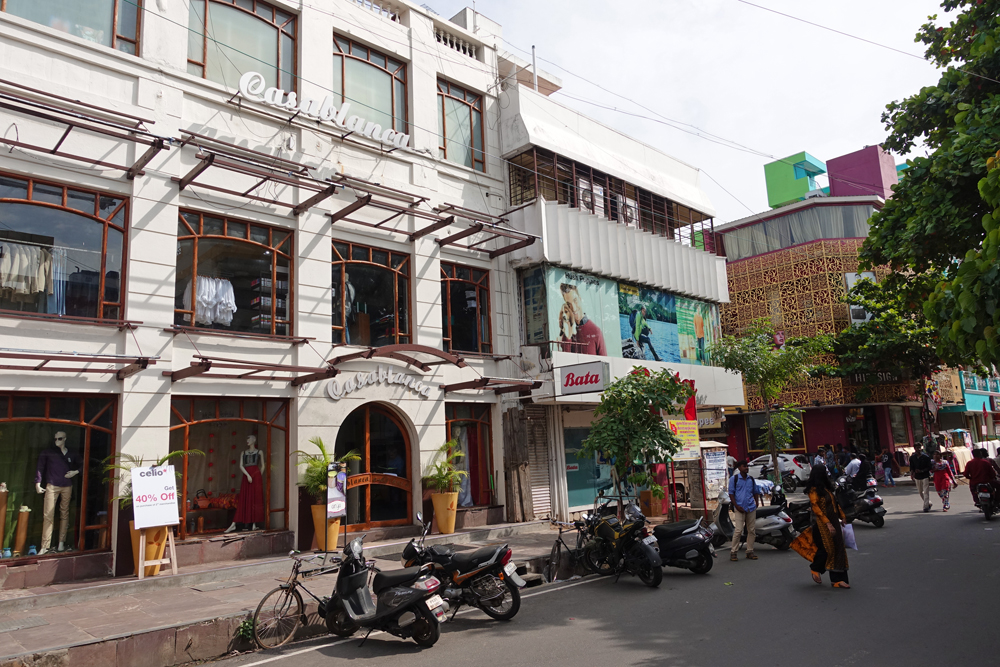
The Casablanca and the Hidesign outlets. Please visit Flickr for more images of the region
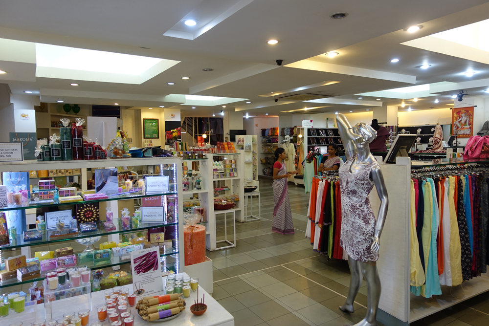
Inside the Kalki boutique store. More from the region at Flickr

An artist painting landscapes; within hours, he’d wrap a sheet. More from the region at Flickr

Puducherry is famous for creative and beautiful souvenirs. More images from the region at Flickr
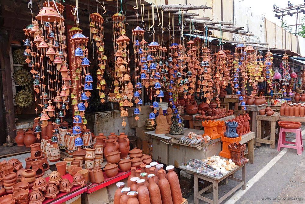
Teracotta, handmade papers, wooden handicrafts, aromatics, leather products, linens and garments are unique here
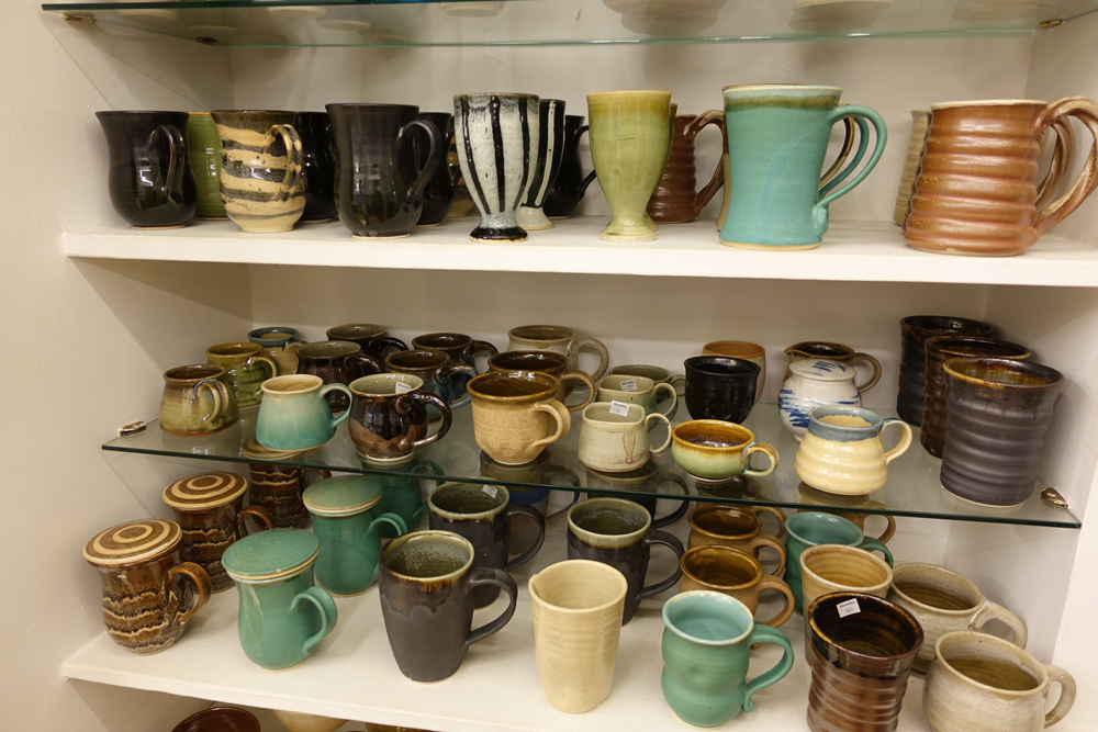
Tea pottery on display at an Auroville boutique store. More images from the region at Flickr

Hand-rolled incense sticks on display at Auroshikha. Please visit Flickr for more images of the region
Getting There
The town of Puducherry, formerly known as Pondicherry, is 170 km south of Chennai, the capital of Tamil Nadu. Bengaluru is 317 km from Puducherry.
Best time to visit: Any time of the year
Travel Lure: Beaches, Heritage, Shopping and Spiritual Awakening
Accommodation: Plentiful
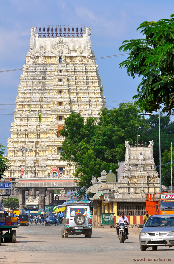
Kanchipuram Diary: The ancient temple of Kailasanathar

Having spent a rainy weekend at Puducherry, I decide to explore the vibrant Kanchipuram, the temple town of the coastal state of Tamil Nadu. It takes me just under three hours to drive down to Kanchipuram from the east-coastal settlement of Puducherry. Also known as Kanchi, Kanchipuram is one of the most colourful religious centres of south India. The town has more than 50 temples, many of which are multiple centuries old and are dedicated to different Hindu deities; primarily Shiva, the Goddess and Vishnu. Apart from the imposing temples that dot just about every corner of the city, Kanchi is also popular for its thriving silk industry.

The entrance to the ASI protected Jurahareswarar Temple; quite strangely, the temples remain closed from noon till 4pm
The profusion of shrines also means proliferation of religious sanctities into the layout and planning of the city. The larger of the two, Shiva Kanchi – where most of the Shiva temples are located – occupies the western portion of the city and the smaller one called Vishnu Kanchi – where most of the Vishnu temples lie – is spread along the eastern fringes of the city. The religious festivals that take place in the city keep the administration occupied almost continuously all through the year. Noticing the lofty imposing ancient structures that appear to be blocking the streets of the town is a first for me. But then, even with all its historical temples, the current spread of Kanchipuram fails to testify the fact the city once served as the capital of the mighty Pallavas from seventh to ninth centuries and later continued to maintain its hold during the succeeding empires of Cholas and Vijayanagaras, etc. Before coming here, I actually imagined the city to be much larger than what I am seeing currently.
The shopping aficionado in me decides to first explore the silk products. I straightway head towards the Gandhi Street where most showrooms are located. Shops and shacks to suit all budgets dot both sides of the road. I end up buying a pair of dhoti, locally called waistie, for myself. Not only silk and cotton, the street also has a few restaurants which serve authentic local cuisine. I decide to have brunch at a local branch of the South Indian foods chain, the Saravana Bhawan. The restaurant is much larger and crowded (by locals) than what I had expected it to be. The thalis, which are most preferred items from its South Indian Menu, are almost instantly readied and served. My choice is a Tamil thali.
The busy Gandhi Street of Kanchipuram. Please visit Flickr for more images of the region
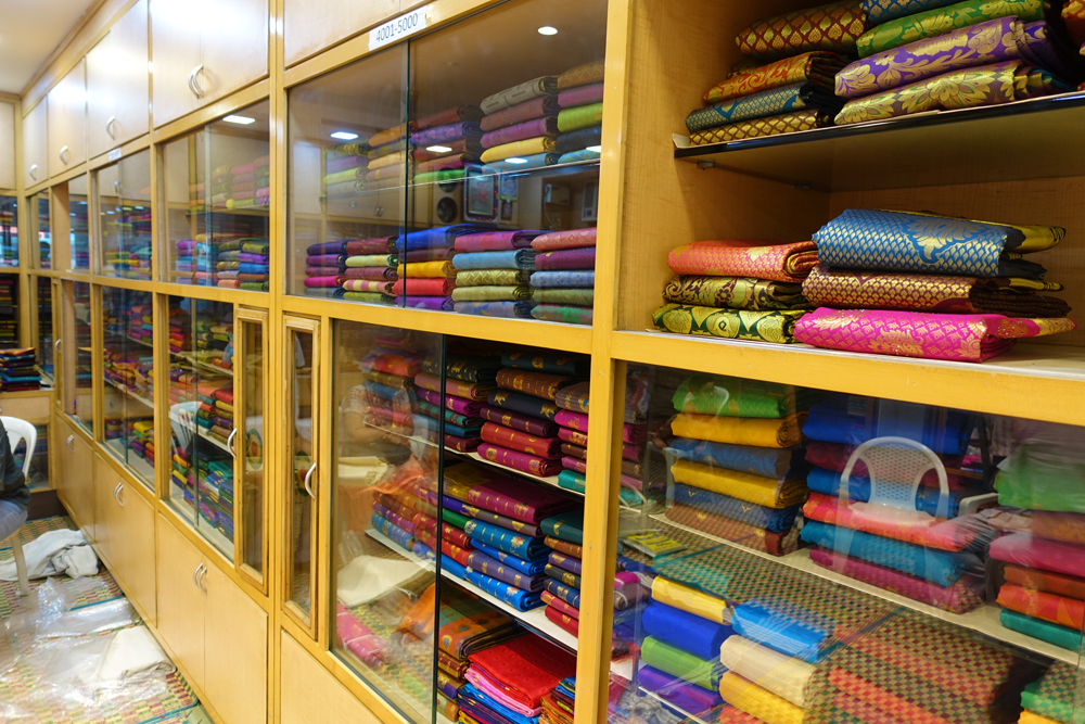
Inside a silk shop; Kanchi is famed for silk and cotton products. More images from the region at Flickr

The Saravana Bhawan restaurant. Please visit Flickr for more images of the region
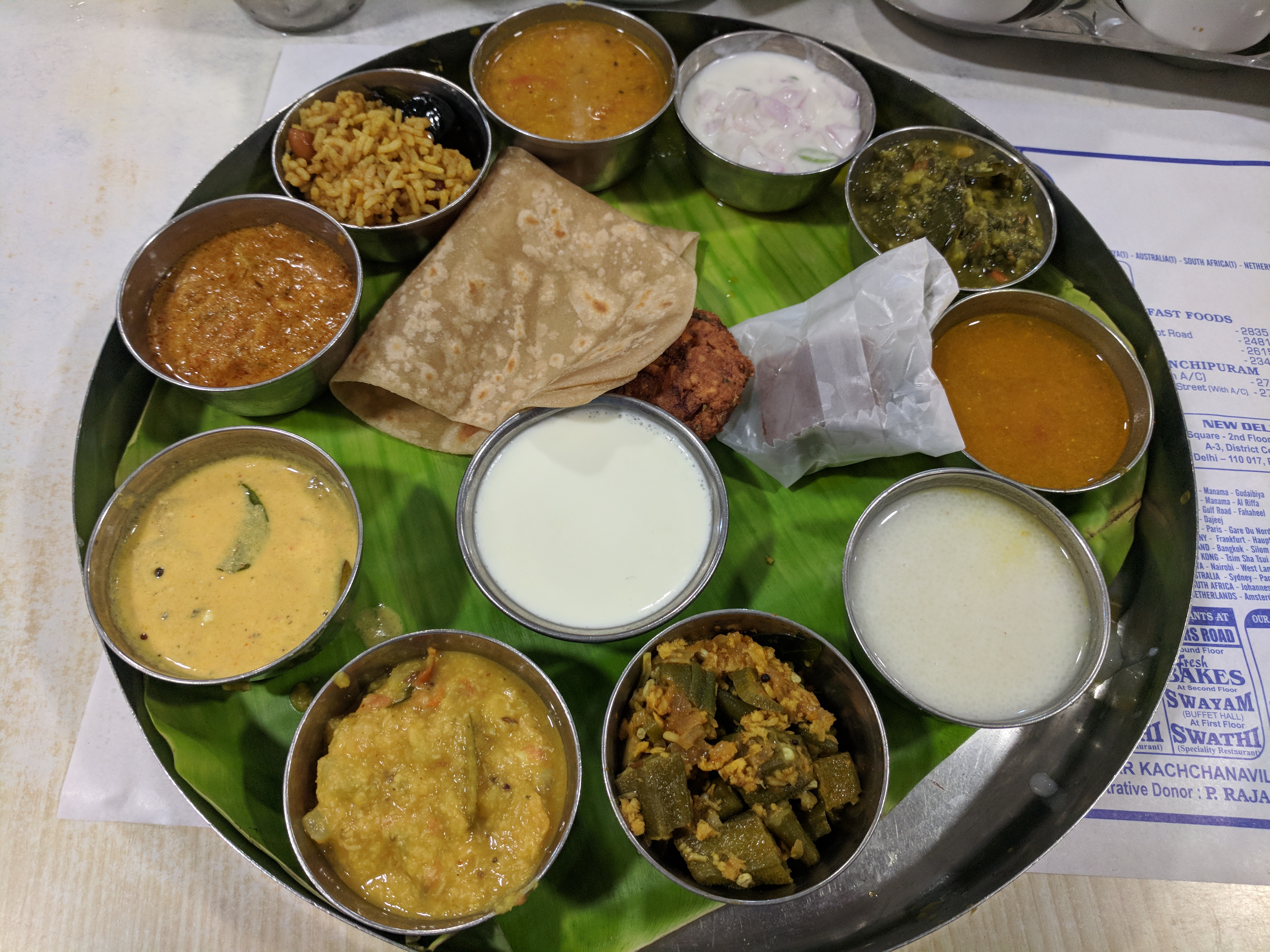
Thats the Tamil thaali I ordered. Rice, soup, ice-cream, buttermilk was served after I clicked this pic
Having munched on a Tamil veg-feast, I now head towards the Kailasanathar Temple, which stands on the edge of an open space about 500m west of Shiva Kanchi. It is a thing of much curiosity to imagine why historically so many temples continued to be built in an around Kanchipuram. Legend has it that the city Kanchipuram – literally meaning a sacred place – gets its name from the Kanchi Tree that bears fragrant Kanchi flowers which are meant for Gods. The tree is said to be found only at the sacred place of Kanchi; and hence the uniqueness.
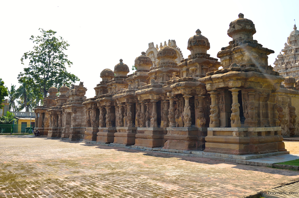
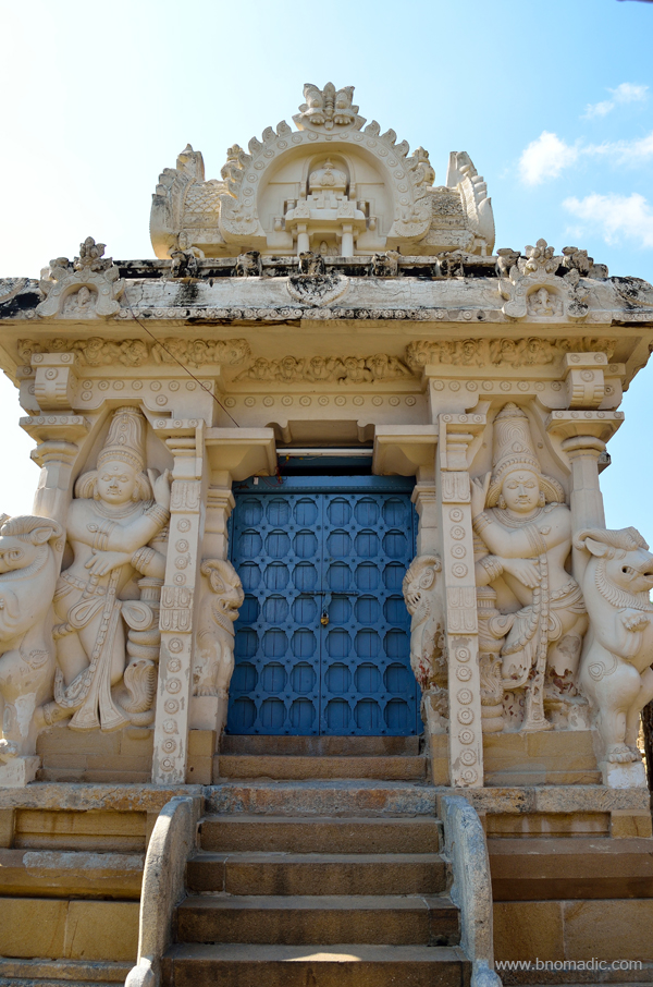
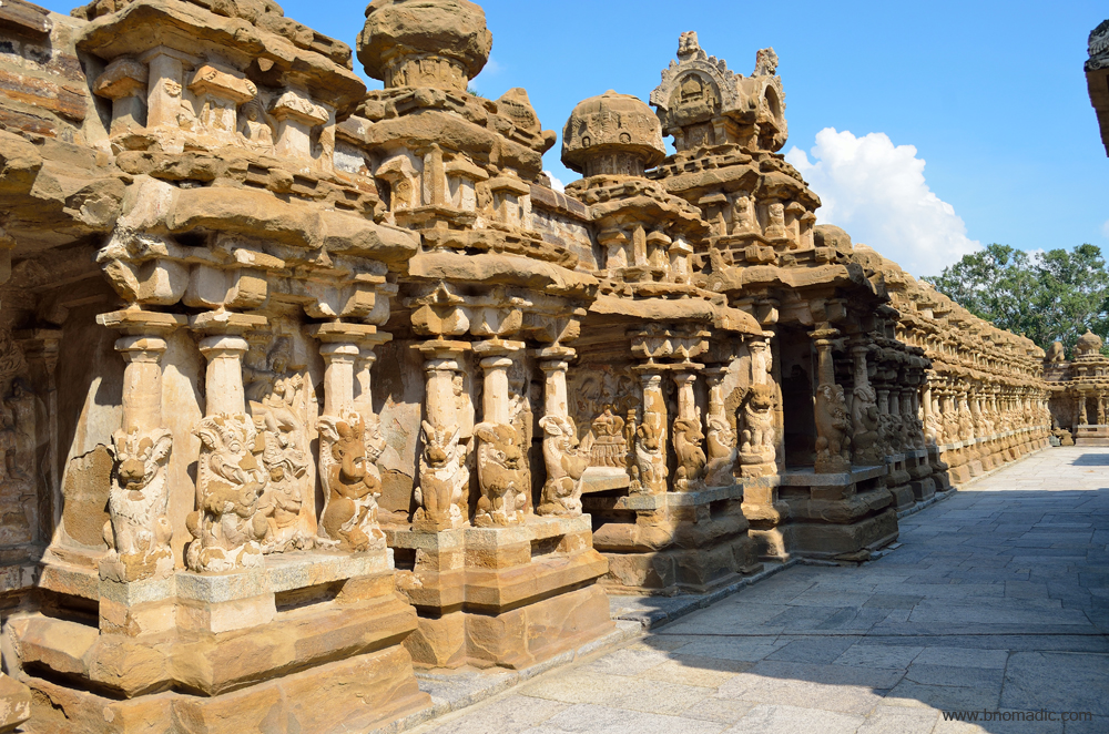
The ancient temple of Kailasanathar is protected by the ASI. A walled and fenced enclosure protects the temple premises from street walkers and stray animals. Just in front of the narrow passageway to the temple complex, souvenir and prasad selling shops dot the wide street. The temple appears to be a likely evolution of the seventh century panch rathas of Mahabalipuram. Started by the Pallava king Rajasimha, also known as Narasimhavarman II, in the late seventh century, Kailasanathar is the oldest standing building in the confines of the city; however, older temples still exist outside the settlement but within the district Kanchipuram. The temple, an ancient monument now, still attracts followers who throng the complex every year in the month of February, when a gala festival is held on the occasion of Mahashivaratri.
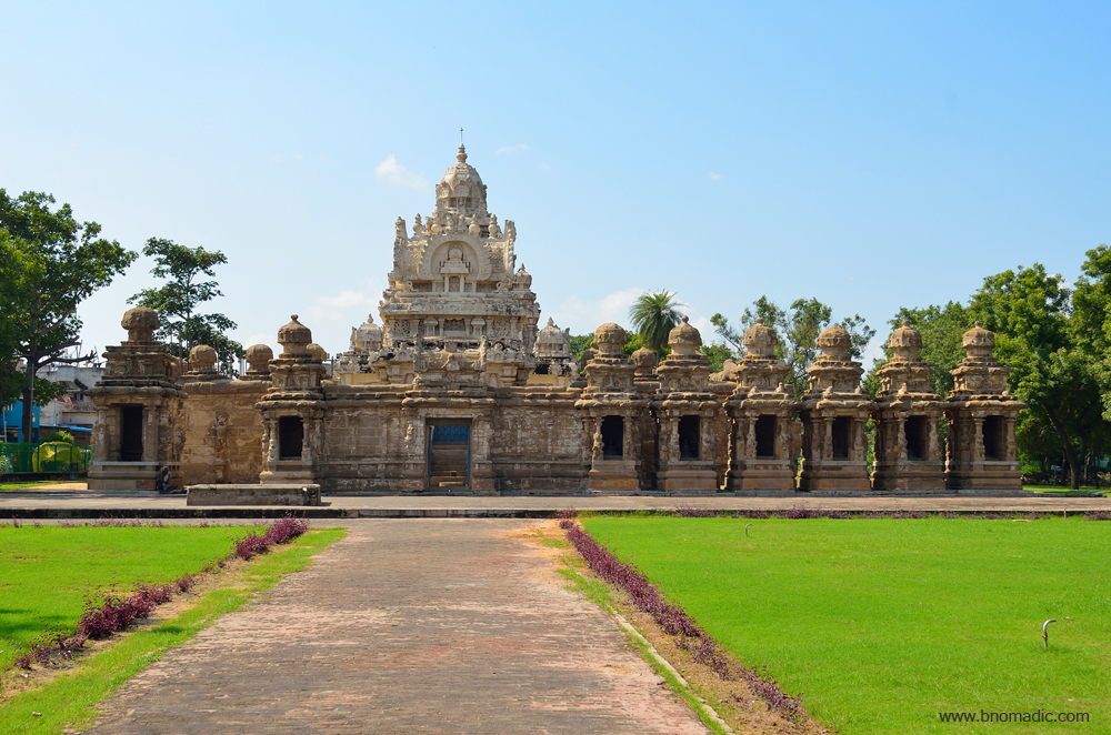
The Kailasanathar Temple. Please visit Flickr for more images of the region

The calm Nandi, the mount of Shiva. Please visit Flickr for more images of the region
Minute designing must have gone into planning the temple which is constructed mostly out of sandstone. A rectangular wall lined with small shrines surrounds the main temple. One of the two opposite doorways; the one towards the west, is now blocked up. The inner sanctum of the temple houses a multi-faceted linga, with a Somaskanda representation carved onto the rear wall. An old man in white outfit asks me not to take any photographs inside the main temple, which is surrounded by a narrow passageway. The outer walls of the main shrine are raised on a square basement. Outwardly projecting shrines from the corners and in the middle of three sides are framed by columns with Tamil yalis towards the base.
Belonging to the Dravidian architectural style, the Kailasanathar temple is the oldest structure in Kanchipuram, Tamilnadu. Please visit Flickr for more images of the region
Known for its historical importance, the temple is dedicated to Shiva. More images at Flickr

The structure contains 58 small shrines which are dedicated to various forms of Shiva. More at Flickr

The temple is a fine example of the architectural beauty that flourished during the reign of the Pallavas
The ancient temple of Kailasanathar is protected by the ASI. Somewhere in early previous century, a concerned officer fancied the yellow plaster layering on the sandstone to protect it. He was obviously wrong in his experiment. More at Flickr

The sandstone compound comprises carvings of deities which were popular during the early Dravidian architectural period. Please visit Flickr for more images of the region.
The walls adorn different figurines and representations of Shaivism. In one of such representations, the Shiva who is flanked by Vishnu and Brahma is shown to appear out of a linga; while in the other, surrounded by Durga and Bhairavi, the Shiva is portrayed shooting arrows from a chariot. The figures are enclosed by columns donning sea creatures and crocos with decorated tails. The same scheme of figures adorns the pyramidal walls of the main shrine. The storeys of the pyramidal tower that rise above repeat the wall scheme below at diminishing scales, the capping roof is an octagonal dome. The top is decorated with an octagonal shaped dome. The small pillared outdoor hall next to the shrine was initially built as a separate structure.
It might be the oldest one in the town, but Kailasanathar is a fairly small temple complex. An unaware visitor might not take more than ten minutes to complete a visit. A walk through the passageway around the main shrine makes me wonder about the intricateness of craftsmanship. The circumambulatory passage comprises a display of various deities including multiple sculptures of dancing Shiva. The temple of Kailasanathar is a fine example of the might and beauty of the ancient Indian temples. Even though, the images of Shiva and other deities are mostly eroded and overlaid with coloured plaster that seems recent, a few paintings from the Pallava period still lay preserved on the interior of the shrine walls. The smaller shrines lining the compound wall of the temple complex; all have domed roofs with carved Nandis and elephants in the sitting posture.

Even though, the images of Shiva and other deities are mostly eroded and overlaid with coloured plaster that seems recent, a few paintings from the Pallava period still lay preserved on the interior of the shrine walls.
The temple is adorned with many interesting sculptures of Shiva. More images from the region at Flickr

The architectural wonder of Kailasanathar

The temple of Kailasanathar is a fine example of the might and beauty of the ancient Indian temples.

The outer passage comprises a display of various deities including multiple sculptures of dancing Shiva.

The main shrine is enclosed with sculpted walls of sandstone. More images from the region at Flickr
Fine manicured lawns surround the temple compound from two sides. Just a few metres away from the main shrine in the green lawn is a seated Nandi on a low plinth. It is lunch time and the caretaker has gone out somewhere leaving the garden tap running. I still manage to make a few photographs as the sky gets cloudy. Quite uncommon of a touristy place, there isn’t any reputed restaurant, a café or a food joint outside the premises of the temple of Kailasanathar which is thronged by domestic travellers as well as foreigners. Having spent a couple of hours at the temple, before the clouds precipitate, I head towards the most imposing structure of the town.

A souvenir stall outside the temple. Please visit Flickr for more images of the region
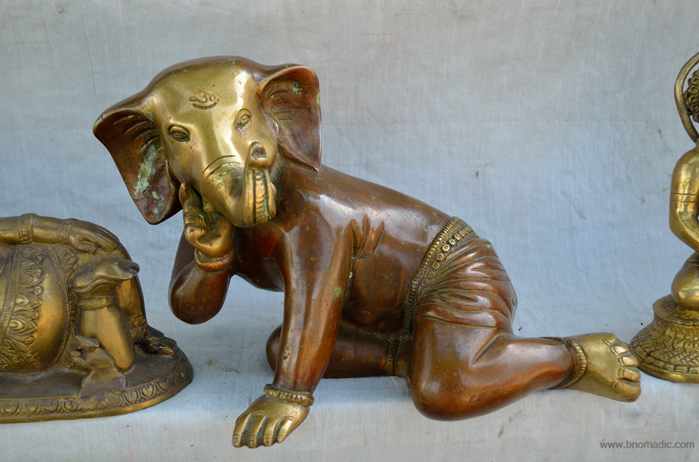
A souvenir of Ganesha; quite intriguing image for me. Please visit Flickr for more images of the region
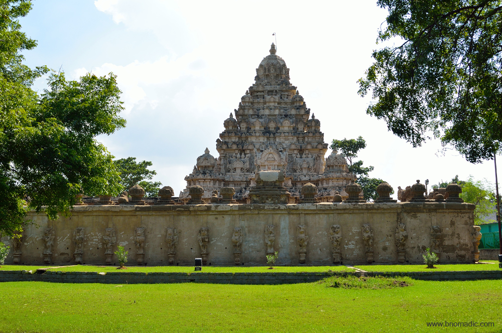
Returning to the crowded streets of the city, I am on the street that leads to the Ekambareshwara or Ekambaranathar Temple, the largest in Shiva Kanchi. Straight ahead of me is the 60m lofty tower of slender columns, which stands in the middle of the street, and serves as the south-entrance to the main complex. This impressive seventeenth century temple has a later year’s pyramidal tower comprising nine stories mounting on granite walls. The imposing temple is also the site for the yearly festival of Panguni Utiram held every spring. Above, the clouds and sun are playing hide and seek. The temple adores a dull look as it darkens.
The Ekambareshwara Temple. More at Flickr

Straight ahead of me is the 60m lofty tower of slender columns, which stands in the middle of the street, and serves as the south-entrance to the main complex. Please visit Flickr for more images of the region
Just as I conclude making photographs of the tower, it starts raining incessantly. I take hide inside my vehicle and head towards another Saravana Bhawan outlet located nearby. Many cups of filter coffees follow as I prepare my travel notes before heading back to my place in the evening.
Getting There
The town of Kanchipuram is 75 km from Chennai and 125km from Puducherry. Bengaluru is 300km from Kanchipuram.
Best time to visit: Any time of the year
Travel Lure: Heritage and Silk Shopping
Accommodation: Plentiful
Book Talk: The Lost World of Ladakh

As apparent from the title and book-cover itself, the book The Lost World of Ladakh is a collection of century-old photographs of the trans-Himalayan terrain of Ladakh. Tastefully captured by a talented amateur photographer, Claude Rupert Trench Wilmot who was an army officer stationed in India during the British regime in 1930s; the book comprises over 150 black and white photographs of the then Ladakh, when he undertook two different expeditions to the trans-Himalayan territory.
In 1931 and 1934, Wilmot travelled through two of the popular ancient trade routes leading to Ladakh; initially from Kashmir and then from the Kullu Valley. Those were the harsher times when the luxurious option of travelling on trans-Himalayan roads was non-existent. Like others, he travelled on foot with a retinue of servants and guides who carried his luggage and related paraphernalia on pack animals. Much unlike most other travellers of the initial quarter of the previous century, he remained occupied with making photographs and observing the lifestyle of the locals. He later provided informative captions with needed details of his photo records.

Wilmot had engagingly captured the life and times of the people of Ladakh, when the trade still flourished and Leh was the hub of trade routes between Tibet, Kashmir, Kullu and Yarkand. The photographs include portraits of locals, street photography, landscapes as well as some records from monastic ceremonies. The book, in fact, has been compiled by Wilmot’s relatives Nicky Harman as well as Roger Bates, who has digitised the old prints. Published first in 2014 as Volume 31 of Asian Highlands Perspectives, a journal that voices concerns of Tibet and allied geographies, this edition of the book was subsequently published by Stawa Publications of Leh, cultural and administrative headquarters of Ladakh. The edition of the book, which I received last month, has about 135 pages of pure trans-Himalayan love. The book is divided into two parts: the first half detailing the photographs from Wilmot’s journey of 1931 and the second part that showcases the 1934 expedition.
Just before summers of 1931, Wilmot set out on his first journey to Ladakh through the popular trade route – the Treaty Road – via Srinagar and Zoji La in Kashmir. At that time the route, at best a bridle path was passable only on foot. The current highway follows the same route for most part and was opened to vehicular traffic decades later. After reaching Leh, Wilmot made two side-trips, first to the top of the Khardung La on the Karakoram trade route, and then to the monastery at Hemis where he attended the annual Hemis festival as well.
Wilmot undertook the second expedition to Ladakh in the peak of summers of 1934. This time he got himself a new camera – a Rolleiflex twin-lens reflex – and travelled south-to-north through the traditional Kullu Valley route to reach Leh. Just as in his previous expedition, this time as well he travelled on foot with pack animals as this route was made motorable much later in 1970s. Both his journeys were significant because of the priceless photographic record it created. Unlike today, during those times, the monks, pilgrims, merchants, peasants and nomads, etc. as documented in the book appear largely as they would have done for hundreds of years.
One thing that unmistakably comes out of the book is the expression of satisfaction and pride even in the otherwise poverty ridden faces of Ladakh. Like most travellers to that part of the trans-Himalayas, Wilmot is particularly enamoured by the streets of Leh bazaar, a thriving hive of not only commercial but cultural activities as well. During those times, travellers visiting Ladakh encountered considerable challenges; something which is made luxurious by present day’s wheeled travelling. Through his photo records, Wilmot has done a remarkable job in portraying traders, nomads, schoolkids, townswomen, herders, farmers and Buddhists monks, etc.

The Ladakh which Wilmot photographed has long since disappeared with the onset of modernisation of trade and transport apart from the political conflict that ensued partition. The book portrays a time when wandering monks, esoteric astrologers, masked dancers and elaborate turquoise headdresses were still common. In bits and pieces, the book brings out the lost folkways of Ladakh when it was still untouched by modernity. The tougher times of mountainous trade that lifted so many of Ladakhis above poverty might have gone but Ladakh still retains the charm that continues to attract travellers from far and wide.
The thing which I don’t like about this edition of the book is its designing. Given the greatness of the content, the layout as well as typeset of the book is actually very pitiful. It seems the local publisher assigned the job of designing the book to a newbie who didn’t even have an access to modern software except for MS Word. I seriously hope that the publisher would rectify this in the next edition. Anyhow, I’d still recommend this book to a devotee of trans-Himalayan travels. The book is currently priced at Rs 630 on Amazon.in
Dodra Kwar Diary: The Devtantra at Dodra

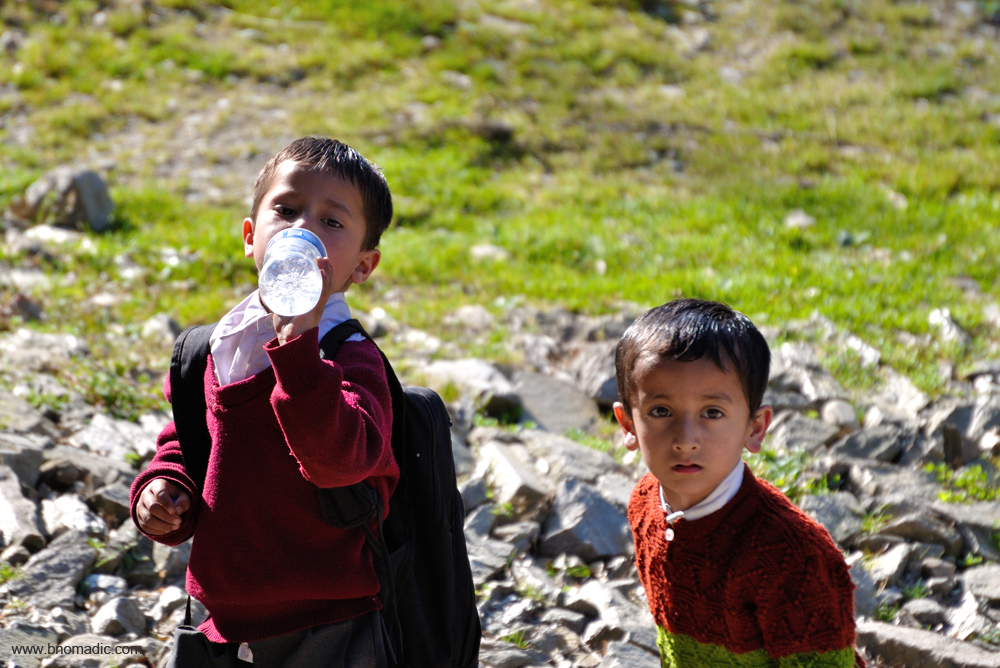
I pull up one of the spare chairs in the small patch of grass in the courtyard of the Forest Rest House at Dodra (2564m). The intriguing folkways of Kwar still occupy my mind. For me, there is a fresh excitement related to any trip in the Himalayas. For pure delight what can equal a day’s walk or trek out into a fresh landscape? With eyes shut I can conjure up a picture of every day’s journey I have so far made in this Himalayan sojourn; I can even recall every bend of the narrow lanes of Kwar. On such outings even the most common object is of fascination; every viewpoint, every plant, bird of beetle. And for this reason, it does not worry me if the locals stop and stare at the mad visitor in me.
The bus stop of Kwar. Please visit Flickr for more images of the region
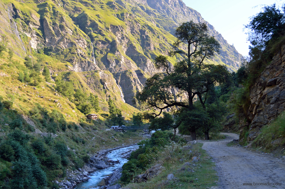
Descending from Kwar; the bridge over River Rupin. Please visit Flickr for more images of the region

The Rupin River as it cascades downstream. Please visit Flickr for more images of the region

Confluence of Saru Gad with the Rupin below Dodra. Please visit Flickr for more images
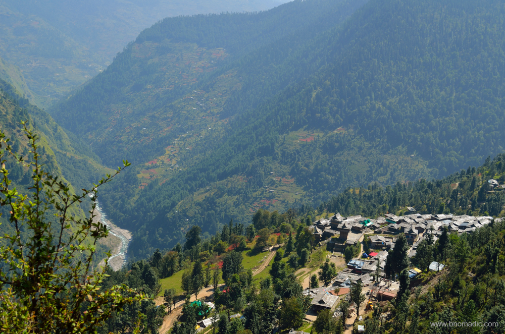
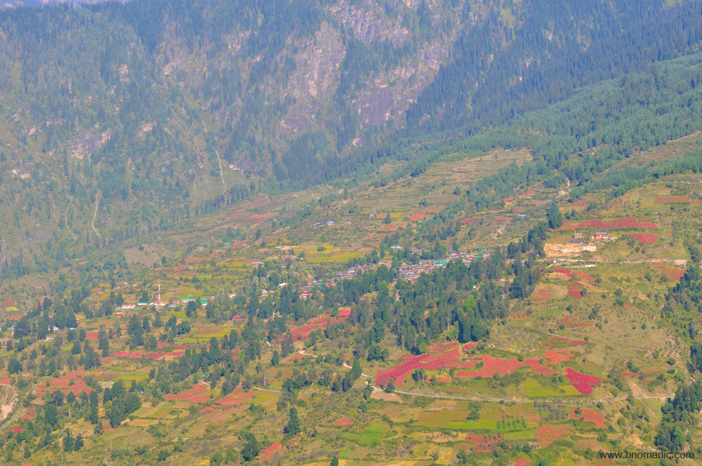
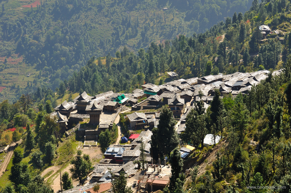
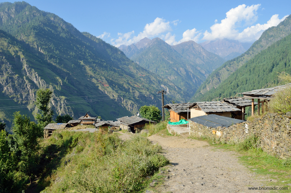
The village Dodra perched above the Rupin River. Please visit Flickr for more images of the region

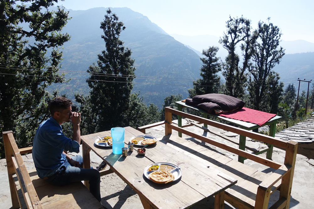
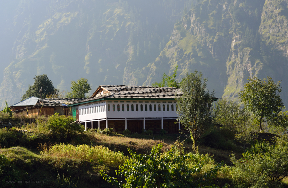
The lawn and small verandah of the forest hutment at Dodra. More images at Flickr
It is a bright sunny day and the air is softly caressing the tall woods. The bubbling and loudly hissing sound of my portable electric tea kettle portends a warm morning. Mangal’s associate in the agriculture department who hails from Dodra is expected here anytime now. Just as Mangal in Kwar, he will guide and accompany me through this side of the valley. Dodra and Kwar do not have any of the clichéd tourist attractions to put it in the same bracket as other hill destinations. Apart from raw village life and folkways, what it offers is an uninhibited rendezvous with nature to fuel a process of self-discovery, oblivious of time.
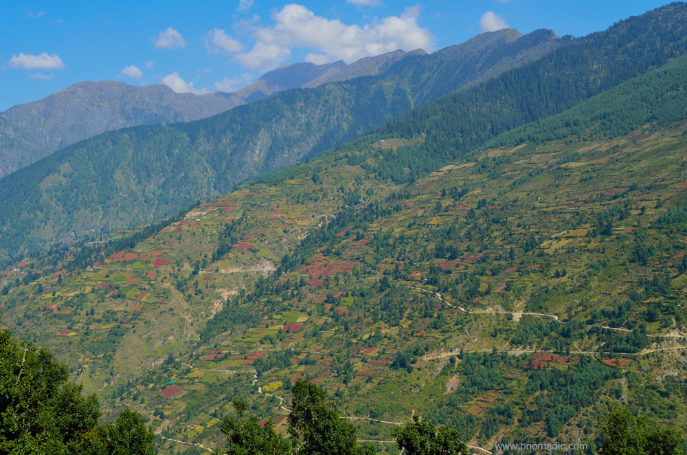
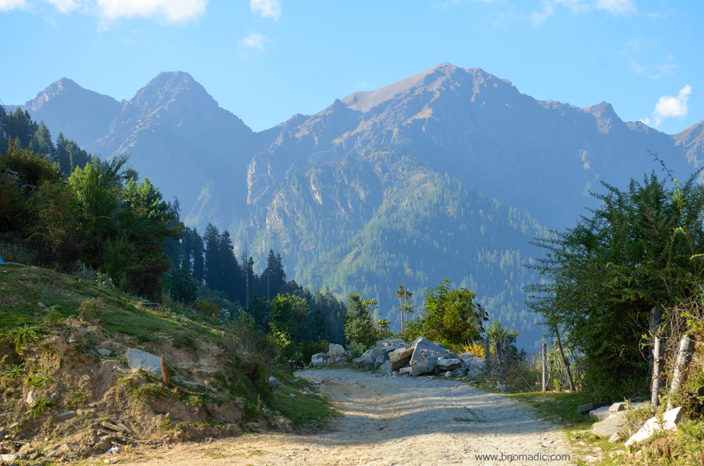
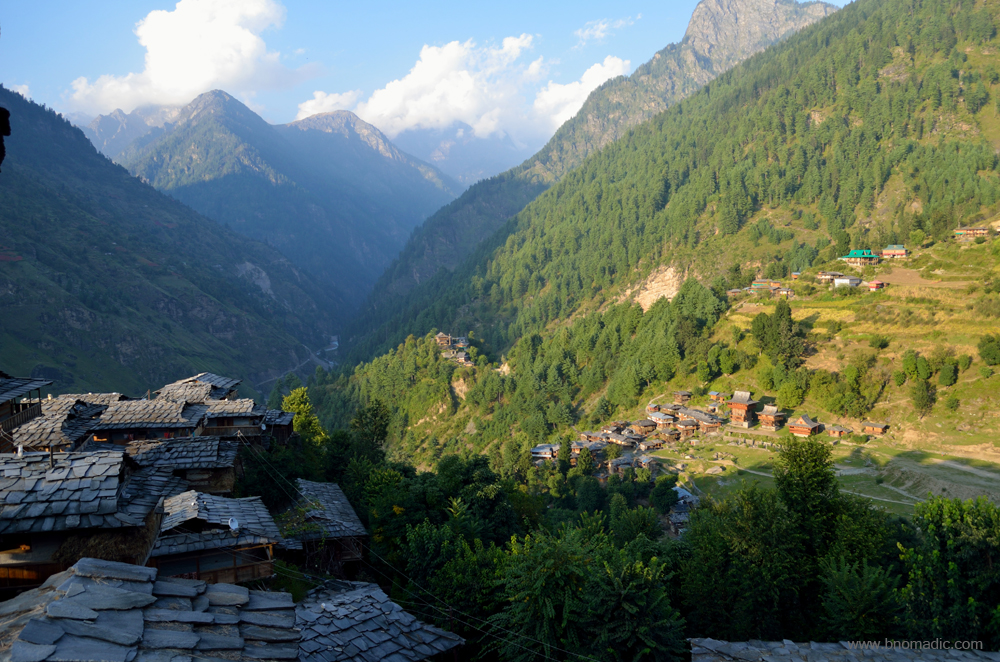
Curled beneath the eastern ramparts of the Himalayan state of Himachal Praddesh, broods a hidden corner surrounded by unexplored forests in a lesser visited valley. The picturesque valley of Dodra Kwar lies folded between scenic Baspa Valley, the steaming jungles of Govind Pashu Vihar National Park, the mountains of Kanatal above the Tons Valley and the heritage Valley of Pabbar. Remote and mountainous, local spirits and demons thrive even as the devtas are appeased by the blood of sacrificed beasts. The hidden valleys and forests of this absolute goldmine of flora and fauna, provides sanctuary to a fabulous array of exotic and alarming creatures. Specie that villagers fear the most includes the Himalayan Bear, which prowl along the wooded ridges and sometimes through their fields.
The mountain face of Kwar below the Dhakimar Tibba; on the opposite bank of Rupin. More images at Flickr
Mountain face opposite the Saru Gad. Please visit Flickr for more images of the region

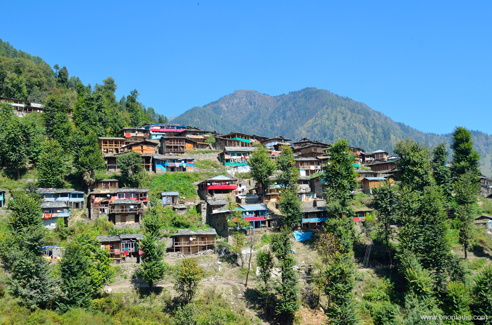
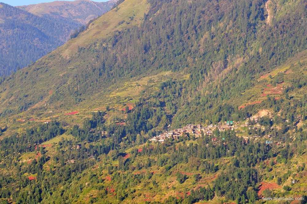
The village of Kwar. Please visit Flickr for more images of the region
The village of Kwar encircled by colourful fields and forests. Please visit Flickr for more images of the region
The motorway through the fields of Kwar. Please visit Flickr for more images of the region
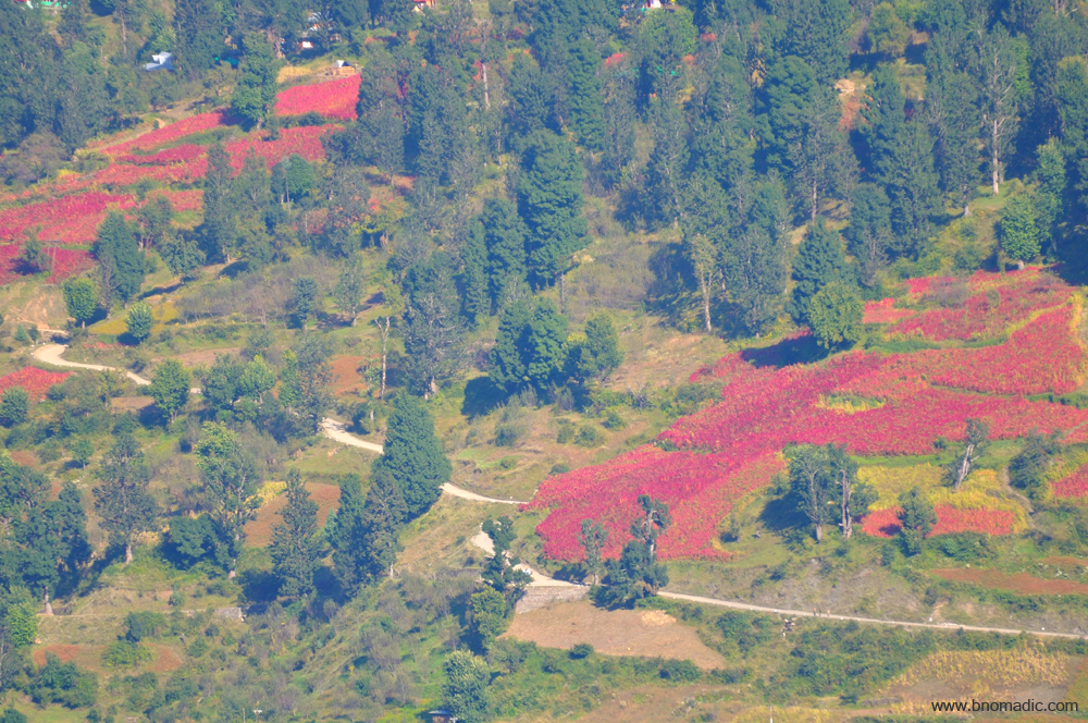
The colourful fields of village Kwar. Please visit Flickr for more images of the region

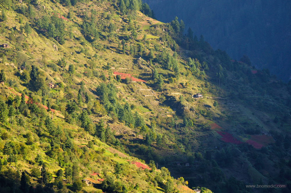
Below the forest line of Kwar. Please visit Flickr for more images of the region
The FRH is located a little above the bus stop point of Dodra. The caretaker, who hails from Dodra, comes to the two-roomed hutment only when asked to do so. The key of the FRH remains with the owner of the only dhaba located at the bus stop down below. This morning when I landed at the dhaba for a cup of tea and to enquire about the whereabouts of the caretaker, the owner instead handed me a bunch of keys. I later gathered that this has been a normal practise here and whenever a traveling official or government servant needs a place to crash for the night in case of emergency, this coordination comes handy. Besides, the dhaba is the only place to get an easy meal in Dodra. The FRH has no kitchen of its own. The FRH at Pujarli as well as the PWD RH at Kwar both have working kitchens but the caretakers would still want you to eat outside. Here I am presented with no option but to eat outside.
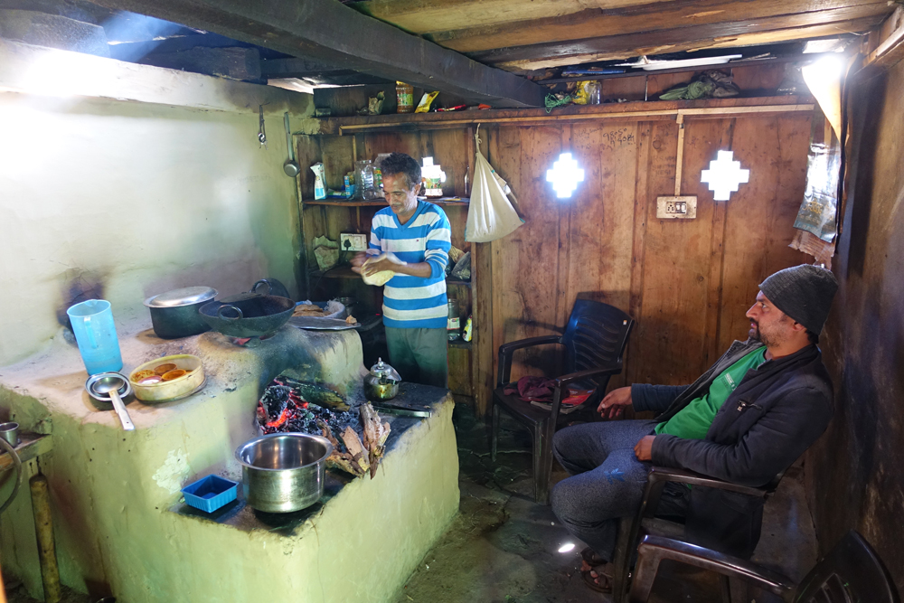
Rameshwar Negi inside the kitchen of his dhaba at Dodra. More images from the region at Flickr
The terrace of the dhaba; this is the only place at Dodra to secure a meal. More images at Flickr
I am particularly wary and mindful of my eating habits at Dodra primarily because someone at Kwar had warned me not to eat at any place or home except for this dhaba. As per the local lore in the valley, outsiders don’t eat in the houses of Dodra for fear of the food being poisoned to please the spirits. The man at Kwar (name withheld) told me that the incidents of poisoning one’s food (bish) occur only in the village of Dodra in the entire valley. Despite my obvious keenness, I do not discuss this issue with the dhaba owner, Rameshwar Negi, a local only.
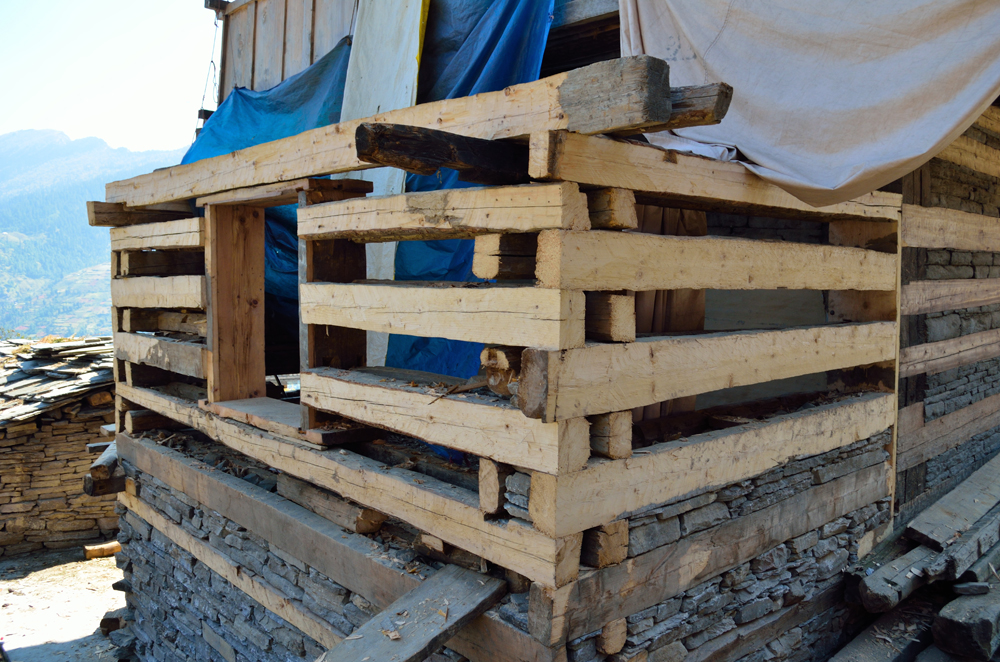
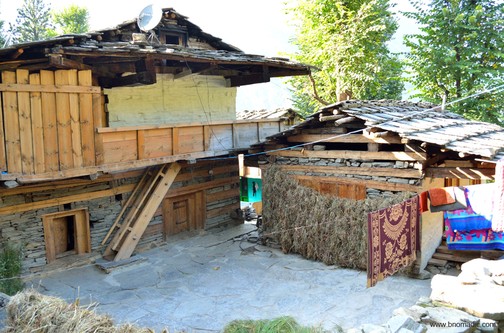
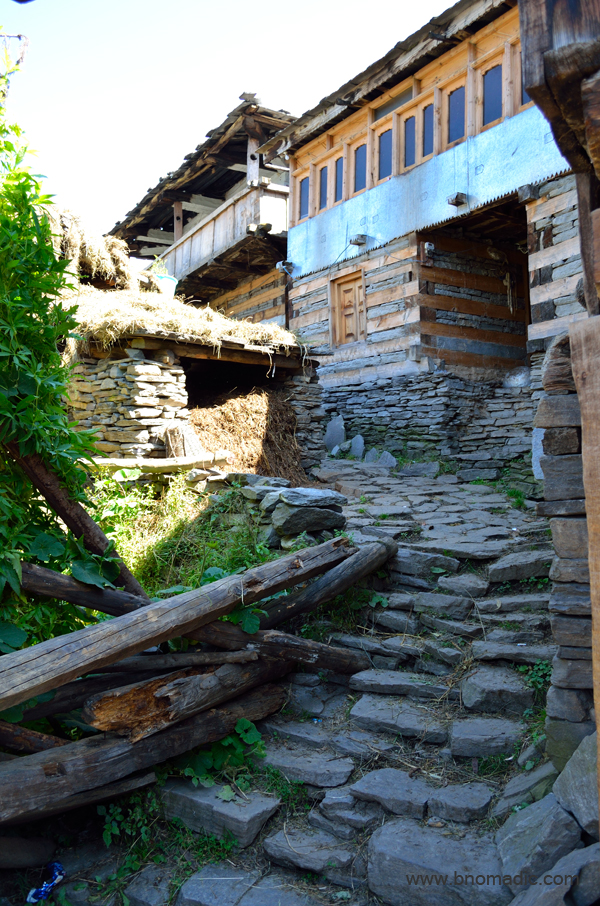
A house under construction; notice how the wooden beams are arranged. More images at Flickr

After arranging stones between logs, the wall is then plastered with mud. More images at Flickr

An old wooden structure still standing strong. Please visit Flickr for more images of the region

The eatables and grains stored inside a Kuthar; the valley used to be the artery to the salt trade route to Tibet. Such houses came in handy to store extra amount of Tibetan Salt. Please visit Flickr for more images
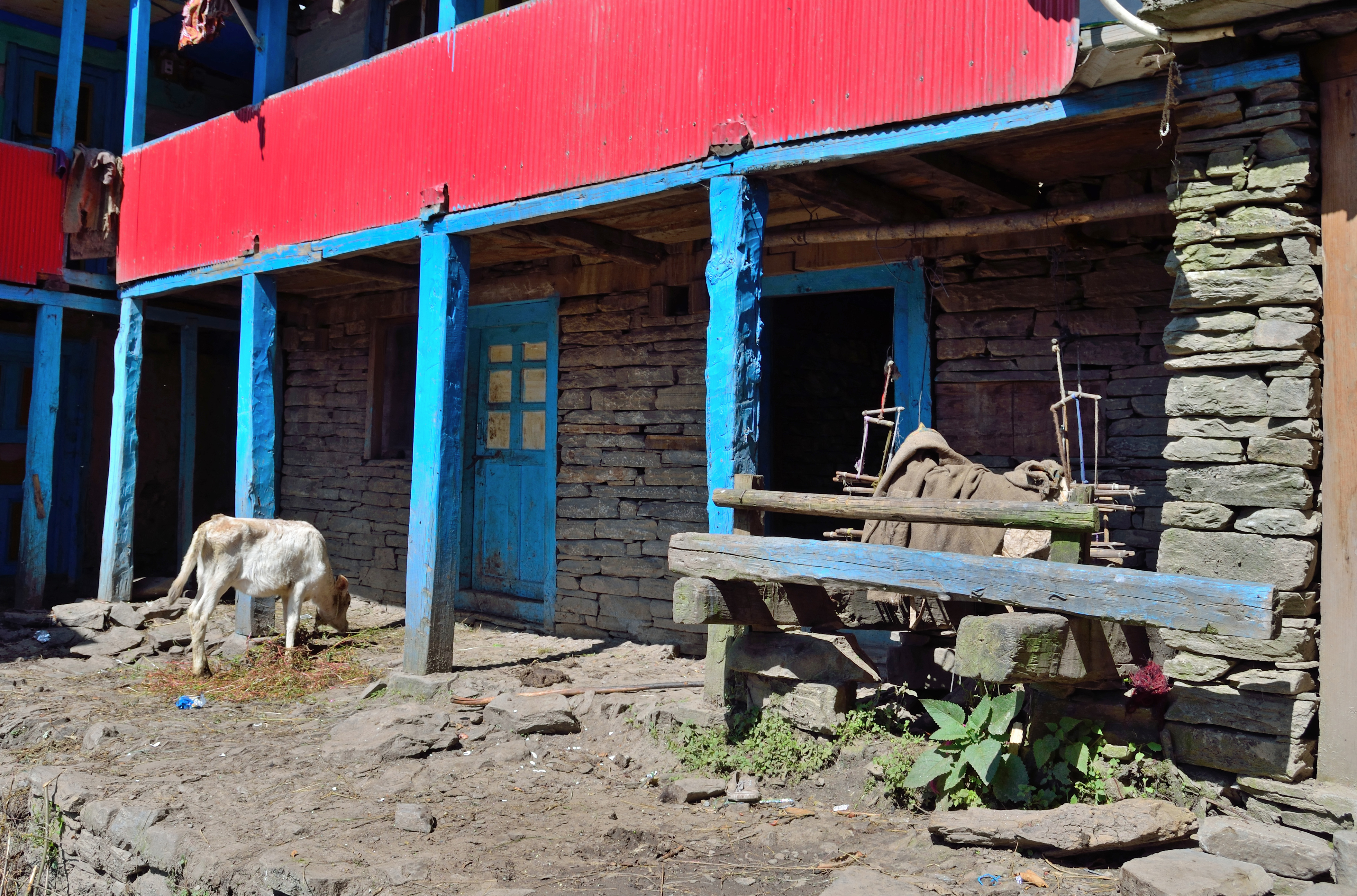
A wool spinning machine lying unused towards the right of the frame. More images at Flickr

The vapid sloganeering and graffiti walls of Dodra. Please visit Flickr for more images of the region
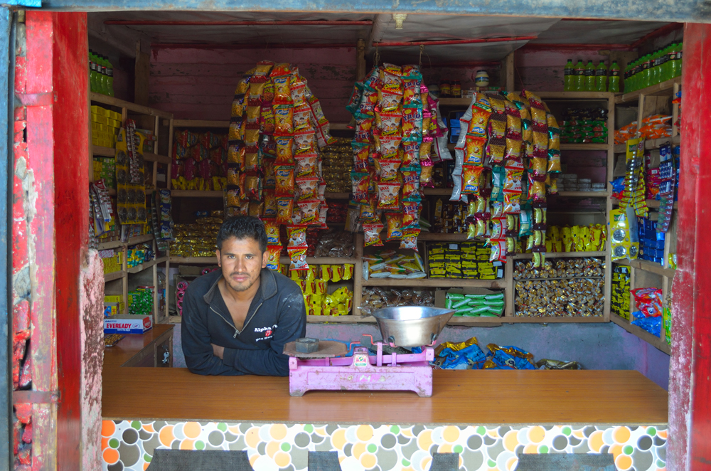
A grocery store at Dodra; Raidev procures all the stuff that he sells inside his small shop from Rohru.
The dhaba owner, an unruffled oldie also told me that a couple of school teachers, who were on their way to Shimla, had stayed here the night before to hitchhike up to Rohru, on the other side of the Chanshal. He adds that due to its remoteness and connectivity – despite the recently carved motorway – the Dodra Kwar region proves to be a nightmarish posting for the government employees of the state. In the bureaucratic parlance, a transfer to this region is oft-called a political punishment. During winters, to reach Shimla, the district as well as state headquarters for the valley, one has to trek till Naitwar to catch a transport till Dehradun in Uttarakhand. The bus then reaches Shimla via Chandigarh and Solan. Providing a connect between the Pabbar and Rupin Valleys, the Chanshal opens only for a few months after the snow is cleared off the Pass in summers.

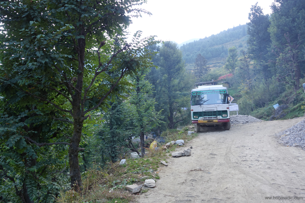
The HRTC bus that plies between Kwar and Rohru is the lifeline of the valley. More images at Flickr
The settlement of Dodra glittering in the evening sun. Please visit Flickr for more images of the region
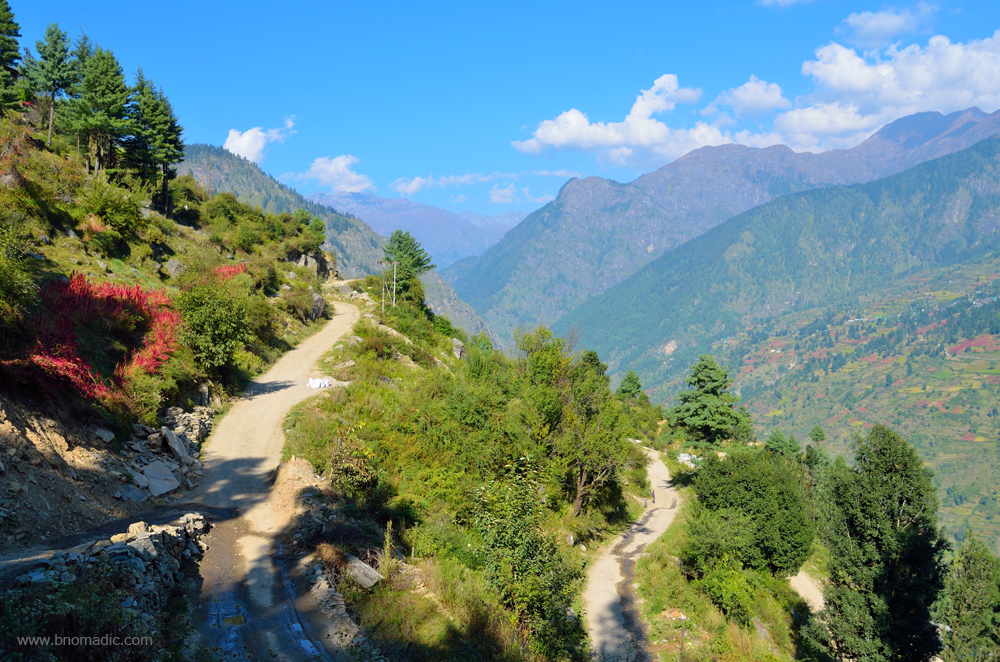
The road to Kwar descending the slopes of Dodra. Please visit Flickr for more images
The motorway to the Chanshal Pass. Please visit Flickr for more images of the region

The village of Dodra against the backdrop of Kanatal forests of Uttarakhand. More images at Flickr
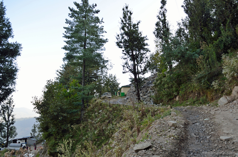
The FRH above and the dhaba below; at Dodra. Please visit Flickr for more images of the region
The first view of Dodra after descending from the Chanshal
After an hour of wait, Vikas is finally at the FRH. We then depart for the village. Now attached with the agriculture department on contract, Vikas has previously worked with a popular trekking agency active in the Rupin Valley. As we approach the narrow lanes of the village, Vikas introduces me to his former colleagues who are now engaged on the popular Rupin Pass trek that culminates at Sangla in the Baspa Valley. The trail is not only very scenic but is moderate on the activity scale. As we had seen this morning, while returning from Kwar, the character of the Rupin is more of the nature of a torrent than that of a large voluminous river. As it descends the slopes of Rupin, the river takes fall in several spots to reach the valley floor. As the river rushes over rocks with a clamorous noise, few of such falls are over 100 ft that exhibits heaps of white foam.
Not only among the current mountaineering fraternity but the Dodra Kwar to Sangla trail over the Rupin Pass has always been popular. Before the advent of the bridle path, the HT road through the Satluj Valley, many travellers and traders preferred to enter Kinnaur via the Baspa Valley. Traversing the middle Himalayas, this could be accomplished through a series of passes. Just as the pioneer explorer of Kinnaur, Alexander Gerard, preferred the Buran pass to crossover from the Pabbar Valley, Lady Canning, the then Vicereine of British India is said to have trekked over the Rupin Pass on her way to Chini in 1860. It has of course been a preferred route for local shepherds as well.

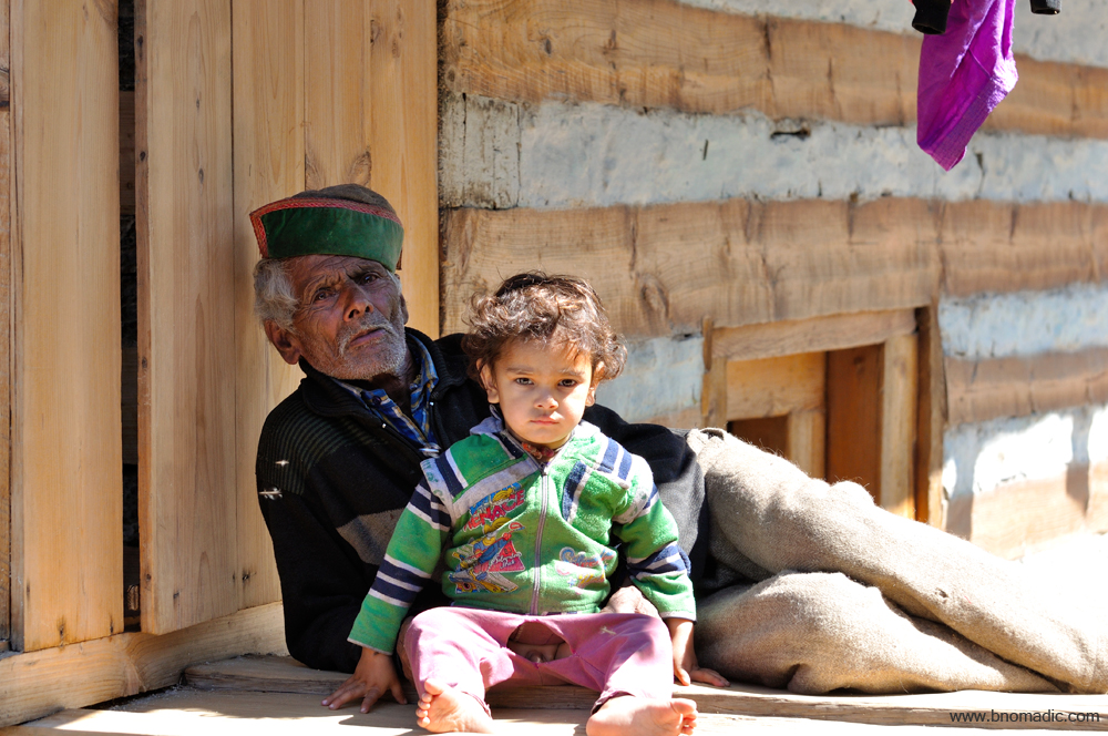
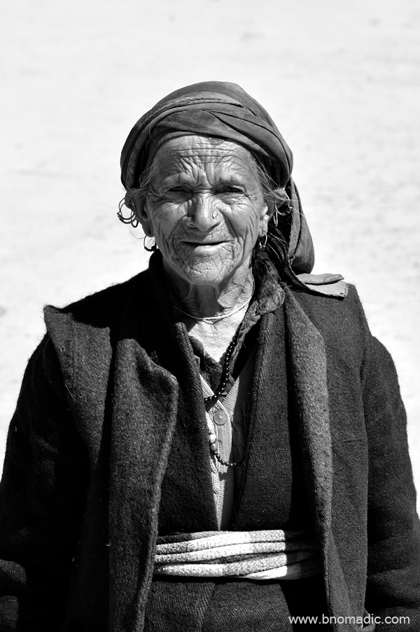
Faces from Dodra! More at Flickr
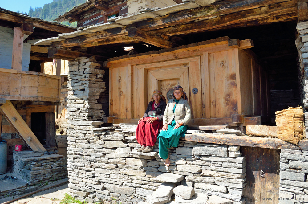
Womenfolk outside their kuthar. Please visit Flickr for more images of the region

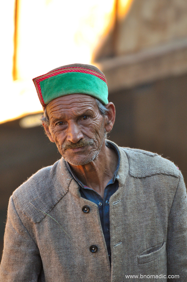
Faces from Dodra; the bushehri topi is part of their costumes now. More images at Flickr

Faces from Dodra; the schoolkids had come to the FRH to get themselves clicked. More at Flickr

Faces from Dodra. Please visit Flickr for more images of the region
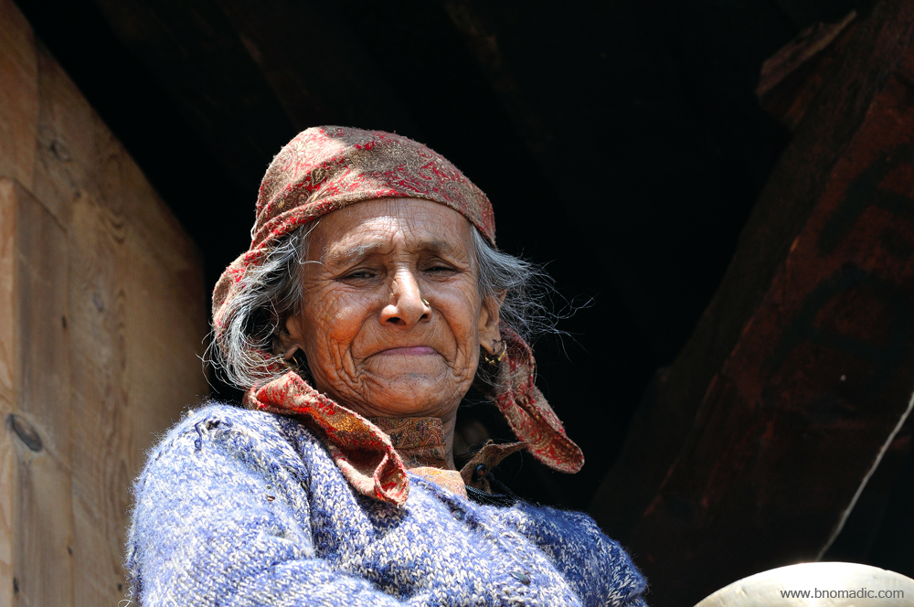
Faces from Dodra. Please visit Flickr for more images of the region

The head pujari of Dodra Jakh temple

Faces from Dodra. More at Flickr

Faces from Dodra. More at Flickr

Everyone is busy with procuring winter supply of fodder

Notice the lakhoti tied around her waist

Faces from Dodra
The girl is eating wild walnuts
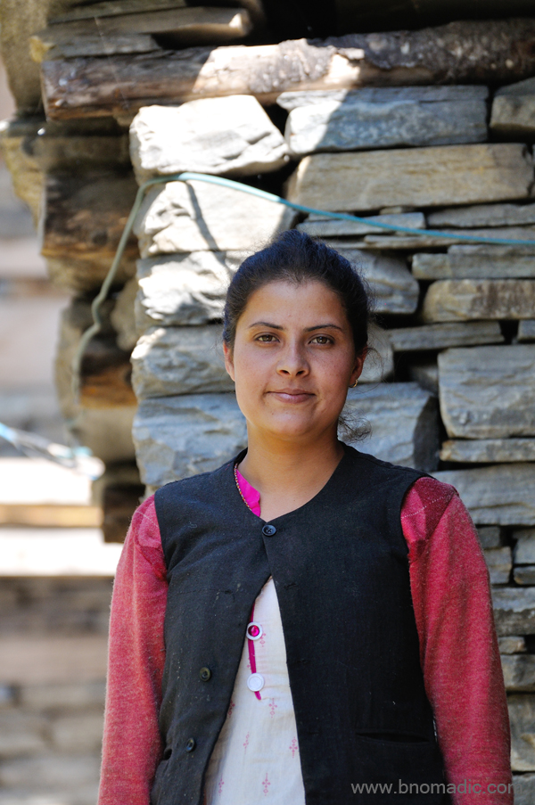
The lady works with the Education Department

Faces from Dodra. More images at Flickr
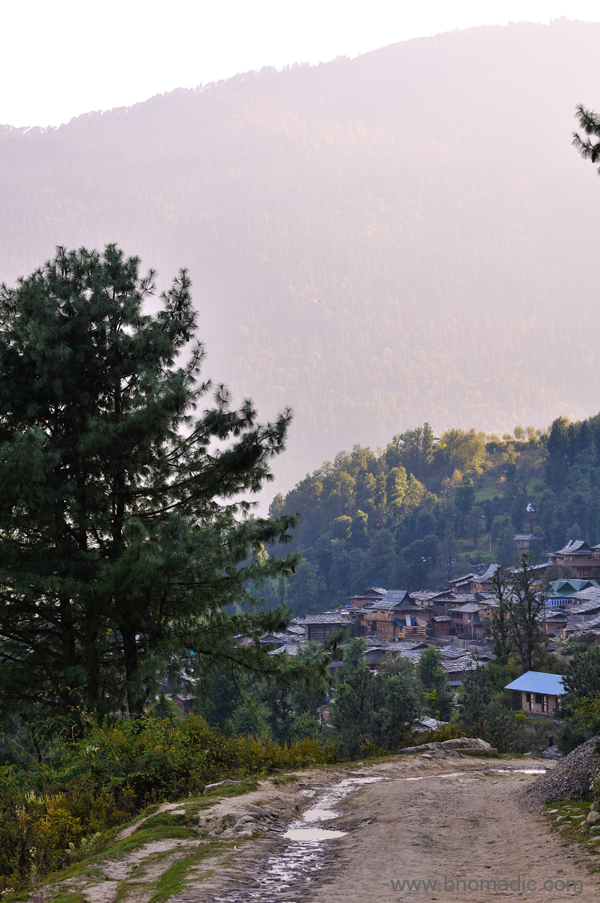
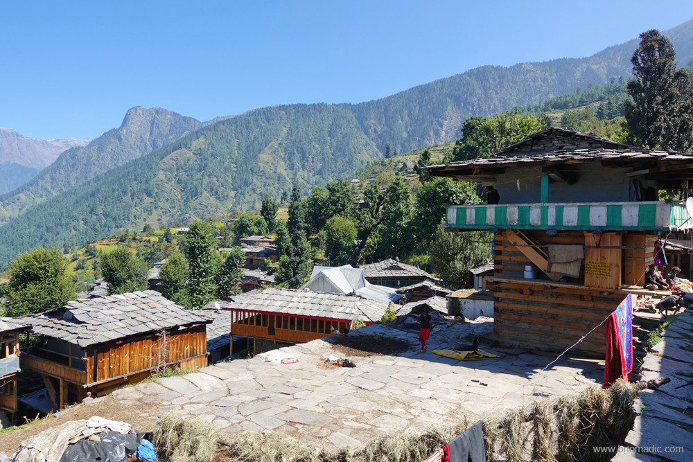
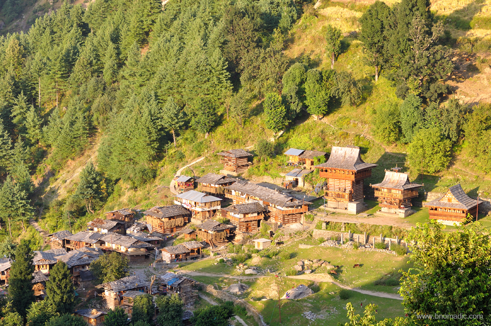
By now we are in the middle of the village Dodra. In comparison with the village of Kwar, the settlement of Dodra looks more rustic. Barring a few houses, most structures retained the traditional wooden design of the valley. With roof slates shining bright in the sun; from a distance, the entire village looks to be occupied by houses which are made of wood. Howsoever cramped though it may be, every structure seems to get its little patch in the valley under the sun. The small settlement of Dodra has more temples in comparison to a fairly large village of Kwar. We visit all the temples one by one. Just as the case in Kwar, I am denied an entrance inside the main temple.
On the other side of noon, a shift in the weather happens. The sun is directly above the valley; and we are in the midst of cold green woods below the village. The trees are increasingly moru oak, arising out of a sunless ground of dense foliage. The stillness of the forest seems held in a place by the unbroken, ceaseless chirping of birds. Tips of tall trees catch some sun. Filtered by their thick leaves, the light that falls on the ground is dark and green. Light is not favourable but I still make a few photo records.

The bus stop of Dodra; the motorway from the Chanshal descends to Kwar. More images at Flickr
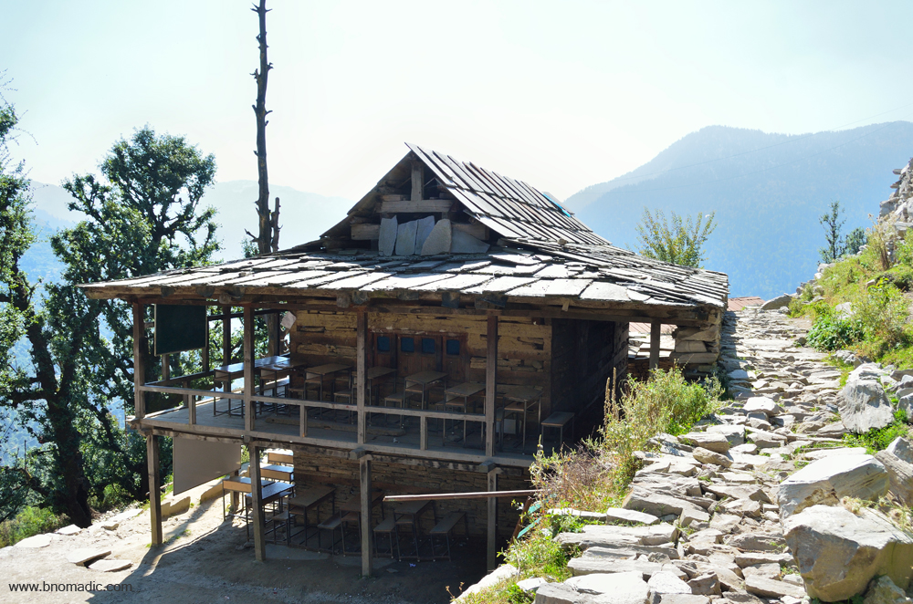
The primary school of Dodra. Please visit Flickr for more images of the region

A courtyard in the settlement of Dodra. Please visit Flickr for more images of the region

A house has been recently demolished here; the newer structure will soon be ready. More at Flickr

The main lane of Dodra. Please visit Flickr for more images of the region

Preparing for the long winters ahead
Notice the beautiful wood craft from up close
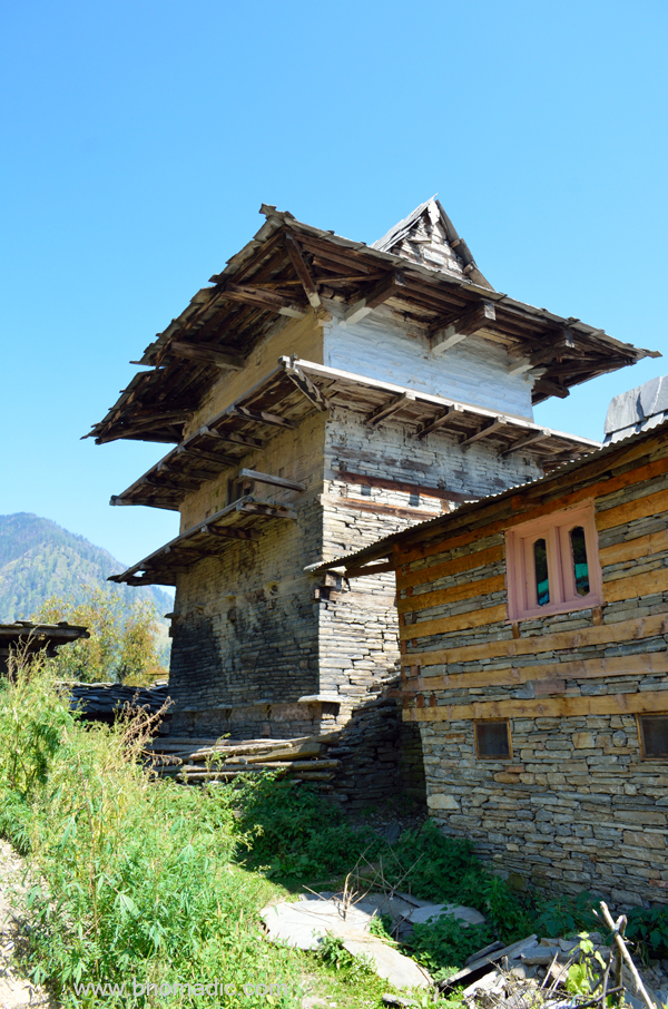
A five-storeyed traditional house at Dodra
The house of head priest of Dodra Jakh
Temples of Dodra. More images at Flickr

Faces from Dodra. More at Flickr

A group of travellers joyous after descending from the Chanshal
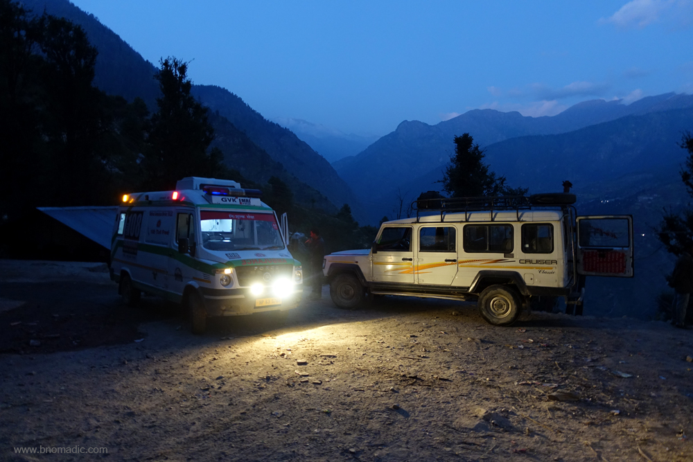
An ambulance on its way to Rohru has come to Dodra from Kwar at night; the family follows in a separate vehicle. From here, a vehicle would take at least six hours in reaching the nearest hospital.
If one comes to Dodra Kwar as a tourist to make merry or for luxurious vacation, he may well be entirely disappointed by the complete nonexistence of such options. Forget the social photographs. Of course, there are heritage temples but that’s about it. One could probably visit these and take a walk around the entire settlement in less than thirty minutes. Save for a single shop selling items of basic necessity, there is no bazaar or a café to hangout. But then what a casual glance would observe is its distinctive culture, belief and architecture. Having observed the geography, village life, architecture and costumes, etc. from close quarters in Kwar, I wanted to get a sneak into the temple life and structure. But then outsiders are seldom allowed inside. With separate temples meant for different castes, adherence to the caste system is duly observed.
The main temple of the village is Dodra Jakh. Just as Kwar, the cult of Jakh devta dominates this village as well. The Dodra Jakh devta is the collective chief deity of villages Dodra and Chohara. The devta spends two years in Janglik and Kinnaur and returns to Dodra in a procession, in which a member from each household participates, every third year. The Jakh is considered to be the supreme God of this valley, where nothing can be done without his consent. This is precisely why the concept of Devtantra was strictly observed for administrative as well as judiciary purposes till a few years back. Just as Prajatantra (the authority of the people) or Rajtantra (authority of the King) functions elsewhere, Devtantra (authority of the Gods) functions in Dodra Kwar. These days, the Devtantra is no longer observed for administrative or judicial issues but for social issues, it still calls the shots. In olden days, the Devtantra solved most issues and the system suited the people as well as the harsh terrain where it was always difficult to govern for any kingdom.
The temple of Dodra Jakh, the chief deity of village Dodra and Chohara; animal sacrifices are held atop the roof.

The temple of Devriyal Devta at Dodra. Please visit Flickr for more images of the region

Notice the sports trophies and a leopard skin, apart from sacrificial trophies; entrance inside is totally prohibited

The Kilbalu Devta temple of Dodra. Please visit Flickr for more images of the region
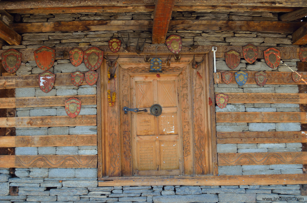
Notice the trophies and coins nailed around the main door; the trophies belong to the village which the teams had won in various sports tournaments or local competitions
The settlement of Dodra. Please visit Flickr for more images of the region
Read the complete Dodra Kwar Diary here
To conclude this series, I’d say that my sojourn in the remote valley of Dodra Kwar had almost all essentials of a Himalayan exploration and travels. Beautiful landscapes to mysterious folkways, food habits to house architecture, agriculture to adventure; just about everything qualifies for it be explored by intellectuals, adventurers and travellers alike with a much deeper interest. With this thought, I’d request each one of you to constructively devour Himalayan adventure, discovery and knowledge to realise love with your inner self. I have tried to sum up my sojourn in this hidden world to the best of my understanding. If you still have any query left in your mind, please feel free to ask. Email is the best way to reach me.
Getting There
The village of Dodra is 21km from the crest of the Chanshal Pass and 22km from Kwar.
Altitude: 2500m
Best time to visit: Autumn
Travel Lure: Culture and sylvan charm
Accommodation: Very limited at Dodra
Dodra Kwar Diary: Temples of Pujarli

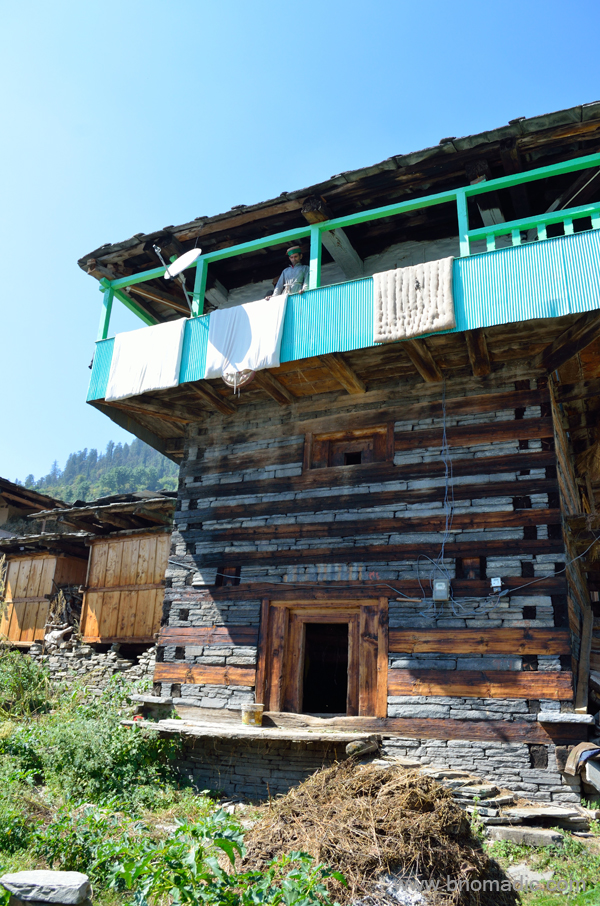
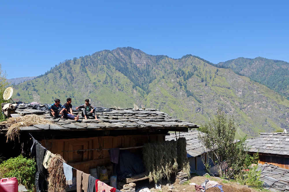
Already high from the impact of the raw folkways of Kwar, I was back at my room in the afternoon. The village was briefly blanketed by a cloud of mist in the morning today. Now with the clouds having boiled up from condensation, the valley wears a dreamy look as though it was kept under wraps in the morning. The cloud layer has completely vanished by now. A majority of the olden houses are built using deodar wood. With the lifting of mist, the already fresh air becomes filled with the resin smell of deodar.

Green outliers of the Rupin Valley. Please visit Flickr for more images of the region
Being the peak of grass cutting season, both women and men are working frantically with their short-handled sickle to cut grass for winter fodder. Up here, their schedule is busy at any time of the year but now they will soon have to start harvesting the kharif crop and simultaneously cut whole hillsides clear of lush grass. The tough season of winters is just around the corner. The overpowering scent of newly trimmed hay is the heady factor in making me feel that this is a place of pure unrestrained joy. As I lay down on the small patch of green grass in the courtyard of the rest house, the caretaker offers me some ginger tea. He is aware that I have missed today’s afternoon meal as well. Sipping the hot sugary tea and nibbling biscuits, I soak up the afternoon sun. A sense of contentment grips me.
There is something in the Himalayan air – especially in autumn season – which according to me is conducive to both passion and romance. The warmth of the bright sunrays turn my mind to journeys those taken and those never done. Thinking of my travel fantasies, this time my mind wanders to a road expedition along the ancient GT Road from Kolkata to Peshawar as well as the Great India Road Trip and an extended sojourn in the North East India. With me being lost in oblivion, my gaze suddenly catches on a bird of prey. A Himalayan griffon vulture is soaring high in thermals. I collect my camera kit and try in vain to make a photograph. The barrenness of the Rupin range overshadows the colour of the bird.
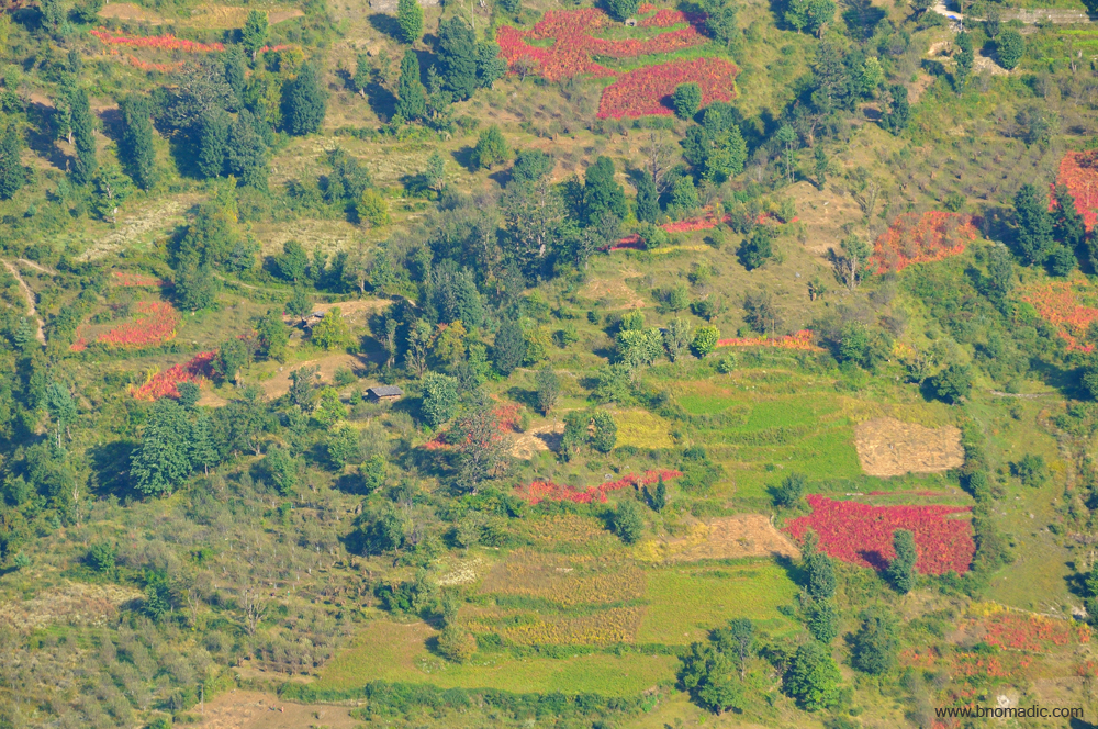
The village Dodra below the sacred groves. Cultivation is abounding and thriving with grains, vegetables, orchards or apricots and apples wherever a slant in the terrain is observed. More images at Flickr
What is most common is a solitary house with a small piece of cultivation or a few orchards attached; that seldom attracts the eye of the observer. Please visit Flickr for more images of the region.

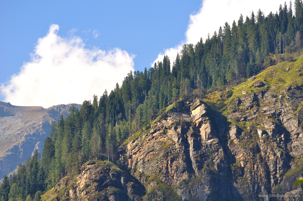
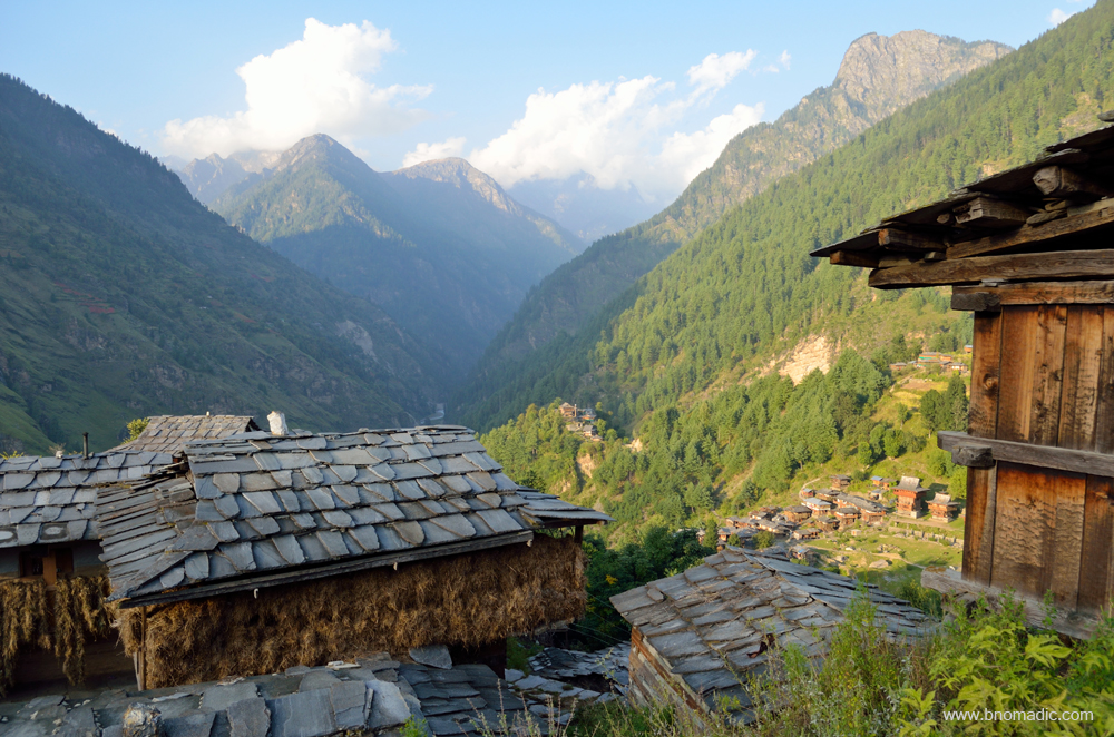
The scenery of this valley partakes more of magnificence than of beauty. More images at Flickr
I try to make a sense of the geography of the valley. The river Rupin is not visible from the spot where I am standing. The level space at the bottom of the valley is inconsiderable; being usually not much broader than is sufficient for the passage of the river. On its both sides, the small level spots on the mountain faces are laid out into orchards. Generally, the arable land is scattered in narrow slips interspersed with incredible woods of pines and deodars. In between, the terrain is covered with green sward and countless varieties of loveliest wildflowers; there are clumps of forest and beds of juniper here and there, but the inclination is occasionally gentle, mostly ruled by sheer rocks which are exposed in most parts. The uppermost green belt forms the pasture lands, where shepherds tend their flocks in summer. These verdant meadows reach to above 4000m and are crowned by mountains covered with eternal snow or sterile peaked masses of granite. The snowline is not visible from the village clusters of Kwar as well as Dodra.
Cultivation is abounding and thriving with grains, vegetables, orchards or apricots and apples wherever a slant in the terrain is observed. Extensive orchards and fields are possible in the middle portions of mountain faces here; after which the mountains rise rapidly at an angle of 60 to 75 degree; and are thickly wooded. The forest belt on both sides extend to the treeline; but owing to the moisture content, such is the crumbling nature of the terrain in some parts, that prodigious masses every now and then give way with a horrid crash, overthrowing the trees and leaving nothing behind but a wreck of naked rocks, devoid of vegetation. Landslides and slips are very common and so is the availability of water. The pasturage here is not as abundant as on the right bank of the river a little downstream. Beyond the pasturage on the left bank towers the white summit of the stupendous Himalayas.
The downside of traditional wooden houses is the risk of fire, which often used to be the strategy of enemies.
The trail to Pujarli just after the secretariat compound. More images from the region at Flickr
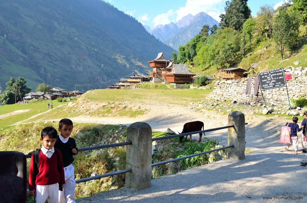
Enthusiastic schoolkids on way to Kitrawadi. Please visit Flickr for more images of the region
A fairly large courtyard; One of the chief occupations of the locals is to collect wild plants, shrubs and herbs which are then used for medicinal purposes. The upper tracts of the valley are rich in wild flowers of various kinds.
Curious eyes! Please visit Flickr for more images of the region
The scenery of this valley partakes in grandeur as well as beauty. From my vantage point, I can see the transition from the inhabited terrain to the forest line, from forest line to the tree line and from tree line to the snowline; the mountains of indestructible snow are invisible from here. What is most common is a solitary house with a small piece of cultivation or a few orchards attached; that seldom attracts the eye of the observer. As we had been observing for the past few days, people have devised their own pastimes on account of rigorous climate, mountain-locked isolation. They spend long wintery nights by relating traditional stories. Singing and dancing is the hallmark of almost all auspicious occasions. Locally brewed liquor finds its consumption to maximum on such occasions.
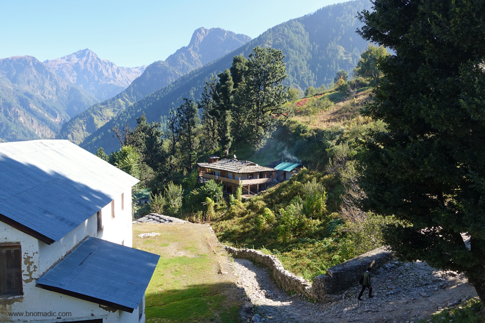
The plan for the day was to climb down to the village of Pujarli and hike back before the sundown. Mangal presents an excuse at the last moment and the caretaker has to hold the fort in SDM’s absence at the rest house. I immediately arrange my stuff and head towards the village of Pujarli. Returning from their primary school, a few enthusiastic school kids join me on the marked trail that begins just next to the rest house. Descending the slopes of Kwar, Kitrawadi is the first settlement that I reach where the kids bid me bye. I enter the premises of the main temple of the village. The vantage point offers a comprehensive view of the Pujarli flat ground along with the Kwar Jakh temples as well as the settlement. Cascading down the slopes, the blue-white waters of the Rupin adds to the beauty of the landscape. The entrance to the temple, marked by numerous trophies and game wins, is locked. With nobody in sight, I begin my descent towards the Pujarli flats.

A village house with some modern features. Please visit Flickr for more images of the region.

A multistory house; certainly not a five story structure. The use of cement is not uncommon nowadays
Courtyard of a house at Kitrawadi. Please visit Flickr for more images of the region
The narrow lanes of Kwar. More at Flickr

Jovial schoolkids at Pujarli after their evening break. More images from the region at Flickr
The Gurkhas lost badly when they attacked the valley of Dodra – Kwar. The locals overpowered the armed Gurkhas and caught them off guard in their sleep at night. It is claimed that the armours of Gurkhas, seized that night, are kept on display at the Kitrawadi temple. For visitors and outsiders, entry inside the temple is seldom possible. With much ease I descend the narrow lanes of Kitrawadi to reach the Pujarli flats. A motorable track that branches off the Dodra-Kwar motorway just before Kwar, reaches the settlement of Pujarli. The picturesque little hamlet of Pujarli is situated on a slope with houses rising one above the other, and the Rupin valley head looming large over the horizon. Orchards are abundant here. The settlement is already full of afternoon hustle-bustle. With no local to give me a company, this time I am considered a total tourist. Curious eyes follow me till the temple complex.
The village Kitrawadi, Kwar. Please visit Flickr for more images of the region

The temple of Kitrawadi in sight. Please visit Flickr for more images of the region
It is claimed that the armours of Gurkhas, seized that night, are kept on display at the Kitrawadi temple. For visitors and outsiders, entry inside the temple is seldom possible. More at Flickr
View as observed from the Kitrawadi temple courtyard. Please visit Flickr for more images of the region
Village Kitrawadi, Pujarli flats, the Kwar Jakh temple complex, the village Katol and the Rupin Valley

Village Katol is dominated by Thakurs, who once ruled the Rupin Valley. More images at Flickr
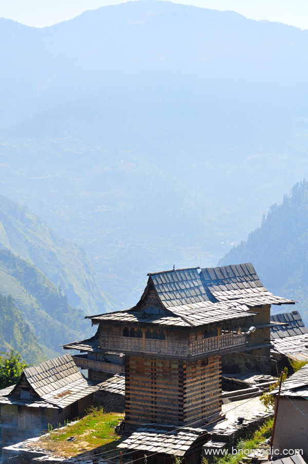
The Kwar Jakh temple complex at Pujarli flats. Please visit Flickr for more images of the region
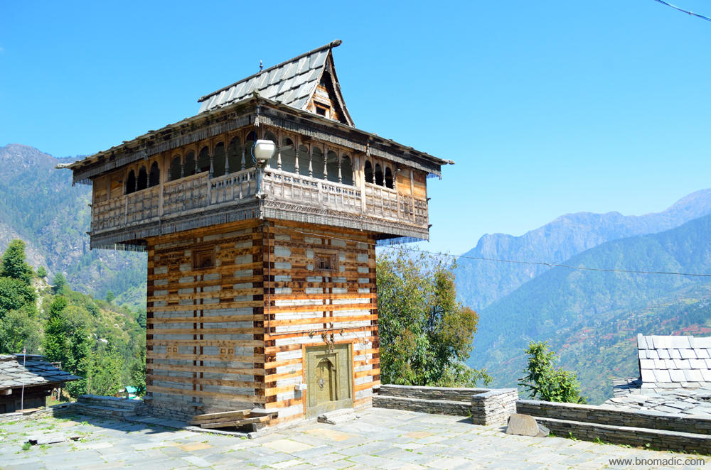
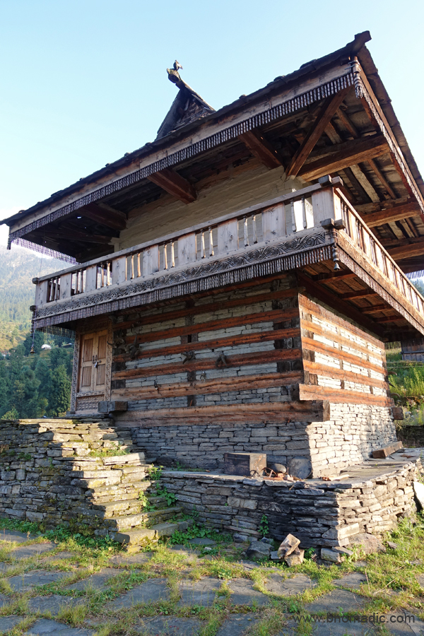
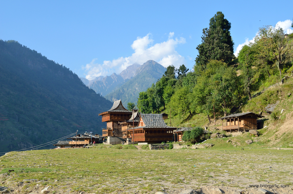
As I reach the temple site, a young man, who was earlier sitting idle in the complex, comes forward and instructs me not to enter any of the three temples. “And you cannot get the permission either”, he adds. I ask for the temple priest and the maali, a conduit for the devta, the chief deity of Kwar Jakh. “No one is around at the moment”, he responds. Later, I gather that one has to prove his caste before entering the temple premises. Even Raja Virbhadhra Singh, the Chief Minister of the state, who enjoys considerable respect among the locals, pay his obeisance by remaining outside only. Whatever be the reason, the temple belongs to locals only. But it must be said that the temple architecture of Dodra – Kwar valley is a thing of beauty to behold. Perched on a platform, the exquisiteness and clarity of the wood craft can take one’s breath away.
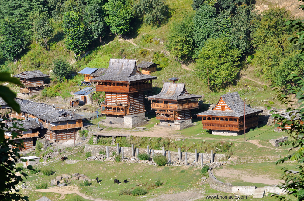
The Kwar Jakh temple; the Kwar Jakh devta, the chief deity of the Kwar cluster, is considered to be very powerful who is conversant with tantric methodologies as well. The devta, who is said to be demoniac, vengeful and predatory in practice, loves animal sacrifices. More images at Flickr
The Pujarli flats. Please visit Flickr for more images of the region

The village school across a small stream. Please visit Flickr for more images of the region
Later, I gather that one has to prove his caste before entering the temple premises. Even Raja Virbhadhra Singh, the Chief Minister of the state, who enjoys considerable respect among the locals, pay his obeisance by remaining outside only. More images at Flickr
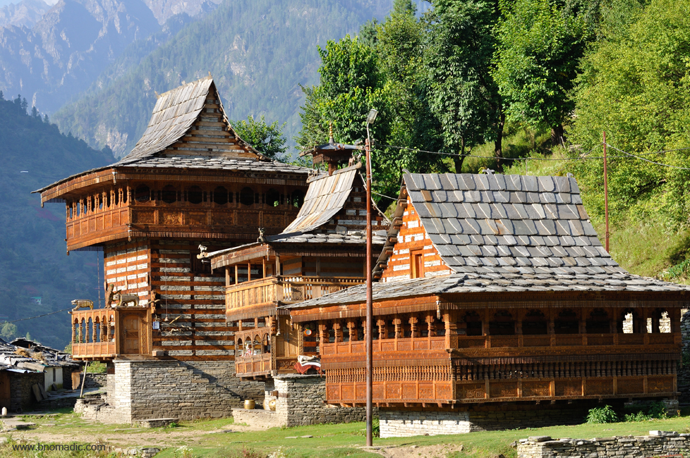
But it must be said that the temple architecture of Dodra – Kwar valley is a thing of beauty to behold. Perched on a platform, the exquisiteness and clarity of the wood craft can take one’s breath away.

These temples are not only the focal points of its religio-cultural activities and beliefs of the peoples, but also the veritable repositories of the religio-artistic expression of the art of the people.

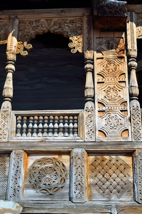
With rich floral devices, elegant verandas and pierced panels, the temples are a true masterpiece of the local wood-craft. A small detached balcony adds to the perfection. Round it hangs a fringe of wooden drops, which often produces a soft jangling in the wind.
The valley experiences very heavy rain and snow fall which forced the architects of the temple to construct wooden structures to protect the devotees from cold; the slanted roofs provide these intriguing structures with a long life. These temples are not only the focal points of its religio-cultural activities and beliefs of the peoples, but also the veritable repositories of the religio-artistic expression of the art of the people. The wooden carvings of temples are different than those of the residential complexes. The carvings on houses depict designs of flowers, branches, trees or birds; whereas, the carvings on temples showcases deity and devils, monsters, animals, snakes, war scenes, etc. With rich floral devices, elegant verandas and pierced panels, the temples are a true masterpiece of the local wood-craft. A small detached balcony adds to the perfection. Round it hangs a fringe of wooden drops, which often produces a soft jangling in the wind. As is noticeable in the newly constructed as well as under construction houses, the wood-craft is still alive and thriving in the valley.
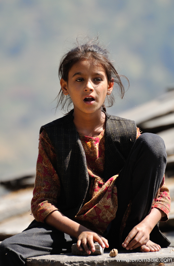
Faces from Kwar! Please visit Flickr for more images of the region

Being the peak of grass cutting season, both women and men are working frantically with their short-handled sickle to cut grass for winter fodder. Up here, their schedule is busy at any time of the year but now they will particularly have to start harvesting the kharif crop and simultaneously cut whole hillsides clear of lush grass. The tough season of winters is just around the corner.

Faces from Kwar! Please visit Flickr for more images of the region

Getting ready to embrace the tough winters

The Bushehri topi is a recent addition!
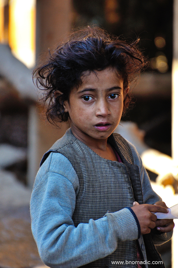
Faces from Kwar! More at Flickr
Faces from Kwar! More images at Flickr

Faces from Kwar! The headgear is influenced by the neighbouring Garhwal. More at Flickr
Faces from Kwar! Notice the rope called “rezi” or “lakha” tied around the waist; traditionally it was made of goat’s hair but now it has been replaced by soft nylon ropes. Whenever needed it can double up to tie grass or wood-fuel. More images at Flickr
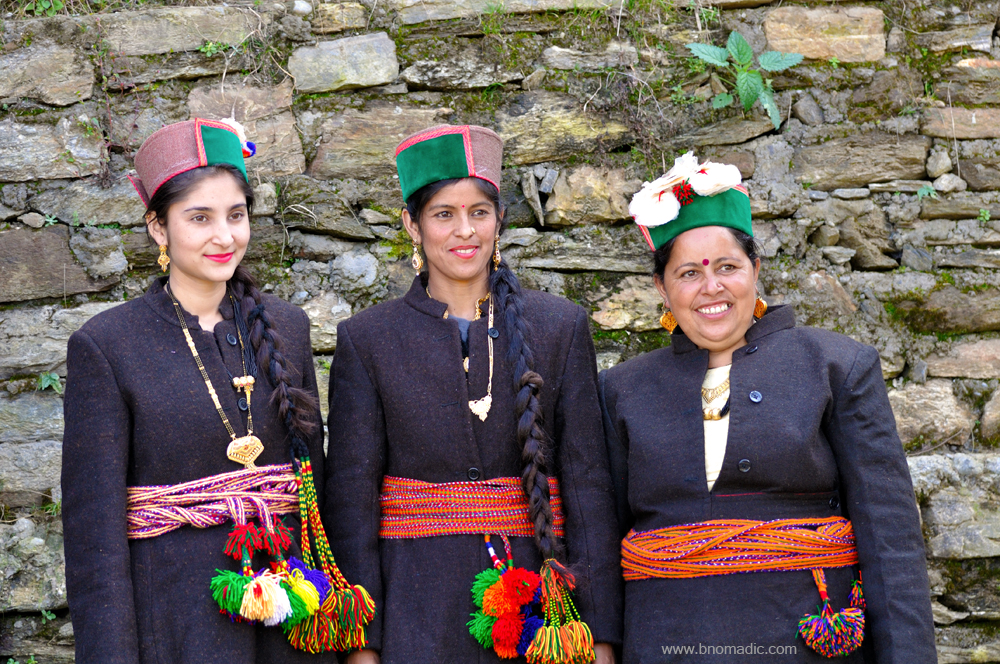
Faces from Kwar! Men prefer white coloured judkis, whereas, women prefer to wear black coloured judkis (outer coat) with a colourful lakhoti tied around the waist. Modern jewelry has replaced the traditional jewelry. And so is the headgear, flowered bushehri topis in this case. More at Flickr
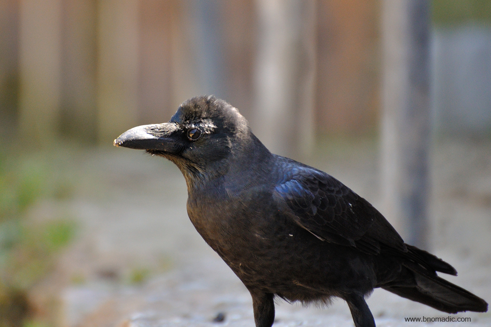
A large-billed crow. It is very adaptable and is able to survive on a wide range of food sources
Getting There
The village of Pujarli is at a 2km of hiking distance from Kwar, which is 42 km from the Chanshal Pass. A narrow motorable road to Pujarli branches off the Dodra-Kwar motorway a few kilometres before Kwar. Separated by the Rupin, Dodra and Kwar are 22km from each other.
Altitude: 2400 m
Best time to visit: Autumn
Travel Lure: Culture and sylvan charm
Accommodation: Very limited at Pujarli


