 bNomadic
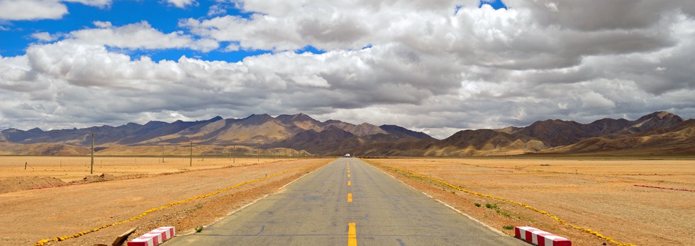
Up-close with the Tea river
The following is a page entry from On Road through the trans-Himalayas. To read complete travel memoirs and trip report, please visit here.
Chapter 4 of 22

Reckong Peo was also the venue for the Dalai Lama’s Kalchakra celebrations in 1992. For more detailed images on the region, please visit bNomadic’s Flickr Photostream
Early next morning, after the routine breathing-exercises, I paid my tribute to the Rock-shivling on the imposing Kinner Kailash range and took some customary photographs. The 17m rock pillar of Shivling reflects different hues with the movement of the sun. It was a perfect morning for photography. Situated 600m higher than Peo, Kalpa enjoys better views of the Kinner Kailash range including the shivling, Jorkanden, Sarong and Raldang peaks. I shall soon upload more details, including a bicycle ride, about this Sairag region of middle Kinnaur in a separate blog.

A closeup of the 17 m rock “Shivling” in the Kinner Kailash Range. Photo credit Sarabjit Lehal

The Kinner Kailash Range. For more detailed images of the region, please visit Flickr Photostream
After breakfast and checkout, we took walk on the road to Roghi, a small village on the original Hindustan Tibet Road. The yet to be harvested apple orchards as well as groves of Chulli trees marked the initial section of the narrow tarmac-path to the village. The old HT road here is etched on the infamous ‘suicidal’ Roghi cliffs falling sheer to the Satluj flowing 1000m vertically below.

The “Suicidal” Roghi Cliffs on the original Hindustan-Tibet Road
The ancient version of the HT road, reminisce of petty wool politics and Indo-Tibetan trade, was at best a broad and bridle trail. The olden route passed through the villages and revenue centres that included Narkanda, Kotgarh, Sarahan, Chaura, Tranda Solding, Sungra, Nichar, Tapri, Urni, Roghi, Kalpa, Pangi, Rarang, Jangi, Kanam, Shiaso, Pooh, Namgia and thereafter reached Shipki La. Today, the few stretches of the old HT route that overlap with the NH22 comprise Theog – Narkanda, Wangtu – Tapri and Shiaso – Pooh – Namgia. The excitement of retracing the olden route lies in the fact that it archives in its passage a noteworthy transition in climate, vegetation, terrain, people and culture.

Some apricots left out to dry on a rooftop
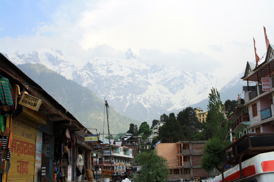
The market of Peo is nothing better than those of the towns we passed through after Shimla on the NH22. But then again, approaching from Spiti, one would definitely get the feel of a metropolis. The town is a sprawl of shops selling cheap garments, fake electronics, veggies fetched from plains, tea/ momo, fake Tibetan products as well as a few internet-cafés, a liquor shop, tin-roofed government, tourism offices and a Himalayan Handloom store, etc.

Early morning at Kalpa; the Jorkanden peak. More on the area Flickr Kinnaur
The Himalayan Handloom store located near the main-market chowk sells authentic stuff and is looked after by a lady from upper Kinnaur. It is from this region onwards, one starts to notice the gradual shift in culture and religion from Hinduism to Buddhism. Peo was also the venue for the Dalai Lama’s Kalchakra celebrations in 1992. Foreigners can obtain their Inner Line permit, to enter upper Kinnaur and Spiti, from Peo. More on this area, from my previous visits, on a separate blog soon!
The Raldang captured from the Main Market of Reckong Peo. Photo Credit Sarabjit Lehal
We were in no hurry to reach or plan our destination to spend the night. Nevertheless, having been to this area quite a few times, I did not want to dawdle in the town any longer. In a short span, the Faithful was on the NH22 again at Powari.

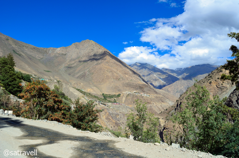
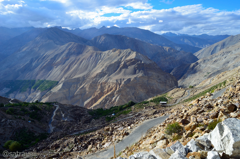
The section of NH 22 connecting the Sairag with Jangram region in the Sutlej Valley. For more detailed images, please visit bNomadic in Kinnaur
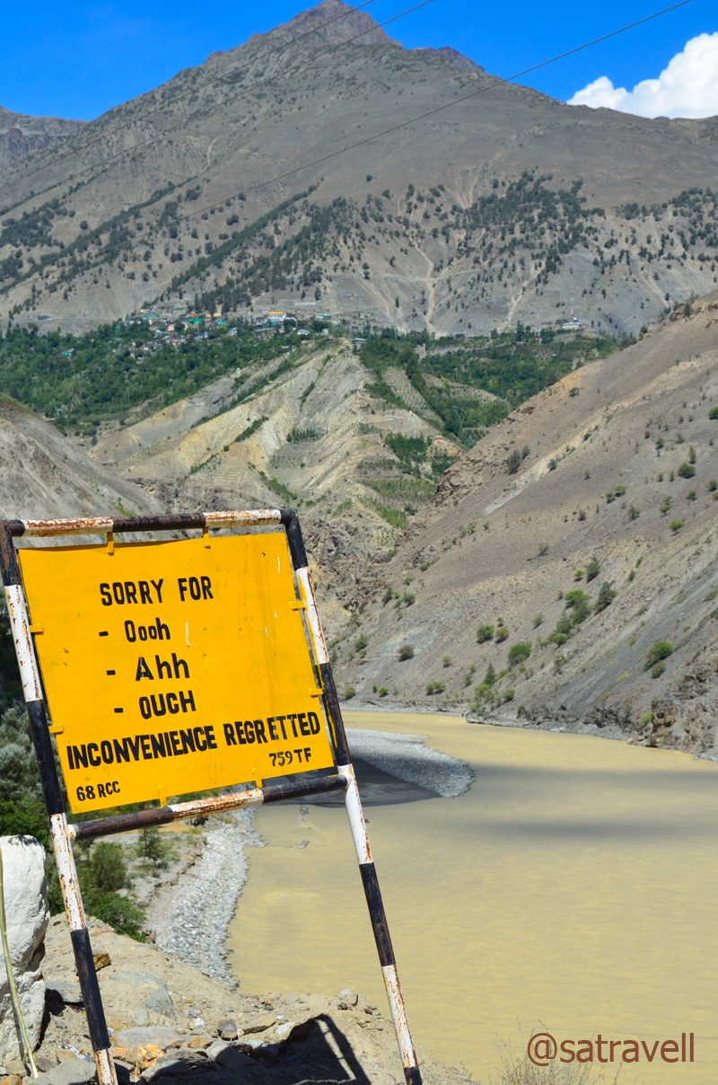
After the recent monsoon-rage that flooded parts of the Spiti as well as the Sutlej valley, the state of the highway ahead was a secret that was going to unfold now. On our way after Powari, we passed through pulleys transporting villagers and their cash-rich harvest of apple, right from the highway to the ridge-top across the mighty Sutlej, which was indeed a daunting task. Intermittent earlier, this is where Airtel connectivity totally gave up leaving us with my BSNL number. After this, Airtel showed up its presence at Leh and Srinagar only.
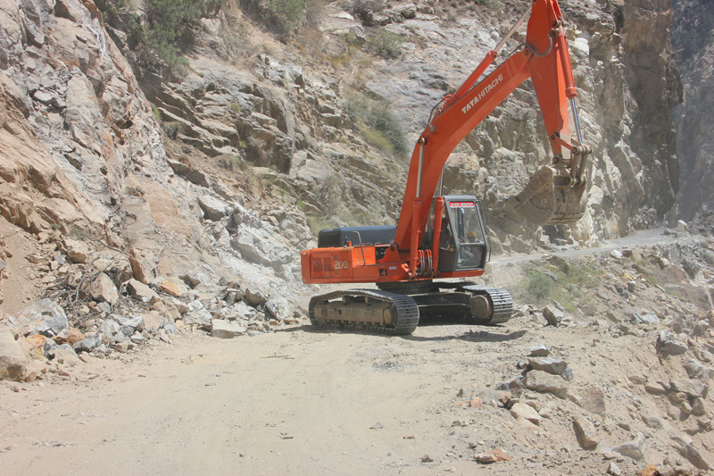
Clearing the highway for vehicles

A live landslide and the road ahead
The highway crosses to the left bank of Sutlej at Kharo Bridge and again to the right side a little while later at Akpa (2231m). From the bumpy road itself, the site of 2005 flash floods was apparent that had washed away several bridges. A little before the bridge was the diversion for village Ribba, commanding the best views of the Sesarang group.

Welcome to the Sumcho region
The neatly tarred levelled-road now snakes to reach the Police check post at Jangi (2294m) passing through a beautiful sight of the flat-floored valley at Thangi. Not only foreigners but domestic travellers are also required to submit their credentials at the check post. Of course the non-nationals need to show their Inner-line Permit too. Famous for its Ukiang festival and cumin seeds, the current Jangram region possesses the most extensive Chilgoza pines in Kinnaur making the villagers quite prosperous.
The Sumcho region. The green patches of village Spillo, Labrang and Kanam (on the original HT route) are also visible in the frame. This and more on the region at bNomadic’s Flickr Photostream
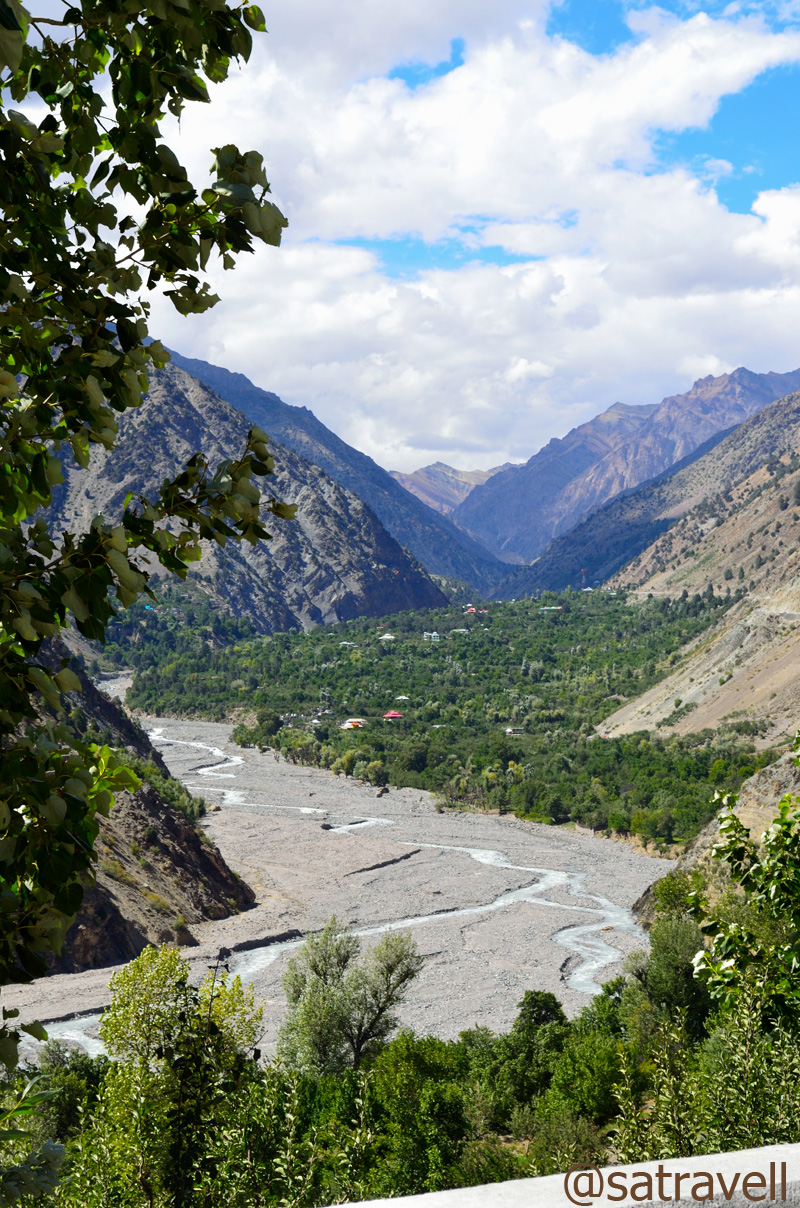
As we crossed the check post, vegetation started to fade and along with that the tar on the highway. Having savoured the view of Gymthing River as well as the natural rock shower, a little ahead of Spillow (2360m), we headed towards the Ropa valley, traditionally famous for shawl-weavers and producing finest metal artisans. The road to the scenic Ropa valley branches off the main highway right after the bridge on the Ropa River, a few kilometre before Pooh.
The amusing BRO signboards are actually meant to caution the drivers
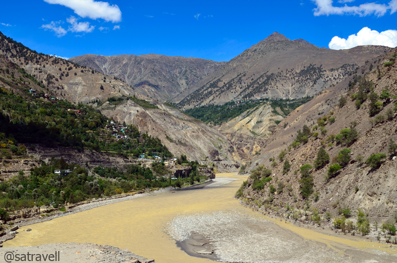
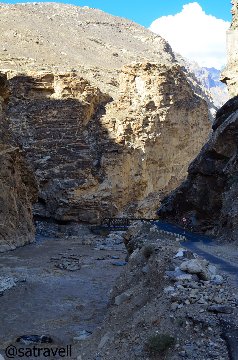
The “Tea River” Gorge

Also known as Shiaso, Sangnam or Gangyul, the Ropa Valley. For more pics of the region, please visit Flickr Photostream of bNomadic
Initially barren and arid, the un-metalled jeep track crossed the ancient village Giabong to reach Ropa virtually positioned in the midst of Chilgoza pine-cover. Not that we bothered relishing the fruit of hard labour, Chilgoza, literally a hard nut to crack, is known to possess aphrodisiac quality. A couple of hours more and we were back on the NH22 through the same road.
The historical villages of Ropa and Giabong in the Ropa Valley

The Sunnam village in the Ropa Valley. More pics in the series bNomadic in Kinnaur
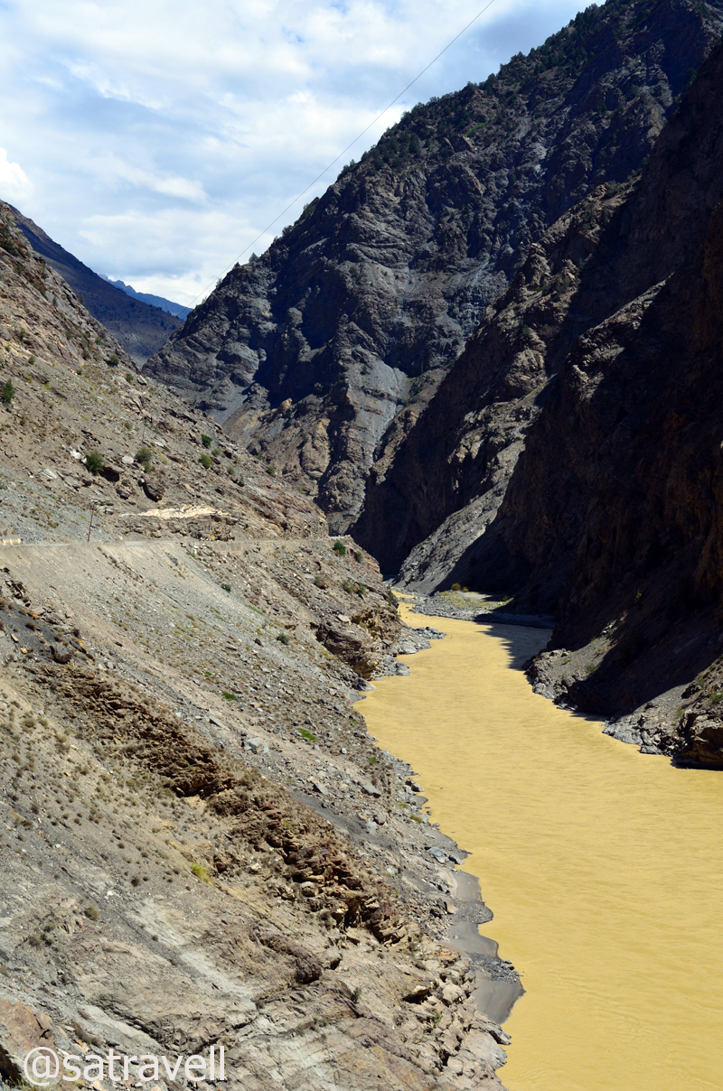
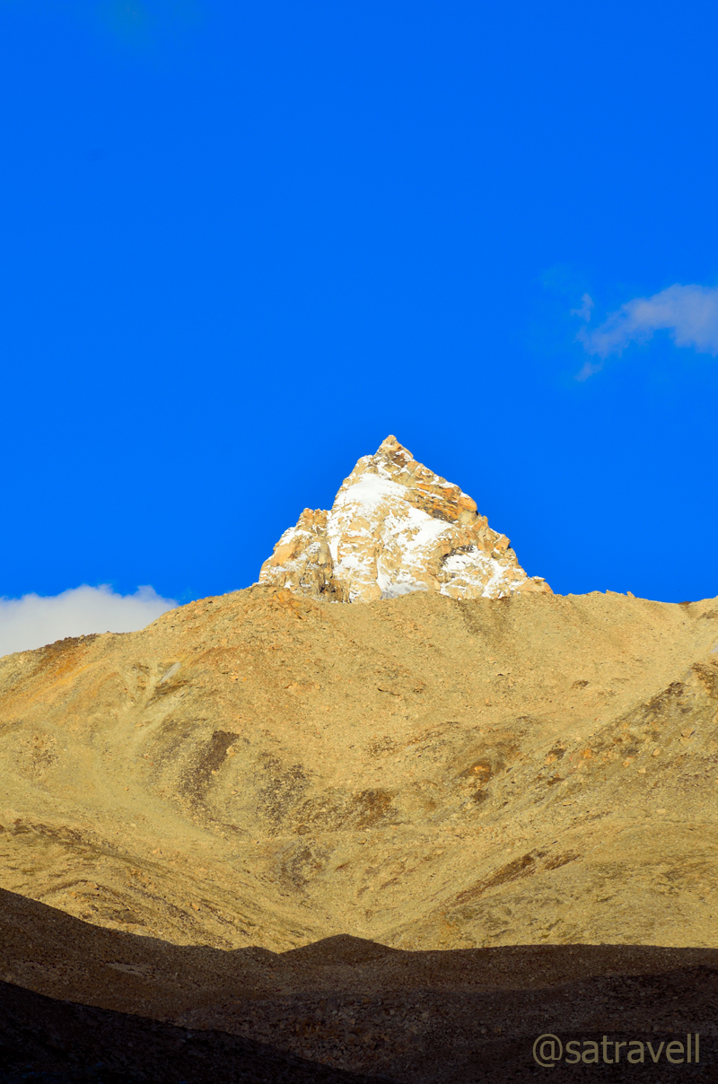
The road continued to gradually climb along the bare gorge with the muddy and tea-coloured Sutlej engaging the travellers to unending secrets waiting to unfold at every bend on the mountain slope. A little before Pooh (2820m), from the highway we captured the view of the Gangchua’s snow-capped pyramid in the beautiful Hojis valley towards the right side. Visible from the highway itself, Pooh, like most villages in Kinnaur, is not on the valley floor but a steep 200m above it on a 4km link road.
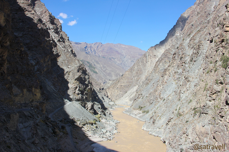
The bare gorge of muddy and tea-coloured Sutlej. The HT Route is etched on the left mountain-face in the frame. More pics of the region at bNomadic’s Flickr Photostream
The Pooh-Namgia region. For more pics on the region, please visit Flickr Photostream of bNomadic
The landscape after Pooh was now fast transforming itself into a land of dry and barren mountain ranges devoid of any noticeable vegetation though it lacked the enormity of the Spiti valley. The Dubling bridge, located a few kilometre ahead of Pooh took us to the other side of the river Sutlej after which we patiently descended and looked forward to the confluence of Sutlej and Spiti river at Khab (2620m) to make its appearance. Originating at Lake Mansarovar in Tibet, Sutlej travels a great distance before pouring itself into the Arabian Sea at Karachi just as the Indus River.

The Sutlej Gorge ahead
The confluence of Spiti and Sutlej at Khab
The Shipki La near Khab used to be a favoured trading route between Tibet and Hindustan since time immemorial and, although a trading post was opened here in 1995, the Pass sees very little trade-off these days. After crossing the recently-relocated bridge on the river Sutlej, the highway enters the narrow Spiti gorge on the river’s left bank. Before, near the Namgia turnoff the peaks you get to see to the southeast belong to the Himalayan range and to the northeast lies the gigantic Reo Purgyal (6816m), rising 3700m on the right bank, among the largest single rock-faces in the world. Although the road was neatly tarred, the confluence point of the two rivers is notorious for landslides or floods-related road-blockage. I got down and took a few photographs to capture the landscape as well as the majestic Reo Purgyal, the highest peak of Himachal Pradesh.

The majestic Reo Purgyal, the highest peak of Himachal Pradesh

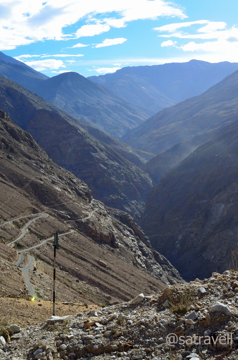
The Spiti Gorge ahead
At Khab, across the bridge, we came across a Spitian family, comprising a mother and her young daughter, waiting to board the transport bus to Sumra. The mother asked for a lift and I promptly nodded in agreement. The next hour and a half was spent photographing the landscape, relishing the apples from Namgia offered to us by the young lady as well as chatting over the current state of affairs in Spiti.

The narrow Spiti Gorge in the Hangarang region

Prayer Flags, Wheels and a small shrine at Ka on the road to Nako
Lost in the conversation and soaking in the beauty of the barren land, we almost ignored the narrow bumpy road on the final stretches of upper Kinnaur. Passing through Ka (3000m) and climbing the Ka Loops, we reached Nako (3650m) and entered the trans-Himalayan region. It was still an early evening but we decided to call a halt at Nako and dropped the mother-daughter duo near the helipad where they expected to get a bus soon.
View towards Khab; and the start of Ka zigs
Located on the irrigated side of the valley, another village Leo, visible from the main highway lies in the lesser-visited area of the Hangarang.

The green Leo and the Lipuk stream ahead, tributary to the Spiti River. For more pics of Kinnaur, please visit bNomadic’s Flickr Photostream
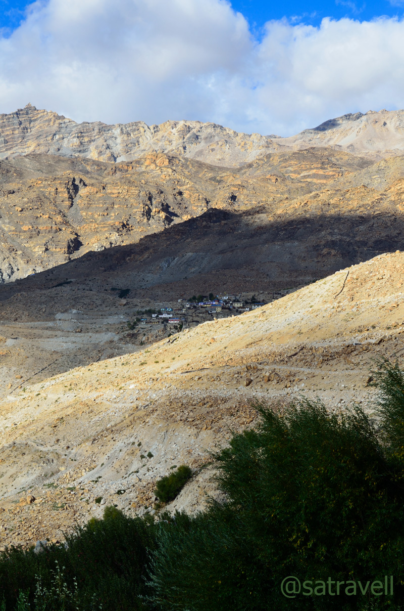
The Malling Village near Nako
The Yangthang and the end of Ka Loops. For more pics on the area, please visit Flickr Photostream
The next in line was a search for room-with-a-view. The upside of accommodations in such a terrain meant that almost every guest-house had a fascinating view to offer. We refreshed ourselves with a tumbler full of ginger-tea and local cookies coupled with veg momos in a reasonably priced room-set managed by twin sisters from the village itself. The agreement was Rs 500 for a night exclusive of food and teas. The balcony offered an extraordinary view of the snow-capped peaks in the Srikhand range.
The edges of Reo Purgyal massif eloping with the pastures of Nako
Noticing the evening reach it’s crowning and hearing the increasing chitter-chatter of the birds, I headed up the pastures to take some shots. Placed just in the lap of a vast expanse of steadily sloping terrain, with snow-capped mountains all around, provides Nako with the feel of soaring high among the clouds. The edges of Reo Purgyal massif eloping with the irrigated fields of the village dominate the landscape. The village Nako is a random jumble of traditional stone-built houses with small wooden-doors and cowsheds located in earthen narrow-lanes. The village temple complex, credited to Rinchen Zangpo, is situated towards the west side.
Unidentified peaks towards the Srikhand Range. For more detailed pics of the region: Flickr Photostream
Although I couldn’t get much from bird-photography perspective but I did manage some reasonable clicks of clouds hovering over the Srikhand range. While I was busy with my game I observed a sound of humming and drumming coming from the direction of the village which was getting louder as the daylight faded.

The ancient roofed chortens towards the pastureland from Nako
I headed towards the direction from which the sound was coming and on the way asked cousin to join. And there we were attending and witnessing a marriage ceremony!
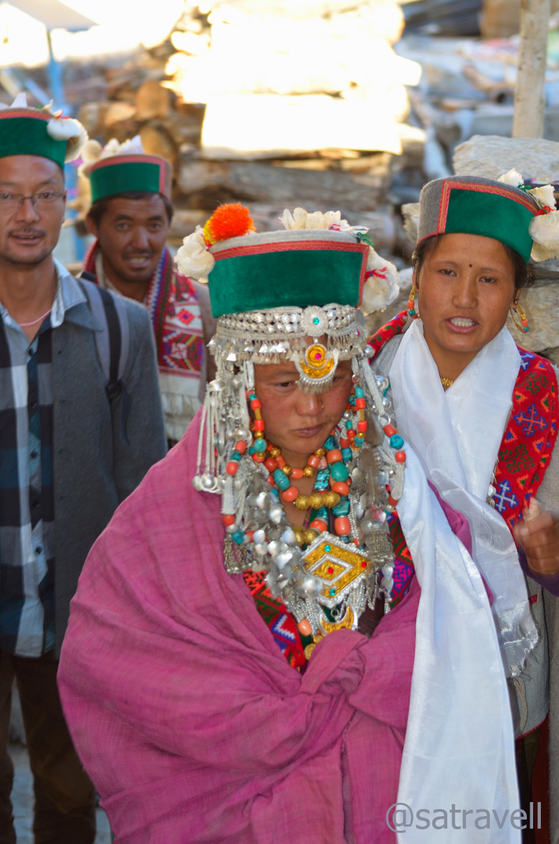
The bride
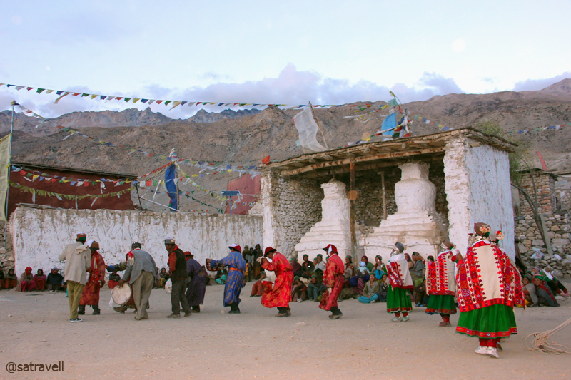
Women certainly enjoy a better social status in the trans-Himalayan areas than in most of rest of the India. Well, almost certainly the civility has been instilled by the prevalence of the Buddhism. It was the boy’s family that had made the initial offer through an intermediary. Surrounded by the villagers and onlookers like both us, the initial part of the wedding ceremony was held in the girl-family’s courtyard. Overseen by a head lama present to bless the couple and ward-off the evil spirits, only a select few had accompanied the groom to take home the bride. On the way back the marriage party took form of a procession, joined by almost the entire village, and headed towards the ancient tenth-century village Gompa (also known as the Sacred Compound).

Lamas rotating the ancient prayer-wheels to mark the beginning of marriage-functions

All set to participate in marriage functions, family members outfitted in traditional attire lined up on the ground of Sacred Compound
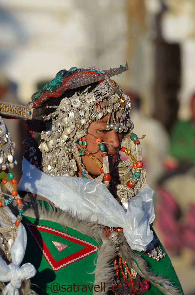
A Kinnauri Beauty. More on Flickr
Families of both the bride and the groom outfitted themselves in their traditional attire whose elements included a gachang, chuba, suthan, topru, white-feathered Kinnauri cap, round Tibetan hat, costumes/ head gear decorated with turquoise stones, silver jewellery, etc. Having consumed copious amount of Chaang, locally brewed barley beer, the family members danced and feasted the entire night in the courtyard of the monastery. The ceremonial activities of udanang and belding were attended by the residents of the entire village who sat cross-legged around the area kept for the purpose. Each gift exchanged was meticulously noted down.

In the courtyard of the ancient Sacred Compound
Family members taking part in marriage functions. Also visible in the frame are the tenth-century crumbling shrines credited to the Rinchen Zangpo. More on the region Flickr Photostream

Villagers assembled alongside ancient roofed-Chortens, part of the tenth-century Sacred Compound, to watch the proceedings. More pics of the region at bNomadic’s Flickr Photostream
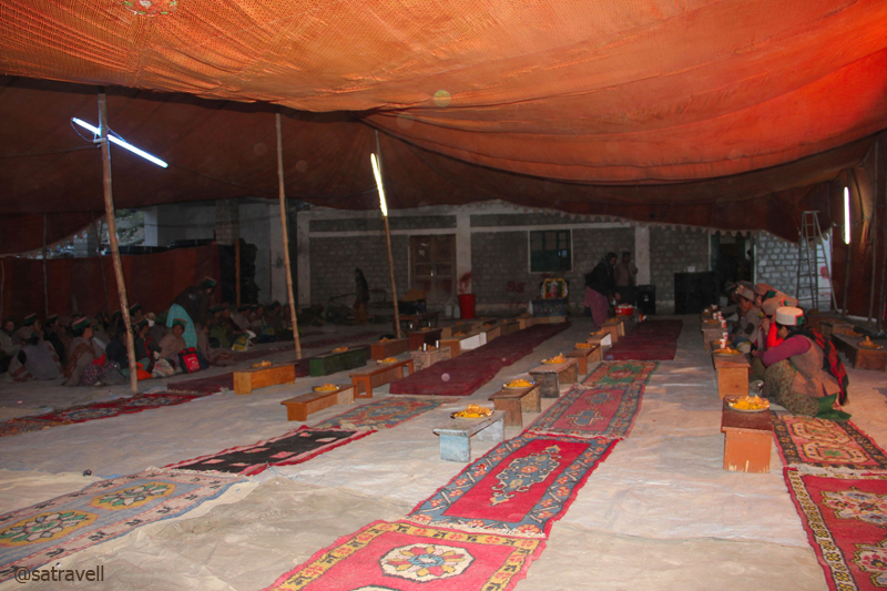
After-marriage community feasting. More on the region at bNomadic on Flickr
After the dance-related ceremonies got over, the proposers literally announced the onlookers and bystanders to go home. We left the scene and took a walk encircling the village including the lake and monastery. Bordered by willows and poplars, in the night, the lake seemed more of a village-pond rather than a natural water reservoir. The starlit night-landscape surpassed the beauty of the evening’s treasure. The next morning-view was indeed expected to be a secret. Aiming to capture birds in the morning, I retired to the bed soon after reaching the room and consuming a healthy meal of dal-rice.

A tiny chorten in the narrow dusty lanes of the village
Without taking into account the government-run rest-houses, the places in Kinnaur where a night halt could be easily negotiated included Jeori, Sarahan, Kalpa, Recong Peo, Pooh, Nako, Chango, etc.
View and read more on the region at the Flickr Photostream of bNomadic
You may also like to subscribe to the email updates, of the remaining chapters, by entering your email id in the sidebar.
Leaving Home to reach the Roof of the World
The following is a page entry from On Road through the trans-Himalayas. To read complete travel memoirs and trip report, please visit here.
Chapter 2 of 22
With Dorje at his home in Leh
Just as I was about to start for Chandigarh from Jind (Haryana), my hometown, I again faced a few unexpected events which were, mercifully, both welcome and favourable this time. I opportunely got an offer to travel along with a cousin of mine who was also well versed in driving Toyota Innova, our vehicle for the journey to the dreamland. As a consequence of the last-minute quandary, we had only three weeks left to finish our journey. Without losing any further time, I immediately set out for Chandigarh, our stop for the night, and picked my cousin on the way from Karnal. Before switching the engine on, I put the tachometer of my new Innova on zero reading at Jind itself. Powered by a BS-IV engine with intercooler, the latest addition to our garage had only done 4300 km but I was confident of Toyota’s reliability and Innova’s performance as it was a fourth Toyota vehicle and third Innova in our family.
Taking full advantage of the spacious Innova, within a shortest of time frame, we packed whatever we could manage that was felt to be needed for the journey. The list included a fuel-canister, fruits, packaged-water bottles, juice, biscuits, sleeping bag, blankets, extra winter wears, head gears, sandals, bathroom sleepers, etc. Howsoever jejune it may appear, it is my belief that if you have extra space left in your vehicle outstretch the checklist of essential articles and include items that meet ancillary needs. This belief later proved to be life protector at Pang in Ladakh.
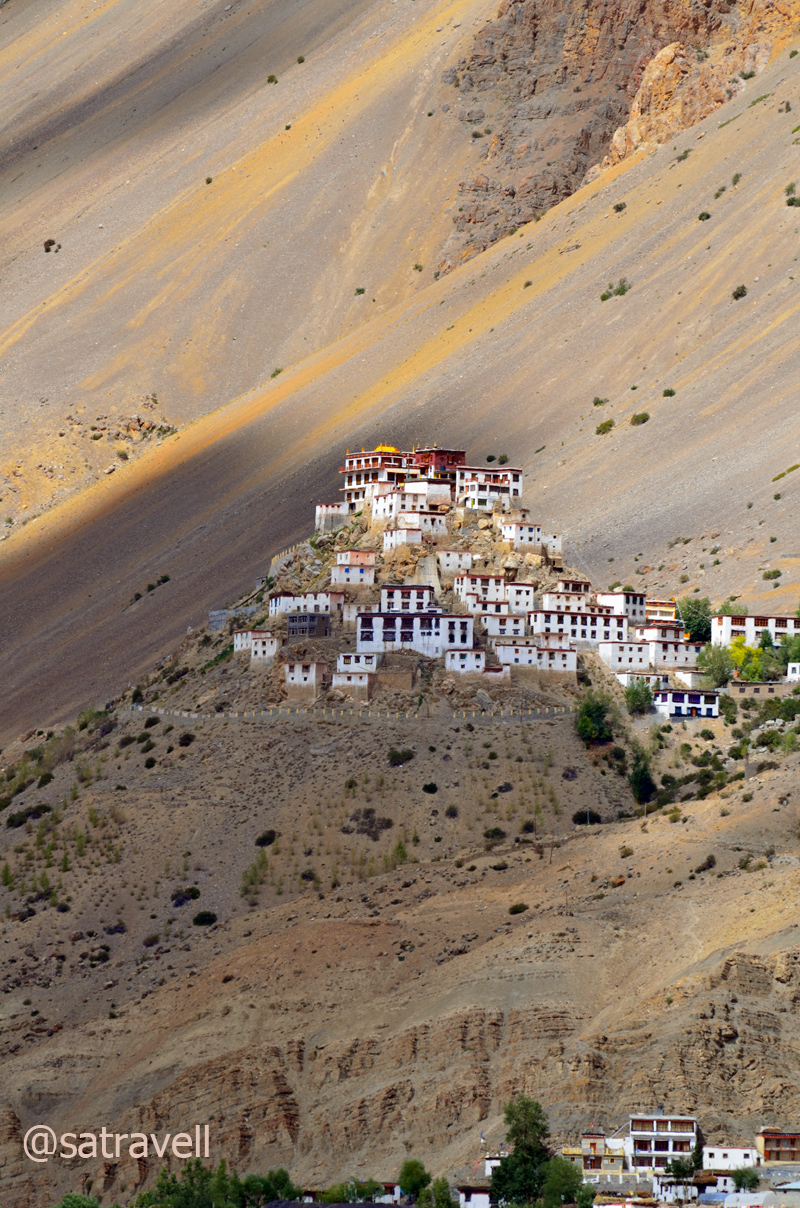
One of the most important Monastic schools in the Spiti Valley, the Ki Gompa is claimed to have been built in the eleventh century.
The idea behind staying in Chandigarh at the start of the escapade was to safeguard an opportunity to boost our supplies for the journey to the land of high passes. I particularly wanted to buy a book on Kashmir to understand the area, traditions, culture and its people. Although, Kashmir was not in our itinerary for the current trip but since Zanskar was so I held it to be a valuable brainwave to read something about its neighbouring region before we reach there. My cousin absolutely left it up to me to chalk out the route, night-halts and destinations. We both wanted to avoid the traffic at Rohtang and city-like humdrum of Manali, so I lost no time in deciding that we will explore Spiti first and join the Manali-Leh highway at Gramphoo after crossing Kunzum La. The excitement immediately got multiplied.
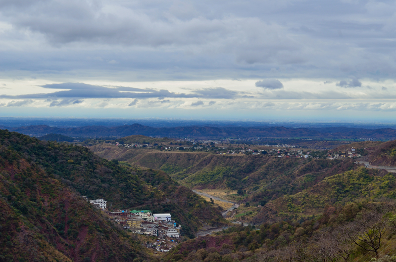
Shivalik Hills merging with the plains at Pinjore. Captured (later) from a point near Dharampur
However, a night-halt at Chandigarh would have meant a few additional hours to cover the distance for the next day. I could anyhow buy the book from Leh, our transit halt for the trip. Full of energy and excitement that night, we decided to drive up a maximum possible distance on the National Highway 22, lifeline of Shimla, Kinnaur and Spiti. The farthest he had been on this highway was Narkanda and for me it was middle Kinnaur. As both of us had enough experience of driving up the highway to Shimla and knew the terrain well, anyplace after Shimla was acceptable to spend the night. No sooner did we cross the Chandimandir cantonment than it started raining. It was bucketing actually, to say the least.

We saw no point in dragging ourselves on the highway in such a bad weather
Cousin immediately used contacts to book a luxurious accommodation at Dharampur for the night. After recharging our supplies from the main road market at Dharampur, we headed towards the extra comfy accommodation which was reserved for us and retired early after a quick dinner and informing parents about the plan. I also communicated to the cousin that this was to be the only accommodation for the next three weeks where we could enjoy the amenities offered by a plush property. Such niceties on a constricted budget may not always be possible everywhere. The favourable fact, however, was that we were venturing into the land of high passes in September, technically a tourists-off-season which meant greater discounts on accommodations.
You may also like to subscribe to the email updates, of the remaining chapters, by entering your email id in the sidebar.
Prologue to my trans-Himalayan Stroll
The following is a page entry from On Road through the trans-Himalayas. To read complete travel memoirs and trip report, please click here.
Chapter 1 of 22

Up there, Dragons are considered to be protectors of Buddhism. Photo-credit Sarabjit Lehal
From the time when I was studying in the university, jaunts to the roof of the world were planned on several occasions every season but nothing fructified. The highland-sojourn kept getting delayed on various accounts ranging from personal to professional to logistical. The closest I ever got to the region was in the monsoons of 2010 when I embarked upon a bicycle-ride to Leh from Shimla crossing Jalori pass. The expedition-ride had to be discontinued a little ahead of Jispa in Lahual, Himachal Pradesh after one of the teammates started showing symptoms of AMS and succumbed to the shortage of oxygen. Of the three-membered team, only one got to brave the odds presented by the treacherous terrain and rode solo from thereon to reach Leh as per the schedule.

Descending the Rangcha slopes after visiting the Kardang Gompa. Upper Keylong in the backdrop.
In between, the periodic strolls in the lap of Himalayas were restricted to the areas and surroundings of Kinnaur, Great Himalayan National Park, Manali, Garhwal and Kumaon, etc. The only way of appeasing the mind partially was to read and research more and more about the area. Having delayed the visit by more than seven years now, nothing except an extended visit would satiate the soul.
The long-cherished childhood dream of visiting the trans-Himalayan region was destined to see the light of the day in 2012. After dreaming as well as discussing all these years coupled with reading numerous travelogues and books on the area, I was ordained by the fate to travel the ancient-era trade-routes at this time of the year.
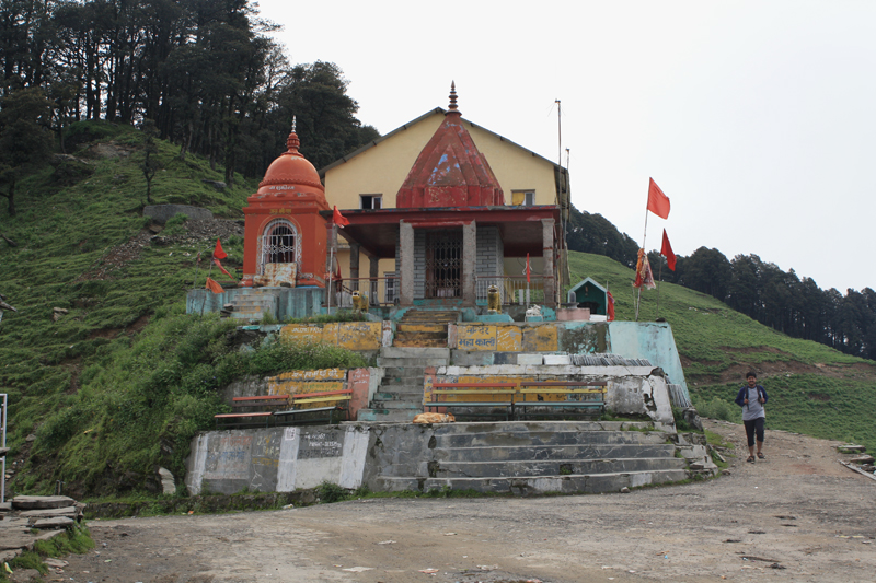
The temple dedicated to Goddess Mahakali marks the top of Jalori Pass
Although not everything happened as per the original plan and intention but this was one journey I enjoyed to the bottom of my heart. I promised myself to travel again the coming seasons armed with even better preparation.
The trip was initially billed to be a month-long expedition containing worthwhile exploration elements resembling short treks as well as camping, wherever required. A checklist of necessary and required items was prepared and routes were debated and a conclusion was arrived at in the form of a blueprint for the next one month. The areas to be covered were roughly identified as Lahaul and Spiti, Ladakh, Rupshu, Changthang, Nubra, Shyok, and Zanskar, etc. Owing to the delay in delivery of the 4×4 SUV by the manufacturer, second week of August was identified to be the perfect timing to departure for the expedition. In the meantime, me and my partner-in-crime for a long-time now, we both got ourselves to arrange for the items in the agreed checklist. By end-July, everything required was in the possession including the vehicle profoundly waiting for its first inspection and service before the commencement of our trip. I prudently selected music for the proposed expedition and the entire operation took several hours for me to load a 16 GB pen drive.
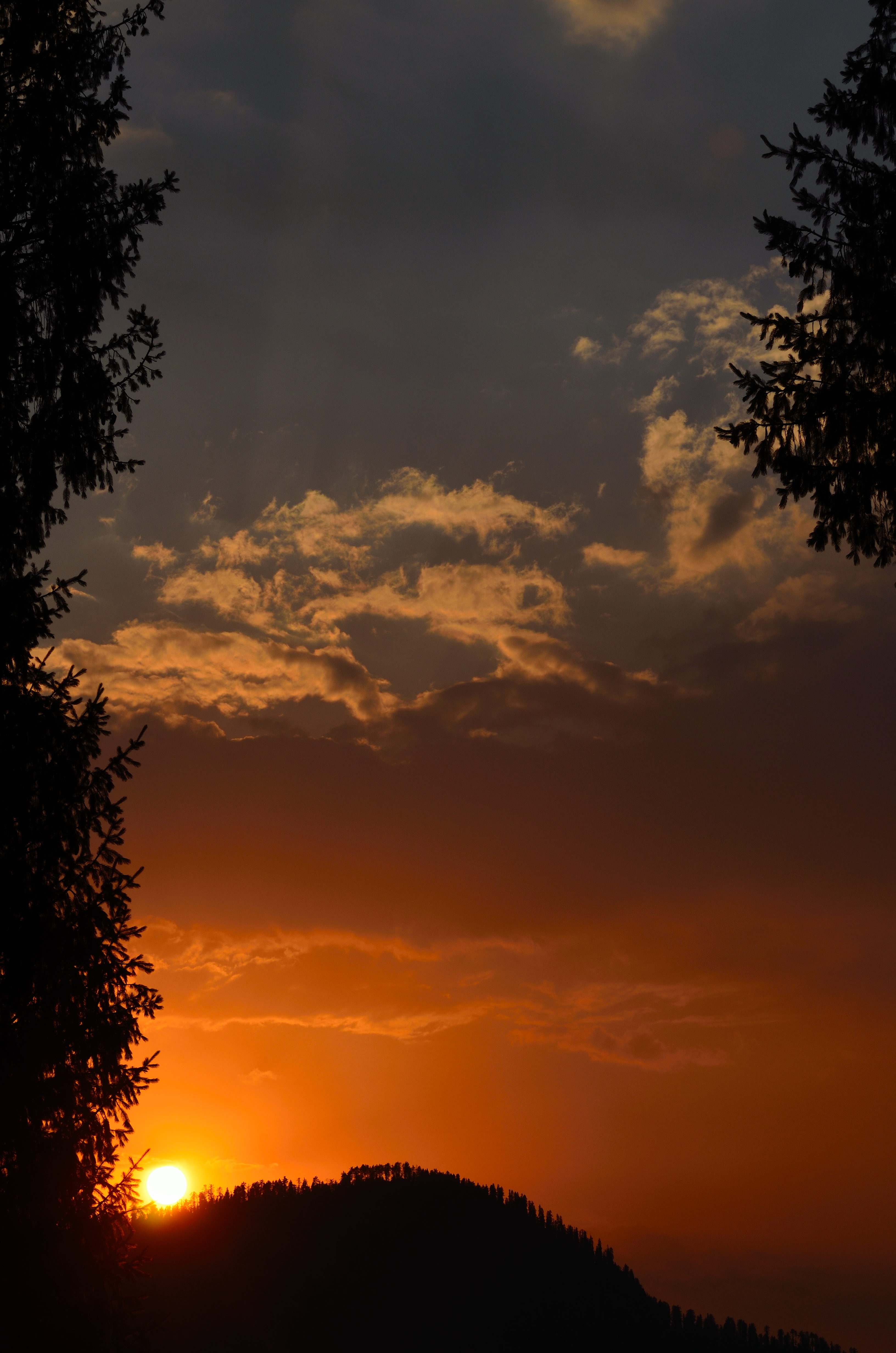
Sunset at Great Himalayan National Park
However, at the eleventh hour, a turn of few unexpected events in the family as well as work-life made it impossible for me to depart before August 30, 2012. Owing to his work-related obligations, the outcome was that my partner had to withdraw from this much talked about expedition. It was a gloomy period and I was simply unable to digest the very thought of having to postpone the expedition to the next season which would have meant a wait of one more year. The month of September being the last safe window for travelling to the trans-Himalayan region, I deliberated about travelling solo. Earlier, I have had a few occasions of travelling solo and knew both the excitement and responsibilities associated with it. Nevertheless, travelling solo to this part of the world necessitated a different set of planning and preparation which I immediately undertook.

The renovated Kardang Gompa, Keylong. One of the most important Gompas of Lahaul, the 12th century Kardang follows the Drukpa lineage
The plan was simple. Carry only the required stuff in a rucksack and ignore the gadgets and camera-kit for the time being. Travel in a shared cab, hitchhike and prefer public transport wherever available. I confirmed the same to Tsewang Dorje (James), my friend and classmate at the university, who is based in Leh and asked for his help in getting permits for the classified region in Ladakh and travelling to Zanskar. My brother booked me in a night bus from Chandigarh to Manali, where I would have taken a shared cab to reach Leh in a day. But the ticket had to be cancelled later on.

A bridge on the ferocious Bhaga River. The bridge connects the lower Keylong with Kardang village
(You may also like to subscribe to the email updates, of the remaining chapters, by entering your email id in the sidebar)
Bird-watching at Asan Barrage
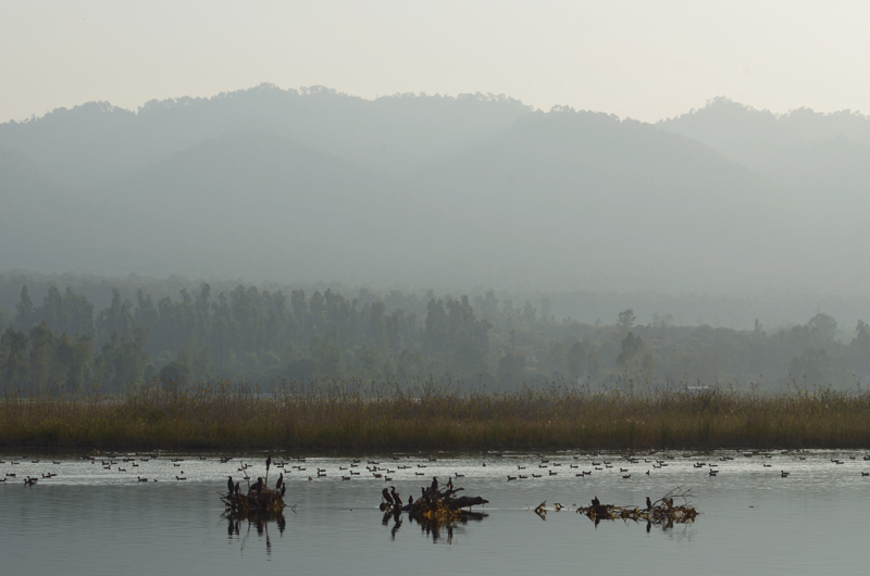
It was during my recent visit at the Kalesar National Park when I finally got a chance to visit the Asan Barrage in Uttarakhand. It was on Sh Bharatlal’s, Forest Guard at the Sultanpur National Park, recommendation as a must-visit that I decided to visit the much talked-about wetland of the region. Situated at hardly a 20-min drive from the Kalesar Forests, it would, in fact, be a good idea to tie up this and nearby wetlands along with a visit to the National Park. I just wanted to do this when the moment finally arrived early this year.
Also known as Dhalipur Lake, the four km sq wetland created at the reservoir of the Asan Barrage is located at the confluence of Eastern Yamuna Canal and the Asan River, claimed to be Asmanvati of the Rigveda, in the Doon Valley which shares its borders with two other states – Haryana and Himachal Pradesh. From the NH 1, the diversion towards Ladwa from Kurukshetra takes straight to Yamunanagar from where the barrage is further 70 km towards Dehradun crossing Paonta Sahib on the way. Accessible from the Paonta Sahib – Dehradun road, the water-level in the manmade reservoir is controlled by the barrage.
The depth of water at the lake varies from 3 to 20 ft.
From the time when the barrage was constructed in 1967, the water body has been attracting a large number of migrants, passage migrants as well as birdlife from the scrubland and woodlands of the adjacent forests. Although supporting birdlife round the year, the lake transforms itself into a true wetland when the water level goes down. Seeing its popularity grow among birdwatchers, the tourism development authority of the concerned government, the Garhwal Mandal Vikas Nigam (GMVN) made some efforts to develop this site into a picnic as well as tourist spot. Currently, the GMVN runs a cafeteria, a log-hut complex to provide accommodation to the visitors as well as a few adventure activities including water-skiing, rowing, kayaking and boating, etc. Unfortunately (but typically), most of the services provided by the GMVN at the site are nearly in tatters due to bad infrastructure management.

Cormorants sunbathing after drying their wings
Nevertheless, the average daily bird count at the wetland has been fairly large enough to appease the soul of a birdwatcher. The site was recently declared a Bird Sanctuary by the state government. Providing some natural hides as well as offering near-access, it was, in fact, an ideal site to photograph the waterfowls. The pedal-boats, though crumbling, make it possible to reach the small marshy islands and photograph the birds quite easily in their natural habitat. For me, the prized sighting of the wetland would remain that of the Pallas’s Fish Eagle which I spotted while sipping hot tea at the cafeteria, surrounded by a familiar menace of monkeys, by the lakeside.

Brahminy Ducks dominated the bird-count that day
As many as up to 240 bird-species, including a few endangered ones, have been reported in the checklist of the area including its immediate surroundings. The wetland has been known to be frequented by up to 53 species including 19 migratory birds from Europe and Asia. Begin winters and the migrants as well as passage-migrants to South India start arriving in large flocks. Common visitors include Shoveller, Ruddy Shelduck, Mallard, Coot, Wagtails, Pintail, Pochards, Gadwalls, Wigeon, Teals, Tufted Duck, etc. Birds of prey such as Marsh Harrier, Greater Spotted Eagle, Osprey and Steppe Eagle, etc. add to the magnificent biodiversity. Winters might be the most exciting season to visit but for serious birdwatchers the remaining time of the year offer just as exciting opportunities to see the local migrants like Cormorants, Storks, Cranes, Herons and Egrets, etc.
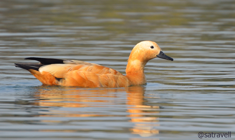
Ruddy Shelduck breeds in high altitude lakes in the trans-Himalayan region
The waters of the Yamuna could be accessed a couple of kilometres from the wetland. Other popular destinations within an hour’s reach from the site include confluence of Tons and Yamuna at Dakpathar, Asokan rock edict at Kalsi, Kalesar National Park, Kaleshwar Math, Paonta Sahib Gurudwara, Hathni Kund Barrage, Chuharpur Nature Park, Buria, Sugh, Bilaspur, Kapal Mochan Temple, Saraswati Udgama Sthal, etc.
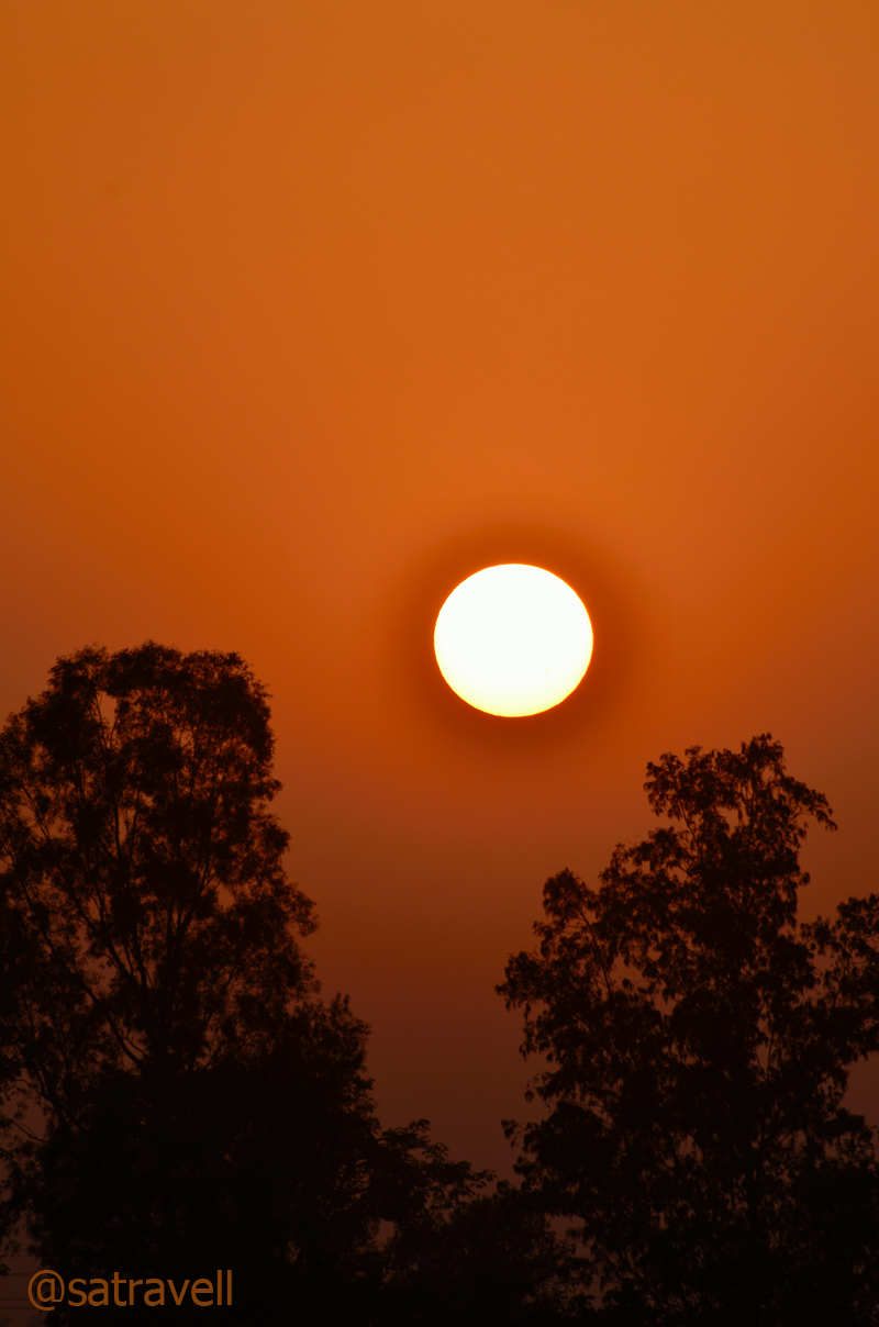
Sunset captured at the Yamuna riverbed
Hathni Kund Barrage – A lesser-known bird watching destination
During one of my recent visits to the Kalesar National Park, Haryana’s only Sal forest, I finally got an opportunity to visit the famed Hathni Kund barrage on the Yamuna River. Although, I had crisscrossed the barrage as well as the forest many a times before but a dedicated visit could only be made possible this time.
Located in Yamunanagar district of Haryana just before the Sal forest cover of Kalesar starts, the barrage marks the state’s border with Uttar Pradesh. The diversion towards Ladwa from Kurukshetra at NH 1 takes straight to Yamunanagar from where the barrage is just 40 km, a little aside the State highway connecting the district headquarters with Dehradun via Paonta Sahib, a popular pilgrimage of Sikhs.
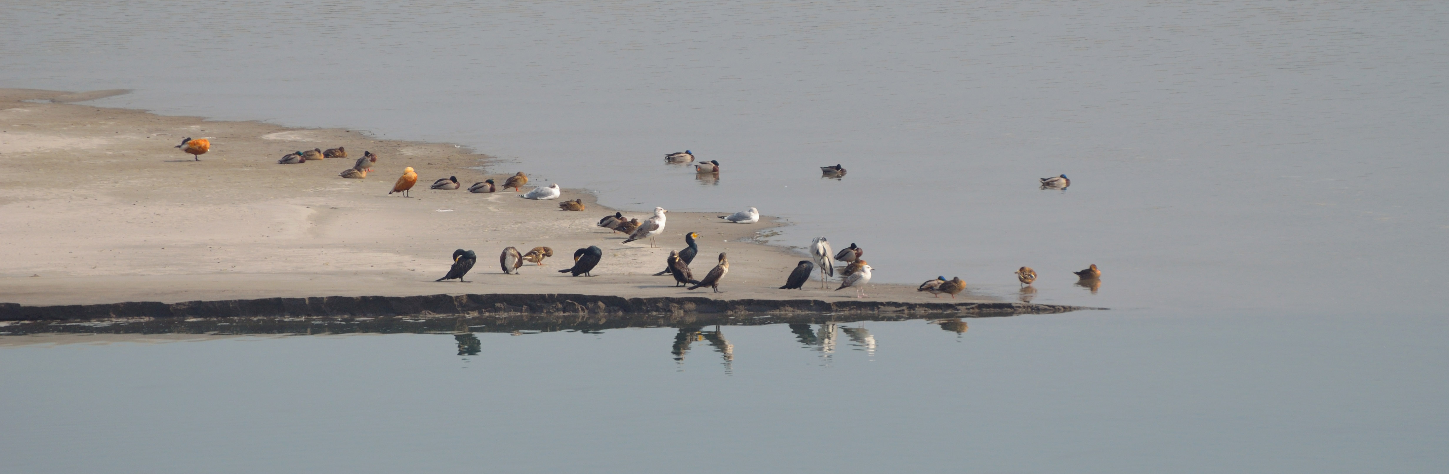
Waterfowls at the Hathni Kund reservoir
The folklore claims that an elephant, belonging to the personal cavalcade of the Mughal emperor Shahjahan, was drowned here (and hence the name). Legend has it that the emperor got the beast thrown into the Kund in the hope of retrieving the golden elephant in return, after someone told him that a priest had tossed the Paras Stone into the riverbed.
The Hathni Kund barrage, which diverts water into the Western and Eastern Yamuna canals, serves as a wetland for over 40 waterfowls including 15 resident species. During winters when water is mostly stagnant, the one-km-sq reservoir created by the barrage is known to attract a fair quantity and variety of migratory as well as resident waterfowls. Luck possibly was not on my side that day as the barrage surprisingly did not live up to its reputation as the quantity of the collective bird species was quite low. Nevertheless, I spotted River Lapwings in its natural habitat among others and the view from the barrage was quite absorbing. The foothills of the Himalayas, further afar, served as a link between the plains and the skyline.
Built on an elevated platform, Hatni Kund is not only a preferred bird watching site but is frequented by river rafters alike. As the river Yamuna enters the northern plains after meandering through Himalayas, crossing its last rocky lap at Paonta Sahib, the water-related adventure activities culminate at the Hathni Kund. As with other non-perennial rivers, such adventure activities are highly seasonal and flourish only when the flow of water is adequate (as in late spring). The waters of the Yamuna are redirected through a barrage at Hathni Kund and at Tajewala, located five kilometres further afield. The state tourism department bills these links as rafting course of the lowest grade or beginner level. Although, with regard to purpose, the British-era Tajewala barrage has been replaced by the recently constructed Hathni Kund barrage, the links are still very much functional. The waterfront at Tajewala could be combed for angling activities, after obtaining a special permit, specifically pertaining to Mahaseers.

The Hathni Kund barrage creates a one km sq small wetland
The seasonal camping facilities provided by the state tourism department have been discontinued and the best options to stay nearby include the Guest House of electricity department at the site and the colonial Forest Rest House at the Kalesar National Park. Having spent a couple of hours at the crystal clear waters of the barrage, I headed towards the National Park where I wished to spend at least three days.
Other popular destinations within an hour’s reach from the site include Asan Barrage, Bheemgoda Barrage, Kaleshwar Math, Paonta Sahib Gurudwara, Chuharpur Nature Park, Buria, Sugh, Bilaspur, Kapal Mochan Temple, Saraswati Udgama Sthal, Ban Santour, Adi Badri Temple, etc.


