 bNomadic
The following is a page entry from On Road through the trans-Himalayas. To read complete travel memoirs and trip report, please visit here.
Chapter 4 of 22

Reckong Peo was also the venue for the Dalai Lama’s Kalchakra celebrations in 1992. For more detailed images on the region, please visit bNomadic’s Flickr Photostream
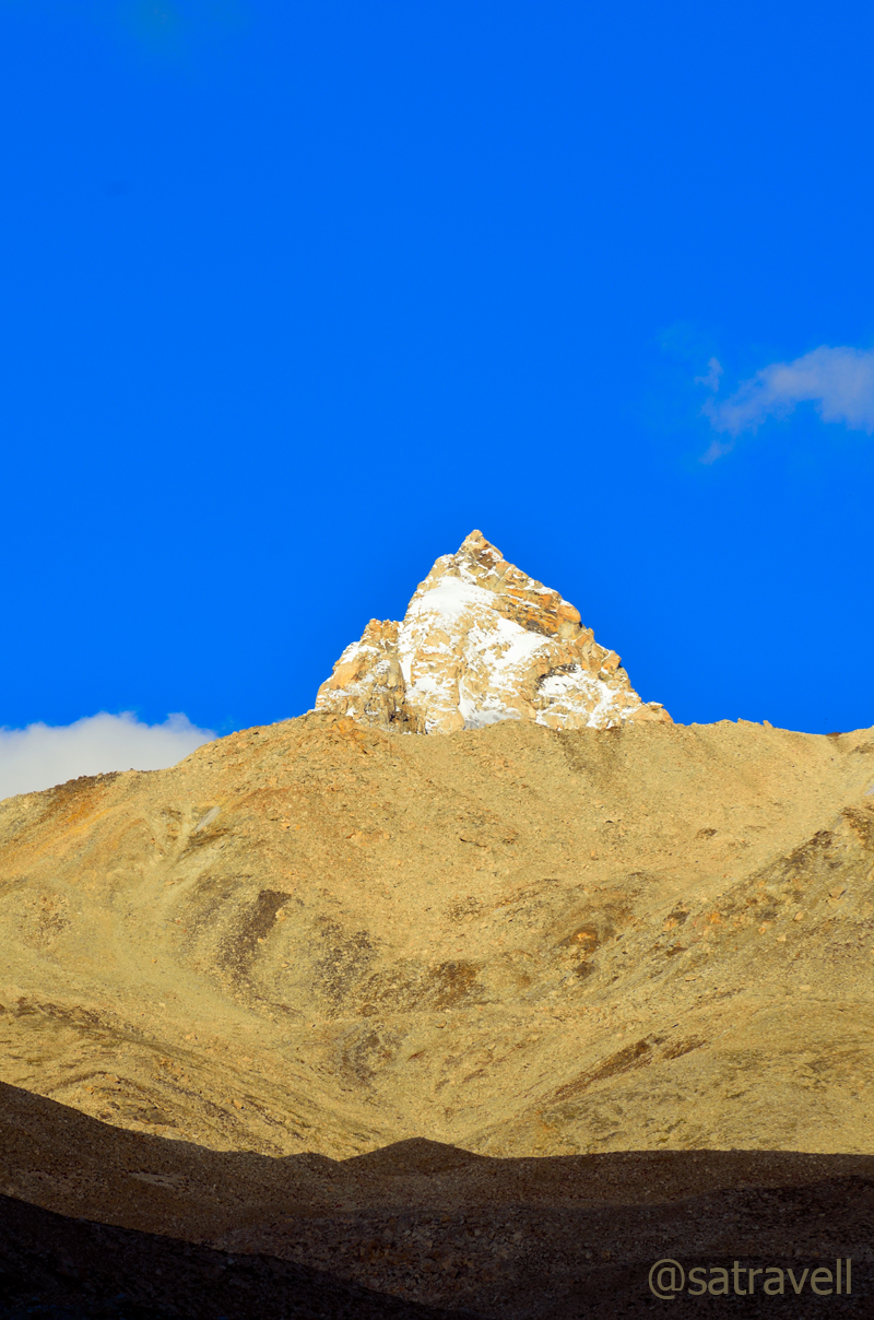
Early next morning, after the routine breathing-exercises, I paid my tribute to the Rock-shivling on the imposing Kinner Kailash range and took some customary photographs. The 17m rock pillar of Shivling reflects different hues with the movement of the sun. It was a perfect morning for photography. Situated 600m higher than Peo, Kalpa enjoys better views of the Kinner Kailash range including the shivling, Jorkanden, Sarong and Raldang peaks. I shall soon upload more details, including a bicycle ride, about this Sairag region of middle Kinnaur in a separate blog.

A closeup of the 17 m rock “Shivling” in the Kinner Kailash Range. Photo credit Sarabjit Lehal

The Kinner Kailash Range. For more detailed images of the region, please visit Flickr Photostream
After breakfast and checkout, we took walk on the road to Roghi, a small village on the original Hindustan Tibet Road. The yet to be harvested apple orchards as well as groves of Chulli trees marked the initial section of the narrow tarmac-path to the village. The old HT road here is etched on the infamous ‘suicidal’ Roghi cliffs falling sheer to the Satluj flowing 1000m vertically below.

The “Suicidal” Roghi Cliffs on the original Hindustan-Tibet Road
The ancient version of the HT road, reminisce of petty wool politics and Indo-Tibetan trade, was at best a broad and bridle trail. The olden route passed through the villages and revenue centres that included Narkanda, Kotgarh, Sarahan, Chaura, Tranda Solding, Sungra, Nichar, Tapri, Urni, Roghi, Kalpa, Pangi, Rarang, Jangi, Kanam, Shiaso, Pooh, Namgia and thereafter reached Shipki La. Today, the few stretches of the old HT route that overlap with the NH22 comprise Theog – Narkanda, Wangtu – Tapri and Shiaso – Pooh – Namgia. The excitement of retracing the olden route lies in the fact that it archives in its passage a noteworthy transition in climate, vegetation, terrain, people and culture.

Some apricots left out to dry on a rooftop
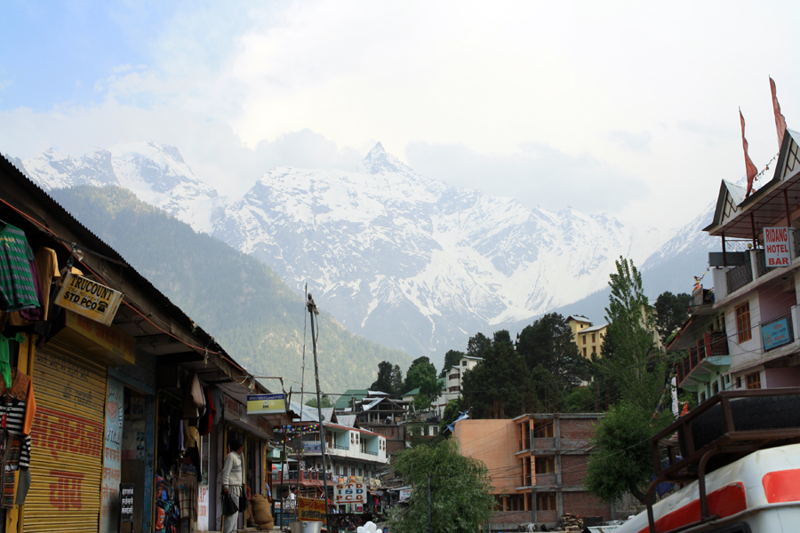
The market of Peo is nothing better than those of the towns we passed through after Shimla on the NH22. But then again, approaching from Spiti, one would definitely get the feel of a metropolis. The town is a sprawl of shops selling cheap garments, fake electronics, veggies fetched from plains, tea/ momo, fake Tibetan products as well as a few internet-cafés, a liquor shop, tin-roofed government, tourism offices and a Himalayan Handloom store, etc.

Early morning at Kalpa; the Jorkanden peak. More on the area Flickr Kinnaur
The Himalayan Handloom store located near the main-market chowk sells authentic stuff and is looked after by a lady from upper Kinnaur. It is from this region onwards, one starts to notice the gradual shift in culture and religion from Hinduism to Buddhism. Peo was also the venue for the Dalai Lama’s Kalchakra celebrations in 1992. Foreigners can obtain their Inner Line permit, to enter upper Kinnaur and Spiti, from Peo. More on this area, from my previous visits, on a separate blog soon!
The Raldang captured from the Main Market of Reckong Peo. Photo Credit Sarabjit Lehal
We were in no hurry to reach or plan our destination to spend the night. Nevertheless, having been to this area quite a few times, I did not want to dawdle in the town any longer. In a short span, the Faithful was on the NH22 again at Powari.

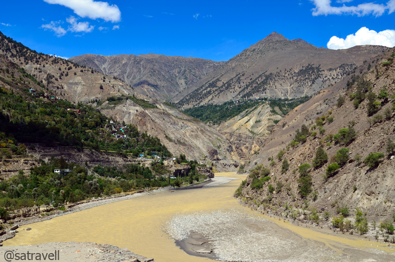
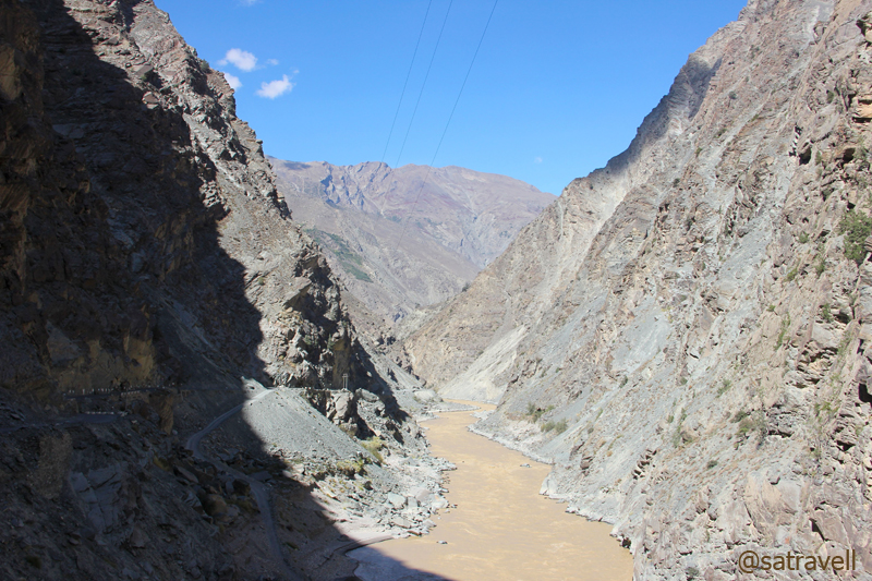
The section of NH 22 connecting the Sairag with Jangram region in the Sutlej Valley. For more detailed images, please visit bNomadic in Kinnaur
After the recent monsoon-rage that flooded parts of the Spiti as well as the Sutlej valley, the state of the highway ahead was a secret that was going to unfold now. On our way after Powari, we passed through pulleys transporting villagers and their cash-rich harvest of apple, right from the highway to the ridge-top across the mighty Sutlej, which was indeed a daunting task. Intermittent earlier, this is where Airtel connectivity totally gave up leaving us with my BSNL number. After this, Airtel showed up its presence at Leh and Srinagar only.
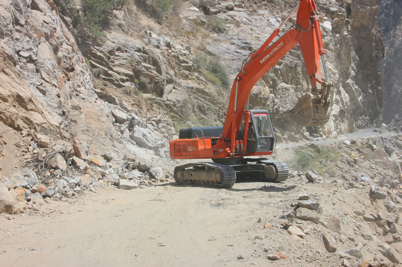
Clearing the highway for vehicles

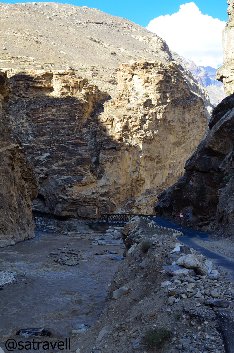
A live landslide and the road ahead
The highway crosses to the left bank of Sutlej at Kharo Bridge and again to the right side a little while later at Akpa (2231m). From the bumpy road itself, the site of 2005 flash floods was apparent that had washed away several bridges. A little before the bridge was the diversion for village Ribba, commanding the best views of the Sesarang group.

Welcome to the Sumcho region
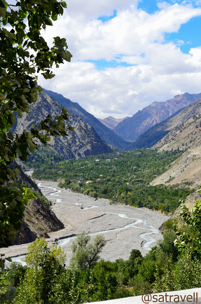
The neatly tarred levelled-road now snakes to reach the Police check post at Jangi (2294m) passing through a beautiful sight of the flat-floored valley at Thangi. Not only foreigners but domestic travellers are also required to submit their credentials at the check post. Of course the non-nationals need to show their Inner-line Permit too. Famous for its Ukiang festival and cumin seeds, the current Jangram region possesses the most extensive Chilgoza pines in Kinnaur making the villagers quite prosperous.
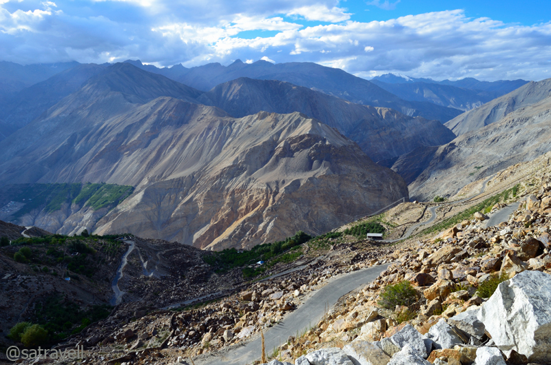
The Sumcho region. The green patches of village Spillo, Labrang and Kanam (on the original HT route) are also visible in the frame. This and more on the region at bNomadic’s Flickr Photostream
As we crossed the check post, vegetation started to fade and along with that the tar on the highway. Having savoured the view of Gymthing River as well as the natural rock shower, a little ahead of Spillow (2360m), we headed towards the Ropa valley, traditionally famous for shawl-weavers and producing finest metal artisans. The road to the scenic Ropa valley branches off the main highway right after the bridge on the Ropa River, a few kilometre before Pooh.
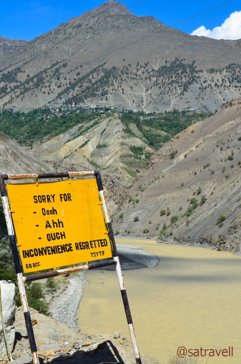
The amusing BRO signboards are actually meant to caution the drivers
The “Tea River” Gorge

Also known as Shiaso, Sangnam or Gangyul, the Ropa Valley. For more pics of the region, please visit Flickr Photostream of bNomadic
Initially barren and arid, the un-metalled jeep track crossed the ancient village Giabong to reach Ropa virtually positioned in the midst of Chilgoza pine-cover. Not that we bothered relishing the fruit of hard labour, Chilgoza, literally a hard nut to crack, is known to possess aphrodisiac quality. A couple of hours more and we were back on the NH22 through the same road.
The historical villages of Ropa and Giabong in the Ropa Valley

The Sunnam village in the Ropa Valley. More pics in the series bNomadic in Kinnaur
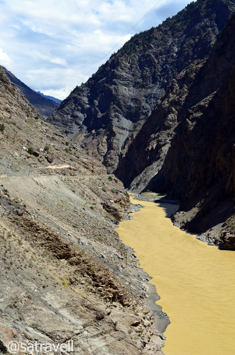
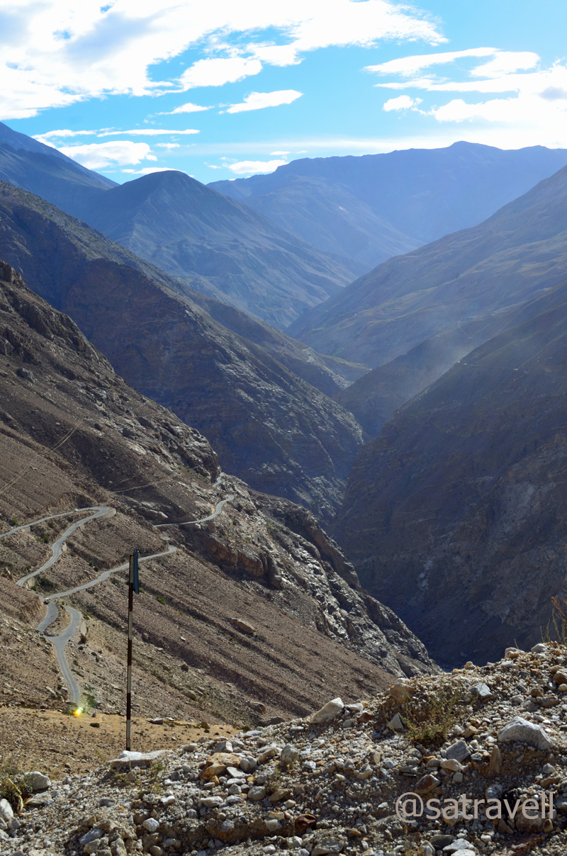
The road continued to gradually climb along the bare gorge with the muddy and tea-coloured Sutlej engaging the travellers to unending secrets waiting to unfold at every bend on the mountain slope. A little before Pooh (2820m), from the highway we captured the view of the Gangchua’s snow-capped pyramid in the beautiful Hojis valley towards the right side. Visible from the highway itself, Pooh, like most villages in Kinnaur, is not on the valley floor but a steep 200m above it on a 4km link road.
The bare gorge of muddy and tea-coloured Sutlej. The HT Route is etched on the left mountain-face in the frame. More pics of the region at bNomadic’s Flickr Photostream
The Pooh-Namgia region. For more pics on the region, please visit Flickr Photostream of bNomadic
The landscape after Pooh was now fast transforming itself into a land of dry and barren mountain ranges devoid of any noticeable vegetation though it lacked the enormity of the Spiti valley. The Dubling bridge, located a few kilometre ahead of Pooh took us to the other side of the river Sutlej after which we patiently descended and looked forward to the confluence of Sutlej and Spiti river at Khab (2620m) to make its appearance. Originating at Lake Mansarovar in Tibet, Sutlej travels a great distance before pouring itself into the Arabian Sea at Karachi just as the Indus River.

The Sutlej Gorge ahead
The confluence of Spiti and Sutlej at Khab
The Shipki La near Khab used to be a favoured trading route between Tibet and Hindustan since time immemorial and, although a trading post was opened here in 1995, the Pass sees very little trade-off these days. After crossing the recently-relocated bridge on the river Sutlej, the highway enters the narrow Spiti gorge on the river’s left bank. Before, near the Namgia turnoff the peaks you get to see to the southeast belong to the Himalayan range and to the northeast lies the gigantic Reo Purgyal (6816m), rising 3700m on the right bank, among the largest single rock-faces in the world. Although the road was neatly tarred, the confluence point of the two rivers is notorious for landslides or floods-related road-blockage. I got down and took a few photographs to capture the landscape as well as the majestic Reo Purgyal, the highest peak of Himachal Pradesh.

The majestic Reo Purgyal, the highest peak of Himachal Pradesh

The Spiti Gorge ahead
At Khab, across the bridge, we came across a Spitian family, comprising a mother and her young daughter, waiting to board the transport bus to Sumra. The mother asked for a lift and I promptly nodded in agreement. The next hour and a half was spent photographing the landscape, relishing the apples from Namgia offered to us by the young lady as well as chatting over the current state of affairs in Spiti.

The narrow Spiti Gorge in the Hangarang region

Prayer Flags, Wheels and a small shrine at Ka on the road to Nako
Lost in the conversation and soaking in the beauty of the barren land, we almost ignored the narrow bumpy road on the final stretches of upper Kinnaur. Passing through Ka (3000m) and climbing the Ka Loops, we reached Nako (3650m) and entered the trans-Himalayan region. It was still an early evening but we decided to call a halt at Nako and dropped the mother-daughter duo near the helipad where they expected to get a bus soon.
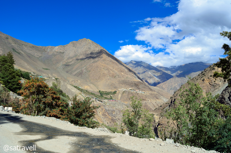
View towards Khab; and the start of Ka zigs
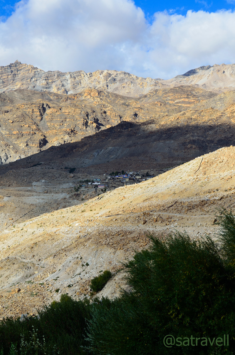
Located on the irrigated side of the valley, another village Leo, visible from the main highway lies in the lesser-visited area of the Hangarang.

The green Leo and the Lipuk stream ahead, tributary to the Spiti River. For more pics of Kinnaur, please visit bNomadic’s Flickr Photostream
The Malling Village near Nako
The Yangthang and the end of Ka Loops. For more pics on the area, please visit Flickr Photostream
The next in line was a search for room-with-a-view. The upside of accommodations in such a terrain meant that almost every guest-house had a fascinating view to offer. We refreshed ourselves with a tumbler full of ginger-tea and local cookies coupled with veg momos in a reasonably priced room-set managed by twin sisters from the village itself. The agreement was Rs 500 for a night exclusive of food and teas. The balcony offered an extraordinary view of the snow-capped peaks in the Srikhand range.
The edges of Reo Purgyal massif eloping with the pastures of Nako
Noticing the evening reach it’s crowning and hearing the increasing chitter-chatter of the birds, I headed up the pastures to take some shots. Placed just in the lap of a vast expanse of steadily sloping terrain, with snow-capped mountains all around, provides Nako with the feel of soaring high among the clouds. The edges of Reo Purgyal massif eloping with the irrigated fields of the village dominate the landscape. The village Nako is a random jumble of traditional stone-built houses with small wooden-doors and cowsheds located in earthen narrow-lanes. The village temple complex, credited to Rinchen Zangpo, is situated towards the west side.
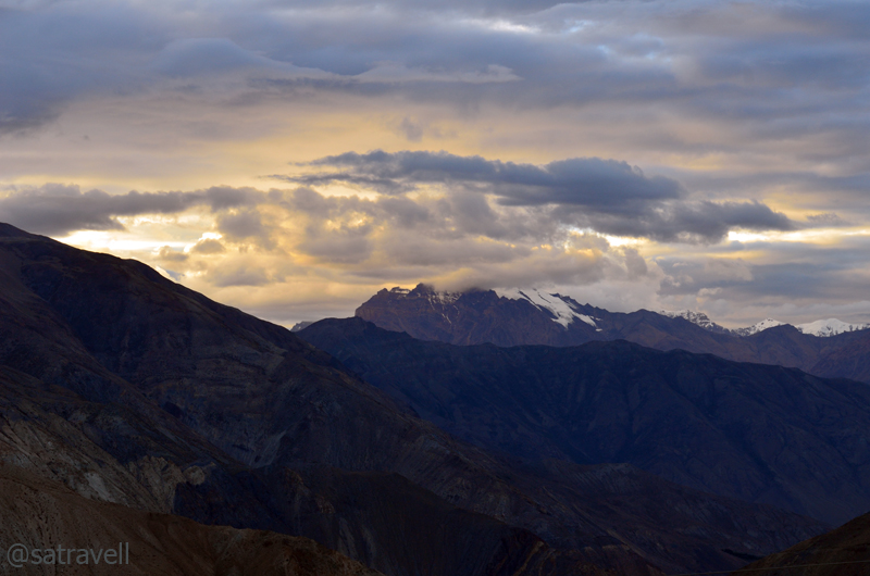
Unidentified peaks towards the Srikhand Range. For more detailed pics of the region: Flickr Photostream
Although I couldn’t get much from bird-photography perspective but I did manage some reasonable clicks of clouds hovering over the Srikhand range. While I was busy with my game I observed a sound of humming and drumming coming from the direction of the village which was getting louder as the daylight faded.

The ancient roofed chortens towards the pastureland from Nako
I headed towards the direction from which the sound was coming and on the way asked cousin to join. And there we were attending and witnessing a marriage ceremony!
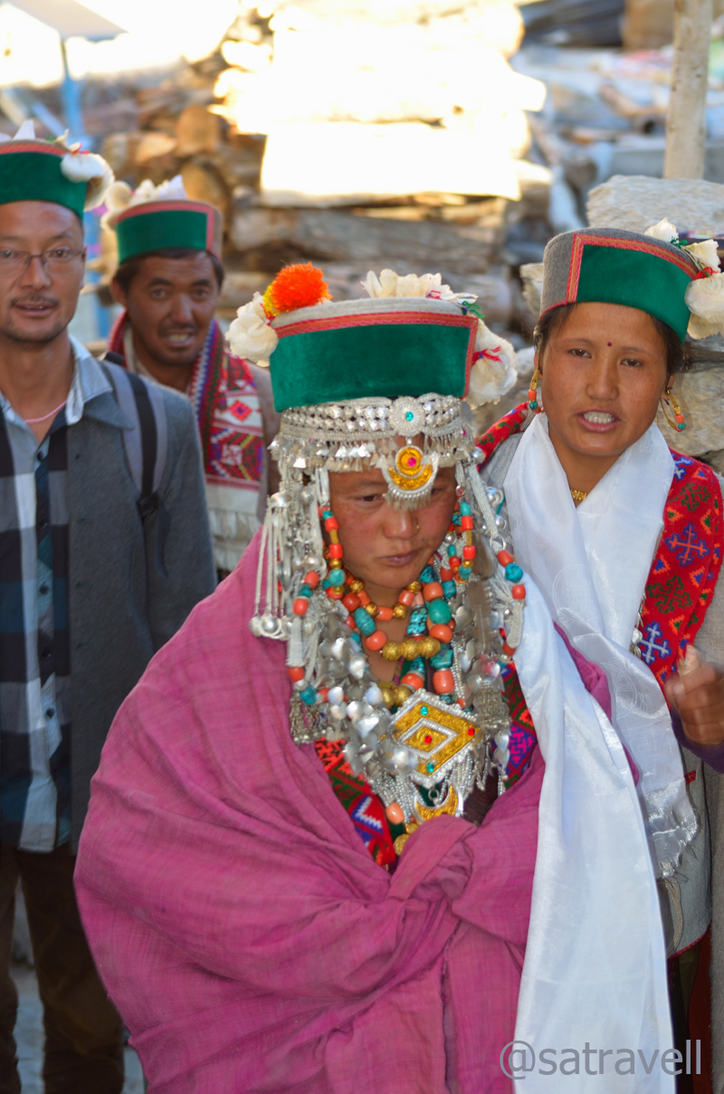
The bride
Women certainly enjoy a better social status in the trans-Himalayan areas than in most of rest of the India. Well, almost certainly the civility has been instilled by the prevalence of the Buddhism. It was the boy’s family that had made the initial offer through an intermediary. Surrounded by the villagers and onlookers like both us, the initial part of the wedding ceremony was held in the girl-family’s courtyard. Overseen by a head lama present to bless the couple and ward-off the evil spirits, only a select few had accompanied the groom to take home the bride. On the way back the marriage party took form of a procession, joined by almost the entire village, and headed towards the ancient tenth-century village Gompa (also known as the Sacred Compound).

Lamas rotating the ancient prayer-wheels to mark the beginning of marriage-functions

All set to participate in marriage functions, family members outfitted in traditional attire lined up on the ground of Sacred Compound
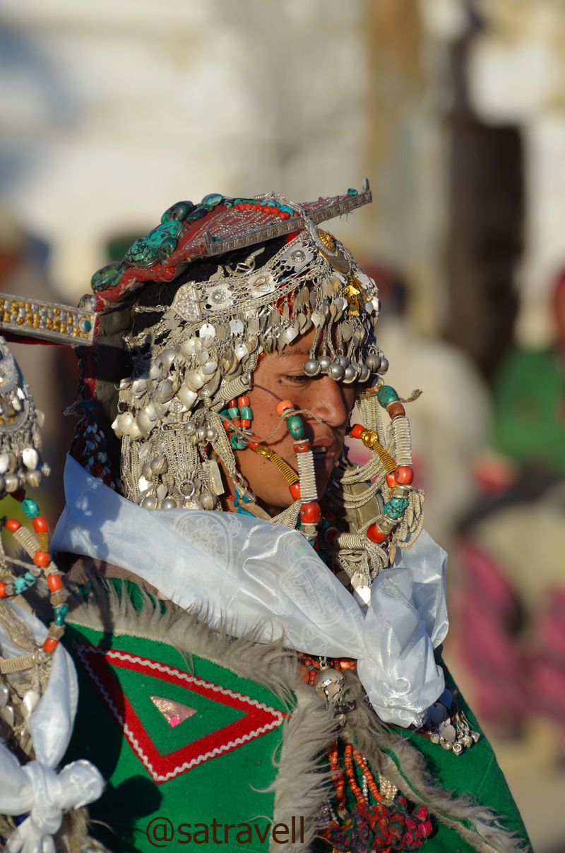
A Kinnauri Beauty. More on Flickr
Families of both the bride and the groom outfitted themselves in their traditional attire whose elements included a gachang, chuba, suthan, topru, white-feathered Kinnauri cap, round Tibetan hat, costumes/ head gear decorated with turquoise stones, silver jewellery, etc. Having consumed copious amount of Chaang, locally brewed barley beer, the family members danced and feasted the entire night in the courtyard of the monastery. The ceremonial activities of udanang and belding were attended by the residents of the entire village who sat cross-legged around the area kept for the purpose. Each gift exchanged was meticulously noted down.

In the courtyard of the ancient Sacred Compound
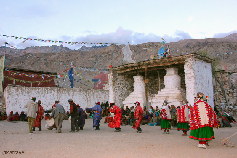
Family members taking part in marriage functions. Also visible in the frame are the tenth-century crumbling shrines credited to the Rinchen Zangpo. More on the region Flickr Photostream

Villagers assembled alongside ancient roofed-Chortens, part of the tenth-century Sacred Compound, to watch the proceedings. More pics of the region at bNomadic’s Flickr Photostream
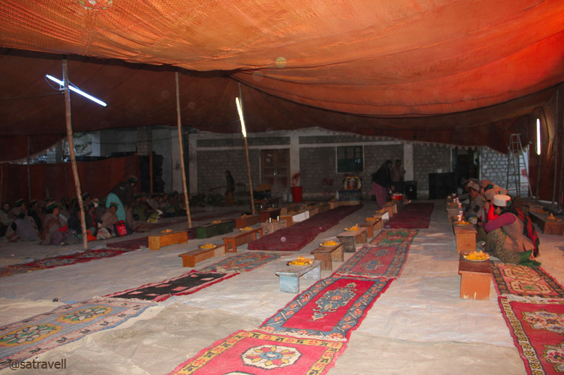
After-marriage community feasting. More on the region at bNomadic on Flickr
After the dance-related ceremonies got over, the proposers literally announced the onlookers and bystanders to go home. We left the scene and took a walk encircling the village including the lake and monastery. Bordered by willows and poplars, in the night, the lake seemed more of a village-pond rather than a natural water reservoir. The starlit night-landscape surpassed the beauty of the evening’s treasure. The next morning-view was indeed expected to be a secret. Aiming to capture birds in the morning, I retired to the bed soon after reaching the room and consuming a healthy meal of dal-rice.

A tiny chorten in the narrow dusty lanes of the village
Without taking into account the government-run rest-houses, the places in Kinnaur where a night halt could be easily negotiated included Jeori, Sarahan, Kalpa, Recong Peo, Pooh, Nako, Chango, etc.
View and read more on the region at the Flickr Photostream of bNomadic
You may also like to subscribe to the email updates, of the remaining chapters, by entering your email id in the sidebar.


Pingback: On Road through the trans-Himalayan Region | bNomadic
oh ! boy !! phew !! u had some fun…. amazing amazzing aaammazing clicks bro… I feel as if the place just rocks and the snaps are just teasing me while see them .. I am not a part of such beautiful landscape !!
Thanks for the encouragement and visiting my page. The region is truly splendid both from cultural and landscape aspect. Hope you’d visit the forthcoming chapters of the current description.
without a doubt bro….i will !
Beautiful beautiful photographs and a detailed account!
Thanks for stopping by my blog bNomadic! Do visit often! 🙂
Thanks for visiting my blog and encouraging me.
wow, lovely captures….
Thanks for visiting my blog and the encouragement. Hope you’d keep visiting.
beautiful pictures! Loved them. And really nice post.
Thanks for visiting my blog and for the encouragement. Hope you’d visit again.
Just one word, Wowwwwwww!
Thanks for visiting my blog and appreciation. Hope you’d visit again.
For sure. I jus loved it….You have a knack of photography and I must say it is very impressive
Thanks for the encouragement.
Hi Satyendra
I have nominated you for the contest that Arti is running.
It is about a non-digital post from your travels and why it is a precious memory. Contest closes on May 5th.
Thanks.
Thanks Madhu ji for the encouragement. Although I am slightly unconnected with the contest, I look forward to remain in touch with you. Hope I am able to create enough reasons for you to visit my blog again. Thanks
whats the procedure to book an appointment to listen to your travel stories? this blog is like a treasure of beautiful pics & amazing stories!
Thanks for the encouragement brother. I hope to improve in writing as well as photography part. Just keep visiting the blog and you’d notice newer memoirs.
but you need to split it more, too heavy for the page tgo load fast…tested my patience yesterday & i won of course 😀
Point taken Sir.
*salutes* 😉
Absolutely loved reading this post, and got my first feel of Kalpa through your photographs and write-up! So look forward to being there someday!
Thanks for showering with appreciation Ragini. Kalpa offers one of the finest snow-capped panorama in the region. You must plan a visit sometime.
Grand scenic sights! I like those costumes.
Thanks for the lovely feedback Indrani.
Genius photography and really, post show a glimpse of Incredible India.
Thanks for visiting my blog and for the feedback. Do visit often.
Pingback: Mooning with the Highway to Tibet | bNomadic
Pingback: Brush with The Malling | bNomadic
That is a lovely tale and beautiful photos too.
Thanks admin for stopping by my blog and showering it with appreciation too. Hope you’d want to visit again.