 bNomadic
The following is a page entry from On Road through the trans-Himalayas. To read complete travel memoirs and trip report, please visit here.
Chapter 3 of 22

The excitement of retracing an olden route lies in the fact that it archives in its passage a noteworthy transition in climate, vegetation, terrain, people and culture
Having polished off a king’s breakfast, we checked out early to continue with the initial climb on the NH 22. A favourable outcome of the previous night’s downpour was an open weather that perfectly suited the needs of a photographer. Still in order to cover as much distance as possible, I deliberately avoided taking my camera out.
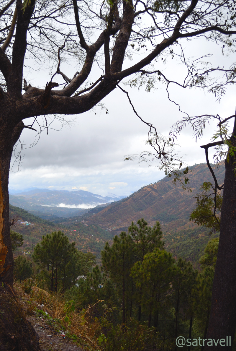
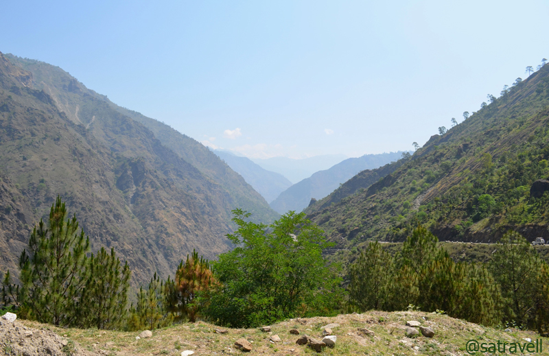
Valley view from Kandaghat on the NH22
The 460 km-long NH22-highway starts from Ambala and goes up to village Khab, located on the slopes of Shipki La just before the Indo-Tibetan border, passing through important towns like Kalka, Solan, Shimla, Theog, Narkanda and Rampur. Till Shimla, the highway is full of resorts, hotels, guest houses, dhabas, restaurants and picnic-spots of all sorts. The initial 70 km section of the NH22 runs through both Punjab and Haryana to enter Himachal Pradesh after Kalka. The four-lane expressway now bypasses the industrial towns and earlier traffic-bottlenecks Pinjore, Kalka as well as Parwanoo and, as the terrain changes, turns into a mountain-road at Timber Trail, an old resort located 18 km short of Dharampur.
The highway continues to steadily climb till Dharampur and subsequently dropping by about 200 m over the next 17 km towards north-east to reach Solan. The next 50 km drive to the hill-station and state capital Shimla is initially a gradual climb and becomes steep towards the end to overall gain approximately 800 m. In-between quite a few sections of the highway run alongside the Kalka-Shimla heritage rail-track. From Shimla, the road heads nearly north-east to reach the Tibetan border. We bypassed the queen of hills to avoid facing any traffic jam. At times, the bypass itself gets very chaotic due to heavy traffic. So if you have a prior knowledge about the same better avoid it and reach Kufri via Chail from Kandaghat ahead of Solan.
After bypassing the state capital, the road steeply climbs to reach Kufri at 2500m crossing Dhalli. The highway then widens and abruptly loses height; passing Fagu (2470m) and till Theog (2300m) comes into view after about 15 km. Although wide enough for two heavy vehicles to cross simultaneously, the potholed road indicated the enormity of previous winter’s snowfall.
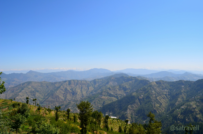
Dhauladhars captured en-route to Theog; with snow-capped Himalayas located further afield
An ancient trade-town, Theog appears to be spread on a ridge that drops down to the Sutlej River to the north and Giri River, Yamuna’s tributary, to the South. Since time immemorial, its market has more hustle than Narkanda’s due to its positioning at the junction of busy fruit-farming Giri valleys. Theog onwards, the road to the border was earlier known as Hindustan-Tibet Road popularised mostly by Britishers and traders.
Offering beautiful views of the Dhauladars and Satluj valley, the Himachal Pradesh Tourism Corporation’s (HPTDC) property at Fagu made for an inviting tea-break but we preferred to continue driving through heavily wooded ridge tops bestowing fewer views due to the wilderness around. With decreased traffic and better road-condition, the NH22 gradually climbed to reach another popular tourist destination, Narkanda (2625m). We passed quite a few road-side eateries as well as the Cherry gardens owned by Capt Amarinder Singh, ex-Chief Minister Punjab, on the way.
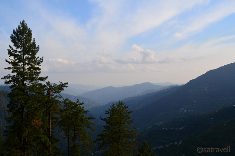
Apple and Cherry orchards sloping down to Giri Valley from Narkanda
The hill station of Narkanda is set among pine-covered slopes with views of snow-capped peaks towards northeast as well as Garhwal visible from either the Hatu peak or near the old rest house managed by the state government. It’s a popular skiing destination in winters so the accommodation would be expensive than elsewhere. There isn’t much to shop in Narkanda except seasonal farm produce comprising famous golden apples of Thanadhar and cherries. As both of us had been to this destination quite a few times earlier so we carried on with our march to Kinnaur. I shall post the outcomes of previous visits to Narkanda and around in an unconnected weblog later.

The narrow straight road at Narkanda trifurcates to climb Hatu Peak while the left one slopes to reach Kotgarh, Thanadhar and the jeepable one on the right goes up to Rohru via village Khadrala.
To avoid the narrow stretch immediately after crossing the bus stand at Narkanda, we took the left switchback and descended abruptly over the next 37 km to reach Sainj at 835m. Although the weather had become slightly overcast at Narkanda, very usual for this hill-station, the downhill drive was very smooth and scenic. Lush green pine-cover rich with wildlife, mostly birds and monkeys, dotted almost both sides of the road. I remembered the spot where I saw a Yellow-throated Martin crossing the road during my previous visit to the area. On the way, we came across many road-side eateries, dhabas at Kumarsain and captured the first view, for the current trip, of the mighty Sutlej River at Kinghal and the flat-looking terrain we were about to enter. Sainj, the lowest point for the next three weeks is also the place where a road after crossing the Sutlej and Jalori Pass loops to meet the Bilaspur – Manali highway just before the tunnel. Weblog on Jalori shall be published later.

Locally known as Khopadi Mandir, the Hanuman Mandir by the Sutlej River near Rampur
Sainj onwards, the NH22 gradually ascends all the way up to Kunzum La with a few insignificant sections offering a decline as well. The NH22 now runs alongside the Sutlej on its left bank till Panvi, a little ahead of Wangtu in lower Kinnaur. Being on the road for almost five hours now, we took a tea-cum-leak break at a roadside café managed by HPTDC a little before Rampur. The tea was nothing special but for the loo break and information needs related to the road conditions of Spiti we halted briefly. A majority of seemingly right persons, proved to be duff, for the information we sought. Such persons included receptionists at the HPTDC properties, traffic police staff posted on the road, roadside shop owners and even taxi-drivers at Rampur.
In order to be very sure about the road conditions, as I had promised my parents the previous night, I established contacts with the ADC office at Kaza and a few trekking guides. The plan B was to take a U-turn and cross Jalori Jot to reach Manali and continue with the journey. My enquiries revealed that the road to Jalori had been closed due to landslides last week. The late arrival of monsoons had wrecked some real havoc in certain parts of the state. Anyhow the road to Spiti appeared passable as I also noticed the typical Spiti dirt on some of the vehicles coming in from the opposite direction. Still we needed clarity on Kunzum as well. Recong Peo, the district headquarters of Kinnaur was the right source. And a go-ahead was obtained over the phone within no time.
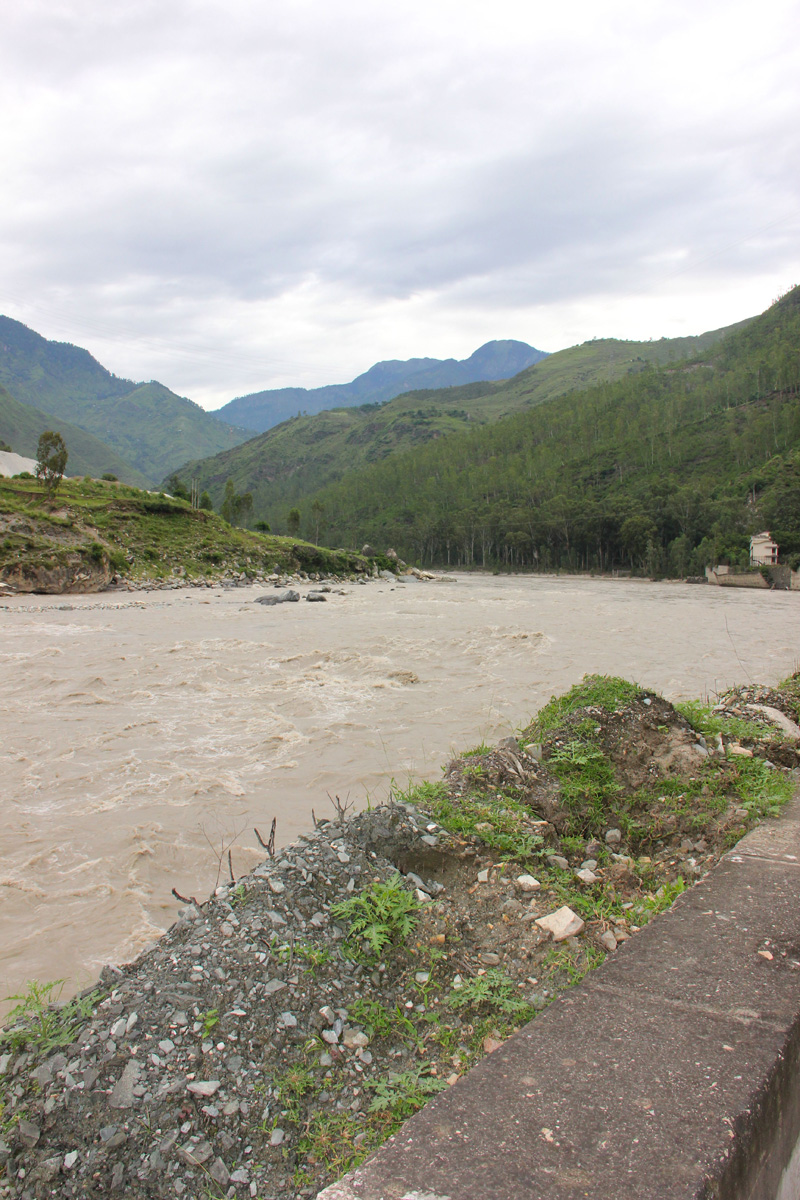
The mighty Sutlej just before Rampur
What is now a commercial and transport hub for the region especially Kinnaur, Rampur (1020m) was the capital of the erstwhile Rampur-Bushahr kingdom. The state had acknowledged suzerainty of the British in the pre-independence period and post-independence the territory was made part of a larger administrative unit called Mahasu district. Kinnaur was later separated and conferred the status of a district. Squeezed between the river and valley walls, the town appears to be blessing you for the climb ahead. From the main highway, the settlement escapes down towards the river across narrow lanes crammed with shops and offices of all kind.
Kaneri onwards, the highway starts narrowing and gaining height over the Sutlej valley walls to cross Jhakri
Tourism to the region was declared open for domestic as well as foreign travellers in the early 1990s. Before that, since independence, entry into the area required a special permit granted by the state administration. Until recently, the restrictions included carrying a camera! Hinduism continues to dominate till lower Kinnaur after which Buddhism takes over together with the areas of Spiti, Lahaul and Ladakh. Although Buddhism started perforating the arid land of Tibet and surroundings in the fifth century but it was actually in the latter half of the eight century when the religion acquired the status of the state religion. The renowned Indian teacher, Padma Sambhva is credited with being instrumental in the spread of Buddhism in the area around that time as well as for the setting up the first Buddhist monastery in Tibet. Owing mostly due to the erstwhile Shamnistic traditions as well as the various tribal cults present with the area, many areas have developed and follow their own distinct sect within Buddhism.
Just as we crossed Rampur, I insisted that we get the fuel tank of Innova, the Faithful, topped up. I knew from my previous experiences that Kaneri, 5 km ahead of Rampur is practically the last place with a fuel pump before we reached Kaza. In between a few pump stations operate either for government/ army vehicles or for the Jaypee Group, responsible for operating the hydropower projects ahead.

Built at Jeori to commemorate the death of workers and officials who died while constructing the Hindustan-Tibet road. Photo credit: Sarabjit Lehal
Kaneri onwards, the highway starts narrowing and gaining height over the Sutlej valley walls to cross Jhakri, factually a power village that also houses the staff of Nathpa Jhakri hydropower station, and Jeori, gateway to Bhimakali Temple situated at Sarahan. Just as we enter the Jeori chowk, there a pink-coloured imposing monument, towards our left, built to commemorate the death of workers and officials who died while constructing the Hindustan Tibet road. The low-altitude pine, chir pine, gives way to chilgoza/ neoza pines and blue pines dominate above 3000m altitude.
The Kinnaur Gate welcomes your arrival
Near the villages, poplar, willow, wild apricot, peach and well laid apple orchards dominate in vegetation. The chief cash crop comprises apple and almonds considerably reducing the dependence on apricot and grapes.
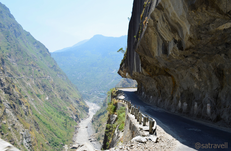
From a distance, the C-shaped cuts appeared to be a sheer incision in the overhanging rock high above the river
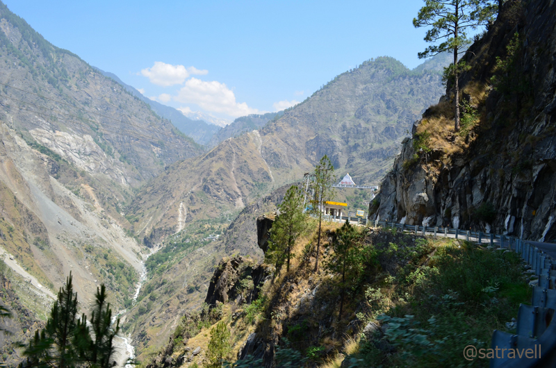
The road starts getting narrower further and the valley transforms itself into a deep gorge. From a distance, the C-shaped cuts appeared to be a sheer incision in the overhanging rock high above the river. No wonder there are several shrines on the way. Interestingly, it was from here the stretch of the NH22 that was featured in the History Channel’s Deadliest Roads series for the perfidious and risky driving conditions it offers. This continues up to Bhabanagar after which the road broadens and crosses the Sutlej towards its right bank at Sholtu. This section of the road has also acquired considerable notoriety in the recent years due to frequently occurring flash floods as well as vehicle accidents.

The road broadens after Bhabanagar

Hydropower station at Wangtu
From Wangtu there is a diversion towards the left and the jeepable path goes up to village Kafnu presenting a picturesque landscape. The concerned authorities are currently in the process of connecting Kafnu with village Mudh in the Pin valley through a road over the Bhabha Pass. In its present form, Kafnu to Mudh is a popular three-day trek.

Crossing over to the right bank
Having crossed Tapri after Wangtu, we were at an elevation of 2000 m, minimum for the rest of the trip until Srinagar. I knew that we had left the hot, humid climate behind and along with that the greenery. The river was also acting accordingly. As we neared Karcham, gateway to Baspa Valley, the river mellowed down from its monstrous best.

The narrow bumpy motorway appears to be touching the river level
Entering the middle Kinnaur, the road again crossed over to the opposite left bank and appeared to be touching the river level. Some bad patches due to the on-going blasting work to broaden the road and after crossing the recently-constructed Shongtong bridge, we were again on the Sutlej’s right bank. All through the way from Sainj, the potency of the river was milked thoroughly to generate massive power output making this hydropower project to be the largest in India.

Shongtong Bridge over Sutlej
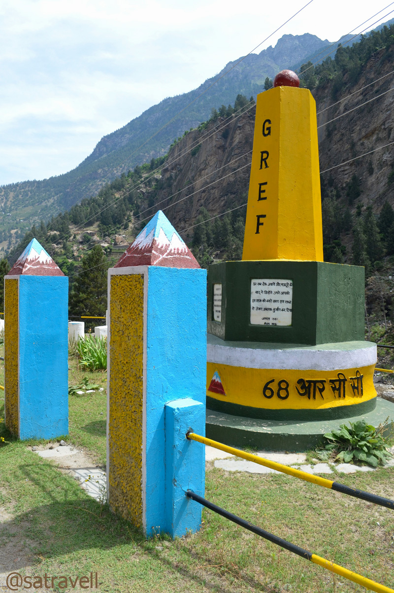
Shongtong Memorial
After paying our homage at the Shongtong memorial, a tribute to those who died while constructing the highway, we left for Kalpa which was still at an hour’s distance. Ahead of the GREF camp at the next settlement, Powari, we took the diversion to climb up to Reckong Peo or just Peo.

Nearing Peo, the Sutlej mellows down from its monstrous best
From my previous experiences, I knew the area where to look for the night’s stay. Before it got dark, we headed to rest house road at Kalpa, now just 11 km from us of which first 6 were very steep. Without much bargaining we settled for an accommodation for Rs 900 which included dinner and breakfast, the next morning. I particularly demanded freshly-cooked boiled-rice and rajma for the dinner and my request was adhered to. Rajma and boiled-rice makes for a perfect, hygienic and energetic meal in this part of the Himalayas. After a quick hot shower that got us cleared of the day’s dirt, I sat to plan the next day’s advance. Having informed parents about the activities of the day, I made some calculations from the map and my travel diary to decide the must-visits for the next day. At 2850m, with outside temperature hovering around 8 degree, a good sleep awaited us after the superb meal.

The Kinner Kailash Range captured (in the evening) from Peo
You may also like to subscribe to the email updates, of the remaining chapters, by entering your email id in the sidebar.


Pingback: On Road through the trans-Himalayan Region | bNomadic
go ahead..i am waiting..has subscribed
Thanks for visiting this post. Your suggestions and feedback are always welcome.
Awesome and deadly too 🙂 I did saw this road on History Channel’s World’s Most Deadliest Road…I have a dream to ride my bike to Chandratal and beyond…let’s see when 🙂 And I am going to Dharamsal next week of course on by Royal Enfield and later a trek to Kareri Dal Lake in Dauladhar is on the cards. This is a beautiful post. Thanks for sharing!
Bike ride would be an awesome plan. Wish you all the success in your proposed ride to Dharamsala. I look forward to reading your blog updates from the little Tibet. Thanks for revisiting the page.
Just want to say awesome and hats off for showing this beautifiul place .Lovely pictures and good description.
Travel India
Thanks for revisiting my page and for the feedback. Thanks for being a constant source of encouragement for me. Hope you’d visit again.
Lovely blog description and images.
Sangla valley is among the most beautiful in Himalayas. I also had chance of visiting this place. Hope you enjoy my blog http://www.inkmytravel.com/blog/Chitkul_Bike_trip/120
Thanks for visiting my blog. Thanks for the feedback and encouragement. Sangla Valley is indeed a beautiful region. Interesting blog on inkmytravel.
amazing pics bro !!
Thanks for the feedback and visiting the blog. Thanks for the encouragement.
expect me peeping in at frequent intervals bro!! 🙂
Thanks.
Its a beautiful place 🙂
Thanks for appreciation and visiting my blog. Hope you’d visit again.
May be some day…
till then I will be satisfied with your pics.
Thanks for visiting my blog and for the feedback. Thanks for encouragement.
Exceptional work man ! beautiful clicks !
Thanks for visiting my blog and for the feedback. Thanks for the encouragement.
Tibet divine and you convey the enchantment through your photography.
Thanks for visiting bNomadic and for the feedback. Thanks for the encouragement.
Nice job, it�s a great post. The info is good to know!
Thanks for visiting my blog and appreciation. Do visit often.
Pingback: Leaving Home to reach the Roof of the World | bNomadic
Pingback: Up-close with the Tea river | bNomadic
Hi
Came to your blog while doing some research for my own post about Kinnaur. Now I am wondering if it is worth the effort 🙂 , Your travelouges are brilliantly written and the photographs are to die for. Kudos to you from someone who loves to travel but doesn’t have much resources. I wish to link your post to mine with due credits.
Hope you don’t mind.
Do visit my blog sometime though it isn’t a travel blog. Good luck for your future travels.
Tikuli
Thanks Tikuli for dropping by my blog. Also for showering it with appreciation. I appreciate your writing to me.
You may please feel free to link any of my posts on your blog with suitable credits. Hope I’d get to know whenever a link is up and alive 😉
You dont have to be resourceful to travel. For tourist-ing you need to be. Believe me.
ps: You maintain a beautiful weblog. Keep blogging. Now following you.
Hello bNomadic 🙂 The kinnaur posts are up and I have linked your blog to both of them. Hope you like them. There are just words to decribe the breathtaking experience we had. Do leave a comment to let me know your views.
Pingback: Kinnaur Diary; The unceasing charm of Baspa Valley | bNomadic