 bNomadic
Book Talk: The Epic of Mount Everest

The series of expeditions undertaken by the British in the early 1920s to stand atop the Mount Everest had globally spawned interest towards the mountain. Even as the expeditions resulted in thirteen deaths including those of the then celebrity mountaineers George Mallory and Andrew Irvine, the question whether the summit was reached in 1924 remained a mystery.
A legend himself, Francis Younghusband, the author of The Epic of Mount Everest, was the promoter and instigator of the first four sustained assaults on the mountain. He was also, according to a frequently repeated story, the inventor of the very idea of trying to stand on the top of the Everest. Francis wrote this book, the definitive account of the 1921, 1922 and 1924 expeditions – in the aftermath of Mallory and Irvine’s death, when it was not clear whether a further attempt on the mountain would ever be permitted.
Subsequently, numerous claims were made, several stories and accounts published and several generalities followed, but the tantalising mystery became even deeper. The heightened interest gave way to several such expeditions which were organised just to trace the remains of Mallory and Irvine so as to ascertain the claims of a successful summit attempt. It was more than seven decades later when by a mix of adventure and luck, the alabaster corpse of Mallory was discovered high on the slopes of Everest during the summer of 1999. The discovery had a spectacular universal impact. By now, Mallory was widely recognised as the emblem of the early Everest expeditions.

The book is currently available at Amazon at an average price of Rs 150.
Mallory’s body was found to be lying face down at full stretch, with his right leg broken and fingers gripping the frozen gravel in a desperate attempt to slide no further. There was no camera, but by analysing notes in his pockets and other fresh data, his discoverers concluded that the probability of a successful summit was greater than previously thought. The mystery remains with the elusive camera and its cold, undeveloped film; the only way a definitive answer might ever be found.
The discovery of Mallory’s preserved body and some of his other belongings in the snow at 27,000 ft had renewed the interest in those early Everest expeditions. The book The Epic of Mount Everest, originally published in 1926 was republished in 2000 with some more photographs from the earlier expeditions. The Indian born Francis Younghusband, who made his reputation as a spy and explorer in China and Central Asia as well as led the 1903 British invasion of Tibet, condensed the descriptions of the three expeditions into one book.
Separate chronicles of the three Mount Everest expeditions had already been written by those who took part in them, and have been published in the three books, Mount Everest: The Reconnaissance, 1921; The Assault on Mount Everest, 1922; and The Fight for Everest, 1924. The book by Francis tastefully brings out the crux of all the expeditions in just about 250 pages. The current edition of the book has its introduction penned by the celebrity author Patrick French. It becomes even more interesting to read what one legend writes about the other.
Through this book, Francis not only captures the essence of the three British expeditions but has added his own analysis and explanations gathered from his mammoth experience of explorations, mountains and the Himalayas. “Everest indeed conquered their bodies. But their spirit is undying. No man onward from now will ever climb a Himalayan peak and not think of Mallory and Irvine,” he concludes.
Apart from mountaineering, the book contains a great deal of knowledge for a naturalist, historian, Himalayan lover and anyone who loves to travel. I’d recommend this book to every mountaineering, exploration and Himalayan enthusiast. The book is currently available at Amazon and other online resellers at an average price of Rs 150.
Jubbal Diary: The Hateshwari Temple of Hatkoti

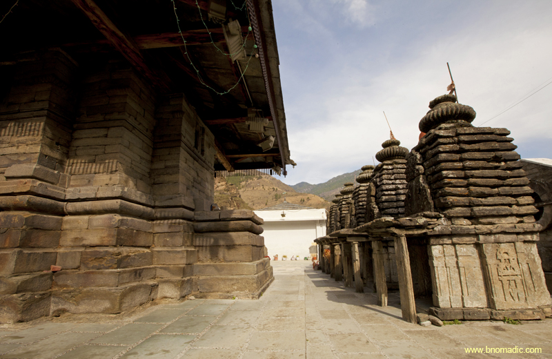
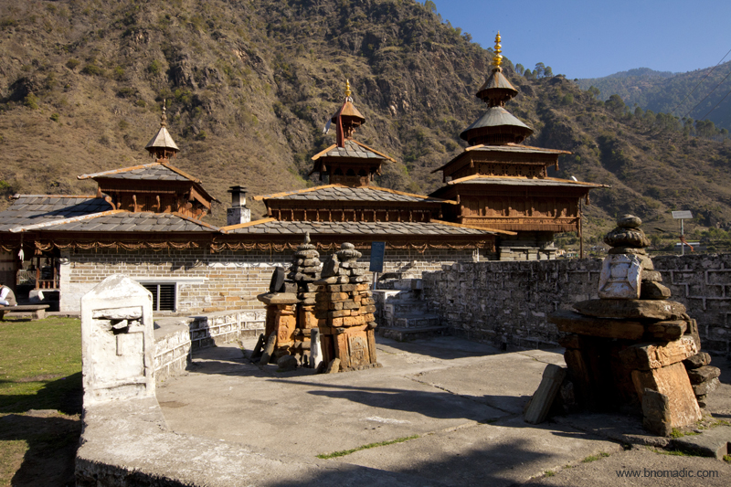
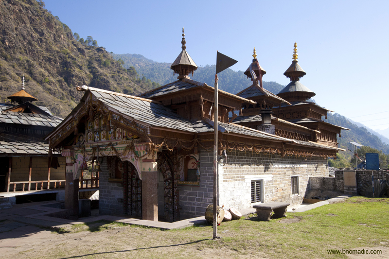
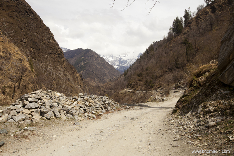
Continuing our run through some of the lesser visited parts of the inhabited Himalayas, we next stopped at the ancient Hateshwari temple at Hatkoti. The ancient village of Hatkoti, located on the right bank of the River Pabbar in Himachal Pradesh, has a number of stone shikhara temples unpredictably scattered over an area of five square km. Based on the architecture and carvings, archaeologically the temples are placed between the sixth and ninth centuries and many still relate their construction to the revival of Hinduism by Shankaracharya during the same period. Many locals claim that it was constructed by the Pandavas who spent a considerable time at Hatkoti during their exile.

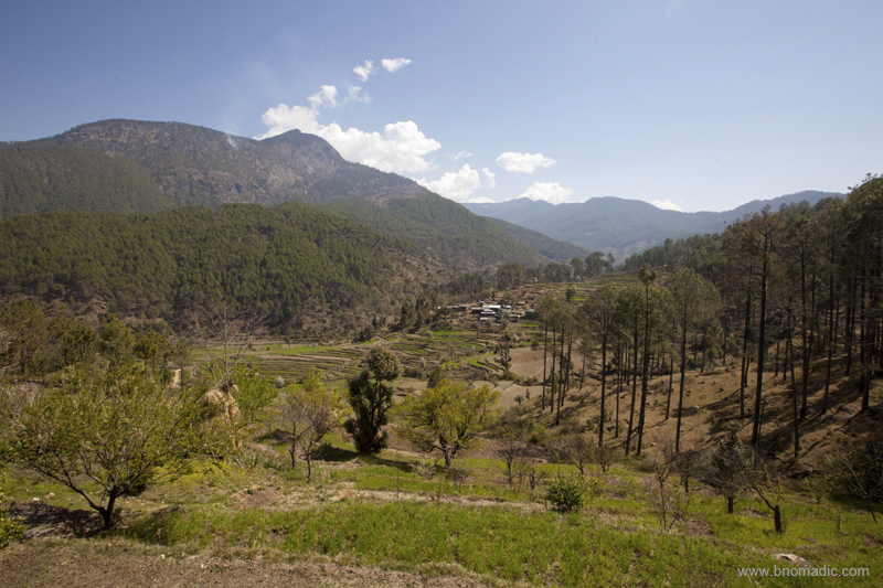
The green Pabbar Valley. Photo by Sarabjit Lehal. Please visit Flickr for more images from the region.
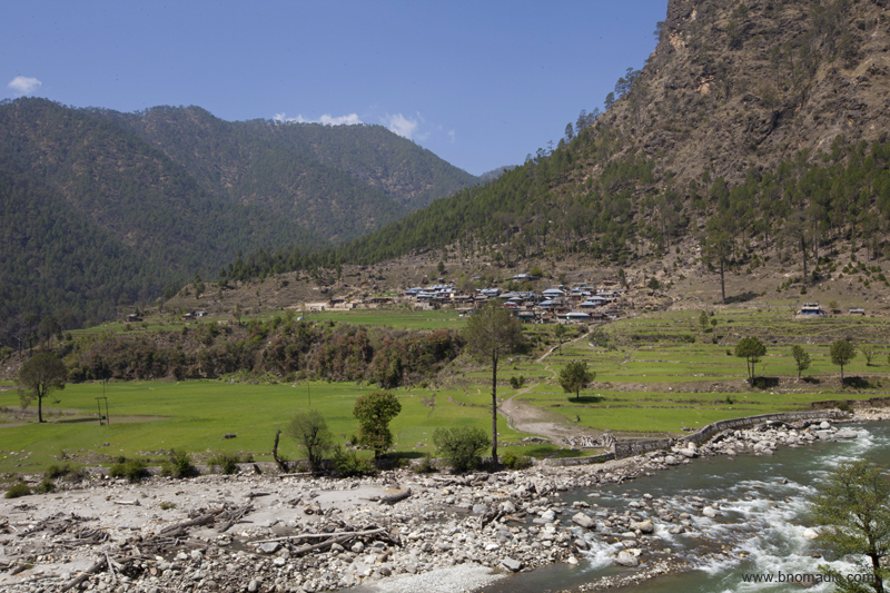
The village of Hatkoti by the Pabbar River. More images from the region at Flickr
Built in the nagara style, the classical temples of Hatkoti have always been a major attraction for both pilgrims and travellers. Centring on the Mata Hateshwari and Shiva temples, the temple complex is surrounded by lush paddy fields interspersed with a few dharamshalas and official buildings. Of the two, the main temple is that of Durga Devi, the mahishasuramardini – the slayer of the demon Mahishasura. In the local parlance, the Devi is known as Hateshwari. Legend has it that two sisters of Jubbal Valley together renounced the world and devoted themselves to the service of mankind. The elder sister was accepted as a manifestation of the Goddess Hateshwari Devi and a temple built in her honour.
Thar at the gate; I must say, the vehicle did quite a descent job up in the mountains. More at Flickr
Yours truly lined up at the prasad shop outside the temple complex. More images at Flickr
The Hatkoti complex was being observed with wonderment from as early as early nineteenth century, when a British traveller, JB Fraser noted the temples with Chinese type large overhanging roof with ornamented cornices and carvings. We parked our vehicle in the parking area maintained just before the entrance gate. The PWD guest house complex is situated just at the entrance. The prasad shops and a couple of dhabas are also located near the entrance gate itself. Photography inside the premises of the complex was restricted but not prohibited completely.
Both the main shrines, that face east, were repaired and given new roofs by Maharana Padam Chandra of Jubbal in 1885. The slate tiled pyramidal roof of the main temple was adorned with a marble amalaka and a golden kalasha. The original stone shikhara of the temple is now kept at the entrance to the premises. The Jubbal Chief enclosed the original structure of the temple with wood and stone walls to protect it from the damages of the harsh climate. This has led many experts to claim that even the Hateshwari temple could have been built on the remains of an earlier temple in the ninth to tenth centuries.

Legend has it that two sisters of Jubbal Valley together renounced the world and devoted themselves to the service of mankind. The elder sister was accepted as a manifestation of the Goddess Hateshwari Devi and a temple built in her honour. Photo by Sarabjit Lehal. More at Flickr

The adjacent Shiva temple was built around a large lingam enshrined in it. Its ceiling is exquisitely carved with figures of various Gods and Goddesses. Photo by Sarabjit Lehal. More images from the region at Flickr
The cold floor of the complex was carpeted with green coloured fabric to create comfortable walkways. We headed straight to the main temple. Said to be dated the seventh century, the 1.22 m tall idol, made of ashtadhatu, of the Goddess is placed inside the dark sanctum; typical of most ancient temples of Himachal Pradesh. The deity is depicted as Goddess Mahishasurmardini with eight arms, riding a lion and slaying the demon Mahishasur. She is illustrated with all her attributes, most notably her chakra, which she holds in the rarely seen prayogamudra. One of her left hands holds another demon, Raktabija by a lock of his hair.

Goddess Mahishasurmardini. Source: Temple’s Facebook Page (Photography is restricted inside the complex)
The smaller shrines have dvaramandapas supported by stone pillars with big sculptures of Shiva carved on them. Locals believe them to have been built by Pandavas and often call them Pandavo Ka Khilona or toy houses of the five Pandavas. More images from the region at Flickr
Inside the sanctum on either side of the idol, the inscriptions, most of which are yet to be deciphered, are also said to be dated seventh or eighth centuries. On the arch of the torana are the navdurga, veenadhara Shiva and other Gods led by Indra. On the two sides are the celestial horse, Hayagriva and the elephant, Airayata. Curiously a copper pitcher emblematic of Parshurama is also kept there and is taken out in a procession during fairs as a representation from the temple.
Evening landscape from a point below Kharapathar. Photo by Sarabjit Lehal. More images at Flickr
Within the shrine, a stone sculpture of the Goddess is shown carrying a thunderbolt in one hand; an act that point towards the Goddess of Vajrayana Buddhism. The lips of the sculpture are inlaid with copper and the eyes with silver. The adjacent Shiva temple was built around a large lingam enshrined in it. Its ceiling is exquisitely carved with figures of various Gods and Goddesses. Between the main Hateshwari Devi and Shiva temples is a bhandargriha that consists of various objects used during festivals and fairs. Part of the sprawling complex, a beautiful baithak is also built where devotees gather for religious ceremonies and conversations.

The apple bowl of the Himalayas. Photo by Sarabjit Lehal. More images from the region at Flickr
Although, we were walking on the carpet only, yet our feet were frozen from the chilled floor. Another attraction within the complex was five small shrines adjacent to the Shiva temple. The smaller shrines have dvaramandapas supported by stone pillars with big sculptures of Shiva carved on them. Locals believe them to have been built by Pandavas and often call them Pandavo Ka Khilona or toy houses of the five Pandavas. Several sculpted images of Gods and Goddesses such as Vishnu, Vishnu-Lakshmi on garuda, Ganesha and Durga have been kept outside these shrines, which are worshipped by the devotees. Having spent close to an hour inside the complex, we polished off a hearty dahl chapati meal in one of the dhabas outside the complex.

Getting There
The heritage temple of Hateshwari or Hatkoti is located at a distance of nearly 100 km from Shimla via Theog and Kharapathar. The road length from Dehradun is approximately 200 km. Budget more time than usual to cover both the stretches because of potholed road network.
Average Altitude: 1450m
Best time to visit: Spring and autumn
Travel Lure: Heritage
Accommodation: Plentiful with dharamsalas
Garhwal Diary: Mahasu Devta Temple of Hanol

The rugged and mountainous expanse between the Satluj and Yamuna Rivers in the western Himalayas, irrespective of the administrative boundaries of Himachal Pradesh and Uttarakhand, has broadly been occupied by heterogeneous group of people; some of whom are native to the land and the others who settled here under various socio-economic pressures. Much like the rest of the Himalayan interiors, the area has remained dominated by primitive animistic cults, a reason enough to invite curious travellers to the region.
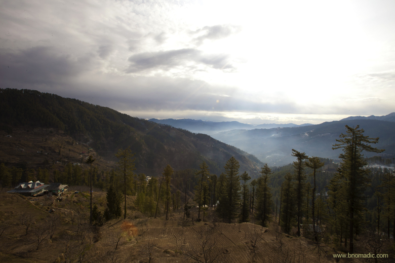
Magical morning from the ridges of Chakrata. Please visit Flickr for more images of the region
On way back from Taluka, gateway to Har-Ki-Dun. More images from the region at Flickr

The Tons Valley; the Tons is the largest tributary of the Yamuna. Photo by Sarabjit Lehal. More at Flickr
A few months back, while returning from Har-Ki-Dun, we went over to the Hanol village in the scenic Tons (or ancient Tamas) Valley in the Bawar region of Garhwal. The village happens to be the main seat of the chief deity of the region – Mahasu Devta, an embodiment of Lord Mahashiva, the supreme God of not only the mortals but the innumerable subordinate Gods and Goddesses of the Himalayas.

Mahashiva Dwar marks the main entrance to the temple complex. More images at Flickr Photoset
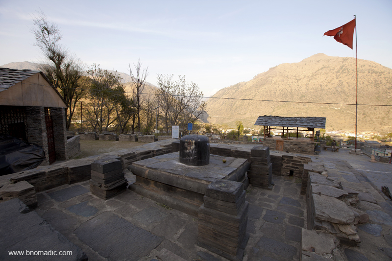
Surrounded by small hills, the ancient Mahasu Devta temple is sited on a clearing just below the main Tiuni-Mori road by the left bank of the crystal-clear Tons. Built in the ninth century, the temple is secured by the Archaeological Survey of India (ASI) and has emerged as a prominent tourist attraction of the area near Chakrata. Named after a Brahmin – Huna Bhatt, the temple was initially constructed in Huna architectural style and subsequently acquired a mixed style with expansion.

The ancient Mahasu Devta temple at Hanol. More images from the region at Flickr Photoset
The main shrine inside the temple complex and the site of animal sacrifices. More images at Flickr
A sacred shrine representing the four brothers. More images from the region at Flickr
The Mahasu Devta temple of Hanol lies just at the administrative boundaries of Uttarakhand and Himachal Pradesh. The temple is located at a five minutes walking distance from the GMVN property. Having devoted the early hours of the day for birding, we left for the temple quite late after breakfast. Even though, the village market was yet to open, the prasad shops selling flowers, malas and other religious offerings were fully opened for business. Barring some locals, a few goats and lambs, there weren’t many living beings when we entered the temple complex. The small doors of the sanctum sanctorum were still locked.
The main shrine inside the temple complex. Photo by Sarabjit Lehal. More image at Flickr
The remote location of the temple may not be as frequented by tourists but is held in very high regards by local Jaunsar-Bawar hill people. Legend has it that in the times gone by, the surrounding hills were terrorized by a demon named Mandarth until pious Deoladi Devi pleaded with the Shiva, who incarnated as her sons to defeat the demon. Since then, the villagers started worshipping the four brave sons – Botha Mahasu, Pavasik, Vasik and Chalda here in the region. The temple of Botha Mahasu is the main shrine at Hanol even as the Pavasi Devta’s temple is located just across the Tons atop a small hillock. The Vasik Devta’s temple is a 40km trek up the mountain from Pavasi’s temple, whereas the Chalda Devta’s temple is a 2km trek from Tiuni.

The Pavasi Devta temple at Hanol. More at Flickr

Lore goes that during the Mahabharata era, the King Duryodhana reached the area after travelling through Kashmir and Kullu. He ultimately preferred to settle down in the region. So he is said to have prayed to the Mahasu Devta at Hanol asking for a piece of land. The deity not only accepted his pleas but made him the king of the area. He made Jakholi his capital village where a temple is commemorated to him.
As we roamed around in the complex, we came across some more stories related to the temple. The locals told us about the site where animal sacrifices were held annually until the tradition was reversed in the year 2004. A fair at the temple is held every year in August when the deity is taken out in a procession by the followers comprising people from nearby districts. Architecturally, the Mahasu Devta temple at Hanol is a perfect example where stone and wooden structure harmoniously blends to form one composite grand edifice. It took a while before the doors of the main shrine were opened.
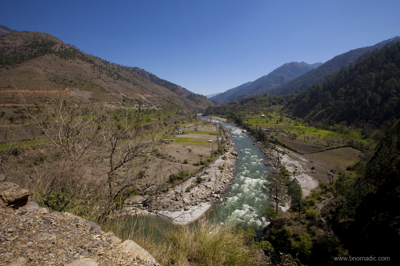
The fertile Tons Valley near Hanol. Photo by Sarabjit Lehal. More images from the region at Flickr

Mata Deoladi Temple built a little downstream to commemorate the birthplace of four brave brothers. Photo by Sarabjit Lehal. More images from the region at Flickr
On a different note, a curious aspect of the Hanol temple is that what the people worship as the Mahasu Devta in the sanctum-sanctorum, in fact, looks to be a statue of the Buddha seated in the bhumisparsha mudra. It may bring us to the point that before this area was overtaken by the Shivaism, the complex at Hanol might have been an active centre of the Buddhism. Even the layout of the temple complex indicates the possibility of existence of a well-defined monastic complex.

The junction of Tiuni by the river Tons. Photo by Sarabjit Lehal. Please visit Flickr for more images
All in all, other than your religious inclinations, if you have interest in culture and history of the region, devote at least a day to Hanol. Take a walk along the Tons valley floor or the road towards Mori, for watching birds.
Getting There
The heritage temple of Hanol is located at a distance of nearly 100 km from Chakrata. The road length from Dehradun is approximately 190km. Budget more time than usual to cover the stretches because of bumpy and patchy road network. Another approach from Dehradun could be via Mussoorie, Naugaon and Purola.
Average Altitude: 1230m
Best time to visit: Winters and spring
Travel Lure: Heritage and Birdlife
Accommodation: Limited with a GMVN facility
Garhwal Diary: The Kamal Valley of Purola

Sometime ago in late spring, we chanced upon an unlikely halt at the state government run traveller guest house at Purola (1530m) in the Garhwal region of Uttarakhand. Travelling on our way to Sankri – base village for Har-Ki-Dun trek – from Yamunotri, we settled for a night halt at Purola as the evening light faded. The finery of the terraced open landscape of the valley floor seemed to invite us to take walks and explore the immediate area next morning.

The Yamuna Valley against the backdrop of the Bandarpoonch Massif in a fading light. More at Flickr
As we travelled through the hillsides of Garhwal, the changing landscape on our line of approach from Yamunotri including the climatic transitions from heat to cold and vice versa arrived almost suddenly; as we ascended or descended. In covering the distance, sometimes we were dreadfully annoyed by the encumbrance of our dusty vehicle while travelling through the Yamuna Valley to the open and sunny Kamal Valley. The sylvan charms of the Jarmola Dhaar, as we approached Purola, provided some respite from the dust as well as late noon heat. The landscape changed as the pine adorned grassy valley appeared.

Jungle Owlet; as we entered the valley

Camera curious locals bathing in a stream that joins the Kamal River. More images at Flickr
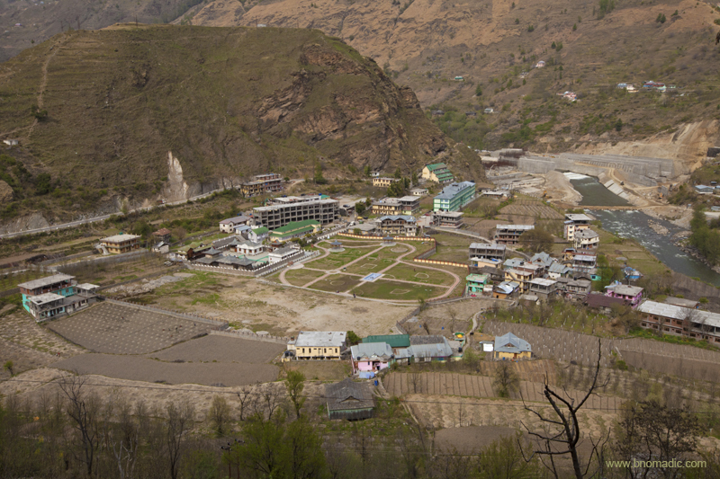
From what it seemed, the guest house was not very frequently occupied. The caretaker arranged for a cook who dished up some local foods by the time we took an evening stroll in the market. The valley of Purola is said to be one of the most fertile as well as widest valleys of the region. Geographically, the valley is the biggest divide between the Yamuna and the Tons Valleys. The street was full of vegetable vendors and kiryana shops selling local red rice produce as well as other traded items. The typical tea-cum-sweet shops weren’t difficult to locate either; where, if lucky, one could freely exchange knowledge of the various treks and routes up the higher ridges of the Himalayas including the very famous shorter alternatives of Har-Ki-Dun or Kedarkantha treks. In fact, the settlement of Purola has also been popularised as the gateway to both these treks. The other popular alternative today is of course the village Sankri, where we were heading in a few days’ time.

The Kamal River meandering below the settlement of Purola. More images from the region at Flickr

The fertile Kamal Valley. Photo by Sarabjit Lehal. Please visit Flickr Photoset for more images of the region
Relatively untouched by the rapid development of the hill stations, the quaint hillside of Purola offers picturesque views and serene salubrious environs making it an ideal destination to rejuvenate the soul. The road meandering along the valley up to the ridge top, Jarmola Dhaar, offers spectacular and awe-inspiring views of the valley. The Jarmola Dhar fringes the southern end of the Govind Pashu Vihar National Park and Sanctuary, which is home to many endangered species of fauna and flora. The following morning, we headed to the valley floor where the remains of an ancient Yagya Kund were discovered.
Relatively untouched by the rapid development of the hill stations, the quaint hillside of Purola offers picturesque views and serene salubrious environs making it an ideal destination to rejuvenate the soul.
The Kamal Valley; geographically, the valley is the biggest divide between the Yamuna and the Tons Valleys.
A passage through the market leads to the ancient ASI site of the Yagya Kund that is said to be dating back to the second century BC. The ancient site is located on the left bank of the river Kamal. The Yagya Vedica (burnt brick alter) is unique in its kind resembling a floating Garuda. During excavation a good number of Sungha-Kushana period red wares and coins belonging to the Kuninda rulers were discovered. The popular yields at the site include the remains of Painted Grey Ware (PGW) from the earliest level along with other materials like terracotta figurines, beads, potter-stamp and the dental and femur portions of a domesticated horse. The most important one being a brick alter identified as Syena Chiti. The valley is also associated with the Mahabharata period.

The ancient Yagya Kund site all covered with a shed. Please visit Flickr for more images of the region

The Yagya Vedica (burnt brick alter) is unique in its kind resembling a floating Garuda. More at Flickr
Legend has it that during the Mahabharata era, Duryodhana came to Purola after traveling through Kullu and Kashmir. Duryodhana liked Purola so much that he decided to reside there. He prayed to the Mahasu Devta for a piece of land. The deity accepted his pleas and made him the king of the area. King Duryodhana made Jakholi his capital village and constructed Mahasu Devta Temple. In medieval time the Mughal emperor Akbar also made frequent visits to the temple.

Valley view from Jarmola Dhaar. Photo by Sarabjit Lehal. Please visit Flickr for images of the region
The settlement of Purola offers good scope for morning and evening walks especially to watch and admire the rich birdlife of the region. Although, the upper slopes offer some enthralling treks that takes one through surging waterfalls, verdant hills covered with pine and oak trees, gushing river streams. The state tourism agency also lists that wildlife enthusiasts can visit the sanctuary which is one of the largest national parks in India and home to myriad species of animals like Himalayan snow leopard, bharals, sloth bear, deer, flying squirrel and Himalayan Tahr.

A Siberian Stonechat. For more images from the region, please visit Flickr Photoset

The valley of Purola is said to be one of the most fertile as well as widest valleys of the region. More at Flickr
Getting There
The valley of Purola is 112 km from Uttarakashi and nearly 100 km from Mussoorie. The stretches of the hillside from Mussoorie as well as Uttarakashi side are remarkably beautiful but beware of the road condition especially during the monsoons.
Average Altitude: 1530m
Best time to visit: Winters and spring
Travel Lure: Heritage and Birdlife
Accommodation: Limited; confirm in advance
Garhwal Diary: The ancient temple of Lakhamandal

Sometime ago we visited the Yamuna Valley in the Garhwal region of Himalayan state of Uttarakhand. We took the route through Dehradun and Chakrata so as to avoid the touristy humdrum of Mussoorie. Having already visited the Ashokan rock edict at Kalsi, I was particularly motivated towards visiting yet another site of archaeological importance – Lakhamandal – situated in the Yamuna valley itself.

Mystic Himalayan morning at Chakrata. Please visit Flickr for more images of the region
Capturing various hues and tones of the landscape as well as the rich birdlife on camera, we made slow progress on the bumpy, dusty narrow stretch of the road from Chakrata to Lakhamandal. On the way we stopped briefly for lunch by the famous Tiger Falls located just over 20km from Chakrata. Locally known as Keraao Pachad and with a spectacular fall of 312ft, the Tiger Falls are said to be highest waterfalls of the state. Being much away from the hustle bustle of Mussoorie, Chakrata or Dehradun, the falls are relatively untouched by crass commercialisation and attract many a trekkers. People I know prefer to trek all the way to Lakhamandal from Kalsi edict; taking about three days to cover the distance over multiple ridges. Tiger Falls are a natural choice for a an attractive halting place or a preferred option for a brief stopover on such treks.

The scenic Tiger Falls. More images at Flickr
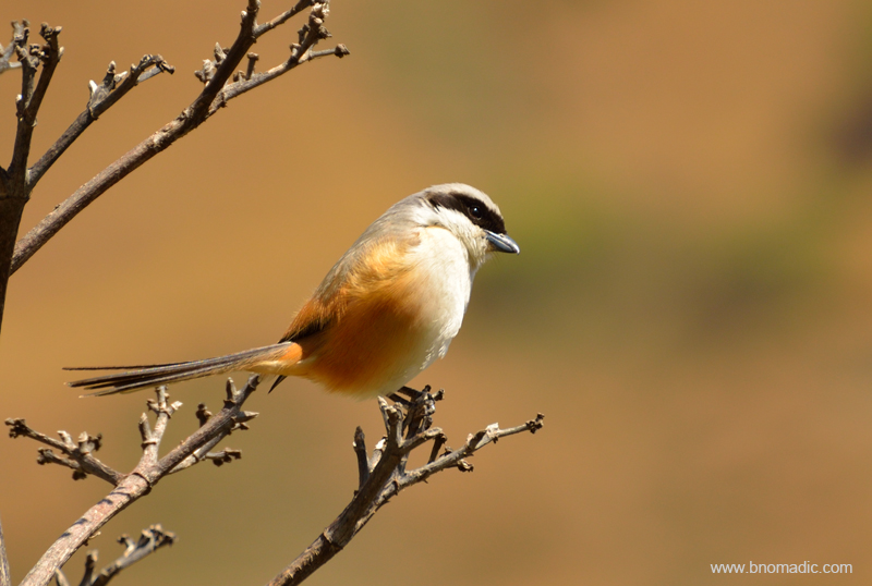
A Long-tailed Shrike. More images from the region at Flickr
Ahead, the bumpiness and dust of Garhwal hillside had clearly overtaxed our bodies. The antiquarian paradise of Lakhamandal, a small village in the Jaunsar-Bawar region of Garhwal is situated at an altitude of 1150m on the rolling slopes of a rugged mountain range that runs parallel to the Yamuna on its right bank. After the recent construction of a regular motorable road from Mussoorie to Yamunotri via Chakrata on the opposite bank along the river, Lakhamandal was left unconnected on the other side. Situation improved gradually.
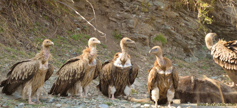
Himalayan Griffon Vultures feasting on a dead cow. More images from the region at Flickr
The bumpy, narrow, dusty road through the Yamuna Valley. Photo by Sarabjit Lehal. More images at Flickr
Being right on an ancient trunk-route that connects the Indian mainland to Yamunotri and beyond to the trans-Himalayan destinations, Lakhamandal had all the reasons for its flourishment and prosperity. It was because of its advantageous position on the spur of a mountain overlooking the valley that it became a convenient halting stage for the travellers and pilgrims heading towards upper Himalayan destinations. The village was once an active centre for the mercantile trade and religious activities; a fact which is so well attested by the ruins of the ancient structures spread all around in the locality.

Lakhamandal gets its name from lakha meaning “many” and mandals meaning “temples” or “lingam”. Photo by Sarabjit Lehal. More images at Flickr

The temple is built in North Indian architectural style, which is common in the hilly regions of Garhwal, Jaunsar and Bawar. Photo by Sarabjit Lehal.

Temple-cum-playground for village kids. Photo by Sarabjit Lehal. More images from the region at Flickr
At the village entrance, one is greeted by an ancient yupa inscription. Around here, small stone relics or inscriptions could be spotted piled on one of the village chabutras. One might get surprised to find sculptural fragments or even stone images lying uncared in and around the village. Farmers occasionally dig out pieces of carved stones and images from the fields. Such fragments of stones could also be observed fitted into the boundary walls of village houses. Out on the village streets near the temple complex, such antiquarian wealth dot both sides of lanes.

Some of the many mandals at Lakhamandal Temple. More images at Flickr
Even with the archaeological and religious wealth that abounds this village, surprisingly, it has largely remained a terra incognita even to the Yamunotri bound pilgrims. The situation unquestionably should not have been so in the sixth or seventh century when a Shiva (Bhava) temple was said to be constructed here by a princess named Ishwara. The temple was constructed over the base of an earlier brick structure that could well have belonged to a non-Shiva deity. This happened when the Brahminism was going through a revival in the area. Today, the indigenous Khashia Brahmans, who revere the characters of the Mahabharata, largely populate the region. The magnitude to which the Brahminical Hindu elements have been able to influence the native social system could directly be felt in the legendary association of the Kauravas and Pandavas with this area. They are believed to have lived in this region with the locals for many years during their incognito exile.

Believed to be doormen, the twin statues of Danav and Manav are located just beside the main shrine. People attribute these statues to be those of Bhima and Arjuna. Many believe they also resemble Jai and Vijay, the doormen of Lord Vishnu. Some historians claim the figurines belong to Buddhist era. Photo by Sarabjit Lehal. More at Flickr

Even in the village outside the complex, one could spot small stone relics or inscriptions piled scattered. More images at Flickr
Even with respect to the temple, legend has it that the Kauravas built lakshagriha, the house of shellac, here for the Pandavas to stay in. The idea was to trap the Pandavas inside the highly inflammable house and set it ablaze. However, the Pandavas escaped to a place called Chakrapur through a tunnel. That place is associated with the present day Hanol. Similarly, yet another folklore associates the place to which the Pandavas escaped with present day Chakrata (ancient Ekachakrangari).
Built in North Indian architectural style, which is common in the hilly regions of Garhwal, Jaunsar and Bawar, Lakhamandal gets its name from lakha meaning “many” and mandals meaning “temples” or “lingam”. In its heyday, the temple must surely have been popular but to the western world the temple site attracted the attention of archaeologists for the first time in 1892 AD when George Buhlar discovered an inscription dated sixth to seventh century AD.
The shiny graphite lingam is one of the attractions of this temple complex. More images at Flickr

The Yamuna Valley view ahead. Photo by Sarabjit Lehal. Please visit Flickr for more images of the region
Getting There
The heritage temple at Lakhamandal is 128 km from Dehradun and nearly 70 km from Chakrata. The road length from Mussoorie via Chakrata is approximately 100km. Budget more time than usual to cover this stretch as you could never be sure of the road condition.
Average Altitude: 1150m
Best time to visit: Winters and spring
Travel Lure: Heritage and birdlife
Accommodation: Limited; confirm in advance


