 bNomadic
The following is a page entry from On Road through the trans-Himalayas. To read complete travel memoirs and trip report, please visit here.
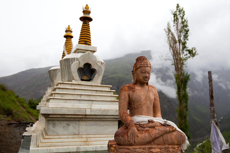
At Karding Monastery. Photo credit Sarabjit Lehal
Chapter 10 of 22
Next morning after the routine morning chores and a satisfaction of having gained some experience from the previous night’s drive, we headed back to Tandi to get the fuel tank topped up. The 55L tank of the Innova simply didn’t necessitate filling up the fuel-canister we were carrying. Taking the same road up to Keylong (3350m), we rushed to reach Jispa (3260m) before it was too late for the breakfast. The metalled road past Keylong is slashed out of a wide gorge high above the Bhaga River on its right bank. Passing through village Gemur (3300m) and some settlements by the river, we soon reached Jispa, recently in news for being among the chosen sites where the government is mulling to set up a hydroelectric power plant. Aware that the next permanent habitation on the Manali-Leh highway was still over 280km away, we wolfed as much food as we could. While settling the bills, the owner of the hotel politely requested me to drop a letter at a tent-accommodation at Sarchu 100km ahead. Devoid of any communication network, sending important communication through traveller-courier is the best alternative.
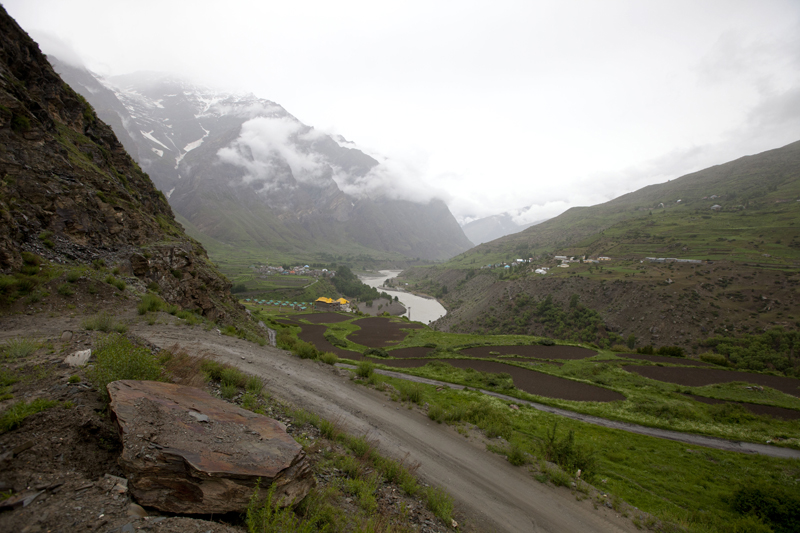
Somewhere near Tandi. Photo credit Sarabjit Lehal
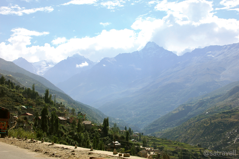
Leaving Keylong; Pk 4610 in sight. Please visit Flickr Photoset for more pics and information
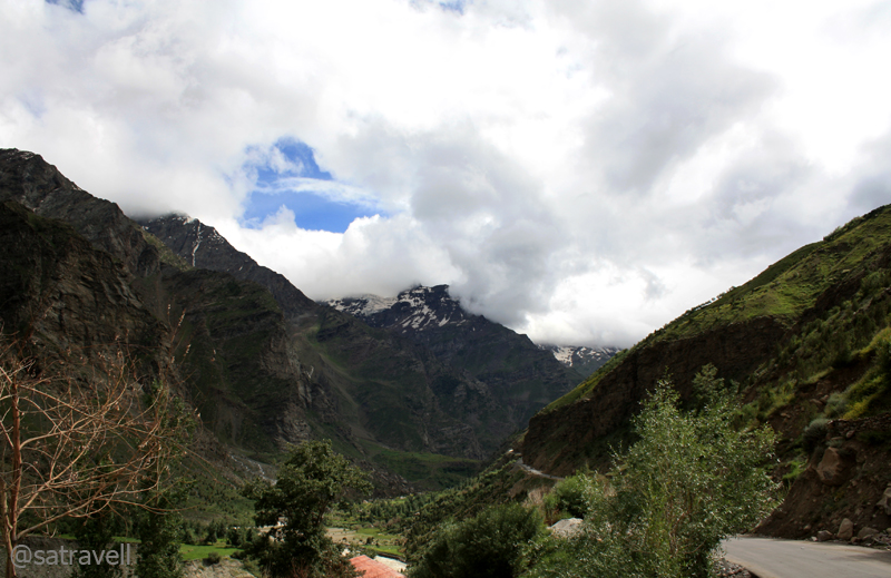
View towards Chhapar Sharna from Gemur. Please visit Flickr Photoset for more pics of the region
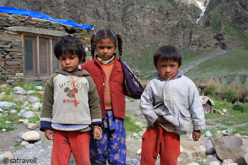
Curious kids at Gemur. For more pics of the region, please visit Lahaul & Spiti
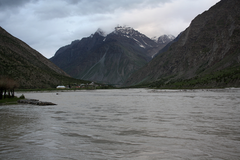
Voluminous Bhaga River at Jispa; Pk 4962 in sight. Visit Flickr Photoset for more pics of the region
Landscape at Jispa; Tinget Nala in sight. Please visit Lahaul & Spiti for more pics of the region
Confirming our location to my friend Tsewang Dorje in Leh, we set out to begin our share of adventure on the Manali-Leh highway, now a popular safari route. The neatly tarred road snaked to reach Darcha (3330m), house to a series of dhabas and a police check post, where we had to register ourselves and were asked to hold our horses for some time. On its way to Leh, a convoy of army-vehicles, ahead of us, had damaged the iron-bridge over the Jankar stream. Summoned by the policeman, the BRO workers arrived after some time and with the help of bystanders started the patch-up work to replace the dented iron-logs. The road camaraderie mustered enough numbers to enable quick repair of the bridge. In the meantime, I restocked supplies for the day and captured a few birds including Alpine Choughs.
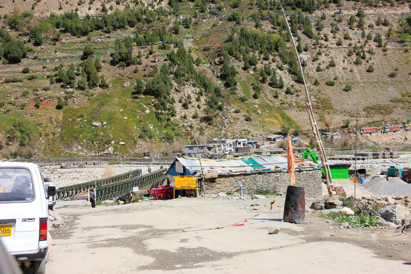
The damaged bridge over Barai Nala at Darcha. Please visit Flickr Photoset for more pics of the region
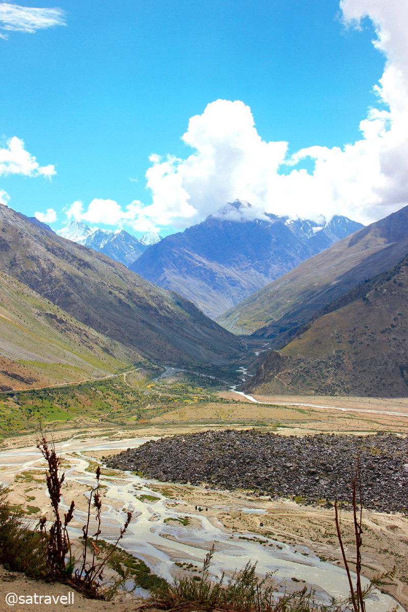
View towards Milang Valley; legend has it that a village lies buried underneath the rubble of stones
Passing through the point where the popular trek to Zanskar over the Shingo La starts, the road steadily climbs upstream to reach Patseo (3765m). Although still known as Darcha – Padum trek, it has effectively reduced to Palamu – Ichar trek, cutting down a few days of slogging at both ends. The Government of India is in the process of fabricating a motorable road to connect Manali with Kargil. A common sight in the region during the summer months are huge flocks of sheep and goats lead by Gaddi shepherds from their village homes in the Chamba valley in search of the nutritious Niru, a blue-green grass.
The small holy Deepak Taal (Lake). Please visit Flickr Photoset for more pics of the region
Patseo is also the confluence point of Bhaga River and Panchi Nala. For more pics, visit Flickr Photoset
An erstwhile trading outpost, Patseo was the meeting place for traders from Zanskar, Lahaul, Kullu and Ladakh who would barter salt, wool from uplands for tea, grains, and spices from lowlands. Located on the slopes of the Baralacha La, Patseo has a couple of parachute-tents selling hot food and limited supplies, a PWD Hut, a small lake with pedal-boat facility, etc.
Patseo onwards the road climbed on the left bank of the Bhaga and a few kilometres ahead past the army encampment was an imaginatively named but a meagre-looking place called Zing Zing Bar (4100m). Zing Zing Bar onwards the ascent continues on a metalled road through a bare as well as rocky landscape. The road was in good condition and the ascent was also gradual still we were moving at a snail’s pace as had just caught up with the tail-end of the army cavalcade.
View towards Mane Bar (Zing Zing Bar) and 6008m Pk Maiwa captured from the slopes of Baralacha La
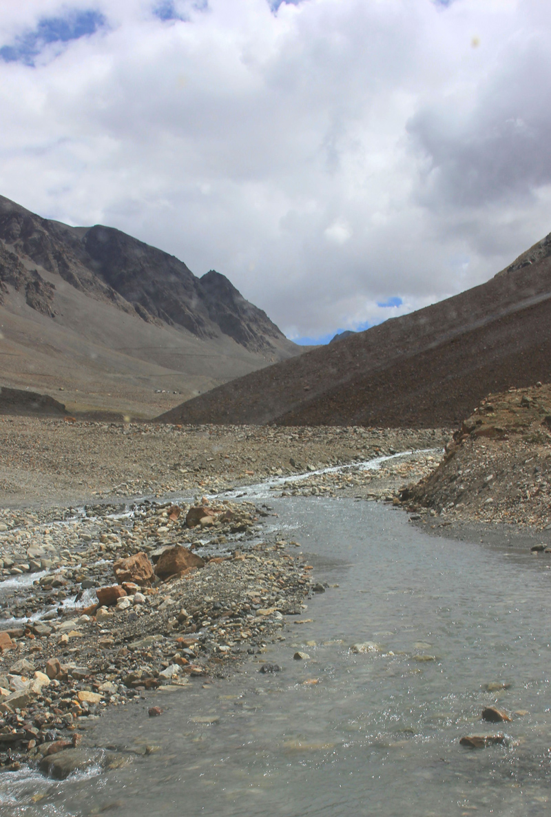
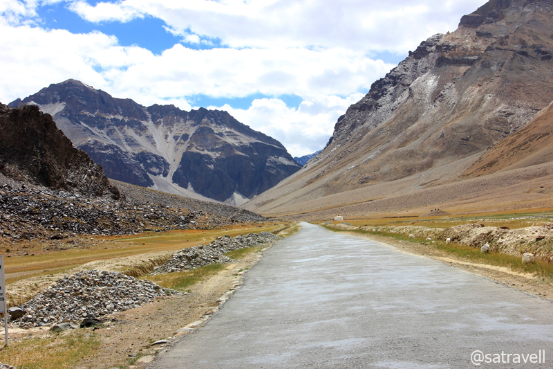
The motorway through the infant Bhaga River just short of Suraj Taal
Ahead after crossing the Bhaga stream, believed to be originating from the turquoise Suraj Taal visible from the road, the highway climbs to reach the crossroads of Ladakh, Lahaul, Zanskar and Spiti. 110m higher than Europe’s highest mountain, Mont Blanc, the Baralacha La (4939m) on the Great Himalayan Range commands outstanding views across both sides. A typical landscape encompasses brown rocks topped with white and shiny snow that looks like chocolate brownie in camera-viewfinder.
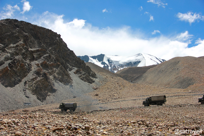
Army Cavalcade climbing to cross the Great Himalayan Range; Pk 5608 in sight
The holy glacial Suraj Taal at 4802 m. Captured later by Sarabjit Lehal
The noise and fumes-pollution caused by the movement of huge army convoy made it impossible for us to stop and appreciate the views. We now aimed to get ahead of the cavalcade at the soonest. The gradual but rough descent from the high-mountain pass almost got unnoticed because of the magical views embracing marbled red-pink mountains and green glacial lakelets giving rise to the Yama River. We got past the army caravan at Bharatpur (4750m), located 5km after the pass, where the unit briefly halted for a tea-refreshment. The seasonal parachute tent at Bharatpur brews up the usual – chai, maggi noodles, daal/ rajma and rice – the official menu of the Manali-Leh highway.
The encampment of Bharatpur within reach. Photo credit Sarabjit Lehal
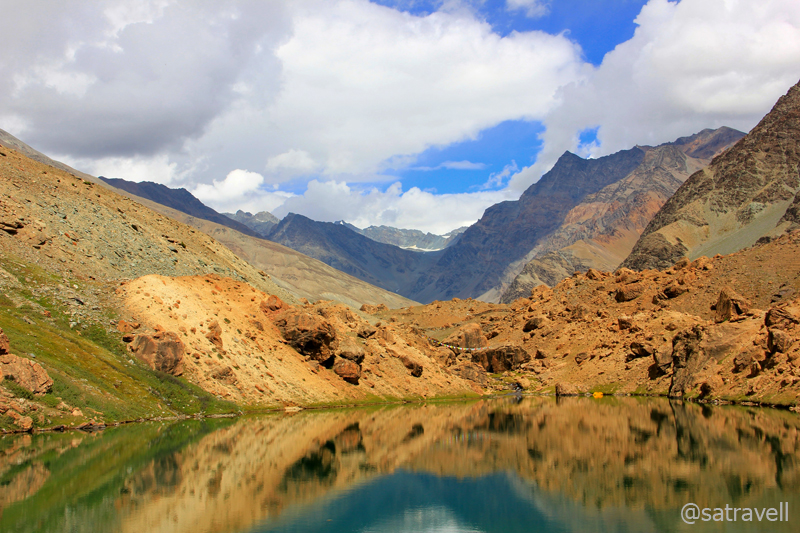
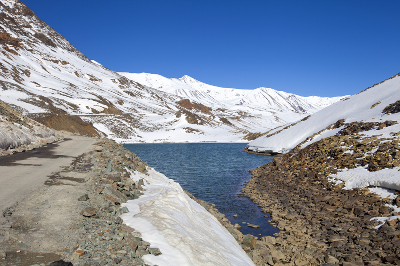
The glacial Yunam Tso at 4670 m. Photo credit Sarabjit Lehal
A little ahead of the tent, a damaged iron-bridge over the torrential Yunam stream made us stop and terrified us briefly. The bridge seemed to have been damaged by overloaded trucks ferrying supplies to Leh for the coming winter season. The vehicles ahead had dismantled the iron sheet as well as the iron-logs. An alternate track leading across the stream confirmed that it was fordable but the now thigh-deep dashing water-flow made it impossible for any vehicle to cross it. We could either wait for the BRO team to arrive or head back. A close inspection of the problem at hand made me believe that with some basic replacement of sheets as well as logs and a careful manoeuvre of the Innova over the 10-12m bridge-length could relocate us to the other side. We did the same with a success which brought us major relief. Om Mane Padme Hum!
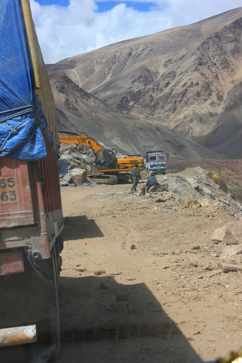
Earth-mover at work!
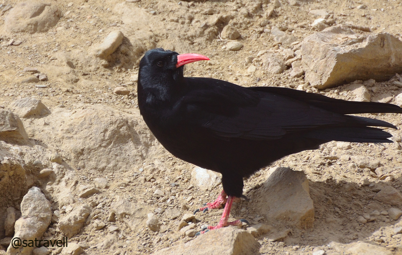
Locally called Karnbhedi, Red-billed Chough near Kilang. For more pics, visit Flickr Photoset
Nearing the Phalrong Danda camping grounds. Please visit Lahaul & Spiti Photoset for more pics
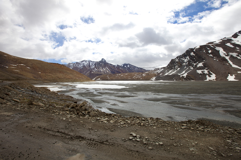
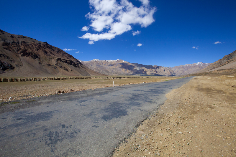
After Bharatpur hairpins, the road follows the rowdy river passing through a gorge until it calms down entering into the wide open alluvial Sarchu Plains (4300m). On the way we passed through the Killi army campsite as well as a couple of small lakes after which the popular campgrounds emerged. Ahead the Sarchu plains looked strikingly beautiful: vivid green grass, carvings made out of erosion on the canyon walls, neatly tarmacked road, endless blue sky, low-velocity winds forming a tiny dust squall as well as dhabas and tea-shops. The barren land at the border of Himachal Pradesh and Jammu & Kashmir even had a liquor shop!
Into the alluvial Sarchu Plains. Photo credit Sarabjit Lehal
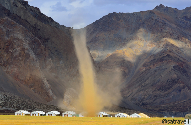
A dust-devil taking shape in Sarchu plains. Please visit Flickr Photoset for more pics
Offering the Manali-Leh menu, most of the items are overpriced in the camps as well as the dhabas. With the popularisation of this Safari route, Sarchu has emerged to be a popular overnight stay option among the travellers on the Manali-Leh road. Registering ourselves at a Police Check Post, we proceeded ahead and after negotiating a small stream and crossing a bridge over Chharap Nala that joins Yunam to form the main Tsarap River, briefly stopped for a tea. The next 85 km stretch on the highway is literally without any habitation or tea shops or army encampments.
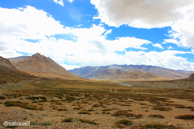
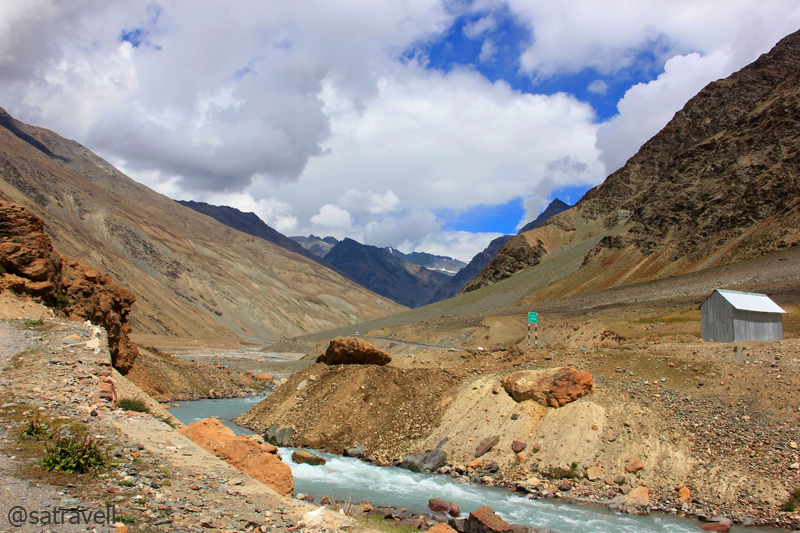
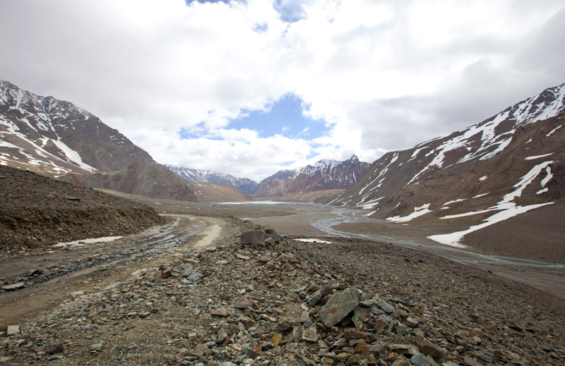
Landscape towards Sarchu captured while approaching Brandy Nala. More on Flickr Photoset
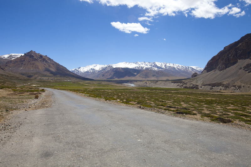
Leaving Sarchu Plains. Captured later by Sarabjit Lehal
Ahead the road meandered by the right bank of the river for the next 31km to reach Brandy Nalah (4205m) on a levelled ground just at the base of the ill-famed Gata Loops. The climb to the scruffy Nakee La (4950m) begins from the base of the Gata Loops by the Tsarap, a set of 21 switchbacks spread over 9 km to gain over 420m in altitude. Ascending further through a narrow tarred road in a series of hairpins, the pass is another 10km from the endpoint of the Loops. On the way we came across a few loaded trucks struggling hard to climb as well as a bivouacking site littered with plastics and bottles. Sad indeed!
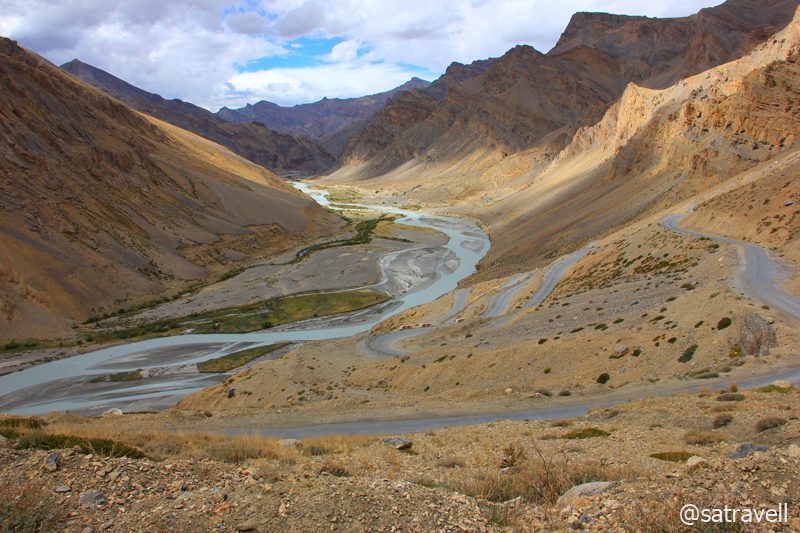
Gata Loops and Tsarap Chu that leads to Zanskar region. More pics at Flickr Photoset
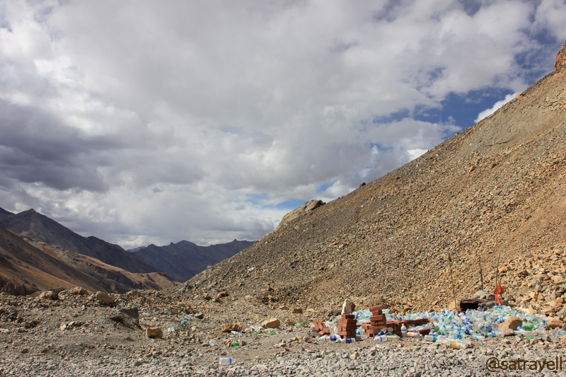
Unfortunate leftovers of trans-Himalayan Safari culture at the “Khopri Baba” site. More at Flickr Photoset
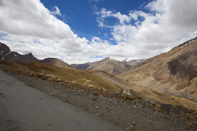
Landscape towards Western Lahul; Pk 5326 in sight. Photo credit Sarabjit Lehal
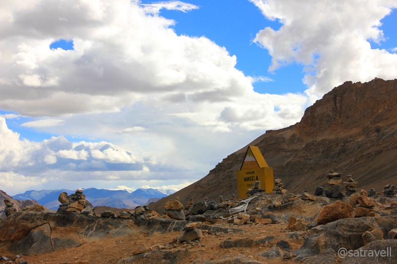
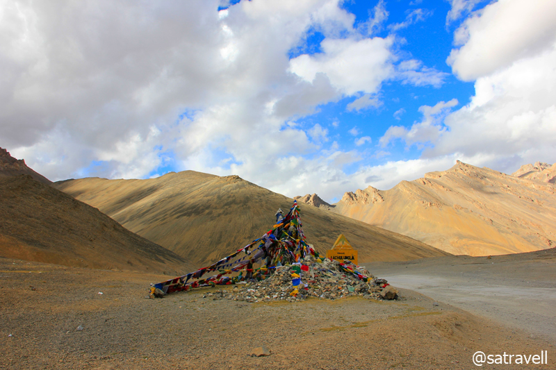
Nakee La at 4950 m. This and more about the region at Flickr Photoset
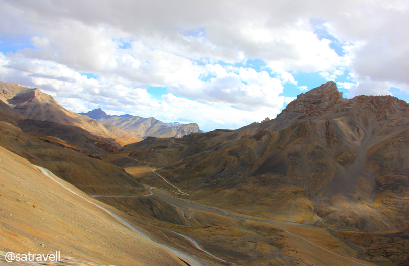
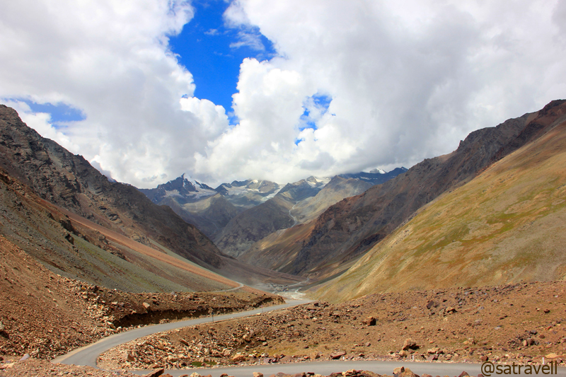
Landscape between NakeeLa and Lachalung La. More pics at Flickr Photoset
The road descended on a similar arid terrain over the next four kilometer to reach a popular campsite – Whisky Nalah (4800m). Located by the stream are a few abandoned army nissen huts, where getting an accommodation in case of an emergency is always a possibility. A further 8km gradual ascent on the narrow bumpy road takes you to the Lachulung La (5060m).
Lachalung La at 5060 m. For more pics of the region, please visit Flickr Photoset
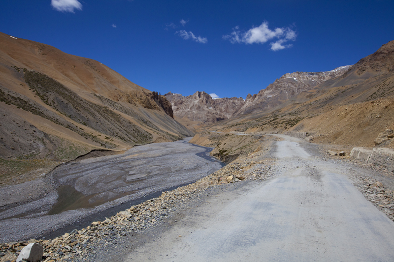
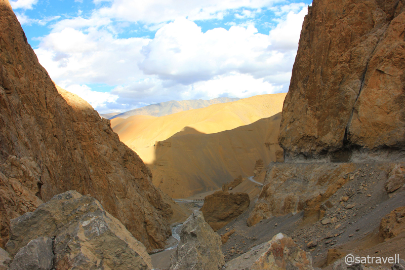
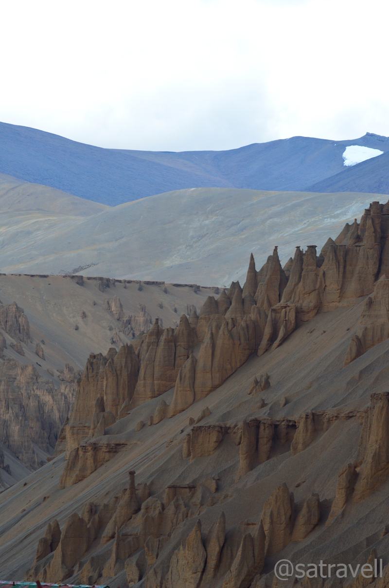
Downhill the rutted road skirts through verdant pastures then drops through a narrow gorge marked by a few memorials by a stream. The theatrical landscape encompassed just every component of arid land: noisy stream, rock pools, eroded turrets, spires and flutes against the backdrop of a slightly overcast sky. Ahead, as the river (Lachalung Lungpa )confluences with Toze Lungpa and Sumakhei Lungpa after the widening gorge, the parachute tents of Pang (4625m), located in a vast amphitheater of rock and sand, came into view. As we neared the temporary settlement, the notice board on the river iron-bridge did not surprise us. It read, “The Bridge is not suitable for any further use”. I got down and observed the knee-deep icy-stream taking the now-operational muddy track a little ahead of the bridge. The vehicle needed to be swiftly maneuvered to counter the flow of water and in a particular fashion to avoid large boulders in the stream. We were successful without a single hit underneath the vehicle. Om Mane Padme Hum!
Landscape ahead; descending the Lachalung Pass. Photo credit Sarabjit Lehal
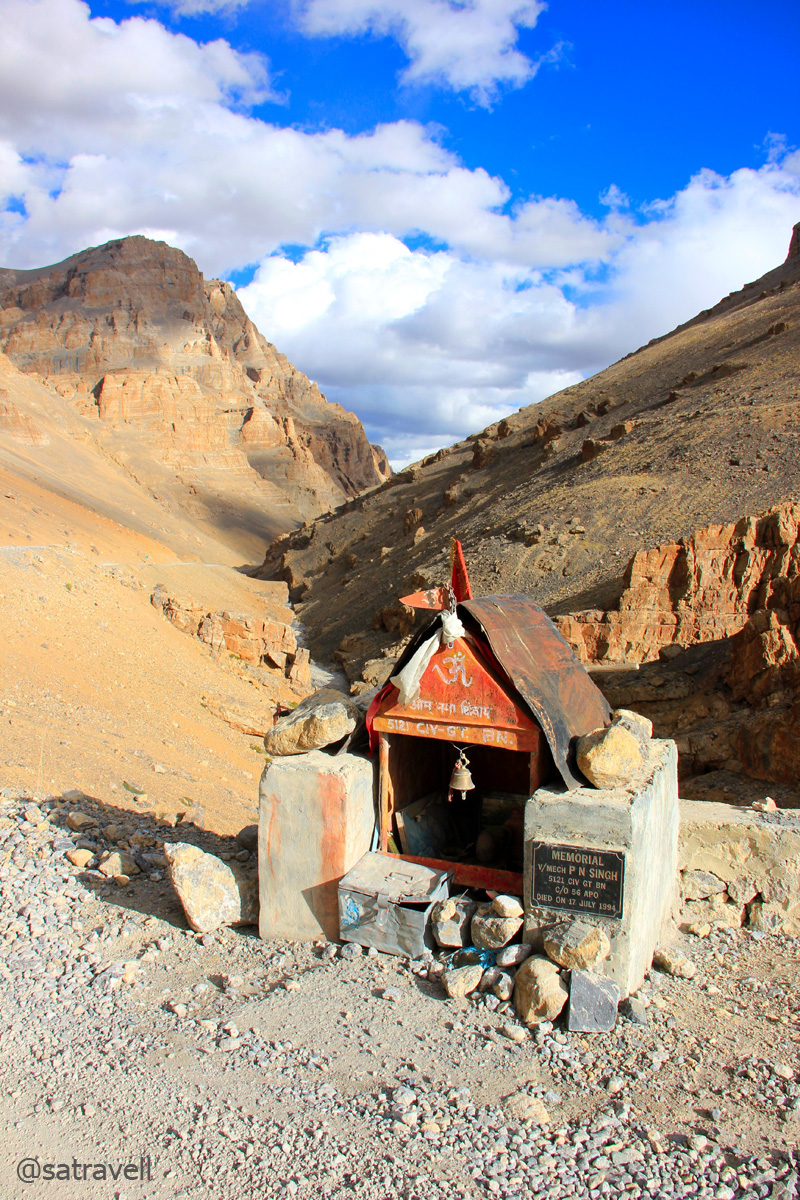
Memorial by the road
A filthy looking settlement comprising a police check post, few parachute-tents monopolised by villagers from Changspa, a government-operated infirmary, dhabas as well as an army encampment, just like Sarchu, Pang is a popular night-halt option for Manali-Leh travellers. It was still early evening but due to the fast changing weather we did not want to fall into previous night-like situation and so decided to call it a day. Having proved our credentials at the police check post, we checked for an accommodation at the army camp’s wet canteen.
Lachalung Gorge. For more pics of the region, please visit Flickr Photoset
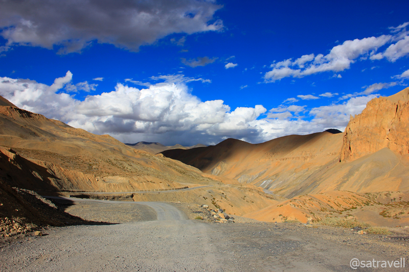
The magical landscape ahead. For more pics, please visit Flickr Photoset
It was a typical lodging providing basic facilities like bedding, blankets, tea, refreshments, Manali-Leh meal as well as open toilet, etc. We preferred tentage over the spacious mud-walled hut just to avoid snores of other occupants at night. Having parked the Innova right in front of the tent’s entrance, I set out for a walk around the area. The cousin occupied himself with a hot-coffee shot and his own usual stuff.
Approaching Pang. Photo credit Sarabjit Lehal
Plastic furniture arranged outside the tents make it a joyful place to laze and sip hot chai or relish the Manali-Leh menu. Garbage is dumped next to the river and the constant flow of travellers, often screamed at by the tent owners to stay with them, keep adding to the junkyard. I was hiding behind a large stone to photograph a few snow pigeons in the fading daylight when it started raining. The weather had changed suddenly and towards the Tanglang La the sky was completely overcast by now. I would say that we were lucky to have taken a right decision to call a halt at Pang otherwise, in such a weather, things may turn messy at the Pass.
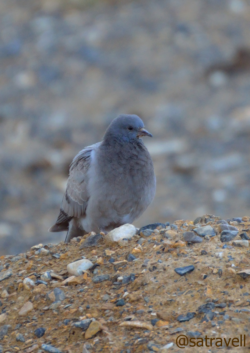
Hill Pigeon captured near Pang
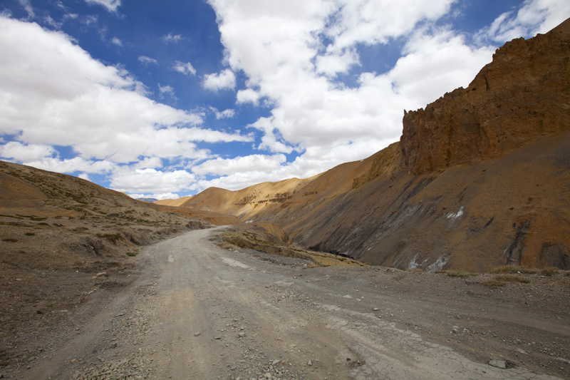
Mountain-face near Pang
Protecting my camera from the downpour, I quickly reached our tent and ordered maggi-noodle-soup along with a cup of hot ginger tea. Expecting a bitter cold night, the cousin had already arranged the beddings; three layers below and four above. Unperturbed by the happenings of the world outside we lied-down and pondered over the previous night’s drive. Thinking of the terrain that lay ahead, the incessant-looking rain seemed to be a blessing in disguise. The tent was an all-weather assembly courtesy the army camp that also supplied limited electricity to our camp. The remaining camps were without any electricity supply. As the sunlight faded and also because of the weather, many more travellers started pouring inside the settlement for an overnight stay. Amidst all this the rain stopped and we got a chance to step outside unworried of the altitude or the lack of oxygen. Not overcast anymore, the silvery starry-skyscape was a soul-filling treat to the body. The various hues of the night sky – comprising golden, silver, pink, orange, blue sheen – appeared straight out of an electronic abstract art page. Far away, the headlights of trucks and taxi-vehicles rattling around the hairpins seemed like watch-tower’s beams draping in the valley.
Loaded with winter wears – for the first and only time – we took a walk around the tents area, infirmary, out-of-order iron-bridge as well as the army site. As an aftereffect of the downpour, the outside temperature was now hovering around 2 – 3 degree. Post dinner we approached the Commanding Officer of the army camp and sought his help in arranging a satellite-operated STD-con with our parents to keep them posted with respect to our coordinates. Having communicated our parents we walked out of the fenced area; chatted briefly with a few of the jawans and came back to our shelter for the night. Our bodily-systems were responding well and did not show any signs of altitude sickness as of now. Packed in multi layers of blankets, I considered it appropriate to ask for some tea as well as a few bottles of water for the night. Everything seemed okay at that moment.
It was around midnight, after a couple of hours of sleep, when I got up to a headache and heard the caterwauling of my trip-partner; I knew we both were hit by Acute Mountain Sickness (AMS). I made him drink half a bottle of water and the remainder I consumed myself. It was very cold and the whistling gusts were almost threatening to blow our all-weather-tent away. Sandwiched between multilayers and with the body in a flu-infected state coupled with the breathlessness made it the longest night our lives. The Langza-hike was of no use it seemed!
Asleep and awake at the same time, we counted every passing minute impatiently waiting for the incipient sunrays. In between both of us drank a lot of water that was ice-cold but the yowling of cousin showed no restraint. I patiently asked him if he wanted to see an army doctor at the outpost still he was not willing. With the outside temperature hovering around minus three, four degree, I must have stepped outside the tent, to discharge the bodily fluids, at least four time post-midnight. After a lot of struggle to locate the drug inside the car, finally I got hold of Diamox and administered half-a-tablet each, which showed its effect after an hour or so. The situation was better but we had not fully recovered and kept drinking small volumes of water at regular intervals.
At the crack of dawn, I moved outside to attend nature’s call in the open at freezing point. The Innova was covered with 3-4mm thick layer of soft ice and needed to be treated with some lukewarm water for it to liquefy. The cousin got the owner’s family to do the necessary morning chores for us including providing the lukewarm water, tea, supplies for the day as well as settlement of bills. Up here, the supplies are costlier by up to 20 per cent of the original price. Soon we were on the narrow ascending road, over a few switchbacks, to reach the Morei plains.
Even though, the experience at Pang continues to haunt me often, it’s not going to stop me from again travelling to the same region. Om Mane Padme Hum!
View and read more on the region at the Lahaul & Spiti Photoset, Ladakh Region on Flickr
You may also like to subscribe to the email updates, of the remaining chapters, by entering your email id in the sidebar.


Pingback: On Road through the trans-Himalayan Region | bNomadic
Drinking water throughout in night kept you fit and fighting may be. Memorable trip indeed.
One of the most memorable experiences ever. Thanks
Simply superb post n photography….
Thanks for visiting and for the feedback. Hope you’d continue to encourage.
fabulous captures !!
bro I have few questions regarding the trip … I mean I wish to tour the place and need you help.if you could give your email id plz !
Anytime Sir. I am available at ssdhull@gmail.com
There is a sense of purity and calmness in those clicks … absolutely amazing coverage .. some brilliant clicks ! Well Done Bro !!
Thanks Aziz Bhai. Thanks for the encouragement.
Hats off to you and your cousin for these stunning pictures and description. I feel that your photos belong in professional magazines.
Hey thanks Madhu for showering with appreciation. I am glad you liked the description. Hope you’d continue to encourage me by visiting (and giving your valuable feedback) the blog.
Superb post. Stunning visuals. The places look scared. Feel a kind of calmness and peace while looking at them. Thanks for sharing.
Thanks ma’am for visiting my page and for showering with appreciation. Thanks for encouraging me to blog more. Hope you’d continue to visit.
Picture perfect……………. Thanks for sharing your memorable trip in such a nice way……………..
Thanks Debopam for visiting and appreciating the efforts. Hope you’d continue to encourage.
Beautiful place. Some day I would love to see it in person.
Definitely a must visit for someone who could appreciate the nature. Thanks for visiting my blog.
बेहतरीन चित्र और वर्णन.. इस इलाके में जाने से पहले आपका ये वृत्तांत लोगों के बड़े काम आएगा।
Dhanyawaad Manish ji. I am glad that my efforts would be of some use for travel enthusiasts. Do visit often.
Hi Satyendra,
Loved your blog and pictures are amazing ….. Thanks for visit to my blog !!
I would love to publish your stories on our blog !! http://renokadventures.com/category/blog/
One more thing Since you are avid bird watcher We are in process of designing a bird watcher trek during Oct. Need your inputs in terms of design of the trek.
Regards
Jai
Thanks admin at crisscrossingindia for visiting my page and for showering it with appreciation. You may like to put links of my pages on your blog as per your wish. Would love to be a part of your effort through your website and else.
Please feel free to contact me at ssdhull@gmail.com for any of your bird/wildlife/travel-related needs (wherever you need help/ assistance) anytime.
Looking forward to learning from your experiences.
Hope you’d continue to encourage me by being a regular visitor on my blog and leaving with your valuable suggestions.
Regards,
Satyender
Thanks
Sayender will keep you posted.
Beutifull
Thanks. Keep visiting.
यह लेख देखकर अपनी बाइक वाली यात्र याद हो आयी।
Thanks Sandeep brother. Hope you’d want to visit the blog again.
Pingback: The majestic Bara Shigri and night-drive by the Chandra River | bNomadic
Pingback: Early morning on the rugged terrain | bNomadic
Once you get past the absolute serenity of the pictures, the words of the post add to this perfect virtual trip for the reader. Proud of you for being a true nomad. 🙂
Thanks Neha for visiting my blog and showering it with appreciation. I am glad you liked the content. Hope you’d want to visit the page again. 😉