 bNomadic
The following is a page entry from On Road through the trans-Himalayan Region. To read complete travel memoirs and trip report, please visit here.

Om Mane Padme Hum! Photo credit Sarabjit Lehal
Chapter 11 of 22
…At the crack of dawn at Pang, I stepped outside to attend nature’s call in the open at freezing point. The vehicle was covered with 3-4mm thick layer of soft ice and needed to be treated with some lukewarm water for it to liquefy. The cousin got the owner’s family to do the necessary morning chores for us including providing the lukewarm water, tea, supplies for the day as well as settlement of bills. Up here, the supplies are costlier by up to 20 per cent of the original price. Soon we were on the narrow ascending road, over a few switchbacks, to reach the Morei Plains…

Leaving Pang. Pk 5866 m Longlichi in sight. Captured later by Sarabjit Lehal
Ascending by the Sumakhel Lungpa. Captured later by Sarabjit Lehal
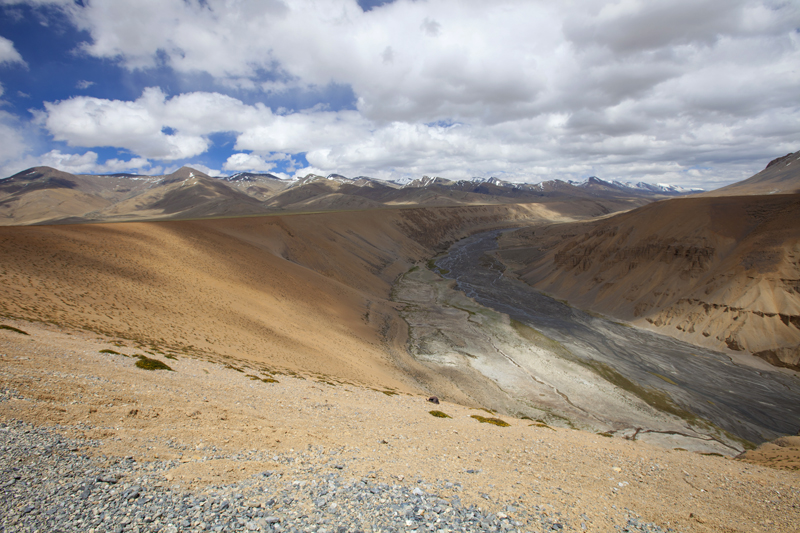
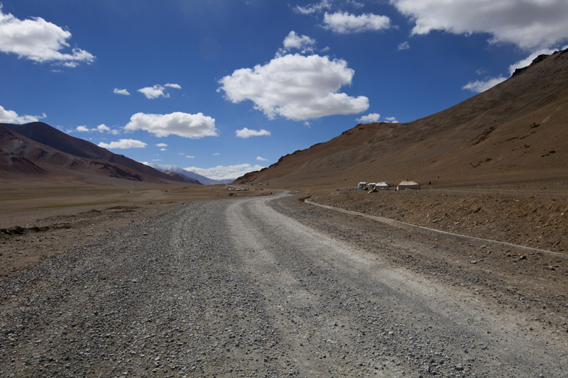
With an average elevation of 4500m, the Morei Plains (More, Moray, Mare) are a 40km plain-stretch, fringed by snow-capped mountains on both sides, which lay between Pang and the slopes of Tanglang La. Initially for a few kilometre (seven) the road wanders through a terrain by the Sumakhel Lungpa featuring some fabulous sand and rock formations. As the authorities are in the final stages of constructing a two-way road through this plateau-like terrain, travelling on the current pathway through the plains is no-longer an adventure it earlier used to be. Traversing the Moray Plains should not take long as the newly constructed road is on a flat terrain all the way till the final ascent to the Tanglang La begins. Tso Kar, one of the salt lakes of the trans-Himalayan region is at a distance of about seven km from the plains (take diversion towards right a little before Debring).
Early morning airbrushing. For more pics of the region, please visit Ladakh Region on Flickr

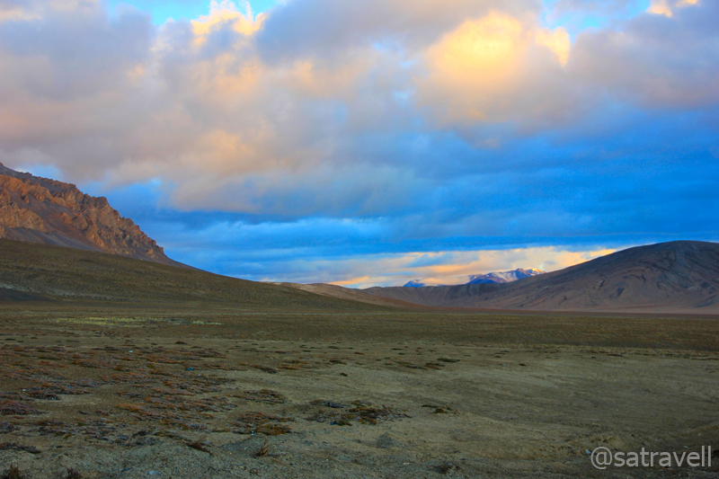
Daybreak at More Plains. For more pics, please visit bNomadic on Flickr
Spread between the slopes of Pang La (4800 m) and camping grounds by the Zara River at Debring, the uninhabited alluvial plateau is peppered with shrubbery often roamed by Larks, Ravens, Snow Pigeons, Kiangs and Marmots. Set at the western corner of the Changthang plateau, the Morei plains, part of the trading arteries of the ancient Silk Route, are frequently tramped by Changpa nomads. Others who venture in to the region include road workers (mostly from Bihar), road-construction engineers, trekkers, road-trippers, tourists and travellers. The drive through this stretch may seem monotonous but look for the nomadic settlements on this terrain.
Welcome to Moray Plains! Captured later by Sarabjit Lehal
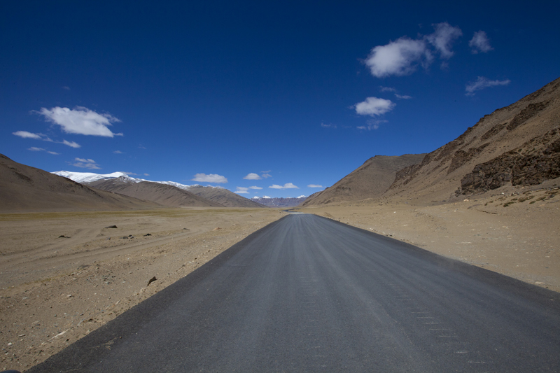
The freshly tarred Manali-Leh Highway through Moray Plains. Photo-credit Sarabjit Lehal
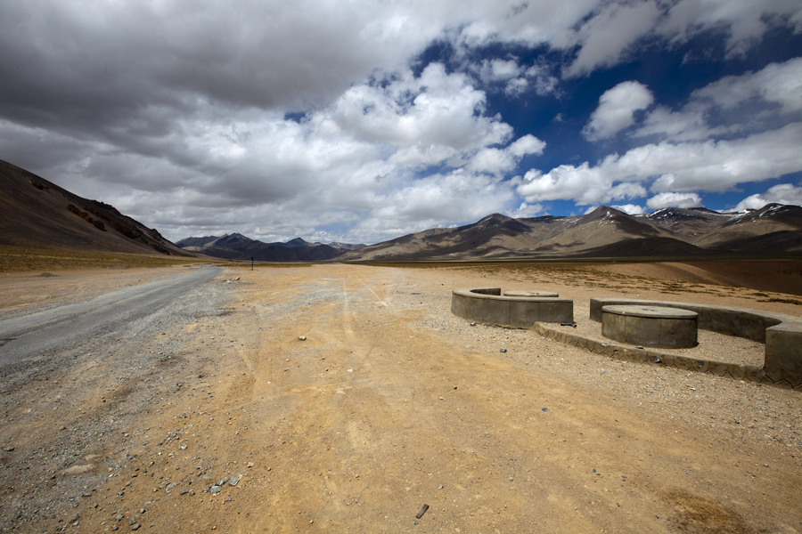
The encampments of PWD workers at Debring. The motorway to Tso Kar is to the left of the frame. Photo-credit: Sarabjit Lehal. For more pics of the region, please visit Flickr Photoset
The declaration of the region as a protected wildlife sanctuary (Rupshu) meant little human intervention and, therefore, rendered the Changpas totally homeless. Hailing from the Changthang plateau-region, the Changpas, along with their Yak-hair tents as well as Yaks are always on the move in search for greener pastures during summer. Raised in such a harsh climate, the goats of these nomads are well-known for their warm underbelly fur, also known as pashm, which is used in making the world-famous Pashmina wool or shawls, something which is often credited to Kashmir’s favour.

Final Climb, to the Tanlang La (visible in the frame), on the Manali-Leh begins. Photo-credit Sarabjit Lehal
Another rarity of the region is the critically endangered Chiru or Tibetan Antelope. Threatening the species’ survival, the antelope are killed for their fur which is woven to produce the luxury fabric Shahtoosh. Production of a fine shawl that could fetch up to USD 20,000 requires up to twenty skinned Chiru.

Spot the nomadic settlements as the climb begins. For more pics of the region, please visit Flickr Photoset
The aftereffect of the previous oxygen-less night was clearly showing. Still consuming water at regular short-intervals, we wanted to get down and reach a lower altitude at the earliest. In addition to that the cousin was feeling feverish. The very thought of last-night’s affairs gave us jitters.

The motorway to Tanglang La. Snow-capped Pk 5836m visible in the frame. Photo-credit Sarabjit Lehal

Moray Plains and snow-capped Zanskar Range from the slopes of Tanglang La. Photo-credit Sarabjit Lehal
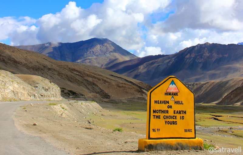
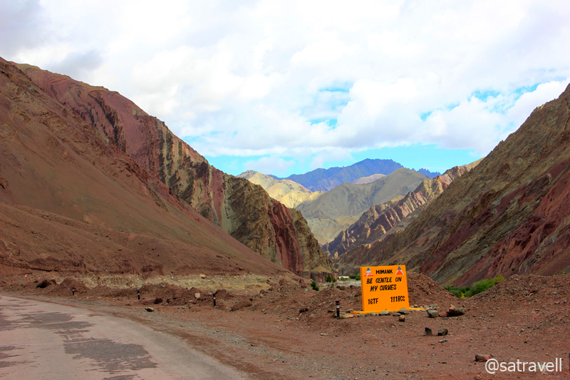
Ahead of Debring, the gradual ascent to the pass on a tarred road is dominated by a landscape encompassing Zara village, grassy pasture-like area, Debring stream, Zanskar range as well as the Tso Kar to the southeast. The road condition deteriorated as we neared the top. Ascending the bumpy road we crossed several hutments of road workers who were yet to start their morning chores. The Tanglang La (5328m) is marked by a BRO board that read, “You are passing through second highest pass of the world. Unbelievable is not it?” We would, however, dissect this claim later.
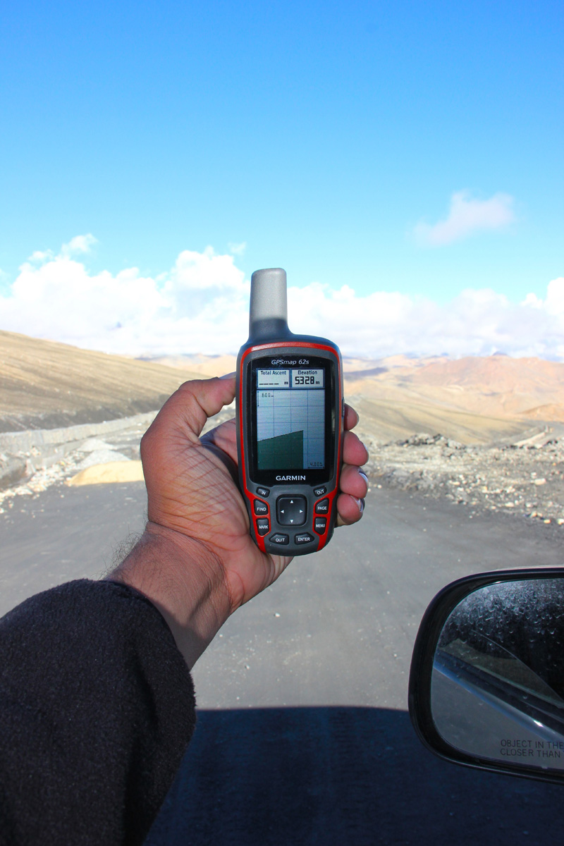
Atop the Tanglang La at 5328 m

Southwards view from Tanglang La comprising distantly visible Tso Kar. More from the region at Flickr
The weather at the summit often acts up but the views are fascinating. Northwards the splendid barren landscape of endless mountain ranges towards Karakoram rippling into distance was outstanding. Southwards the view encompassed the Morei plains edged by snow-capped mountains in the widening valley thronged by hundreds of sheep-flocks that appeared like tiny dots in a pastureland just below the pass.

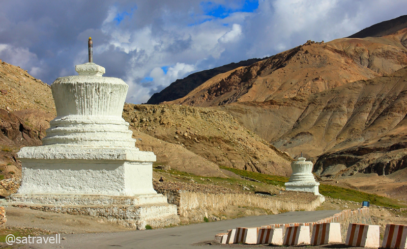
The crest of the pass is typically marked by a Chorten and fluttering prayer flags. Photo Sarabjit Lehal

Northwards landscape from the Pass. Please visit Flickr Photoset for more pics of the region
Although, we were now at an altitude far higher than Pang, the AMS symptoms had withered away. We spent about half an hour at the top capturing myriad perspectives the moment had to offer. I spotted one eagle-sized crow near the flagged roundabout and a closer inspection revealed its actual identity; a Northern Raven, earlier a subspecies of a Common Raven.
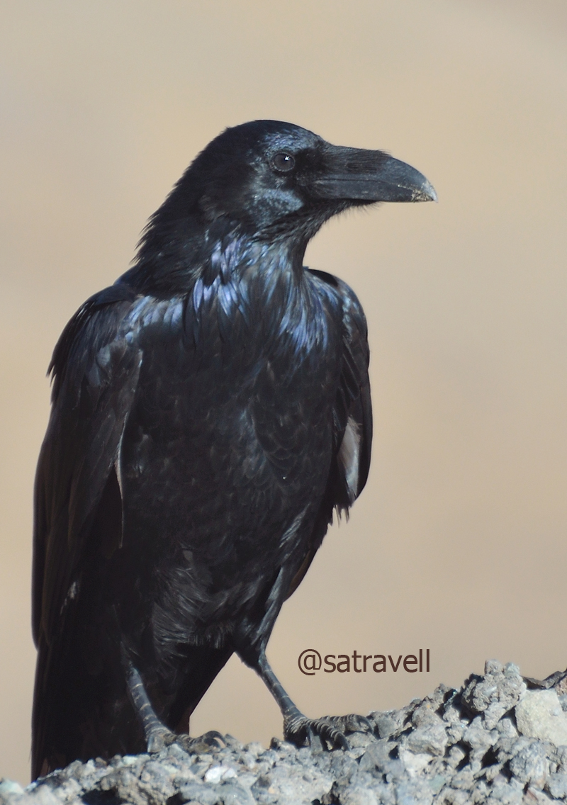
Locally called Phoro, a Northern Raven atop Tanglang La. More birds at Flickr Photoset
Approaching Rumtse. For more pics and info of the region, please visit Flickr Photoset
The descent to the other side of the pass in switchbacks was smooth as well as curvy. Offering the Manali-Leh menu outside the tents, the first settlement on this side of the pass was Rumtse (4230m). Past the Police Check Post, the road now narrows down and runs by the azure Gya River (formed after the confluence of Khyammar Lungpa and Ryam Lungpa a little before Rumtse), a tributary to the Indus River. Passing through the tiny white-washed villages of Sasoma (4172m) and Gya (4111m), we reached the small camping grounds, by the barley fields, of village Lato (4033m). On the way Polong Nakma, Kundanma Chu, Rabat and Shaglak streams join the Gya on its true left bank. Originally white-coloured, the ancient chortens in varied sizes dotted both sides of the road near villages.

The settlement of Rumtse. For more pics and info of the region, please visit Flickr Photoset
Between Sasoma and Gya. For more pics of the region, please visit Flickr Photoset
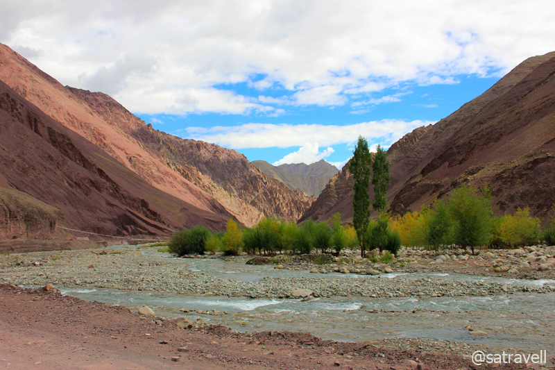
From Lato guesthouse the road constricts through a striking deep red-coloured as well as weather-beaten canyon battered with lots of captivating crannies and peaks beseeching to be explored. On the left bank of the blue Gya slicing the mountains, the narrow bumpy road passes through a terrain comprising various shades of greens and ready-to-be harvested barley. Passing through the village Miru (3720m), the road exits the multi-coloured gorge to reach village Upshi (3399m) located by the mighty Indus River at the junction of motorway to Tso Moriri as well as Leh.
An amusing BRO cautionary board in the red Gya Gorge ahead of Lato (or Late). More at Flickr Photoset
A colourful landscape in the intriguingly beautiful Gya Gorge. More pics of the region at Flickr Photoset

The settlement at the ancient village Upshi. For more pics of the region, please visit Flickr Photoset
Originating from the Lake Mansarovar, the 3180 km-long Indus River runs a course through the Ladakh, Gilgit, Baltistan and flows through Pakistan in a southerly direction to merge into the Arabian Sea near Karachi in Sindh. Positioned on its left bank is the roaming ground of the endangered Snow Leopard – Hemis National Park – the largest as well as highest national park of India.

The mighty Indus River near Upshi. More of the region at Flickr Photoset
Past the bridge, the road rises and falls along the right bank of the Indus to reach village Karu (3450m), primarily a military settlement now. At a roundabout after the military station, the right one goes to the Taktok Gompa, Wari La as well as Pangong Tso and the straight towards Leh. We took the left one to cross the Indus and climb up to the Hemis Monastery (3778m) located at a distance of seven km from the bridge.
View and read more on the region at the Ladakh Region on Flickr
You may also like to subscribe to the email updates, of the remaining chapters, by entering your email id in the sidebar.


Pingback: On Road through the trans-Himalayan Region | bNomadic
Nice post, great set of pictures.
Thanks Ajeeth for visiting my page and appreciating the efforts. Hope you’d want to visit again.
I always love to read your travel post with gripping account enriched with captivating shots. The added thrill is that I feel as if I am also part of the journey.
Thanks maverick for being a constant source of encouragement. I am glad you liked the post. Hope you’d want to visit again.
you know … i am always blown away with your photography … reason being i am a amatuer photographer myself for 2 weeks now … and i can understand the perspective and details you put in all those photos man !! how i would love to train myself to be as good as you one day .. lolzz .. do give me some blueprint on your photography bro !!
Hehe. Thanks for showering with appreciation and encouragement. I am just a beginner and have a strong desire to learn photography like you possess. Let us both join hands and learn the basics of this skill. Looking forward to travelling with you. Hope you’d want to visit the blog again.
so madly I am longing to be here and this inflation crap .. .. cant save for travels !! serene photographs !! Godly !! I say .
I am glad the post has motivated you to travel to this part of the world. You dont need too much of resources to travel. Just a will. I soon plan to hitchhike and travel on this terrain again. Lets join hands. Thanks for showering with appreciation and encouragement.
hmm sounds like a nice initiative !! I will get back to you surely on this … I have your email id … I think going along with an experience traveler would be a nice idea .thanks for the offer brother.
Anytime Sir. We do not travel destinations but company.
Your daybreak picture is truly smashing.
Thanks Mridula for visiting and appreciating the frame. I am glad you visited my blog and hope you’d want to visit the page in future as well.
What stunning pictures! Can’t believe I still haven’t been to Ladakh yet.
Thanks Shivya for visiting my blog and for the appreciation. You should definitely plan a visit to this part soon. Hope you’d find the contents of the page useful and would want to visit the blog again.
Amazing pictures you got here. You surely did a marvelous job of capturing the beauty of Ladakh through your camera. Keep them flowing 🙂
Thanks Swati for visiting my blog and showering with appreciation. Hope you’d continue to encourage me by visiting the page in future as well.
Wow, beautiful pictures of the silence landscapes. nice informative article, written well.
Thanks admin for the feedback and visiting my blog. Hope you’d find the content useful and would want to visit again.
Ok, but also you’re most welcome.
Beautiful pics as usual!!! Mind blowing!!! 🙂
Bhusha’s INDIA TRAVELOGUE
Thanks mitrfriend for showering with appreciation. Hope you’d want to visit again.
beautiful pics! brilliant feat…my salutes sir 🙂
Thanks boss for showering with appreciation. Hope you’d continue to visit my blog and find it useful.
your hope shall not be in vain as long as ypu keep posting such amazing pics & travel notes 😉
Thanks. 🙂
Pingback: Jullay! Junction of ancient highroads | bNomadic
Pingback: The longest night | bNomadic