 bNomadic
The following post is a part of the “Kailash Mansarovar Yatra” Blog Series Into the Sacred Space. To read complete travel memoirs and trip report, please visit here.
Next morning, I hastily packed my stuff before moving out of the room to join the rest of the gang to board the bus for next leg of the journey. I had missed the morning meal. Mercifully, the nuts and energy bars I carried came to my rescue. As the engine of the bus cranked to life, I began to munch the nuts. Our day’s drive involved highland travel of over 475 km to cover the distance between Lhatse and Zhongba (4728m) through the truly nomadic countryside of Tibet.

Within an hour of leaving Lhatse, we passed by the azure blue Lang Tso (or Ox Lake), a bone of contention between the natives and the Chinese because of difference in views over sport fishing being popularised by the authorities. Please visit Flickr for more images of the region

The reflection of such solitary landscapes has been etched forever on the mind. More at Flickr
The 4500m Ngamring La. Please visit more images from the region at Flickr

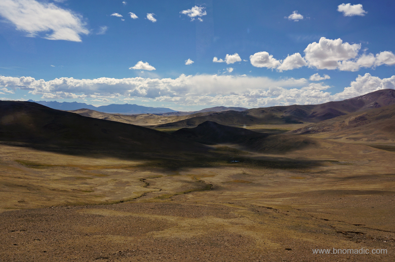
View from the Ngamring Pass. Please visit Flickr Photoset for more images of the region.
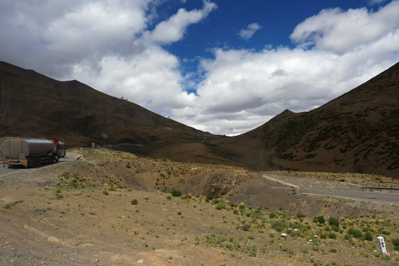
To our utter curiosity, for our journey ahead, we were to travel on the China National Highway 219 (G219), the contentious thread of asphalt from Lhatse in the Tibet Autonomous Region (TAR) to Yecheng in the Xinjiang Uyghur Autonomous Region; both claimed by the People’s Republic of China. It was this 2086 km of highland motorway – running not only adjacent to the Indian Territory but passing through the Aksai Chin area of Ladakh – the construction of which along with some other factors triggered the Indo-China war of 1962. Considered to be one of the highest motorable highways in the world, the G219 traverses many extended valleys most of which are often flat providing a habitable camping ground to nomadic settlements along with their herd.

Descending from the Kar La on the G219. Please visit Flickr for more images of the region
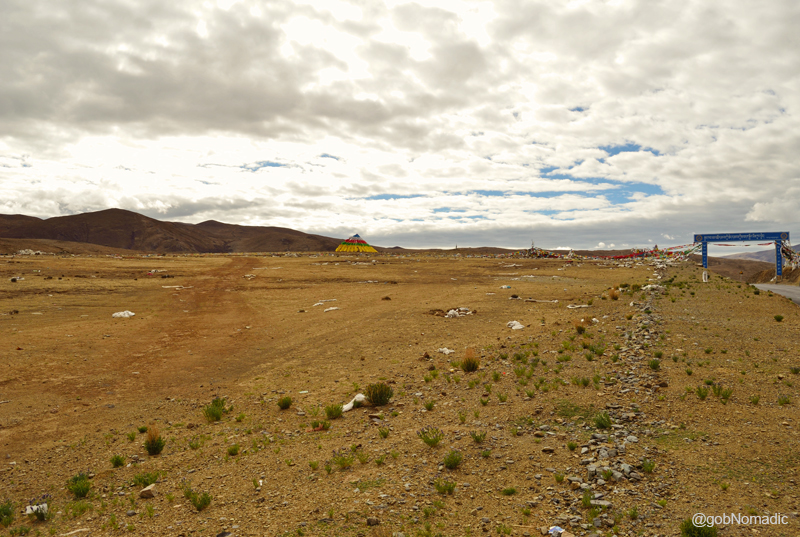
The single street township of Sangsang at 4676m asl. More images from the region at Flickr
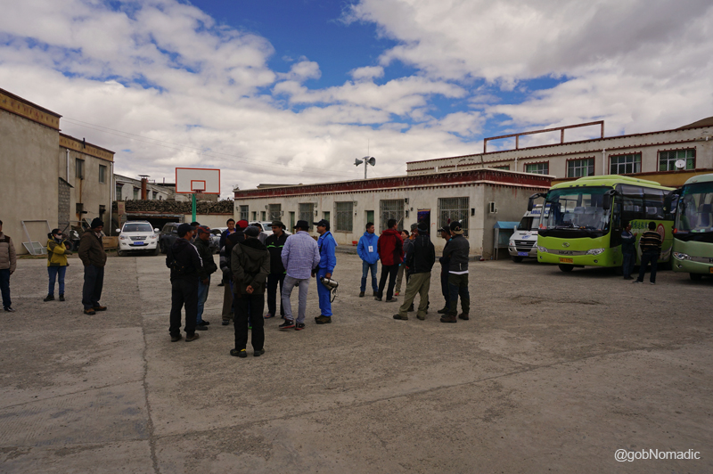
A short break at Sangsang. You may like to visit Flickr for more images of the region

A common sight on the streets, this “jugaad”makes use of solar energy to cook. Photo by Dennis Jarvis
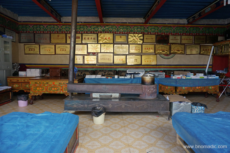
Inside the infirmary at Sangsang. Please visit Flickr Photoset for more images of the region
The chief highlight of the day’s drive was a tête-à-tête with the 2,840 km long voluminous Yarlung Tsangpo River which has its origin in the holy Kailash region where we were heading with all our enthusiasm. In the years gone by a great debate as well as a few controversies raged about the actual source of the river along with its course down to Indian mainland. With the technical advancements and much interest, however, the source and the journey were traced to accuracy; still the gorge of the highest river in the world continues to be an intriguing exploration prize. Originating from the Angsi Glacier southeast of the Kailash Mansarovar region, the Tsangpo or Brahmaputra (in India) flows past the settlements of Zhongba, Saga, Lhatse and Shigatse. The G219, however, does not follow the Tsangpo (also called Zangbo) for a larger part of the route; instead it parallelly meanders through its side valley and tributaries. As with the altering course of the river, the road network too is course-corrected as more easily passable stretches are discovered.

A small settlement on a greenish patch. More images from the region and yatra at Flickr Photoset
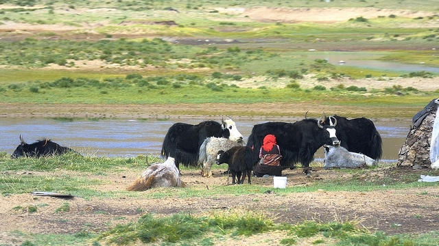
A typical scene by a nomadic settlement. Photo by Jen Reurink

Dogxung Tsangpo, a tributary of Yarlung Tsangpo. More images from the region at Flickr Photoset
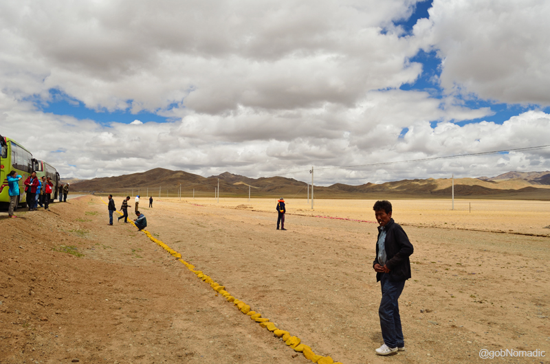
The turn-off to the Kailash Mansarovar region is a few kilometres south of Lhatse; marked by a check post where Aliens’ Travel Permit along with visa and passports are verified. While collecting our passports, the guide reiterated, “no photography, please” as the bus halted briefly. A few kilometres ahead, our nomadic caravan stopped again to tank up. The fuel pumps were located at most major townships we came across during our journey. The first section of the G219 to Saga (310km) passes through a pleasant country with occasional scattered settlements and frequent camping spots wherever water is plentiful. The highway G219 takes off from the Friendship Highway a little ahead of the check post and bears northwest direction afterwards. Ahead the highway crosses the Yarlung Tsangpo and runs through barren canyons and sporadic meadowland with scattered nomadic settlements or small villages. Within an hour of leaving the hotel at Lhatse, we passed by the photogenic azure blue Lang Tso (or Ox Lake), a bone of contention between the natives and the Chinese because of difference in views over sport fishing being popularised by the authorities. Past the lake, the highway climbs up to the crest of the Ngamring La (4500m), our first of the seven passes we climbed on the route that day. Our caravan briefly halted at the pass. In complete awe of the view, I got down from the bus. The morning chill had hided even the insects; besides us there was no trace of any living thing, animal or vegetable.
The chocolatey barren terrain was mesmeric to the core. All life doubts began to fade and all fears reshaped; before us stretched immortality and purification in the form of an act of nature, a revelation of the world as God sees it. For a moment I forgot I was carrying a camera. As far as our eyes could see, gleaming in the morning sun; rippled the rounded mud-frozen waves of the trans-Himalayan region of Tibet. Range after range, furrow upon furrow, stretched the brown hills so clear-cut and distinct from each other. I hurriedly made a few photo records before getting on the bus. The reflection of this stern, sombre and solitary scene was etched forever on the mind.
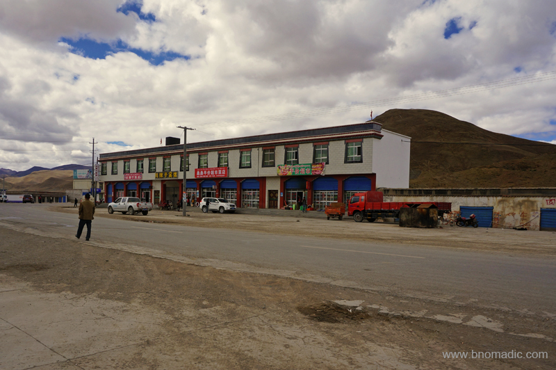
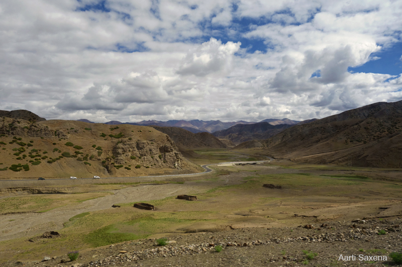
The road ahead passes through Kaga, by the muddy Ngamring Tso; after which the already limited traces of organised vegetation becomes totally rare. The settlement of Ngamring, an army base, is visible across the lake from the highway. With the last traces of trees now passed, the road enters a flood-ridden flat surrounded by broken rusty hills of brown purple hues climbing on each other and contented with having touched the skies. Passing through Yak country and interspersed with nomadic settlements, the road climbs two more passes – the Sang La (4742m) and the 4800m Kar La – before dropping down to Sangsang. Over the past few years, the Chinese have appreciably improved the road infrastructure. Without going into the harm such a one-sided lipstick development would have caused to the locals, I would say that the roadside facilities too improved alongside. Fuel pumps, ATMs, banks, small eateries and restaurants have sprung up by the highway at popular townships. Even though, almost nobody understands English, locals are more welcoming to foreigners than ever.
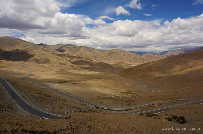
Climbing the Tse La (visible in the frame). More images from the journey at Flickr Photoset
View on the other side of Tse La. Photo Credit: Aarti Saxena. More images at Flickr
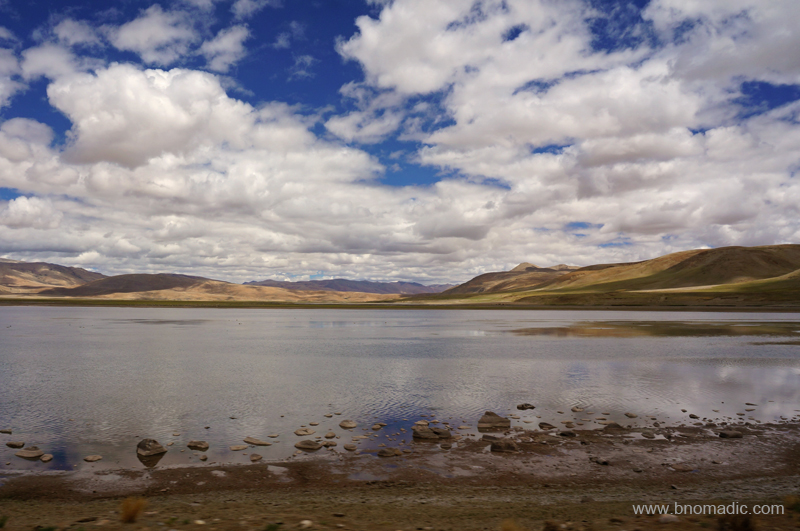
The Gongdou Co. Please visit Flickr Photoset for more images of the region
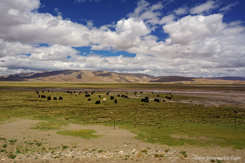
The highway passed through a prime wild yak country. More images from the region at Flickr Photoset
A short break near Gyedo by the G219 highway. More images from the region at Flickr Photoset
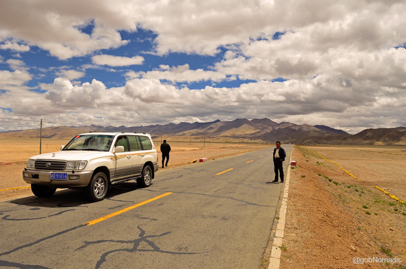
Near Gyedo between Tse La and Gye La. More images from the region at Flickr Photoset
The highway crosses scenic wide alleys to enter a gorge of Dogxung Tsangpo flanked by dark craggy rocks. Emerging from the spectacular ravines, the road skirts Quzhen Tso to enter the flood plains of the Raka Tsangpo. The route then climbs Tse La and Gye La (4954m) before dropping down again to reach the small settlement of Raka (4900m), just before the junction of Northern and Southern routes. The settlement of Saga, by the Yarlung Tsangpo, is another 60 km from this popular junction. Until recently, the circuitous Northern route (1942km from Lhatse) used to be the preferred alternative over the much shorter Southern route (1219 km from Lhatse) to reach the Kailash during floods. The recent upgradation of road infrastructure on the Southern route has effectively put an end to the Northern vs Southern route dilemma as the latter one could now be travelled any season except for snows. We obviously took the shorter one where usually a stream flows alongside; so most sections of the road are not too far from water. A slightly raised level of the paved road ensures trouble-free movement of traffic. The road to Saga now passes through a stretch that is really a series of high valleys and ridges rather than an open plain. Purple, brown and amber rocks flamed against the darkened velvet curtain of the sky. And what a wildlife full countryside it turned out to be where I spotted a lot of birds of prey, marmots, blue sheep, wild asses and antelopes, etcetera.

View from the Gye La. You may like to visit Flickr Photoset for more images of the region
View from a pass, before Saga, marked 4894m. Visit Flickr for more images of the region

Six-thousanders stretching above a barren highland. More images from the region at Flickr
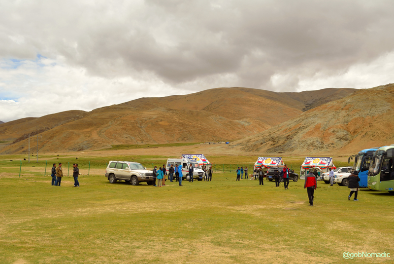
Lunch campsite by the highway G219 before Kyakyaru (Saga). More images from the region at Flickr
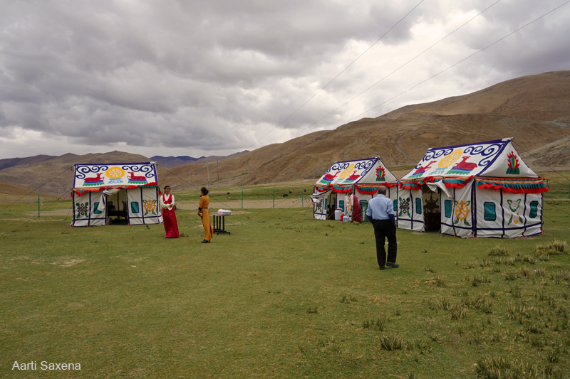
Another one from the lunch campsite. Photo by Aarti Saxena. More images from the region at Flickr
Saga Chakzam Bridge. Please visit Flickr Photoset for more images of the region
The road from Lhatse enters the fast expanding township of Saga from its south and leaves it off from north towards Zhongba. With a fairly large army base, the sprawling township of Saga, a junction of roads from Nepal, Zhangmu, Lhatse and Kailash, is possibly the last practical chance to buy supplies before Darchen. With almost 150 km still remaining to reach Zhongba, the highway passes through a wild countryside inhabited by infrequent seminomadic settlements where flooding is a frequent natural event. The climb to another pass (Torkyo La) begins soon after leaving Saga. There are several ruined structures and monasteries, including the slightly preserved Dargyeling Monastery, alongside this route. The road ahead climbs to a pass marked by hundreds of miniature chortens before dropping to reach Old Zhongba, still 23 km away.
An olden monastery in ruins. Please visit Flickr Photoset for more images of the region

A short break before climbing the Torkyo La. More images from the region at Flickr Photoset

Yours truly!

Wildflowers among boulders. Please visit Flickr Photoset for more images from the journey

Climbing the Torkyo La. Please visit Flickr Photoset for more images of the region

The Torkyo La. Notice the prayer flags, small rock cairns and the solar setup for mobile phone connectivity. A major part of the entire road travel was connected with mobile; roaming for Indian consumers was very costly.
View on the other side of the Torkyo La. More images from the region at Flickr Photoset
The rehabilitated settlement of Zhongba, musingly called New Zhongba, is still a few kilometres northwest from the olden Zhongba that bears the brunt of Cultural Revolution. Save for traditional entrance kani and a few compound huts meant for road workers, there isn’t much in the dusty olden settlement; not that the newer settlement has anything better to offer. Situated on the edge of the vast Thang Kiang Naga, or plain of the wild donkey and grass, New Zhongba is a typical settlement that you might simply just want to pass by. However, we were comfortably arranged in a renovated monastery-turned-guesthouse compound where the already basic facilities became even further basic.
The accommodation at Zhongba had excellent dining hall, comfortable rooms with clean sheets and a TV that only played Chinese channels. It was the lack of availability of hot water, limited supply of normal water and the squat variety Tibetan toilets, figuratively just a deep hole in the ground, which bothered most yatris. The dinner was typically preceded by a briefing from the head guide. By now almost all group members had decided to opt for pony and porter for the Kailash kora. The head guide accordingly proceeded to make the required arrangements. Outside in the compound, the starry nightscape allowed a view in to the depth of the universe. The bright stars looked so near as if they were part of the landscape. The universe was no more a mere abstraction but a matter of direct experience.

By the Yarlung Tsangpo Chu in Tibet, called Brahmaputra River in India. Photo by Jen Reurink

Inside our room at Zhongba. Please visit Flickr Photoset for more images of the region

The compound of the Zhongba accommodation center. More images at Flickr Photoset


Pingback: Getting Shepherded through Tibet | bNomadic
Pingback: Into the Sacred Space | bNomadic
awesomeness
Thanks! Visit more often 🙂
Badlon ke paar shayad aur koi aasma hoga ..
Loved this post. Great photographs. Have you tried experimenting in monochrome? Keep sharing.
Indeed! In fact, pahadon ke baad bhi pahad and asmaan…Keep visiting bNomadic 🙂
Great to see additional ‘exceptional’ spots here…you are so lucky to have taken this journey!
Absolutely! Luck was on my side indeed. Keep visiting bNomadic for more such travel stories 🙂
Great pics.
Thanks. Keep visiting bNomadic for more such travel stories 🙂
What should i say about it…Again and again you are creating such a nice post on this blog…bNomadic you are really a good post designer… Classical pics
Thanks. Keep visiting bNomadic for more such travel stories 🙂
Great tour by you.
Thank you for sharing these gorgeous scenes.
The flowers surprised me.
Thanks Indrani for stopping by the blog. Glad you liked it and the flowers. Keep visiting bNomadic for more such travel stories 🙂
Wow.. Amazing clicks
Thanks. Keep visiting bNomadic for more such travel stories 🙂
Great shots.. !
Thanks! Visit bNomadic more often 🙂
Too many good photos ,this seems interesting place. I hope everyone here also uses that solar wala jugaad
Hehe Yes! Not popular though I am sure such a jugaad would exist somewhere here as well. Thanks for the feedback. Visit more often 🙂
Heavenly photos! Too good.
Thanks for stopping by the blog Leena. And for showering it with appreciation. Keep visiting bNomadic for more such travel stories 🙂
Pingback: Traversing the Barkha Plains | bNomadic
Great pictures
Thanks! Visit bNomadic more often:-)
Interesting write up.
Thanks for the feedback. Keep visiting bNomadic for more such travel stories 🙂
Thanks for all the pictures. I will never make it there on Highway 219 but looking at the pictures makes me feel young.
Thanks for dropping by the blog Marie. I am glad you liked the post and found the pictures informative. Keep visiting bNomadic 🙂