 bNomadic
The following post is a part of the “Kailash Mansarovar Yatra” Blog Series Into the Sacred Space. To read complete travel memoirs and trip report, please visit here.
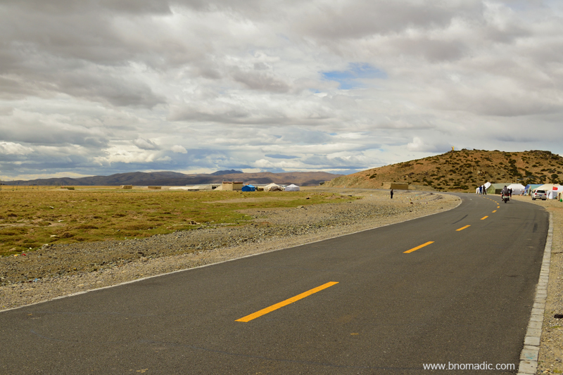
As per our itinerary, our day’s destination – Darchen, an emerging village at the base of the holy Kailash – was 477km away from Zhongba. The road ahead after Zhongba seemed recently carpeted. Till about a few years ago, the stretch of the road immediately after the town used to be frequently invaded by sand dunes on either side of the road. However, with new road we did not face any problem. Within an hour of leaving Zhongba, we passed through a picture-perfect terrain of dunes, river and mountains. The first pass we crested after leaving Zhongba was 4650m Mayum La. Ahead, the road climbs another pass at 4725m and descends through even more dunes to reach Paryang. Photos taken along this stretch got us steppe, streams, desert dunes, azure blue sky and snow-capped mountains all in the same frame.

Photos taken along this stretch got us steppe, streams, sand dunes and snowy mountains all in the same frame; waters of Dangquezangbu visible in the frame. Photo by Aarti Saxena

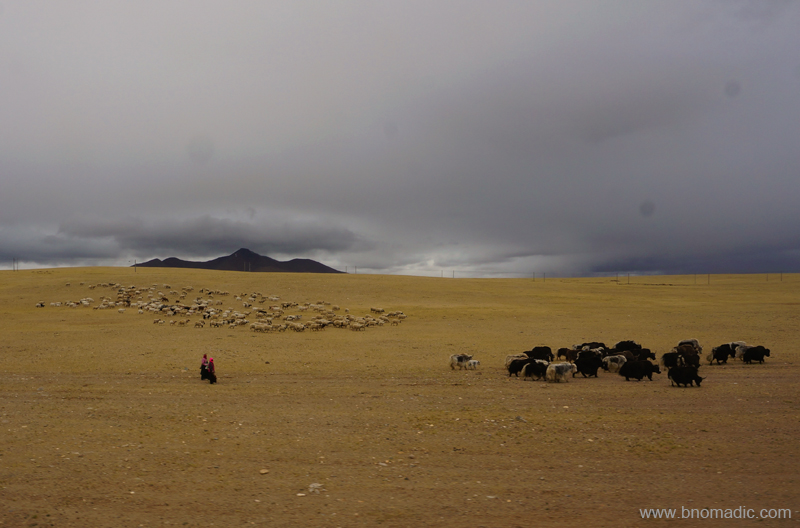
Grazing grounds for Yaks in the Yarlung Tsangpo watershed near Zhongba. Photo by Jen Reurink
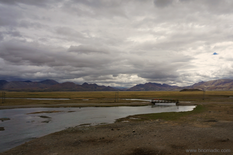
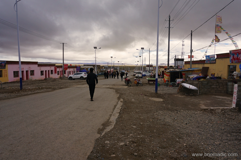
For those travelling in the Kailash Mansarovar circuit, Paryang has always been a popular stoppage point. The main settlement of Paryang, last one on way to the Kailash Mansarovar region, is not more than a typical Tibetan village we had been crossing on the way so far. The dusty village of Paryang is typically spread around a gompa. A majority of the residents comprise migrant nomads from neighbouring villages or labourers on engagement. Among the many houses are a few shops and some family homes that can double up as restaurants. The layout and description of the village, nevertheless, is expected to change in the coming years. Mostly led by the administration, a fairly large number of buildings, cells and compounds were being constructed. I was particularly intrigued by the construction of a massive granary as our fleet of vehicles briefly halted to get fuelled up for the journey ahead.

The marshes of Paryang (also called Baryang or Payangzhen). Photo by Aarti Saxena

The Laiwu Zangbo, a tributary of Yarlung Tsangpo. Please visit Flickr Photoset for more images
With last traces of organised human life now behind us, we marched ahead in full excitement of finally being able to touch and feel the Sacred Space. Marching in the northern side of the Great Himalayan Range in a westerly direction, we descended into a level valley twenty to thirty kilometre wide. At our left we had the icy peaks with tonguing glaciers and another mighty range of the trans-Himalayan region towards the right; with sand dunes and turquoise water bodies on both sides of the highway. Finally we had reached the crown territory of the Tibetan highlands. I mused in awe as we crossed the routes taken, a few decades back, by some of the greatest travellers or explorers on earth.

The marshes of Laiwu Tsangpo. More images from the region at Flickr Photoset
The Dangque Tsangpo. More images from the region at Flickr

Endless expanse of high-altitude terrain; a common sight
Here in this thin and clean air the rounded mountains were adorned in pure changing colours obliterated only by the intensity or angle of light; often at the mercy of the onrushing storms with their impenetrable masses of cloud in this season. On high peaks and ridges the permanent snow expanded in silvery white and in the depressions, on the valley bed, water bodies glittered like turquoises in a vast sea of mud and gravel. In such a calm splendid environment one would experience the same harmony with inner spirit as in entering the holy of holies area in a temple.
It is not as if living creatures are entirely non-existent on this naked, sterile, desolate wilderness of mud and rock. Contrary to the popular belief, a wild life corresponding to the grandeur of the landscape thrives and flourishes here. The scant, stiff and short grass iced by almost fictional shrubbery that grows here on the valley floor may have never contained sufficient nutrients for the caravan animals but for antelopes, wild sheep or wild asses, called kiangs; it appears to meet the need. Wild yaks sustain themselves on the mosses and lichens on the mountain slopes and among the moraines. Given an option I would impulsively follow the wildlife through my camera and record their nimble elastic leaps and rapid flights as they roamed on the mountain slopes in their habitat. But for the structure of the itinerary of this organised yatra!
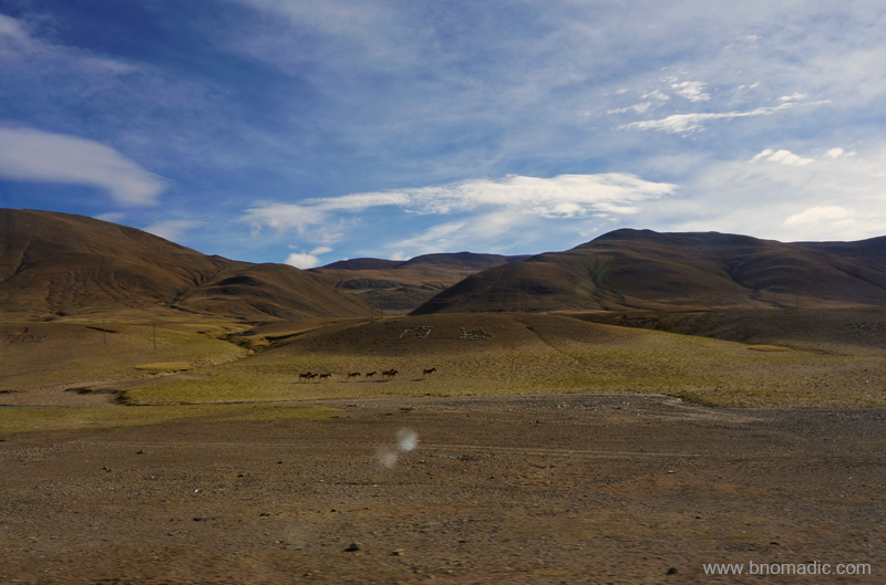
The second of the numerous herds of Wild Asses we came across in Tibet. More at Flickr
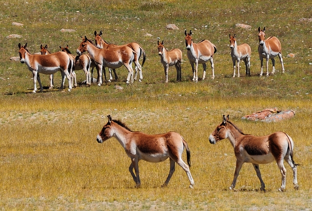
A herd of wild asses, called Kiangs. Photo by Jen Reurink
We stopped for camp lunch by the highway, near Satsang, after a couple of hours drive from Paryang. Our cooking team had hesitatingly prepared poori aloo subzi for packed lunch. I had a hearty meal after which I made a few snap records of the marshy highland around our campsite. The route ahead passes through a yellow steppe zone. Wherever the weather was clear the craggy snow-capped Himalayan peaks were visible to the south. Soon we were encircled by red rocky barrenness in a valley full of icy streams. Winter ice by the streams was yet to melt completely. As if out of nowhere, a check post, manned by Chinese police and excise officials, emerged where our documents were once again checked and verified. The inspector in-charge specifically announced, “No photography is allowed”. “Please”, he added later. Suddenly everyone inside the bus was staring at me. I decided to give my camera some rest.
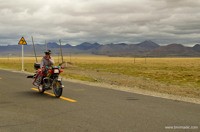
Forever adventurous, truly nomadic. More images from the region at Flickr Photoset

The G219 near Satsang in Tibet. Please visit Flickr Photoset for more images of the region or yatra

Our lunch campsite for the day near Satsang. More images at Flickr Photoset

Lunching inside the bus. More images from the yatra at Flickr Photoset
The G219 near our lunch campsite. More images from the yatra at Flickr Photoset
Soon afterwards, we begun the climb to the 5280m Mayum La, made famous by the legendary explorers and travellers. After Mayum La, the road widens a bit as we crossed the Shigatse prefecture to enter the Ngari prefecture. A rather long turquoise lake called Gung Gyu Tso comes into view to the left. A few of the passengers confused it with the Rakshastal. I was particularly focused on to find the holy rocky height of the Kailash in a total overcast weather. The blueness of the magical Mansarovar comes into view just before the village of Hor Qu (4620m). Robbed off its traditional charm; the village of Hor Qu wore a deserted look. A Chinese army encampment was installed at the village when we entered. The 7728m Gurla Mandhata is to the southwest and the lake was still actually a long hike away. Our convoy briefly halted at the newly constructed tourist reception centre at Hor Qu. I immediately got down from the bus to catch a glimpse of the Manasarovar (4580m). I felt the bone chilling fiercest of winds, the Kailash Mansarovar region has been famous for. Only a near view of the lake was possible in such a bad weather.

Icy stream before Mayum La. Please visit Flickr for more images of the region
Below the Mayum La; towards the Ngari side. More images from the region at Flickr Photoset

The long Gung Gyu Tso after Mayum La and before Hor Qu. Please visit Flickr for more images
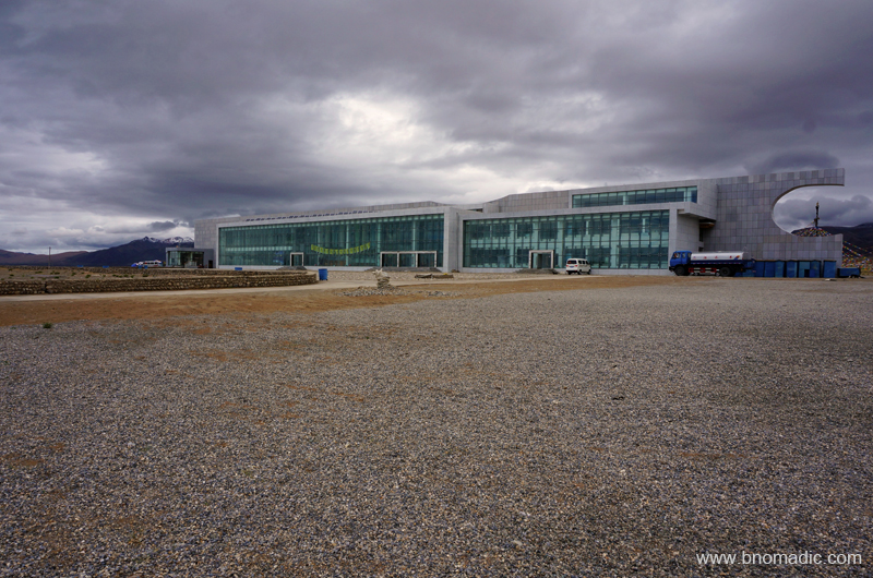
The newly built Tourist Reception Centre by the Mansarovar in Tibet. More images at Flickr
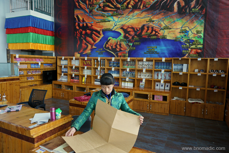
Inside the complex; apart from a cafe, it had a information-shopping centre as well. More at Flickr

Statue of a policeman guarding the streets of village Hor in Tibet. Photo by Aarti Saxena
From here, it was mandatory for all group travellers to proceed further to Darchen in the buses specifically allocated for the purpose. Still, in view of the bad weather, the authorities at the reception kindly agreed for us to travel in our own fleet of vehicles. Ahead, it is 22km to the crossroads of the settlement of Barkha (or Barga) after which we continued west to reach Darchen. Unlike what I had read about this key junction from the diaries of the travellers, Barkha is an emerging touristy village from all aspects. Many shops selling basic needs and supplies, small restaurants, etc. have sprung up alongside the streets of this village square. Our convoy cruised and quickly made its way to the settlement of Darchen, where our permits were once again verified. This time we all were handed a packaged mineral water bottle along with a group entry ticket. “The water inside this bottle is sourced from the Kailash,” we were told. I consumed its contents in one gulp and packed the bottle inside my backpack. By now the weather had improved a bit to the south and we could see right up to the snowy heights of the Gurla Mandhata above the azure waters of Rakshastal. The guesthouse, our shelter for the night, was still a few kilometres away from this checkpoint.
View towards the Barkha plains from Darchen square. More images from the region at Flickr
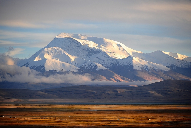
The Gurla Mandhata above Rakshastal and Barkha plains; as viewed from Darchen. Photo by Jen Reurink
View towards the Kailash. Please visit Flickr Photoset for more images of the region/ yatra

Billiards and snooker have become an addiction in Tibet, especially the southwest part. More at Flickr
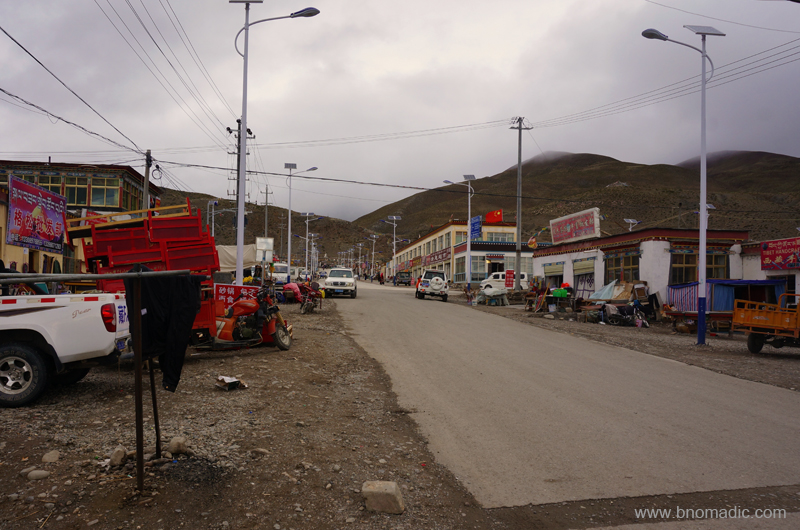
As I recall the accounts of travellers I have been following, calling Darchen (4580m) even a settlement would have been an exaggeration till about a decade ago. That will be so untrue now. From just a seasonal ramshackle collection of tents and camps, Darchen (or Taqin or Lhara) has expanded into a two street settlement comprising houses, a few multi-storeyed buildings, guesthouses, grocery stores, restaurants and hot-shower cafes, etcetera. Having arranged my stuff into the room allocated to me, I went for a stroll in the market. Bargaining is very much a possibility and I bought an aluminium walking stick, at a reasonable price, for the kora trek the next day.
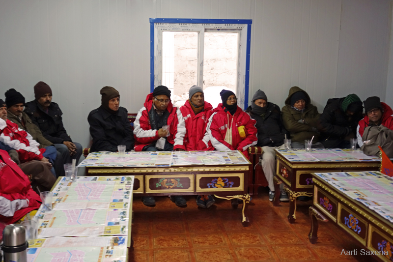
Yatris during the evening briefing at Darchen. Photo by Aarti Saxena

Portrait of an old man. Photo by Rita Willaert

Local kids at Darchen. Photo by Aarti Saxena
I wish we had a couple of more days to spend at Darchen, the starting point of the Kailash kora. Apart from a better acclimatisation, the place offers many interesting short hikes and walks from where even finer and closer views of both the Kailash and the Mansarovar could be obtained. Dense clouds drew over the Barkha plains blocking our view towards the lakes. The wind did not abate until late in the night. I headed back to the guesthouse for yet another briefing session. This time we were joined by the MP Sh Tarun Vijay. Darkness had fallen over the earth. I continued with my strict regimen of extra liquid intake; and headed to the room for an early light out after dinner. Bhatol bhai had uncurtained the window before sleeping. The weather looked dicey outside. Blue-white lightning flashed in the south as the moon rose over the mountains. Far in the distance, Gurla Mandhata rose like a spectre in white sheets. I thought of Longstaff’s unsuccessful attempt to climb the peak more than a century ago. The peak has so far been climbed more than six times since then.

The cell allotted to the two of us at Darchen; Bhatol bhai sorting out his backpack for the kora


Pingback: By the Yarlung Tsangpo Chu in Tibet | bNomadic
Pingback: Into the Sacred Space | bNomadic
Wow! I am so jealous – what an amazing experience. I have been to some interesting places but this is a fantastic travel blog. Superb photographs, too. I often write about tiny places in Texas that will bring you right down to earth. 🙂
Thanks for dropping by the blog Kerry! and showering it with appreciation and feedback. Keep visiting bNomadic for more such travel stories 🙂
Loved the pictures and the write up…my favorite is the kids photo 🙂
Thanks Shweta for stopping by the blog and for the feedback. Visit bNomadic more often 🙂
what outstanding pictures… especially loved the landscape ones 🙂
Thanks Archana! Keep visiting bNomadic for more such travel stories 🙂
Awesome post
Thanks 🙂 Keep visiting bNomadic
Stunning Pictures! and a great post.. Thanks for sharing!
Thanks for showering the blog with appreciation. Keep visiting bNomadic 🙂
Beautiful photos feel like I’m there
Thanks:-) Keep visiting bNomadic for more such travel stories
Beautifully Informative and entertaining post! Thanks for this. 🙂
Thanks for stopping by the blog. And for the feedback. Visit bNomadic more often 🙂
bNomadic!! Classic and lovely pics again and again, you are really a superb traveller who love to share experience with us…
Thanks admin 🙂 Keep visiting bNomadic
Photo “The Gurla Mandhata” is amazing. Enjoy.
Thanks for stopping by the blog. That image is by Jen Reurink (link provided in the caption). Keep visiting bNomadic for more travel stories 🙂
Sorry for late comment. Had read the post when you posted. Superb as a always. Way to go.
Hey thanks Tikuli! Next one soon 🙂
Oops is the last one, when can we expect the next dose : )
🙂 Its there! Visit bNomadic more often
Pingback: The Kailash and the Yam Dwar | bNomadic