 bNomadic
The following post is a part of the “Kailash Mansarovar Yatra” Blog Series Into the Sacred Space. To read complete travel memoirs and trip report, please visit here.
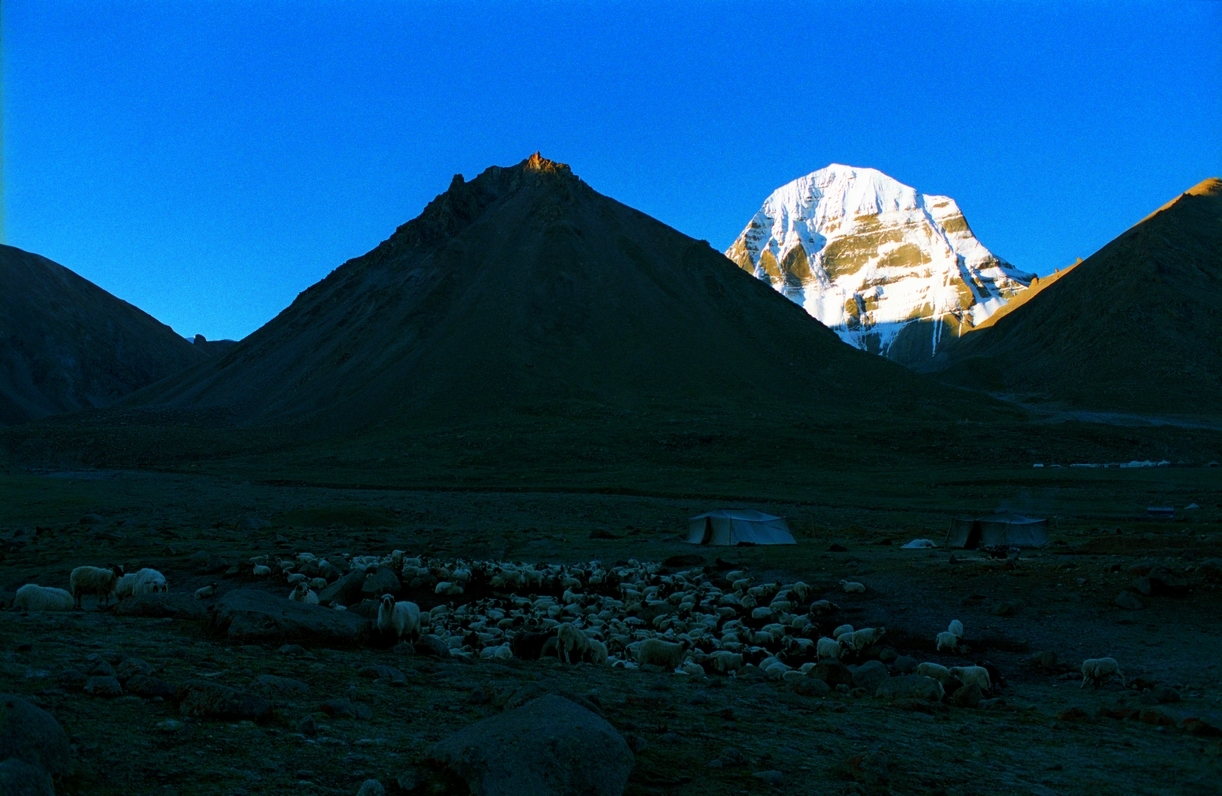
Next morning I got ready for the day earlier than usual and rushed to the street from where an unobstructed view towards the Barkha could be obtained. Out there a cloudy dawn splattered the trans-Himalayan landscape with gold and purple hues. By now, mind was quite used to seeing the Himalayas to the south. With the massive block of tilted snowy rock of Gurla Mandhata (7,694m) rising unchallenged from the plains, the mountains and glaciers of Zaskar range that feed the twin lakes were partially visible. The quiet of the terrain devoid of any vegetation was cracked only by the ruffles of the prayer flags in a relatively low intensity wind. Everything stood frozen except for the dark grey clouds. The golden light quickly faded into nothingness once the moisture laden clouds took over the sky.

The glittering whale-backed snowy rock of Gurla Mandhata (7694m) as observed from Darchen street. The peak has been climbed many a time since the first unsuccessful attempt by TG Longstaff in 1905. Please visit Flickr Photoset for more images of the region and yatra
The Kora around Mount Kailash starts and finishes at Darchen only. Following a heavy morning meal, we packed up our trekking gear and left for the Yam Dwar at Tarboche (4730m); modern day start of the trek. Owing to altitude sickness and other ailments, three of the group members decided to stay behind in Darchen and give the parikrama attempt a miss. Our guide briefed us that the medical facilities throughout the route, including that at Darchen, are next to nothing even as more than a dozen Indian pilgrims are reported to die on the Kora every year. The most effective treatment for altitude sickness is to immediately take the patient down as many feet as possible. The issue here is that there is just no place to escape in this endlessly vast high altitude territory. Even the nearest airlift facilities are located at more than five days journey from Darchen.

Tarboche, flagpole with prayer flags, is the modern day start of the Kora. More images at Flickr

The head porter and Guru (our guide) engaged in a lottery draw. Photo by Aarti Saxena

A stone artist mechanically carving Om Mani Padme Hum in Tibetan script. More images at Flickr
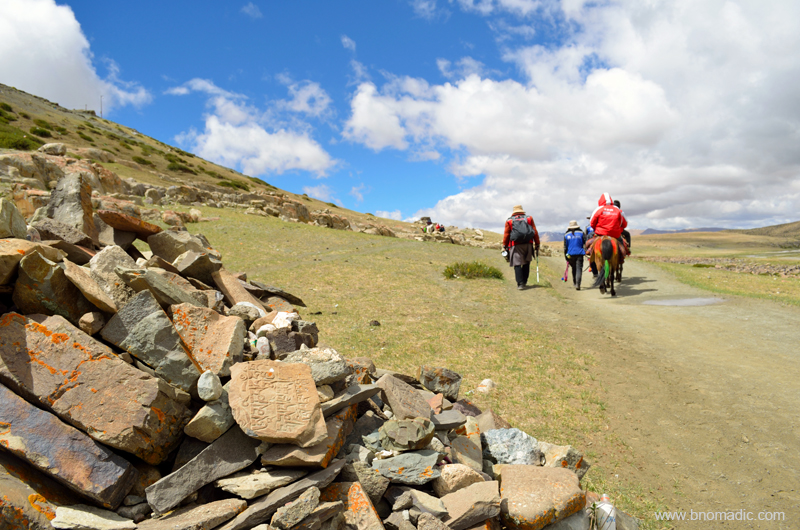
Inside the bus, a few of the yatris begin to chant Shiva bhajan in chorus; filming each other with mobile-cams at the same time. Facing northwards, some of us are praying fervently with folded hands. The holy summit was still hidden behind a dark cover of clouds. Located at a distance of 5km westwards from Darchen, Tarboche is the site of the popular Saga Dawa festival organised every year in late spring. Just next to it is a sky burial site where, as per tradition of the last ritual, the mortal remains of eighty-four Buddhist saints were fed to the birds of prey. When we arrive at Tarboche, the trailhead is deserted but soon enough a team of porters and pony herders assemble. Light drizzle starts. I pull out my poncho from the backpack and wear it over my backpack and trekking gear. I step out of the mêlée created by the lottery draw proceedings among the herders and porters who seem to be in no hurry to start for the trek. The yatris were allotted porters and ponies through a lottery draw. We have been intimated by the guide that nobody is allowed to share a pony and the backpack cannot be carried while riding; requiring the task of a porter. Although, the summit of Kailash was hidden behind dark clouds, the lower bands of the rock were quite visible. Skulls of wild yak and sheep are stacked on mani walls. At the site stands a recently renovated ancient chorten Kangnyi – Yamdwar – that has a passage through its middle.

Kangnyi chorten or Yamdwar. More images from the region at Flickr Photoset

The sky burial site (not used anymore) at Tarboche. The south face of the Kailash is partially visible above the site. For more images of the region, please visit Flickr Photoset
Part of their religious tradition, the Hindus and Buddhists circumambulate the Kailash in a clockwise direction whereas Bonpas do it in the opposite way. As soon as a porter and pony were allotted to me, I set off up the trek leaving behind the chaos of ponies and porters. Stooping to enter the doorframe, I crossed the Yamdwar. Inside, a mummified sheep was tied to its ceiling. From this point onwards, most of the group members preferred to ride on ponies with porters carrying their belongings and stuff. Only four – five of us opted to attempt the kora on foot.

The trek begins in a bad weather. Please visit Flickr Photoset for more images of the region

Walking the Kora. Please visit Flickr Photoset for more images of the region
Ahead, the valley of Lha Chu narrows dramatically at an area called Sershong. Flowing through the valley of Gods, the Lha Chu is almost 10 metre wide carrying the snowmelt of holy rocks. On either side, spectacular cliffs of granite rise above; with mineral rich water cascading down to the valley floor. Wearing cowboy-like floppy hats, a few ponymen outpace me; their ponies adorned with embroidered saddles and brass bells tied around their necks. Soon enough a few motorcyclists overtake all of us. After about an hour or so, I find myself below the Chuku (or Nyenri) Gompa, the thirteenth century monastery perched high above the valley floor in a mountain-wall on its right bank. During the Cultural Revolution all the monasteries of the Kailash region were wrecked down and this happened to be the first one to be rebuilt.

Rebuilt after the cultural revolution, the thirteenth century Nyenri Gompa. More pics at Flickr

“भोले की जटाएं” someone from the group expressed in emotional excitement. More images at Flickr
The initial stretch of the trail is in fact a dusty footpath spread on a gradual gradient. The weather has gone from bad to worse as I stutter ahead on the holy trail. Showers of rain are possibly the last thing one would expect in this already freezing and windy high-altitude terrain. Snowfields and tonguing glaciers are visible up on the mountain wall wherever the fading visibility allows. Even though I am walking in a rarefied air, my breathing is not strained; partly due to the ascent being gradual but mostly due to being alone. Moving at my own pace, I feel exhilarated. Clouds keep getting darker. Inside a three layer of cloths, I am sweating as I trudge ahead. Outside its mind numbingly cold as the intensity of drizzle increases.
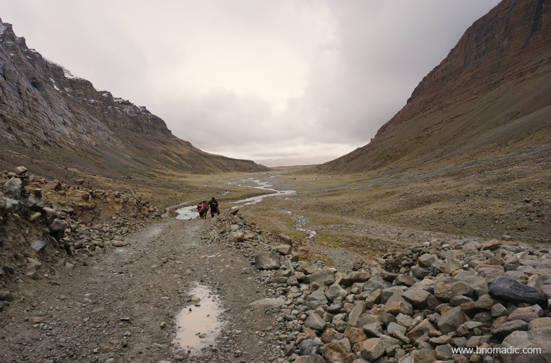
Looking back: It would have been impossible to get lost on this trek; trails separate but re-converge along the left bank of the Lha Chu. More images from the region at Flickr Photoset

Mountain walls, rocks and boulders take on magical shapes that create an optical illusion. More at Flickr
As I trek around Kailash, following timeless paths and footsteps of millions who have walked this mile before, I muse over its ever intriguing geology. At just about every turn of the trek numerous cairns and piles of mani stones stand a witness to millions of pilgrims who have treaded the same path before us. The terrain in this barren valley indubitably possesses a hypnotic charm. Mountain walls, rocks and boulders take on magical shapes that create an optical illusion. The infinite variety of rock here comprise every tinge ranging from crystal to creamy, amber, tawny, yellow, orange, pink and red, etc. The Kailash itself is blacker granite.

Quite high above a livable altitude, the ascent was gradual. More images at Flickr Photoset
From a distance, the ridges around me appear a darker shade of reddish brown as a dense patch of fog engulfs the western face of Kailash. Unlike other faces, the western side looks imposing and almost menacing when viewed from an angle just below it. A notice board marks it to be a landslide zone. The abundant cairns and fluttering prayer flags testifies it to be a sacred site. The wind eroded and chiselled rocks speak of the threatening forces and laws of nature. Climbing a winding trail ahead, long pent up emotions inside of me unexpectedly become irrepressible as I feel divinity guiding my feet and carrying me aloft. Speechless and with teary eyes, I get a feeling of having arrived as I accomplish the long cherished goal of being in the presence of Kailash. Pilgrims are greeting each other with repeated holy cries of “Om Namah Shivaya!” Soon I find myself standing by a cluster of a few tented teashops where I stop to take some rest and get some relief from the drizzle.
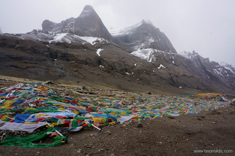
The west face of Kailash engulfed in fog. Unlike other faces, the western side looks imposing and almost menacing when viewed from an angle just below it. More images from the region at Flickr
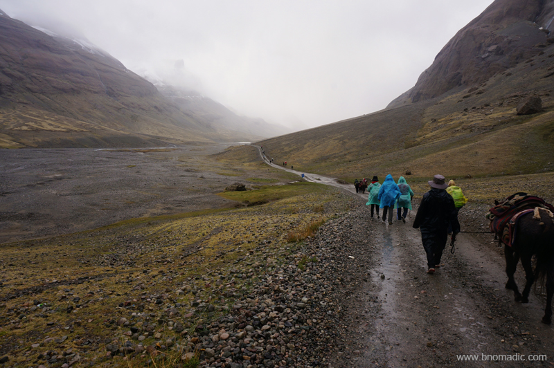
Trudging ahead. Please visit Flickr Photoset for more images of the region
The teashops are large canvas tents, set up during the pilgrimage season, selling freshly brewed yak butter tea, basic supplies, noodles, coke, red bull and even beer. Tables and benches are arranged along with some emergency bedding as warmth is provided by smouldering yak-dung in a cast-iron stove used for brewing tea. I consume three cupful of butter tea before starting again. The rest of the yatris ramble in on uncomfortable ponybacks. Many of their porters and ponymen are women who wear ankle length bright costumes and cover their faces with surgical masks to protect against the dust. Truly hardworking lot they are!
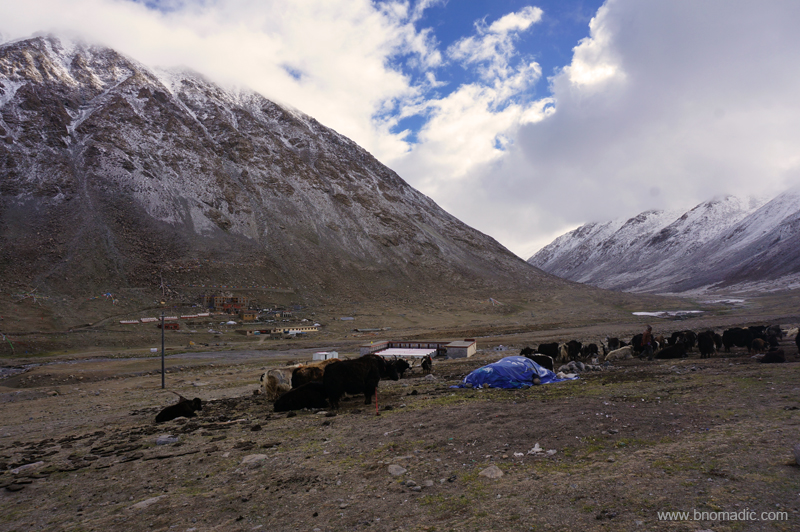
Nearly four – five hours after Nyenri, covering the most scenic stretch of the kora, we reached our campsite for the day at Deraphuk. Many visitors including locals and foreigners were camping in the vicinity of our guesthouse as well as the ancient monastery that was rebuilt in 1985 at the same site facing the striking north face of Mt Kailash. New concrete structures were being constructed including a few at the Deraphuk monastery located on the other side of the Lha stream. The guesthouse we were allotted seemed recently fabricated. Although, my body didn’t show any signs of altitude sickness but cannot stomach even a thought of any food in this below freezing temperature. Hanging my shoes and clothing to dry, I tucked myself in a layer of blankets and quilts. I vainly hoped to catch a glimpse of the north face in the evening light.

Just before Deraphuk; Cairns and rocks festooned with prayer flags are an indication to a sacred shrine
Deraphuk monastery as viewed from the left bank of Lha Chu. More images at Flickr Photoset
In the evening I stepped out to explore the tract above our guesthouse and reached a mani wall. Ahead of me is a stream that leads to the deceptively close looking foot of the Kailash. As I decide not to venture any further, I thought of the adventures of Sven Hedin who more than a century ago in 1907 went through a similar experience. To cross the 5640 m Dolma La and reach our next campsite at Zutulpuk, we have been instructed that we must start by 4am. The persistently bad weather thought otherwise.
North face of the holy Kailash as observed from Deraphuk. Photo by Jen Reurink
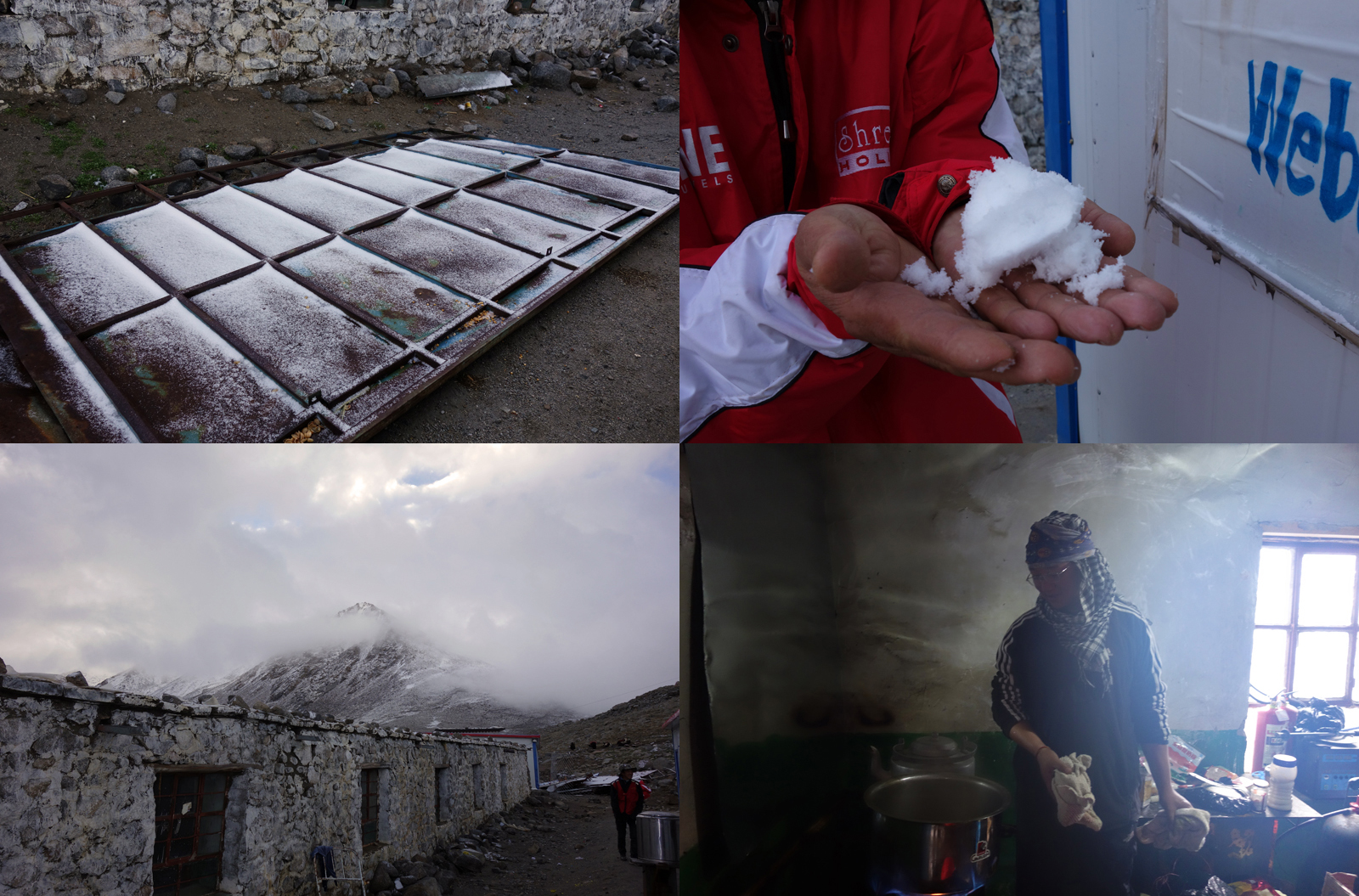
Clockwise from top: 1 & 2) It had snowed in the wee hours of that morning, 3) Head cook in the kitchen and 4) Olden cells of a guesthouse. Photos by Aarti Saxena
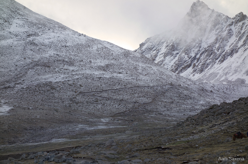
The trail ahead of Deraphuk. Photo by Aarti Saxena
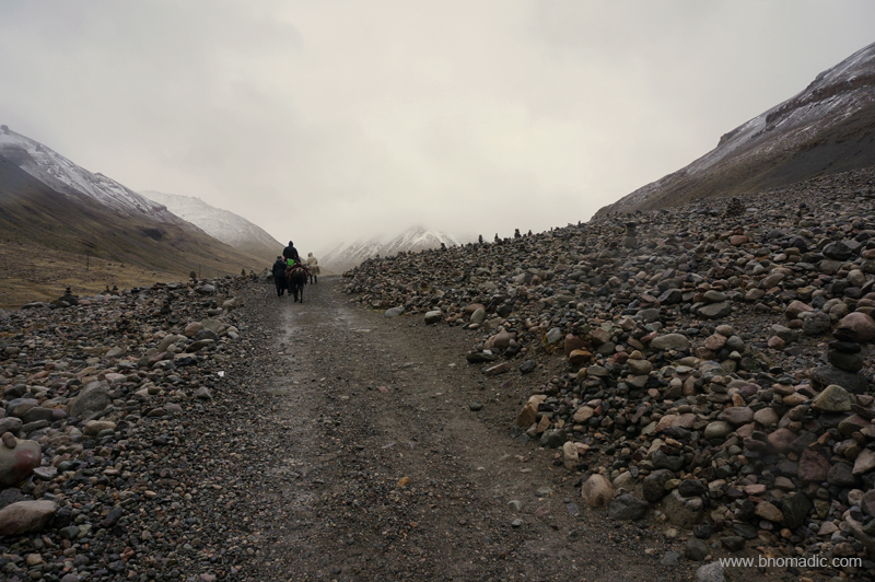
Notice the innumerable cairns. More images from the region at Flickr Photoset

Like most groups from India, we spent a night in Deraphuk; hardy locals circle Kailash in a single day to cover a total of 56 km. Some determined souls prostrate with every step. Photo by Jen Reurink
It had snowed all through the previous night. Next morning before we started the day’s activities, a few yatris scrambled up the slope and collected chunks of ice to show the others. As the group prepares to leave for Darchen, endpoint of the circuit, one of the yatris made a round excursion to Kangkyam glacier that descends from the north face of Kailash. Regular kora walkers cross the Lha Chu and ascend up the Dolma Chu valley on a trail strewn with moraine and boulders. The trail forks at Jarok Donkhang (5210m) to a shorter one and less frequented route through Khando Sanglam La. The rocky expanse called Shivasthal, a pind-daan site is located at about three hours distance from Deraphuk on the route through Dolma La. Ahead the trail flattens a bit to reach the pass. The crest of the pass could be reached in about couple of hours from this site. The sacred lake Gauri Kund (5608m) appears as the steep descent begins. The grassy banks of Lham Chu Khir are reached in a tough hour-long descent. From here a rather easy descent takes you to the monastery of Zutulpuk (4790m). The pick-up point for – a bus ride to Darchen – is at an easy distance of five km from here.

The terrain in this barren valley indubitably possesses a hypnotic charm. More images at Flickr
Wish our itinerary allowed us to stay around Darchen for at least five days. More images at Flickr

A Himalayan Marmot outside its burrow. More images from the region at Flickr Photoset
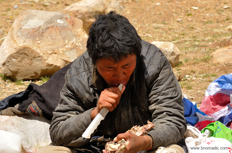
A Tibetan feasting on a dried meat at the end of the Kora. More images from the region at Flickr
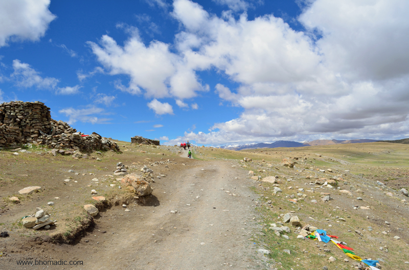
At just about every turn of the trek numerous cairns and piles of mani stones stand a witness to millions of pilgrims who have treaded the same path before us. More images at Flickr

Ready to board the blue buses. More images from the region at Flickr Photoset

The road through Barkha plains appears leading to the base of Gurla Mandhata above Rakshas Tal. The weather opened up as we reassembled at our guesthouse at Darchen. Please visit Flickr Photoset for more images of the region/ yatra

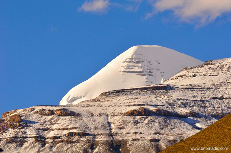
The summit of Kailash as observed from Darchen street in a clear weather. Please visit Flickr Photoset for more images of the region/ yatra
A closeup of the south face of the Kailash from Darchen street square. More images at Flickr


Pingback: Traversing the Barkha Plains | bNomadic
Pingback: Into the Sacred Space | bNomadic
Excellent Travelogue. That photo of North face of the Holy Kailash is very interesting. All Dark with the peak glowing in the middle.
Thank You Sir! I am glad you liked it 🙂
Wow… what an incredible post !!!
Simply stunning images and beautiful narration…
Thank you so much for sharing and I really wish I would be able to explore this place once 🙂
Have a beautiful day ahead 🙂
Thanks Nair jee! Keep visiting bNomadic for more such travel stories. Best wishes 😊
Excellent and Fabulous trip, after getting me here love to go there once in a while…
Thanks! Keep visiting bNomadic and rocking 😊
Difficult journey but interesting and exciting at the same time.
Absolutely true! Most interesting, I’d say for myself. Keep visiting bNomadic 😊
Wow.. too good post.. thanks for sharing
Thanks for stopping by the blog nomadic people! I am glad you both liked it. Keep visiting bNomadic 😊
यादें ताजी होगयीं। यहां एक जगह मेरा घोडा एक गाडी को देखकर बिदक गया और मुझे गिरा दिया। गाडी से निकल कर श्री तरुण विजय, संसद सदस्य उनकी श्रीमतीजी और उनके डाक्टर ने तुरन्त ऐनर्जी केलिये दवा दी। मुझे भगवान कैलाश की साष्टांक दण्डवत करनी थी।अस्तु। यह ब्लौग लिखने वाले खुद सतेन्दरजी भी एक फोटोशौट लेते हुए गिर गये थे।
जी बिल्कुल पूरी तरह से याद है यात्रा का वह एक एक पल! पढ़ते रहिए bNomadic 🙂
Good, interesting and I enjoyed it. Lots of people went to Charn Sparsh, did you all not cover the same? By the way i did not see any pictures of Gauri Kund?
Kangkyam Glacier! It wasn’t a good time of the season to trek up to the site to have Charan Sparsh. It was totally snowbound.
Thanks for the lovely tour. Love the Himalayan Marmot outside its burrow. 🙂
Thanks for stopping by the blog. Visit bNomadic more often 🙂
Great experience.
Thanks for dropping by the blog. Keep visiting bNomadic for more travel stories:-)
NAMASTE !COULD YOU PLEASE LET US KNOW WHICH TRAVEL ORG HAVE BEEN ENGAGED BY YOU WHETHER THEY TAKE US TO SAPTARSHI CAVE AND MILERAP CAVE
Thanks for stopping by the blog. We did not approach any travel agency for this journey. We were part of the first batch via the Nathula in Sikkim (managed by Ministry of External Affairs, Government of India). Keep visiting bNomadic for more such travel stories 🙂
Pingback: A Glimpse of Eternity by Mansarovar | bNomadic
Fabulous, that was a really great read. The pictures are just spectacular and truly motivating. I have not visited this place before so it definitely makes to my bucket list. The sight of the north face of the holy Kailash is a visual treat, would love to see it in person. Thank you for sharing!
Thanks for stopping by the post Maria! I am glad you found it meaningful as well as informative. Keep visiting bNomadic for more such travel accounts 🙂
Thank you for sharing. Were you traveling in a diesel vehicle? I am trying to locate diesel stations on the G219 before traveling it in a couple of months.
Hi! Thanks for stopping by the post. Yes we were in a diesel vehicle. Fuel stations are located in most cities and urban settlements. Locating one should not be a problem at all. I’d suggest you also carry a jerrycan for some extra fuel. Keep visiting bNomadic 🙂