 bNomadic
Not many people would have noticed that an open conical snow-covered peak is visible from Chandigarh on clear winter days. Foregrounded by the Kasauli and Sirmaur hills of Shivalik Range, the peak is distinctively noticeable from the plains of Chandigarh. Bearing a romantic name of Chur Chandani Ki Dhar or the mountain range of silver bangle, this is the nearest snow-peak to the national capital territory of Delhi. Referring to the glittering snow, the intriguing Himalayan feature of Churdhar humbly holds snow for more than seven months of the year and is visible from the hills around Mussoorie and Shimla as well as from the plains of Chandigarh and up to Saharanpur.
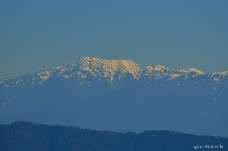
At 3647m, Churdhar is the highest peak in the outer Himalaya; as observed from Shimla.
I recently climbed this grand peak in rather spontaneous circumstances. Aman Sood, the founding member of Chandigarh ByCycle and my partner in crime on most such outings asked me to join him on this trek on one fine weekend of recent autumn. Even while doing our post-graduation at the Panjab University in Chandigarh, we would often see the Choor (as the Britishers used to call it) and admire it; the first peak of prominence rising above the Shivaliks. Having budgeted a week-full of free time to explore the Rajgarh Valley, we planned a quick trek to Churdhar, a ridge popular for religious as well as historical values offering quite moderate approaches.

The road to Nohradhar, the base station to attempt Choor from southern side. Nohradhar is 70km from Solan via Rajgarh. More images at Flickr
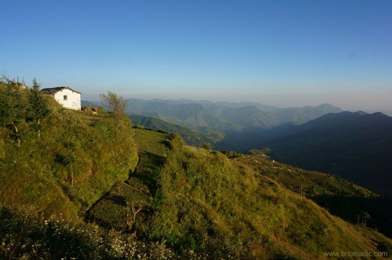
The peak of Churdhar is accessible from many approaches but the popular and safest ones are northern one from Chaupal and southern one from Nohradhar at 2160m. We were keen on climbing the peak through its southern face from the base located at Nohradhar. We self-drove from Chandigarh to Nohradhar via Rajgarh, a bumpy ride on a popular orchard trail of the state. The trail to Churdhar begins adjacent to the PWD Rest House (2191m), where we parked ourselves. In the evening we took a few acclimatisation walks around that area and the main market. Calming down the gusts of dust and heat coming from the plains, the valley of Nohradhar is fairly wooded where orchard economy is valued over grains. The market is very basic but the supplies necessary for the trek could still be sourced. A few locals have converted their house into guesthouses for visitors like us. Depending upon the facilities they offer, a room should be available from Rs 500 to a thousand including basic dahl, chapatti and rice meal. Planning to start early the following day, we slept earlier than normal.
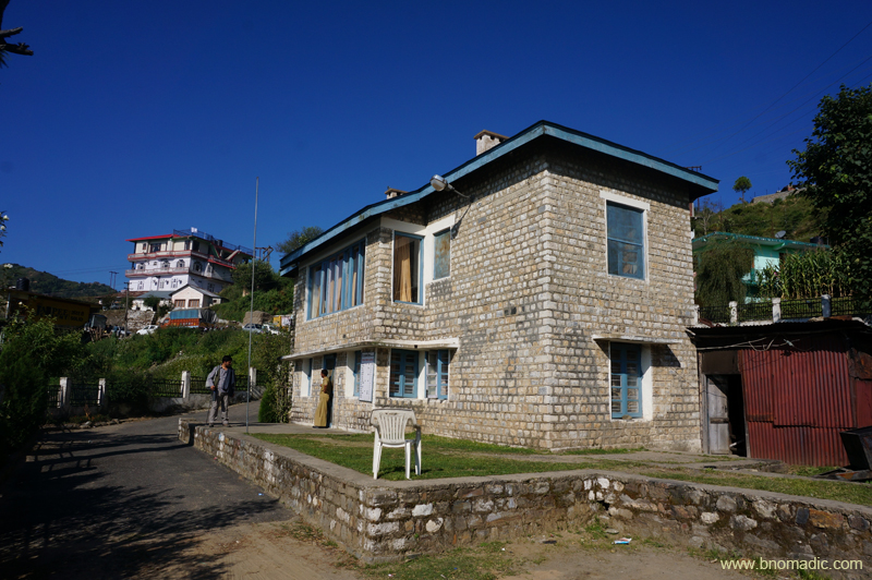
The PWD Rest House at Nohradhar that has remained a host to many celebrity trekkers of the country
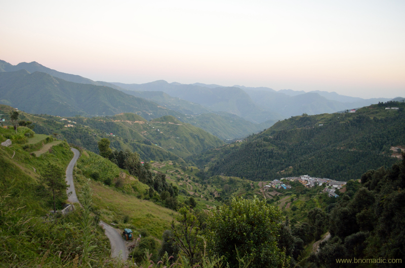
Valley view from Nohradhar. Please visit Flickr Photoset for more images of the region
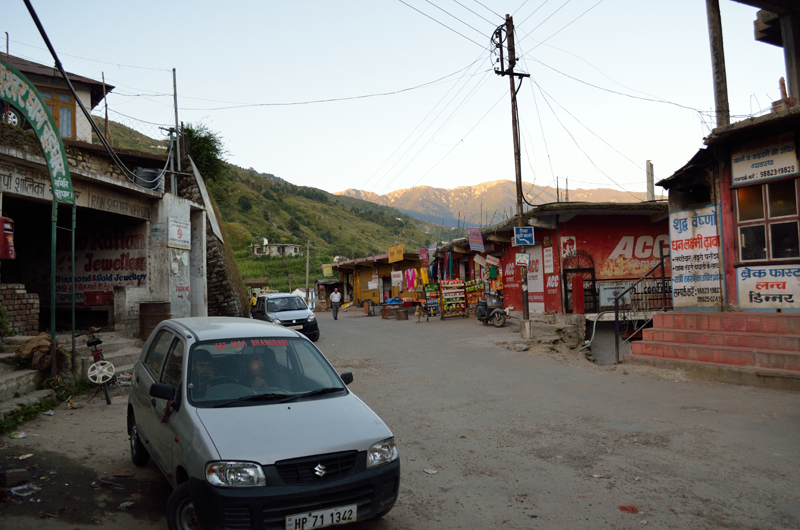
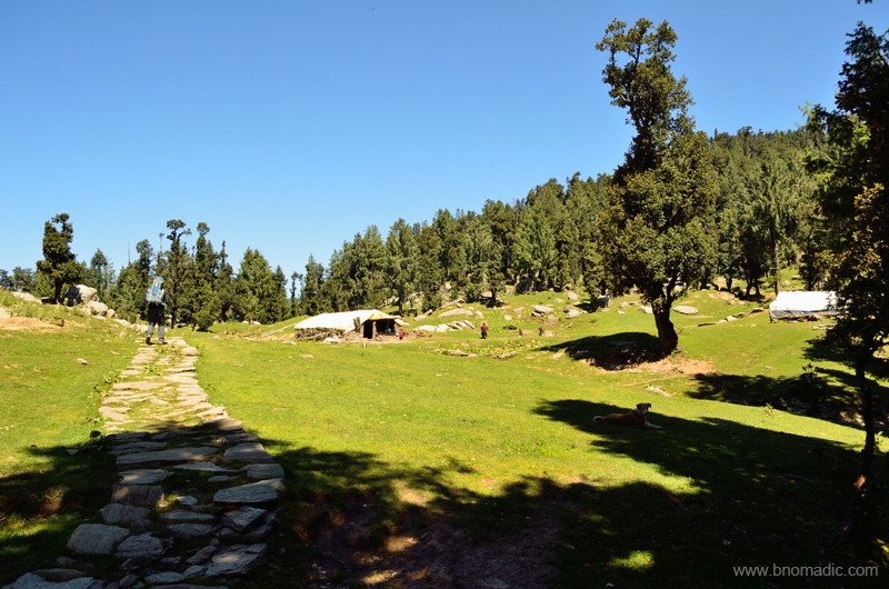
Choor view from the Nohradhar market; the trek begins from the gate behind Alto car in the frame
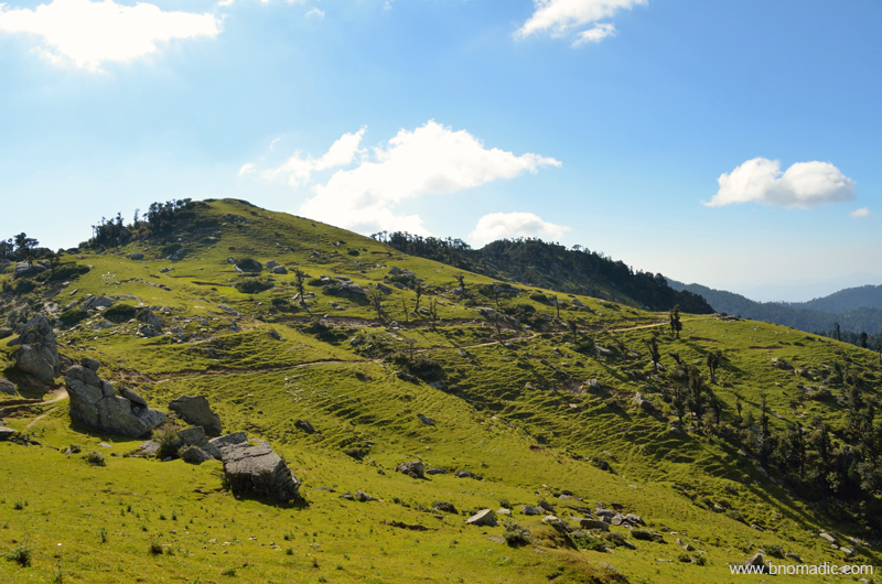
Next morning at 0730hrs we began our steep climb to the ridge above the settlement of Nohradhar and then proceeded along this gentle and lightly wooded ridge to reach the first popular campsite at Jamnala, also referred to as doosri. Part of a religious trail, the various rest sites on the route as we climb higher are known by pehli (2422m), doosri (2885m) and teesri (3258m), popularised by locals. These are also the sites where you could have a refill of water from fresh mountain springs. I’d recommend carrying good quantity of water with you from Nohradhar itself if you are not prepared to drink the spring water of mountains. Refraining from creating any further plastic on the mountains, we carried our bottles from the base and kept topping them up on the way from such streams; which is what I suggest. It took us nearly three hours to reach Jamnala at 2885m where a couple of enterprising families from Nohradhar had put up a seasonal dhaba providing a fixed menu of rice, dahl, tea and biscuits at a slightly premium rate. Surrounded by tall deodars, the Jamnala meadow is at a sunny spot and offers excellent camping grounds as well as water facilities. We took full advantage of the salubrious charm of the site and took a nap after polishing a plateful of dahl and rice.

The initial part of the trail; before pehli. Please visit Flickr Photoset for more images of the region

Inching ahead on the trail. Photo by Aman Sood. Please visit Flickr Photoset for more images of the region.

Taking a small break at pehli; the upper reaches of the habitation ends here. More images at Flickr
The entire stretch of the trail from Jamnala to teesri passes through a wooded section of the ridge where spotting Himalayan birds and infrequent wild animals becomes easier. I was lucky to come face-to-face with a male Himalayan Monal as also a Himalayan Griffon. Unlike the stretch from the base to doosri, where you steeply gained 725m over a distance of 6.7km; this stretch from doosri to teesri is relatively easier on the gradient. In about a couple of hours’ time we covered a distance of 4.9km to gain 373m and reach the windy campsite at 3258m. From teesri, 5.5km of distance spanned over an altitude gain of 384m takes you to the summit at 3647m.
The doosri campsite, called Jamnala. More images from the region at Flickr Photoset
At 2885m, Jamnala is a good campsite insofar as availability of water is concerned. More at Flickr

Napping at Jamnala. The paper cup in the frame was properly disposed of at Nohradhar and not at the campsite

Himalayan Griffon Vulture. More at Flickr

Taking a short rest in a wooded patch of the climb between doosri and teesri. More at Flickr

Smitten by the mountains, the Himalayas. More images from the region at Flickr Photoset
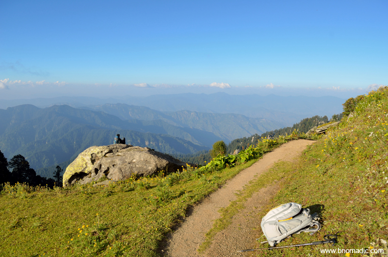
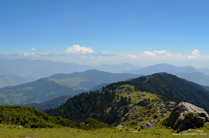
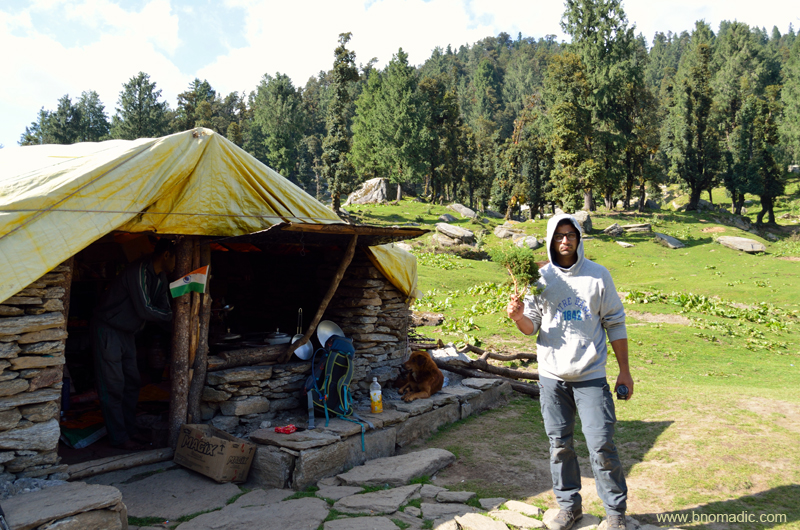
Intending to complete the trek over a weekend, many people prefer to halt for the night at teesri meadows but being on a curved part of an exposed ridge from both sides, it can be really windy to put up own tent. Save for the availability of water nearby there isn’t much comfort insofar as a campsite is concerned. And in case you plan to stay inside dhaba owner’s hut, be prepared to face mammoth-sized rats. But then the views! From here we could see right up to the Kullu Himalayas including its lower peaks and the prominent Deo Tibba as well as Indrasan. As we sat admiring the panoramic view, we met Panditji who introduced himself to be a farm owner at Nohradhar and a member of the Chur Devta committee, which looks after the affairs of dharamsala and the temple. Having munched on a maggi, biscuit and tea diet outside a makeshift seasonal dhaba in a shepherd’s hut, all of us headed towards the temple dharamsala located a little below the summit.

The teesri campsite on the ridge at 3258m. More images from the region at Flickr Photoset
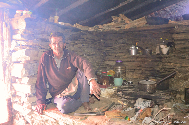
Scheme of things inside the dhaba at teesri. Please visit Flickr for more images of the region

View towards the south from teesri campsite. More images from the region at Flickr
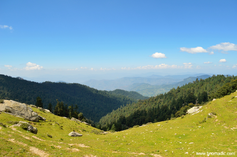
View towards the north from teesri meadow. Please visit Flickr for more images of the region
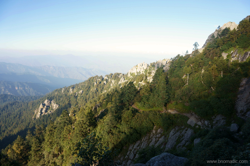
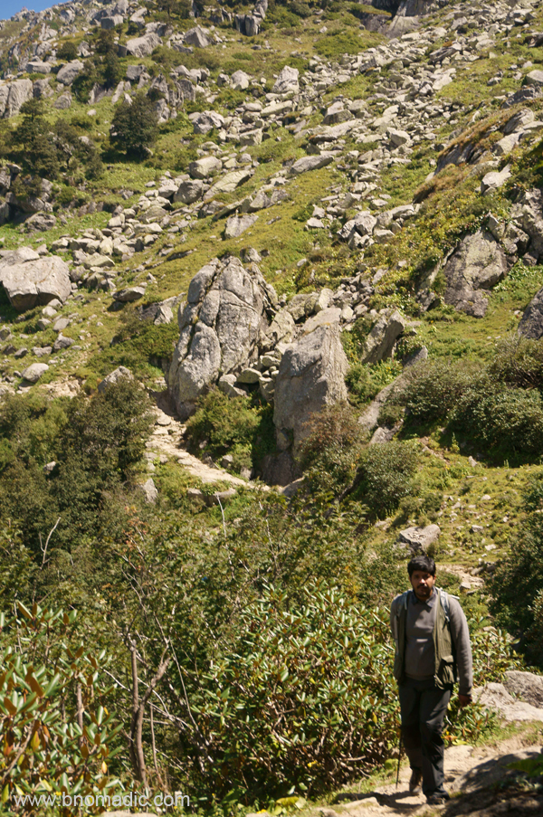
Just 1.1km ahead of the teesri at 3310m is the last point before the dharamsala where you could refill your bottles with water. For the first couple of kilometres from teesri, the route takes a gentle gradient to climb after which it steeply ascends to reach the temple. This is of course the best stretch of the entire route; scenic as well as easy on the go. As the gradient becomes steeper and boulders appear, the route bifurcates into one that leads straight to the summit through its south face and the other one skirts the ridge to approach the summit through its north face via the temple. The direct route is shorter by a kilometre but is very steep and exposed. We took the longer one that passes through a boulder strewn mountain-face, which made our going even more tiring. The boulders and humungous outcrops of granites of course bear a testament to the geological riddle of the Himalayas.
A meadow just ahead of teesri. This is of course the best stretch of the entire route; scenic as well as easier.

A couple more mounds to be crossed before getting to climb the final ridge located further afar. More at Flickr

Panditji and a group of pilgrims resting at the last water refill site ahead of teesri against the backdrop of the Choor

Just before the route bifurcated; one route climbs straight up and follows the ridge line to reach the summit located towards left of the ridge while the longer one follows the treeline from above, gradually finding its way to reach the peak from behind i.e. north face. In the pic: Aman taking notes
As we slogged our way ahead, Panditji told us stories and anecdotes about the region and the religious importance of Chureshwar Mahadeo, an incarnation of Lord Shiva and the guardian deity of the Churdhar. Even though, the trail is more frequented by pilgrims than adventure seekers, the mountain has been popular with both including natural historians. Located in the watershed of the Sutlej-Yamuna, this region has been popular with adventure enthusiasts since ages. Even as George Everest stationed himself on this peak to survey the heights and reach of the Himalayas, the maharaja Yadavindra Singh of Patiala popularised water sports through his activities in the river Giri, located west of the mountain. The climbing records of Choor have references of British expeditions from 1820s.
At the west-end of the Choor‘s south-face. More images from the region at Flickr Photoset
Facing north after skirting the final ridge. More images from the region at Flickr Photoset
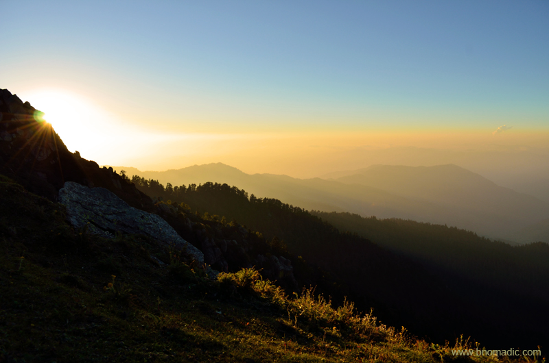
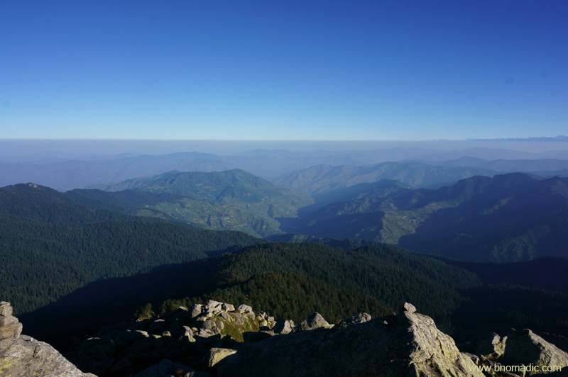
Taxing the knees, our traverse through the rocky crags and boulders was more frustrating than the windy gushes. Wild flowers of all colours and curious shapes popped up from among the stones. By six pm, just in time to witness one of the most remarkable Himalayan sunsets, we made it to the rocky slab above the temple. It was a stunning place to be to soak in an awe-inspiring Himalayan wonder. For the first time I saw the Great Himalayan spectacle at sunset right from Kullu and Kinnaur to Garhwal. The peaks of beautiful Swargarohini and the Bandarpunch that had eclipsed the peaks of Gangotri region looked distinctively golden.
Fading light at Churdhar. Please visit Flickr Photoset for more images of the region

The Swargarohini Massif glittering in the golden light. More images from the region at Flickr

A group of pilgrims observing the natural light and clouds show from the slab below the summit

Landscape a few minutes later. Please visit Flickr Photoset for more images of the region
As it became darker, the pilgrims made a beeline towards the dharamsala that remains operational throughout the pilgrimage season. The facilities at the dharamsala are most basic and don’t expect more than a mattress and blanket to spend the night. The best part is that you can get a meal plus potable water if you knock at their doors at right time of the season. Otherwise, there is no dearth of camping space on top. The air we inhaled was clear and blessed by the Himalayan spirits. That night, apart from Sirmaur region, we could see right up to the lights of Mussoorie hills and Doon Valley that seemed just a few minutes away.

Daybreak at Churdhar. Please visit Flickr Photoset for more images of the region
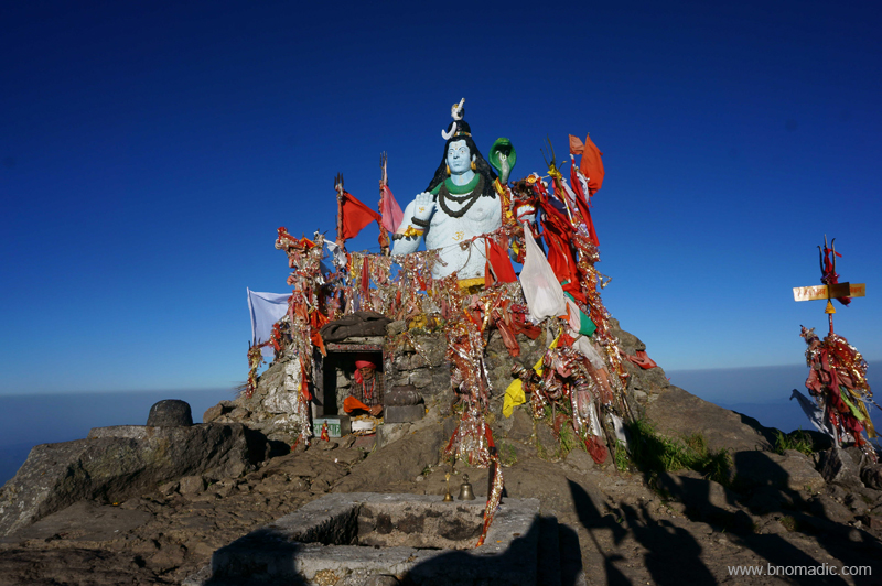
Atop the summit of Choor, above a compilation of rocks and slates rests a statue of Lord Shiva that adds the required five feet to make it a 12,000 ft peak, the nearest snow-capped mountain to Delhi. Photo by Aman Sood
Next morning as I woke up and began to pack our gear, Aman had already made a return from the summit of Choor that offered a remarkable 360 degree view of lower Himalayas. Above a compilation of rocks and slates, a statue of Lord Shiva adds the required five feet to make it a 12,000 ft peak. The view wasn’t as free of haze as we had expected it to be. Shimla hills lay to the northwest and the Ghaggar plains to the southwest. Observed from the top, the lesser ridges appeared to be arid in contrast to the wooded patch we had hiked through yesterday. Far in the distance, the Great Himalayan Range majestically stood above everything else on the way.
Aiming to reach the base at Nohradhar before the sunset, we started our descent by 1000hrs. Even as the descent was more taxing on the feet and heels than the ascent, we were down to Nohradhar by 1900hrs in the evening. Back in the room, the same evening, we met with a local political leader who reciprocated to our greetings from the Choor. We were happy to have finally climbed the peak from where the Mughals used to source ice to keep their imported wines chilled during the summers in Delhi.
Beginning the descent to Nohradhar; north-faced in current frame. With the Great Himalayan Range in the backdrop, the other popular trail that leads to Chaupal is also visible on the lower ridge
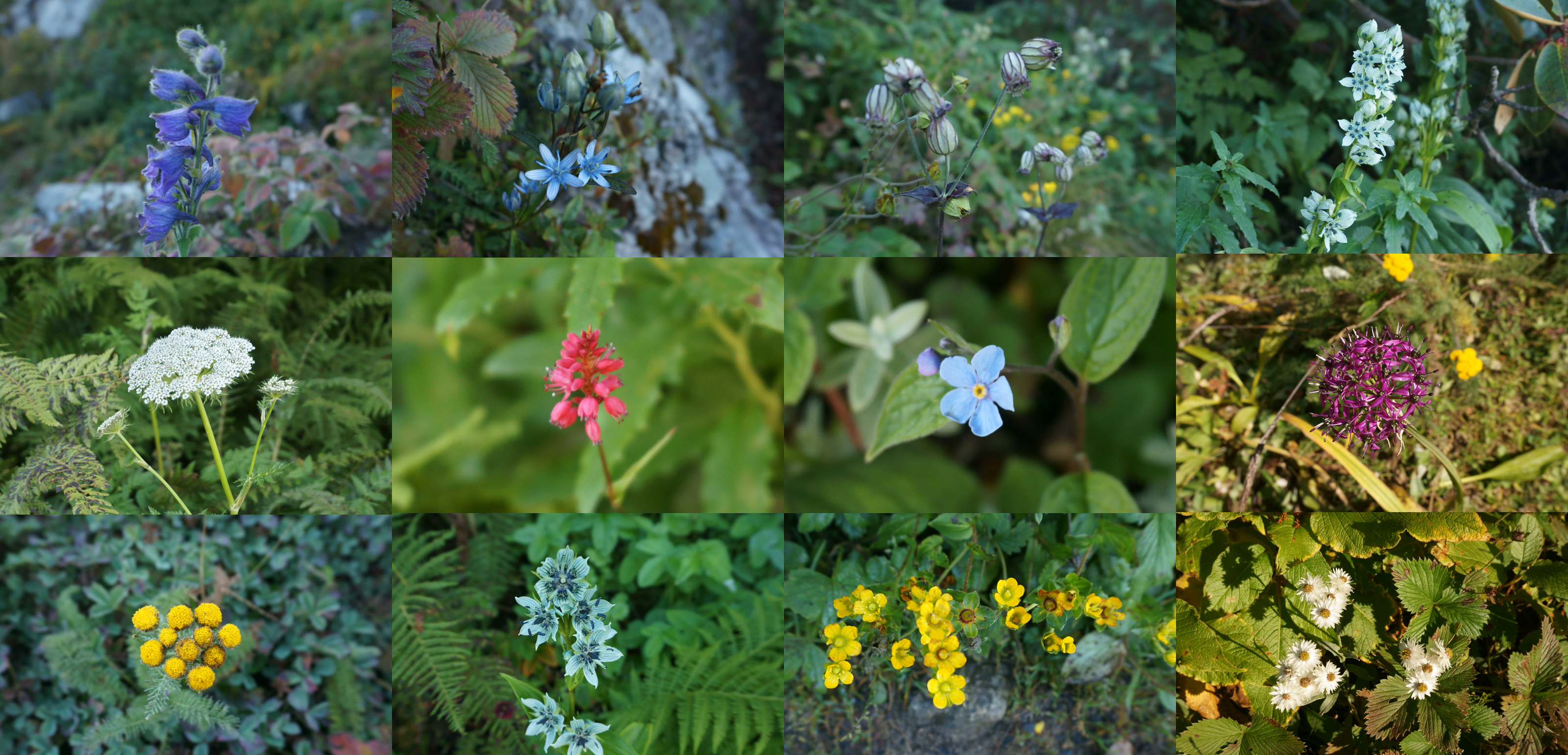
Above 3000m, the trail is carpeted with variety of Himalayan wildflowers. Photos by Aman Sood
Climbing down through boulders and granite rocks

The trail downwards; this dog accompanied us throughout the trek. More images at Flickr Photoset
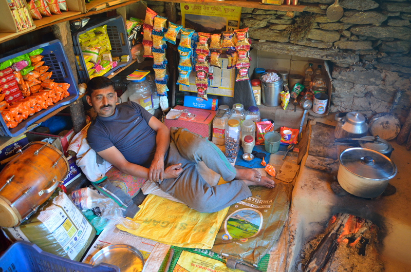
Inside the dhaba at Jamnala; our tea is brewing. More images from the region at Flickr
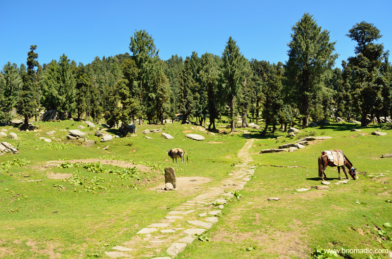
Back at doosri; Aman flashing a branch of a Himalayan shrub that had a strong natural fragrance
First sign of habitation after pehli on the descent. More images from the region at Flickr Photoset

Another hour before we reached the base at Nohradhar. More images at Flickr Photoset

Yours Truly at a fruits shop after the trek. Photo by Aman Sood
Trek Summary:
Total distance: 17.5km (one way)
Time taken: Two days with a night on top
Base (2160m) to Pehli (2422m): 2.5km
Pehli to Doosri (Jamnala) at 2885m: 4.2km
Doosri to Teesri at 3258m: 4.9km
Teesri to Temple at 3454m: 5.5km
Temple to the Peak at 3647m: .4km


Pingback: Sirmaur Diary: The Orchard Valley of Rajgarh | bNomadic
Thanks for a wonderfully detailed post, seems like something I would love to put on my Delhi getaway list. And such fantastic pics! Amazing.
Good to see you here Ami. Thanks! You could easily manage this trip over an extended weekend from Delhi. Just plan it well. You might as well want to get in touch then. Keep visiting bNomadic for more such travel stories 🙂
Beautiful!
Thanks! Keep visiting bNomadic for more such travel stories 😊
Lovely post! We were just about a km from making it to the peak but had to give up because of heavy rainfall and snowl dang in the middle of May!
PS: the rice-daal combination at Teesri feeds your stomach and soul alike!
Thanks for dropping by the blog. Snow or rains can really spoil your plans on this trail. Good you guys turned back. Better luck next time 🙂 Keep visiting bNomadic for more such travel stories.