 bNomadic
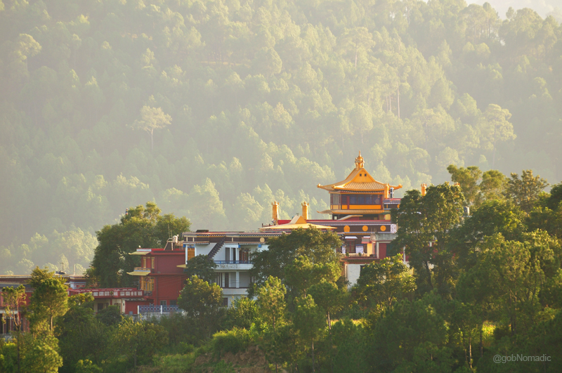
The relocated abbey of ancient Tibetan Bon Religion at Dolanji

Last weekend, while on way to the peach valley of Rajgarh, I visited the Menri Monastery (1195m), situated at village Dolanji in Solan district of Himachal Pradesh. Located within a comfortable reach of Chandigarh, the region has always been a preferred weekend hideaway since the university days. A leisure drive from the City Beautiful takes about a couple of hours to reach the monastic complex of Dolanji; positioned at a distance of three kilometre from the diversion at Ochhghat on the Solan – Rajgarh road.
Dolanji Monastery; The relocated abbey of ancient Tibetan Bon Religion. More at Flickr Photoset
Set in a calm and green bowl of Solan hills, the monastery discourses and resuscitates the teachings and rituals of the most ancient, pre-Buddhist, spiritual tradition and native religion of Tibet – the Bon faith. Built from a scratch in 1967 after the local Bonpo settlement got recognition from the Government of India, today the monastery, the seat of the abbot of Bon faith, has become the chief centre of spiritual learning and ritual activity of Bonpos from across the globe.

The Yungdrung Bon Monastic Centre at Dolanji. Please visit Flickr for more images from the region
The monastery has an intriguing history. After the Lhasa uprising in 1959, a large number of Tibetans including the Buddhists and the Bonpos fled Tibet; along with the Fourteenth Dalai Lama. Much before that the count of Bon followers in Tibet had been reduced to minority as a majority of them now professed Buddhism. It is estimated that nearly one per cent of the total Tibetan refuge-seekers in India were Bonpos who initially gathered in the Manali region where they sought food and shelter. Subsequently, most of them got rehabilitated at village Dolanji while some of them settled at Mandowala near Dehradun in Uttarakhand.
The main entrance to the monastery. More images from the region at Flickr Photoset

A young Bon Monk. More at Flickr Photoset
With the help of the Government of India and a few independent organisations, the Bon followers began to re-establish their chief religious and spiritual centre at Dolanji and named it after the Menri Monastery, the foremost but destroyed Bon monastery of that name in Tibet. Similarly, the new settlement at Dolanji has been referred to as Thobgyel Sarpa after the village Thobgyel which was near the ancient monastery of Menri in the Tsang province of Tibet. In fact, most of the residents in the settlement originally hailed from the Kailash Mansarovar and Tsang regions. In 1969, under the guidance of the abbot of Yungdrung Ling, the second most important Bon monastery of Tibet, the followers of Bon at Dolanji elected their Abbot – Menri Trizin thirty third Lungtok Tenpai Nyima – through a lottery draw system. Later on he assumed the spiritual leadership of all the Bon monasteries and institutions worldwide.

The main assembly hall of the Menri Monastery. Please visit Flickr for more images from the region
View towards the Valley from the courtyard. More images at Flickr Photoset
The bright yellow canopies of the monastery were aglow with the evening sun when I reached Menri. The monks were about to begin their routine evening recreational activities. With the younger ones occupying a large part of the playground, the elder ones were either chatting up in small groups in the compound or taking a walk on the village roads. A few of them were dutifully preparing the main assembly hall for evening rituals. A European couple was inquisitively circumambulating the main assembly hall du-khang in the prescribed anticlockwise direction. The lady had prayer beads in her hand.
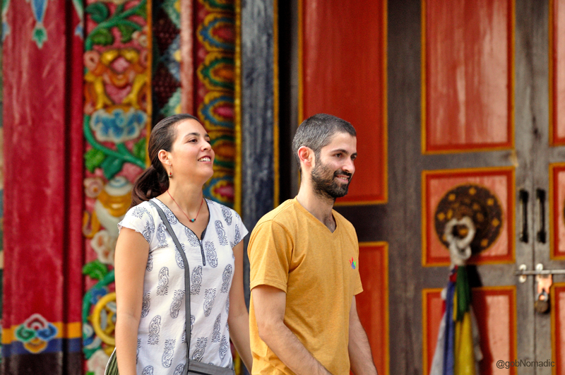
The Menri Monastery is frequented by pilgrims and visitors including foreigners. More at Flickr
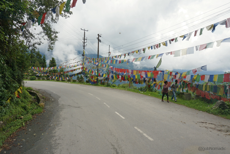
In-between, the energetic calls of blue-red robed monks echoed forth in the calm open courtyards. The inmates were extremely cultured and disciplined. I greeted a young monk with a Namaste who nodded back even though he understood little Hindi. Out of respect, a few of the younger ones I came across nodded from a distance. And without exception, the compound was very well kept. The façade of the monastery is bedecked with the religious emblems and the typical Tibetan colourful prayer flags.
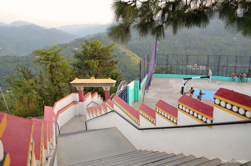
As of now, the whole monastic complex is embraced under the name of “The Yungdrung Bon Monastic Centre” and forms a part of the Tibetan Bonpo Foundation. From just a temple, the centre today has expanded to include a nunnery, a school with hostel, guesthouses, meditation halls and an infirmary, etc. This modern complex is an all-in-one compound with independent temple buildings, monastic cells, playground, etc. built within their own microenvironment. Interestingly (but not surprisingly), in constructing the du-khang, abbot’s residence and the meditation hall or Drup-khang, the management has devotedly stick to the original Tibetan architecture while the other important buildings like the hostel, cells and guesthouses, etc. are built in a typical contemporary concrete style. As of now, the centre is home to more than 400 resident lamas along with over 200 novices.
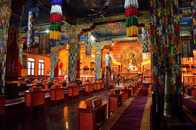
Inside the main assembly hall, du-khang of the Menri Monastery. More images at Flickr
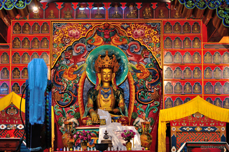
The imposing statue of Senrab Mibo, the primordial Deity of the Bon religion. More images at Flickr
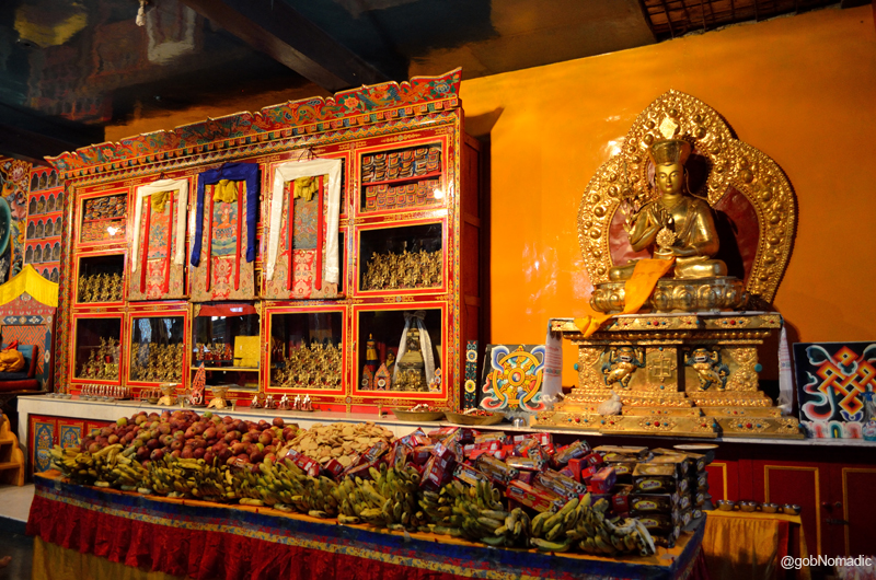
Offerings inside the assembly hall of the monastery. More images from the region at Flickr
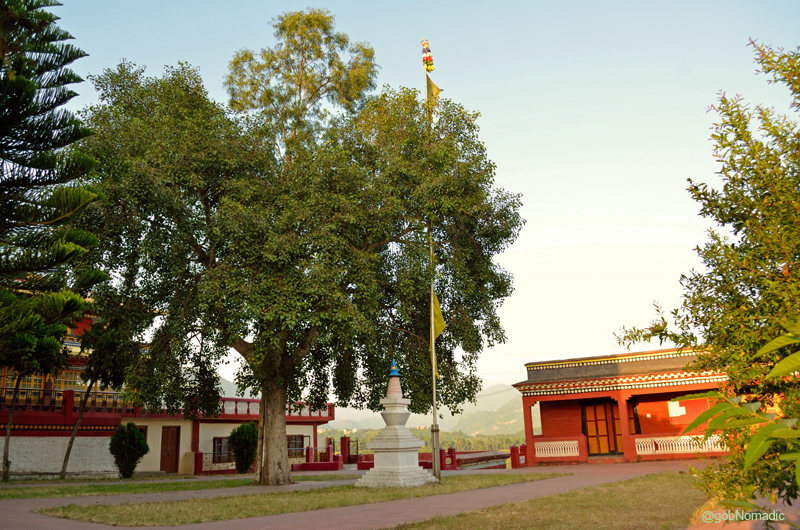
The main courtyard of the monastery is shaded by a large Bodhi tree. A blue-topped chorten beneath it intrigues the uninitiated visitors. The wide courtyard also serves as go-tha or vestibule. I headed inside the main assembly hall while my friend, founder of Chandigarh Bycycle, who accompanied me on this trip video-documented the ambience of the compound. The walls of the main hall of the monastery are painted in red, yellow, white and blue synthetic colours and beautified with ornate floral designs symbolic of the Tibetan style. The veranda walls are painted with the images of the Bon guardian deities of the four quarters, Chhok kyong-zi or the Lokpalas. Although, the monk-artists who executed these paintings took all possible care to preserve the thematic sanctity of the Tibetan art yet the glossy outcome of the enamel paints is at variance from the traditional Tibetan murals. The second important temple of the complex, the drup-khang or the meditation hall, situated adjacent to the du-khang, can only be visited by accomplished monks.
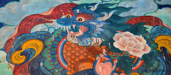
Miyunam Duki Gochhen (the Dragon headed Blue Human), one of the four guardian deities of the Bon Religion
The arrangement inside du-khang is principally traditional; plain walls, rows of monastic chogtse with scriptures placed on them, a central large space with wide aisles on both sides for movement. Against the back wall, miniature metallic images of the Bon deities are placed in the glassy shelves. The images included Tara and the mystic mandala among others. An imposing image of Senrab Mibo, the primordial Deity of the Bon religion, occupies the central space. Attired in ceremonial costumes, Senrab Mibo is shown meditating in the Bhumiparsha mudra of the Buddha Shakyamuni. Tibetan-coloured banners, painted and embroidered thangkas along with silken wall-hangings decorate up the interiors. Prepared in recent times, most of these thangkas depict Senrab Mibo in various manifestations. No particular activity was taking place inside the du-khang at that time of the evening. A few young monks were cleaning and rearranging the offerings, at the altar, that comprised fruits and biscuits.
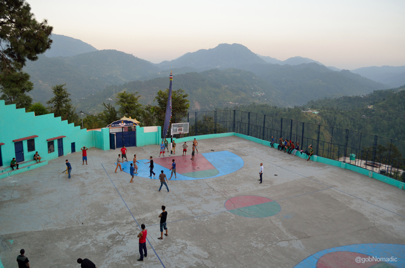
Younger ones at the playground; Don’t get surprised to find someone playing two games simultaneously
The Bonpos have taken great care in reviving the religious and spiritual essence of their faith; doing their best to keep the nostalgic fervour and traditional character of their Tibetan homeland alive in this modern form. Leave aside the Tibetan architecture, rebuilding a society in an entirely different geo-climatic, socio-religious, cultural and political setting is a no mean feat. The Bon religion preaches a high regard for nature and advocates the conservation of environment. It was my ideal weekend dose of travel and I’d recommend it to the curious travellers who seek to visit offbeat destinations and usually have less time at their disposal.
Adjusting to Higher Altitude

The following post is a part of the “Kailash Mansarovar Yatra” Blog Series Into the Sacred Space. To read complete travel memoirs and trip report, please visit here.
And so we set out once more on the road to the Sacred Space. Occupying rear seats in the bus, a few fellow travellers occasionally raised the holy cry Har Har Mahadeo and some others jingled from the middle. “Apart from giving me a wider view for snap recording, the first seat had its own advantage”, I chuckled at the thought. With the local police leading it, our small fleet of the buses along with the vehicles of STDC, ITBP, doctors and ambulance had taken the shape of a convoy.
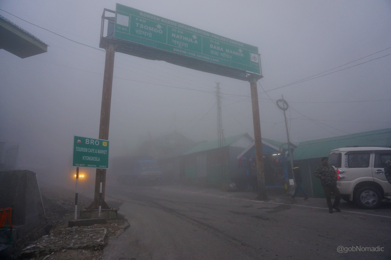
The initial stretch of the highway to Nathula. Please visit Flickr for more images of the region.
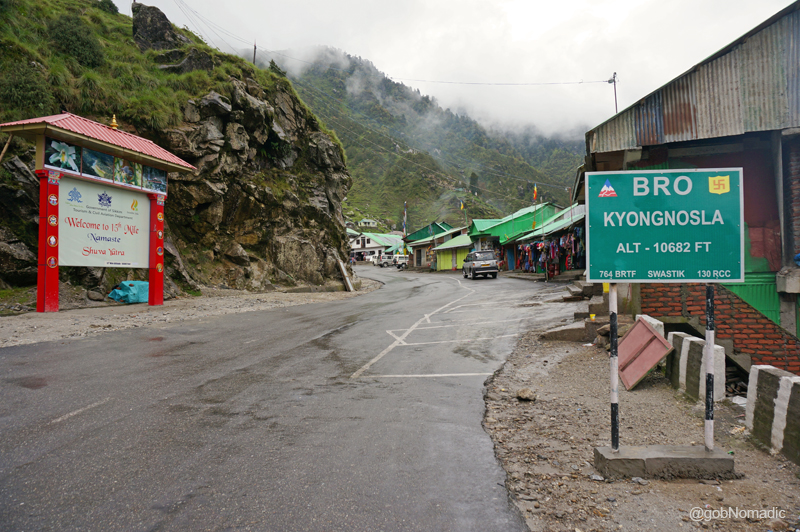
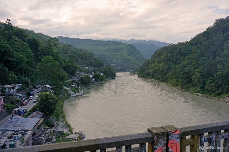
Our next stop was Fifteenth Mile (3200m), as measured out from Gangtok, a small village where in the olden times Tibet-bound travellers, traders along with their transport muleteers used to halt for the night. In fact, more than their native names, the villages on the Gangtok – Nathula highway, an erstwhile trade route artery, are known by their respective distances recorded in miles from the capital city of the state of Sikkim. Our cavalcade looped up the hill and we could distinctly spot the Gangtok settlement spread on densely wooded ridges and terracing towards the valley floor. The white stream of Rongni Chu sparkled far down in the valley.
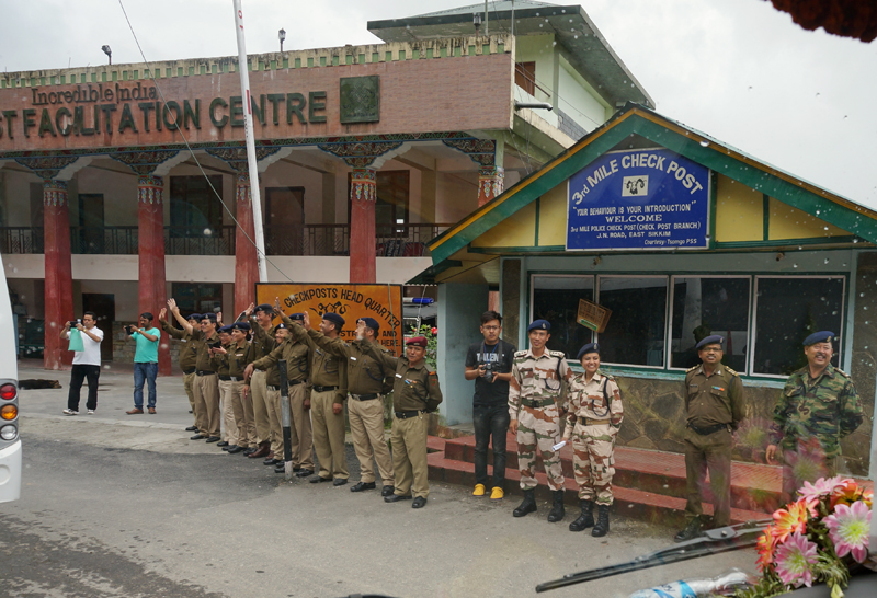
The highway Police and ITBP officers waving at us; at the Third Mile check-post. More at Flickr
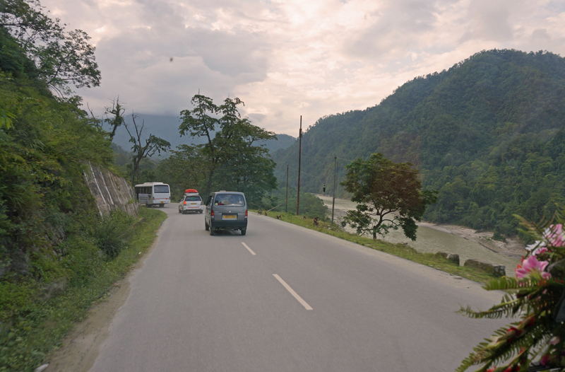
Slowly we inched ahead on a narrow stretch of the road which was notorious for landslides. With the BRO earthmovers parked regularly, the condition of the road reflected on the emergency situation that might arise just anytime during a rainy spell. Vishal, our sturdy Sikkimese driver, seemed to be a total professional with his job. When he was not manoeuvring the vehicle through treacherous patches, he would intelligently plug-in his pen drive to play either local or Bollywood songs only to be stopped later by someone from the passengers.

A narrow stretch of the highway ahead. Please visit Flickr Photoset for more images of the region

Sh Amitabha Sinha, senior lawyer at Supreme Court of India with the STDC support staff; our driver Vishal to his left (right of the frame). More images from the region at Flickr Photoset
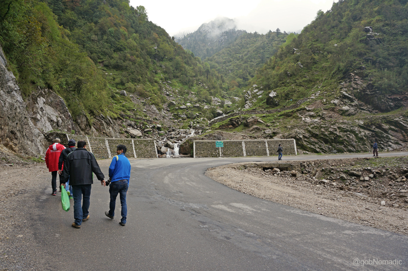
Although the distance between Gangtok and Fifteenth Mile or Kyongnosla, its traditional name, is about 31 km but for the road conditions we took about couple of hours to cover the stretch. During the olden times, this stretch was at best a bridle trail comprising veranda bridges on sheer precipices. The valley here was open as well as stony.

Climbing steadily, we were subjected for the first time to the high-altitude experience which was to become integral part of our journey ahead. More images from the region at Flickr Photoset
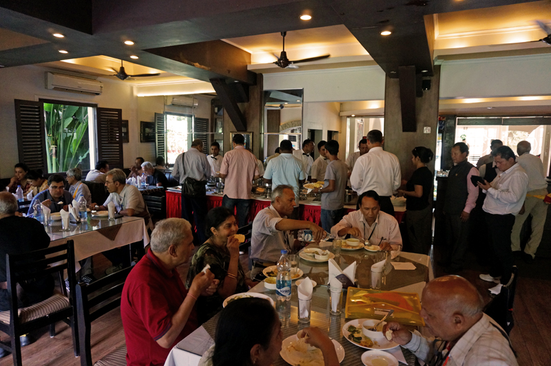
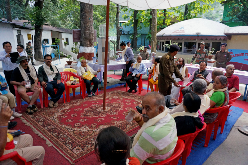
By the time we reached the first acclimatisation centre at Kyongnosla, the weather had become overcast. As the clouds gathered in the valley began to move up, a slight drizzle came. The villagers and curious onlookers had gathered at the centre to welcome and offer us the cultural icon – khadas one by one. A lama from a local monastery had been invited to bless the travellers. We pushed ourselves inside the dining hall of the centre and ravenously began feasting on the hot soup and snacks before the lunch got served.

The fanfare at the Fifteenth Mile. Please visit Flickr Photoset for more images from the region
The locals according traditional welcome to the Kailash Mansarovar travellers. More at Flickr
Post lunch we were allotted our accommodations for the next two days. The newly built acclimatisation hutments comprise dormitories and some rooms. A few of us, mostly the younger ones, were allotted the second acclimatisation hut at the Seventeenth Mile (3250m). The first centre was situated adjacent to the main market of the village. The second centre located ahead is set in a more natural surrounding; away from the humdrum of the market. The occasional traffic movement we noticed comprised army vehicles or tourists, etc. who were mostly heading towards the pass. Down below, two streams merged into one adding splash of whitish water in otherwise a silent densely wooded valley. The next briefing was scheduled early evening at Fifteenth Mile that day. At the Seventeenth Mile, the fellow travellers went into slumber one by one. I took my camera gear and headed on the road towards the Fifteenth Mile. It was still misty and the visibility was very poor.
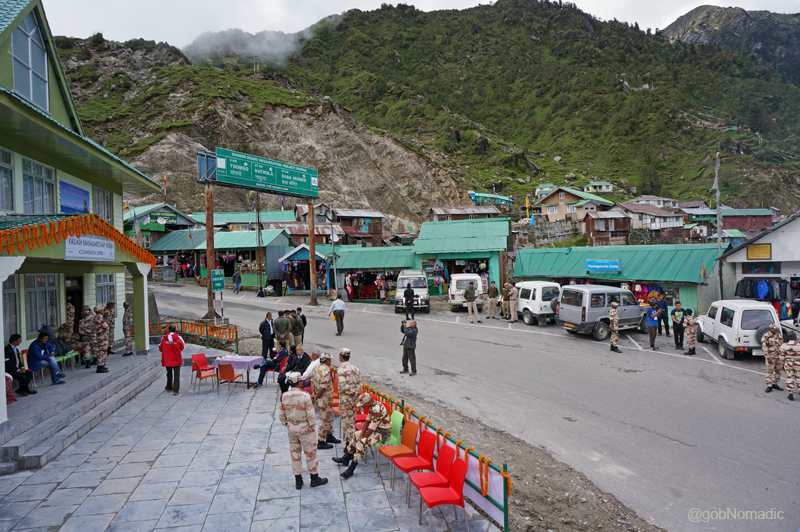
The acclimatisation centre at the Fifteenth Mile and the village market. More at Flickr

Lunching and snacking at the first acclimatisation centre on the Gangtok-Nathula highway. More at Flickr

The accommodation at the Seventeenth Mile. Please visit Flickr for more images of the region
For the next two days taking walks between the two centres was to be the mainstay of the activities. The birdlife was abundant in the valley. With limited visibility for most of the time over the next two days, I was able to identify Blue Whistling Thrush, White-capped Water Redstart, Hill Pigeon, Raven, Doves, Babblers, etc. on the road. In between I would often sneak into the roadside tea-snack cafes at the Fifteenth Mile and update my travel-notes. I always feel that such spots managed by the natives provide you with a lot of first-hand information on the region. Most of such tin-roofed house-cum-shop structures were multi-natured store selling all basic supplies from basic winter accessories to tea, coffee, noodles, simple meals or even liquor and beers, etcetera.
For the next two days taking walks between the two centres was to be the mainstay of the activities.
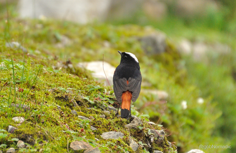
White-capped Redstart, a resident bird of the Himalayas. More bird images at Flickr Photoset
The road and the small market of Kyongnosla. More images from the region at Flickr

Most of such tin-roofed house-cum-shop structures were multi-natured store selling all basic supplies from basic winter accessories to tea, coffee, noodles, simple meals or even liquor and beers, etc.
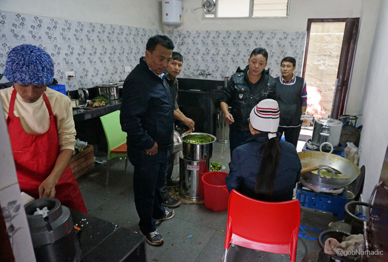
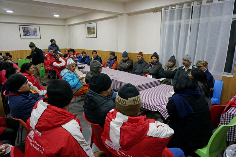
As if the previous briefings were not enough, we were briefed by a set of three doctors in the evening that day about the medical precautions we needed to take on the journey ahead. The worst outcome of such briefings was the questions and answers session that followed. My medicine kit comprised just the basic ones apart from the Diamox, the overestimated drug for high-altitude acclimatisation. I trusted just an extra amount of water intake plus a few cloves of garlic and ginger that I chomped daily in the morning. Dinners were usually a noisy affair; initially because of the briefings and later because of the culinarians. I was part of the foods committee of our batch and we held our first meeting with the cooks that evening. It was the STDC’s job to hire cooks for us. Being a first batch through this route, the STDC deemed it fit to allocate five seasoned “mountaineers” for our batch. Without getting into further details and trusting their experience, the in charge of the committee gave them some cash to buy rations, vegetables, fruits, etc. for the journey ahead.

The Foods Committee meeting with the cooks (mountaineers) in progress. More from the region at Flickr
Meanwhile inside the kitchen. More from the region and the journey at Flickr Photoset
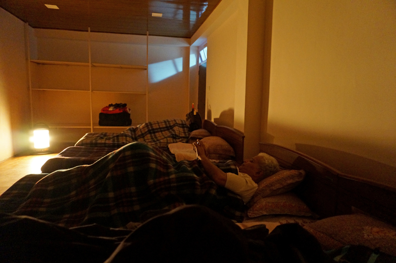
Chaturvedi Ji busy chatting with someone at home. This was the last point on the India side with mobile connectivity (mostly BSNL)
Call it the benefits or drawbacks of staying in a group, that evening I slept at around 9:30pm (actually!) and completed my seven hours sleeping cycle way before the daylight broke the next day. It was still drizzling when I got up the next day. The pitter-patter of the rain outside and on the tinned-roof was musical as I lazily snuggled in my warm beddings. Soon after everyone got up and as the weather eased later, we strolled downwards towards the first centre. At breakfast it was announced that if the weather remains stable we could go visit the Tsomgo (Changu) Tso. The idea of visiting the high-altitude Changu Lake (3800m) appealed to everyone as it would further expose the group to even higher altitude and help in acclimatisation. Someone from the group expressed, “Whatever be the weather, let’s just go!” I headed back to the second centre after the morning meal.
Misty outside with almost zero visibility. More images from the region at Flickr Photoset
One of the forest outposts to the Kyangnosla Alpine Sanctuary – home to the Red Panda, the state animal and the Blood Pheasant, the state bird; apart from a whole lot of invaluable flora – was located just above the hutment of the Seventeenth Mile. I expressed my desire to trek inside the sanctuary to the STDC guys around and sought permissions from the forest department through them. They confirmed but said, “Only if the weather improves”. The pine-clad wooded and boulder strewn mountain-faces were a riot of Himalayan colours; shades and hues of greens and blues; overhead a turquoise sky with a massive grey cloud rolling northwards, sideways were the greens of the Kyangnosla forests and far below the waters of the Lungtse Chu meandering like an angry serpent. Back at the dormitory, I tried to read Charles Allen’s A Mountain in Tibet, the only book I carried but, instead, I slothfully lied down on my bed and listened to Karunesh.

View towards the Nathula side from Seventeenth Mile. More images of the region at Flickr Photoset
A few hours later, an azure mist was rising far in the distance marking the onset of the afternoon cloud as I decided to head towards the Fifteenth Mile once again where the schedule to visit the Changu Lake was already announced. “The only downside of the expedition as observed so far,” I thought, “has been that it was an organised one”. A few of the group members opted to remain at the centre. The bus took nearly 30 min to reach the Lake. The road, wider now, loops to reach the Lake passing a small marketplace on the way. We clambered over the small check dam and found a green water body stretching for almost half a kilometre before us in the shape of a large bowl surrounded by barren mountain faces. The road to the Nathula lay by the edge of the lake. A grey boulder at the lakeside marked the Twentieth Milestone from Gangtok.
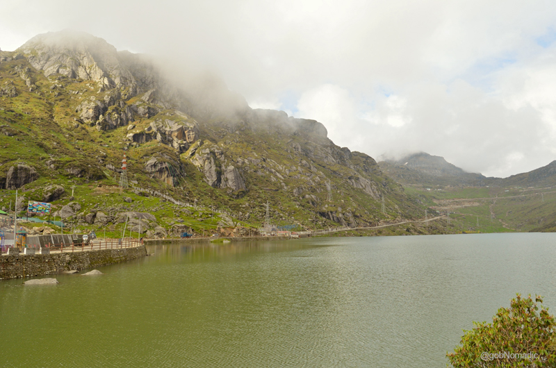
The Changu Lake as viewed from the east end. The road to Nathula is also visible in the frame. More images of the region at Flickr Photoset

Professor Emeritus Kiran Seth, IIT Delhi and co-founder of SPIC MACAY taking a walk by the Lake
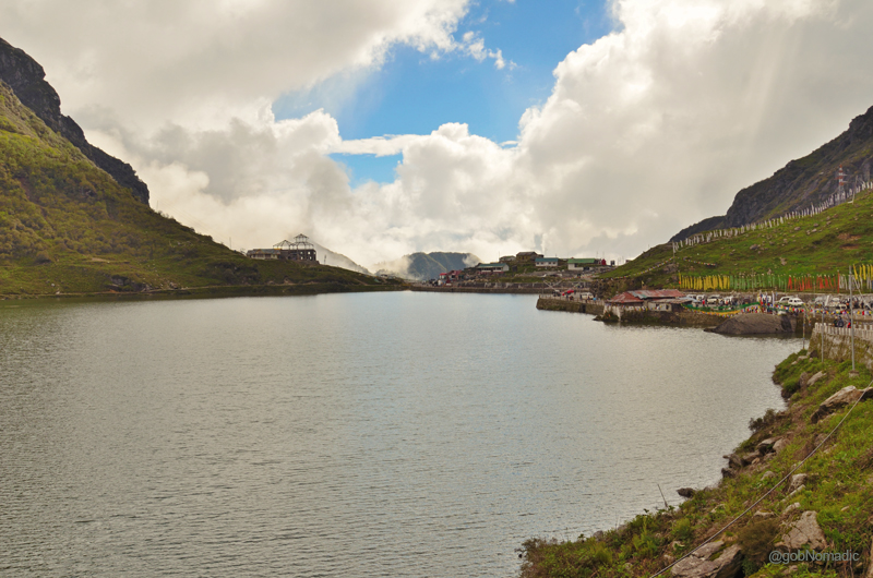
The Tsomgo Tso or Changu Lake is also the origin of Lungtse River. Please visit Flickr Photoset for more
Vegetation was now beginning to cease. I took a stroll around the possible edges of the lake and spotted a family of Ruddy Shelduck along with their ducklings. It is claimed that local lamas could forecast the weather and future by observing the colour of the water of the lake. There was a shrine dedicated to the Lord Shiva as well at the lake.

The purple-veined Cobra Lily with a snake’s tongue-like appendage resembles a striking Cobra snake.
The doctors had advised us not to overexert at the lake and the falling light and visibility rendered the photo-recording quite useless. In about a couple of hours’ time, we were on our way back to the 15th Mile where yet another mega briefing session awaited us (Phew!). The evening was spent in collecting notes, taking snap records and once at the room after dinner: sorting out luggage for the next destination.
The mammoth briefing meet at the Fifteenth Mile. More images from the region at Flickr Photoset
Reception at Gangtok

The following post is a part of the “Kailash Mansarovar Yatra” Blog Series Into the Sacred Space. To read complete travel memoirs and trip report, please visit here.
That morning I again got up quite early from that enigmatic and ever-welcome state of mind which the world calls sleep. The sleep was briefer in comparison to normal days yet it was more refreshing – for we were now in the embrace of the Himalayas. The clean crisp inhale of the Himalayas assists the body to restore its worn-out functions more rapidly than possible elsewhere. Without losing any opportunity, I set about to the day’s activities.
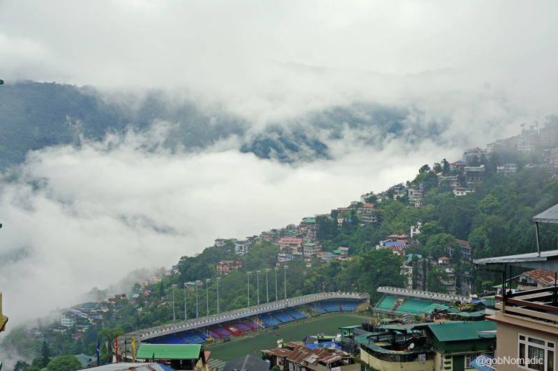
Misty morning at Gangtok; the historic Palzor stadium is also visible in the frame. More at Flickr
The capital of the state of Sikkim, Gangtok (1660m) is located at the head of the Rongni valley; on the road to Tibet through the Nathu La. Apart from holding a very rich cultural history, the capital hill-station located in the East district of the state boasts of all the modern amenities. The town owes its prosperity to its strategic location on the erstwhile trade route to Tibet from the plains. As these thoughts flashed before me, I charted the direction of Kangchenjunga from the window of my room but the clouds quickly rose to obscure the massif from the view. Far away towards the south-west of the town, one could distinctly spot Darjeeling, to the north-east, beyond the immediate ripples of the ridges, lays Tibet. And to the north-west, the great crest of the Kangchenjunga, the guardian deity of Sikkim, towers above the intervening hills.

KMY in the morning newspapers
I strolled out of the lodge we were put in by the STDC and headed over to the near-by state-run hospital. At the 24×7 medical-shop, I bought some medicines that I thought might come in handy in case of a health emergency in Tibet.
It had rained the entire night. The morning still looked overcast. A sense of divine protection imperiously swept away any negativity and energised my soul as the clouds rose from the valley ahead. But the divine-triumph lasted only momentarily as the caretaker soon announced the breakfast to be followed by a presentation, by the ITBP, pertaining to high-altitude acclimatisation. The day’s schedule was also announced. It looked to be a tightly packed one which basically meant that we had no time to shop in the market to refill our supplies for the journey ahead.

All set for the ITBP presentation. Please visit Flickr Photoset for more images of the region
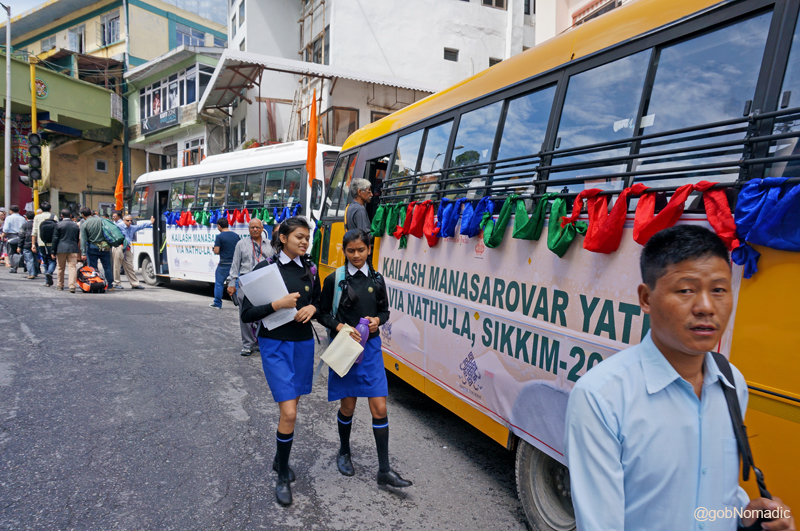
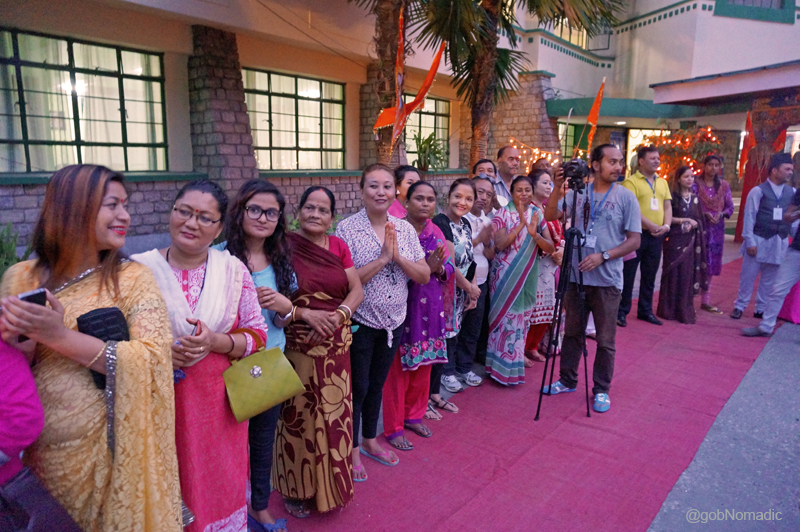
In spite of the terrain-induced harsh elements, the Sikkimese are generally a joyful lot. And the small state that it is; everybody knows almost everyone. The news of the official flag-off ceremony of the first batch of the Kailash Mansarovar Yatra through Sikkim was spread far and wide and locals, it seemed, were keenly looking forward to the events of this day. Before the group could get ready to move into the two buses allocated to us, the locals started dropping-in to see us off for the holy yatra. The series of colourful events that transpired on that day left us overwhelmed. Dressed traditionally in colourful silken robes, the locals with their cheerful presence truly multiplied our joy of participation in the first ever batch of the KMY through this route.
Bedecked with flags – meant to bring luck, happiness, compassion, prosperity, health and longevity – our transport till Nathula. For more images of the Yatra, please visit Sikkim and Kailash Mansarovar albums at Flickr
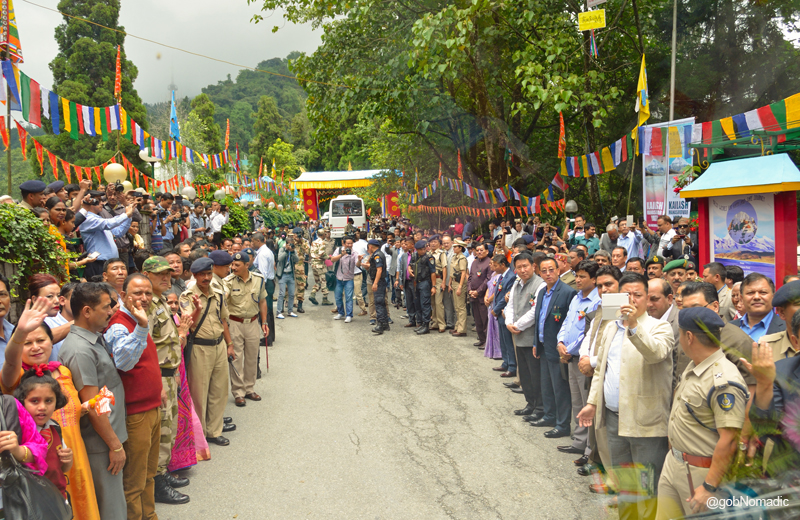
Accompanied by the staff of the STDC, we were steered to the Ridge, the venue for the day’s events and otherwise a place of note in Gangtok. The Ridge is a flat stretch of nicely tarred road above the settlement of Gangtok. Situated next to a twin-storey British-era building, the White Hall and residence of the Chief Minister of Sikkim, the Ridge is beautified by the green cover of the Ridge Park which lays spread along the road. A traditionally built Gazebo marks an important observation point by the road and in keeping with its olden tradition, the Ridge continues to be a popular venue for public events. That day, the Ridge was decorated with colourful Buddhist prayer flags, silken white cloths, flowers and balloons. The stretch of the road from the main roundabout to the make-shift welcome gate was dotted on both sides with college and university students attired in their traditional costumes representing all the main communities of Sikkim including the three main ones – Lepchas, Bhutias and Nepalese. Past the gate, the left side was allocated for the administrative officials, uniformed officers, people’s representatives, Ministers, Cabinet, Assembly Speaker, Chief Minister and the Governor of Sikkim. The right side was occupied by community representatives, religious heads, priests, representatives of the armed forces posted in the region as well as the STDC along with an identified place for the Kailash Mansarovar bound travellers. It seemed as if entire Gangtok along with the select representatives of various communities of Sikkim was out on the Ridge to welcome and bless us with their good wishes. Media too was present in large numbers. And we were the eye-candies!
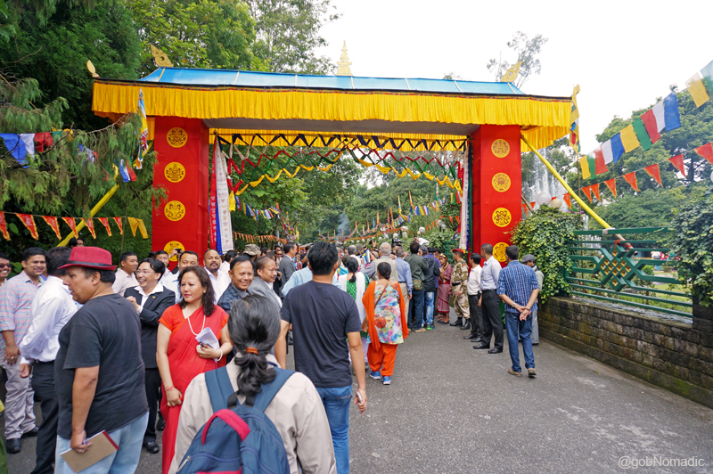
The makeshift Welcome Gate at the Ridge; the two red pillars portray Tashi-Tyagi, the eight good-luck signs of Vajrayana Buddhism commonly found on thankas, paintings, buildings or furniture. More at Flickr

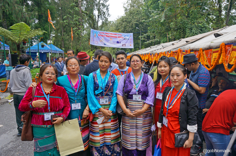
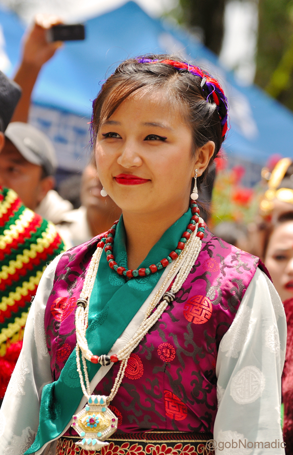
Dressed traditionally, womenfolk of the Lepcha and Nepalese communities welcoming the travellers. In Sikkim multi-ethnic people live in complete harmony despite their diversity in custom, religion or language.
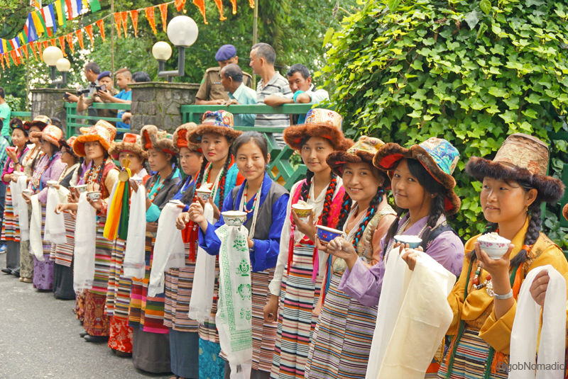
Girls from Bhutia community of Sikkim. For more images, visit Sikkim and Kailash Mansarovar albums on Flickr
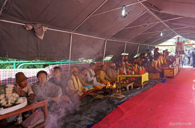
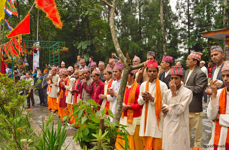
Before us were hundreds of butter-lamps flickering in the colourful ambience and prayer flags fluttering in the breeze from bamboo poles amidst chants of “Om Namah Shivaya” and “Om Mane Padme Hum”. A lama in a thick golden silk half-jacket, with bald head, shaven face and contented round eyes sat cross-legged on a raised platform accompanied by his red-robed subordinates and a few novices as well. A faint glimmer of light from white cotton wicks placed in small gold-plated votive butter lamps lit up from one corner of his low table called chogtse. Ahead the priests of Nepalese community, bedecked in their traditional attire, sat cross-legged on the ground. The incensed air had a heavenly touch. The worshipers were at their will to choose anyone or all of them to pay their obeisance to the Supreme Being before commencing their Holy Journey.

The setup at the Ridge. Please visit Flickr for more images of the region

The fifth time Chief Minister of Sikkim, Sh PK Chamling along with her better half and his cabinet as well as state assembly colleagues. Please visit Flickr Photoset for more images of the region
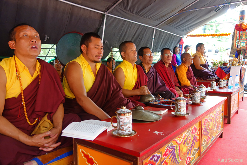
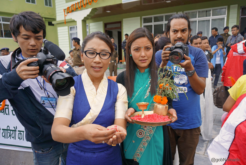
Monks performing puja at the venue. Photo-credit Aarti Saxena. For more, please visit Sikkim on Flickr
Representing the three chief communities of Sikkim – Lepcha, Bhutia and Nepalese – the puja setups at the venue to bless the commencement of the Nathula route for the KMY. More at Flickr

Votive metalled butter-lamps at the venue. For more images, please visit Flickr Photoalbum
Dressed in their traditional costumes, the staff of STDC at the venue. For more images, visit Flickr
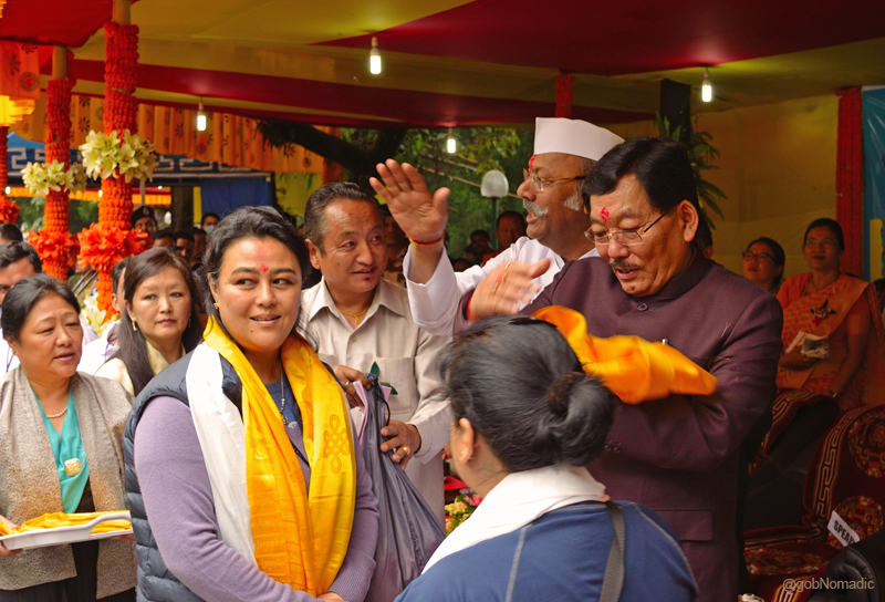
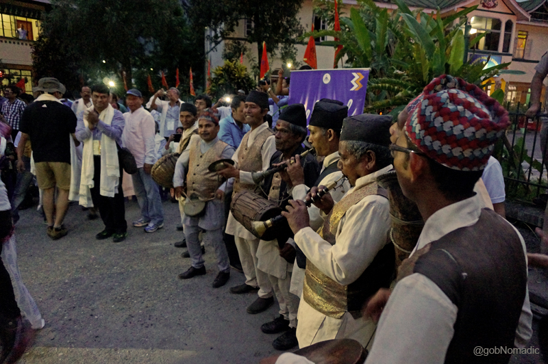
Within no time the Chief Minister, Sh Pawan K Chamling and the Governor Sh Shriniwas D Patil arrived at the venue and joined their other colleagues and subordinates from the government and administration. After the enthralling speeches by the government heads got over, the Governor released a commemorative India Postage stamp to mark the opening of the Nathu La route for the Kailash Mansarovar Yatra. The Sikkim Police Band played the National Anthem. The Government of Sikkim presented small kits to the yatris which comprised a raincoat, a warm jacket, a mascot badge dedicated to the yatra. Accompanied by the traditional – wind, string and percussion – music and songs, a captivating cultural program followed. One by one all the main Sikkimese communities presented their folk performances. The program ended after an absorbing Yak Chham performance by the young artists after which the Governor and the Chief Minister performed puja for the success of the yatris. Prasad was distributed. Concluding the ceremony, which lasted more than four hours, the Governor flagged off the first bus. Locals from the Nepalese community blew conch shells to mark the auspicious occasion. We were waved wishful goodbyes from almost everyone who was there at the Ridge. All of us reciprocated to their wishes as well as to our host Sikkim and followed the path towards the Nathu La and the highland of Tibet.
The program began with a performance of the Singhi Chham, a Bhutia folk dance linked to forming a snow-lion, a significant cultural symbol of the state. For more images, please visit Sikkim at Flickr

The various Nepalese communities of Sikkim lined up and awaiting their turn to perform, respective folk dances, before the audience at the Ridge. For more images, please visit Flickr
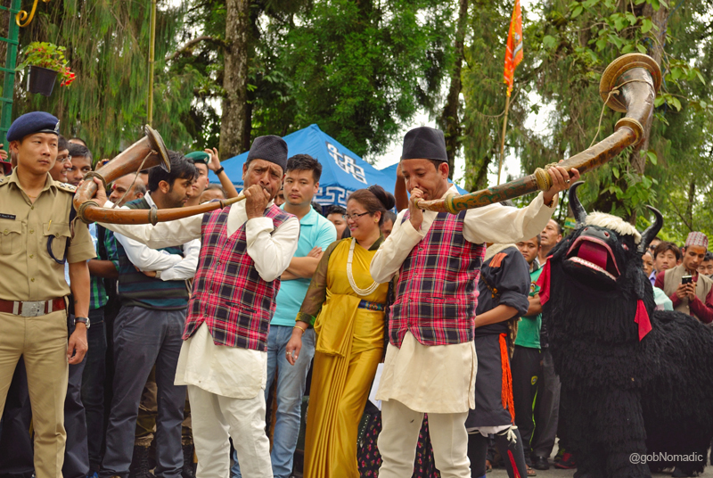
Sikkimese artists playing the traditional Sringa. More images of the region at Flickr Photoset

Girls from the Nepalese community of Sikkim. More images from the region at Flickr Sikkim
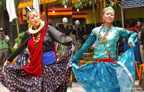
Girls from the Nepalese community presenting Maruni and Tamang Selo. More at Flickr Sikkim
A Sikkimese belle awaiting her turn to partake in the Tashi Zaldha, a Bhutia dance. More at Flickr

Sh SD Patil, Governor of Sikkim engrossed in the cultural program. More images at Flickr
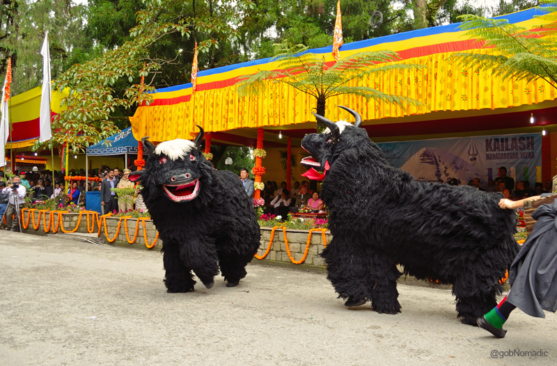
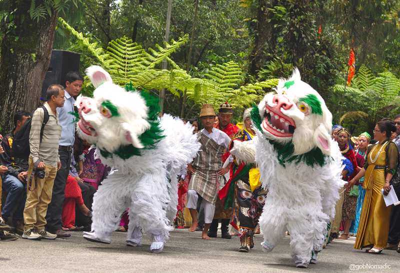
The popular Yak Chham; performed here by the Bhutia community. This dance depicts the Yak and projects the involved lifestyle of the herdsman in the high-altitude terrain. More images at Flickr
The Governor and Chief Minister of Sikkim presenting travel-kits to the yatris. More at Flickr
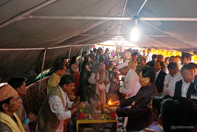
The Governor and Chief Minister of Sikkim performing puja just before the formal flag-off
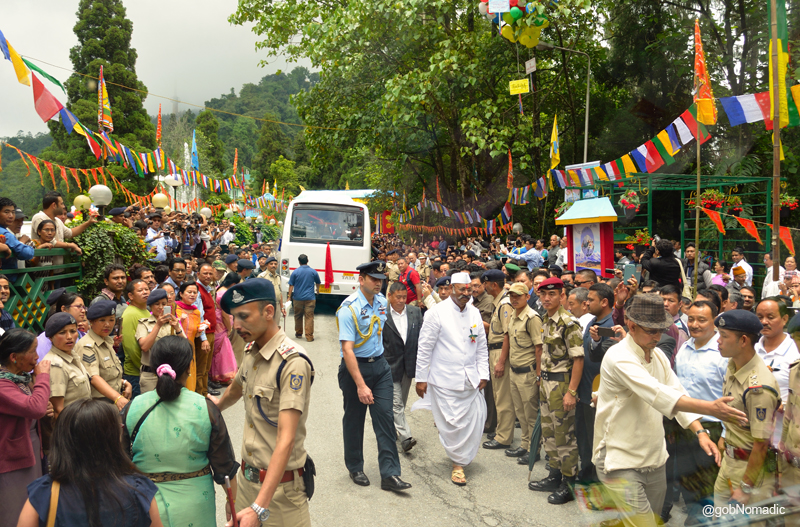
The Governor after flagging off the first bus. More images from the region at Flickr Photoset
The locals with conch shells in their hands; the religious ceremonial trumpet is believed to drive off the evil spirits. For more images of the region, please visit Sikkim or Kailash Mansarovar at Flickr
Without batting an eyelid, I opportunistically placed myself on the (uncomfortable) first seat of the second bus and began preparing a photo-log as we left the Ridge for our next halt, the Fifteenth Mile. Gulping water from the bus driver’s water bottle I wondered, “A pompous and extravagant show such as this and not a slight damage to the environment!” That’s what Sikkim actually is. A waste-free, polythene free state where people freely practise organic cultivation by default and remain committed to saving environment more than any other Himalayan administration. Whoa!
Now its our turn to be flagged-off; the crowd all set to offer us their wishes. More images at Flickr
And so in our hunger for the divine presence, we set out on our journey northwards, hardly knowing what lay ahead on the other side of Nathu La.
From Plains to Sikkim

The following post is a part of the “Kailash Mansarovar Yatra” Blog Series Into the Sacred Space. To read complete travel memoirs and trip report, please visit here.
Early that morning, the day five of the Yatra, I got up to pack my stuff for the yatra. I had already arranged everything I needed, the previous night but the packing needed to be organised. I divided my stuff into two bags, a 100L duffle bag, to carry all the heavy clothing, along with a 40L backpack. The backpack contained my cameras and other gadgetry besides some basic high-altitude winter gear like a balaclava, bandana, floppy hat, sunscreen cream and gloves, etc. as well as an assortment of small energy bars along with some quantity of dry fruit.
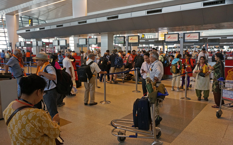
The Yatris preparing for a group check-in at the New Delhi airport. Please visit Flickr for more images
All of us were supposed to reach the Gujarati Samaj Sadan by 0600hrs to be a part of the flag off ceremony hosted by the Delhi Government. Owing to some family commitments, I had to give that event a miss and instead aimed to reach the New Delhi airport by 1000hrs. The group gathered at the check-in window of the airline we were booked at by the Sikkim Tourism Development Corporation (STDC). By the time we assembled at the kiosk, the members of the group had already adorned themselves into outfits symbolic to a traveller; some wearing trekker’s gear, some sticking to pilgrim’s robes and some still formally dressed. The “journey” had begun. The introductory exchanges the yatris had had amongst themselves for the past few days were increasingly getting productive now. Insofar as the general expression of the group with respect to the holy Kailash was concerned, a shift from formalities to “What this Yatra means to me” was increasingly felt. Clearly, each one of us was enthusiastically looking forward to the journey ahead.
The flight from New Delhi to Bagdogra – located in northern part of the state of West Bengal – base airport for Sikkim, takes about 90 minutes. Luckily, I got the window seat. For those who know these mountains, not more than 20 minutes after you take off, a Himalayan curtain-raiser awaits you. Soaring high above the clouds, the twin peaks of Nanda Devi catch your attention; the frame quickly transports to other higher peaks. Shortly before the inflight onscreen GPS map flashes the position of your flight soaring above Patna, the mammoth rock of Mt Everest (Chomolungma) comes into view. I didn’t expect it to be so vivid and was just awestruck!
Soon enough, the aircraft hovered above the lush green patch of Siliguri and as it prepared for its aerobatic-touchdown, I took a few more photographs of the green-scape from the tiny aircraft window. We were earlier briefed about our routine for the day but the welcome bestowed at us on our arrival at the Bagdogra airport was something none of us had expected. And well, in all goodness, this one was merely a glimpse of what lay ahead.
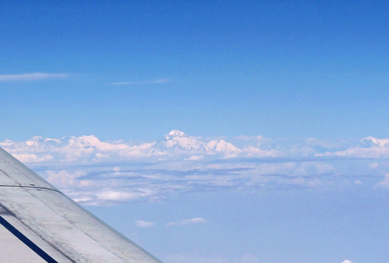
The mighty eight-thousanders of the Himalayas. Please visit Flickr for more images of the Yatra
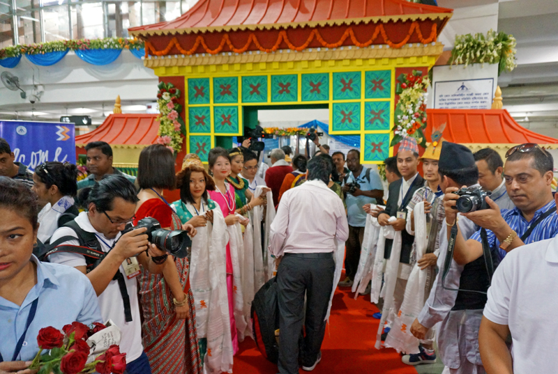
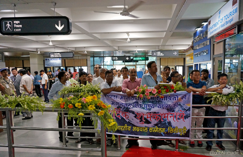
The welcome ceremony at the Bagdogra airport. For more images, please visit Flickr
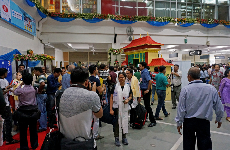
Fanfare after arrival at the airport; Batch 01 of KMY via Nathula. Please visit Flickr for more images
Organised by the STDC, select college and university students from Sikkim – dressed in their traditional attire – had come to greet us on our arrival at the airport. A few local traders and businessmen accompanied them. Without creating any trouble for other co-passengers, the representatives of STDC humbly presented the yatris with khadas, the traditional scarf-like ceremonial garland made of silk. Symbolising a pure heart of the presenter, the incensed greeting left us mesmerised. Before our luggage committee could come into action, the helpers of STDC arranged our entire luggage in the two buses provided to us for our journey to Gangtok that day.
The local traders and businessmen at the airport to welcome the Yatris. Visit Flickr for more images

A TV press reporter inside our bus. Please visit Flickr Photoset for more images of the Yatra
Siliguri, part of West Bengal, lies at the base of the Himalayan foothills. The flight had made our journey to Bagdogra as comfortable as it could have been possible. The scenery was spectacular save for the monsoon haze just below the top of high Himalayan peaks. After a quick lunch, we left for Gangtok, the capital hill-town of Sikkim.
Lunching at Bagdogra. Please visit Flickr Photoset for images of the Yatra

Passing through the dense cover of Mahananda Wildlife Sanctuary. For more images, please visit Flickr Photoset
The second leg of the day’s journey to Sikkim, from Bagdogra to Gangtok, was to be completed by road. For a long part of the drive, the road passes through the Teesta valley and then branches off to Gangtok. Although nothing of note could be mentioned here, the delight of the initial moments of that road-journey is indescribable. Having caressed the Himalayan peaks, the cool breeze descending from there could be felt as we passed through thickly wooded foothills. Around here, the lush green country full of tea gardens puts on a new face to the landscape. Northwards lay Sikkim, stretching as far as the Great Himalayan Range and the trans-Himalayan passes. The state of Sikkim is bounded on the west by Nepal and on the east by Bhutan, both sacrosanct to a wandering traveller.
A view of the Teesta Valley from Teesta. Please visit Flickr Photoset for more images of the yatra
For a deeper realisation of the great peace one enjoys as the Teesta Valley slowly reveals itself and to appreciate the beauty of the scenery, the restfulness of trees and hedges, of trails and sidewalks, one must spend a slightly extended time here. I promised myself another visit. Unlike other voluminous rivers originating from the Himalayas, the Teesta was not observed to be in spate even though the water was a little muddy. The road to Rangpo initially followed the right bank of the Teesta through woods and clearings on an easy gradient. We drove at peace, spending most of the time in observing the environment, something that was to be a part and parcel of the day’s routine in the journey ahead. The environment was as beautiful as one could wish, mostly untouched as well as natural and in parts strangely reminiscent of forests.
The road ahead to Rangpo. For more images of the Yatra, please visit Flickr Photoset
On the way, at Melli on the left bank, the Border Roads Organisation (BRO) had hosted a High Tea for us. “How fortunate we were to be a part of the first batch”, most of us would often admit! Quickly enough, we were on our way to Gangtok again. Just before Melli, the greener waters of the Rangit River confluences with the Teesta. There was a great harmony in the valley that day even though it was misty which meant arrival of seasonal rains. Our next halt was planned at Rangpo, another High Tea, we were briefed; this time by the STDC at its reception centre.
The High Tea organised by the BRO at Milli. For more images, please visit Flickr Photoset
Apart from the lush green stunning landscape, one might come across typical BRO road warning signs comically presented as one-liners on roads leading to the border such as this one. “Better to be late Mr Driver than The Late Mr Driver”, “BRO – Cutting Hills but Joining Hearts” or a little suggestive one “Be gentle on my curves” and “Peep Peep, Don’t Sleep”, etcetera to name a few. The valley opened up after Melli. Quickly enough, we reached Rangpo where another welcome ceremony, albeit an extended one, was held. The ceremony included cultural and folk dance performances by local artists and college/ university students. Almost the entire village including the local MLA as well as the administrative staff had gathered to welcome us. And, of course, the media was there!
Locals gathered at the Rangpo Tourist Reception Centre to welcome the travellers
The local artists welcoming the Yatris at Rangpo. For more images, please visit Flickr Photoset

Local artists performing Tashi Sholpa (a Tibetan opera dance symbolizing good luck) to welcome the KMY Batch 01 at Rangpo. For more images, please visit Flickr Photoset

The local SDM at Rangpo welcoming the Yatris to Sikkim. For more images, please visit Flickr
By the time we left Rangpo, it was dark already. Rangpo has always been a police check post where entry permits to Sikkim get checked. A fairly large village now, Rangpo also marks the border between Sikkim and West Bengal. It is from Rangpo that the East Sikkim starts. Gangtok is still another 30km from here. Ahead, the Teesta valley was terrace-cultivated. The next town on our way was Singtam, located at the junction of the Rongni Chu with the Teesta. Our guide informed us that the stretch of the river between Singtam and Rangpo is a popular rafting tract. Culturally, Singtam marks the end of a civilisation we all were familiar with. All the crests, bridges, public places were marked with colourful fluttering flags that announced the acceptance and arrival of Buddhism. It was pitch dark and we arrived at Gangtok in time for a late dinner and still spent the early part of that night discussing the expected series of event lined up for the next day. “End of a long but fulling day it was”, I marked in my travel notes.
Almost 2200hrs at Gangtok; the staff of the STDC is all smiles (for yet another welcome ceremony!)
Planning and Preparations

The following post is a part of the “Kailash Mansarovar Yatra” Blog Series Into the Sacred Space. To read complete travel memoirs and trip report, please visit here.
Gingerly, I found my way to the first floor of the Gujarati Samaj Sadan on the evening of 13th June, 2015. Or was it the second floor? A middle-aged man at the reception had told me that this was where the Kailash Mansarovar Yatris had been put up. It was day one of the yatra, according to the Ministry of External Affair (MEA)’s schedule – the day the yatris arrived in Delhi, and I being their Liaison Officer (LO), first met them here.
As I soon found out, they were all just as anxious and excited about this yatra as I had been for weeks! Through the social media group that we had created, most yatris had at least some knowledge of each other before coming to Delhi. Ranging between the ages of 27 to 70 years, our motley group had people who hailed from almost all regions of the country – Tripura, Rajasthan, Gujarat, Karnataka, Uttar Pradesh, Madhya Pradesh, Haryana, Maharashtra, West Bengal and more. The burning desire to see and pay homage to the Holy Mount Kailash as well as to experience the serenity of the grand Lake Mansarovar was the common thread that united all of us. The constituents of the group ranged from all walks of life – be it homemakers, or bankers, or teachers, or government servants, or even businessmen, politicians and doctors, etc.

All enthusiastic, Yatris posing with their vehicle to reach the DHLI from the Gujarati Samaj Sadan in Delhi. Please visit Flickr Photoalbum for more images
The first three to four days of stay in Delhi for the yatris are looked after by the Delhi Government. The Tirth Yatra Vikas Samiti of the government arranges for the bedding and lodging of the yatris at the Gujarati Samaj Sadan where they are accommodated in a well maintained dormitory. For outstation participants, this place serves well to allow initial (and often lifelong) bonding to happen amongst them. Apart from that the samiti also provides a comfortable transportation to the yatris to facilitate their movement in Delhi.

The yatra got nationwide publicity right from day one
Outwardly, the Yatra formally begins on day two with a detailed medical check-up at the Delhi Heart and Lungs Institute (DHLI). This is also the time when all the shortlisted participants get to meet each other for the first time. The MEA had given me a list of 49 yatris, about half of whom I had already met the previous evening at the Gujarati Samaj Sadan. As required, all the participants reached the hospital at 0800hrs on empty stomach. The medical tests included an umpteen number of blood tests, TMT, PFT, ECG, and the like. I had been through these nerve-wrecking tests just a few weeks ago as part of the selection procedure for LOs. The nervousness in the air was palpable, as was the excitement.
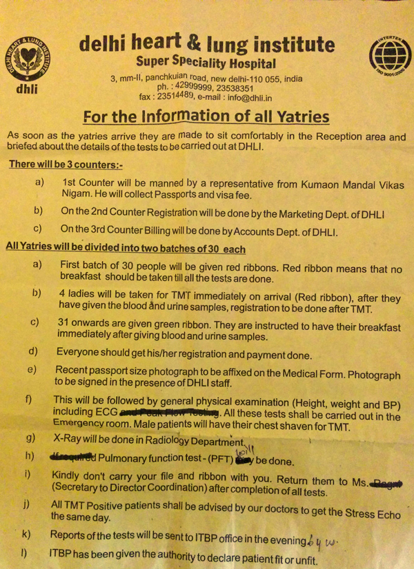
The moment we entered the DHLI main hall, we were handed over with this leaflet along with a few forms to be filled up individually.

Vasant Bhatol and Sanjeev Kumar awaiting their turn for the Treadmill Test
Passports of all the participants had been collected along with some visa related formalities. The Chinese were not going to affix the visas on our passports apparently; they were going to issue us a common group visa for all the yatris. All this and more was just mentioned in the booklet the MEA had sent us a few days before. The medical tests at DHLI took almost the whole day, and ended with a short presentation on the medical emergencies that may arise at high altitudes.
The results of the medical tests, and also the final list of fit yatris, were to be declared on day three at the ITBP Base Hospital in Delhi where we were expected to reach by 0900hrs. Today was also the day we had set aside for the formation of our yatri committees who would independently manage the group’s affairs, related to the task assigned to them, till the completion of the yatra. The briefing document I had prepared for the yatra comprised all the agreed committees along with a brief description of their duties and responsibilities. The list included Finance committee, Food committee, Luggage committee as well as a Headcount committee. Mercifully, I was able to get volunteers within no time as everyone was keen on making the yatra a success.

After the briefing session at the ITBP Base Hospital. As fitness results were expected today, the overall mood of the yatris was more tensed than that of yesterday at the DHLI. It was sad to see five of us going back after they were found unfit.
The doctors at the base hospital called the yatris one by one and after a brief media check-up; the DHLI report was examined to gauge the level of fitness for the yatra. By the time the final fitness list got prepared, we had organised a briefing session as well as a formal question and answer session in the conference hall of the ITBP base hospital. As ours was going to be the first batch of the KMY through the Nathula, there was some uncertainty with respect to the facilities and procedures in Tibet Autonomous Region (TAR). So this was going to be one adventurous trip!
We all agreed to not leave any shopping for the last minute in Delhi, as the next day was to be packed with official formalities at the MEA building. With that in mind, all of us made a recheck with respect to the checklist of items to be carried, as mentioned in the MEA booklet, including the travel accessories, winter gear as well as medicines. It was also agreed that all the yatris should carry just a little extra money with them – for unforeseen eventualities.

The itinerary prepared by the MEA; holds true for all the remaining four 2015 batches.
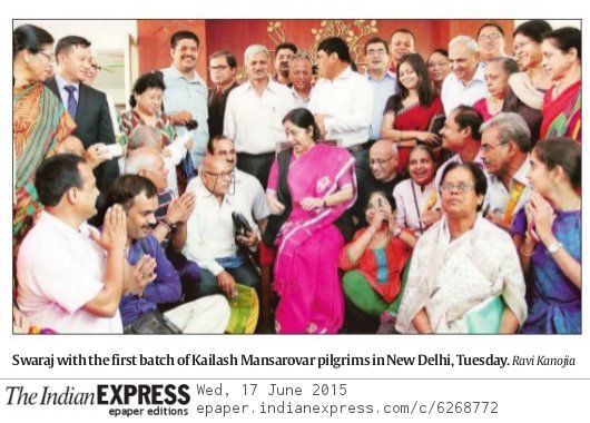
Next day, the day four of the yatra, all of us gathered at the MEA building, on the Janpath in Delhi, where we were briefed one by one by the concerned officials of the ministry. Smt Sushma Swaraj, the Minister for External Affairs, Government of India had come to flag off the first batch – of the newly opened route through Nathula to the holy region. The auditorium was packed with media from all over the country. Little did we know that the presence of cameramen and reporters was going to become a regular sight for the batch throughout the journey!
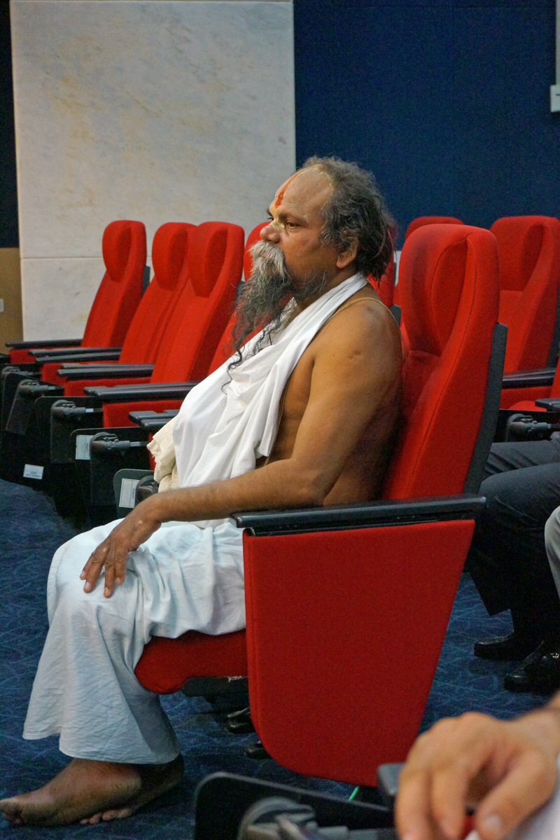
Babaji from Khargone, MP
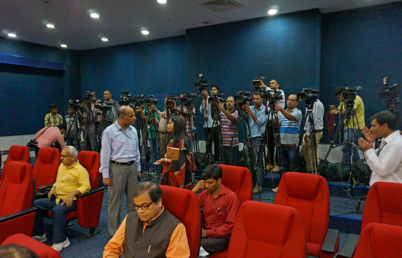
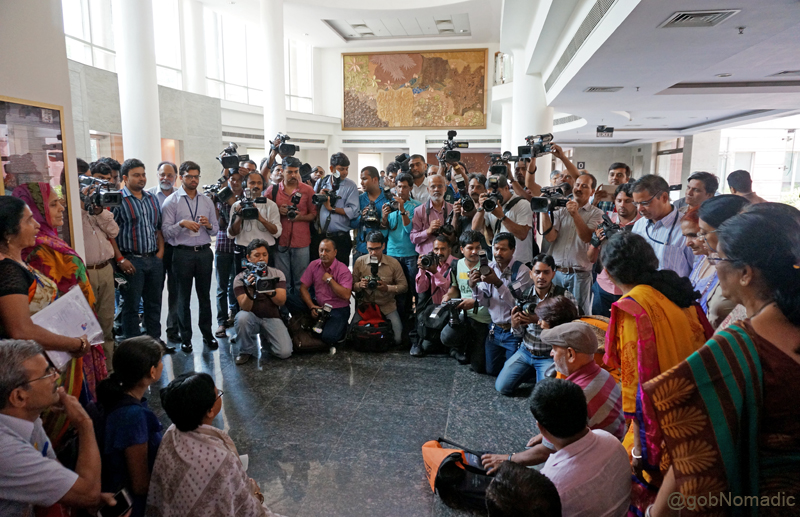
Media at the ceremonial flag off ceremony held at the MEA building. By virtue of being part of the first batch, we were under constant media glare throughout the yatra. More images at Flickr
Smt Sushma Swaraj, the Minister for External Affairs, Government of India and the Batch 01
And the other side of the picture. Please visit Flickr Photoalbum for more pics
And the next day in papers.
The ceremonious flag off by the Minister was followed by some general briefings relating to dos and don’ts, submissions of indemnity bonds and other such formalities, after which we finalised the task as well as assigned duties to the various committees. Everyone got down to perform the role as was expected by the group. The Finance guys collected money towards the common pool. The Luggage team took feedback of baggage from each of the members of the group. The Food committee prepared a menu and identified the ration we needed to purchase from Gangtok, the capital of Sikkim, and last marketplace before we crossed the border. The remainder of the day was spent in getting forex conversions or making last minute purchases for the journey. Once in Tibet, conversion from US Dollar to local currency was possible but not from Rupee to the local one. Therefore, most of us carried some extra dollars.

The MEA Briefing at the media centre. For more images, please visit Flickr Photoset

Getting ready for the High Tea with the Minister. More images at Flickr Photoalbum

Members of the Food Committee brainstorming the menu and quantity of rations required to be carried for the journey. Please visit Flickr Photoalbum for more images
On a personal note, I had been intimated of my selection as LO of Batch 1 via Nathu La at the eleventh hour, and given my hectic work life, so was the case with my preparations. Although I do consider myself physically and mentally fit, I was aware that this yatra required a lot more than that. In terms of physical fitness, anyone with a spiritual or Himalayan inclination and a healthy as well as mentally fit body frame should be able to take up this journey. I had been to Himalayan treks before but here we were stepping on foreign soil and being on the first batch none of us were sure of what lay ahead. On the logistical side, I had made a hurried trip to an adventure gear store the previous weekend to upgrade my accessories and gears to match the extreme climatic and harsh conditions of Tibet for this yatra. We were venturing into Tibet at a time and season when the weather can actually get very wet. The list of items I planned to carry closely resembled the one recommended by the MEA in its booklet.

The meticulously prepared checklist of items as mentioned in the MEA booklet
Having said that I always feel what you wear is very much a personal choice and so stick with what works best for you. The real possibility of facing extreme temperatures in Tibet means that you must be prepared for both below freezing and burning sun conditions. My personal advice would be to carry a good quality raincoat or a poncho, down-filled jacket and a pair of high quality trekking shoes apart from all other listed gear or accessory. And above all, get physically and mentally fit before you decide to go. Success on this journey will depend upon your fitness and more importantly how you are able to manage your health with the changing altitude.
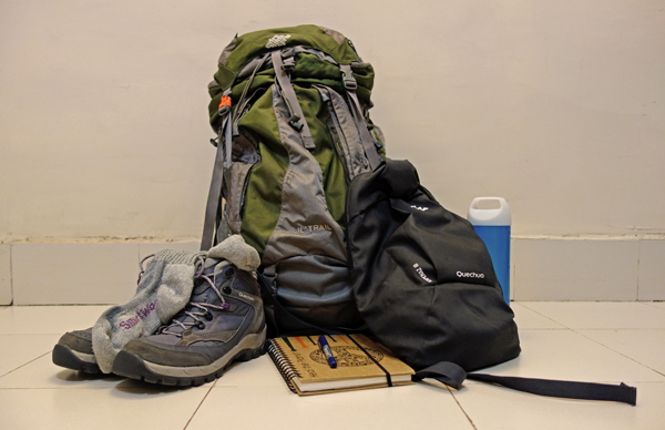
Apart from a 60L duffle bag, this is what I carried. More images from the yatra at Flickr
That night, I could hardly get any sleep. Our flight to Bagdogra was scheduled early next morning. My last minute packing, as also the excitement, kept me awake till wee hours that morning.
Disclaimer: All views expressed here are personal, and do not represent the views of the Government of India in any manner.


