 bNomadic
Dodra Kwar Diary: Climbing the Chanshal Pass

Next morning, I take it rather easy initially but as I leave the Rest House, I gingerly manoeuvre my vehicle to climb the narrow dusty bumpy motorway to Chanshal (3784m). The air outside is fresh but every descending vehicle, load carriers mostly, whips a cloud of dust along. It is already nine. The sun beams are streaming onto the Pabbar valley which is now enclosed by high hills. The road changes bank at village Tikri. After the Tikri bridge, the narrow paved but potholed road steadily climbs for the next 10 km to reach Shiladesh, where multiple marketing agencies are working day and night to make the best out of the remaining few days of the apple harvesting season. Until few years ago, the tarred road existed up to Tikri but now Shiladesh is the point after which it’s all stony but slight wider. The settlement of Larot is still couple of kilometres away. I take nearly two hours in reaching Larot (2620m) from Sandasu. But that’s okay, taking notes and making photo-records does take time. Being a travel writer is totally different than being on a holiday.

The road to Tikri by the Pabbar River. Please visit Flickr for more images of the region
The Pabbar cascading down the valley at Tikri. Please visit Flickr for more images of the region

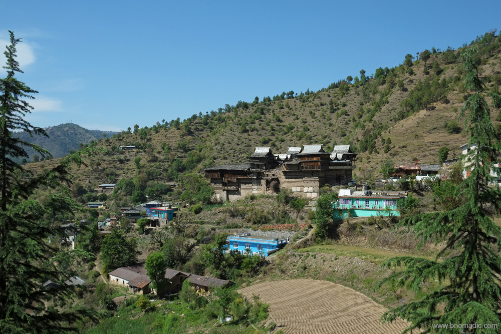
The settlement of Tikri perched high above the Pabbar. Please visit Flickr for more images of the region
By writing about the rarer corners of the Himalayas, travel writers are somewhat responsible for taking the veil off a secluded land. More writing means more advertisement. The Himalayas offer thousands of kilometres of rugged kutcha tracks for rallying through its valleys, forests, along its mighty rivers and over its famous passes. The concern of vehicular exhausts polluting the virginal peace of the mountains is a sour matter. But then there is a lot to be said regarding the use of a vehicle to reach the lesser visited portions of the Himalayas and get an access into the hidden cultures and geographies. Responsible travelling requires us to have a heart with respect to every aspect of environmental health. This calls for a special empathy for the ecosystem as well as the cultural traditions that have grown out of it. Visitors and locals grow together and a sense of this living relationship is what Himalayan travel ideally ought to inspire. This thought makes me even more responsible as I negotiate the slopes ahead.
The agriculture fields of village Tikri by the Pabbar. More images from the region at Flickr

The scenic village of Larot perched high above the valley. Please visit Flickr for more images of the region
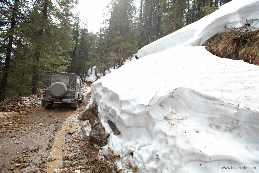
Just a kilometre ahead of Larot is the teashop at Shagulta. The wanton destruction of hills is yet to reach in this area. The pit stop marks the end of habitation as the road enters a dense forest belt. Hereafter, the road length to Chanshal is spanned over 15km of forest and meadow drive comprising 13 hairpin bends. My vehicle is in first gear ever since I crossed the bridge at Tikri. With not a single trace of civilisation around, I am elated to feel the old world charm of a Himalayan drive as I enter the magnificent forests of Chanshal. The climb is steep. A Tata Nano (sounding like a tractor) is struggling hard to climb. The driver stops to let its engine cool after every bend. I am a trifle surprised to notice logging and cutting of trees in this notified dense forest cover. A worker informs me that the cutting and felling of trees is very selective and is being observed by the concerned departments of the state government.
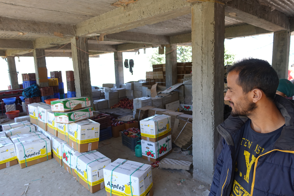
Scheme of things at an apple marketing agency; Its the end of harvesting season and apple packing is in full swing. The apples from all over the state are mostly procured on long term contract by Adani Group. The highest price the Group offers to the contractors is Rs 24 per kg. The same apples are then supplied and sold all over India on much inflated rates.

The main square of Larot that doubles up as a parking site. It has a couple of tea shops, medicine shop, a dhaba and a grocery store. Please visit Flickr for more images of the region
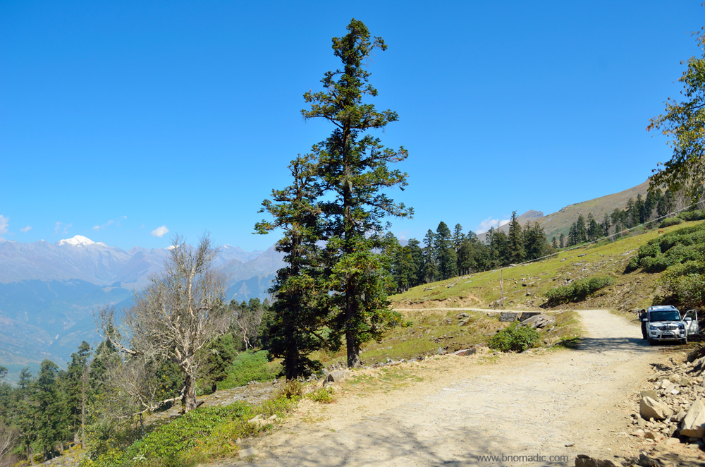
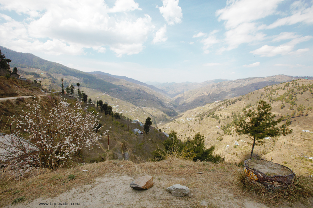
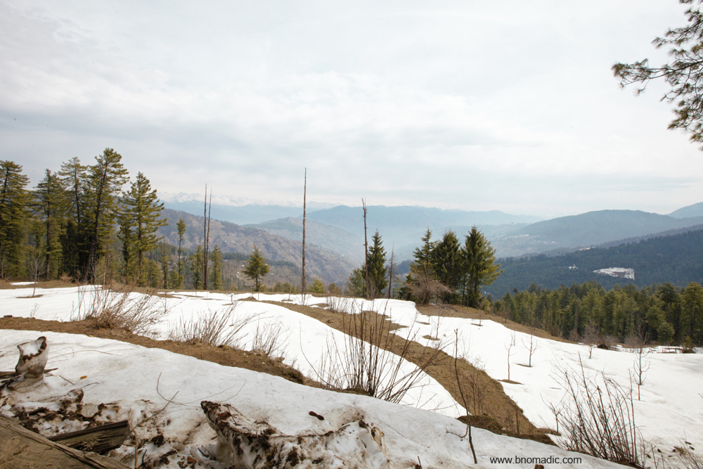
I stop to savour the view of the valley I have just crossed. Water is oozing out of the mountain face and cascading down in the form of small streams. Topped with some icy peaks, the Sangthar Ghati and Durgi Ghati Range is in full view. The mountains and sky are playing out the overtures of a perfect landscape. The stunning panorama of the glorious array of snowy and rocky peaks surrounding the Sangthar and Durgi Ghatis with dense green valleys below under a deep blue sky is heavenly to say the least. The overpowering scent of dense forest is the heady factor that gives me pure and instant untrammelled joy. In addition to the peaks, the pulsating blueness of sky and the wildly intoxicating tang of fresh grass is the benison of hillsides of energetic alpine foliage shining bright under the sun. Rarely has my soul experienced such a sensually unrestrained pleasure. Six kilometres before the pass, I leave the treeline to enter a vast grassy wind-swept face of the Chanshal Range.

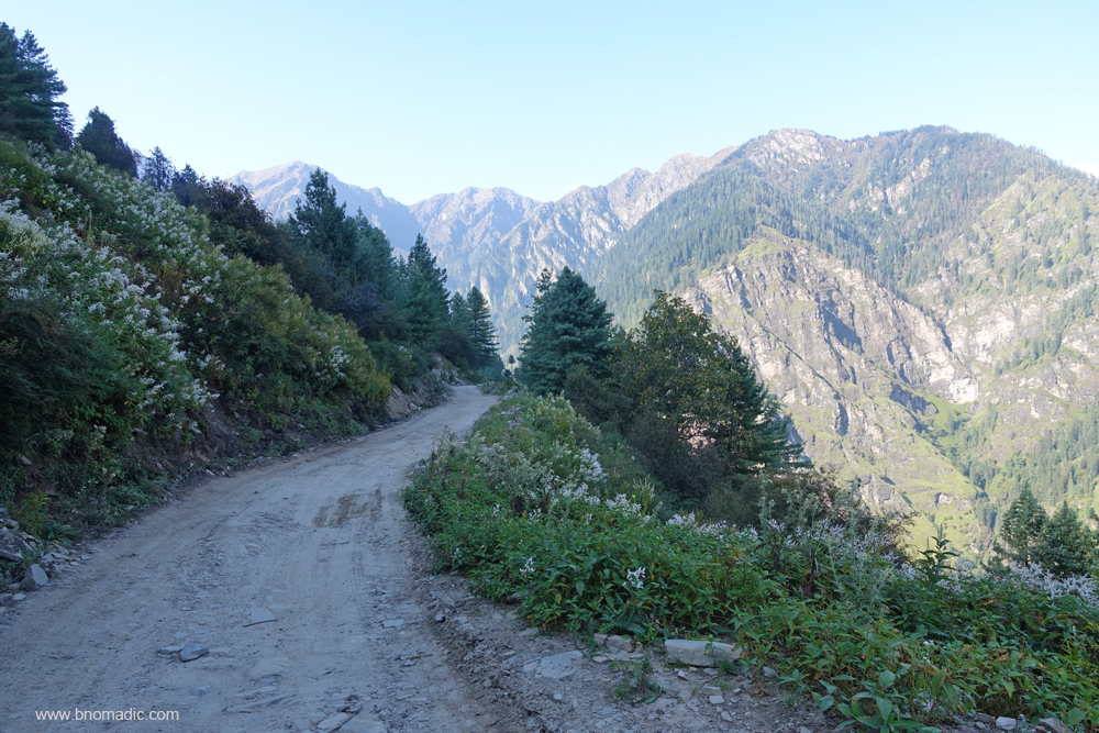
Motorway right after Larot as it prepares to enter the forest cover. Initially, it was proposed that the road to Dodra Kwar should be built from Netwar given the ease of its construction. The initial negotiations with various departments and governments started in 1976. The proposed route got negated as it passed through Govind Pashu Vihar National Park. Later in 1980s, it was decided to construct a road in Himachal itself via the Chanshal Pass. Before this the road existed up till Tikri.

Timber cutting and logging in progress. It was because of this forest and a similar stretch on the other side of the pass after Gajyani Thatch, the road construction to Dodra Kwar kept getting delayed. Obtaining permissions from the then disinterested central government was not an easy task
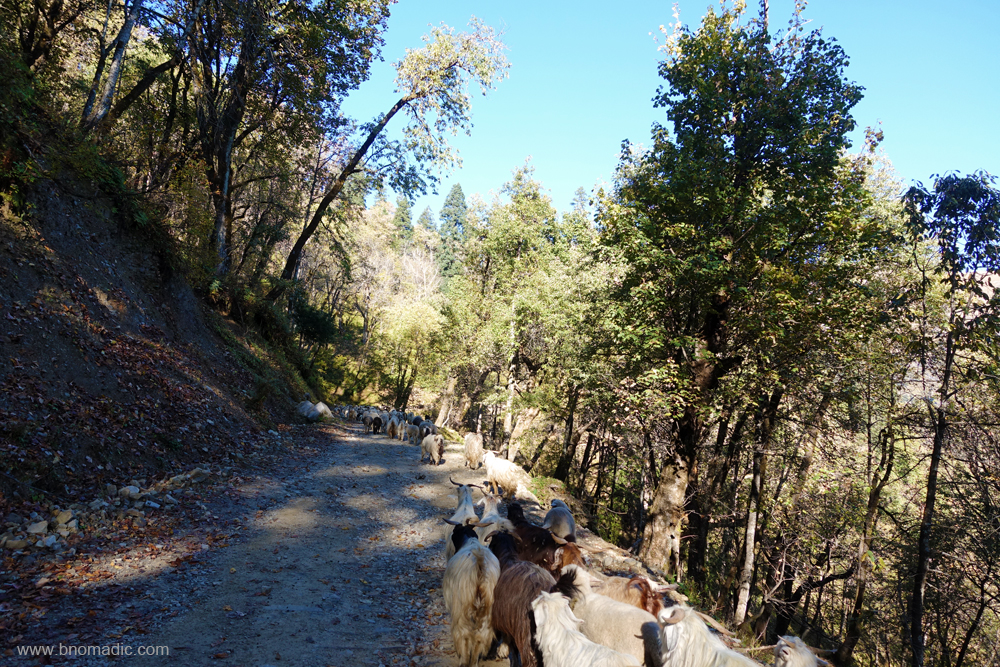
Must be among the largest flocks of sheep on a road (more than 3,000). I take more than 30 min to cross the flock looked after by just three men and four gaddhi dogs. More images at Flickr

Lifeline of Dodra Kwar, the state owned transport bus that makes one trip a day. As of now, only two buses ply between Rohru and Dodra Kwar. More images from the region at Flickr
A photo break just after exiting the forest cover. Please visit Flickr for more images of the region

Topped with some icy peaks, the Sangthar Ghati and Durgi Ghati Range is in full view. More at Flickr

A panoramic view of the Pabbar Valley from the slopes of the Chanshal. More images at Flickr

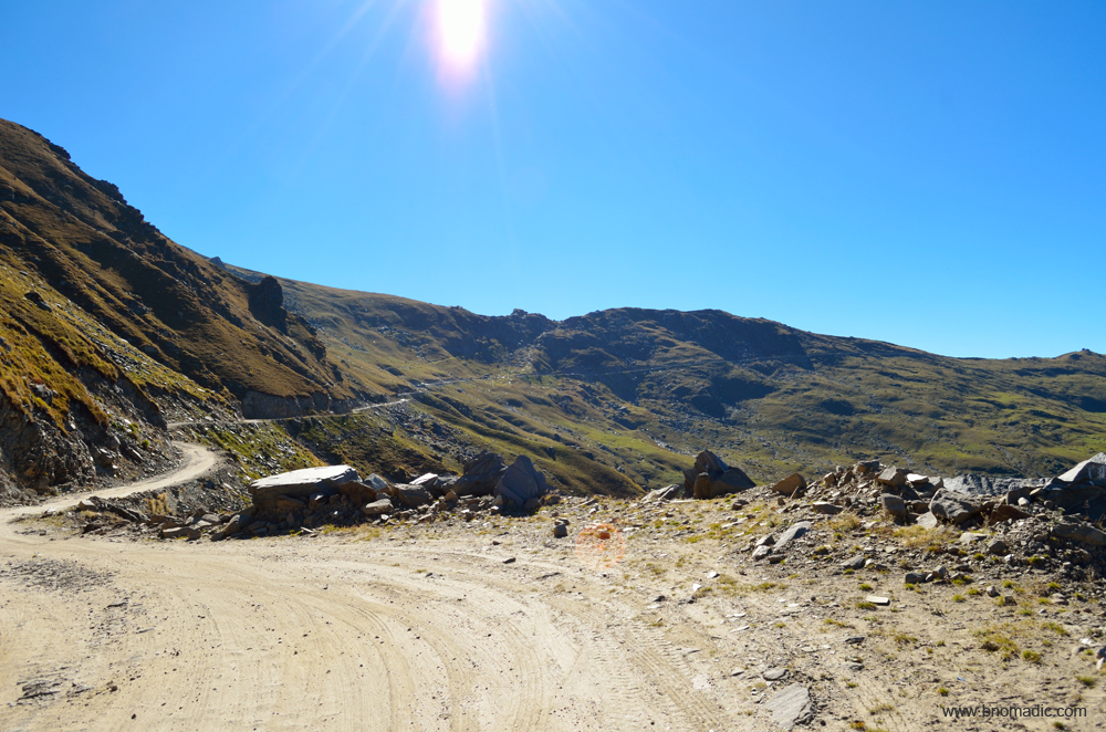
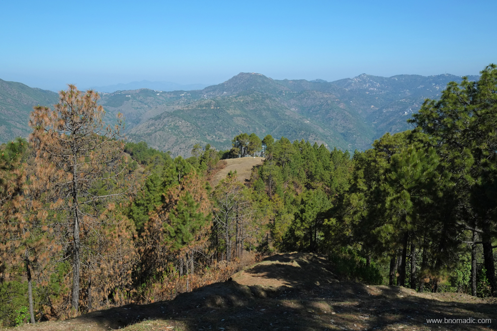
Four more kilometers to the crest of the pass, marked by a small mound. More images at Flickr
The final line of ascent. Before the advent of this road, the track was merely a rough footpath and mostly unfit for mules. Please visit Flickr for more images of the region
The mountains and sky are playing out the overtures of a perfect landscape. More at Flickr
With a few more photo-halts, I am atop the pass after driving for about five hours from Sandasu. Once again, I get down from the vehicle. The panoramic display of the icy Himalayas is truly captivating. The sweeping mountainscape encompasses magnificence as well as beauty. Here everything is on the grandest scale, fragments of fallen rocks of immense bulk, hurried from the peaks above, and vast impending cliffs fringed with dark forests, and topped with mountains of indestructible snow, appear on two sides; vast meadows spread on rounded ridges encircled by verdure, and marginally populous villages encircled by fields and orchards towards the valley floor that hardly attracts my keenness which, at the moment, is devoted to minutely observing the Great Himalayan Show.
Some emergency equipment of road workers is parked near the crest of the Chanshal Pass (3784m). Despite the fact that I am venturing into a relatively unknown territory, I am in no hurry to descend the pass which has been infamous for landslides. With every passing hour, the intensity of sunlight changes enabling me to capture different perspectives of the same landscape. Later in the day, I begin my descent towards the Rupin Valley. The motorway becomes slightly narrow. The shaded patches on the road are still slushy. A teashop welcomes me to the treeline. Ahead, the road passes through a dense forest before reaching village Dodra. It is getting dark but I still opt to continue with the same pace. As I exit the forest belt, I wonder over the amount of Himalayas, the pass has induced in my senses a while back. The green valleys full of floating mist, white clouds against a crisp blue sky, the eternal snow of the Himalayas, smoke drifting up from the valley floor, the smell of logs and fresh-cut wood, the resinous smell of the conifers, the damp smells of foliage in the forest of Gods; everything is going to be forever etched in my mind.
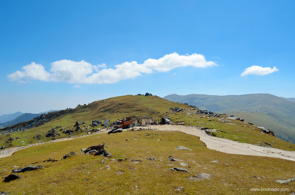
Probably realising the end of season, the makeshift dhabas atop the pass are no more. More at Flickr
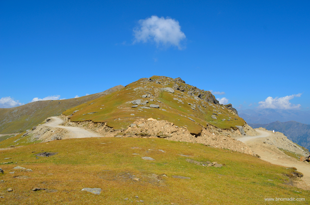
Atop the Chanshal Pass; the left road (in the frame) comes from Rohru and the right one leaves for Kwar

Preparing to leave for Dodra Kwar. Please visit Flickr for more images of the region

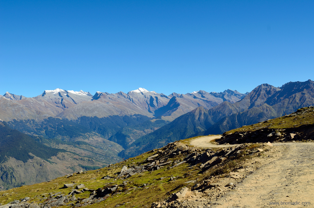
The sweeping mountainscape from the Chanshal encompasses magnificence as well as beauty. Most peaks of South Kinnaur and West Gangotri region are visible. More images from the region at Flickr

Ready to descend the Chanshal. Please visit Flickr for more images of the region

A panoramic view of the Rupin Valley from the slopes of the Chanshal. More images at Flickr

The forest cover of Dodra is clearly visible below the Pass. Please visit Flickr for more images of the region.

The road to Dodra on the other side of the pass as I begin to descend. More images at Flickr
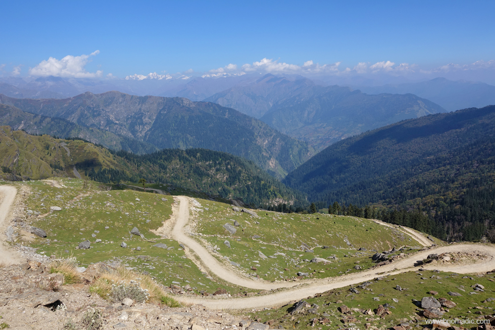
The road to Dodra Kwar descending in loops from Chanshal. Please visit Flickr for more images

A tea shop (to the right of the frame) marks the beginning of the forest cover. More images at Flickr
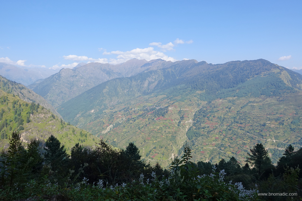
The village of Kwar across the valley is also visible from the slopes of the pass. More images at Flickr
The narrow motorway as it prepares to enter Dodra. Please visit Flickr for more images of the region

The mystic Himalayas! View towards the West Gangotri region. More images at Flickr

The magical Himalayas! View towards Western Garhwal, Uttarakhand. More images at Flickr
Getting There
The Chanshal Pass is nearly 50 km from Rohru in district Shimla. The distance between Chanshal and Kwar is 42 km. Separated by the Rupin, Dodra and Kwar are 22km from each other.
Altitude: 3784m
Best time to visit: Autumn
Travel Lure: Panoramic views and sylvan charm
Accommodation: Very limited at Kwar, Dodra, Larot and Chirgaon
The mysterious Dodra Kwar

The last week of September found me driving up the slopes of Chanshal Pass (3784m) in eastern Himachal Pradesh. Keen to explore the settlements and folkways of the enigmatic Dodra Kwar villages, I set out for a sojourn in the beautiful Rupin Valley. The road to the Rupin over the Chanshal is very recent and was made operational less than a decade back. Lunching at the HPTDC Rest House of Rohru, the waiter unconcernedly informs me of the road condition and distance between various settlements on the way. Even though, he hails from Chirgaon, the last major settlement after Rohru (1560m) on way to the Chanshal but has never been to the hidden Dodra Kwar cluster. His advice ‘don’t underestimate the surprises on the way’ proved very encyclopaedic and the first difficulty I find myself dealing with is finding a bed to crash anywhere alongside the road.
Situated by the Pabbar River, Rohru is famous for apples and trout fishing. More images at Flickr
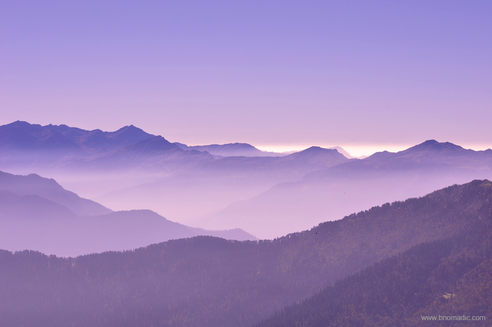
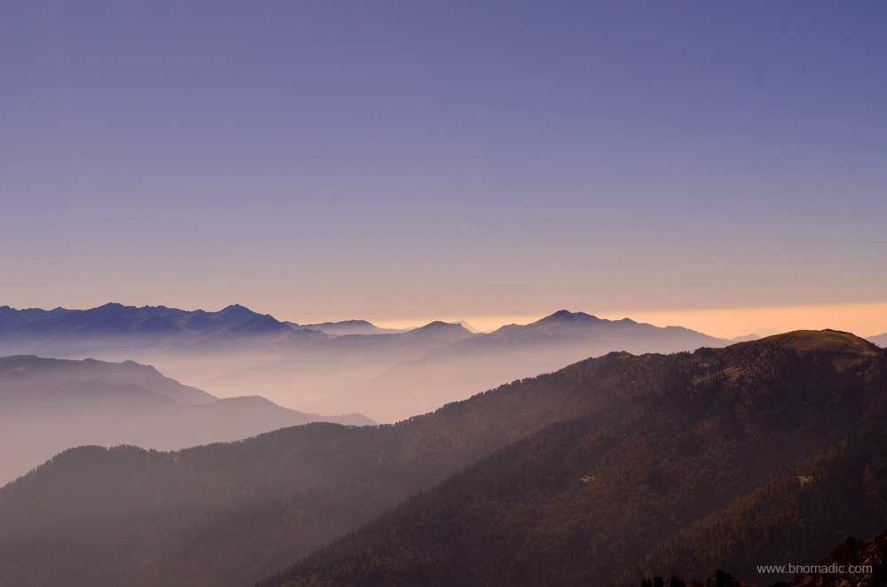
Morning hues atop valleys below Chanshal. Please visit Flickr for more images of the region
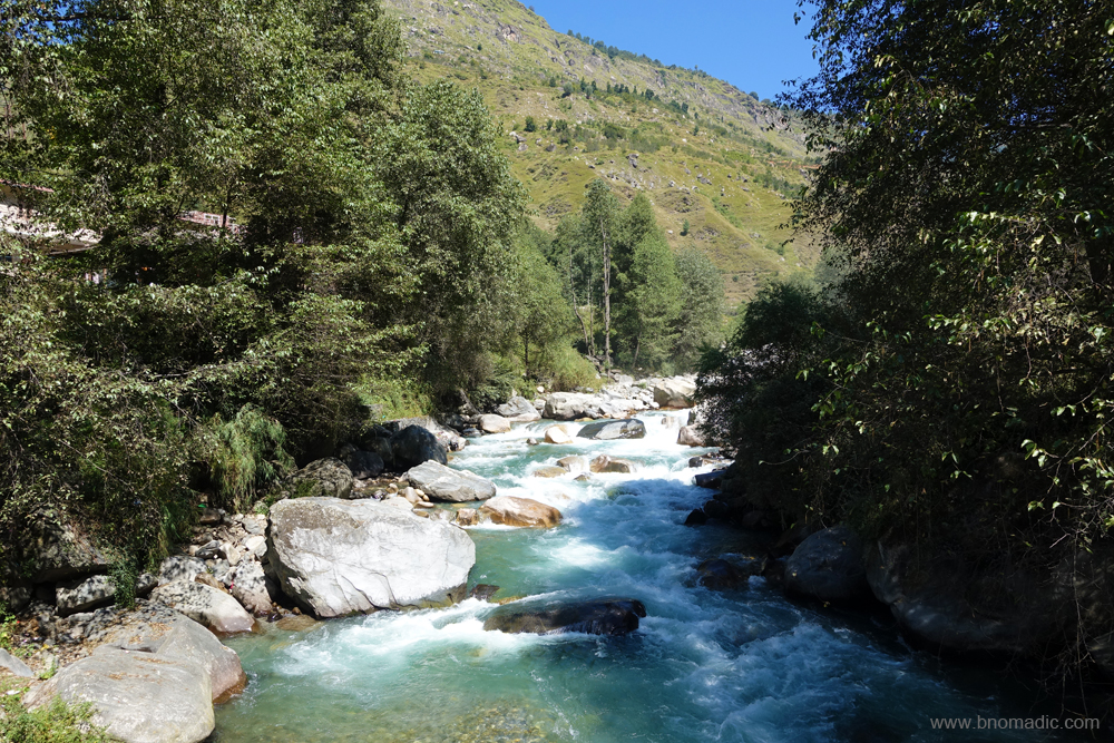
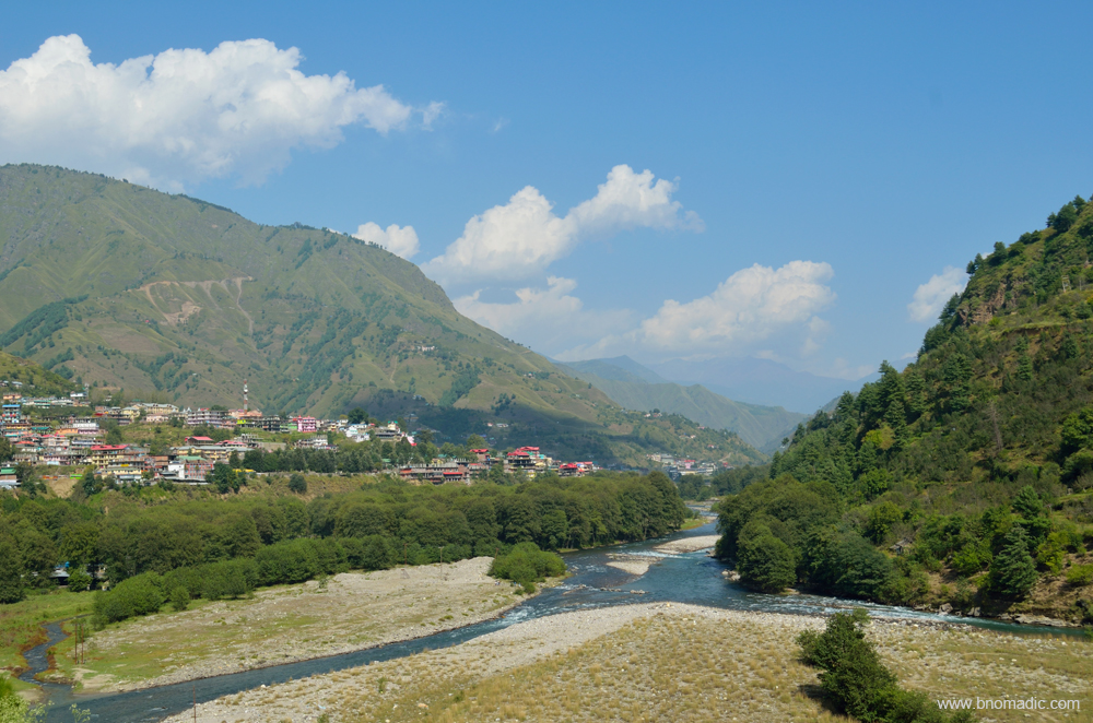
For the next 14 km, the road follows the right bank of the Pabbar upstream as the river cascades down the broad valley. Eager to get away from the traffic and noise of Rohru as quickly as possible, I rush towards the Chanshal hoping to find some accommodation at Larot, the last village on the way. Unable to establish any contact with the caretaker, I still have the scenically perched Forest Rest House in mind. “Just go and get the possession of the room”, the Rohru DFO had advised me over the phone today morning. Repaired in patches, the road to Chirgaon is potholed as well as narrow with some exposed sections. Descending from heights, trucks and pickups overloaded with apple boxes make the traffic movement onerous. I make steady progress till the narrow one street market of Chirgaon where a bottleneck has halted the traffic completely. A pickup carrying apples has broken down in the middle of the road. Daylight has started to fade as the vehicle gets towed away. Just a few meters ahead of the market, another traffic jam, under the watchful eyes of Himachal Police, on the bridge above Andhra Khad – a tributary to the Pabbar – has added to my misery of not finding a suitable accommodation before the day is over.
The Pabbar descending towards Chirgaon. Please visit Flickr for more images of the region
“Time is running out, wise to arrange something at the first available opportunity”, I tell myself. The road condition has started to become progressively worse after Chirgaon, the last village en route to the Rupin Valley where the mountain-luxuries of supplies, fuel pump, tyre and vehicle mechanics, etc. are available. Meandering along the Pabbar on the same bank I reach Sandasu (1770m), a small settlement just 2 km ahead of Chirgaon and located on the opposite bank. Compared to the number of houses in the village, I am rather surprised to see an elaborate colony of government offices and a hospital on the right bank of Pabbar. A ray of hope flashes in my mind. Next minute I am standing in front of a HPSEB field hostel by the road. The local BDO, his reader as well as the caretaker of the Rest House are sipping tea in the courtyard. Some minutes of negotiations and a room is made available for me. Given the area and terrain I am in, the room is a total luxury. The bathroom even has a bathtub! I settle for a homely cooked simple meal in the evening. The caretaker hails from a nearby village and has been working with the same property for over four decades now. He is able to clear the air about the road condition ahead and confidently tells me that just three hours to the top.

The road by the right bank of Pabbar, a tributary of Tons River. More images from the region at Flickr
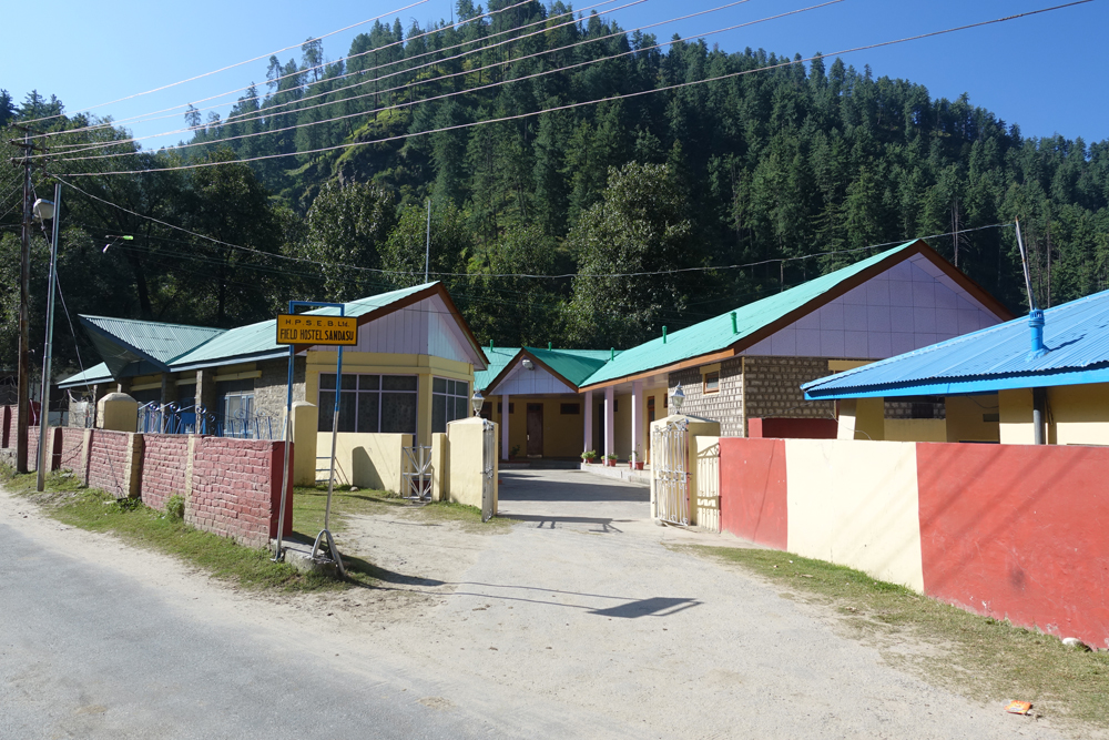
The HPSEB Field Hostel at Sandasu is situated by the right bank of Pabbar. More images at Flickr
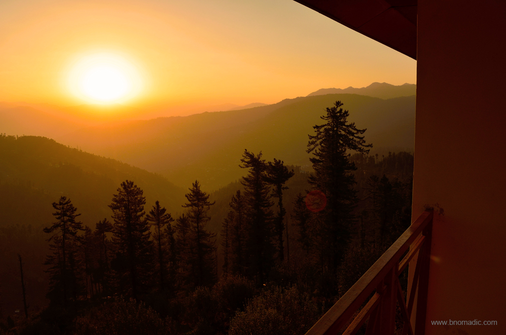
Morning inspiration from the Himalayas! Please visit Flickr for more images of the region
The last few years has seen an increase in the traffic to the Chanshal. The decade old road has been a boon to the residents of the Rupin Valley. The residents, especially farmers, of Dodra – Kwar could now transport their produce to Rohru in the valley of Pabbar which is fairly accessible through roads. Before the advent of the road, it took three days of hiking for the residents of Dodra – Kwar to reach the road head at Tikri. Even now the Rupin Valley remains cut-off from Rohru in winters as the road opens only for a few months after the snow is cleared off the Chanshal Pass. The near 50 km climb to the 3750m high pass is formidable. Given the remoteness of the region, reaching the Chanshal is considered as an achievement in the motor-biking and adventure lovers’ circles.

The road to Tikri by the Pabbar. Please visit Flickr for more images from the region

The road to Chanshal
After several months of planning and dreaming, I was finally on my way to get an access into the mysterious world of Dodra Kwar. Even though, the valley falls directly on the traditional Sangla – Rupin Pass – Netwar trail that links the Baspa Valley of Himachal Pradesh with Tons Valley of Uttarakhand, the region remains a mystery to the outside world. Legend has it that the valley was once a part of the kingdom of Tehri and was presented in dowry to the King of Rampur Bushahr. The villages, their temples and many unique houses are remarkable example of art and wood craft that still flourishes in the region. The valley is famed for the countless wild flowers as well as medicinal herbs it offers. Streams, wooded forests and fauna add to the natural beauty of the valley enclosed by high hills and rocky peaks. The road connectivity is very recent and the region still retains much of its pristine beauty.
It is for fascinating reasons like these that I have the feeling of contentment of finally being on the road to climb the Pabbar Valley. This blog series is an outcome of my travels to the enclave of Dodra Kwar villages, a hidden pocket which is absolutely full of history, interest and significance. The following posts are an endeavor in capturing the aura, beauty and rawness of Dodra and Kwar. I hope you’d enjoy reading about my journey and experience it through my eyes.

The morning hues of the Pabbar Valley. Please visit Flickr for more images of the region
Getting There
Rohru is a small town situated by the river Pabbar in Shimla district of Himachal Pradesh. Rohru is nearly 112 km from Shimla via Kharapathar and Hatkoti. The Chanshal Pass is nearly 50 km from Rohru in district Shimla. The distance between Chanshal and Kwar is 42 km. Separated by the Rupin, Dodra and Kwar are 22km from each other.
Average Altitude: 2500m
Best time to visit: Autumn
Travel Lure: Heritage, panoramic views and sylvan charm
Accommodation: Very limited at Kwar, Dodra, Larot and Chirgaon; HPTDC at Rohru
Weekend adventures at Kharapathar

Sparrows are busy playing Catch and Escape in the balcony and performing acrobatics outside the window of our room. They seem to be doing everything on the move including feeding, biting and even making love. The sporty chirrups of the sparrows have filled my ear with wonder. I wake up rubbing my eyes and immediately step out of my bed to slide the curtains and catch the morning rays of the sun. It’s cold outside and standing in my boxer shorts, I watch in awe as the morning sun rose to shower the wide Himalayan valley with its golden hues.
Morning at Kharapathar; Except for the sound of water, everything was silent and peaceful. More at Flickr

I watch in awe as the morning sun rose to shower the wide Himalayan valley with its golden hues.
I open the balcony door and let the morning chill visit the interiors of the room. The breeze in the pines and deodars hums and moans, but in the apple orchards it rustles and makes cheerful conversation. The glowing green and rusty red apples make for a cheerful sight immediately below the balcony. With sunlight filtering in through the trees, the fresh smell of moss and moisture permeates the air. With the dusty drive of the previous day behind us, I feel totally rejuvenated. The sun is about to light up the valley below me. An occasional leftover of the cloud from previous evening, glitters to make the skyscape even more surreal. Splashing water from a nearby creek looked like an explosion of diamonds in the morning light. Except for the sound of water, everything was silent and peaceful.
The sun is rising behind the rocky peaks in front of me, slowly painting the valley in hues of pink, magenta and red. Sitting there in the cold morning, warming my hands in my armpits, I feel a spiritual closeness with the Himalayas. I thank the powers that are responsible for allowing me to witness this grand spectacle of nature. The golden rays are swathing over the Apple Valley. Kharapathar (2615m) may not have been the perfect choice to witness this morning manifestation of a dream, as there are places more lovely elsewhere in the Himalayas, but in many ways it suited us as a brief stopover on our way to the mysterious Rupin Valley.
The fertile Pabbar Valley (early spring on previous visit). More images at Flickr
The fertile Pabbar Valley, apple bowl of Himachal (early spring). More images from the region at Flickr
Without giving any serious trouble of driving up from the plains, Kharapathar has instantly transported us into the solitude of the mountains. The hillside may see a lot of snowfall in peak winters but in October it has a mix of wild flowers, apples and massive pines and deodars to charm the visitor. Lush forests, encompassing landscapes, refreshing walks and hike trails, all within a couple of hours drive from Shimla! Compared to what we experienced in the previous spring season, the room we had been allotted at the HPTDC property this time had rather a spooky atmosphere inside. The drip of water in the bathroom, fungus infected curtains, dampness on the walls, inky carpets and light cunningly kept low so as to hide everything from the visitors. We were a happy lot still. Normally, I would stay up into the early hours, reading and planning next day’s advance but then this time we were very particular to get up early. And that decision clearly shaped our daily routine on this trip to our advantage.

Hello Rhesus Macaque! Please visit Flickr for more images of the region

Breakfasting at the HPTDC restaurant; just the basic stuff despite an elaborate menu. More images at Flickr
Only basic items are available from the elaborate restaurant menu card of the HPTDC. After breakfast we leave for the hike to Giri Ganga temple (2836m). We are very keen to complete the hike this time as previously our march up the hill was stopped by large amount of winter snow which was yet to melt. We park our vehicle mid-way of the 7km narrow and kutcha motorway, to the Giri Ganga temple site, which leaves the Hatkoti-Kharapathar highway slightly ahead of the HPTDC property. On our return we discover that the point where we had parked our vehicle was precisely the same site from where we took a u-turn on our previous attempt.

An easy stretch on the Giri Ganga motorway from Kharapathar. More images at Flickr
The trail passes through a densely wooded Deodar forest that is swarming with active birdlife. Hearing a monotonous squawking ‘pee-ouh, pee-ouh’, I spot a barbet. The Great Barbet is one of those birds which are heard more often than they are seen. It keeps to the tops of high trees, where it is not easily distinguished from the foliage. Unlike most other birds, barbets are noisy all the year round. The familiarity with the call reminds me of my occasional evening walks at Sukna Lake in Chandigarh. Up here in the mountains, legend has it that the bird is a reincarnation of a money lender who died of grief at the unjust termination of a lawsuit. Consequently, a barbet’s call continues to be interpreted in many ways.
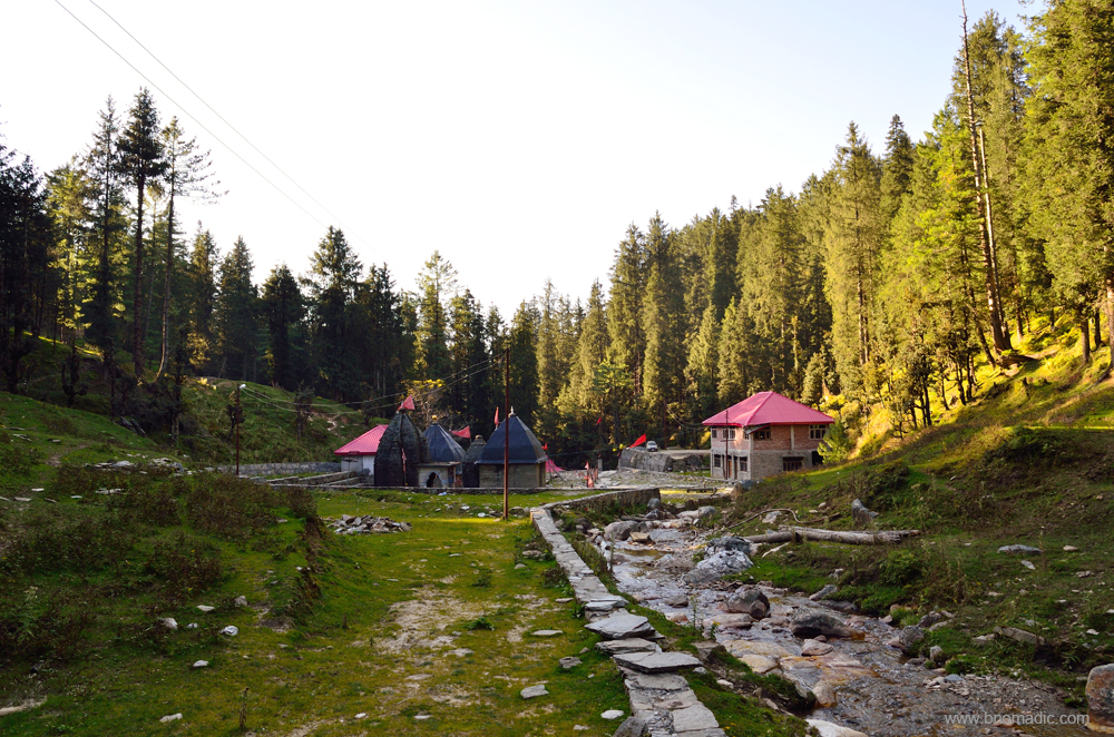
The Giri Ganga temple marking the source of Giri River. Please visit Flickr for more images

The three shrines, part of the Giri Ganga temple complex. More images from the region at Flickr
The hike to the temple site is more rewarding than the site itself which is dotted with a few modern but displeasing constructions and garbage dumps alongside the stream. The river Giri (also called Giri Ganga) originates as a small stream just below the Kuppar peak and subsequently pours its waters into the mighty Yamuna upstream of Paonta Sahib after passing through Chail and Sirmaur in Himachal Pradesh. Literally meaning the fallen Ganga, legend has it that the Giri was formed after sages brought Ganga jal here from Haridwar. Therefore, today, the site is considered to be as holy as Haridwar.
Literally meaning the fallen Ganga, legend has it that the Giri was formed after sages brought Ganga jal here from Haridwar.

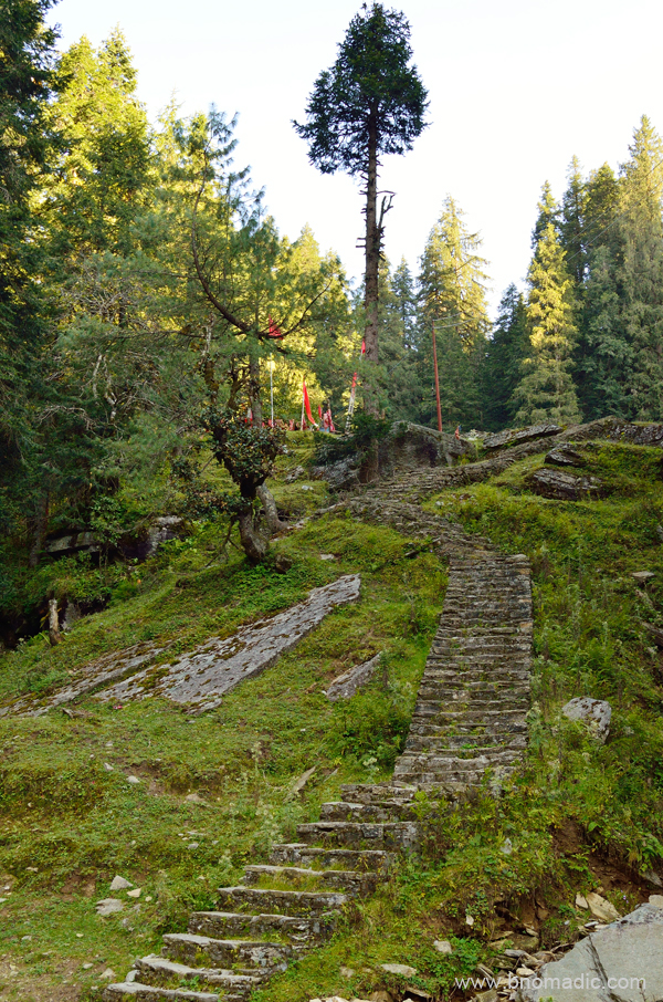
The trail passes through a densely wooded Deodar forest. More images at Flickr
We planned to be back at the base before the end of the day. At the hotel, a group of travellers from West Bengal was anxiously waiting for us to return and hear our stories from the day. I patiently recollected every required detail of the hike to their utter satisfaction and pleasure. “Prefer to take a walk and carry enough water and supplies to last half a day”, I suggested. The shaded walk and gradient is quite easy on the knees and not strenuous at all. The olden temple complex comprises three shrines and a cottage. Positioned inside the small water pond, the conical shaped main shrine is dedicated to Goddess Durga. Facing each other, the other two shrines are placed above this pond. One of these shrines has the idols of Rama, Laxmana and Sita. The other one has a marble Shiva Lingam inside it.
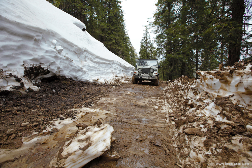
Attempting to reach the Giri Ganga in snow (early spring). More images from the region at Flickr
Had to turn back midway. Please visit Flickr for more images of the region

The hillside below the motorway. More images from the region at Flickr
Kharapathar receives good amount of snow in winters. More images from the region at Flickr
Later that night, the calm of the starry Himalayan sky invite me to the balcony for a mug of chamomile. I sit back and observe the nightscape. Over the years, the night has become my friend. On one hand, it gives me privacy; on the other, it provides me with limitless freedom. The night sky full of countless twinkling stars, a near full moon at one end, rocky shadows and ice reflections – something a dreamy nightscape is made of. No emotion or expression could do justice to the feeling of contentment in the complete embrace of the Himalayas.

Next morning at Kharapathar; With sunlight filtering in through the trees, the fresh smell of moss and moisture permeates the air. Please visit Flickr for more images of the region
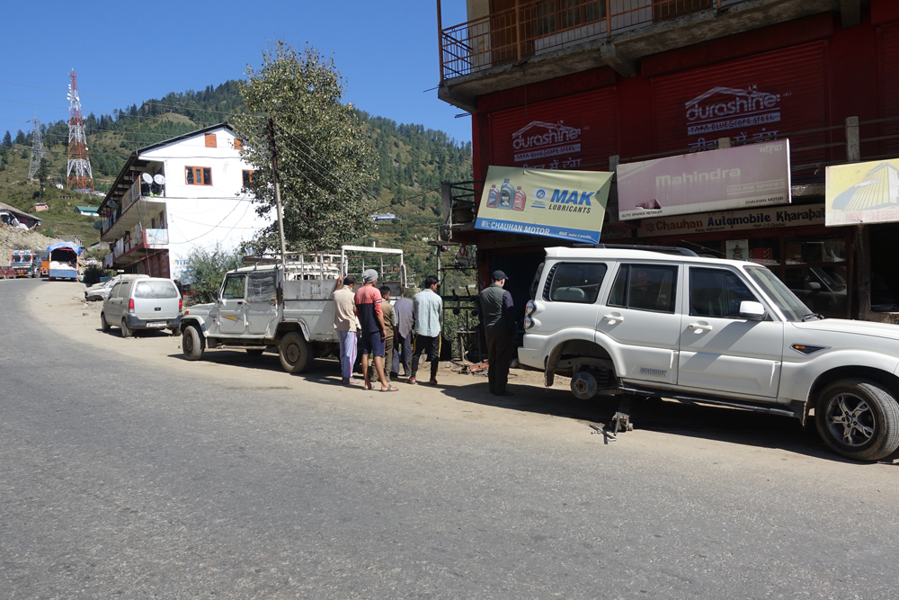
Getting the tyre fixed at Kharapathar before leaving for Rohru; carry a spare tube and a travel air-pump even if you have all five tubeless tyres
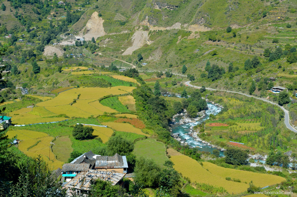
Next morning, we plan to visit the Jubbal Palace on way to Rohru, our motorbase to climb the Chanshal. The receptionist tells me that a landslide has blocked the highway to Rohru via Hatkoti. We will have to take an alternate route which is a bit narrow and bumpy. It is also the end of apple harvesting season in the valley which means there will be load carriers too on the narrow link road to Rohru. The Kotkhai and Jubbal valleys are one of the few valleys of Himachal Pradesh that produce good quantity of apples.
A good portion of the alternate narrow route to Rohru from Kharapathar. More images at Flickr
The red roof of the newer Palace is visible from the balcony of HPTDC property. We reach the older Jubbal Palace (2037m) first. Now in a total dilapidated state, the Palace still houses the royal family temple which is entirely made of wood. A delegation from Chaupal, a constituency earlier represented by the Raja of Jubbal in the Himachal Vidhan Sabha, has come to visit the temple premises. The temple priest is totally reluctant to allow them an entry. The group heads towards the newer Palace to meet the Raja. We too join their company albeit in parallel.

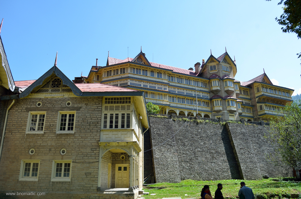
The old Jubbal Palace. Please visit Flickr for more images of the region

The royal temple, part of the old Jubbal Palace
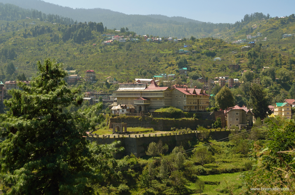
The grand Jubbal Palace surrounded by green and wooded hillside. More images at Flickr
The courtyard of the Palace; was surprised to see a Chinar in it. More images from the region at Flickr

Awaiting permission to meet the Raja, people from Chaupal standing at the entrance to the Palace
Claimed to be founded around 1100 AD, the Jubbal State lies east of Shimla between Sirmaur and Rampur-Bushahr in a very beautiful and well wooded valley. In the nineteenth century, the royal family derived their income largely from the sale of timber helping the Raja become the richest of the hill chiefs with a house ‘Hainault’ in Shimla. Before 1918, the ruling family used the title of Rana after which the British conferred the title of Raja to reward their loyalty towards them. The new Palace of Jubbal (1931m) designed by a French architect in 1930s, is situated a kilometre ahead of the original one. I park our vehicle just at the entrance to the grand Palace. The entry inside is very restricted and even the delegate from Chaupal, Raja’s voters, couldn’t get an access. We spend a few more minutes in making a few photographs and leave the premises to reach Rohru just in time to secure a late lunch.

The temple of Hatkoti by the Pabbar (from the previous season). More images at Flickr
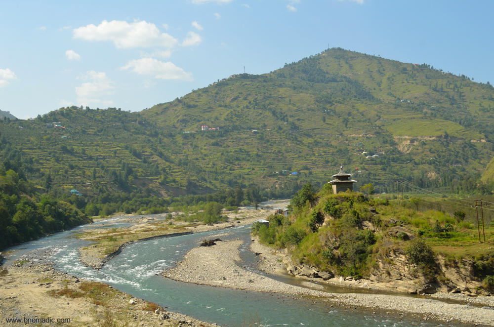
The expanse of the Pabbar Valley between Rohru and Hatkoti. Please visit Flickr for more images

The highway between Hatkoti and Rohru. Please visit Flickr for more images of the region
Getting There
The hill-station of Kharapathar is 77 km from Shimla via Theog and 23 km from Hatkoti. The distance between Hatkoti and Rohru is 11 km. The approach from both sides is fairly easy. The road distance between Kharapathar and Giri Ganga temple is 7 km. The Jubbal Palace is nearly 10 km from Kharapathar.
Average Altitude: 2000m
Best time to visit: Spring and Autumn; avoid apple harvesting season
Travel Lure: Heritage and sylvan charm
Accommodation: Very limited; HPTDC and a few homestays
An Active Weekend at Chail

Chail is one of my favourite weekend destinations. I first discovered the sylvan charms of Chail while pursuing post-graduation in communication studies from Panjab University in the City Beautiful Chandigarh. Back then, we would often make weekend trips to Chail on our motorbikes. I vividly remember the first spicy smell of pine trees and the scent of those charming wild roses as we rode from Chandigarh to climb the higher foothills.
Just before the current monsoon season, I was in Chail again on a weekend to escape the summer heat of plains. Sitting in the courtyard of the decrepit Junga Palace while sorting out my knickknacks to gear myself up for the day’s hike to the cooler environs of Chail, I ruminated about my earlier escapes from Chandigarh on weekends. I remember how beautiful Chail looked; how cool and scented after the heat and dust of the plains. Wild flowers, chirpy birdies, pine needles and wood smoke; Lovely!

The doorway of the old Junga Palace that is in a state of neglect now. Image by Sarabjit Lehal. More at Flickr
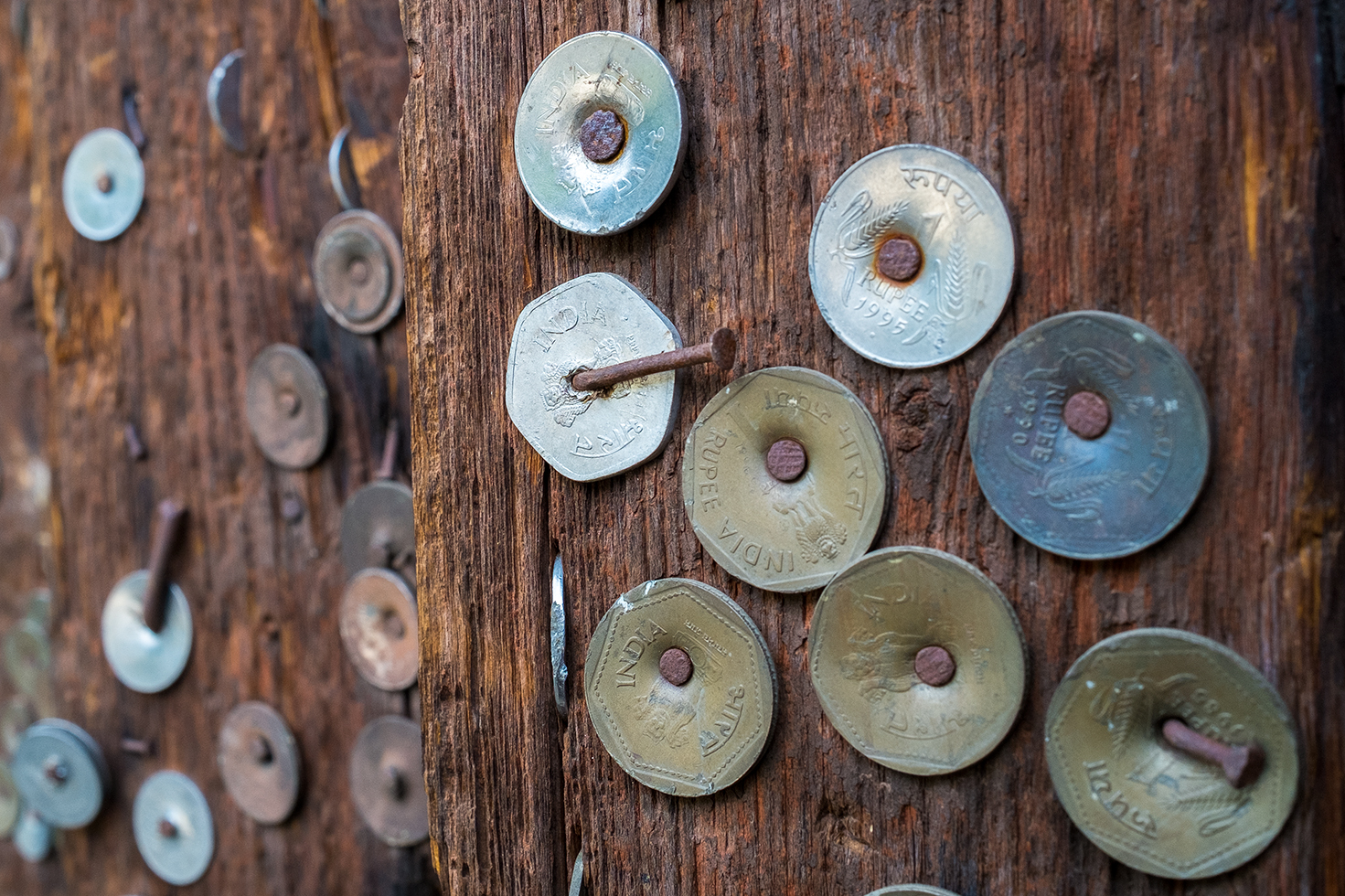
The doorway had numerous coins nailed on its frame; said to be signifying the answered prayers. More at Flickr

From the courtyard of the erstwhile Junga Palace! More images from the region at Flickr

Derelict paintings inside the building. For more images from the region, please visit Flickr

The colorful courtyard of Junga Palace.
One of the memories for which I consider myself to be fortunate is that I have been visiting Chail from the days when just a few vehicles travelled to this part of the Himalayas. Minus any fuel fumes, no loud bangs, blaring horns or screeching tyres, no SUVs or transport trucks belching reeking clouds of diesel exhaust, and pedestrians walking carelessly, it was total peace. It was wonderful. Those were the days that continue to inspire me for weekend outings.
The settlement of Junga, an erstwhile princely state, is surrounded by green hills with Shimla in front. The green environs of Kufri are to the northeast and the rich Chail Wildlife Sanctuary is towards the south of Junga. The rich forest cover comprises trees of kail, deodar, pine, cheel and ban, etc. The settlement of Junga is the midpoint and a popular stopover on the traditional trail between Shimla and Chail. With the advent of roads in the area, the trail is, however, seldom used these days except possibly by herders, runners or for soft adventures, which is what we planned to do.
The picturesque settlement of Junga with several interesting olden buildings and structures.

The initial part of the trail; the Karol Ka Tibba towering in front. More images from the region at Flickr

Plucking wild edible berries as we start. More images from the region at Flickr

The route we took was part of the centuries-old Shimla-Chail trail and was much frequented before the roads forayed into the lush green hills. More images from the region at Flickr

The trail, mostly unmarked in the confines of the sanctuary, climbs over 700 m to reach Chail
Starting from Junga at breakfast time, we planned to reach Chail by evening tea time. The length of the trail from Junga (1560m) to Janedghat at Chail (2224m) is a little less than nine km. Having packed our lunch and some fruits in our day backpack plus two litres of water, full of energy we left for Chail. It was a sunny day and in the initial hour of walk we were sweating profusely. The trail passes through some quaint hamlets and then proceeds on to the densely forested slopes of the Chail Wildlife Sanctuary. The shade of wooded ridge after the second kilometre gave us some respite from the heat. The entire hillside of Shimla including the neighbouring Shoghi was clearly visible. Not only the capital Shimla but the picturesque settlement of Junga with several interesting olden buildings and structures can also be plainly seen from the ridge we were skirting.

The settlement of Junga is the midpoint and a popular stopover on the traditional trail between Shimla and Chail.

Not an uncommon sight given the season, a forest fire on the opposite side of the ridge. More at Flickr

All the seven hills of Shimla including the tall red statue of Lord Hanuman atop the Jakhu hill were clearly visible from the trail. Photo by Sarabjit Lehal. More images from the region at Flickr
Owing to its proximity and richness, the forests of Junga we were passing through used to be one of the preferred hunting sites for the officers in Shimla during the British rule. During those times, Junga, the capital of the erstwhile Keonthal state surrendered many villages to form the present station of Shimla. The gazetteer adds that the chief of Keonthal used to be called a Rana but in the mutiny Rana Sansar Sen behaved most loyally giving shelter and hospitality to many Europeans who fled from Shimla when it was feared that the Gurkha regiment stationed there had become disloyal. The title of Raja was conferred on him in perpetuity for these services.

Inching ahead; it was a sunny day and in the initial hour of walk we were sweating profusely.

The trail passes through some quaint hamlets and then proceeds on to the densely forested slopes of the Chail Wildlife Sanctuary

A well earned lunch in the shade. Please visit Flickr for more images of the region
The shade of wooded ridge after the second kilometre gave us some respite from the heat. More at Flickr
Once a retreat of a few solitude loving British officials, hunters and explorers, the hillside we were walking through is fast turning into a preferred holidaying destination. Although devoid of any snowy view, the Chail Widlife Sanctuary is truly a walker’s paradise. The wooded charm of this region will be a pure delight for a birding enthusiast. On my walk, I spotted 27 different species of birds and pheasants including a lifer. As we gained height, the weather became cooler. All the seven hills of Shimla including the tall red statue of Lord Hanuman atop the Jakhu hill were clearly visibly from the trail. We lunched at one of the several meadows we crossed on the way. It took us nearly six hours at a leisurely pace to cover the distance between Junga and Janedghat, a popular trailhead located three km before the hiker’s paradise of Chail.

The shade of wooded ridge after a few kilometers gave us some respite from the heat. More at Flickr

A water break atop one of the many meadows we crossed. More images from the region at Flickr

The rich forest cover comprises trees of kail, deodar, pine, cheel and ban, etc. More images at Flickr

The settlement of Junga is the midpoint and a popular stopover on the traditional trail between Shimla and Chail.

With the advent of roads in the area, the trail is, however, seldom used these days except possibly by herders, runners or for soft adventures.

Tea break atop another meadow. Please visit Flickr for more images of the region

Although devoid of any snowy view, the Chail Widlife Sanctuary is truly a walker’s paradise.
The wooded charm of this region will be a pure delight for a birding enthusiast. On my walk, I spotted 27 different species of birds and pheasants including a lifer.

As we gained height, the weather became cooler. More images from the region at Flickr

Owing to its proximity and richness, the forests of Junga we were passing through used to be one of the preferred hunting sites for the officers in Shimla during the British rule. More at Flickr
The route we took was part of the centuries-old Shimla-Chail trail and was much frequented before the roads forayed into the lush green hills. The trail, mostly unmarked in the confines of the sanctuary, climbs over 700 m to reach Chail, once the summer retreat of Maharaja of Patiala and now spread over a cluster of three popular hills Pandhawa, Rajgarh and Sidh Tibba. Today, the sleepy hillside of Chail stands as a faint reminder of the times of how the salubrious environs of Shimla would have looked before the British forayed in.
The market square-cum-taxi stand of Chail. Please visit Flickr for more images of the region

A tea shop-cum-dhaba in the market. Please visit Flickr for more images of the region
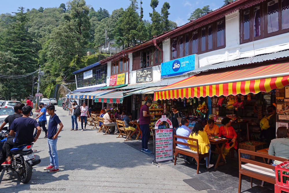
Offering a peaceful vacation, Chail does not have a Mall or a shopping arcade; though a huddle of shops that double up as a bus stop include grocery and vegetable vendors, dhabas and chemists. The chief heritage attraction of the town is the HPTDC run Palace Hotel. The hillside became accessible to visitors after the Patiala royals handed over the 75-acre property, where Maharaja Bhupinder Singh of Patiala spent six months in a year, to the government in 1972. The Palace is popular with honeymooning couples and weekenders who hop in for a day or two of princely excitement. On weekends, it would be nearly impossible to get a foothold in the Palace. On weekdays, enjoy the tranquillity of the surroundings and countryside.

The Chail Palace garden on a busy summer weekend. More images from the region at Flickr
The recently renovated interiors of the Chail Palace. More images from the region at Flickr
Ever since its inception, the palace is said to have reverberated with the sounds of partying and merry-making. The gazetteer notes that couples drank from sidecars and smoked cigarettes leaning against staircases while listening to tunes played on a grand piano. Inside, the peeling, water-soaked walls; worn, musty carpets; dilapidated woodwork and furniture; dusty chandeliers, etc. might add to the disappointment but on the positive side, the exteriors are, however, surprisingly well kept. Sitting on the white-painted wrought iron benches in the lawn, muse over the gossips and stories of the Palace and hear innumerable accounts of Maharaja’s personal life.

The Churdhar towering above a fertile ridge of Chail. Photo by Sarabjit Lehal. More images at Flickr

The Sidh Baba Ka Mandir. Photo by Sarabjit Lehal. More images from the region at Flickr
Another attraction, Sidh Baba Ka Mandir is placed atop a ridge sandwiched between Rajgarh and Pandhawa hills. Part of the army cantonment area, the temple is built near the cricket stadium. The site is nearly 4km from the market square and is surrounded by a dense cover of woods. One more temple of repute is the Kali Ka Tibba, located a little further; six km from the market. The prize catch would certainly be the evening view from the Kali Ka Tibba – with foothills on one side, sinking down in line after line until beyond them you could feel the plains stretched out; and on the other, the Churdhar; as also the high Himalayas.

The temple atop the Kali Ka Tibba glittering in the evening light. Photo by Sarabjit Lehal. More at Flickr

The skyscape at sunset from the Kali Ka Temple. Photo by Sarabjit Lehal. More images at Flickr
Getting There
The hill-station of Chail is 25 km from Kandaghat on the Kalka-Shimla highway. Chail to Kufri on the Shimla-Theog highway is 31 km. The approach from both sides is fairly easy. The road distance between Junga and Chail is 21 km.
Average Altitude: 2000m
Best time to visit: Round the year, avoid holiday seasons
Travel Lure: Himalayan views, heritage and sylvan charm
Accommodation: Plentiful
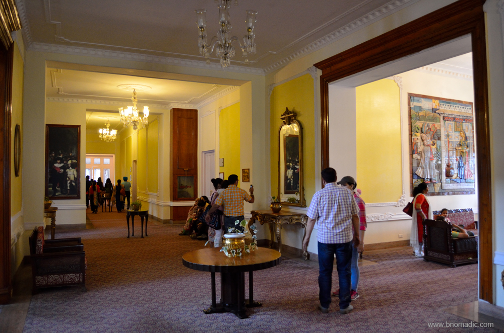
Garhwal Diaries: The Mall Road of Mussoorie

My attachment to Mussoorie goes back to the mid-1990s, when as a kid I first visited this hill station on a family holiday. First impression was memorable. So, we sojourned this hillside again and again until 2005. On my latest visit last month, I came here after a gap of more than 10 years. One of my earliest memories attached with Mussoorie holidays was passing through dozens of tea stalls perched perilously on the edge of precipitous drops. I wasn’t a tea drinker then but the snack lover in me remembered the way out.
This time, as I opened the car doors, I was hoping to step out into a fresher, more invigorating world. Straddling its long ridge, Mussoorie didn’t give a relaxed holiday feel it was once famous for. In the last decade, much water has flowed under the bridge. It wasn’t just the weather. Clinging to the hillside, the houses, hotels and shops were all brimming with business. During the on-season that now seems to extend throughout the year, Mussoorie takes on a carnival atmosphere.

A major tourist attraction in Mussoorie, Company Bagh has a variety of flowers and an amusement park as well; overpriced tickets basically. More from the region at Flickr
Having successfully negotiated my way through the jam-packed roads leading to the main square, I comfortably parked myself for a few days at a secluded retreat on the northern hillside of Mussoorie. The snowy view continued to be blocked by moisture-laden grey clouds. The traffic of weekend holidaymakers had crowded the roads to capacity. It wasn’t a complete quiet at the retreat either. The ear-piercing honking of desperate vehicles stuck in long jams along with random sound of car speakers blaring out Punjabi songs reverberated across the valley.
Among the first known British settler in Mussoorie was Captain Young, an enterprising British Military officer, who in 1823 built Mullingar, the oldest surviving cottage that has been encroached now. Being the favoured holiday destination of the British officers as well as rajas and nawabs, Mussoorie remained to be the most exclusive club in India before independence. Much after that, in the 1960s, Mussoorie’s downturn began that, however, only lasted until the rapidly growing ambitious Indian middle class started to see the hill station in the same light as the British did – as a getaway. This trend continues unabated till date, as attested by the scores of visitors who weave their way through the crowded Mall with its festive atmosphere. The crisp mountain air of Mussoorie always had a hint of romance.
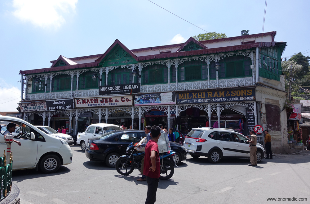
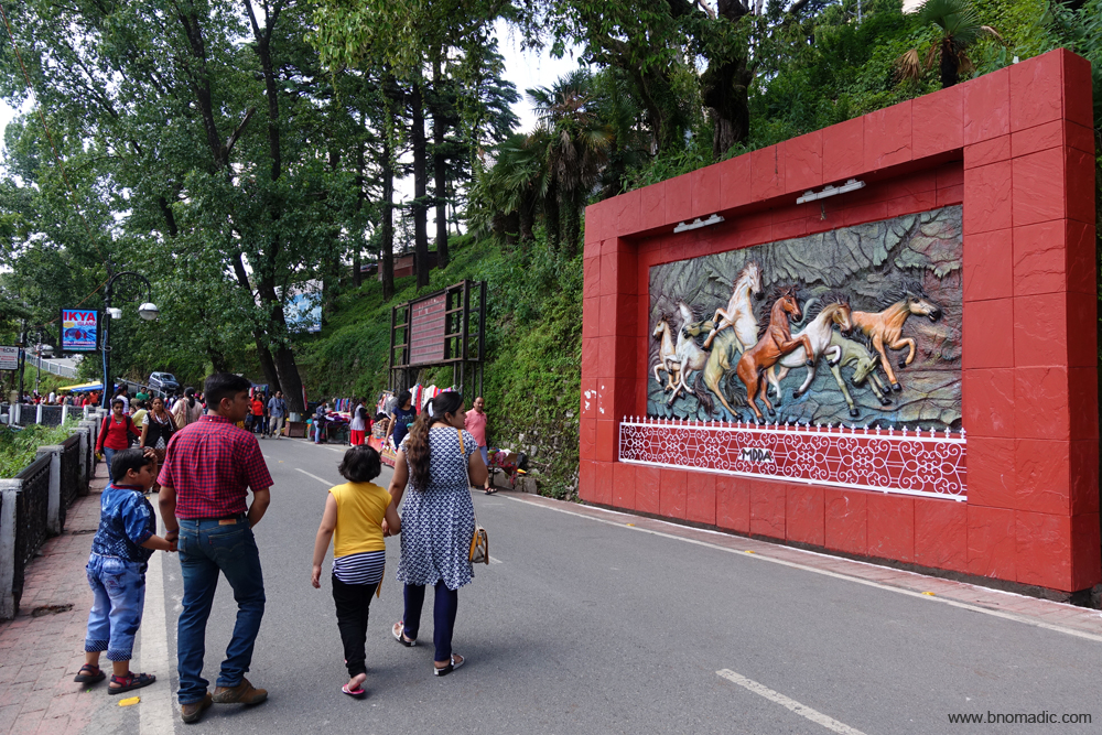
The jam-packed Gandhi square. The Library is the oldest literary landmark in Mussoorie, founded just 17 years after the town itself. Since then, the library has maintained its presence at the head of the Mall, overlooking the main crossing. A private institution governed by a society of members, the library is not open to the public. More at Flickr

A title inside the library. Source: Mussoorie Writers Fest
On a busy Saturday morning I decide to take a walk across a major part of the inhabited ridgeline of Mussoorie. In the thick of the touristy crowds, burgeoning hotels and thriving market, physical remains of eld remain scattered all across the ridge. There isn’t any naturally level area of any sort along the portion facing the Dun valley. Spanning from the library to the Landour Post Office, the wide road known as the Mall is the chief promenade and hub of the hill station. Towards the west the Mall divides into two bridle paths, one leading to Vincent’s Hill and the other to the Happy Valley. From the eastern end the road continues from the Post-Office through the bazar to the Landour cantonment. The Library square is jam-packed with traffic coming in from the plains and Kempty side.

More traffic and more traffic-jams. Please visit Flickr for more images from the region
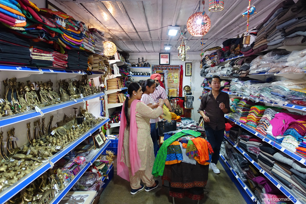
The Mall road is brimming with holidaymakers. Crossing it once or twice every day is inevitable. Past the toll-barrier, the ornate lamp-posts and benches with curlicues remind of the colonial period and add to the aura of yesteryears that outlines the Mall. Just ahead is the Camel’s Back hill that is studded with huge boulders which occasionally roll down from its northern face. One of the popular walk starts from here and loops the northern ridgeline to reach the Kulri Bazaar further ahead on the Mall. Along the Camel’s Back road is the Scandal Point, presumably so named because it has always been a favourite meeting place for young amoureux. The entire stretch of the Mall is dotted with all sort of hotels, restaurants as well as shops selling clothes, groceries, woollens, medicines, souvenirs, walking sticks, faux jewellery, monkey caps, ice-cream cones and popcorn and every other touristy stuff.

Morning at the Mall Road, a famous promenade of the hillside of Mussoorie. More images at Flickr

North India’s favourite snacking items at display
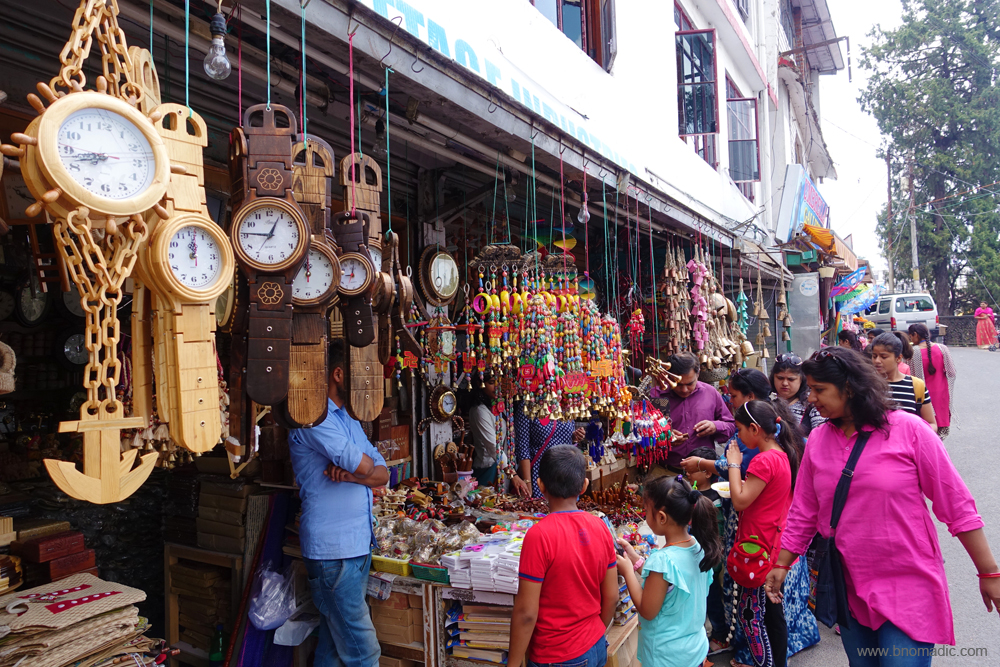
The shops selling all sort of touristy stuff including sticks and wooden crafts
A Tibetan exhibition inside the premises of the Post Office, the Mall.
Walking on the Mall may not be a very attractive thing to do in Mussoorie, especially in a peak season. It can even be hazardous. Wildly driven taxis, macho drivers, unpredictable bikes, slow-moving rickshaws and cyclists and thousands of wavering, wayward walkers make for a complete chaos on the road. The otherwise romantic air is filled with smoke and diesel fumes. Amidst loud honks and thumping music, I realise that the Mall is perhaps meant for almost every purpose except walking leisurely.

The romance of the rickshaws and other crowded affairs of the Mall. Please visit Flickr for more images
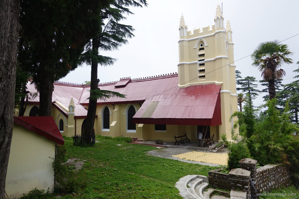
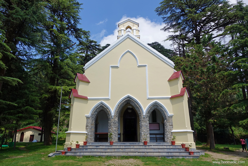
The Christ Church dates back to 1836 and is the oldest Protestant Church in the Himalayas. The Church celebrated its 175th anniversary in May 2011.
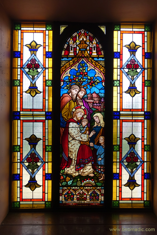
The old stained glass windows are said to the finest in India and are still very well maintained even after 180 years.

“Enter a charmed world where magic woven of sunbeams, with not a shadow of annoyance, filters through the splendour of stained glass”
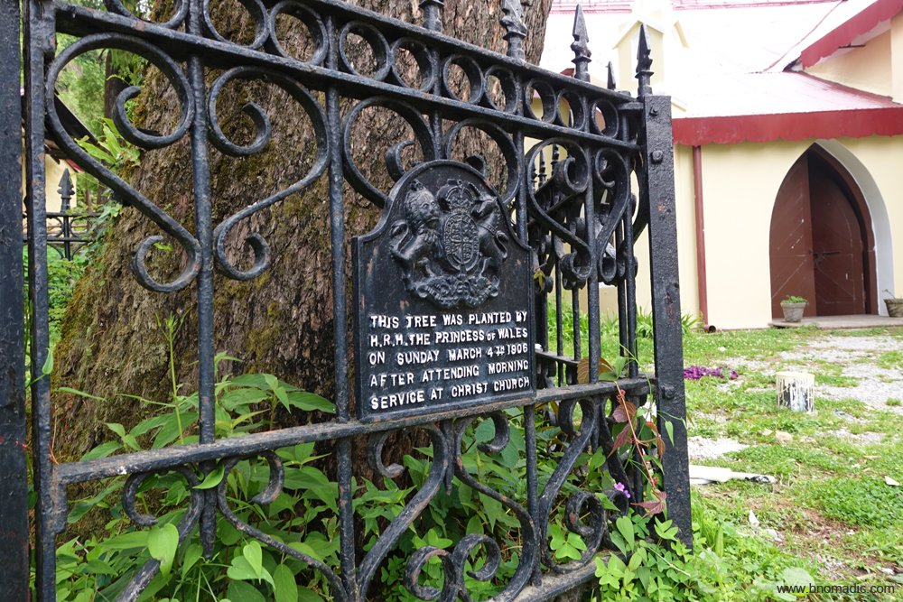
In the courtyard, you’d come across the spread of a huge deodar tree, the plaque under which reads: “This Tree Was Planted By HRH The Princess of Wales on Sunday March 4th 1906 After Attending Morning Service At Christ Church”. Please visit Flickr for more images of the region
Setting out on a long walk, I head towards the Christ Church. Standing in tribute to the religious concerns of the early inhabitants of the hillside, today, the Church is a beautiful reminder of an era gone by. The royal emblems, the grills, furnishings and the façade are all still very intact. History lies littered all around in the churchyard. Inside, bathed in the magical light filtering through bits of coloured glass, one suddenly comes face to face with the colours of a rainbow. I head back to the Mall through a Tibetan street bazaar to briefly stop at the Gun Hill ropeway site. Otherwise reachable through an uphill trail of 500m, the ropeway ferries the amusement-seekers to the top of the Gun Hill that affords brilliant views of the Great Himalayan Range. The hilltop is so named as during the British days till 1919, a cannon used to be fired from here at noon to let people know the time.

The ropeway trolley ferrying tourists atop the Gun Hill. More images from the region at Flickr
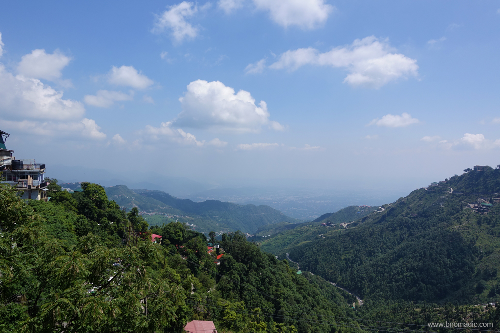
The Dun Valley landscape from the Mall. Please visit Flickr for more images of the region

The Martyrs’ Memorial at the Mall, Mussoorie to commemorate the martyrs killed in police firing during the agitation to demand statehood 21 years ago. Please visit Flickr for more images
Despite the maddening crowd at the Mall, it was fortunately well maintained and clean

The Exchange building still retains much of its original design. More images from the region at Flickr
The Dun valley views from the platform of martyrs’ memorial are very beautiful. The rich and varied expanse of the Dun is bounded by the Shivaliks beyond which the prospect extends over the plains. The Kulri Bazaar begins right after crossing the ropeway on the Mall. I withdraw some money from an ATM of SBI only to realise later that the landmark SBI building was the same one that was once built to house Queen Victoria on her visit to the hill. Just opposite this building is the Cambridge Bookstore where a banner is put up every Saturday to advertise the literary figure Ruskin Bond’s schedule of visiting this store later in the evening. Autograph seekers are already making enquiries of Bond’s arrival timings. Few youngsters are excited that they are going to meet “James Bond” in the evening. Some distance ahead is the hundred years old imposing Methodist Church. The touristy crowd starts shrinking as I reach the road barrier. The various 1980s styled gaming parlours operate from the now defunct Picture Palace.

Autograph and selfie seekers outside the Cambridge Bookstore at the Mall. More images at Flickr

The bookstore has almost all books by Ruskin Bond; the store’s bestselling author. More images at Flickr

The central Methodist Church at Kulri. Founded in 1885, it was formerly called the Osborne Memorial Church, named after the deceased daughter of its founder, Reverend Dennis Osborne. In the grounds of this church is plaque installed by the Survey of India that notes the exact altitude at the centre of the station. More at Flickr

The Union Church was established in 1868 and was constructed in 1872-74. Its activities today include running the Hebron Elementary School for local children. More images from the region at Flickr
Despite all its touristy disappointment, the Mall is enjoyable but there’s a quieter, prettier and salubrious Mussoorie above it. Once I cross the territory haunted by tourists, Mussoorie reveal an entirely sylvan face. An uphill paved trek of 5km from Kulri Bazaar brings me to Landour (2250m), founded in 1827 as a British cantonment. On the way, I cross Landour Bazaar that sells a variety of handmade woollens, customised leather footwear as well as antiques.

The Landour Bazaar, there never were that many trees! Please visit Flickr for more images of the region
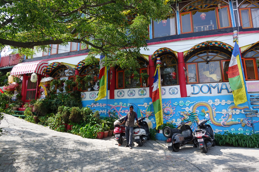
The Doma’s Inn Restaurant at Landour serves excellent Tibetan cuisine. More at Flickr
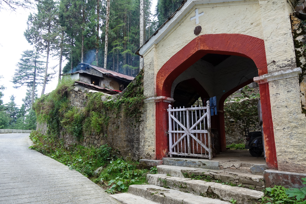
The lych-gate of the Landour cemetery. Please visit Flickr for more images of the region
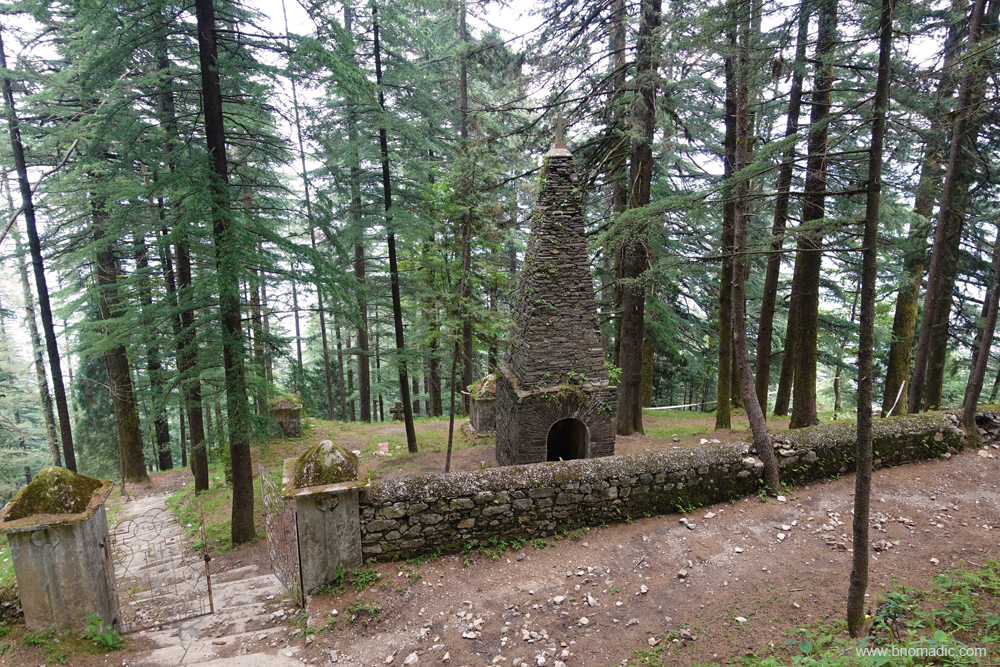
The Roman Catholic Cemetery. In it are interred the remains of the Italian prisoners-of-war who passed away during their internment at the time of the IInd World War.
Dargah of a Sufi Saint at Landour. Please visit Flickr for more images of the region

The God’s own home. Please visit Flickr for more images of the region
Reconfirm your directions to the God’s home. Please visit Flickr for more images of the region
Initially, Mussoorie and Landour were quite distinct from each other. Today, as both the hillsides are gradually merging, each one still possesses its own unique character. Whereas, chock-a-block Mussoorie is mobbed by tourists, Landour, on the other hand, has successfully retained much of its quietness. The unexpected quietness must be attributed to the fact that about two-thirds of Landour belongs to military and then the strict forests laws. As a result, Landour still retains many of the attractions that drew Young to this hillside high above Mussoorie. As I walk further up the ridge, shops give way to bungalows and dense woods. At Landour, I briefly stop for snacking at Char Dukan. Circling the ridge, I next visit Lal Tibba, colonial-era cemetery, Sister’s Market and the nineteenth century St Paul’s Church.

Founded in 1903, the Kellogg Memorial Church at Landour. A Presbyterian missionary, Kellogg met his death in Landour from a fall which, unfortunately, is still not an uncommon event around here.
The scheme of things at the neat and cosy mini-marketplace of Char Dukan at Landour. Literally just four shops (now five), Char Dukan has its own post office, a bank. Its specialties are bun-omelettes, cheese toasties, pancakes and waffles. For more images of the region, please visit Flickr
The St Paul’s Church in Landour was established in 1840 for use primarily by British officers and soldiers in the cantonment. The building was renovated in 2008 and now serves a civilian congregation, made up largely of Woodstock School staff and students. By the way, Jim Corbett’s parents tied the knot here.
A walk through the misty streets of Landour takes me on a journey through the history of this hillside. A refuge to homesick British, Landour, perhaps more than any other hill destination, is said to have had a reputation for frivolity, fun and flirting. One would soon discover that, apart from seeking spiritual healing, rejuvenation of soul, recharging batteries and strengthening faith, people come to this hillside with other beautiful ideas on their mind. For those who love downpour, the monsoons here are quite magical. A rain-drenched hill station like this in the Himalayas is bound to bring out the best of romantic in you. As the monsoons sets in, the ridge’s enchanting tranquillity and quietude is once again restored. The stunning Himalayan views appear washed in colour and the sounds and sights seem magnified. Even if the snowy range is hidden during a rainy season, the landscape is dramatically obscured to within a few hundred yards by the vast clouds of mist that creep up from the valleys.

Inside the Prakash Handicrafts at Sister’s Bazaar. The store is looked after by a welcoming and helpful young lady; budget a little extra time if you want to hear stories and anecdotes about Landour.
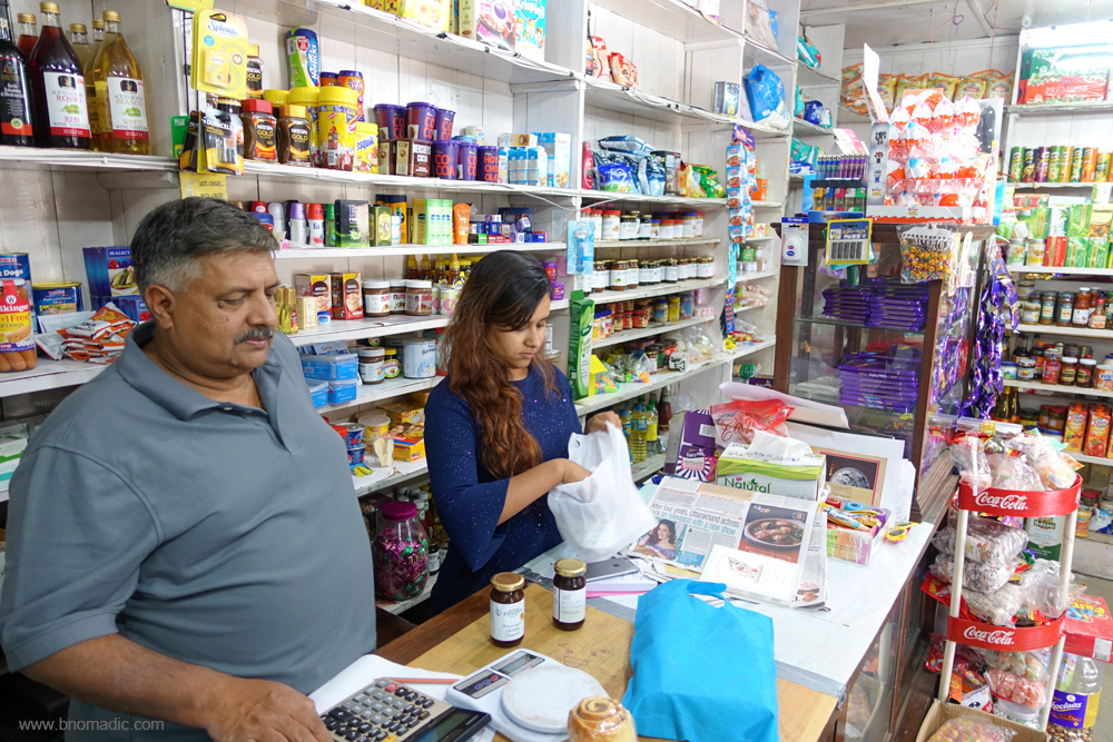
Famed for its homemade jams, peanut butter, chutneys, breads, cookies and cheese, the Prakash store in Sister’s Bazaar. The store must be a boon for the locals. More images at Flickr
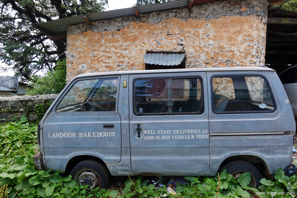
This looked a recent addition to market the newly launched cafe. More images at Flickr

The Mudcup Cafe, just above Mullingar in Landour is the best place to have conversations and coffee
The cafe serves super excellent Coffee, Tea and Bakery items. Please visit Flickr for more images
Getting There
The hill-station of Mussoorie is 36 km from Dehradun. The approach is fairly wide but steep. The distance from Library to Landour, via the Mall, and back is 12km.
Average Altitude: 2000m
Best time to visit: Round the year, avoid holiday seasons
Travel Lure: Himalayan views, heritage and sylvan charm
Accommodation: Plentiful


