 bNomadic
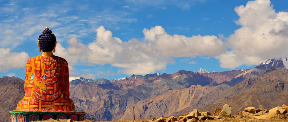
Kullu Diary; The fading woods of Solang

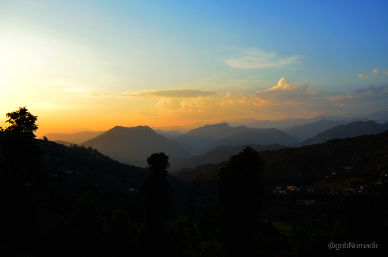
The ensuing thoughts are based on my visit to the popular destination Solang late in the spring last year. Having visited Manali on numerous occasions serving varied purposes, it was only then when the long cherished wish to experience its popular touristy sidearm – Solang Valley – materialised. Although, I have rarely been able to develop the curiosity necessary to visit a site jammed by tourists, Solang happened to be on the list because of the unparalleled landscape it offers.

The Pirpanjal Range as observed from a point near Solang. More from the region at Flickr
The cloud-free weather window at this season of the year vibrantly splattered the scenery with haze-free sunshine to make it enchanting beyond description. The mountain-sides were clothed with rhododendron – white, mauve, and scarlet, standing out against grey rocks outlined by shining snowy heights under a sky of intense blueness. The dreamy Himalayan-scenery had every natural element at its colourful best.
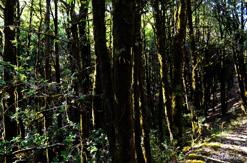
The valley of Solang is located at a distance of 3 km from Palchan and 8 km from the tourist centre point of Manali. The Solang nala in a swift current courses between mountains clad in scattered deodar patches, from the midst of which jut out vast headlands of perpendicular rock; and a couple of miles above Palchan, a series or similar gigantic cliffs rise up sheer from the river and line its course for a considerable distance.
Approached through a widened road past remaining fragments of beautiful glades of olden pines and horse-chestnuts, the centre point of the valley comes at last into view, bowered with green patches on either shore, against the indescribable backdrop of the marvellous heights of the snowy Pirpanjal Range. The landscape in the Solang Valley was in my opinion unsurpassable and certainly unmatched by anything in the rest of the region.

The snowy heights of Pirpanjal and the developing settlement at Solang. More at Flickr Photoset
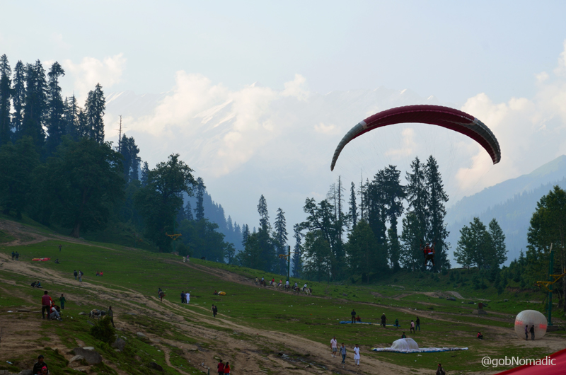
No sooner than I reached the tourist-activity centre of the valley, my thoughts and hope to experience the beauty of “adventurous” Solang seemed to fade away. It was still spring, technically an off-season from tourist-traffic point of view, and even though the area was far from being overcrowded, the state of affairs at the site were indeed pathetic.
Thronged madly by Manali-bound tourists, honeymooners and party animals alike, the site was claimed by stall-sellers, activity guides, touts, open-air restaurants, dubious cafes often supplying stale foodies at over-priced rates. As I was mobbed by desperate parasail guides, I deliberated over the change in the outlook of the region since 1990. The upsurge in the tourism was partly led by the political problems in erstwhile more popular Kashmir. Many multi-storeyed concrete hotels had been constructed that would have been more suitable to Delhi or Mumbai than to the Himalayan foothills.
Funfair themed park had been built where once stood wide expanse of dense deodar forests, concrete shopping complexes had occupied the traditional bazaars and video-gaming arcades had mushroomed to accommodate the needs of tourists unable to cope with the serenity of the mountains. Traffic jamming was now a routine occurrence; the constant blaring of horns and thump of music a loud reminder of our growing frustrations of life.

The activity site of Solang is popular with tourists round the year particularly in winters and summers.
The activity site of Solang is popular with tourists round the year particularly in winters and summers. The few hundred metres of immediate meadowland is used for parasailing, hiking, horse-riding and zorbing. In winters the same portion is thronged by skiers and snow-boarders. What’s more, a ski-lift has now been installed to facilitate the “adventures”. Leave aside the smoke gushing and diesel-fuming scooters, favourite with Machos of the valley and among the tourists, the desperate adventure-tour companies, operators as well as agents equally dot the scene throughout the day.
Grabbing a machine-pissed coffee, I headed towards the take-off point of tandem-parasailors, positioned a few hundred metres away towards the ridge. The then British Col CG Bruce, a Himalayan veteran-cum-hunter was immensely impressed by the views of the Solang Valley back in those times. “As for Kullu, I simply yearned to travel there. It seemed to contain all I wanted – magnificent forests which I love, fruit, flowers, rivers, picturesque scenery, interesting people and of course mountains. I had also heard of its quaint and curious Gods. I always hoped to hunt red bears and even Ibexes at Solang”. During those days, Solang Valley used to be the favourite roaming grounds for Red Bear which required license from the administration to shoot. The Black Bear, being more common, did not require any such formalities.
The main slide of the activity centre at Solang. More pics from the region at Flickr Photoset
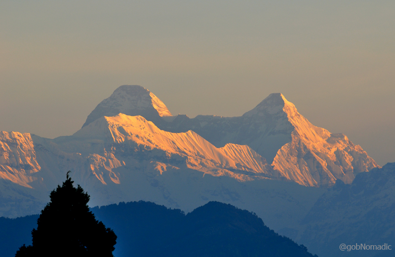
Despite the ever-increasing flow of tourists near the activity centre, the existence of cooler and sylvan environs in its higher purlieus could not be denied. And that’s where the magical charm flourished. In its vicinity, one may still be able to find an alpine-like feel. The head of the Beas Valley is known as Beas Kund which only means the source of the Beas. The popular hike to the Kund takes about 8 hrs from Solang main parking. The peak views are dominated by Hanuman Tibba (5928m), Ladakhi Peak (5342m), Manali Peak (5669m), Muker Beh (6069m), Shikar Beh (6200m), Shiti Dhar (5294m), Gondla and Goh Kincha (5153m).
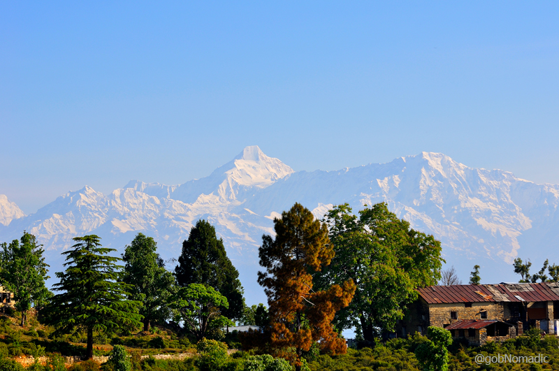
I would, however, recommend staying in the chalet-styled guest-houses located downstream on way to Manali. Far in the distance, the deodar-rich scenery exceeded in magnificence anything that can be found elsewhere in mainstream Kullu region.
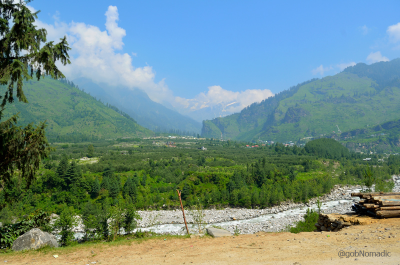
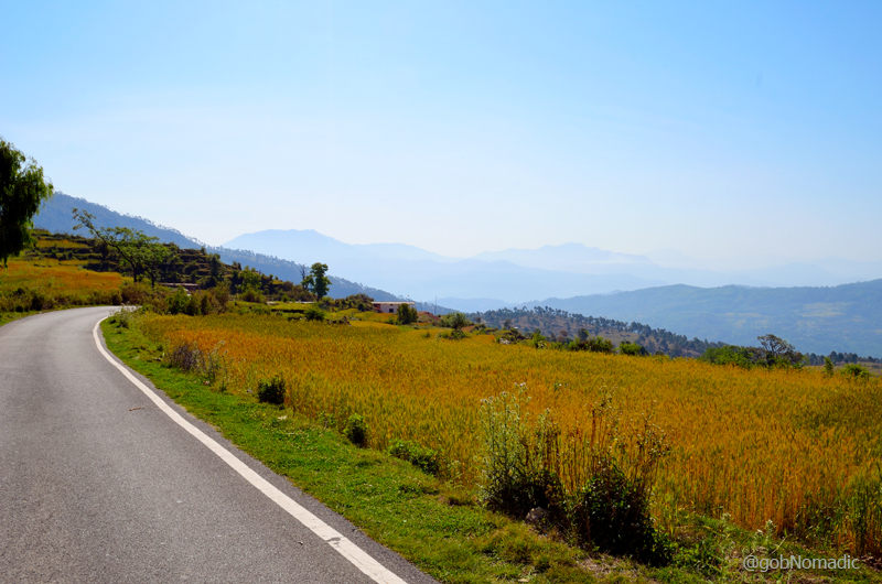
Landscape captured downstream. For more pics from the region, please visit Flickr Photoset
Average Altitude: 2300m
Best time to visit: Throughout the year; Summers and Winters in particular
Travel Lure: Himalayan views, Picnic adventures
Accommodation: Always in plenty
Almora Diary; Into the forests of Jhandidhar

Trishul and Mrigthuni from the Binsar Wildlife Sanctuary. More pics at Flickr Photoset
As I begin to pour my thoughts down concerning a brief holiday-stopover at the notable forests of Jhandidhar, I am nearly getting a feeling that I might be doing injustice to the beauty and inimitability associated with this location. As a travel blogger, I have always felt that writing about experiences after the visits have long been concluded is a grave error one would commit and only the portrayal churned out by the relative thought-process provides the soul to the travel-memoirs. And yet, this time with the aid of travel-notes of my first excursion to Binsar, I am attempting to recreate my experience about a break which dates back to the summers of 2011.
Popularly known as Binsar, the forest of Jhandidhar derives its name from the ancient temple of Veeneshwar (or Bineshwar) located within the sanctuary. Spread in the heart of Kumaon at altitude varying from 1500 to 2500 m, Binsar is about 30 km on the Almora-Jageshwar road (SH37) from the main township of Almora. The smooth motorway from Almora makes its way through the forests of Jhandidhar to reach the interpretation centre-cum-entrance gate of the sanctuary. The notice boards at the interpretation centre clearly states the general obligations of a visitor with respect to the biodiversity inside the sanctuary. The entry ticket, obtainable only during the daytime, is valid for up to three days.

“Come and Get Lost”!! More pics from the Kumaon region at Flickr Photoset
Jhandidhar’s popularity shot up when during the days of British Raj, Binsar was declared to be the administrative centre of Almora. As many as six estates still exist within the confines of the sanctuary and several other colonial bungalows could still be spotted in its vicinity. The sprawling estates have played host to a number of politicians and celebrities including the likes of Henry Ramsay, Vijaylaxmi Pandit, Jawahar Lal Nehru, Sardar Ballabh Bhai Patel, Tiziano Terzani and Uday Shankar, etc. Thanks to the efforts of environmentalists especially the Goralkot estate owner, the ridge and its forest wealth was saved from the clutches of commercialisation when it was notified as a sanctuary by the then UP government. Today, the forests of Jhandidhar are among the few remaining densely wooded green patch in the Himalayan state of Uttarakhand. Mercifully, Binsar continues to harbour one of the few remaining natural temperate broadleaved forests in middle Himalaya.

The name Binsar originates from the ancient temple of Lord Shiva, Bineshwar Mahadev, situated in the middle of the sanctuary. More pics from the region at Flickr Photoset
As elsewhere, I had not made any prior arrangements to spend the night inside the sanctuary. There is no dearth of accommodation around the sanctuary but inside it is very limited. Located at a distance of 13 km from the main gate, the KMVN tourist rest house is positioned just perfectly on a ridge top. To keep myself away from the touristy humdrum, I was inclined towards staying at the Forest Rest House located a couple of km further. The supply of electricity inside the sanctuary is very limited and both properties operate on solar energy. Wooden floored, the FRH was still in its original state.

As the light fades, tourists inside the sanctuary throng the FRH compound to admire the sunset

Interiors of the FRH still retain much of its original charm. More from the region at Flickr
The then caretaker of the FRH, Sh Bache Singh Bisht readily agreed to double up as a guide through the forest. Having gobbled up a cup of hot ginger tea, we headed into the denseness of the forest. It is claimed to be the only wildlife sanctuary in the country where walking is permitted on the 62km of designated paths. Depending on the interest of the visitor, there are many identified trek routes within the jungle. The most popular of the lot is the one to the ridge top marked as Zero Point. The remainder of the trek options are for those who intend to observe the village life. There are as many as five villages inside the sanctuary limits. However, venturing into the forest after sunset is strictly prohibited.

The pathway to the Zero Point atop a ridge inside the sanctuary. More from the region at Flickr
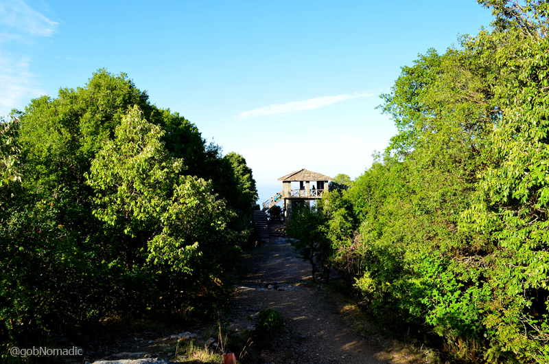
The watch-hut named Zero Point atop the ridge. More images from the region at Flickr Photoset
Commanding an uninterrupted panoramic view of the Great Himalayan Range from Yamunotri in the west to Nepal’s Mt Nampa towards the eastern horizon, the vantage point atop the ridge is popularly christened as the Zero Point (2410m). The watch hut at the ridge top is situated roughly at a distance of about two km from both the KMVN facility and the secluded FRH. Impregnated with moisture, the hazy greyish hue in the sky awaiting the grand arrival of monsoon partially obstructed our view towards the snowy heights. Nevertheless, the Goddess deity of Garhwal as well as Kumaon, Mt Nanda Devi was still noticeable above the clouds. It was my first affair with the grand view of Himalaya. The snowy curtain had induced Himalayan addiction into my soul. And as they say once the Himalayas are in your blood, there can be no escape.

A portion of the Great Himalayan Panorama captured from the Zero Point. L to R: Nanda Ghunti to Dangthal in the monsoon-rich skies. More from the region at Flickr Photoset

Binsar is a hiker’s paradise. Pathways are accessible for most part of the year. One may not find habitation for hours at end, therefore, it is advisable to carry supplies along
Not only the magnificence of Himalayan views but the rich flora and fauna along with the folklores ranging from the mythological Saptrishis to the British administrators makes Binsar an idyllic sojourn halt. The relatively unspoilt wilderness is alarmed only by the noises of animals or birds whereas the centuries old oaks testify the changing perspectives. Much before the British moved in, Binsar was the summer capital of Chand Rajas. However, a little survives from its undoubted ancient past except for the thirteenth century temple complex dedicated to Shiva and Parvati.

A large quantity of watering holes, called Naulas, are found in this water retaining Oak forest

Banj and Maaru Oak trees, useful medicinally, are found in the upper reaches of Binsar.
Divinely worshipped, Deodars are considered to be a reliable building material. As a matter of fact, The British had thoroughly exploited Deodar forests throughout the Himalaya.
The forest wealth of Binsar comprises Himalayan Oaks, Chir Pine, Deodars, Rhododendrons, etc. apart from noteworthy birdlife and usual wildlife. I was particularly enamoured by my first sighting of a flying squirrel as it jumped in the thick of moss-covered dense woods. The sanctuary pamphlet I was carrying claimed that Binsar is home to leopards, barking deer, wild boars, monkeys, jackals, red fox and porcupines, etc. Housing over 150 bird species, it is considered to be an absolute paradise for birdwatchers. The popular ones include flycatchers, khaleej pheasant, cuckoo, great barbet, tits, nuthatches, parakeets, thrushes, koklas, golden eagle and himalayan woodpecker, etc.
While morning hours see a buzz at the Zero Point, daytime is generally popular for bird-watching as well as observing village life. As the light starts fading, residents in the confines of the sanctuary throng the FRH compound to admire the setting sun.

The century old FRH is one of the popular Sunset viewpoints inside the sanctuary
In these environmentally testing times, Binsar continues to be one of the last remaining fortresses of well-preserved blooming nature. Unlike most other reserves, the forest sanctuary of Binsar is open throughout the year and offers distinct flavours in all four seasons ranging from the red rhododendron to energetic flame of the forests in spring, from the misty monsoons to the unparalleled vibrant views of autumn and snows in winter.

पहाड़ की चेलीले, पहाड़ की बौरी ले, कभे नी खाया दि रोटा सुखले। हाय हाय ले काटा दुखले दिन ले, पहाड़ की चेलीले, पहाड़ की बौरी ले। More images from the region at Flickr Photoset
Average Altitude: 2200m
Best time to visit: Throughout the year; autumn in particular
Travel Lure: Himalayan views, Wildlife rich forests
Accommodation: Always confirm in advance
Doon Valley Diary; The Rock Edict of Ashoka at Kalsi

A replica of Ashoka Pillars guarding the entrance (twitter: @satravell is now @gobnomadic)
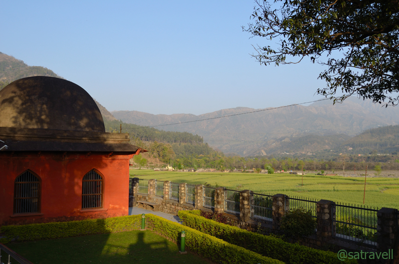
As we were heading to Chakrata in the spring of 2013, an Information Board by the highway, near Herbertpur, announced the location of an Asokan Rock Edict at Kalsi still a few kilometres ahead. Honestly speaking, none of us had any idea that the approach to the historical site was on this particular stretch of the highway in the Vale of Doreen. Even the guidebook we used to rely upon failed in its purpose to provide any useful information about the site. The next thing I knew we were at the spot looking for clues to be captured.
The entrance-lane to the site lies towards the right side at the end of the main market of Kalsi town. Located near the confluence of Yamuna and Tons, Kalsi is about 50 km from Dehradun on the road to Chakrata via Herbertpur. The military barricade on the road to Chakrata is positioned just ahead of the market of Kalsi after which foreigners are required to furnish a permission from the Home Ministry to venture beyond.

The paved entrance to the site at Kalsi
The Great Mauryan Emperor Ashoka (273 – 232 BC) got his fourteenth edict inscribed on a rock at Kalsi. However, the site was brought to light by John Forest in 1860. Considered to be one of the most important monuments in the field of Indian epigraphy, the rock edict is looked after by the Archaeological Survey of India (ASI). Representing the times when Ashoka had vowed himself to be a Buddhist, after having conquered a substantial chunk of the globe, the 10 x 8 ft-rock edict is identified in Prakrit language and Brahmi script.

The fourteenth Rock Edict of Ashoka
Having embraced Buddhism, Ashoka is known to have got 14 rocks inscribed, spread across his empire, with a unique religious message on each. The edicts reflect Ashoka’s humane approach towards his administration and his commitment to non-violence as well as abandonment of warfare. The inscriptions are believed to be a testimony to the fact that what Ashoka preached also practiced.
The small garden around the dome appeared to be a reasonable place to picnic. The landscape from the site presented with a rich frame comprising fertile fields spread on successive ledges till the bank of Yamuna against the backdrop of shallow hills. I wondered what the scene would have been back in the Ashokan times.
In its heyday, the region surely must have been the best of tarai forests full of wildlife. Even as recently as the late 1940s, the valley of Jungle Princess Doreen, Dehradun was full of tigers and other big cats. On a sadder note, the current state of wildlife appears to be very gloomy despite the presence of two national parks – Rajaji National Park and Kalesar National Park – in the vicinity of Dehra Valley. Nevertheless, the vale continues to be popular with birding enthusiasts.
This building, the dome, over the Rock Edict was constructed by the Government of the United Provinces in March 1912 to protect the inscription
Kalsi can be visited round the year albeit if you are okay with the idea of spending a hot summer afternoon at an average altitude of 750 m. Apart from a lone FRH at Kalsi, the nearest appreciable accommodation options are at Dakpathar (just four km) or Asan barrage.
Book Talk: Maharaja in Denims, a tale of Love, Intrigue and Passion
Appositely titled, “Maharaja in Denims”, the latest story by Khushwant Singh intriguingly combines passionate love, history, tragedy as well as the local culture of Chandigarh, author’s worktown.
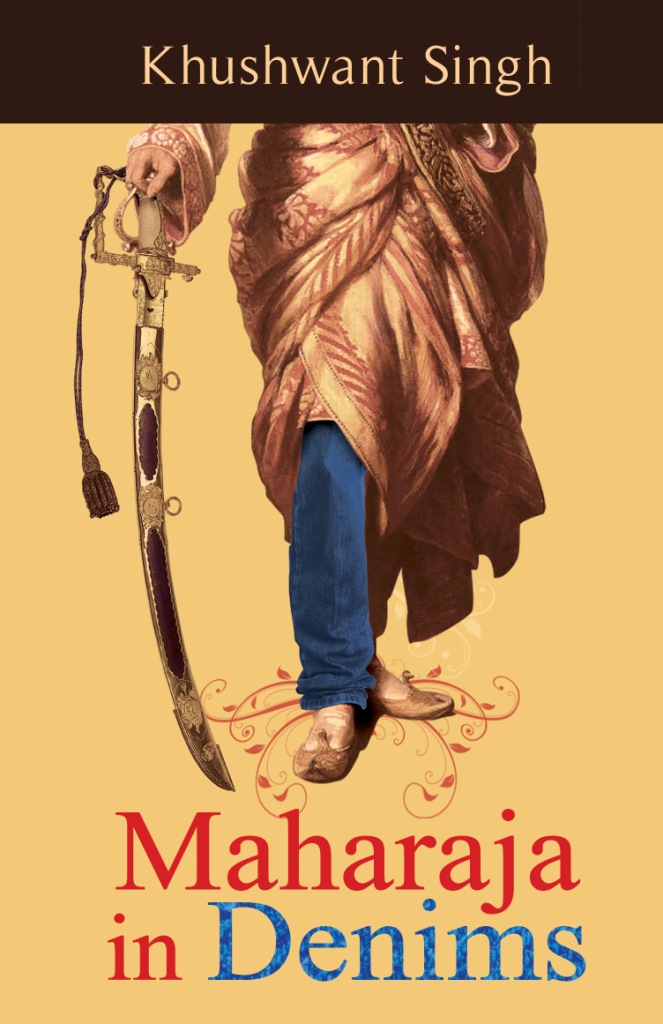
In his first fictitious narrative spanning multiple time zones and generations, the author relates with various aspects of Punjab, including its formation, as well as Punjabi families particularly the farming community and successfully creates flashes of university life of Chandigarh.
Justifiably priced at Rs 250, the book dramatically creates interest in its reader towards the crucial events that shaped the present day Punjab. Blended well with the modern fiction, in less than 200 pages, the book emerges to be a light but thoughtful dose of antiquity of Sikhism and Punjab. Starting with the aura and greatness of Ranjit Singh, the book touches upon Captain WG Osborne’s fascinating account of Ranjit Singh, his harem and his love for women (no womaniser). Moving ahead, the book reflects on the aftereffects of the partition and 1984 riots in Delhi.
“Ranjit Singh, who rose from the status of a petty chieftain to become the most powerful Indian ruler was also the first and only Sikh ruler of Punjab. His empire extended from Tibet to the deserts of Sindh, and from the Khyber Pass to the Sutlej in the east, with an estimated area of 1, 00,436 sq. miles and a population of five-and-a-half million.” I was particularly inspired by the vastness of the empire of the great Maharaja. Although, the typical political hatred could also be smelled out of the flow of events, overall the book is very much a work of fiction.
The fictional aspects of the book revolves around the central character Hari, a college going young adult who inadvertently discovers himself to be a reincarnation of Maharaja Ranjit Singh, the true lion of Punjab and Sikhism. His caring girlfriend Suzanne becomes a rather helpless observer of his previous lives traversing through multiple generations.
Presenting an outline of the major events that led to the creation of modern Punjab and the multiple problems it had to face in its eventful journey; the book will motivate you to know more about the greatness and effectiveness of Ranjit Singh. Anybody who has spent his college or university days in Chandigarh would be able to relate with the flow of fiction in the book. The simplified language of the book interspersed with witty local phrases makes for an easy and compulsive fresh fiction read on the region.
You can buy the book online at Flipkart.
Kumaon Diary; The Himalayan Showground at Chaukori

The twin peaks of Nanda Devi. Nanda Devi (7816m) to the left and Nanda Devi East (7434m) towards the right. Photo Credit Sarabjit Lehal
The Himalayan state of Dev Bhoomi Uttarakhand is the most perfect setting to experience the deific relationship between the extremities of beauty and grandeur. For me, the chance to shadow-walk the established ancient trade route arteries of Kumaon division, in the mountain state of Uttarakhand, arose later last month when the time window allowed an escape to the erstwhile trade region of Munsiyari.
The current Himalayan spree proved to be far more than just an escape from the summer heat of north India plains. As they say, “No road is long with good company”, accordingly the hilly road travel of more than 1500 km spanned over a week seemed like a doddle.
Before last season I had been to the forests of Jandidhar (Binsar) when the sheer plenitude of the Himalayan effect had initiated me into the White Range from a deeper perspective and forge an eternal harmony. Each and every time there is an indescribable pleasure in looking up the gigantic holy pinnacles and soaking in the pure mountain air.
Captured near Kanda. Photo Credit Sarabjit Lehal
Having cooled off our engines at Nainital from the previous night’s long drive through the plains, we set off for Chaukori via Almora, Binsar and Bageshwar. Although, the route through Bageshwar (182 km) is a little longer than the Almora – Sherghat – Berinag highway (174 km) but is more scenic as well as appealing. In between the eight hours long travel, the markets of Bhowali, Khairana, Almora and Bageshwar were typically full of local produce including seasonal fruits and necessary travel-supplies.

Mountainscape near Kanda. Photo Credit Sarabjit Lehal
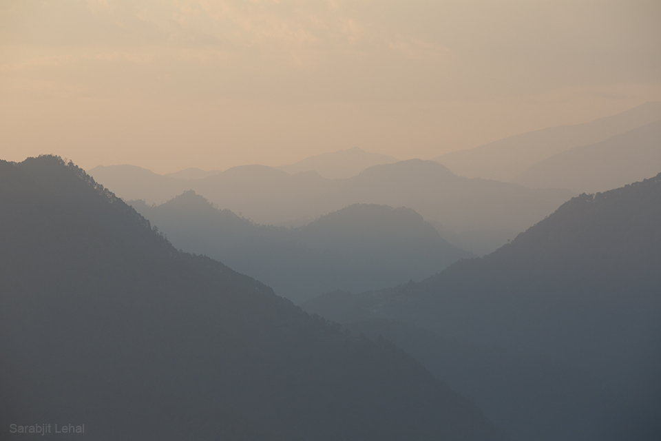
Ahead of the wide Sarju valley at Bageshwar, where in the midst of fertile fields the flat-roofed houses seemed like prudently placed matchboxes, the drive became even more pretty. As the vehicle inched up the motorway to Chaukori, our halt for the night, we had our first ‘provoking’ view of the Great Himalayan Range. Although, our momentous bliss was partially disturbed by the evening haze, the vividness produced by the golden crop in the shadow of high snows smeared the landscape in consistency with the putative belief that Kumaon offers the best snow views. The incredible last stretch of 16 km between the tiny hamlet of Vijaypur (1820m) and Chaukori (2015m), in the waning light, premeditated our thoughts for the night.
Setting sunscape near Vijaypur on the Bageshwar – Chaukori motorway. More at Flickr

Early morning view at Chaukori. Photo Credit Sarabjit Lehal
Out of the limited number of accommodation options at Chaukori, only a few enjoy north-faced setting. We preferred the state government run KMVN property positioned just perfectly. If only the management could improve in its services, the properties of KMVN (or GMVN) would be the most popular tourist spots in the state. The key lure attached to this particular accommodation is the uninterrupted Himalayan spectacle dominated by the mountain Goddess Nanda Devi.
As we sit down in the open lawn (which occasionally doubles up as a helipad) of the complex and soak in the cold hilly breeze downing our share of Himalayan poison and noshing on the accompaniments, our addiction with the Himalaya clearly got aroused anew. We lay under the starry night sky and marvelled at the snowy screen that was preparing to unveil on the other side of darkness. That night had a meaning.
At the break of dawn, cameras were ready and tripods were set. Three anonymous photo artists began capturing their story of Himalaya. The emerging temperate rays of the sun produced a scintillating morning show. With each passing moment, the refining intensity of light proclaimed the presence of heavenly rocks.
“And there she was! Cresting the ragged rocks casually scattered” – CS Houston. In the frame, the Nanda Khat (6611 m) is just below the Nanda Devi summit. More from the region at Flickr Photoset
With the showstopper lying towards the western horizon of the frame, the morning ritual climaxed at the supreme Nanda Devi, the fountainhead of inspiration, reveries and visions as well as patron Goddess of both Kumaon and Garhwal. Both my crime-partners instantly vanished into the wilderness around, with their cameras ready, in search of a better frame. I opted to laze around in the compound.

The southern outliers of Nanda Devi Biosphere Reserve captured from a point in Chaukori. L to R: Mrigthuni (6855 m), Maiktoli (6803 m), Sunderdhunga Khal (5520 m), Panwali Dwar (6663 m), Nanda Khat (6611 m), Nanda Devi (7816 m), Nanda Devi East (7434 m), Lamchir (5662m), Changuch (5322m) and Nanda Kot (6861m). Photo Credit Sarabjit Lehal
The drowsy azure created by the numinous snows, around the Nanda Devi, that was leisurely waking up from its winter slumber, summoned mysticism from far and wide. Only a painter or a poet could do full justice in expressing the view.
Facing north, a riotous chunk of rocks, wooded ridges, deep valleys, mountain ranges inconsistently rippling one above another and producing dark blue hues against the heavenly backdrop of holy snowy peaks of the great Himalaya. He who has absorbed this scene primed by the stunning Nanda Devi, may have fulfilled his yearning to witness one of the most astoundingly inspirational worldly sights.

View towards Nanda Devi twins from Chaukori. Photo Credit Sarabjit Lehal
Spread above the tea gardens of Berinag region, Chaukori offers an angled view, partially foreshortened by the prominence of Nanda Khat, of the twin peaks of Nanda Devi providing a wonderful unimpeded outline of the mountains in the South Nanda Devi Sanctuary. The view in the southern outliers is dominated by the magnificent snow drape of Nanda Kot. East of Nanda Kot, the key peaks include Dangthal, Rajrambha, Panchachulis and up to Annapurna on a clear weather day. For views towards Trishul and Mrigthuni, one needs to walk a bit and cross the first ridge in the west direction.
Nanda Kot (6861 m) and Dangkhal (6050 m) as visible from Chaukori. More at Flickr Photoset
Shadowed by the towering Himalayan peaks and blessed with forests of pines, oaks and rhododendrons, Chaukori makes for an idyllic Himalayan holiday destination. The fresh air, tea shrubs, orchards and the dense woods add to the comforting charm of the hill. One of the tea-gardens here was once owned by the hunter-turned-conservationist Jim Corbett. Of the many interesting walks, the three km hike to the musk deer breeding farm is one of the popular options. The walkway to the farm leaves off the main road in the direction of Vijaypur. Just remember photography is not allowed inside the caged premises of the breeding farm. The nearest marketplace is Berinag (10 km). Other popular “Nags” villages nearby include Dhaulinag, Kalinag, Feninag, Bashukinag, Pinglenag and Harinag. Famous temples nearby include Nag Devta and Tripura Devi.

View from the KMVN Chaukori. More from the region at Flickr Photoset
Golden wheat along the motorway near the tea estates of Berinag; view towards hills of Pithoragarh

View towards Pithoragarh hills. Photo Credit Sarabjit Lehal
Average Altitude at Chaukori: 2000m
Best time to visit: October to April
Famous for: Sylvan charms and Himalayan views
Accommodation: Limited but mostly available. KMVN offers the best views


