 bNomadic
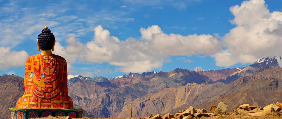
The Jawahar Tunnel
The following is a page entry from On Road through the trans-Himalayan Region. To read complete travel memoirs and trip report, please visit here.
Chapter 20 of 22

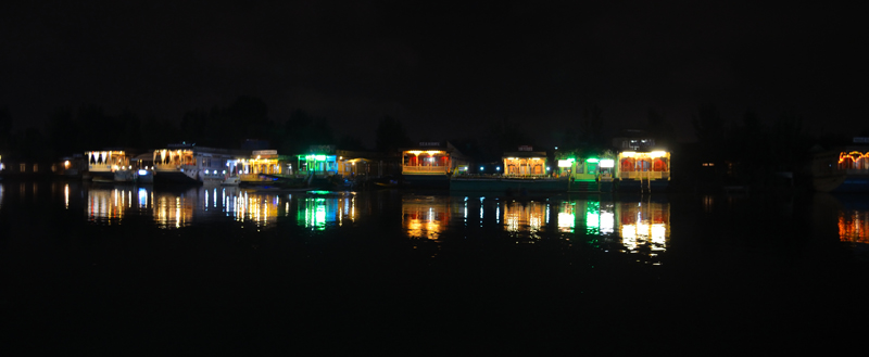
Shikaras lined up on the shores of Dal Lake. More pics from the region at Flickr Photostream
Bidding adieu to the Dal Lake as well as the Hari Parbat in its backdrop, next morning we checked out from the hotel after morning yoga as well as breakfast and headed towards the Lal Chowk on the Ganderbal Road. A popular symbol of political activism from the time when partition was held, Lal Chowk, despite having been decidedly reduced to just a clock tower, nowadays, still continues to be one of the most talked about city squares in India. Not only activism, the Lal Chowk is also famous for the market surrounding it, which as the locals claim, stores anything to everything. I was particularly interested in a few particular books on the region as well as a detailed trekking map.

Gul Gulshan Gulfaam. Remember!. More from the region at Flickr Photostream
The bandh situation had improved from the previous day and the market did seem to return to normalcy but the old city as well as mosques area was still out-of-bound for visitors like us. We bought some handicraft items, as souvenirs, from the stores located in the main market of Lal Chowk. Typical handicraft items from the region would include papier mache articles, shawls (pashmina, semi-pashmina), carpets, rugs, embroidered cloths as well as wall-hangings, pheran, wicker-crafted articles and wood carved items, etc. However, the best place to source such objects are from the workshops located in the labyrinthine lanes of the old city. For wooden carved furnishings, the market of Budshah Chowk and Polo View consists of wider options.

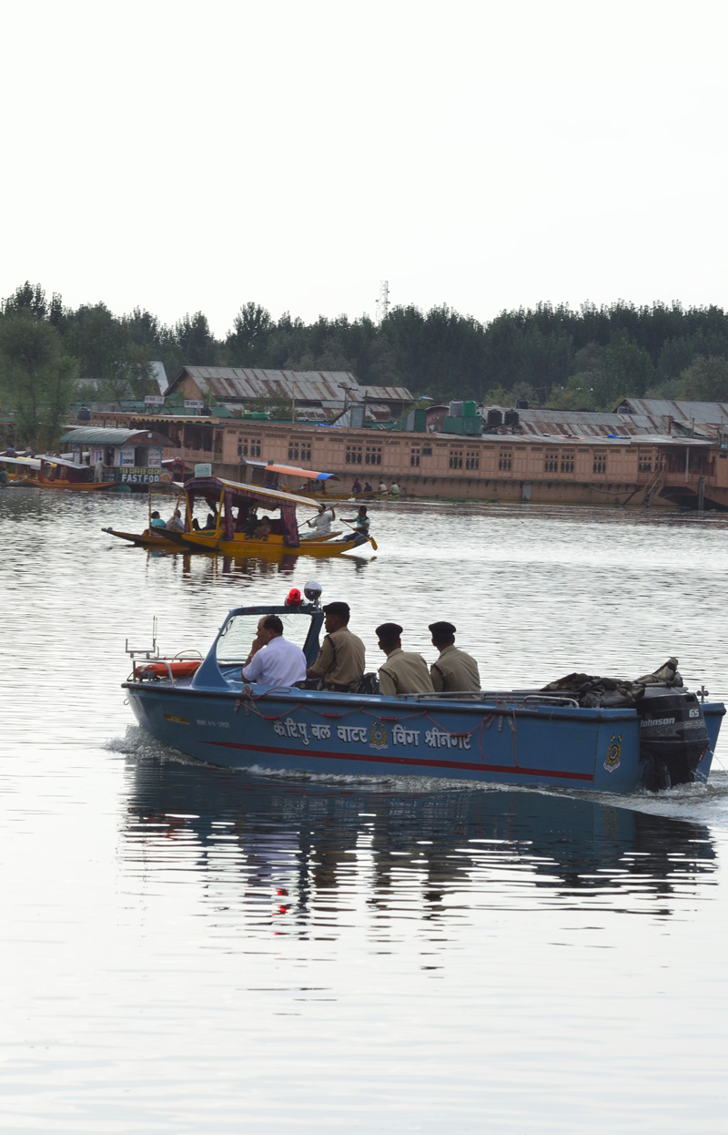
Secured away from land, one is dependent on Shikara rides to move between houseboat and the lake-shore.
Brought to the region in the fourteenth century, the Persian artistry work – Papier Mache, as we call it today – got frequently modified through ages including aligning to the interest of French traders, in nineteenth century, who after finding its huge demand back home in Europe established trade pacts with the Kashmiri artisans. Even replacing the traditional name of the craft with “papier mache”, the French influence had its own downsides including sacrifice of the traditional designs as well as colour schemes. Today, the production of this craftwork is largely confined to Shia community within Srinagar, a majority of who are gradually shifting to other occupations. Quite opposite, the manufacturers of other craft items like carpets, gabbas, namdas as well as pashmina articles, embroidery, crewel, willow, wicker and wood-carved products have economically grown by leaps and bounds. Shopping these products at the Lal Chowk market, be at your best in bargaining as most of the products are overpriced here.
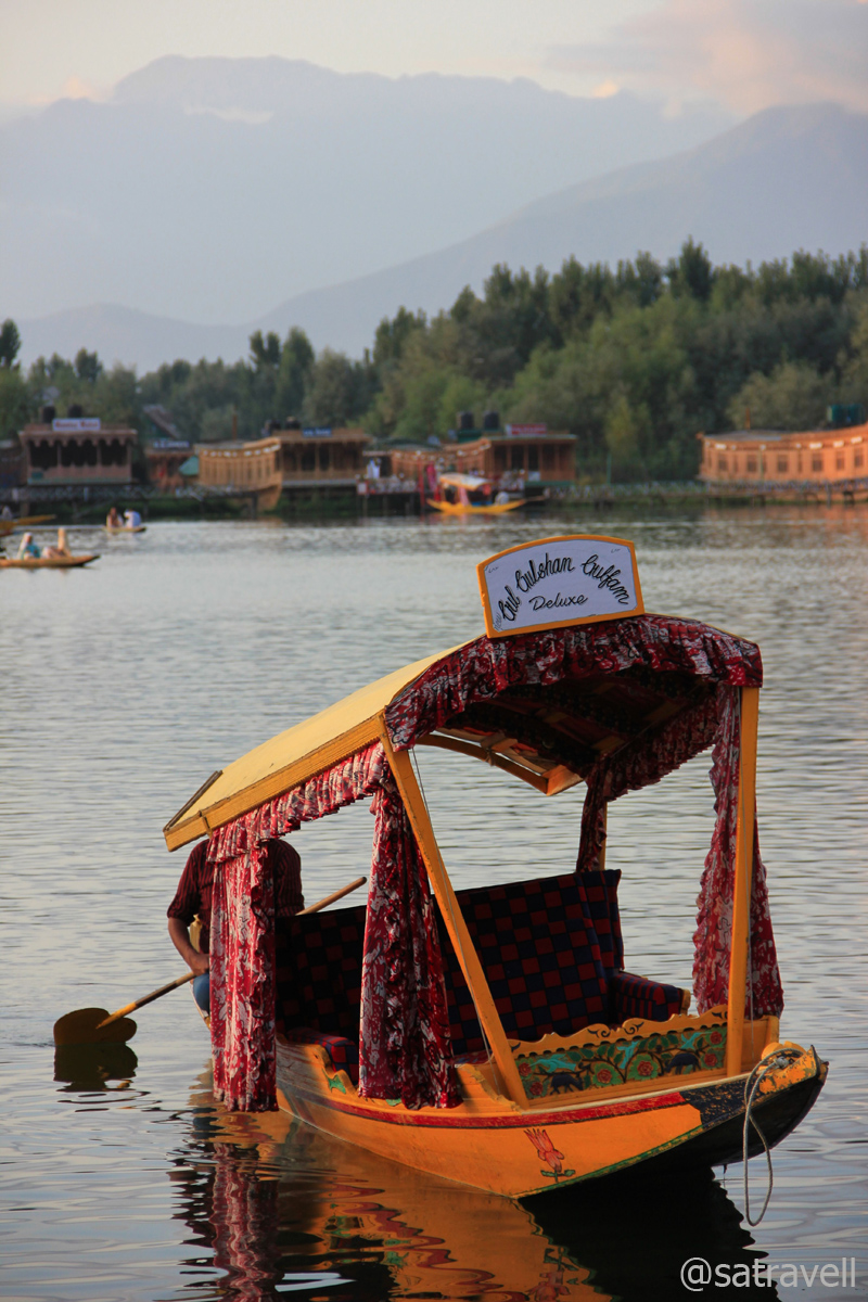
A Shikara titled Gul Gulshan Gulfaam
Despite spending a considerable time in the existing book shops in the market, I failed to get the desired books and the map. Past the Mughal Darbar restaurant (also a guest house now) on right, the road ahead (Residency Road) running parallel to the Jhelum River merges with the National Highway 1A (NH1A) connecting Uri with Jalandhar, covering a total distance of about 663 km. The lunch time at the restaurant starts after 1230 hrs but the thirty six course meal, Kashmiri Wazwan, seemed too heavy a meal for both of us. Refreshing our supplies with some fruits and packaged juices, we headed to the NH1A. Immediately as we left the Residency Road, we were greeted by a massive traffic jam near the Bypass intersection. From the poise of the capital city of gardens, lakes, shrines as well as protests, we were finally nearing the down veracity of grinding life of plains.
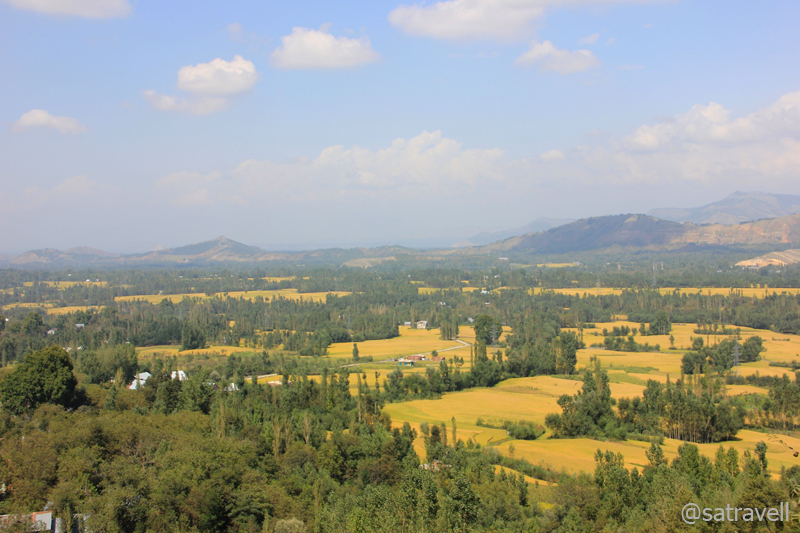
The stretch of the NH1A, for the next 80 km at an average elevation of 1600m, passes through an enormously vast flat vegetation-rich terrain, alongside river Jhelum in the Kashmir valley, till Qazigund, a few kilometres before the Jawahar Tunnel on the Pirpanjal Range. Right after the saffron town Pampore, the highway crosses a dense forestation of willows dotting both sides of the road called Green Tunnel. Past Awantipura (housing a few eighth-century Hindu temples that we failed to locate), the stretch famous for its bat manufacturing small units dotting both sides of the highway cruises towards the diversion of Pahalgam at Anantnag, the commercial and financial centre of the Kashmir valley.

A Kashmiri Willow Bat manufacturing unit. More from the region at Flickr Photoset

The local bat industry provides bread and butter to thousands. More from the region at Flickr Photoset
Spread on the NH1A on both sides of Anantnag, the cricket-bat manufacturing belt, providing bread and butter to thousands, comprises villages of Bijbehra, Charsoo, Hallamulla, Sangam, Pujteng, Mirzapor and Sethar, etc. With slabs of willow wood lying stacked in the open to dry, by the highway, at first I mistook it to be some furniture market. A few metres ahead, fully refined and ready-to-use bats displayed as wall-hangings around the workshops brought the reality out in the open. We excitedly stopped at a roadside teashop to end our curiosity. Kashmiri willow-wood is regarded to be one of the best materials for designing a bat that suits all forms of the game.
After partition, a majority of the craftsmen, mostly Hindu, migrated from Sialkot in Pakistan and resettled themselves in Jalandhar, Meerut, etc. With increasing demand, already famous for its quality wood, the Kashmiri willow crafting industry received the much-needed push. Close to 300 such small manufacturing units are currently on the go in southern part of Kashmir valley. Sitting cross-legged on a carpet of willow shavings spread on floor of his workshop, the craftsman minutely carves the slabs cut mechanically from willow logs. After finishing, depending upon the quality of the design as well as material, the bat is procured by middlemen as well as companies engaged in marketing sports goods. Even if the government is trying hard to save the monopoly of the region in manufacturing bat, the units, pegged at USD 20 million, suffer heavy losses during frequent insurgency operations. However, at this time villages were alive and kicking as some NGO had placed a collective order with them to manufacture one lakh bats to be used in the forthcoming Gujarat assembly elections.
Vale of Kashmir; as viewed from the “Titanic View Point“. More from the region at Flickr Photoset
Vigilantly patrolled by paramilitary personals, the NH1A is regularly peppered with fuel-stations as well as teashops, small dhabas, wicker-workshops, bat manufacturing units, fruits shops, bakery shops, etc. Past the diversion for Shopian, a little before Anantnag, we slowed down to give the apple vendors, a once-over, who were preoccupied with packaging the produce. Sourced from the famous apple basket of Shopian, the apples were being sold to the middlemen at dirt-cheap prices. I at once asked for 50 kg of apples and got them packed in two boxes. Surprisingly, the apples were in perfect condition by the time I reached my hometown in Haryana. Contrary to our Zanskar venture, the in-cabin pleasantly smelled of fresh apples now (instead of the pungent fuel-smell).

The 2531 m long Jawahar Tube from inside
The highway ahead turned right near the administrative offices of Anantnag, located at a comfortable 55 km distance from Srinagar. Literally meaning “abode of springs and lakes”, Anantnag is claimed to be an ancient place that came into existence as a market-town (said to be around 5000 BC) making it one of the oldest urban human settlements in the world. The town houses many ancient monuments as well as temples, most of which are now in ruins, looked after by the Archaeological Survey of India (ASI). As pointed out in Zanskar memoirs, a major hurdle to successfully self-navigate in Jammu & Kashmir is the absence of sign-boards marking the way to such sights. We heavily counted on my Garmin handheld GPS device. The cousin strictly opted, I think rightly so, not to ask for directions, other than leading to the main highway, from a bystander. Adhering to our Kashmir-specific travel-principals, we failed to access the lesser-visited off-route sites.

A rare road-info board ahead. More from the region at Flickr Photoset
The valley that has beheld immeasurable vicissitudes and experienced countless upheavals from time to time, all through ages, including the on-going militants-led tussle warranted a cautioned movement on our part. It is always advisable to check with local travel agencies or tourism offices with respect to the latest travel advisory to the region. Thanks to the vigilant security network set up by our paramilitary as well as defense forces, the travelling environment has improved figuratively as compared to that of the previous decade. On top of the lethargic JKTDC authority that has not contributed much in the overall development of tourism, even now a little organised-information is available on the region.
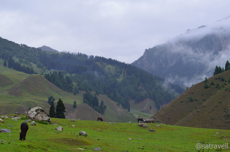
Ahead the highway passed through cultivated stretches marked by pretty shades of agriculture crop in the valley. The highway continues on the same average elevation till Qazigund, after which it ascends gradually over round hairpin bends on green hills. A few kilometres ahead of village lower Mundha (1880m) on a steep switchback, the last and final views of the Kashmir valley could be had. Marked by a BRO board – Titanic View Point – is situated 34 km ahead of Anantnag. We stopped by a small tea stall, which served beverages as well as snacks, where we were greeted by a small paramilitary outpost. With the help of a binocular, I futilely tried to figure out the origin of Jhelum River, the largest of the five rivers of Punjab, formed by merging of many smaller tributaries as well as springs in the southern part of Kashmir. Just six km ahead of the View Point on the highway lays the famous Jawahar Tunnel (2531m).
Evening Landscape captured from a point near Patnitop. More from the region at Flickr Photoset
The 2.4 km-long-tunnel that serves as the only road-link between Jammu and Kashmir valley was constructed in 1956 under the avalanche as well as landslide prone Banihal Pass (2832m) on Pirpanjal Range. Providing round-the-year access to Kashmir valley, the Jawahar Tunnel (or Banihal Tunnel) is heavily guarded by military round-the-clock prohibiting any photography. The stretch of the NH1A up to Jammu is looked after by the BRO. Apart from a railway-tunnel, the authorities are in the process of tunneling passages across the Pirpanjal, the largest range of the lower Himalayas, to support the proposed four-lane highway that will reduce the distance between Jammu and Srinagar.

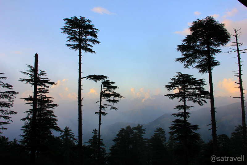
A Pine and a Deodar Tree. More at Flickr Photoset
Exiting the tunnel, the tarmacked-highway gradually descended the slopes of Banihal Pass, graded into several zones according to the magnitude of avalanche as well as landslide proneness. This stretch of the highway is known to have remained blocked for days during peak winters. As the highway descended gradually, the outside temperature increased, reaching its peak at a town called Ramban (1163m), situated 50 km from the tunnel on the right bank of Chenab, where we withdrew some money from a State Bank of India ATM. Moving forward, the road again started to gradually ascend passing through several settlements including Batote. Just before Batote, dhabas (Mansa Ram dhaba run by Sharmas) located on Peerah Morh are famous for freshly-cooked servings of Rajma(sh)-Chawal along with ghee and anaardana chutney. A personal favourite finger-licking quick meal option which we consumed at this very place was relished till the last grain of rice. Ahead the NH1A steeply climbed, one last time, over hairpin bends to reach a popular hill-station of the Jammu region, Patnitop.
Patnitop is an ideal destination to take wooded walks
Situated on a picturesque Shivalik ridge, at an elevation of 2105 m above sea level, Patnitop is blanketed by thickly wooded tall deodar and pine trees. Commanding all-encompassing views of surrounding landscape, on both sides of the ridge, including that of the Chenab basin, the hill-station is thronged by tourists both in peak summers and winters. In winter, the snow-crazy tourists crowd the region to ski on the snow-covered meadows and observe snowfall. Originally named Patan Da Talab implying “Pond of the Princess”, Patnitop, said to be a popular sojourn-destination of royal families, got its name changed over the years.

Patnitop: …the air is cool and still, and the hills are high and stretch away to heaven. More at Flickr Photoset
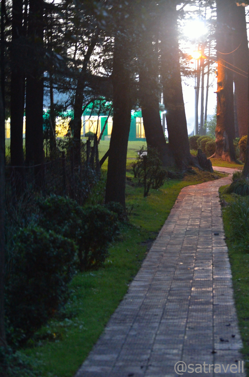
An attractive picnic spot, Patnitop offers peaceful walkways, leading through lush green meadows and dense woods, interspersed by JKTDC holiday huts, a few resorts, refreshment stalls, shopping stalls housing Kashmiri stuff, etc. Indeed for its economical pricing as well as the location, we settled in for a JKTDC property to spend the night. Although superior, other stay-options were located slightly away from the greenery besides food was overpriced. The manager at the JKTDC property offered us an additional off-seasonal discount. That evening we took a long (6 km) walk encircling the green belt looked after by the state forest department. A majority of the hotels and guesthouses are located outside this green-belt marked by dense cover of trees and shrubbery. Being an off-season, the virtual absence of tourists in the hill-station ideated Thomas De Quincey’s quote, “Old grieves shall be forgotten today; for the air is cool and still, and the hills are high and stretch away to heaven.”

Typical of a Touristy Destination
To be fair, all our demands were reasonably attended by the hotel staff. The wooden interiors of the room were maintained and the furnishings seemed old but beddings as well as towels were kept clean. The building looked as if timeworn in which the bathroom, though clean, merited a renovation. Surprisingly, the manager failed to provide me with specific information related to other destinations in the state. Later in the evening the caretaker, after serving dinner, disclosed that this was among the few profitable properties of the JKTDC in the state.
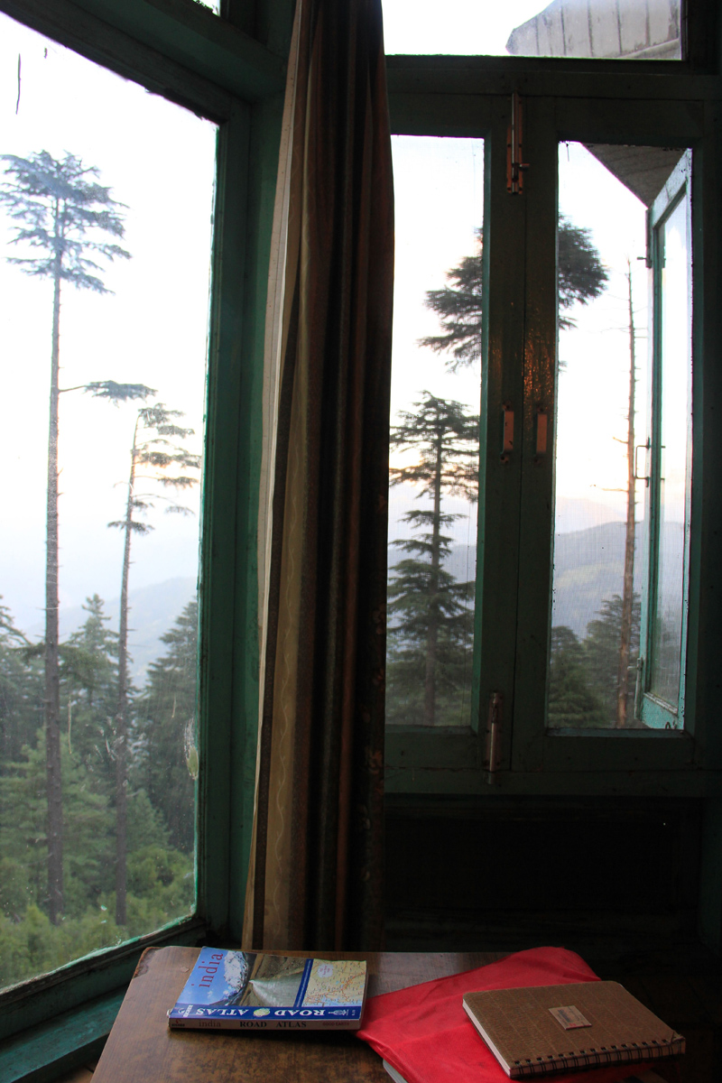
Room with a view (Map Book was a waste of money!)
View and read more on the area at the Kashmir Region Photoset on Flickr
You may also like to subscribe to the email updates, of the remaining chapters, by entering your email id in the sidebar.
The floating village and hanging gardens
The following is a page entry from On Road through the trans-Himalayan Region. To read complete travel memoirs and trip report, please visit here.
Chapter 19 of 22
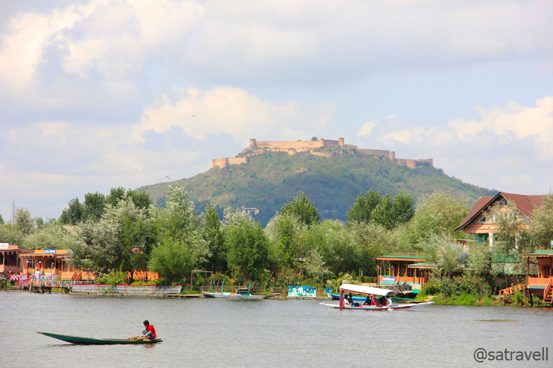
Morning view from the shores of the Dal Lake; spread atop the Hari Parbat, a Durrani Fort in the backdrop
The following morning, I got woken up by the incipient sunlight filtering in from the curtains of the lake-facing window of the hotel room. Out there, the extraordinary floating village had already sprung up to life. Surprisingly there was no traffic on the road. The shikara (a wooden skiff) hawkers rode door-to-door trying to sell their stuffs and services to the occupants of houseboats parked among lotuses, surrounded by pamposh leafs, in serene waters of the Dal Lake (1582m) even as wading birds began fetching their first meal of the day. The tranquillity of the Lake justly lulled me into a dreamy timelessness.
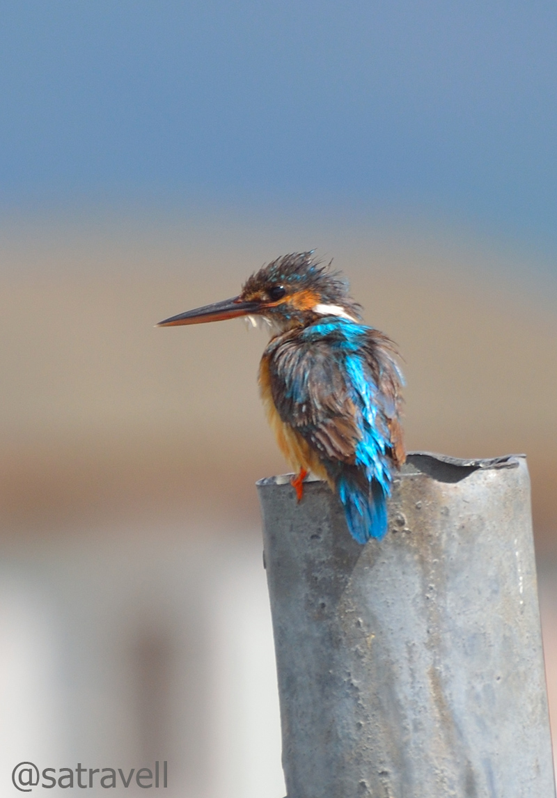
Locally called Tuntu, a Common Kingfisher
It was another matter that the Muslim clerics of the region had declared Srinagar bandh, in protest against alleged undesirable portrayal of Islam in a US blockbuster, that particular day. As the day progressed, it became clear that there was simply no point in venturing into the market area, mosques as well as the olden part of the summer capital of Jammu & Kashmir. Even though the paramilitary presence was ubiquitous throughout the city but it was the old part that was less safe. When it comes to religion, the permanently aggressive inhabitants are known to rapidly reshape into a pugnacious mob pelting stones at every passer-by. Sadly such actions, in fact, deprive the region its justified share of avenues that the tourism is capable of generating.

Srinagar bandh; as the day progressed, it became clear that there was simply no point in venturing into the market
Vigilant patrolling by the paramilitary staff
Had we had even a slightest pre-knowledge of the protest-plans, we would have preferred to halt at Sonmarg itself or may be head to Gulmarg. Nevertheless, to make the best use of the day, we headed to the historical Mughal Gardens where I hoped to find some birds at least. Already caught in the political crossfire between India and Pakistan, the religious protest had turned Srinagar into a virtual fortress with razor-wired sandbag-bunkers as well as machine guns positioned just about everywhere.
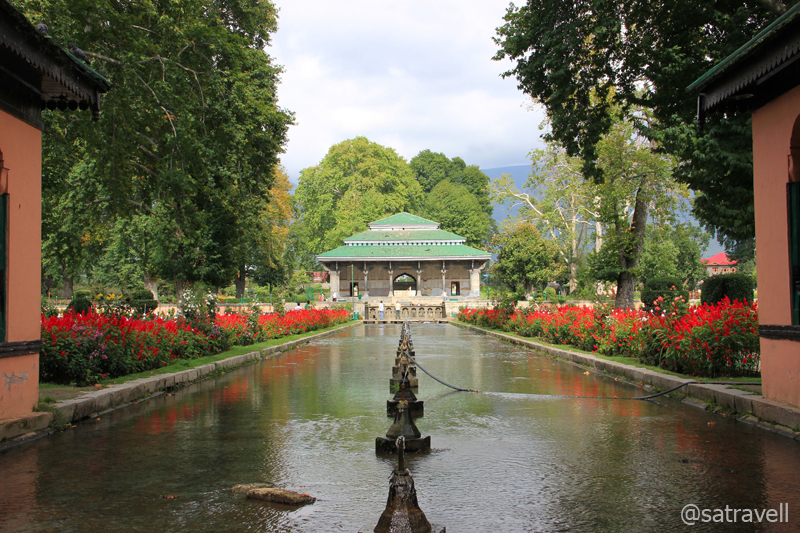
The Shah Nahar leading to the central and the main pavilion of the Shalimar Bagh. More at Flickr Photoset
Constructed in successions, the Mughal Gardens comprises a group of gardens built by Mughals in typical Persian style of architecture consisting of noteworthy rectilinear layouts terraced within a walled enclosure. Other typical features include pools, fountains and decorated canals inside the gardens. Sloping down from the Zabarwan hills, the estates terraced in the precincts of the Dal Lake to meet its north-eastern end, are currently separated by the Boulevard Road as well as a few small residential colonies interspersed with wide causeways and groves of Walnut trees. With different family members commemorating a newer estate along the Dal Lake, the Mughals officially designated Srinagar as their summer resort to adore the wholesome environment. Mughals were so inspired by the Persian garden-architecture that they built several such gardens, at different places, including Bagh-e-Babur in Kabul, Humayun’s Tomb in Delhi, Taj Mahal in Agra, Nishat Gardens in Srinagar, Lahore Fort Gardens, Shalimar Gardens in Lahore, etc.

Flowers inside the Shalimar Bagh. More from the region at Flickr Photoset
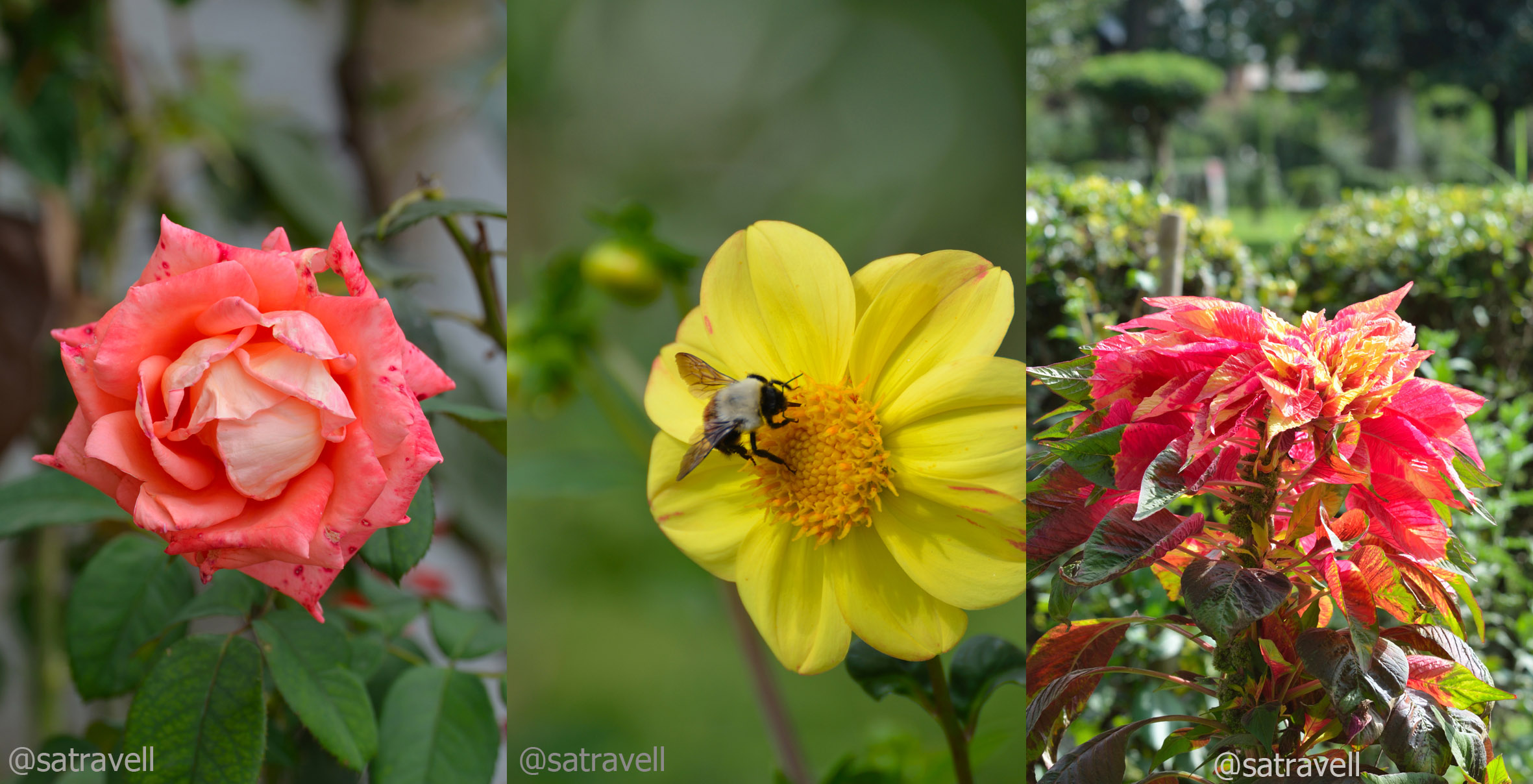
A riot of colours in the lawn. Please visit Flickr Photoset for more images and information of the region

Breeding summer visitor Eurasian Jackdaw
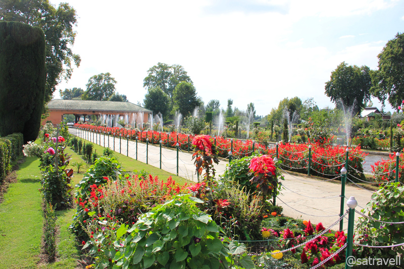
One of the numerous beautifully gardened walkways inside the Bagh complex. More at Flickr Photoset
Having bought an entry ticket for Rs 15 (for two), we first entered the Shalimar Gardens built by the Mughal Emperor Jahangir for his wife Noorjahan in 1619. Considered to be a crown with regard to Mughal horticulture, it was in this garden where the famous Persian couplet – Gar Firdaus rōy-e zamin ast, hamin ast-o hamin ast-o hamin ast – was first related with by Jahangir. The Persian-couplet’s literal translation to English means, “If there is a paradise on earth, it is here, it is here, it is here”. The lush green-carpeted colourful garden also has some Chinar trees dating back to over 400 years. Clicking the infrequent summer visitor Eurasian Jackdaw as well as few other birds, I headed to the garden café and asked for the famous Kashmiri Kahwa served piping hot.

Diwan-e-Khas inside the Shalimar Bagh

Galleria of Diwan-e-Khas; the famous Persian couplet – “Gar firdaus….” was first inscribed on the walls of this complex. More from the region at Flickr Photoset
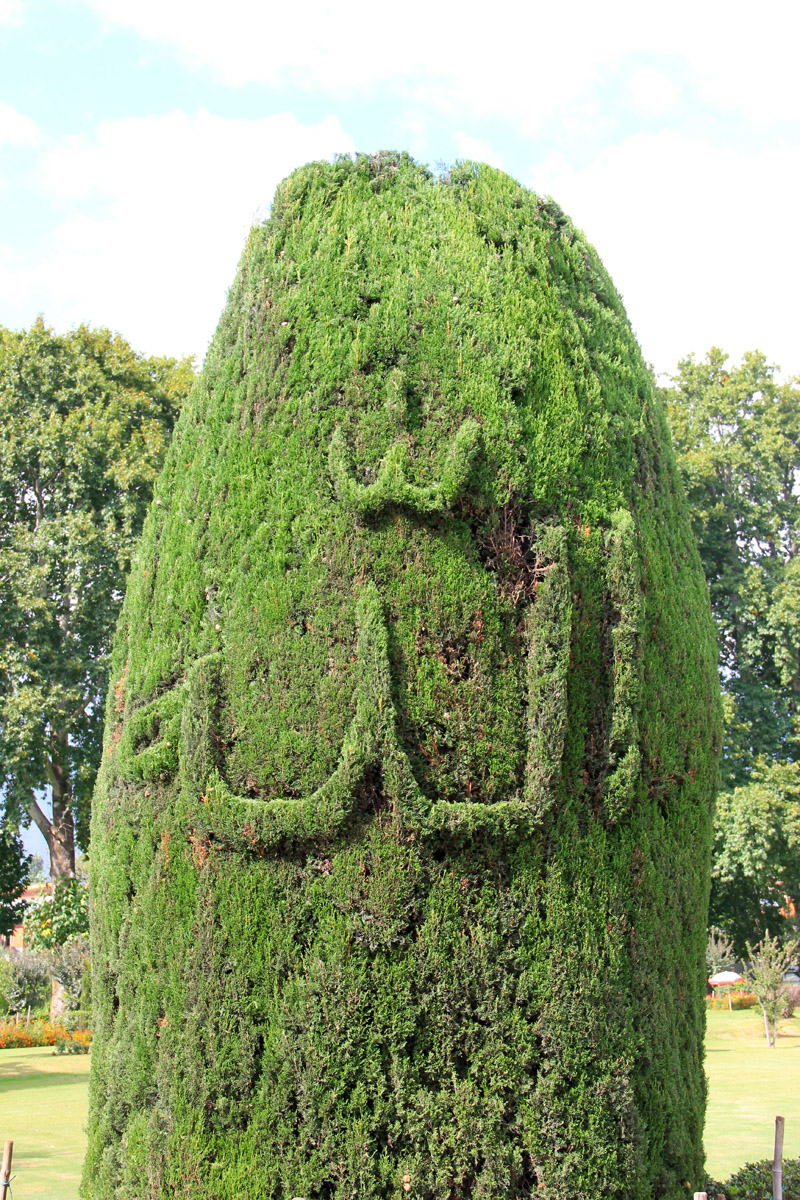
A Shi’ite symbol for Allah; अल्लाह

Originally planted Chinar Tree (more than 400 yrs old)
Having sipped the traditional brew, we headed to the Nishat Bagh garden, which was slightly smaller in size. The other marvellous gardens in the row included Cheshmashi, Parimahal, and Tulip gardens, etc. Later in the evening, we covered the 6km distance to the Dal Gate, by the lake, on foot. Walking on the pavement, on which local contract-farmers had put their walnut produce to dry, we came across floating-hawkers as well as anglers who didn’t have to try too hard to fetch something for the evening. The administration had identified certain ghats on the lake from where the shikaras could be hired. An hour-long outing in the water would cost Rs 300. Popular sites within the lake which boatmen usually sell as must-visits include chaar chinar, lotus garden, floating market, sites of movie shoot of Bollywood flicks Mission Kashmir, Kashmir ki Kali, Gulfaam, etc. Past the café-island in the lake, towards the Dal Gate, houseboats area starts.

Kashmiri Kahwa and my companion travel-diary
Outwardly ethnic and now often associated with Kashmir’s culture, houseboats were ideated as an alternative stay-option by the British who were not allowed to build or own houses as well as offices by the Dogra rulers in the valley. Now a major tourist attraction, maintenance of these houseboats, post-independence, was taken up by Kashmiri Hanji community who later devised newer ways such as floating gardens, shops, camera studios, market, hawkers, etc. to generate additional income. Consisting of a few bedrooms, dining room, sitting room as well as a cushion-spread loggia watching the world go afloat, the houseboats cost upwards of Rs 1000 a night. Secured away from land, one is dependent on shikara rides to move between houseboat and the lake-shore. While negotiating the deal for a houseboat, make sure such additional rides do not cost your pocket. The three popular areas to experience the houseboats are the Dal Lake, Nageen Lake and the Jhelum River. Of these, Nageen Lake is most serene and is popular with foreigners whereas the Dal Lake is mostly frequented by domestic tourists.

House Boats parked on the left and Boulevard Street on the right; with Shikaras offering the connect

A mobile Photo Studio. More from the region at Flickr Photoset
Fearing a backlash with the religious clerics, a majority of shops in the Boulevard Road market, nerve centre of tourism in the city, remained closed in the evening even as boatmen tricked the tourists selling them the idea of visiting the floating market instead. Even though a number of eateries dotted the market near the Dal Gate, there wasn’t much in store for those looking to satiate there taste buds with authentic Kashmiri cuisine. For that the Mughal Garden in the Lal Chowk market is usually the best rated restaurant especially for the famous Kashmiri Wazwan, a multicourse meal.

Evening view at the Dal Lake. More pics from the region at Flickr Photoset
Later in the night as we prepared to sleep, the Bollywood flick LoC on television restored memories of yesterday’s drive from Kargil to Zoji La, a highway-stretch that was frequently targeted with shelling by Pakistani army until the ceasefire of 2004. In all likelihood, we would have got our Kashmir-sojourn extended by a few more days but for the religious protests which are, at times, known to get murkier. Ever since gaining independence, being the lit fuse of relationship between India and Pakistan the future of Kashmir remains under dark more so with respect to tourism. Unless, a well-crafted political will is not generated to improve the environment, tapping avenues related to tourism would continue to pose a risk.
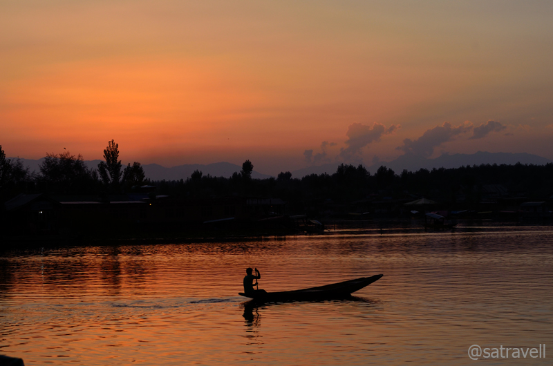
Sunset observed from the Boulevard Road. More pics and information from the region at Flickr Photoset
View and read more on the area at the Kashmir Region Photoset on Flickr
You may also like to subscribe to the email updates, of the remaining chapters, by entering your email id in the sidebar.
Promulgation of War Tourism
The following is a page entry from On Road through the trans-Himalayan Region. To read complete travel memoirs and trip report, please visit here.
Chapter 18 of 22

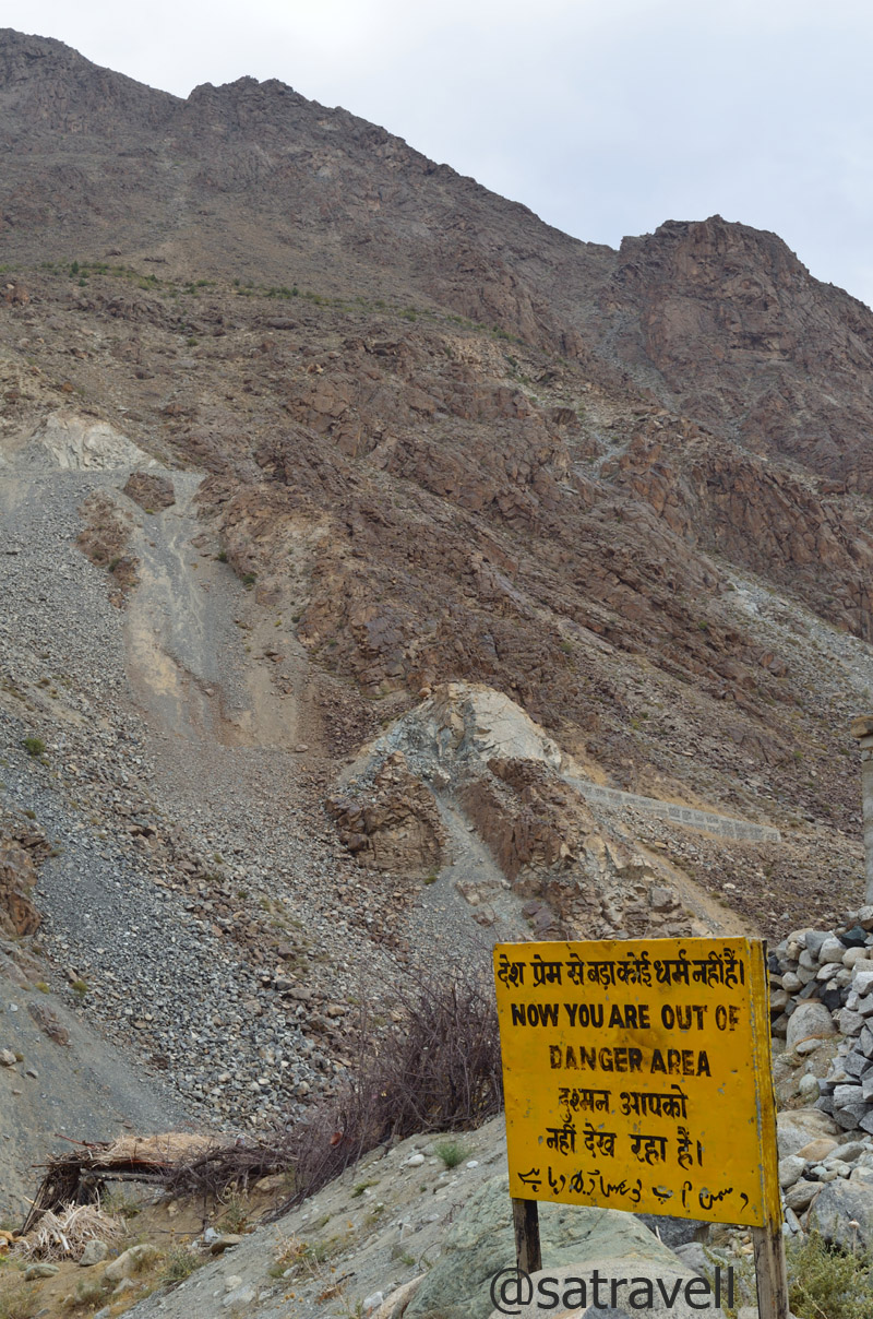
Caution: You are under enemy observation; the closet NH1D brushes the LoC. More of the region at Flickr
The traffic on the Zoji La is managed by the local police in association with the administration. The time earmarked for the vehicles to cross the pass from Kargil-side is in the morning from 0500 to 0800 hrs after which the movement depends upon the road traffic. In peak season one may have to wait for over five hours to get a permission to move to the other side. In this way, unlike other trans-Himalayan gateways from plains such as the Rohtang La, the Zoji La is better managed. The Srinagar-bound taxis usually start from Kargil early in the morning around 0200 hrs to be able to cross the pass within the specified timeframe and avoid any rush. Moreover, the Zoji La is, thankfully, devoid of any mad tourist rush like that on the Rohtang La. The vehicles plying on this section of the Treaty Highway chiefly comprises defence, administration, transporters ferrying supplies, travellers or tourists, etc. Up till the Zoji La, the entire stretch of the highway is dotted with army encampments, bunkers or war memorials.
BRO Signboard on NH1D
Even if the traffic-movement on the pass is better managed, crossing this gateway to Himalayas may prove to be a tricky affair. Frequently changing weather, landslides, melting snow, falling stones, slippery slushy motorway, etc. collectively make the Zoji La (3548m) one of the most treacherous passes to cross. Although, it might have been a risk, we deliberately started from Kargil after the sunrise at 0700hrs just so we could admire the beauty of the terrain. The distance between Kargil and Drass is just 60 km.

Landscape near Dhandal and the Drass River. More of the region at Flickr Photoset
Ahead of Kargil, the highway passes alongside the left bank of the Suru, which confluences with Drass River, past the Silkchey check post near village Kharul, forming the Shingo River that flows across the Line of Control (LoC) to merge with the Indus. Past the confluence, the heavily-guarded NH1D climbs upstream along the azure Drass River on its right bank. A few kilometres ahead, the green-patch of the valley, marked by poplars and willows on both sides of the river, is the closest the highway brushes the LoC. Here onwards, the nicely tarmacked road gradually ascends, on the slopes of the Great Himalayan Range, in the shadow of the enemy bunkers and outposts.
Topographically, the desolate Drass valley is a featureless desert wedged between sedimentary mountain-rocks as well as peppered by groves of willows and poplars. Past the confluence of the Drass with its tributary Shiga River, which rises from the western heights, the highway passes through village Kharbu (2825m) as well as village Shimsha (2876m) after which it crosses over to the opposite bank and passes through village Thasgom (2912m), Yashgun, Dhandal (3008m) as well as Thusgo (3116m) to reach Drass (3250m) in about three hours. A few kilometres after village Dhandal, a kilometre-long trek will take you to stones said to be associated with the Pandavas.
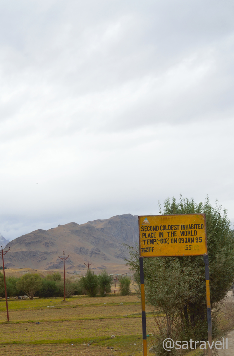
Nearing the settlement of Drass; average winter temperature still hovers around -40 deg C

Greens of Drass against the backdrop of Tololing Range, alone responsible for a majority of the total casualties
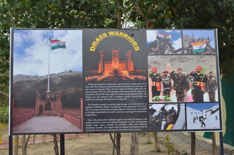
Drass Warriors; the war heroes memorial is profusely advertised all along the NH1D. More at Flickr Photoset
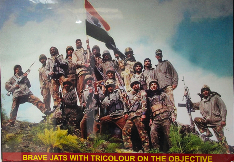
Ahead of Dhandal on the highway itself, nestled in the lap of Tololing Range lies the Kargil War Memorial, so profusely advertised all along the NH1D. Commemorated in honour of the brave soldiers who sacrificed their lives to regain the command of the winter-vacated high-outposts which had been occupied by Pakistani intruders, the memorial is a major tourist attraction nowadays. Lasting over 60 days in the summers of 1999, the war resulted in heavy casualties on both sides including 527 Indians and 453 Pakistanis. Codenamed as Operation Vijay, the war that posed significant logistical complications for both the sides, proved to be an eye-opener for India in many ways. The aftereffect of the wakeup call given by the sudden high-altitude warfare meant newer as well as better roads, superior equipment for defence personals, regrouping of defence deployments, newer airstrips and hoards of other strategic measures to effectively keep a check on enemy’s activities.
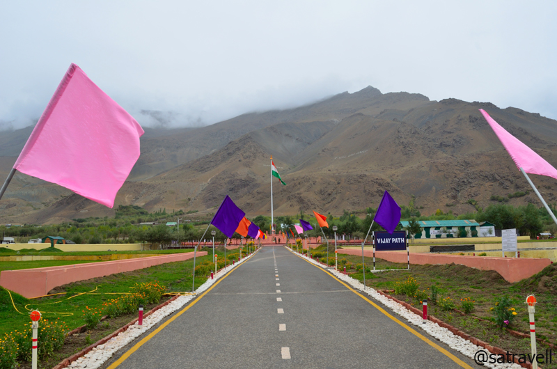
Vijayapath in commemoration of Operation Vijay reflects a saga of Raw Courage and Supreme Sacrifice

शहीदों की चिताओं पर, लगेंगे हर बरस मेले
वतन पर मिटने वालों का, बाकी यही निशान होगा।
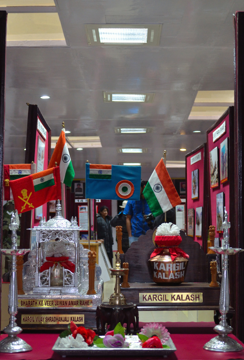
Constructed with chitter-stone, the memorial (3117m) at Drass consists of every facility a tourist would need including ATM, wash-rooms, cafeteria, parking, lush green lawns, war museum, souvenir shop as well as names of the soldiers, who lost their lives fighting the enemy, inscribed on an imposing memorial-wall. Greeted by Agnipath, a motivating poem by renowned hindi poet Sh Harivansh Rai Bachchan, at the entrance of the war-museum, which showcases pictures of soldiers, war documents as well as recordings, equipment as well as gear seized by the Indian Army from the enemies and other war-related information, serves as a touching testimony to the sacrifice made by young soldiers of the Indian Army.
…And how can man die better than facing fearful odds, For the ashes of his fathers, And the temples of his Gods
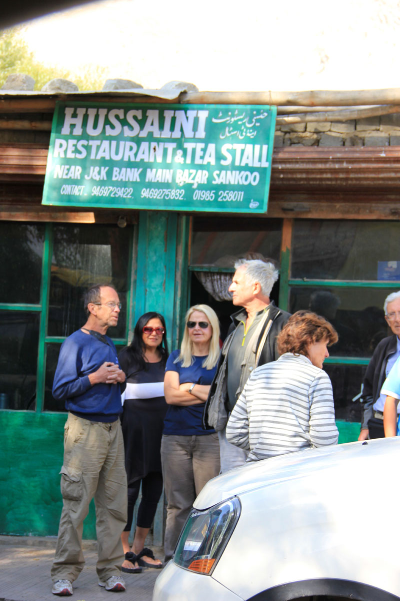
From the Tiger Hill Café of the memorial-complex, grabbing a few hygienically-cooked bread pakoras, which made for a time-saving brunch alternative, we moved ahead to Drass. A couple of kilometres ahead, an under-construction motor-trail to Sankoo, over the Umba La, diverges the highway towards the river side. Ahead the NH1D is dotted with army encampments as well as sarv dharm pooja sthals before reaching the market of Drass.
Enveloped in dark clouds, is the Tiger Hill (Pt 4660 m). More of the region at Flickr Photoset
Consisting of a few shops, basic restaurants and tea shops on the highway as well as a slovenly JKTDC tourist bungalow-cum-office, the town has recently become surprisingly popular for war-tourism. In a dim hope of procuring a state map, I entered into the JKTDC office. My opinion about the pitiable state of affairs at a state tourism board’s property got another endorsement immediately as I entered the dilapidated office with ages-old information wall-hangings and untidy furnishings. Even after spending close to fifteen minutes in trying to figure out the era-old map hanged by the cabin of the concerned official, I failed to discover any human presence responsible for managing the office.

The Main Market of Drass. More pics and information of the region at Flickr Photoset

The “deserted” JKTDC Office at Drass. More from the region at Flickr Photoset
Known to be descendants of the Dards, the beleaguered Aryan clans who are said to have left the Gilgit area under some mysterious circumstances, the Drass valley is inhabited by Drokpas or the Dukpas. Despite their current religious affiliations, the Dukpas, who worked as porters over the Zoji La in the olden times, are still very mindful of their Aryan ancestry. The region is said to have converted to Islam in the fifteenth-century but some Buddhist stone sculptures are still sited on the Treaty Road just before the town.
The main settlement of Drass, in the valley, is spread on an elevated ground on the left bank of the river. Claiming to be the second coldest inhabitation in the world, as marked by a board, after facing extreme temperature of -60 degree C in January 1995, the average winter-temperature still hovers around -40 degree C. Otherwise, the town garbs a pleasant look in short summers. Apart from occasional willows and poplars, the valley-land is generally unfertile. The people, therefore, have limited options to procure their supplies, including fuel-wood, which they gather from across the passes.

An Army cavalcade ahead. More pics and information from the region at Flickr Photoset

View towards Chiskam Valley
No sooner we left Drass than it started drizzling and the weather became overcast. Ahead, the road continues its gradual ascent alongside the same bank of the Drass River. Past the diversion for the glaciated Mushkoh valley, Kargil Battle School as well as the Army Rock Climbing School, the NH1D passes through an area that had witnessed the 1948-war fought to wrest the Zoji La from the clutches of Pakistan. Swinging in a wider glacier-scoured stretch of the valley, the highway passes through small villages of Machoi (3220m), Pandares and Matayen (3271m) to enter picturesque expansive pastureland braided by glacial streams. Forming the extreme western region of Ladakh in the Indian territory, the Drass valley opens in the north-eastern direction from the Zoji La along the turbulent Drass River, which originates from the Machoi glacier located near the pass.

Through the Gamru Valley. More pics and information from the region at Flickr Photoset
The tarmacked motorway gets reduced to bumpy as well as slippery road after the Police check-post at Minamarg (3280m). The next check-post is stationed at Gumri Army Camp (3482m) along with a few teashops. Although, the distance between the pass-top and Drass market is 40km, we still took couple of hours in covering the distance. Already moving at a snail’s pace in deteriorating weather, a huge Kargil-bound military convoy coming from Pathankot further stalled our progress on the highway. Even though the weather disallowed photography, the visible grassy slopes were surrounded with peaks as well as glaciers.

A Black Kite Imm. More at Flickr Photoset
Pasture lands near Matayen
Due to inclement weather as well as heavy snowfall on higher reaches in long winters, the pass is declared open for traffic only between June and November but locals cross this pass on foot round the year as they have done for centuries. Following the Union Government’s sanction of Rs 5500 crore, the authorities have recently (Aug 2012) commenced work to construct a six kilometre long tunnel across the pass to allow round-the-year movement of traffic.

No sooner we left Drass than it started drizzling and the weather became overcast. More at Flickr Photoset

Approaching the crest of the Zoji La. More pics and information from the region at Flickr Photoset
As of now, attributable to frequently changing weather, the crossing is as dramatic as that on the Rohtang La though the road condition here has recently been improved by putting cemented slabs on the motorway. Past the information board on top of the pass, the road bifurcates to ease the traffic movement. The one going steeply downhill in switchbacks is narrow, slippery and bumpy but offers a shortcut to descend the pass. Although wider, the right one is less bumpy as well as slippery but passes through a live stone-fall area.
The condition of highway ahead

Captain’s bend; Baltal down below. More from the region at Flickr Photoset
A traffic jam on the descent; Zoji La
With a LED flashlight in hand to signally communicate from a distance, I positioned myself on the left downhill narrow road and rallied around to pilot the vehicles in the line, led by ours, looking to take the shorter route. Running ahead of the vehicles past a couple of sharp bends on the slippery motor-track, down below I spotted a string of trucks struggling hard to climb the pass, thereby, causing traffic jam. Accordingly, I signalled the vehicles to stop. There was no alternative other than to turn back and take the longer route. In the light drizzle, I helped the vehicles return to the forked junction. Thereafter, the road camaraderie continued to blossom and we were now guided, by a Srinagar-bound local taxi from Kargil, through the stone fall area. The driver seemed to know the motorway well. At every troublesome mountainside, he would park his vehicle to safety and helped us watch out for the falling stones. Passing through yellow mountainside, the smooth highway descended to a vegetation-rich countryside.

Notice the traffic jam on the lower motor-trail; Machoi Glacier enveloped in clouds. More at Flickr Photoset
Ahead, the highway sloped above the famous Baltal camping grounds located by the Sindh River at the base of the Zoji La. Offering a high-altitude shorter trekking route, the Amarnath Cave is just at a day’s march from the camping grounds. Literally meaning “a meadow of gold”, a popular trekking destination of 1980s Sonmarg (2748m) is located just 10km from Baltal.

By the infant Sindh River; near Baltal

View towards Durin Valley. More at Flickr
Ahead as we entered the Sindh valley in Sonmarg, the weather showed some improvement though it was still unfit for photography. Apart from sheep as well as horses grazing afield, another common sight is locals attired in the pheran, a body-length robe worn by Kashmiris under which they tuck a kangri, a wicker-basket full of hot coals placed in dust, in winters to warm themselves. Worthy of being a must-visit hill-station, Sonmarg nowadays has been sadly reduced to a popular tea-stop for vehicles heading to the pass. Even though the town offered plenty of options, across all budgets, to holiday but owing to terrorism and the hill-station’s strategic location along the highway, one would come across more soldiers and policemen occupying the properties than tourists.

The trek by the infant Sindh near Baltal leads to the Amarnath Shrine. More at Flickr Photoset
Historically, Sonmarg has been referred as a gateway on ancient silk route leading to Ladakh and Gilgit connecting Kashmir with Central Asia as well as Middle East. Sipping hot tea at a roadside stall as we chatted, the emerging popular options to sightsee the area included short walk to nearby Thajiwas glacier, which was enveloped by clouds that evening, river-rafting, trout fishing and trekking up to nearby glacier-lakes. Leaving the explorations to some other day next season, we moved ahead on the nicely tarmacked highway to Srinagar.
Rain-washed greenscape near Sonamarg. More pics and information from the region at Flickr Photoset

Also a good seasonal grazing ground. More at Flickr Photoset

View towards the Thajiwas Glacier (4856m) from Sonamarg. More from Kashmir at Flickr Photoset
Past the picnic-cum-fishing spots marked along the right bank of Sindh, the largest tributary of the Jhelum River in the Kashmir Valley, the NH1D passes through wonderful vegetation-rich fir-clad hillsides. As of now, due to heavy snowfall and frequent avalanches, Sonmarg remains inaccessible in winters but the situation may change once the tunnel across Zoji La gets constructed. Here onwards, the highway alongside the right bank of the Sindh is dotted with vigilant presence of armed personals.

The touristy Sonamarg. More pics and information from the region, please visit Flickr Photoset

The highway by the Sindh River. For more pics and information from the region, please visit Flickr Photoset
Landscape near Kulan. More at Flickr

Bakarwals en-route to the Vale of Kashmir
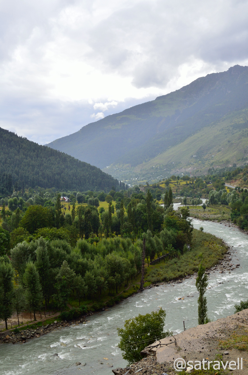
The 84km distance between Sonmarg and Srinagar could easily be covered within a driving time of couple of hours. Sourcing supplies or even fuel for that matter would not be a problem after crossing a settlement called Gund (2141m), 23km ahead, on the highway. Past Gund, the highway is dotted with dhabas, fruit vendors as well as Amarnath Yatra-signage histrionics. Passing through harvest-ready yellowscaped paddy fields wedged between Harmukh and Zoji hills of Pirpanjal, the road ahead meanders on the slopes and cross numerous settlements, including Kangan (1836m) and Mangan (1711m), to reach Srinagar via Ganderbal (1629m). Minus the dust and crowd, this stretch reminds one of the Kullu-Manali sections on NH21. Ahead of Mangan, as the road bifurcates exiting the Sindh valley, the bear left heads directly to Dal Lake in Srinagar. The broad Vale of Kashmir can be observed stretched ahead after crossing Mangan.

Landscape near Gund. More pics and information at Flickr Photoset

Through the Sindh Valley; Sindh is the largest tributary of Jhelum River in Kashmir. More at Flickr
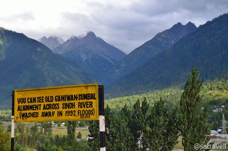
Ganiwan–Sumbal stretch on the Treaty Road to Srinagar; also Pk Deo Masjid (4440m). More at Flickr Photoset

The highway to Srinagar
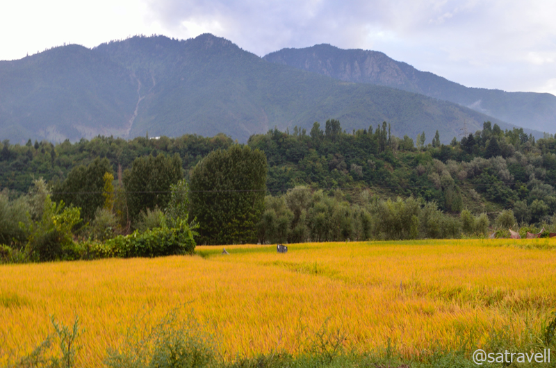
The ready-to-harvest crop in the Vale of Kashmir. More from the region at Flickr Photoset
Crossing Nageen Lake on our right, we headed towards the Dal Gate where we hoped to get a decent lake-facing accommodation on the Boulevard Road. Almost every street and road in Srinagar city was marked with alert military presence where armed with light artillery guns, paramilitary personals frequently roamed around the streets. Howsoever tempting the houseboats might be we preferred to stay at a hotel or guesthouse just so we could ensure a safe parking for our vehicle. On the road, a significant number of hotels were occupied by the paramilitary staff; still our search did bring result. Having fixed an accommodation, we stepped out of the hotel-room to take a walk on the pavement of the Boulevard Road along the bank of the Dal Lake. In the evening, the soft reflections of lights of lined houseboats added to the alluring charm of the lake; a nightscape that worked as an ideal balm for the day’s drive from the wind-blasted as well as dusty passes of trans-Himalayan region.

A refreshing late-evening stroll by the Dal Lake. For more pics and info from the region, please visit Flickr Photoset
Dal nightscape; an ideal balm for wind-blasted trans-Himalayan Region. More at Flickr Photoset
View and read more on the area at the Ladakh Region / Kashmir Region Photoset on Flickr
You may also like to subscribe to the email updates, of the remaining chapters, by entering your email id in the sidebar.
The sliding Darung Drung in Zanskar
The following is a page entry from On Road through the trans-Himalayan Region. To read complete travel memoirs and trip report, please visit here.
Chapter 16 of 22
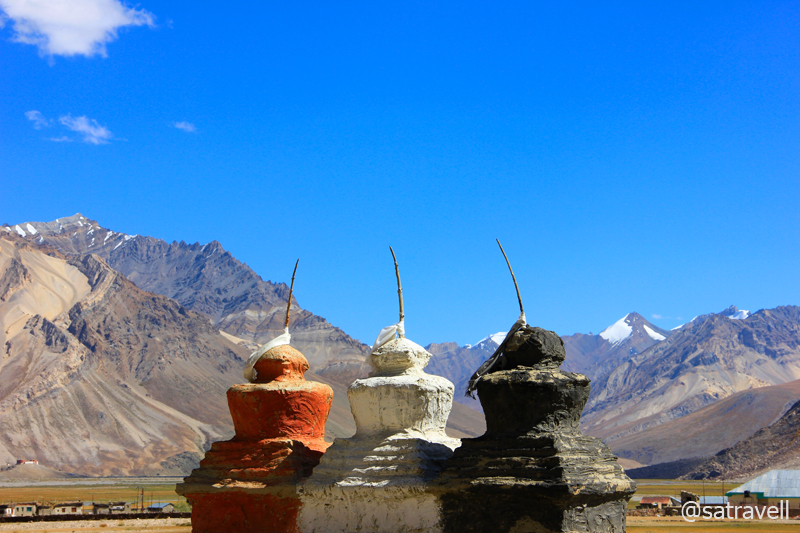
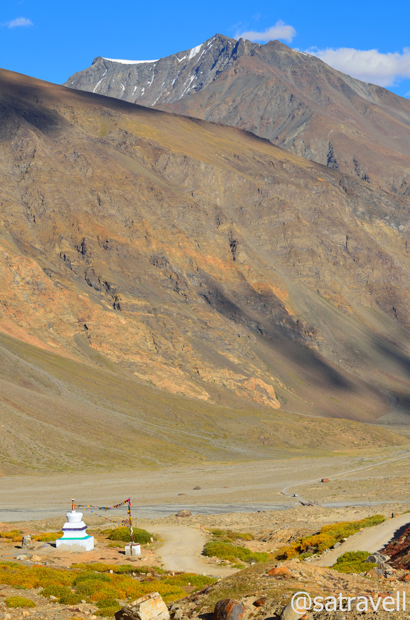
Entrance to Rangdum Valley by tri-colour chortens; the tri-colour – Black, White, Red (Ochre) – on chortens in trans-Himalayas symbolize a worldview – underworld, sky, earth – much older than Buddhism itself. More at Flickr
Located in an awe-inspiring barren mountainscape and surrounded by steep hills, orange-shaded pastures as well as streams, the village Zolidok or Juldo is a popular breaking point for travellers en route the Kargil-Padum motorway. Part of Rangdum area, the village houses a few basic guesthouses, dhaba-cum-teashops, JKTDC property, PWD rest house as well as a mandatory police check post which is located a little off the road. We straight headed to the police check post to submit our details. After two-three knocks at the door, the policeman ,who had just finished off performing namaaz, appeared and asked for the details. The most amusing part of his questionnaire was, “Why do you want to travel into this desolate territory”?

Flat-roofed houses at Zolidok. More pics and info of the region at Flickr Photoset
Having submitted the details, we headed past the village houses towards the Pensi La. Located a few kilometres after the village in the river basin, the ancient Rangdum Gompa (or Ringdom) perched atop a hillock is the centre-point of the Kargil-Padum road. On the way, I identified several perspectives, including visiting this historical monastery, to be photographed on way back to Kargil. The chief reason was that I had fitted my camera with a 70-300mm for the current stretch of the journey, which disallowed capturing of several perspectives including from inside the monastery. I intended to use a wide-angle on the return journey.
The Thungos Massif, 5805 m, and the view Westwards. More of the region at Flickr Photoset

A monk collecting water from Kanji nala. More info and pics of the region at Flickr Photoset
Past the Waka nala and the Gompa as well as the Kanji nala, the bumpy-road skirts the village Tashi Tongtse to continue the gradual climb to the pass. Here onwards to Padum, the population is chiefly Buddhists and accordingly the architecture changes. For the next 25km, the narrow gravelly-motorway passes through marmot country crossing the Paldar Tokpo as well as the camping grounds of Shuniz and Puchang that offer good pasturage interspersed with wild rhubarbs. Providing a natural habitat to the long-tailed marmots alongside the right bank of the Suru (or Ringdom Sankpo as known in this area), the stretch offers captivating views of Rangdum glacier, Chilung glacier, Pundum glacier as well as the Pensi Glacier, located on the left bank, just before the pass. Dominated by the Pk 6197 m (previously marked Pk 6050m Z8), the Pensi Glacier is also the source of the Suru River.

Village Tashi Tongtse in the Paldar Tokpo valley. More from the region at Flickr Photoset

Locally called Phiya, the threatened Long-tailed Marmot. For more pics of the region, please visit Flickr Photoset

Climbing the Pensi La by Ringdom Sankpo. Pk 6274 m in the Lalung Valley in sight. More pics at Flickr Photoset
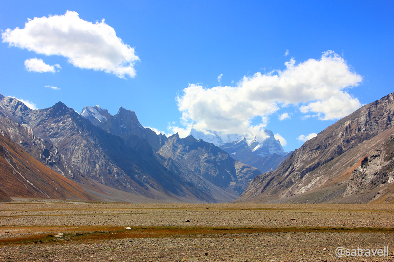
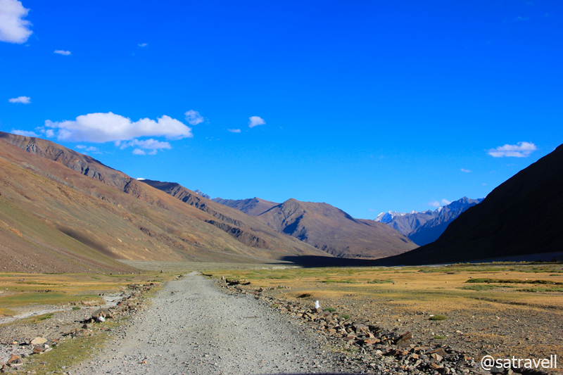
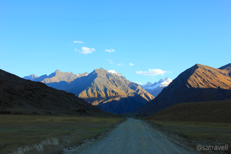
From Rangdum, we took almost an hour and a half to reach the Gateway to Zanskar, the Pensi La top at 4440m, offering the only motorable access to Padum, the administrative headquarters of the Zanskar valley. The landscape from the pass comprises fascinating views of snow-capped mountains on both sides. Past the shrine, just before the pass-top near a watch-tower, lays a couple of glacial lakelets – Sta Tso and Lang Tso. The top of the pass is marked by an information-board with prayer flags tied all around. A couple of kilometres after the information-board, to the eastern flank of the pass is the prized natural-formation – the majestic Darung Drung Glacier. With the Peak 6485 m Darung Drung (earlier marked as Pk 6270m Z3/ Cima Italia), located adjacently, the Darung Drung glacier is a long winding river of snow and ice sliding from the western slopes of the Doda peak (6550m).

Landscape towards Rangdum. More at Flickr

Pk 6197 m on Pensilungpa-Darung Drung Glacier divide. More pics and info of the region at Flickr Photoset

Pk 6485 m Darung Drung. “As per the latest nomenclature adopted by the Survey of India” – Harish Kapadia. More peaks, pics and information at Flickr Photoset dedicated to the region
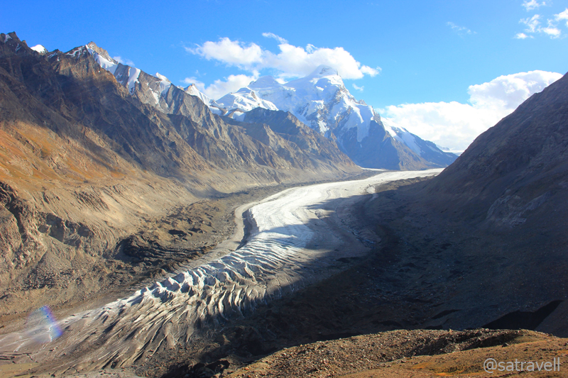
The sliding Darung Drung in Zanskar Region; Pk 5909 m on its Eastern wall. More pics and info at Flickr Photoset

The Darung Drung Glacier and Pk Aiseo 6029 m at its head; Pk Rahamo (6000 m) towards right. More of the glacier, surrounding peaks and the region at Flickr Photoset
It may be of interest to note that peaks in Zanskar near Nun-Kun, located within the periphery of the Darung Drung Glacier are numbered with a prefix Z. However, the Survey of India (SOI) has recently published an update to this; marking many of the formations. The 23km-lengthy glacier, likely to be the second largest glacier within India, is the source of 79 km-long Stod River or Doda River. The northern flanks of the Doda peak gives rise to the Haskira Glacier while its eastern slopes join the Kange Glacier. Mesmerised by the charm of the glacier and the peaks surrounding it, we spent almost an hour, amidst the typical afternoon high-velocity icy-winds, in trying to observe the visible formations around it.
Into the Stod Valley from the Pensi La
Winding in hairpins and switchbacks, the rocky descent from the Pensi La into the Stod Valley is steeper than the climb up from Rangdum. Past an azure glacial-lakelet, the motorway meanders through a wider section of the Stod valley alongside the left bank of the Stod River. The famed Boyo Comma camping grounds appear after crossing the Pholokiow nala and the village Trakkur appear just before Chanu Tokpo that later joins the Stod.

The famed Boyo Comma camping ground in the Stod Valley. For more pics and info, please visit Flickr Photoset
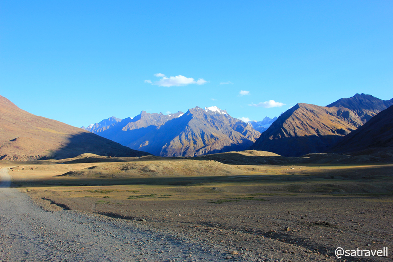
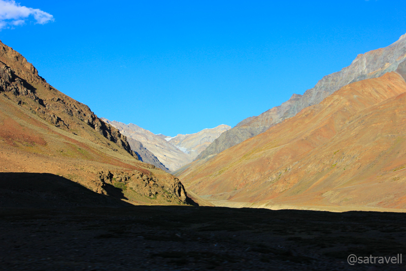
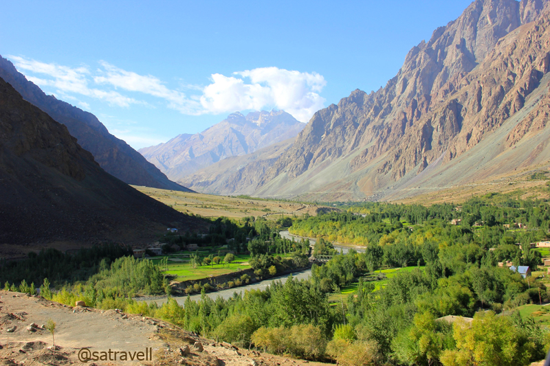
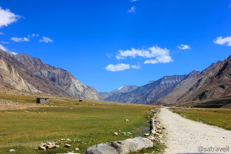
Ahead, drained by the Stod, the vegetation and irrigation-rich landscape appeared much similar to Kaza-Losar section of the Spiti Valley. Tucked away from civilisation, it is a less-frequented valley surrounded by the Great Himalayan Range on the right bank and frontiers of the Zanskar Range on the left. Joined by small tributaries on both sides, the Stod meanders at its gentlest in this portion of the main valley. Consistently spread out villages outlined by vegetation along the alluvial banks walled by high mountains under fine blue sky establishes eternal bondage between a traveller and the creator. As many as 20 settlements lay interspersed on both sides of the river, connected by a pulley or foot bridge, till Padum. Comprising not more than 50 houses, the key settlements include Chibra, Abring, Hamling, Shagam, Phey, Ating, Tungri, Sani, etc. A few of these villages offered prime facilities, allowed by the terrain, such as guesthouses, teashops, STD booth, etc. Without a single stoppage on the way, we reached Padum from the pass in almost five hours covering a distance of 85km.
The motorway ahead in the Stod Valley. More pics and info of the region at Flickr Photoset
Although, the road-condition was a notch better than Kargil-Rangdum section, it offered many fresh perspectives to be captured most of which, due to fading light, I identified for the return journey. The motor-trail passed through some of the agriculture as well as pasture-rich greener sections of the Stod valley. The cultivated fields intermingled with a uniform carpet of red-shaded green vegetation dotted with ancient chortens, prayer wheels, flags as well as sheep, goats, yaks and further afield, wild horses; striking mountain faces in myriad hues; snow-covered peaks pushing up into cloudless blue skies; blackened moving snow fields and hanging glaciers; all combine to leave an eternal imagery on the mind. The villagers seemed to be occupied in preparing themselves for the long and dreadful winter season. The key tasks included collecting fodder to support the livestock, fuel and grains to support the family as well as collecting the red-turned alfalfa grass to provide thick insulation from snow on rooftops of their stone-built houses.
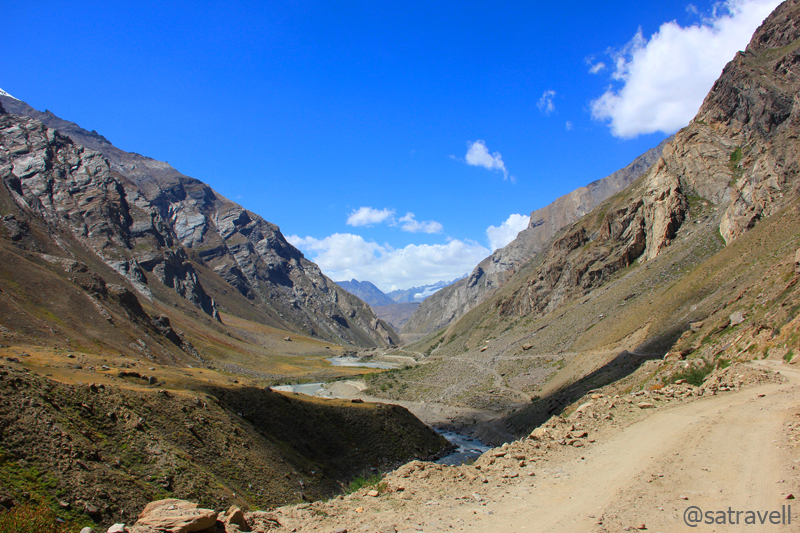
Landscape ahead; captured near Chim Kurpo. For more pics and info of the region, please visit Flickr Photoset
Driving alongside the left bank of the river till the Tungri iron-bridge to crossover to the right bank and reach Padum, as many as 14 rivulets rising from the slopes of the Zanskar Range that join the Stod River, needed to be forded with or without bridge. A few energetic ones are Pholokiow nala, just after the pass; Chanu Tokpo, after the Trakkur village; Kyala nala after Phey village; and Tungri Tokpo before Tungri village. Key tributaries on the right bank of the river are Kange Tokpo, Hangshu nala, Denyal Tokpo, Mulung Tokpo as well as Haptal Tokpo. Important natural-formations on the right bank include Haskira Glacier, best-viewed from Chim Kurpo fields; Kange Glacier, best-observed from Tepuk camping grounds; Hangshu Glacier from village Chibra, etc.
Shadow game on the Zanskar Range; near Tepuk. For more pics and info, please visit Flickr Photoset
Just 15km before Padum, after crossing the Tungri iron-bridge over the river, tarmac again showed up (3640m) after which we pressed on the accelerator to gradually climb to Padum. It was around 2100hrs when we reached the headquarters of the Zanskar Valley at 3670m. Most of the shops, restaurants as well as guesthouses were closed so without taking any risk we opted to settle in at the very first accommodation that we came across. Marking the onset of winters, mid-September, an off-season with respect to travelling in Zanskar meant limited facilities at disposal for residents by the guesthouses. Even though, a hectic day on road merited a well-deserved night still we settled for a rajma-subzi-chawal-roti menu. We intended to travel around the Padum area tomorrow and turn back for Kargil over the morrow.
Snow-capped spires of the Great Himalayan Range; near Aksho. For more pics and info, please visit Flickr Photoset

Sundown in the Stod/ Doda Valley; captured near Tepuk. For more pics and info, please visit Flickr Photoset
View and read more on the area at the Zanskar Region Photoset on Flickr
You may also like to subscribe to the email updates, of the remaining chapters, by entering your email id in the sidebar.
Driving alongside Glaciers in Copper Land
The following is a page entry from On Road through the trans-Himalayan Region. To read complete travel memoirs and trip report, please visit here.
Chapter 15 of 22

The road to Padum branches off the NH 1D on the left bank of the Suru. More pics and information at Flickr Photoset
We planned to start at the earliest but the delay on part of the hotel staff in preparing breakfast deferred our departure by an hour. By the time the hotel staff prepared morning meal for us, I wafted towards the bakery shops in the market and bought rich supply of locally-baked fruit cakes as well as biscuits, canned juice and water bottles, etc. At about 0805hrs, we left the hotel and headed straight to the fuel station, located on the Leh road after the bridge of the Suru River, and got the fuel-tank topped up. Having washed the 10L-canister from inside with some fuel, we got that too topped up. A feeble container to hold diesel, the canister later needed to be babysit. Although, I had successfully procured leak-proof as well as fume-proof canisters for the trip but for the last minute change-of-plans we were now carrying a cheap plastic container, something which is readily available in Manali, Leh or Kargil. For now, I kept the canister in the vehicle-trunk packed around by luggage-walls.
Administratively a part of Kargil, the Suru Valley is one of the most agriculturally productive valleys of Ladakh
The road to Zanskar’s administrative headquarter Padum branches off the NH 1D, on the left bank of the Suru, immediately after the iron-bridge on the gushing river. Past a few cantonment buildings as well as the administrative headquarters of Kargil, the tarred road outlined by poplars enters a green valley. Contrary to yesterday’s experience on the Leh-Kargil stretch where the influence of Buddhism kept decreasing as we neared Kargil, travelling on the current road meant quite the opposite. Buddhism, once again, takes the centre-stage in the Stod Valley after crossing the Pensi La.
A majority of the population of the Suru valley comprises orthodox Sunnis with some Shias as well. Also known as Balti, they are crossbreed of Dards (from Dardistan) and the Tibetan-Mongolia descendants. In the olden times, this region might have been a centre-point of Buddhist activities as is indicated by the presence of the Kushan-age Buddhist inscriptions and images in this valley.
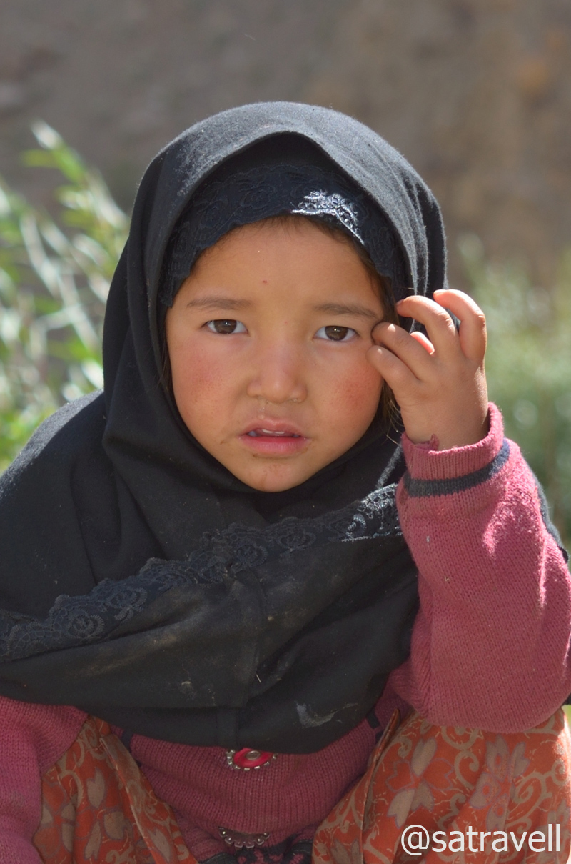
A crossbreed Balti kid in Salaskot village
With not much of gathered information on the area we were venturing into, excitement build up was palpable. In spiritual terms this was no less than the pursuit of salvation. Flanked by Zanskar on right bank and the Great Himalayan Range on left bank of the Suru, the valley widens as the road meanders, alongside the left bank, through vegetation-rich Islam-dominated settlements. Located at a distance of 27km from Kargil, settlements at Kumbathang are beautifully spread in the bowl-shaped valley.
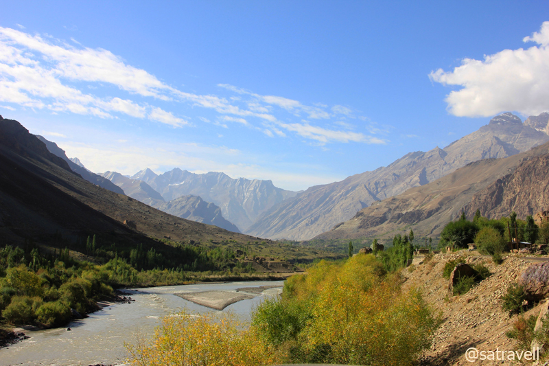
A vegetation-rich stretch ahead in the Suru Valley. For more pics and info of the region, please visit Flickr Photoset
Cruising on a freshly tarred road, we took an hour and a half to cover a distance of 42km to reach the first major settlement of Sankoo (2979m) after passing through eight – nine settlements including Titichuming, Gramthang, Salaskot, Pharona, Thona, Kilmarcha, Thang, etc. Surrounded by a dense cover of manmade forest comprising poplars, willows, apricots and wild roses, etc., Sankoo is also known as Gulmarg of Ladakh. Drained by Kartse and Nakpochu streams, tributaries of the Suru, the picturesque picnic spot Sankoo is bounded by russet mountains all around. Comprising a few bakeries, tea shops, guesthouses, ATMs, the township is practically the last place to replenish supplies for the drive ahead to Padum.
A tea shop at Sankoo

With Zanskar to left and the Great Himalayan Range on the right (of the frame), the Suru River creating an optical illusion downstream. For more pics and information of the region, please visit Flickr Photoset
With some rough sections while twice exchanging banks across the river, the road ahead gradually climbs through village Karpokhar and Thamo to Purtickche (3186m) through a narrowing valley. With a few guesthouses including a modest JKTDC hut, Purtickche is located just at the right spot offering splendid views of Nun Kun massif; Nun peak – 7135m and its neighbour peak Kun – 7077m separated by a glacier four kilometre in length. The grandeur of the landscape warranted a small stop which I utilised to observe and identify the natural formations as well as landmarks around.

In the shadow of The Great Himalayn Range; captured from a point near Purtickche. More pics at Flickr Photoset
Barring a few information boards, in Urdu, the entire road-length in this desolate terrain was rarely marked by sign-boards. So for all the distance and altitude related information, I heavily counted on my Garmin GPS device which proved to a life saviour at few occasions in Kashmir. The nonexistence of sign-boards continued to be a concern in the Kashmir valley as well.

A close-up of the Nun (R)-Kun (L) Massif. For more information and pics of the region, please visit Flickr Photoset
A few kilometres ahead at village Kargee (3185m) past Shanshi nalah, the road bisects for a few kilometres alongside a few settlements on both sides of the river. We crossed an iron-bridge and took the road passing through village Namsuru on the right bank of the river as advised by a village elderly. “The road on the right bank is better as it has more khaartol (blacktop) and both the roads, passing through different villages on either bank of the Suru, converge after 14-15km”, he said.

Cultivated fields of Panikhar and view towards Shanshi Nala. More pics and info at Flickr Photoset
With a few villages spread around the opposite side of the Suru, the motorway, ascending in hairpins from the river bed, passes through a striking vegetation-rich region of the Suru Valley. The energetic Suru River originates from Panzella Glacier, near the Pensi La, and joins the Indus after meandering in the Himalayas for about 185km. The agriculture-rich area also acts as a popular station for the famous trans-Himalayan traverse between Ladakh and the Kashmir Valley. The chief agriculture produce in this region include barley, wheat, millet, beans and a variety of vegetables.

Sloping on Zanskar and looking at the Great Himalayan Range. For more info and pics, please visit Flickr Photoset
The tarmac on the road disappeared after 60km from Kargil and, although we were very hopeful of its reappearance, the condition of the road only worsened. Depending on the terrain we were driving through, the road-condition kept altering from bad to worse to worst. The only silver lining was that the current condition was still better than the Losar to Gramphu road-stretch. The sudden variation in road condition merited a recheck of the fuel canister. It was all fine as of now.

Pk Parkachik 5107 m and Tongul village
As the tarmacked road ceases to exist before approaching the Parkachik ridge, the narrow bumpy motorway ahead often diverges, in form of shortcuts, for a few kilometres to converge again. In a less-frequented valley with zero help from sign-boards, such diversions may confuse initially but as a golden rule keep yourself as lower as possible and stay close to the river alongside its right bank.
Driving on the slopes of the Parkachik La (3810m), the narrow bumpy road ahead climbed to reach village Parkachik (3570m) located on the other side of the ridge. Marked by extensive green terrace-fields and old houses, the village is located, at a distance of 83km from Kargil, in the shadow of Nun and Kun peaks and also comprises a JKTDC accommodation as well as mosques.

Parktik Glacier tonguing the Suru and Parkachik ravines. More pics and info of the region at Flickr Photoset
Owing to an on-going blasting work on the Zanskar mountainside to create a network of motorways and connect the Suru valley with other adjacent valleys, the next 20km-stretch on the motorway ahead after the village surpassed even the Losar – Gramphu stretch when it came to driving on rocks as well as slates, by-product of the blasting process. The beginning of this stretch is marked by the Parktik Glacier osculating with the boisterous Suru on its left bank. Sliding from the Nun-Kun slopes, the huge 300ft blackened-icefall looks as if the massif is tonguing the energetic Suru River flowing through the Parkachik ravines.

Rungofarka and Lingsarmo. For correct nomenclature, identification, info and pics, please visit Flickr Photoset
Driving through the tricky stretch, partly due to road-condition, the nauseating smell of diesel, now snowballing inside the cabin necessitated repositioning of the luggage as well as the canister-baby. The luggage placed around the fuel-canister had soaked the leakage from it, an act which was even more problematic than the pong itself. Burying aside the frustration caused by the workers at the blasting sites due to lack of coordination between the signal-guides, which wasted an hour, we reached the village Zolidok (4015m), an idyllic tea-break destination.
We took almost 160min to cover the 30km-stretch between Parkachik and Zolidok. On the way, the bumpy road gradually climbed alongside the right bank of the Suru through some of the worst stretches on the Kargil-Padum road. Laden with gravels as well as slates, the lonesome stretch of the motorway passed through splendid landscape encompassing green-red slopes, abandoned shelters, rocky mountain faces with icefalls and blackened-hanging glaciers on the left bank of the river, etc. Bestowing a unique contrast in the landscape with green to red shades of the vegetation, the valley seemed to be embracing the onset of winters. Past an abandoned Police Check Post at Shafat (3920m), the road-condition improved a bit and was surrounded by glacial leftovers included lakelets throughout.
Also in the frame, an abandoned Police Check Post. For more info and pics, please visit Flickr Photoset

A colourful landscape ahead. For more information and pics of the region, please visit Flickr Photoset

Divide between Zanskar and the Great Himalayan Range. For more info and pics, please visit Flickr Photoset

Embracing the onset of winters, Glacial lakelets and Alfalfa ahead. More pics and info at Flickr Photoset
Apart from oblique views of Nun-Kun, the prized natural-formation included that of the Shafat, Rungofarka as well as Lingsarmo Glacier, situated adjacent to Rungofarka (6495m) and Lingsarmo (6955m) peaks. Originating from the glacier, said to be melting at an alarming rate, on the left bank of the Suru River or Karcha Nar, the Shafat nallah join the river flowing below. On a terrain on which several streams originating from the Zanskar Range overpassed the motorway, important camping grounds marked by emergency shelter-huts (labour huts) included Samodangsa, Gulmatonga, Yumlun, Shafat, Latapsa, Sangma Kurpo, etc. Views from the village Zolidok included that of Hamjul Glacier giving rise to a stream on the left bank of the Suru River (or Sangpoo River as known here).
View southwards; captured enroute to Zolidok. More pics and info at Flickr Photoset
View and read more on the area at the Zanskar Region Photoset on Flickr
You may also like to subscribe to the email updates, of the remaining chapters, by entering your email id in the sidebar.


