 bNomadic
The Highest inhabited village in the World
The following is a page entry from On Road through the trans-Himalayas. To read complete travel memoirs and trip report, please visit here.
Chapter 8 of 22

“Highest inhabited village in the world”
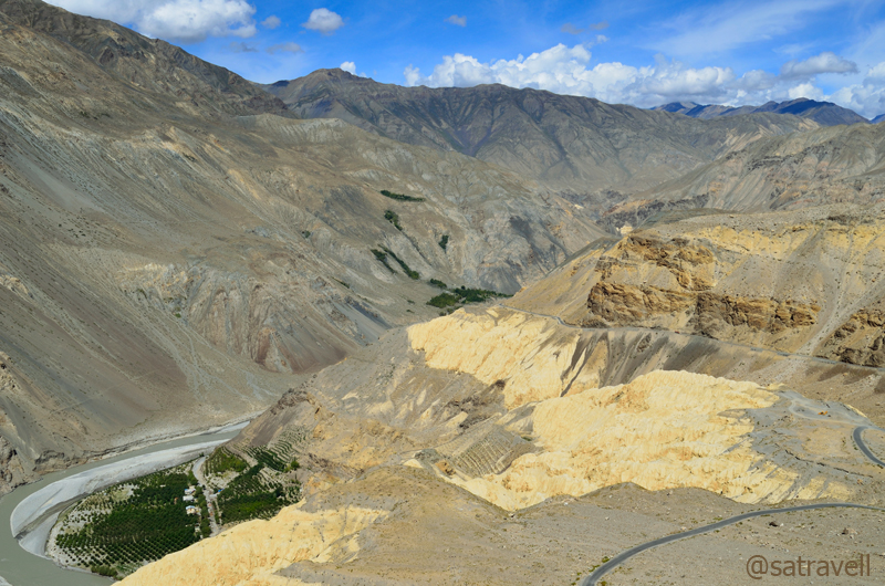
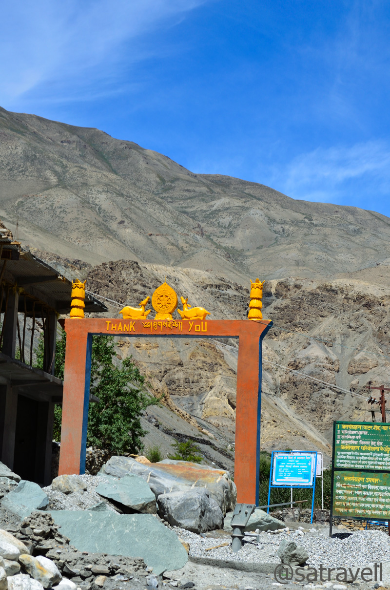
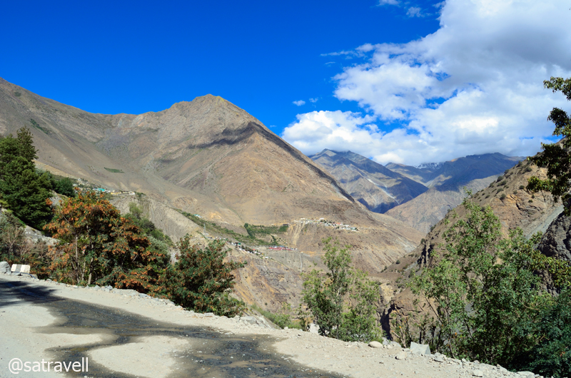
Like every morning, having started the day with Yoga and overjoyed with the activities of the previous day and also of the fact that we had done our bit to get acclimatise with the high-altitude, we checked out of the Kaza-guesthouse after consuming a heavenly breakfast. The plan was to visit the ancient Ki monastery, take the road to reach Kibber, said to be the highest inhabited village in the world and take the narrow link-road to reach Kiato. However, after a mandatory re-check that I conducted with the help of a local taxi-driver at Ki monastery, the plan warranted a change. This was due to the bad condition of the bridge connecting the Kibber and Chicham village over the Parilungbi Canyon. Now we had to turn all the way back after Kibber and reach Losar taking the usual road passing through village Rangrik located on the right bank of the Spiti just next to Kaza. This however meant an additional 30 km almost.

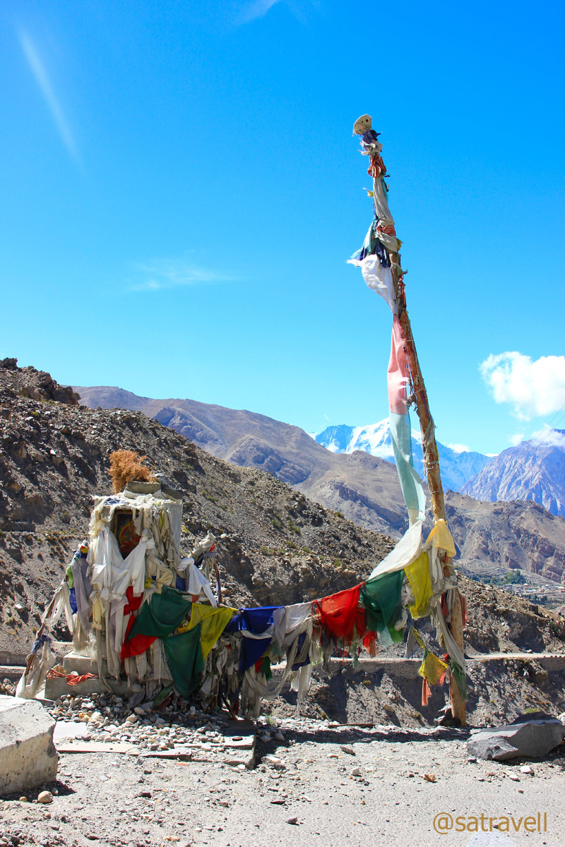
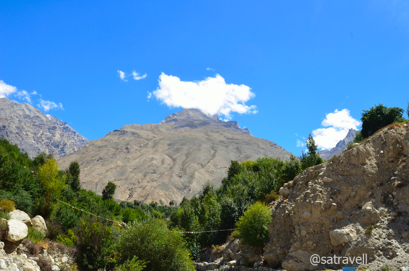
View towards the windswept Tud region; captured on way to the Ki Gompa. Please visit Flickr for more pics
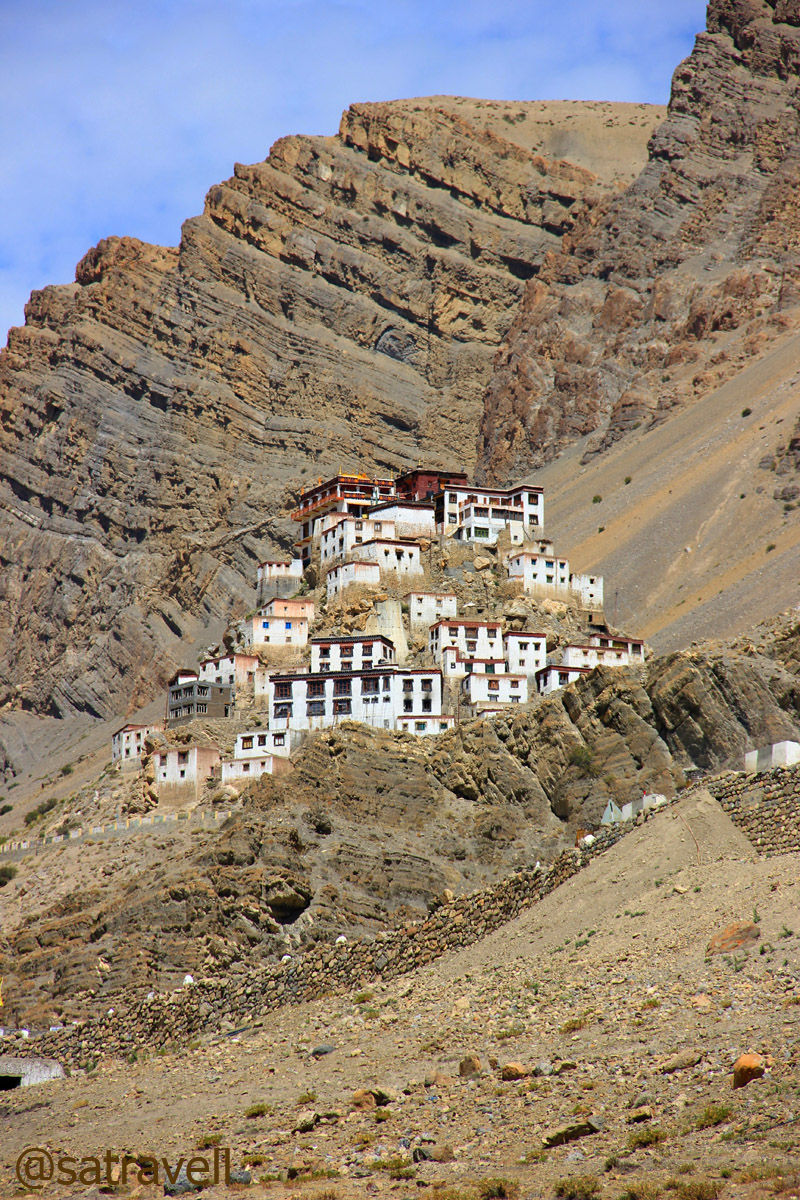
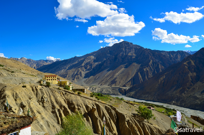
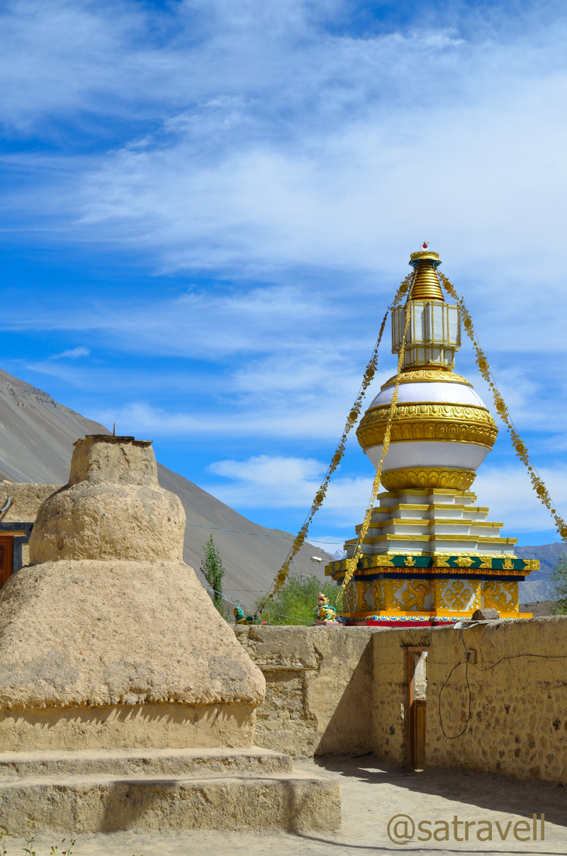
The attractively perched ancient monastery of Ki
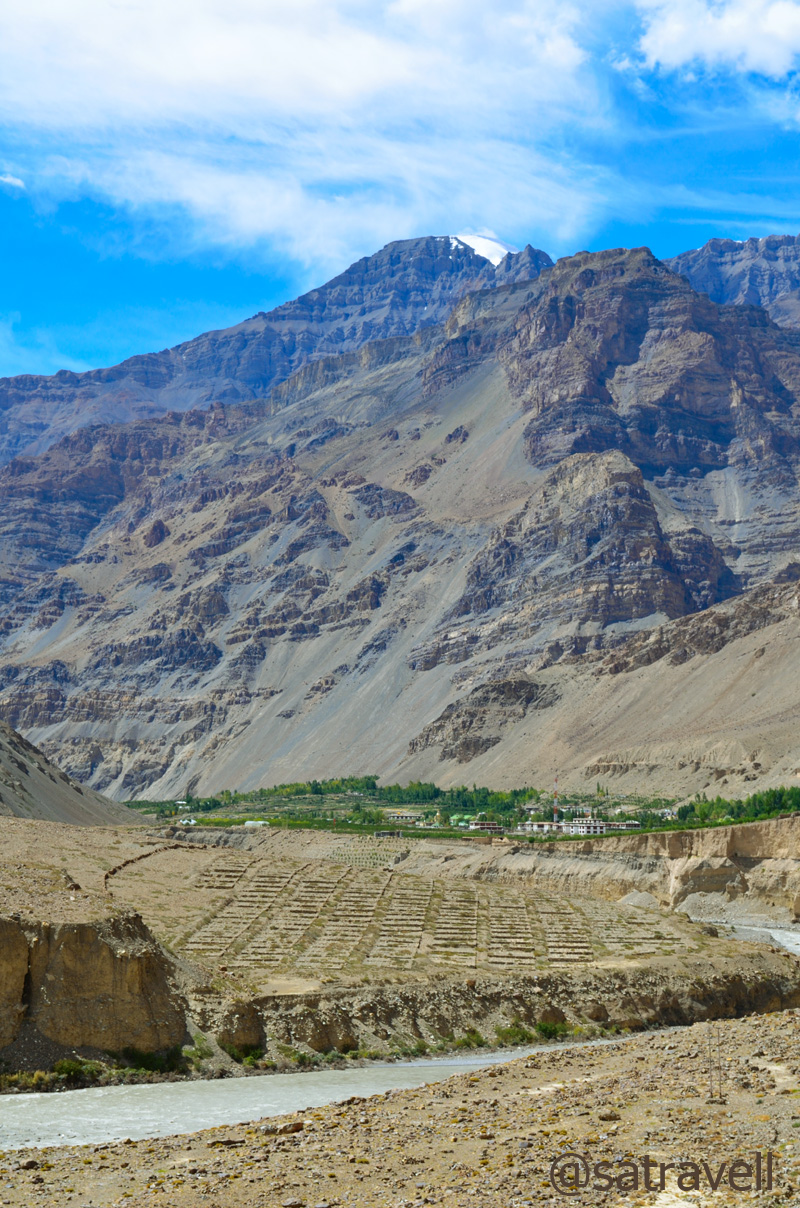
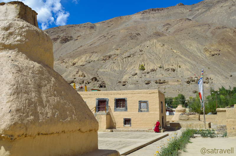
Driving on the true left bank of the river, past the iron-bridge that goes to the opposite bank, we steadily climbed on a neatly tarred narrow road to reach Ki village. The attractively perched ancient monastery of Ki, on a rocky hillock just above the village, was visible from the road itself. Within no time we reached the gompa and I was not surprised to see it thronged by both foreigners and domestic tourists. Both were found to be equally eager to photographically-capture various viewpoints the monastic life of Gelugpa sect had to offer. But the perspective appeared to be making a difference which was apparent.
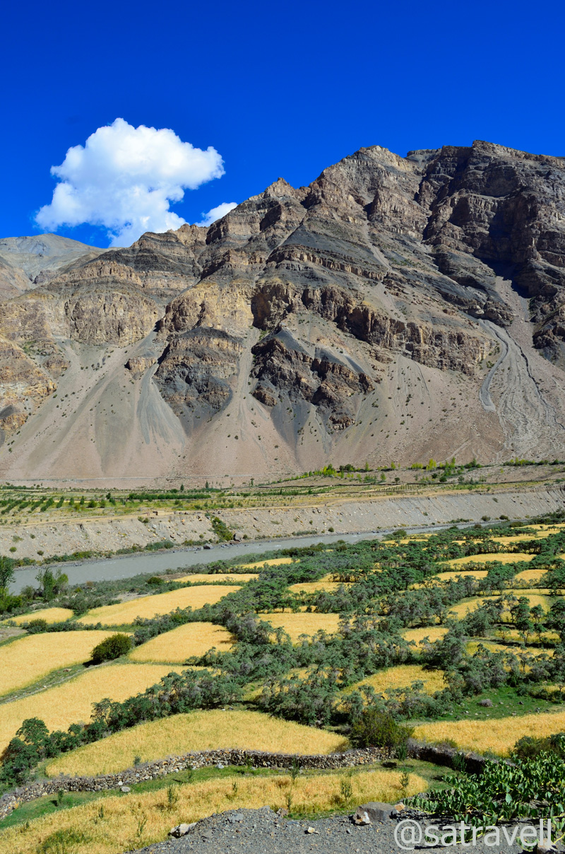
Agriculture fields of village Ki. Fore more images of the region, please visit bNomadic in Spiti
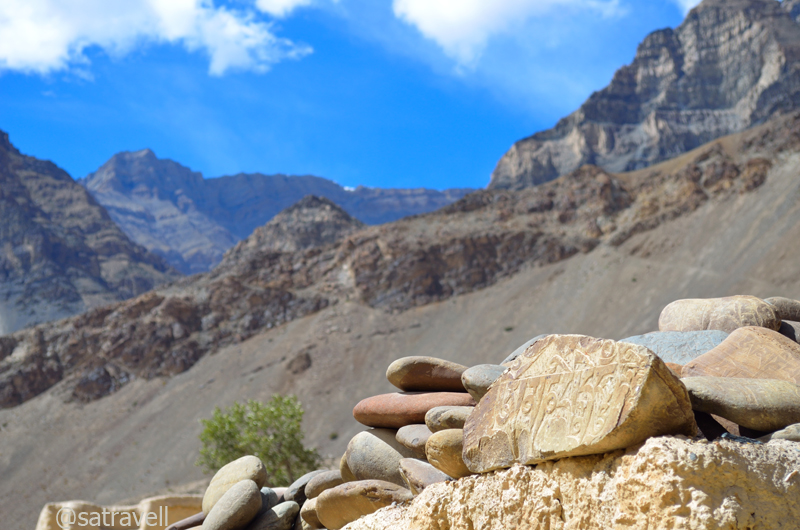
A chorten in Ki complex overlooking the Spiti Valley; Gyundi Gorge is also visible in the frame
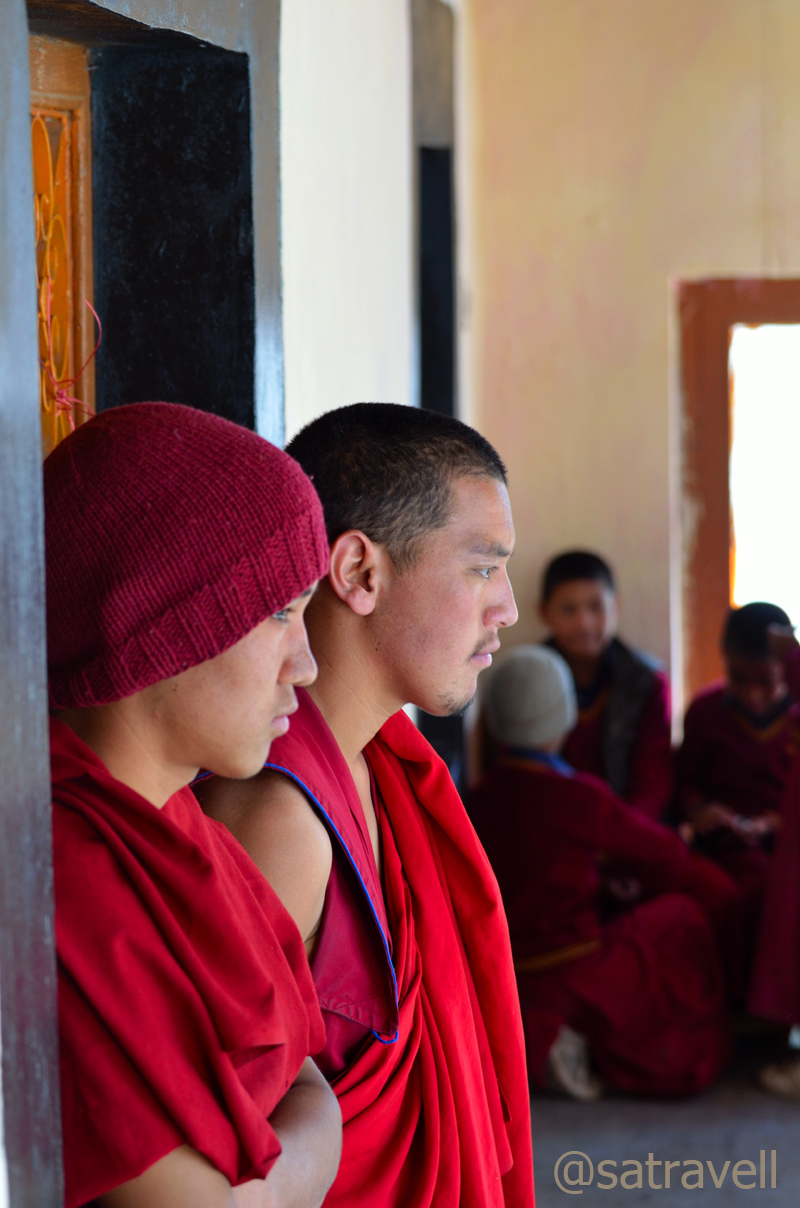
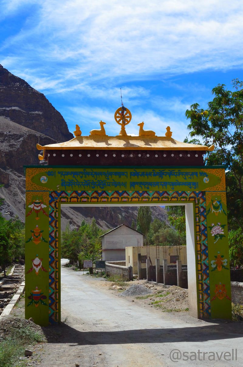
Foreigners observed and captured whatever angle the place offered. Ours posed and asked the monks, without any knowledge of their internal hierarchy, to model either with them or depict the essential elements of their routine life such as prayer wheel, robes, tea cups, performing daily chores, etc. The view from the terrace was splendid including that of the colourful formations in the river basin courtesy the Spiti River meandering through various channels. Observing and without bothering about other visitors, I quickly wrapped up my activities at the monastery and continued with our climb to Kibber village. One of the most important learning centres for Buddhists in India, Ki monastery is house to over 400 monks, rare thangkas and artefacts including olden music instruments.
Monks on terrace of the Gompa. Visit Flickr for more

Terrace-view towards Ratang Gorge. Please visit Flickr Photostream for more pics of the region.
Leaving Ki Monastery complex. Please visit Flickr Photostream for more photographs
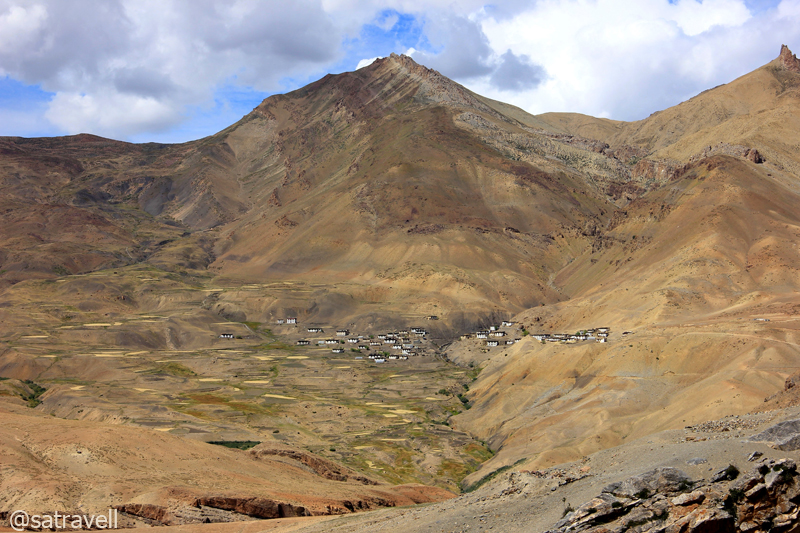
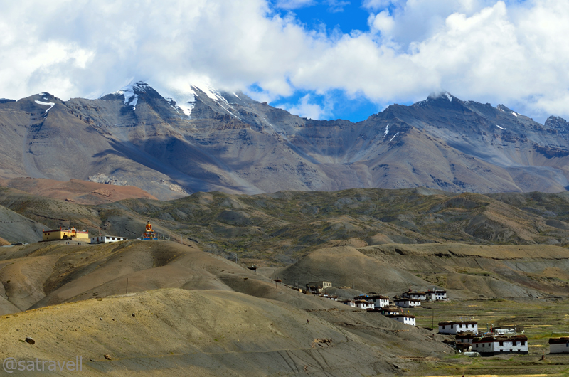
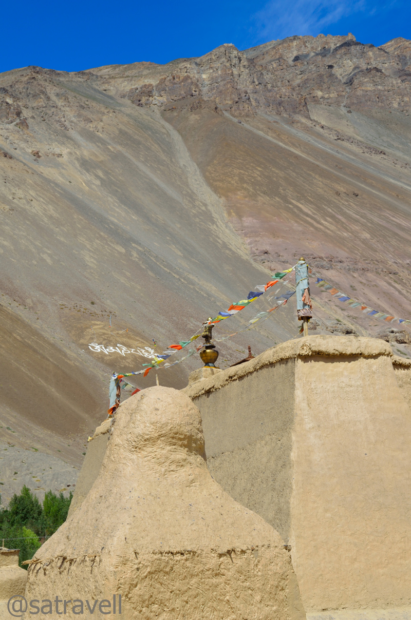
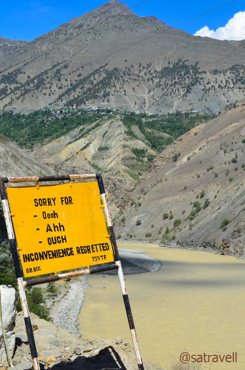
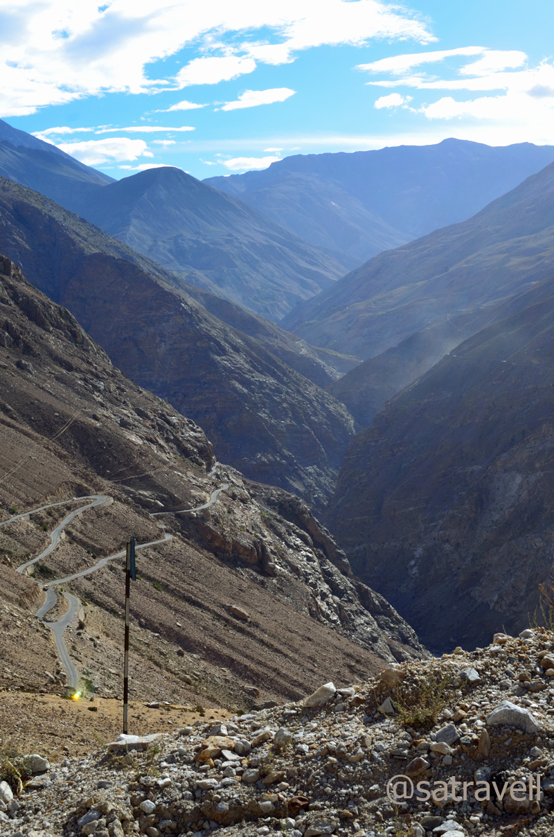
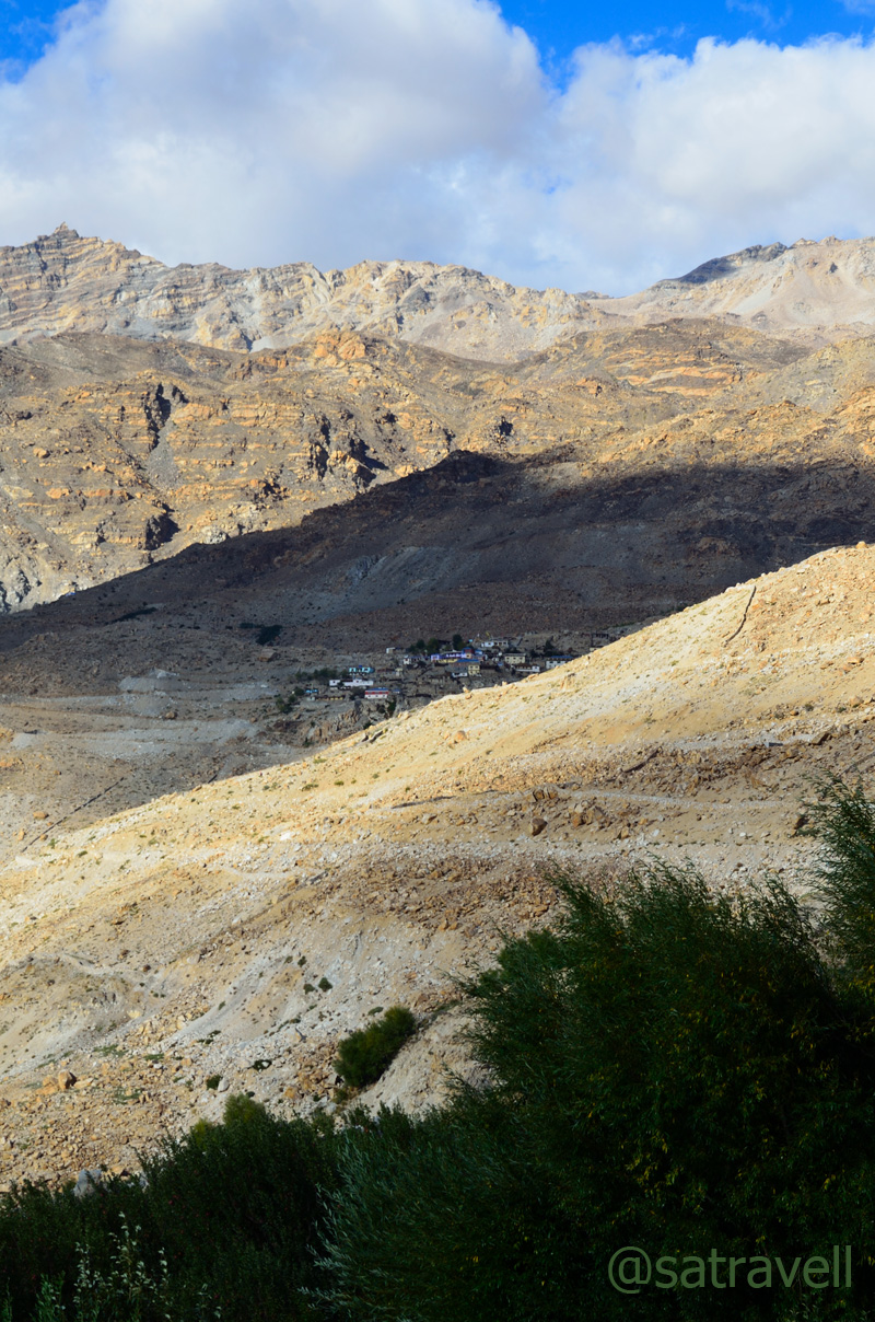
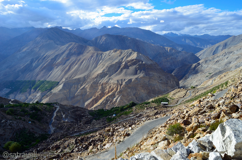
The tarred but potholed road to Kibber climbed in a series of easy hairpin bends and loops. Like most valley roads, this one was narrow too and was etched on a vertical face of rock. The village Chicham was visible across the other side of the deep canyon. Claimed to be the “highest inhabited village in the world connected by a motorable road and with a voting ballot”, Kibber (4210m) is a friendly village comprising stone-built-houses, with typical dusty contracted paths, located on a picturesque topography. Although lacking the market-comforts of Kaza, Kibber is any day a better place to put up than Kaza. Situated just at the village entrance, Norling Guesthouse is the place to stay and offers good food as well.
Village Chicham separated by the Parilungbi Canyon. Please visit Flickr Photostream for more pics
I took a few photographs of the landscape from the village entrance, visited the village gompa – Yaktin Chuling – and subsequently asked for ginger tea at the guesthouse. The highlight of the landscape included the majestic Kanamo peak, pasture country, deep gorge, Chicham village, etc. Sipping the hot tea, we began to dissect the claim of Kibber being the “highest inhabited village in the world connected by a motorable road and with a voting ballot”. Having visited Langza the previous day, much higher in altitude as well as connected with a road, half the claim was clearly off beam. Not only Langza but the nearby village Gette (above 4350m) also enjoys road-connectivity. As regard the issue of voting ballot, almost every village in the country today enjoys such a provision at home. As I wrote this blog, situated above 4400m on a ridge connecting Langza and Komic, village Hikkim was officially declared the highest polling station in the state registering a record 81.14 poll percentage in the recently concluded state assembly elections 2012. So wonder why the tourist-agencies still sell this claim!

Village Kibber. Please visit bNomadic in Spiti for more pics of the region

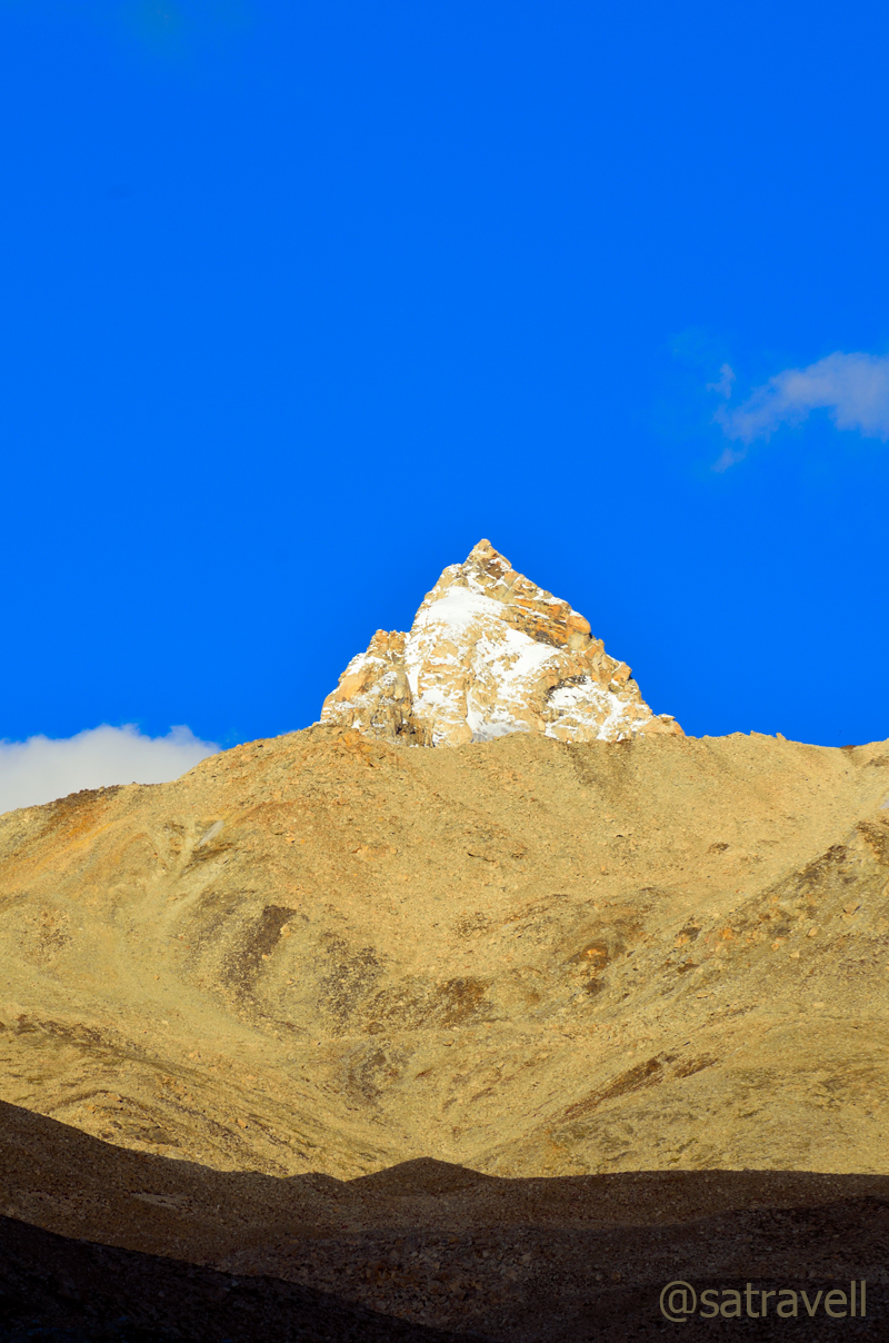
The 5974m holy Kanamo Peak as visible from Kibber village. Please visit Flickr for more pics
The answer possibly lies in the definition of “inhabited”. With over 350 people staying, the village is provided with a school, post office, civil dispensary and some other departments by the government.
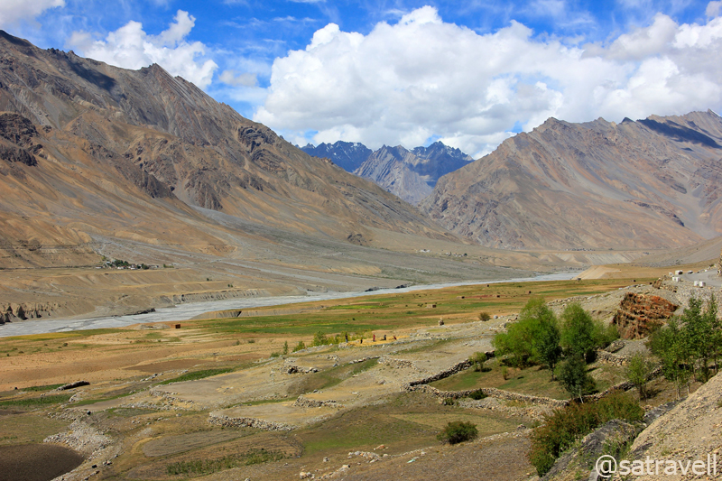
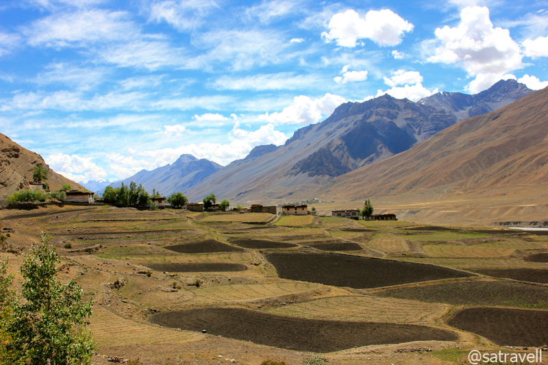
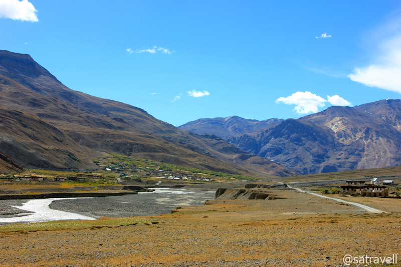
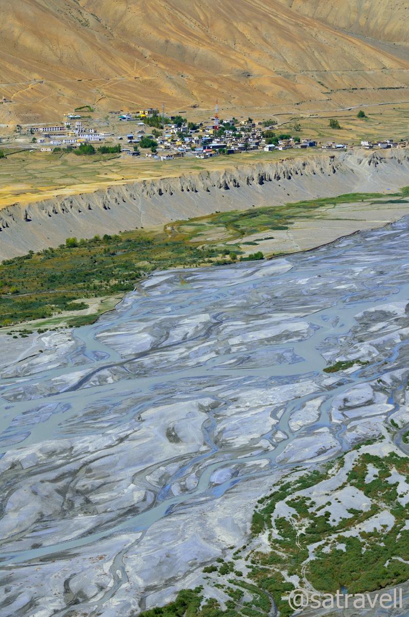
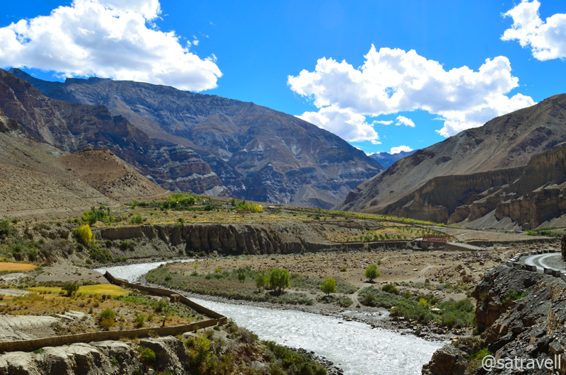
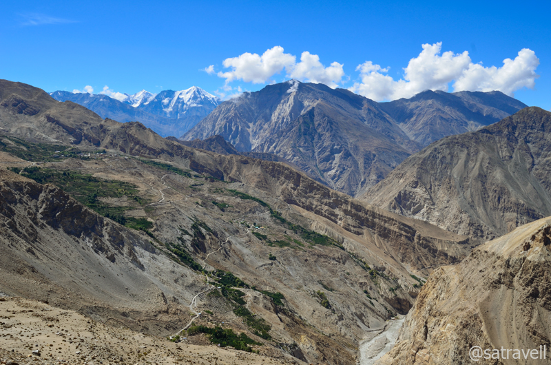
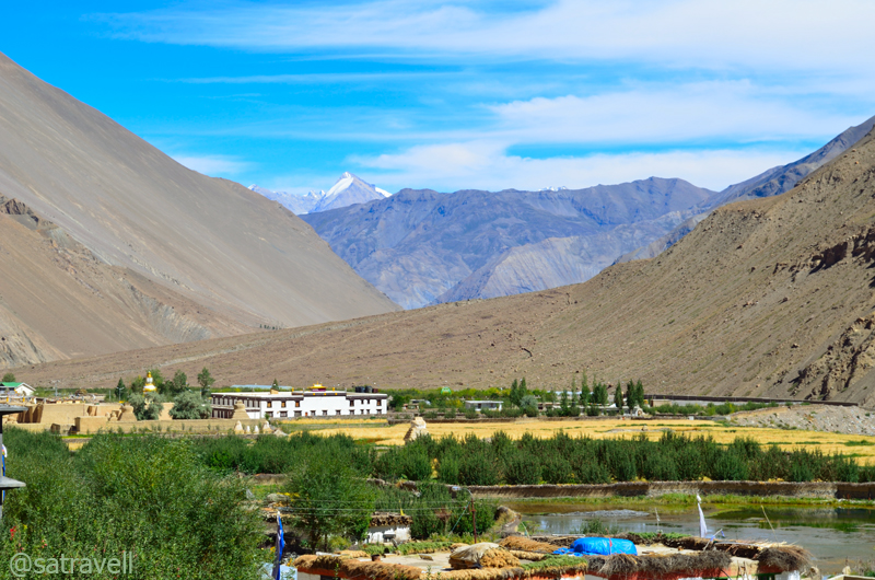
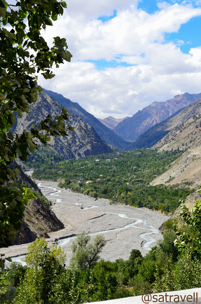
Keeping an eye on a bearded vulture gliding high in the sky, I left the spot but ended up rekindling the desire of possessing a 600mm. Soon we were on our way to village Rangrik (3730m) through the same road. Visible from Ki, Rangrik looked like a tiny patch painted green on an uninhabited river-basin walled by high mountains. Circumambulating the long mani wall, as per the tradition, past the bridge across the river, we reached Rangrik in less than an hour.
Landscape at village Ki. Please visit Flickr Photostream for more pics of the region

Landscape at village Ki comprising agriculture fields and unnamed 6000-ers of Gyundi Valley
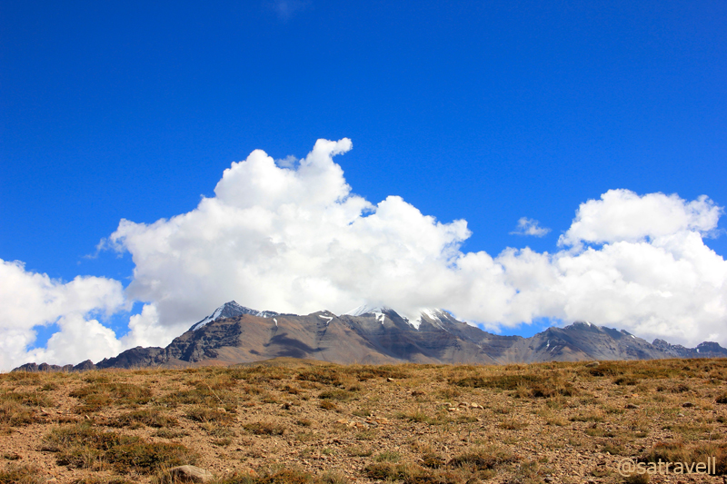
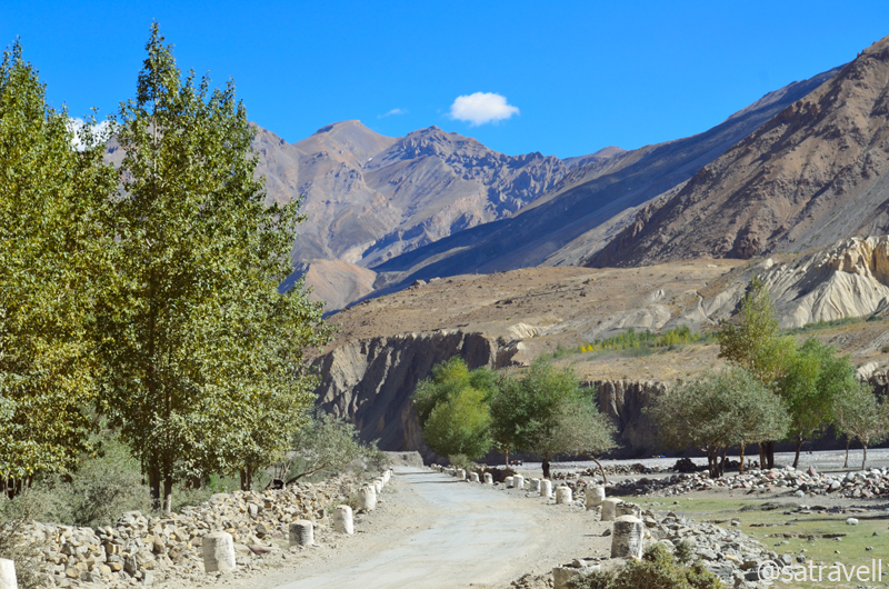
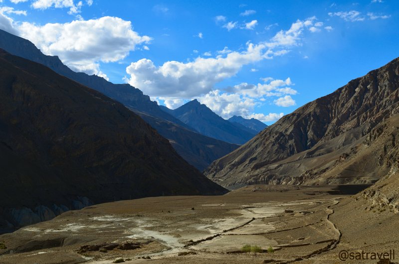
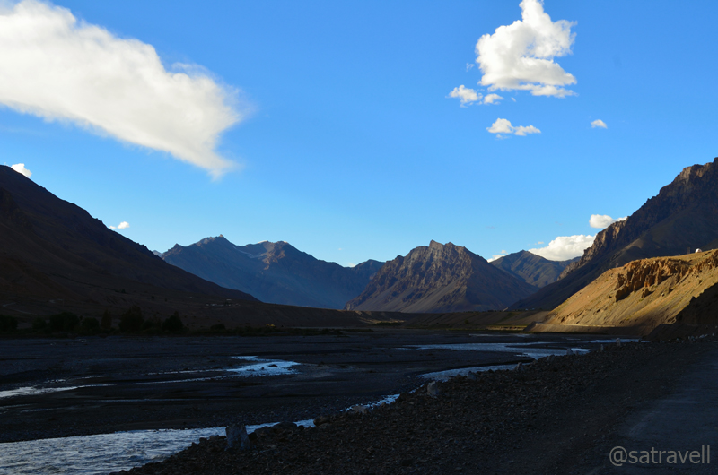
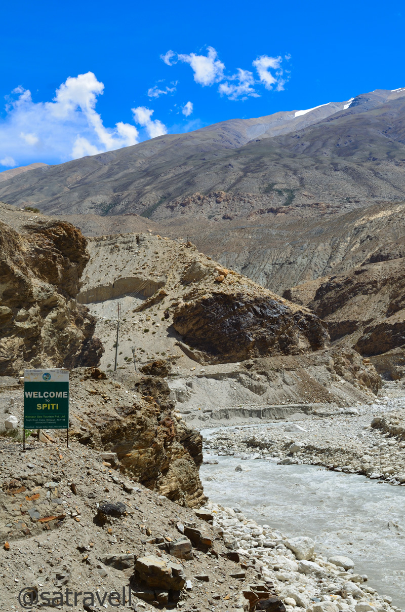
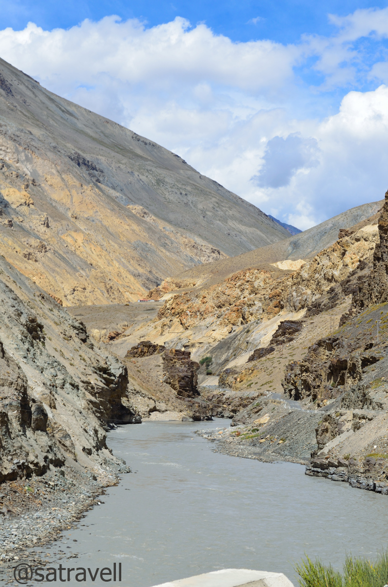
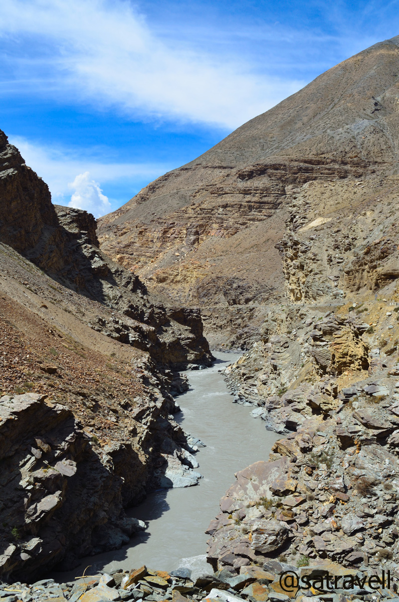
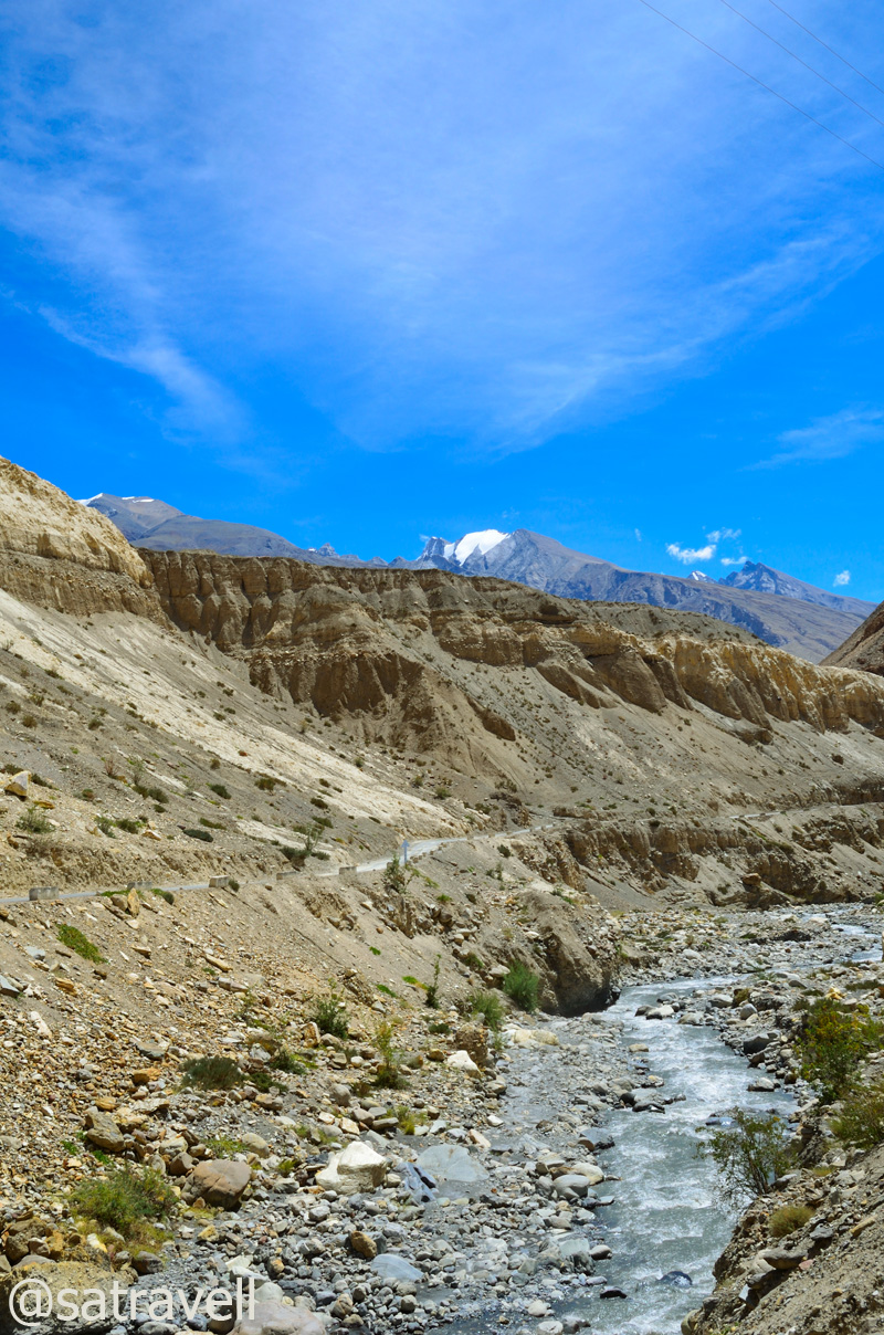
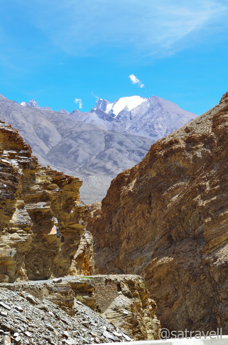
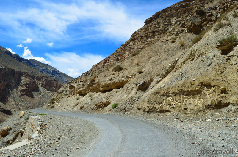
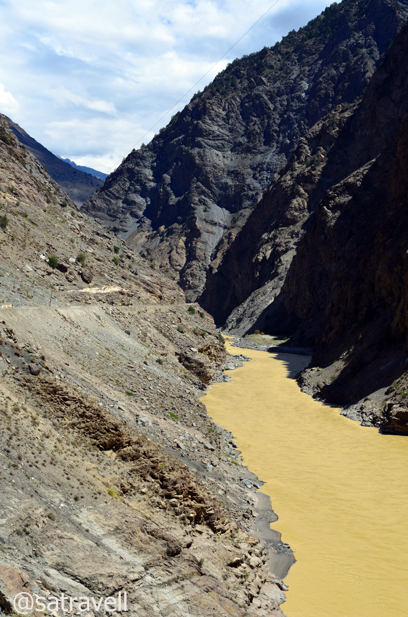
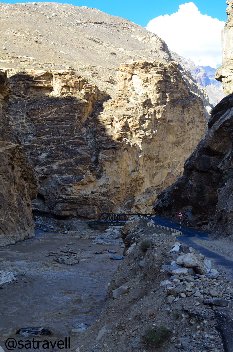
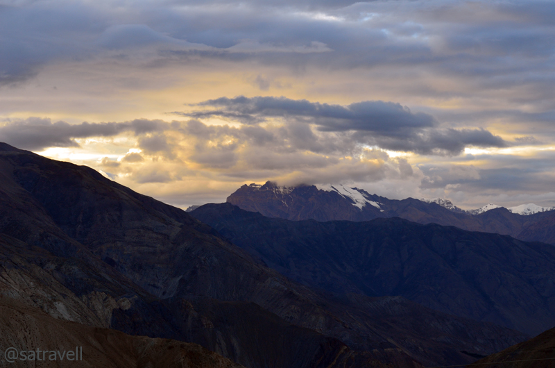
The weather after Rangrik started revealing its cloudiness, bit by bit, for the rest of the trip. Until now what we came across was the bluest sky that we could imagine. Passing through the settlements of village Sumling (3790m), Sherab Choeling monastery at Morang, Hull (3890m) as well as the Gyundi nala, we climbed to reach Pangmo (3950m) where it started drizzling albeit a light one. This windswept upper valley region Tud of Spiti is the least populated of the four regions – Sham, Bhar, Pin and Tud.
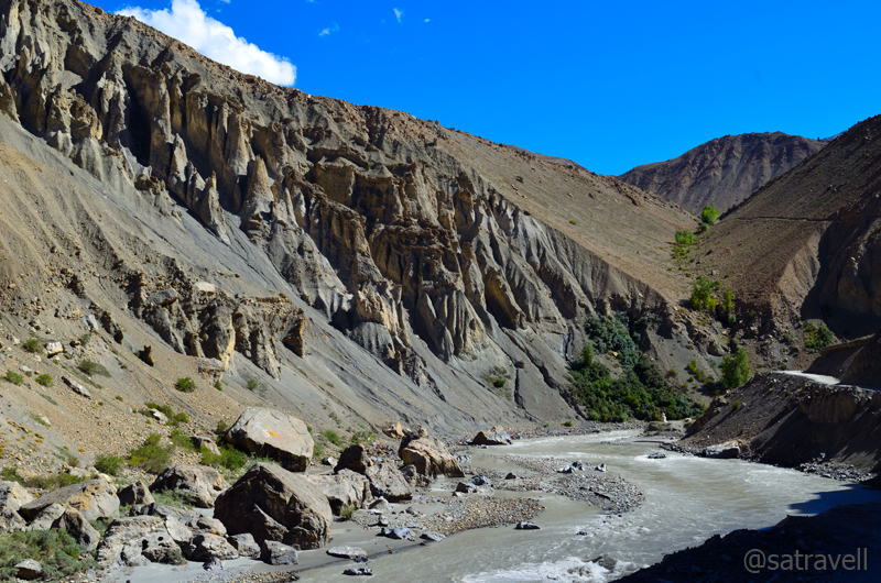
The Gyundi Gorge

Final view towards the Bhar region. Please visit Flickr Photoset for more pics of the region

The landscape comprising Chau Chau Khang Nilda captured from near Morang. Visit Flickr for more pics

Landsape at windswept Pangmo flats. Please visit Lahaul & Spiti Flickr Photoset for more pics
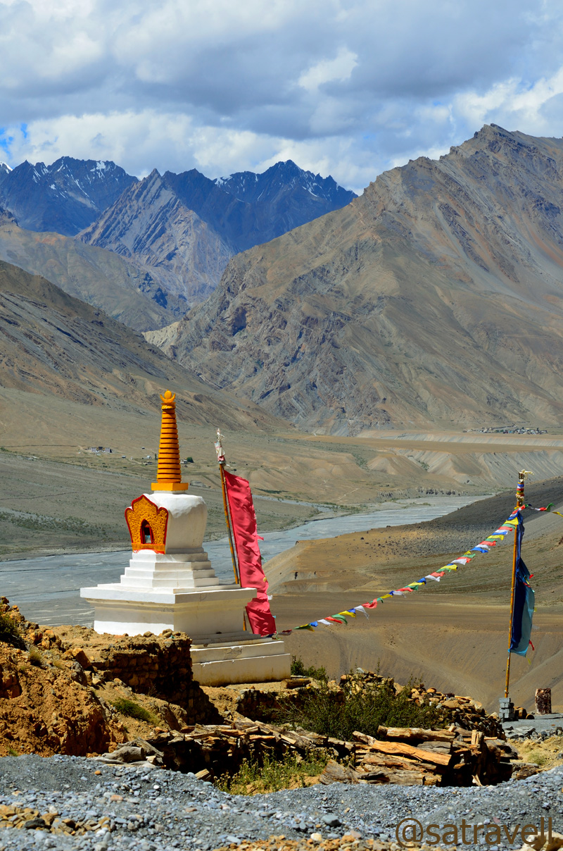
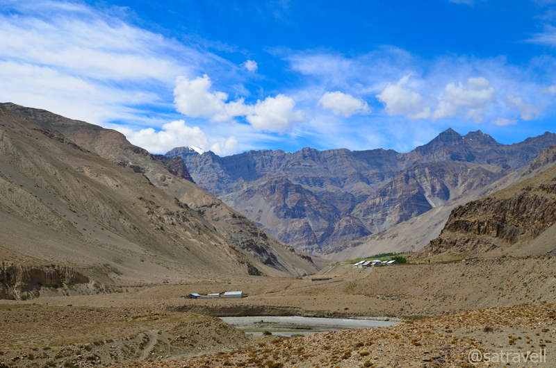
Even though we reached Pangmo by 1400hrs, the drizzle made us rethink about our plans to cross the mighty Kunzum La, later in the evening, where weather can get real nasty at times. A typical Spiti afternoon included headwinds, growing in velocity as the day progressed, and sunrays piercing into the skin. The valley receives very little rain round the year and monsoon spells are mostly dry. We didn’t want to take any risk and planned to call it a day at village Losar still a couple of hours away.

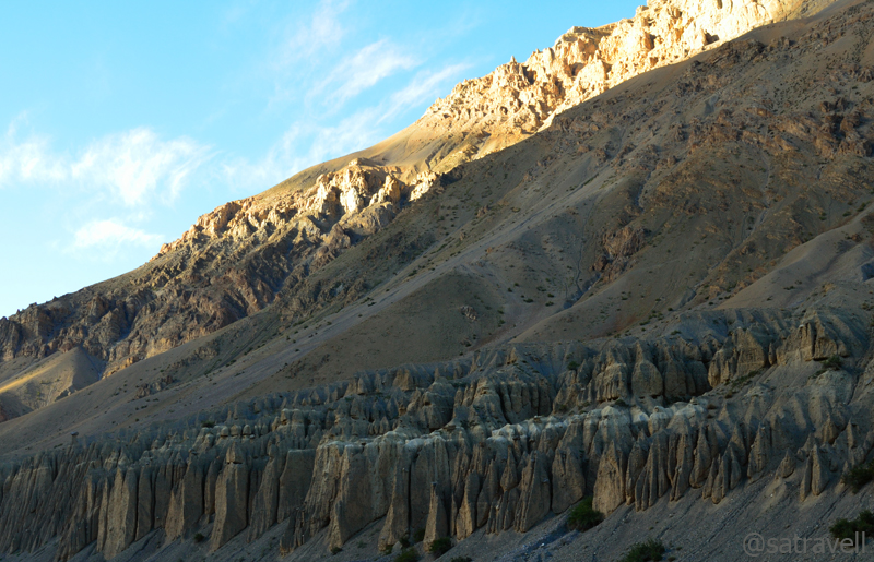
Wind-carved hoodoos a little before Kiato. The SH 30 is also visible in the frame. Visit Flickr for more pics
With dark clouds sluggishly making their way into the dry valley, the fabulous landscape at Pangmo encompassed every shade of nature. Past the Chomo monastery, the road scrolled through poplars, pea and potato fields to enter the yellow-coloured moonscape of hoodoos and ascended over loops to cross the other bank of the river and reach village Kiato (3960m). A little further the village Hansa stretched out in the cultivated fields amidst poplars. The village housed quite a few tin-roofed administrative structures as well as a few shops, dhabas, etc.

Approaching modern Hansa village. Please visit Flickr Photoset for more pics of the region

Landscape above Kiamo village in the Tud region. Please visit Flickr Photoset for more pics
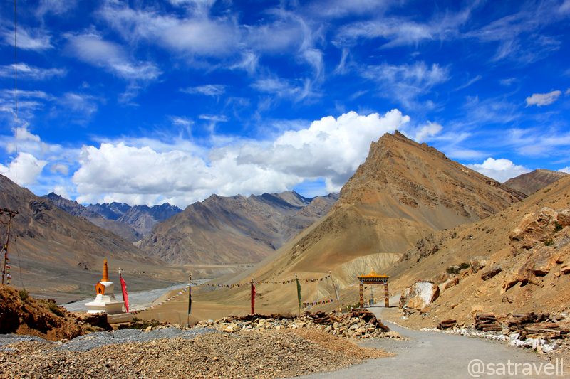
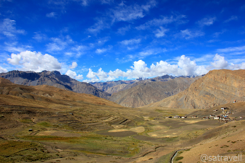
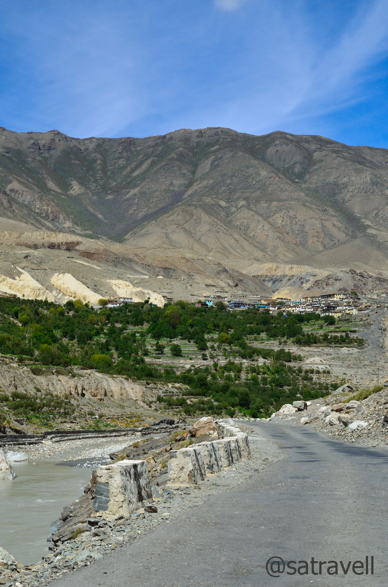
Intermittently descending and ascending to cross a few nallahs, the road to village Losar (4110m) followed the Spiti in an expansive glacial valley. Just before the village, the road crossed the Spiti River to reach its right bank as well as the Dongrimo nala or Suvita Lungpa. The last and final village of the Spiti valley towards the Kunzum La, Losar houses a couple of guesthouses, just a few shops, mud-brick houses painted white, etc. It is even possible to score the Chhang from the guesthouses of this village situated amongst cultivated fields, streams and poplars. Approaching from Hansa, the location of the village made for an extraordinary landscape.
Approaching the uppermost inhabited region of the main Spiti Valley. Visible in the frame are villages of Chichong, Losar and Kholoksar. Please visit Lahaul & Spiti Photoset on Flickr
Without taking into account the government-run rest-houses, the places in the Spiti valley where a night halt could be easily negotiated included Sumdo, Tabo, Shichling, Dankhar, Kaza, Rangrik, Ki, Kibber, Pangmo monastery, Losar, etc.
View and read more on the region at the Lahaul & Spiti Photoset on Flickr
You may also like to subscribe to the email updates, of the remaining chapters, by entering your email id in the sidebar.
Climbing up the slope of Bhar pastures
The following is a page entry from On Road through the trans-Himalayas. To read complete travel memoirs and trip report, please visit here.
Chapter 7 of 22

Om Mani Padme Hum
Next morning after the daybreak, loaded with limited supplies that would last us a day, we started the steep climb towards the pastures of Kaza. The seven-kilometre sheer ascent took us to the village Langza (4420m). Although, the village was recently connected with a narrow jeep-track over the steep Shilla Gorge, we preferred taking the harsher approach as the guesthouse-owner had warned us the previous evening about road-repair work currently undertaken by the PWD department which meant the road could be closed for traffic movement. Otherwise the village is now connected with a narrow jeep-track to other neighbouring villages including Gette, Tashigong, Hikkim, Komic, etc.

Landscape towards Kaza; captured from slopes. For more pics of the region, please visit bNomadic in Spiti
First views of the veiled Chau Chau Khang Nalda. For more pics, please visit Flickr Photoset on the region
Huffing and puffing we reached Langza in about four hours to come within a handshake distance with the magnificent Chau Chau Khang Nalda (6303m), literally meaning the mountain-princess on which the sun and moon shine. I had earlier read about its astonishing beauty in the Himalayan Journal edited by Harish Kapadia. The gigantic mountain rises suddenly and appeared to be positioned in the backdrop of the village in the laps of the vast expanse of shrubbery around. Eclipsed by a small cloud, the mountain peak, like a newly married bride, refused to reveal its real face the entire duration that we stayed there.

Village Langza and the CCK Nalda
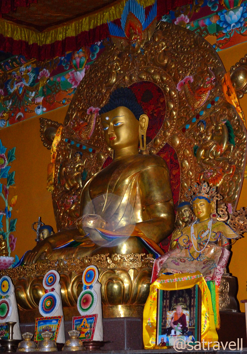
The statue of meditating Buddha – sitting cross-legged – on a mound above the village overlooking the Zanskar and Great Himalayan Range, as well as the newly-renovated village monastery made the visit to the picture-perfect village even more incredible. As per the Bhaisajyaguru Sutra, this posture, also referred to as Medicine Buddha symbolises the Buddha’s meditation to ward-off any disease inner as well as outer. The preservation of local flora and fauna could rightly be attributed to the teachings of Buddhism. The followers of Buddhism in the trans-Himalayan region imbibe in them the motto Live and let Live.
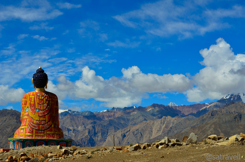
Medicine Buddha. For more pics of the region, please visit bNomadic in Spiti
Lacking overgrown vegetation, the rounded meadows, a treasure-trove of fossils, made for a perfect camping ground. One needs to carry own tentage armed with supplies to make it safer though home-stays are also popular here. Farther out to pastures are still more sites, each with its own wealth of undersea-fossils and viewpoint. Reminisce of earth’s internal movements, the vast and arid terrain, once a sea, is said to record every geological age in pristine formations. Inching skywards, the Greater Himalayas that enclose Spiti in a crescent, prevent moisture-laden clouds from reaching the region thereby creating an arid and desolate landscape.
Meadows and cultivated fields of Langza. For more pics, please visit Flickr Photostream
From the village Gompa, a 360 degree view encompassed almost every topographical feature of the trans-Himalayan region including deep gorges, the awe-inspiring heights of snow-capped mountains as well as ridges, rippling mountain ranges, expanded river basin in wide open valleys, intriguing rock formations, sloshing glacial rivulets, rich flora as well as fauna and expansive meadows, etc. Extending from Nanga Parbat Peak in the west to Namcha Barwa in the east, the Himalayas are not only known to be widest in this western region but are known to possess most intricate geological mysteries.
Village Langza and the Gompa. For more pics of the region, please visit Flickr Photostream
Known as Western Himalayas in the geographical parlance, the area comprises the region west of the Tons-Yamuna gorge right up till the Indus in Pakistan occupied Kashmir (PoK) as well as north of Shivaliks until the snowy peaks towards the northeast direction, which also marks a natural boundary with Tibet. Travelling northwards, the various mountain subsystems that come under the Western Himalayas are the Shivaliks, The Outer Himalaya Range, The Mid-Himalaya Range, The Great Himalayan Range and The Trans-Himalayan Region. Unlike the ranges in the lower Himalayas, located southwest of the Great Himalayan Range, that rise in succession one after the other, the trans-Himalayan region is largely a featureless expanse of high-altitude desert terrain.
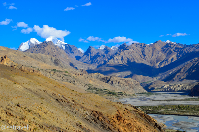
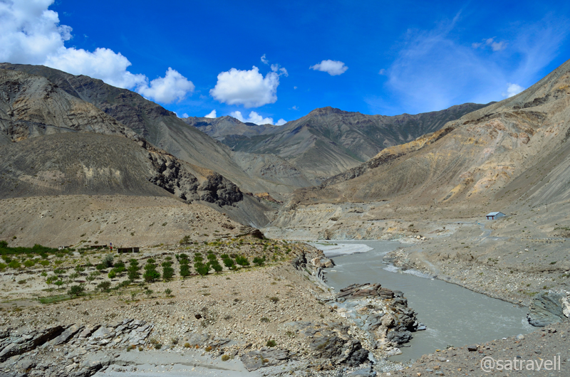
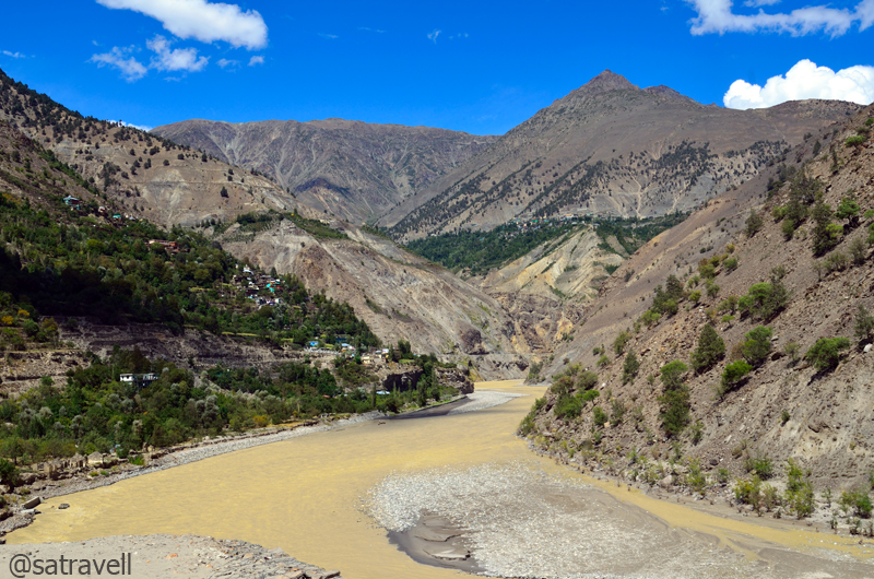
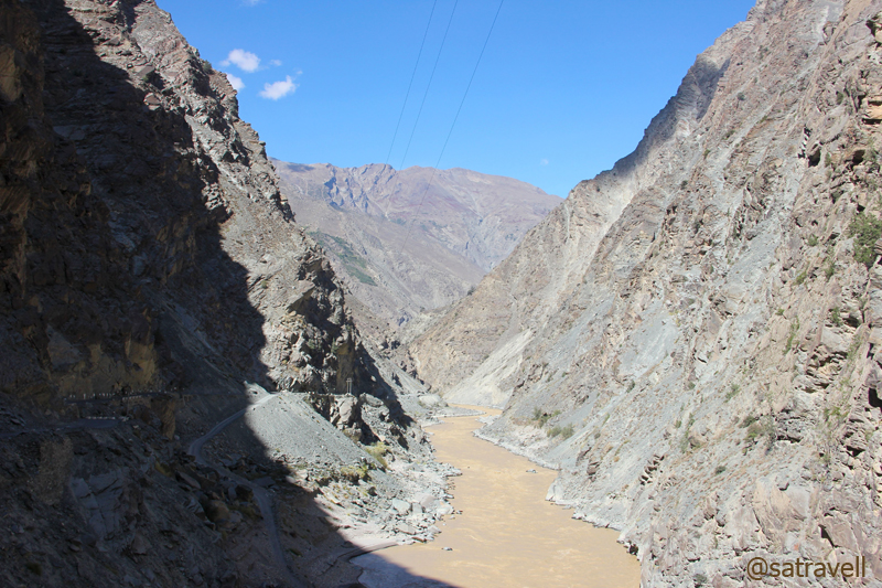
Colourful Spiti riverbed and village Rangrik captured from Bhar slopes
Geographically, the trans-Himalayan region lies northward of the Great Himalayan Range, which after reaching its crescendo drop away forming several ranges as well as ridges running parallel to itself. With elevation ranging from 4500-7500 m, the significant ranges of this region are christened as Zanskar, Ladakh and Karakoram, etc. The topography is sliced into numerous valleys by one of the most prominent river-systems including the Indus, the Spiti, the Sutlej and the Chenab (Chandrabhaga), etc. Culturally, the regions are linked by a common thread including architecture, religion, practices, food, etc. with minor variations related to language differing with valley to valley.

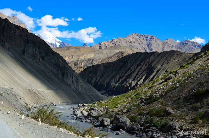
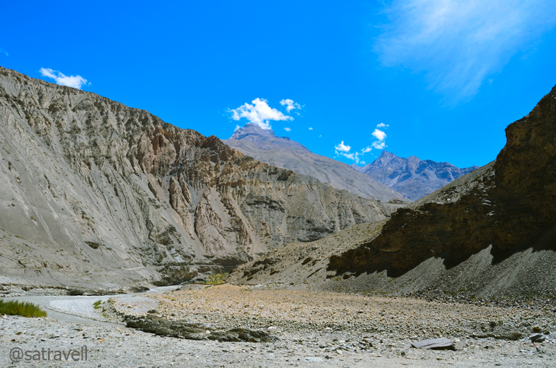
View towards the Tud region
Submitting to the stubborn massif that refused to reveal itself, we took a few photographs and left the dreamland facing strong headwinds downhill. On the way I captured myriad perspectives the landscape had to offer including that of the Kanamo Peak (5964m). With a limited zoom, photographing the shy birds, up there, was always a problem. We were back in town, before the light faded, where a sumptuous feast awaited us at the guesthouse.

Captured while descending Bhar slopes. For more images, please visit bNomadic in Spiti
View and read more on the region at the Flickr Photostream of bNomadic
You may also like to subscribe to the email updates, of the remaining chapters, by entering your email id in the sidebar.
Bumping into a rare four-legged wild creature
The following is a page entry from On Road through the trans-Himalayas. To read complete travel memoirs and trip report, please visit here.
Colourful chortens at Tabo
Chapter 6 of 22
Afterward, the road climbed progressively and crossed village Nadang, Poh to reach village Shichling at 3460m where the valley opened itself up again from the gorge. At Poh we came across a group of local women who asked us to give lift to a lady and drop her at Kaza. We obviously had to agree. The limited number of state transport buses plying on the road, on such a terrain, seldom show up on time. Getting a local taxi is not always a possibility either. The lady turned out to be a professor of biology who taught at a local college in village Hansa. On the way, she gave us some interesting lowdown about local customs, traditions, festivals and treks.
View towards Tabo. For more photographs of the region, please visit bNomadic in Spiti
Landscape ahead; towards Needang. Visit bNomadic’s Flickr Photostream for more pics of the region
Cultivated fields of Poh in the Sham region
On a stretch after Nadang, taking notice of falling stones on the road we stopped and parked the car at a safer location. I walked up to the site to determine the cause and scale of the minute-looking live slide. Lo and behold! I had spotted a rare four-legged wild creature going up the mountainside! I immediately took a few photographs and spotted another guy few feet away. It was a Himalayan Blue Sheep couple.

Manerang North. Please visit bNomadic in Spiti for more pics of the region

A narrow portion of Spiti Valley ahead. For more pics, visit bNomadic on Flickr

A Bharal couple climbing up the slopes of Zaskar Range. More pics on Flickr
The satisfaction of having captured a rare wild animal disappeared the very next moment when I realised my camera was fitted with a wide-angle lens. The impatient movement in my body to procure the telephoto-lens lying in the car frightened the animal. I knew my lucky moment was over and within no time the Bharals left the spot. I greatly lamented the loss but couldn’t do much.

A close-up of Himalayan Blue Sheep, locally called Bharal, Naur, Sna.
Wind-eroded formations in a narrower section of the Spiti Valley ahead. More on Flickr
Looking back; view towards Nadang. More pics on bNomadic in Spiti

Approaching the widest section of the Spiti Valley. More pics at Flickr

Majestic Spiti. For more photographs of the region, please visit bNomadic on Flickr
Road through village Shichling. For more pics, please visit bNomadic in Spiti
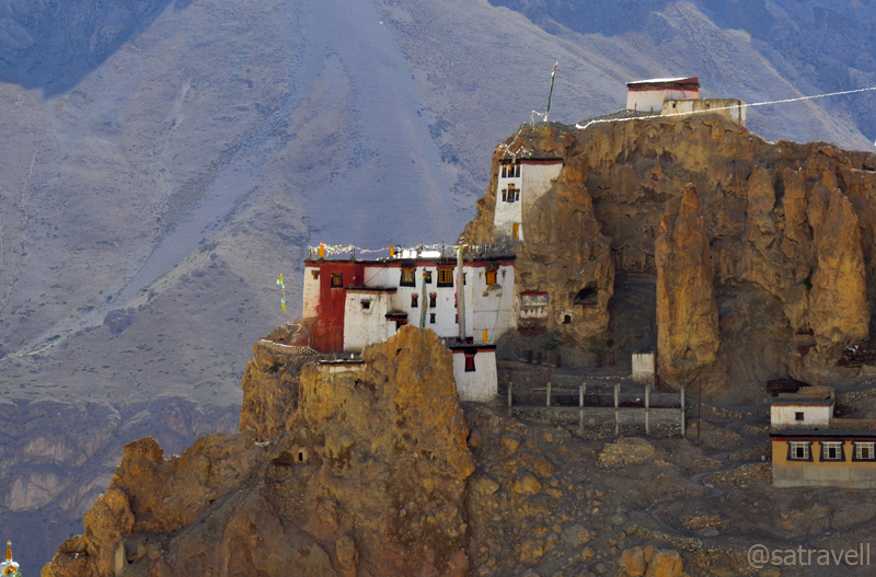
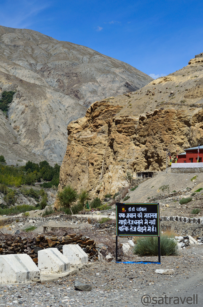
Before agreeing to give the young lady a lift, we had made our intentions clear with respect to a visit at Dankhar monastery. The much-revered Dankhar monastery is located at a distance of about 8 km from the main road. The road after the turn-off at Shichling was steep but freshly tarred owing to the under-construction Helipad near the Gompa. Perched atop the razor-edged rocky pinnacles and alkaline deposits hoodoos above the terraced fields of barley and peas, the Gompa is visible from the main road below and makes for dramatic frame. It is said that in ancient times, faced with raiders, Spitians would hide in these overhangs staving them off by dropping stones from the top. Once the official capital of Spiti, the oldest building in the compound – Nono’s palace, now in ruins – dates back to seventh century.
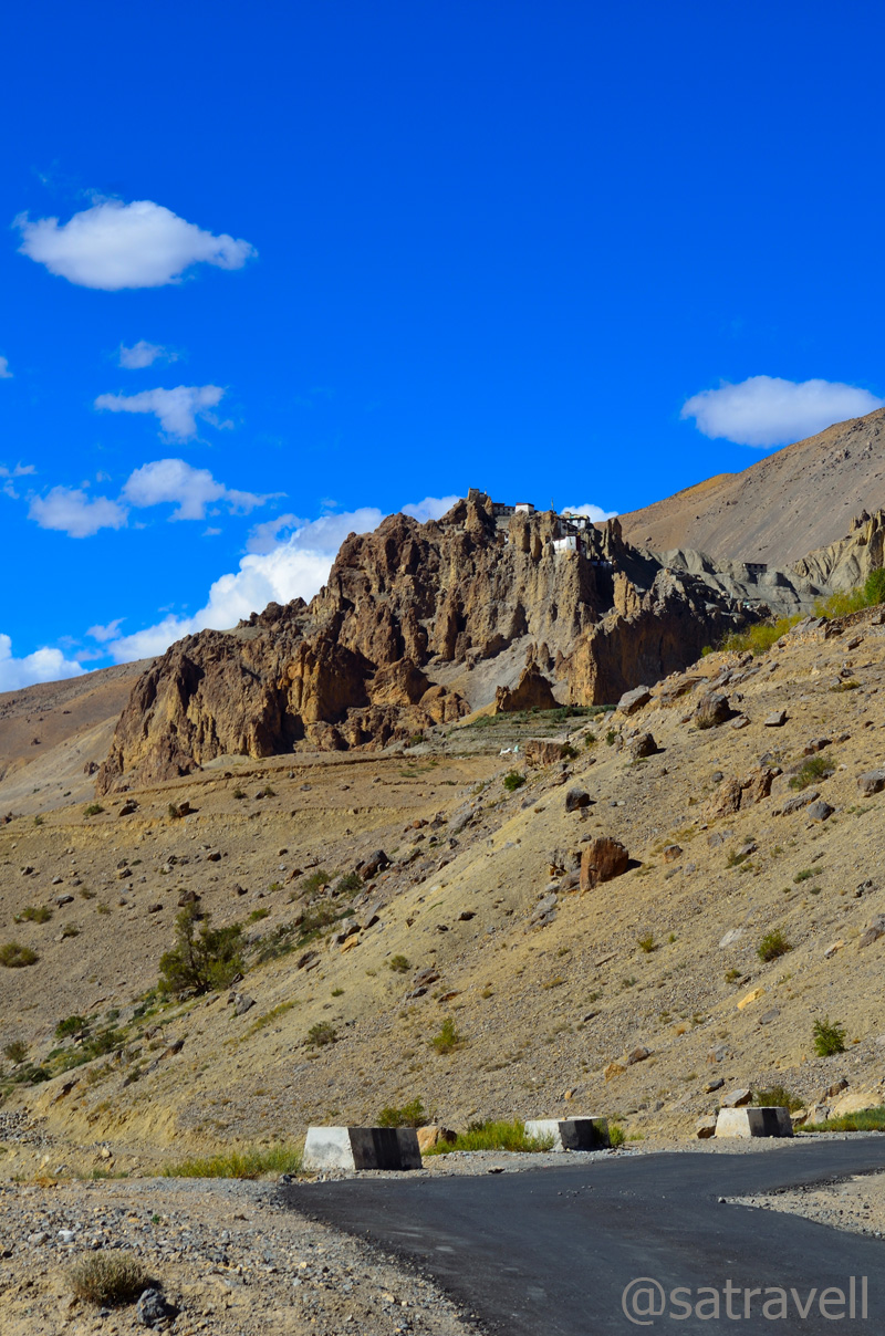
Dhankar Monastery is approximately 300 m higher in altitude than the Spiti at Shichling
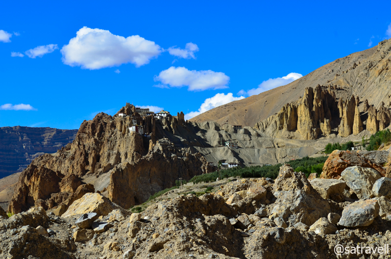
The ancient complex is built on a high bluff overlooking the Pindomor

“The Cold Fort” Dankhar
Literally meaning a fort on a cliff, Dhankar was the capital of Spiti Kingdom in the 17th century
The views from the old monastery’s terrace are commanding and the charms include snow-capped Manerang massif over the gorge towards Tabo, confluence of the Pin, Spiti and Lingti Rivers, Pin valley and the open valley towards Kaza. Next to the recently-built monastery is a small restaurant selling chai and simple meals. Another lure, the Dankhar Lake is situated at a distance of about four km from the monastery. Although both time and mind allowed trekking up the trail to reach the lake but for the commitment made to the young professor to make her reach Kaza on time.
View towards Shichling from the terrace of one of the cells of the monastery. More pics on Flickr

Wind-eroded hoodoos

The confluence of Pin and Spiti Rivers; the Lingti is not visible in the frame. More at Flickr
Next, we crossed a narrow gateway sliced through the hoodoos to reach the other side of the mountain where the narrow-cum-bumpy-cum-dusty jeep-track descended to join the main highway to Kaza. The recently carved jeep-track is seldom used and most vehicles ply on the tarred road via Shichling. We still insisted driving on the same for two reasons – save some precious time as well as capture both the monastery and Manerang peak in a single frame though the typical Spitian dust did not allow much photography on the descent.
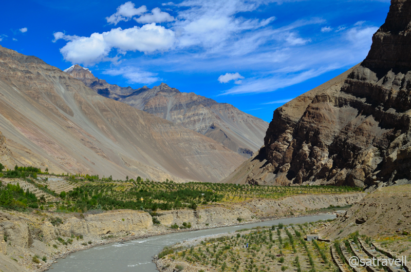
Towards Attargu; The Lingti gorge, visible immediately ahead, separates the Bhar and Sham regions of the Spiti Valley. More photographs at Flickr
Colourful vistas of Spiti. For more photographs of the region, please visit Flickr

The Manerang massif and Dankhar bluff. This and more at bNomadic in Spiti
Engrossed in the conversation, we soon reached Kaza. The mesmerising confluence of three rivers looked even more beautiful against the backdrop of the Zanskar-valley-like mountains. I was always interested in exploring the vistas offered by the Pin valley and even planned to drive up to the village Mudh this time but for the condition of the roads, ravaged by the recent flash floods. Hardly a few weeks before, the unwarranted glacial melt had caused havoc in the entire Pin valley washing off several bridges and settlements as well as submerging entire road-length. The lady professor also advised us not to venture into the area at this stage. The majestic view of snow-capped peaks from village Attargu and groves of seabuckthorn, mostly located on the island formed at the confluence – Pindomor, were among other attractions on the way. Having dropped the professor at the entrance to Kaza, we headed straight to the only fuel pump in the area and got the tank full. We checked into a private guest house and after refreshing ourselves quickly headed straight to the newly built Kaza monastery.

Intriguingly eroded mountain-slopes in the Bhar region. This and more at bNomadic in Spiti
Natural formations in the Middle Land. More photographs on Flickr
Serene expanse of upland-terrain in the Bhar region. More pics at bNomadic in Spiti

Welcome to Kaza, the administrative headquarters of the Spiti Valley. More pics at Flickr
The remaining part of the day was spent with monks in the monastery, walking around the town as well as the market. Surrounded by high-rise mountain-faces by the left bank of snaking Spiti River, at 3680m the tin-roofed town of Kaza could be divided in two comprising the old settlement area or old Kaza and new Kaza housing government offices, market, rest-houses, etc. Interlaid with narrow dusty streets and fast-mushrooming guesthouses, the town is fast-expanding into a vacationer-destination. Being headquarter of the Spiti valley, recognised as a tribal area, it enjoys certain special provisions and relaxations from the Government of India.

The newly built colourful Monastery at Kaza. The monastery was inaugurated by His Holiness the Dalai Lama in July 2009. More pics at Flickr Photostream
The Shakyamuni Buddha

An ornate statue of the great translator and Mahaguru Rinchen Zangpo

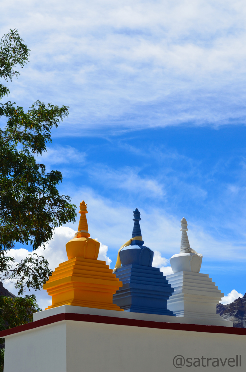
Chortens lined outside the Monastery
To foreigners coming from Kunzum side, Kaza is the place to get your Inner Line Permit. Although the market lacks the amenities of a town, Kaza can be used as an excellent base to explore the village pastures located higher up the mountainsides. We aimed to do the same next morning. An additional day at Kaza also offered us an opportune spell to do the laundry.
View and read more on the region at Flickr Photostream of bNomadic
You may also like to subscribe to the email updates, of the remaining chapters, by entering your email id in the sidebar.
Brush with The Malling
The following is a page entry from On Road through the trans-Himalayas. To read complete travel memoirs and trip report, please visit here.
Chapter 5 of 22

Incredible India

The terraced fields of Nako. For more pics of the region, please visit bNomadic in Kinnaur
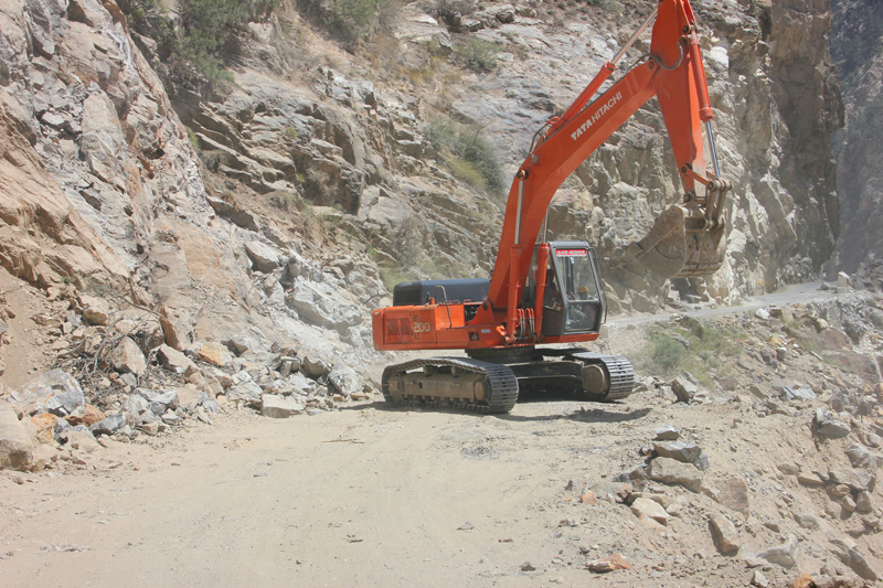
At 3800m, a few kilometre after Nako is the most notorious and terrific section of the road popularly known as Maling Slide. The infamous Maling nallah roaring on a terrain, which is entirely unstable, aggravates the problem. Till about a few years ago, the main road used to run along the left bank of Spiti river and crossing this slide could consume up to couple of hours. The road had been diverted up the mountain only recently. Although, the section is still prone to blockages, a hurried clamber ordinarily takes up only ten minutes. The slide area begins just after a temple near which the road labourers are stationed to clear the area in the event of a landslide.
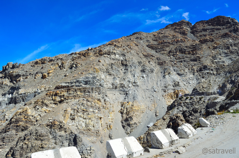
Approaching the infamous Maling section. Notice the narrow motorway as well as a small Hindu shrine. For more pics, please visit Flickr Photostream of bNomadic
Notice the permanently stationed heavy machine on the narrow road. The slide is notorious for going live every 24 hrs (well, almost)
We paid our homage to the mountain Gods after clearing safe the disreputable section of the road. Believe me you; it was this section of the road, the notoriety of which discouraged us from visiting Spiti, in a similar vehicle, earlier this year. Misconceptions mostly!
A Buddhist shrine to ward off the evil spirits at the infamous Malling Slide.
The next few kilometres in the barren as well as narrow Spiti Valley offered little landscape-photography opportunities. A couple of kilometre after the Maling crossing, the now-tarred road descended steadily over a buttery-yellow alkaline ridge in a series of switchbacks to reach village Chango (3000m).
The Hangarang region, in the Spiti Valley, of Kinnaur. The road through the Maling section is also visible in the frame. For more pics, please visit bNomadic in Kinnaur on Flickr

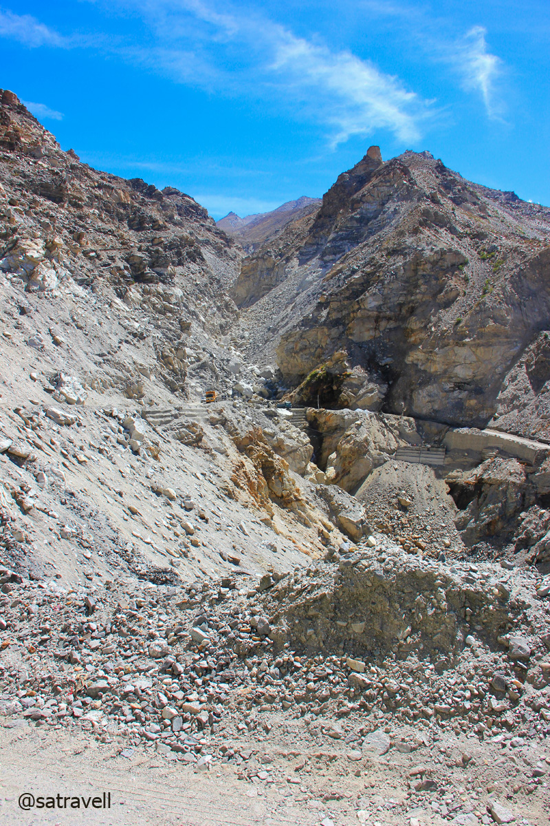
A live slide in the Spiti Valley

The rippling mountain formations in the Spiti Valley. The green patches belong to the village Chango and Shialkar. For more pics, please visit Flickr Photostream of bNomadic
The “Moonscape” of Kinnaur. For more pics, please visit Flickr
Approaching Chango.
Up a mountain-face at Chango. For more pics, please visit bNomadic on Flickr
Comprising a few dhabas, guest houses, the village itself is a couple of kilometre up the main road. A green settlement surrounded by apple, plum, apricot, willow and poplars, the village houses an old Gompa as well. Just before reaching Chango, look for meditation caves located up the mountain walls.
Somewhat wider section of Spiti Valley in Kinnaur. For more pics, please visit Flickr

The road is on the left bank of the Spiti River. For more pics, please visit bNomadic on Flickr
The barren highland. For more photographs of the region, please visit bNomadic on Flickr
Village Shialkar comes into view
Over the next few kilometres, the levelled but bumpy road snaked to cross over to the opposite bank of Spiti and reached village Shialkar (3030m). A few meditation caves could be spotted here as well up the rock face of the mountainside. The bumpy as well as dusty road after Shialkar looks to level the Spiti River to reach Sumdo village and enter the Sham region of Spiti valley.
Welcome to Shialkar

The terrain ahead. For more pics of the region, please visit bNomadic in Kinnaur
At 3100m, Sumdo is the administrative entrance to the Lahaul & Spiti district. All travellers are required to again prove their credentials at the Police check post located right after the bridge by the confluence of Spiti and Parechu River. Foreigners will have to produce the Inner Line Permit they were carrying.
The Parechu river “re-entering” Indian territory from Tibet
The Spiti River. The confluence of Parechu and Spiti rivers marks the administrative boundary of Spiti.
Responsible for flooding the entire Sutlej valley as well as the terminal of Spiti valley in 2005, the truant Parechu River originates from Parang La, 15 km north of Kibber, flows east to enter Tibet and rounds back to India to join Spiti at Sumdo. The river had washed away several bridges and villages in 2005. Back then, the cause, a possible dam burst on the river in Tibet lead to bitterness between the relations of India and China.

The Parechu and the narrow motorway towards Kaurik
The narrow Spiti valley and the terrain ahead
From Sumdo there is a diversion, off the main road, leading to village Kaurik, now an abandoned hamlet, at the border. Ahead the state highway 30 briefly climbs crossing the Gue Nallah Bridge as well as a jeep-road, leading up the Gue village, to reach village Hurling (3150m), settlement comprising relocated people from Kaurik.
The Gue stream and the narrow jeep-road to the village Gue
The narrow Spiti Gorge in the Sham region of Spiti
Starting at Sumdo and ending at Batal in Lahaul valley, the total length of the SH30 is 180km. Blasted out from the rock face with steep drops down the river in a narrow valley, the current bad section of the road reminded of the C-shaped Roghi cliffs. The worst was over now. There was a small Maa Durga shrine dedicated to those who lost their lives constructing this section of the road.
The road-condition also improves. State Highway 30. For more pics, please visit Flickr

Green patch of village Hurling. For more pics of the region, please visit bNomadic in Spiti

The village Hurling comprises relocated residents of Kaurik. For more pics, bNomadic on Flickr

Viewpoint captured from village CHANDIGARH in the Spiti Valley. For more pics, please visit Flickr

Bridge on the river Spiti at Sumra. For more pics of the region, please visit bNomadic in Spiti

Village Sumra and the stream descending from Manerang region. For more pics, Flickr

Poplars in a wider section of the Sham region of Spiti. More pics of the region at Flickr

Village Lari in sight. More pics of the region at bNomadic in Spiti
After this stretch, the valley starts to open up and the monstrous Spiti now appear to calm down. A typical landscape would include occasional green patches surrounding a village forming a sort of oases, rock, boulders, water and waterfalls showering the road, etc. The road gradually gains height to reach Tabo (3300m) passing through village Chandigarh, Sumra on the right bank and Lari.
Wide open Spiti Valley in the Sham region. More pics of the region at Flickr

Nature’s own Open Air Theatre. More pics of the region at bNomadic in Spiti
Tabo within reach. More pics at Flickr
Obviously Tabo, the modest looking one of the key olden Buddhist sites in the world, was to be the main focus area for the day. Set in the fields, the ancient Gompa, a world heritage site declared by UNESCO, is believed to be founded by Rinchen Zangpo, the great translator, in 996 AD. Its soft-mud appearance matches with the barren landscape of the Spiti valley.
The ceremonial Welcome Gate to the ancient Tabo monastery complex

The natural-looking meditation caves for the monks on the mountain-face. For more pics, please visit Flickr
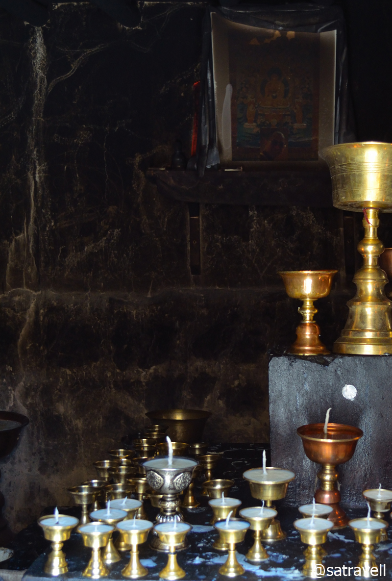
Inside a cell. Butter lamps being readied for the evening Pooja
Tabo is the monastery where his Holiness The Dalai Lama has chosen to retire.
The ancient as well as the Kalachakra Chorten (outside the complex walls)
Inside the complex. The monastery has multiple house-like structures of sand and clay. Visit Flickr
What often puzzles the historians is the possible reason behind its preservation for so long. The widely accepted view is because of its location. Unlike most other monasteries in the Spiti valley which are perched high above the cliffs or mountain tops, this one is plainly set among vast fields located by the left bank of the river. Its ordinary exterior saved it from getting noticed by 18th century raiders including the Sikhs and Dogras. Marked by a ceremonial gateway next to the main road peppered by willows and poplars on both side, Tabo is the monastery where his Holiness Dalai Lama has chosen to retire.
Om Mani Padme Hum

Tabo Monastery Complex
The monastery has multiple house-like structures made of sand and clay. Although, the various temples inside the monastery complex were closed, I spent a couple of hours roaming in and around framing every possible clue that helped distinguish its current life vis-à-vis the tradition. The natural-looking meditation caves for the monks could also be spotted on the slope of the mountainside from the gompa itself.
Set in the fields surrounded by Poplars, the ancient Gompa is also a world heritage site declared by the UNESCO. For more pics of the region, please visit bNomadic in Spiti
Tabo offers plenty of accommodation as well as food options and is also a good place to refill the supplies for the remaining trip. We didn’t hesitate in that and ordered local-thalis for ourselves from a dhaba located at the entrance to the gompa. Priced at Rs 70, the thali included hygienically cooked boiled rice, rajma, dal and pumpkin subzi. The market also housed a few German bakeries. By now well established in Manali, Kasol and Leh, a typical German bakery comprises a counter offering doughnuts, croissants, breads and a few varieties of pastries. No one can really trace the origin of this fad and a majority of such eateries are managed by local people only. At tea, we both ordered a veg sandwich. Well, it was just okay! The remaining part of the day was well spent in strolling around the area and looking for opportunities to photograph any wildlife particularly birds.
Mane Stones at Tabo. For more pics of the region, please visit Flickr Photostream on bNomadic
View and read more on the region at the Flickr Photostream of bNomadic
You may also like to subscribe to the email updates, of the remaining chapters, by entering your email id in the sidebar.
Up-close with the Tea river
The following is a page entry from On Road through the trans-Himalayas. To read complete travel memoirs and trip report, please visit here.
Chapter 4 of 22

Reckong Peo was also the venue for the Dalai Lama’s Kalchakra celebrations in 1992. For more detailed images on the region, please visit bNomadic’s Flickr Photostream
Early next morning, after the routine breathing-exercises, I paid my tribute to the Rock-shivling on the imposing Kinner Kailash range and took some customary photographs. The 17m rock pillar of Shivling reflects different hues with the movement of the sun. It was a perfect morning for photography. Situated 600m higher than Peo, Kalpa enjoys better views of the Kinner Kailash range including the shivling, Jorkanden, Sarong and Raldang peaks. I shall soon upload more details, including a bicycle ride, about this Sairag region of middle Kinnaur in a separate blog.

A closeup of the 17 m rock “Shivling” in the Kinner Kailash Range. Photo credit Sarabjit Lehal

The Kinner Kailash Range. For more detailed images of the region, please visit Flickr Photostream
After breakfast and checkout, we took walk on the road to Roghi, a small village on the original Hindustan Tibet Road. The yet to be harvested apple orchards as well as groves of Chulli trees marked the initial section of the narrow tarmac-path to the village. The old HT road here is etched on the infamous ‘suicidal’ Roghi cliffs falling sheer to the Satluj flowing 1000m vertically below.

The “Suicidal” Roghi Cliffs on the original Hindustan-Tibet Road
The ancient version of the HT road, reminisce of petty wool politics and Indo-Tibetan trade, was at best a broad and bridle trail. The olden route passed through the villages and revenue centres that included Narkanda, Kotgarh, Sarahan, Chaura, Tranda Solding, Sungra, Nichar, Tapri, Urni, Roghi, Kalpa, Pangi, Rarang, Jangi, Kanam, Shiaso, Pooh, Namgia and thereafter reached Shipki La. Today, the few stretches of the old HT route that overlap with the NH22 comprise Theog – Narkanda, Wangtu – Tapri and Shiaso – Pooh – Namgia. The excitement of retracing the olden route lies in the fact that it archives in its passage a noteworthy transition in climate, vegetation, terrain, people and culture.

Some apricots left out to dry on a rooftop
The market of Peo is nothing better than those of the towns we passed through after Shimla on the NH22. But then again, approaching from Spiti, one would definitely get the feel of a metropolis. The town is a sprawl of shops selling cheap garments, fake electronics, veggies fetched from plains, tea/ momo, fake Tibetan products as well as a few internet-cafés, a liquor shop, tin-roofed government, tourism offices and a Himalayan Handloom store, etc.

Early morning at Kalpa; the Jorkanden peak. More on the area Flickr Kinnaur
The Himalayan Handloom store located near the main-market chowk sells authentic stuff and is looked after by a lady from upper Kinnaur. It is from this region onwards, one starts to notice the gradual shift in culture and religion from Hinduism to Buddhism. Peo was also the venue for the Dalai Lama’s Kalchakra celebrations in 1992. Foreigners can obtain their Inner Line permit, to enter upper Kinnaur and Spiti, from Peo. More on this area, from my previous visits, on a separate blog soon!
The Raldang captured from the Main Market of Reckong Peo. Photo Credit Sarabjit Lehal
We were in no hurry to reach or plan our destination to spend the night. Nevertheless, having been to this area quite a few times, I did not want to dawdle in the town any longer. In a short span, the Faithful was on the NH22 again at Powari.

The section of NH 22 connecting the Sairag with Jangram region in the Sutlej Valley. For more detailed images, please visit bNomadic in Kinnaur
After the recent monsoon-rage that flooded parts of the Spiti as well as the Sutlej valley, the state of the highway ahead was a secret that was going to unfold now. On our way after Powari, we passed through pulleys transporting villagers and their cash-rich harvest of apple, right from the highway to the ridge-top across the mighty Sutlej, which was indeed a daunting task. Intermittent earlier, this is where Airtel connectivity totally gave up leaving us with my BSNL number. After this, Airtel showed up its presence at Leh and Srinagar only.
Clearing the highway for vehicles

A live landslide and the road ahead
The highway crosses to the left bank of Sutlej at Kharo Bridge and again to the right side a little while later at Akpa (2231m). From the bumpy road itself, the site of 2005 flash floods was apparent that had washed away several bridges. A little before the bridge was the diversion for village Ribba, commanding the best views of the Sesarang group.

Welcome to the Sumcho region
The neatly tarred levelled-road now snakes to reach the Police check post at Jangi (2294m) passing through a beautiful sight of the flat-floored valley at Thangi. Not only foreigners but domestic travellers are also required to submit their credentials at the check post. Of course the non-nationals need to show their Inner-line Permit too. Famous for its Ukiang festival and cumin seeds, the current Jangram region possesses the most extensive Chilgoza pines in Kinnaur making the villagers quite prosperous.
The Sumcho region. The green patches of village Spillo, Labrang and Kanam (on the original HT route) are also visible in the frame. This and more on the region at bNomadic’s Flickr Photostream
As we crossed the check post, vegetation started to fade and along with that the tar on the highway. Having savoured the view of Gymthing River as well as the natural rock shower, a little ahead of Spillow (2360m), we headed towards the Ropa valley, traditionally famous for shawl-weavers and producing finest metal artisans. The road to the scenic Ropa valley branches off the main highway right after the bridge on the Ropa River, a few kilometre before Pooh.
The amusing BRO signboards are actually meant to caution the drivers
The “Tea River” Gorge

Also known as Shiaso, Sangnam or Gangyul, the Ropa Valley. For more pics of the region, please visit Flickr Photostream of bNomadic
Initially barren and arid, the un-metalled jeep track crossed the ancient village Giabong to reach Ropa virtually positioned in the midst of Chilgoza pine-cover. Not that we bothered relishing the fruit of hard labour, Chilgoza, literally a hard nut to crack, is known to possess aphrodisiac quality. A couple of hours more and we were back on the NH22 through the same road.
The historical villages of Ropa and Giabong in the Ropa Valley

The Sunnam village in the Ropa Valley. More pics in the series bNomadic in Kinnaur
The road continued to gradually climb along the bare gorge with the muddy and tea-coloured Sutlej engaging the travellers to unending secrets waiting to unfold at every bend on the mountain slope. A little before Pooh (2820m), from the highway we captured the view of the Gangchua’s snow-capped pyramid in the beautiful Hojis valley towards the right side. Visible from the highway itself, Pooh, like most villages in Kinnaur, is not on the valley floor but a steep 200m above it on a 4km link road.
The bare gorge of muddy and tea-coloured Sutlej. The HT Route is etched on the left mountain-face in the frame. More pics of the region at bNomadic’s Flickr Photostream
The Pooh-Namgia region. For more pics on the region, please visit Flickr Photostream of bNomadic
The landscape after Pooh was now fast transforming itself into a land of dry and barren mountain ranges devoid of any noticeable vegetation though it lacked the enormity of the Spiti valley. The Dubling bridge, located a few kilometre ahead of Pooh took us to the other side of the river Sutlej after which we patiently descended and looked forward to the confluence of Sutlej and Spiti river at Khab (2620m) to make its appearance. Originating at Lake Mansarovar in Tibet, Sutlej travels a great distance before pouring itself into the Arabian Sea at Karachi just as the Indus River.

The Sutlej Gorge ahead
The confluence of Spiti and Sutlej at Khab
The Shipki La near Khab used to be a favoured trading route between Tibet and Hindustan since time immemorial and, although a trading post was opened here in 1995, the Pass sees very little trade-off these days. After crossing the recently-relocated bridge on the river Sutlej, the highway enters the narrow Spiti gorge on the river’s left bank. Before, near the Namgia turnoff the peaks you get to see to the southeast belong to the Himalayan range and to the northeast lies the gigantic Reo Purgyal (6816m), rising 3700m on the right bank, among the largest single rock-faces in the world. Although the road was neatly tarred, the confluence point of the two rivers is notorious for landslides or floods-related road-blockage. I got down and took a few photographs to capture the landscape as well as the majestic Reo Purgyal, the highest peak of Himachal Pradesh.

The majestic Reo Purgyal, the highest peak of Himachal Pradesh

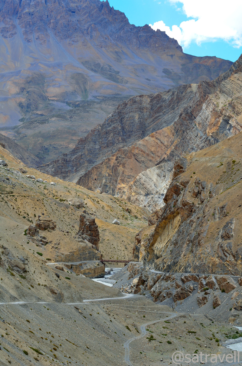
The Spiti Gorge ahead
At Khab, across the bridge, we came across a Spitian family, comprising a mother and her young daughter, waiting to board the transport bus to Sumra. The mother asked for a lift and I promptly nodded in agreement. The next hour and a half was spent photographing the landscape, relishing the apples from Namgia offered to us by the young lady as well as chatting over the current state of affairs in Spiti.

The narrow Spiti Gorge in the Hangarang region

Prayer Flags, Wheels and a small shrine at Ka on the road to Nako
Lost in the conversation and soaking in the beauty of the barren land, we almost ignored the narrow bumpy road on the final stretches of upper Kinnaur. Passing through Ka (3000m) and climbing the Ka Loops, we reached Nako (3650m) and entered the trans-Himalayan region. It was still an early evening but we decided to call a halt at Nako and dropped the mother-daughter duo near the helipad where they expected to get a bus soon.
View towards Khab; and the start of Ka zigs
Located on the irrigated side of the valley, another village Leo, visible from the main highway lies in the lesser-visited area of the Hangarang.

The green Leo and the Lipuk stream ahead, tributary to the Spiti River. For more pics of Kinnaur, please visit bNomadic’s Flickr Photostream
The Malling Village near Nako
The Yangthang and the end of Ka Loops. For more pics on the area, please visit Flickr Photostream
The next in line was a search for room-with-a-view. The upside of accommodations in such a terrain meant that almost every guest-house had a fascinating view to offer. We refreshed ourselves with a tumbler full of ginger-tea and local cookies coupled with veg momos in a reasonably priced room-set managed by twin sisters from the village itself. The agreement was Rs 500 for a night exclusive of food and teas. The balcony offered an extraordinary view of the snow-capped peaks in the Srikhand range.
The edges of Reo Purgyal massif eloping with the pastures of Nako
Noticing the evening reach it’s crowning and hearing the increasing chitter-chatter of the birds, I headed up the pastures to take some shots. Placed just in the lap of a vast expanse of steadily sloping terrain, with snow-capped mountains all around, provides Nako with the feel of soaring high among the clouds. The edges of Reo Purgyal massif eloping with the irrigated fields of the village dominate the landscape. The village Nako is a random jumble of traditional stone-built houses with small wooden-doors and cowsheds located in earthen narrow-lanes. The village temple complex, credited to Rinchen Zangpo, is situated towards the west side.
Unidentified peaks towards the Srikhand Range. For more detailed pics of the region: Flickr Photostream
Although I couldn’t get much from bird-photography perspective but I did manage some reasonable clicks of clouds hovering over the Srikhand range. While I was busy with my game I observed a sound of humming and drumming coming from the direction of the village which was getting louder as the daylight faded.

The ancient roofed chortens towards the pastureland from Nako
I headed towards the direction from which the sound was coming and on the way asked cousin to join. And there we were attending and witnessing a marriage ceremony!
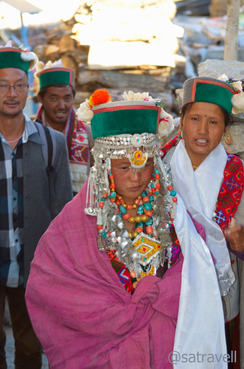
The bride
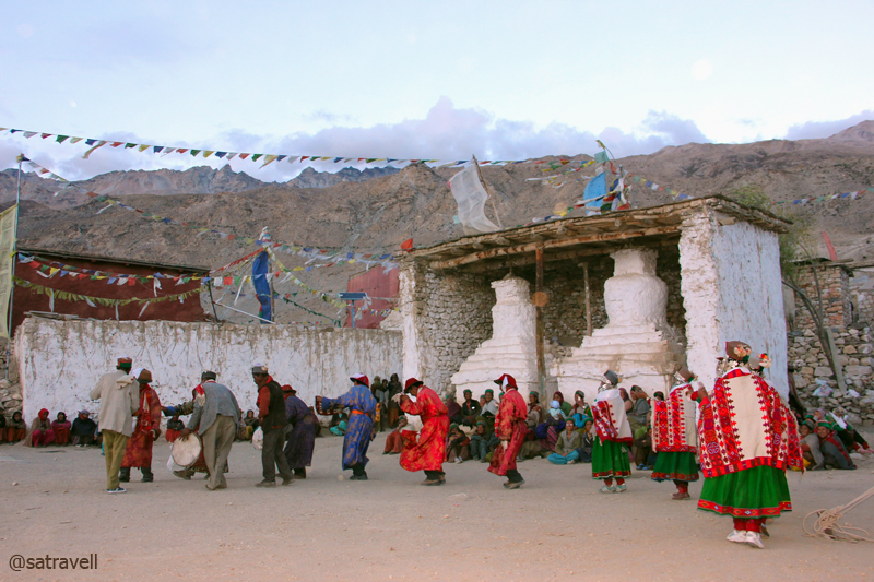
Women certainly enjoy a better social status in the trans-Himalayan areas than in most of rest of the India. Well, almost certainly the civility has been instilled by the prevalence of the Buddhism. It was the boy’s family that had made the initial offer through an intermediary. Surrounded by the villagers and onlookers like both us, the initial part of the wedding ceremony was held in the girl-family’s courtyard. Overseen by a head lama present to bless the couple and ward-off the evil spirits, only a select few had accompanied the groom to take home the bride. On the way back the marriage party took form of a procession, joined by almost the entire village, and headed towards the ancient tenth-century village Gompa (also known as the Sacred Compound).

Lamas rotating the ancient prayer-wheels to mark the beginning of marriage-functions

All set to participate in marriage functions, family members outfitted in traditional attire lined up on the ground of Sacred Compound
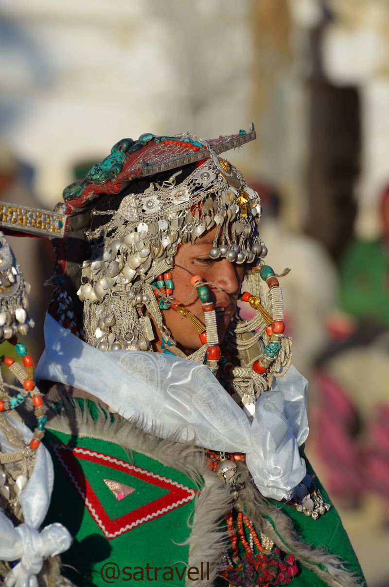
A Kinnauri Beauty. More on Flickr
Families of both the bride and the groom outfitted themselves in their traditional attire whose elements included a gachang, chuba, suthan, topru, white-feathered Kinnauri cap, round Tibetan hat, costumes/ head gear decorated with turquoise stones, silver jewellery, etc. Having consumed copious amount of Chaang, locally brewed barley beer, the family members danced and feasted the entire night in the courtyard of the monastery. The ceremonial activities of udanang and belding were attended by the residents of the entire village who sat cross-legged around the area kept for the purpose. Each gift exchanged was meticulously noted down.

In the courtyard of the ancient Sacred Compound
Family members taking part in marriage functions. Also visible in the frame are the tenth-century crumbling shrines credited to the Rinchen Zangpo. More on the region Flickr Photostream

Villagers assembled alongside ancient roofed-Chortens, part of the tenth-century Sacred Compound, to watch the proceedings. More pics of the region at bNomadic’s Flickr Photostream
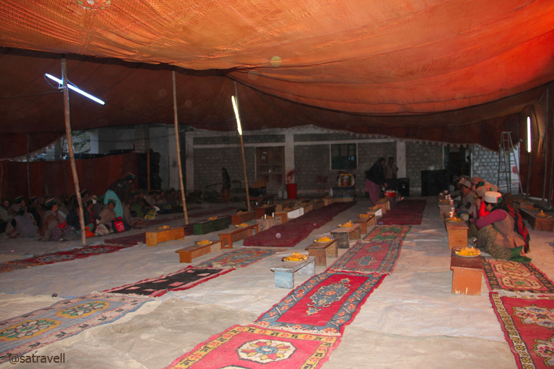
After-marriage community feasting. More on the region at bNomadic on Flickr
After the dance-related ceremonies got over, the proposers literally announced the onlookers and bystanders to go home. We left the scene and took a walk encircling the village including the lake and monastery. Bordered by willows and poplars, in the night, the lake seemed more of a village-pond rather than a natural water reservoir. The starlit night-landscape surpassed the beauty of the evening’s treasure. The next morning-view was indeed expected to be a secret. Aiming to capture birds in the morning, I retired to the bed soon after reaching the room and consuming a healthy meal of dal-rice.

A tiny chorten in the narrow dusty lanes of the village
Without taking into account the government-run rest-houses, the places in Kinnaur where a night halt could be easily negotiated included Jeori, Sarahan, Kalpa, Recong Peo, Pooh, Nako, Chango, etc.
View and read more on the region at the Flickr Photostream of bNomadic
You may also like to subscribe to the email updates, of the remaining chapters, by entering your email id in the sidebar.


