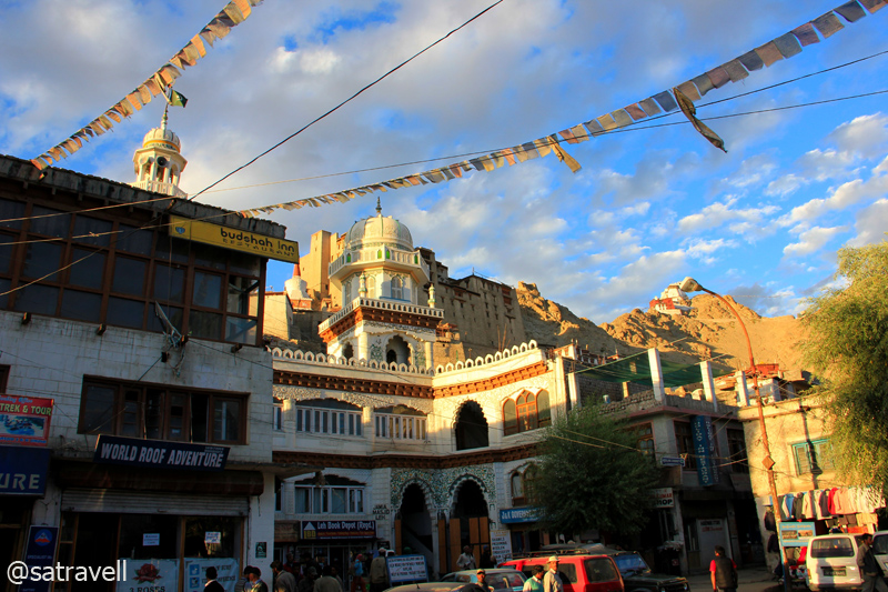
 bNomadic
Retracing The Treaty Road
The following is a page entry from On Road through the trans-Himalayan Region. To read complete travel memoirs and trip report, please visit here.
Chapter 14 of 22
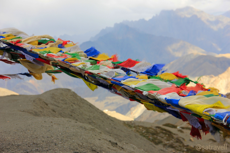
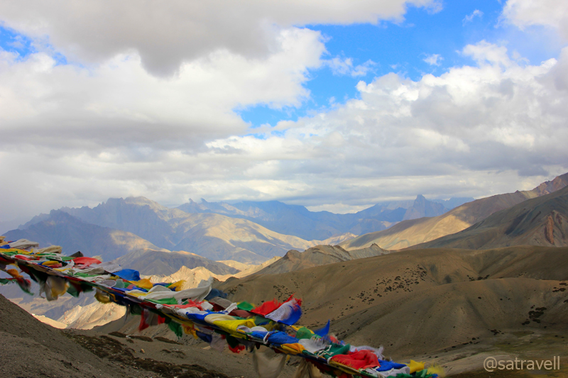
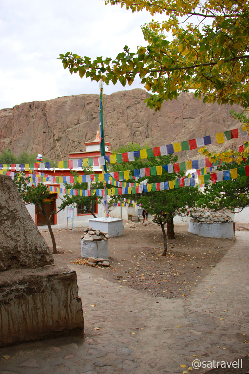
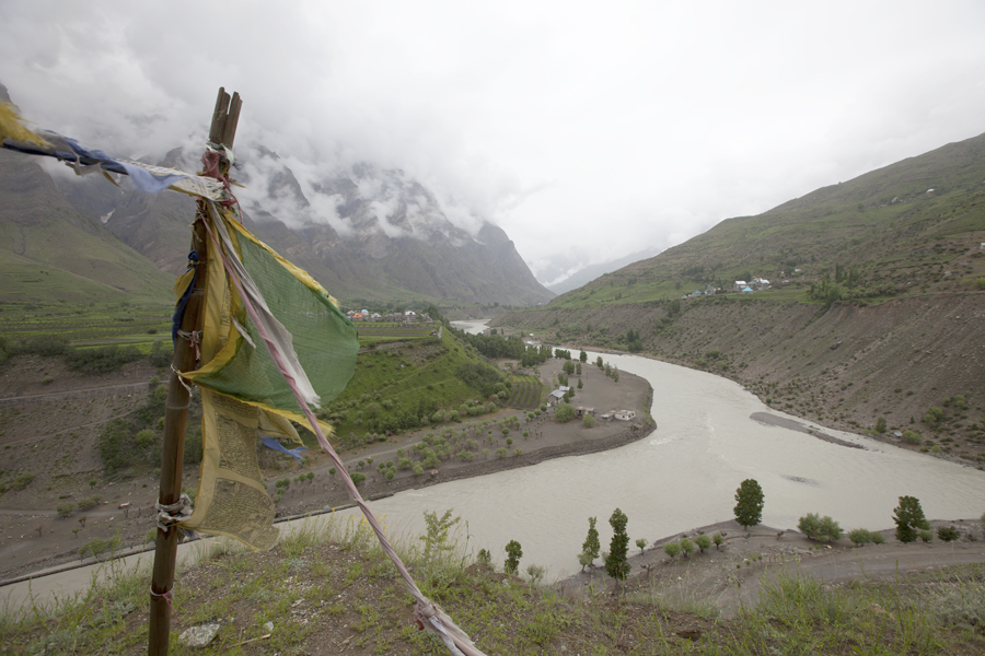
For centuries, Tibetan Buddhists have tied these flags at places of spiritual importance for the wind to carry the divine vibrations across the countryside. Prayer flags are said to bring happiness, long life and prosperity.
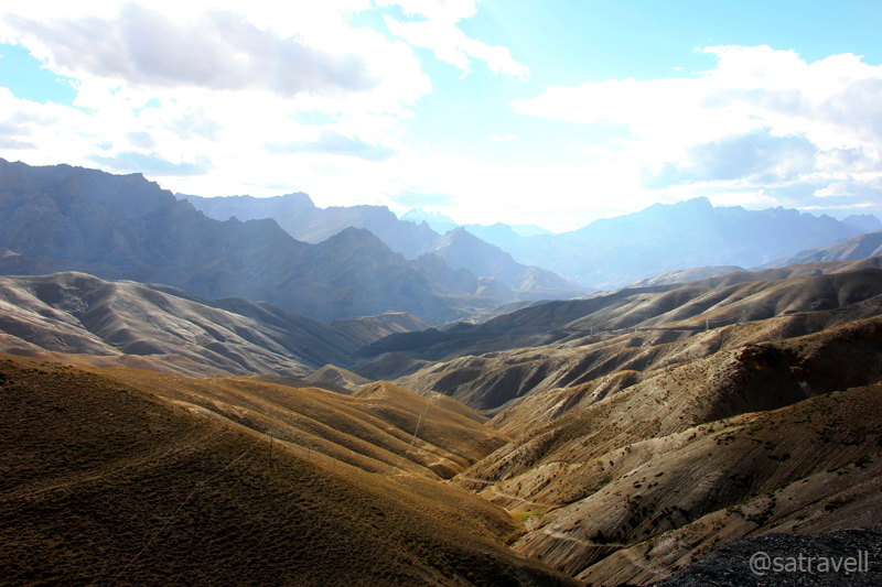
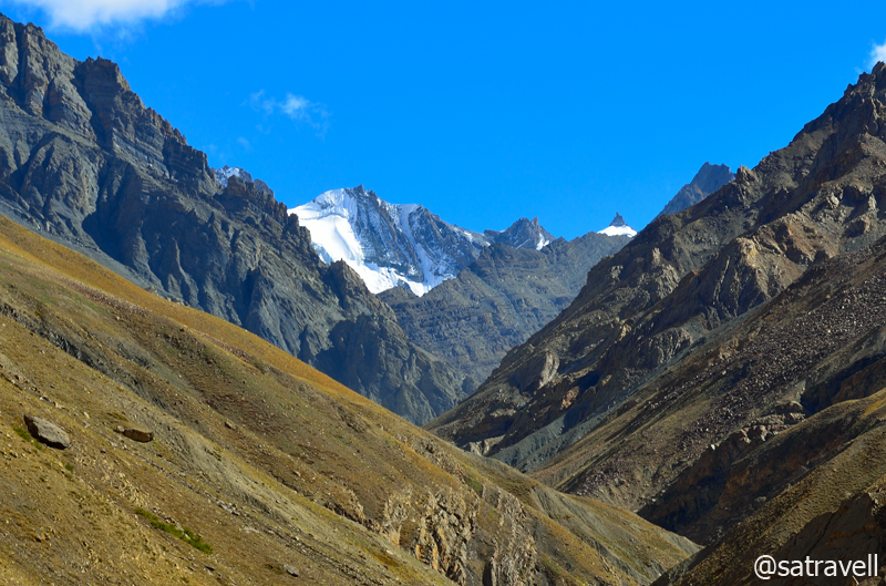
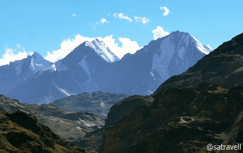
The following morning, we were again on the Treaty Road after crossing the Indus at Saspol. From the Alchi bridge the neatly tarmacked NH 1D is a fanciful drive passing through multi-coloured rock-debris slopes alongside the green-blue Indus River. Crossing Wuleh and Akheur nalahs to reach village Nurla (3019m), the highway is alertly secured by the constant Army movements. Set besides a roaring Dangdong Tokpo, the eateries of the village are a good place to relax and munch on to stuff for the day’s adventure ahead. The village is also a road-head for the popular Likir – Tamesgan trek, an erstwhile trading route.
Landscape near village Nurla on The Treaty Road. For more pics and info on the region, please visit Flickr Photoset

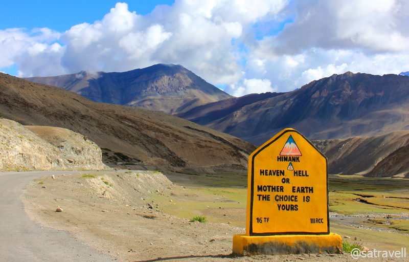
An important landmark at the forked junction at village Khaltse on The Treaty Road
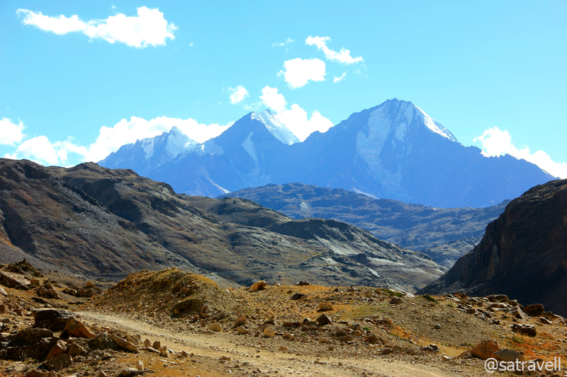
Ahead the road meanders on the same bank to reach the forked junction of village Khaltse (3088m). Marked by old houses, chorten at the roads-junction, a police check post, the historical village houses many ancient rock-carvings as well as inscriptions dating back to first or second century. Crossing Khaltse, we enter a region where influence of Buddhism begins to fade away giving way to Islam.
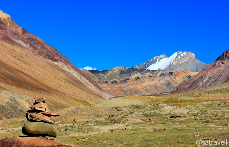
Famed moonscape, comprising alkaline soil, of Lamayuru. For more pics of the region, please visit Flickr Photoset
The right-hand road leads to Dah-Hanu, a little-visited area of Dards that requires Inner Line Permit for foreigners. The left one meanders through a small boulder – strewn valley before partying ways with the Indus, which heads off for Pakistan (POK). The NH 1D turns alongside the Wanlah River when the popular Jalebi bends also called Hangro Loops comes into view high above on the mountainside. From the diversion ahead, the bear left passes through the fabulous characteristic sandstone moonscape, which Lamayuru (3540m) is famous for, and reaches the village tea shops. The right turn, the original as well as longer route to Lamayuru, climbs over a series of 23 bends through an extraordinary landscape of a mountain-face of buttery-yellow sandstone whittled by the elements into vortexes and mounds, rivulets and caverns.

Today’s Lamayuru Gompa belongs to the Drigung-Kargyudpa, a red-hat sect. More of Lamayuru at Flickr Photoset
Founded in eleventh century, the Lamayuru Gompa – splendidly perched upon a hilltop – gazes down the village spread out on the slope around the highway. The entry ticket for the monastery was priced at Rs20 for domestic visitors. “May all sentient beings are quells of obstacles and fulfils all the desires and happiness”, read the message on the printed-ticket. Claimed to be one of Ladakh’s oldest religious sites, Lamayuru is also known as Yung Drung (meaning swastika) and was a centre for the pre-Tibetan-Buddhist animist Bon faith.

Lunarscape from the terrace of the Gompa. More of Lamayuru and the region at Flickr Photoset

In the courtyard of Lamayuru. More pics and info on the region at Flickr Photoset of Ladakh

Inside the cave which the Naropa (1016 – 1100) used as his place of meditation. More at Flickr Photoset
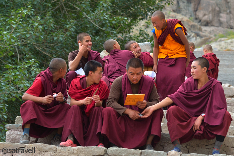
It was still an early afternoon when the ferocity of the chilly wind made it tough for us to remain outside and roam around the area. Nevertheless we spent some useful time around the monastery area as well as olden chortens. From the windows of the monastery, the moonscape appeared like a human brain (eeek!). Interconnected with a footpath, a few guesthouses, homestays and restaurants are interspersed within the village that suits different pockets. From the village, a mule trek leads to Padum in Zanskar and takes approximate ten days to cover the distance.

Lamayuru Village
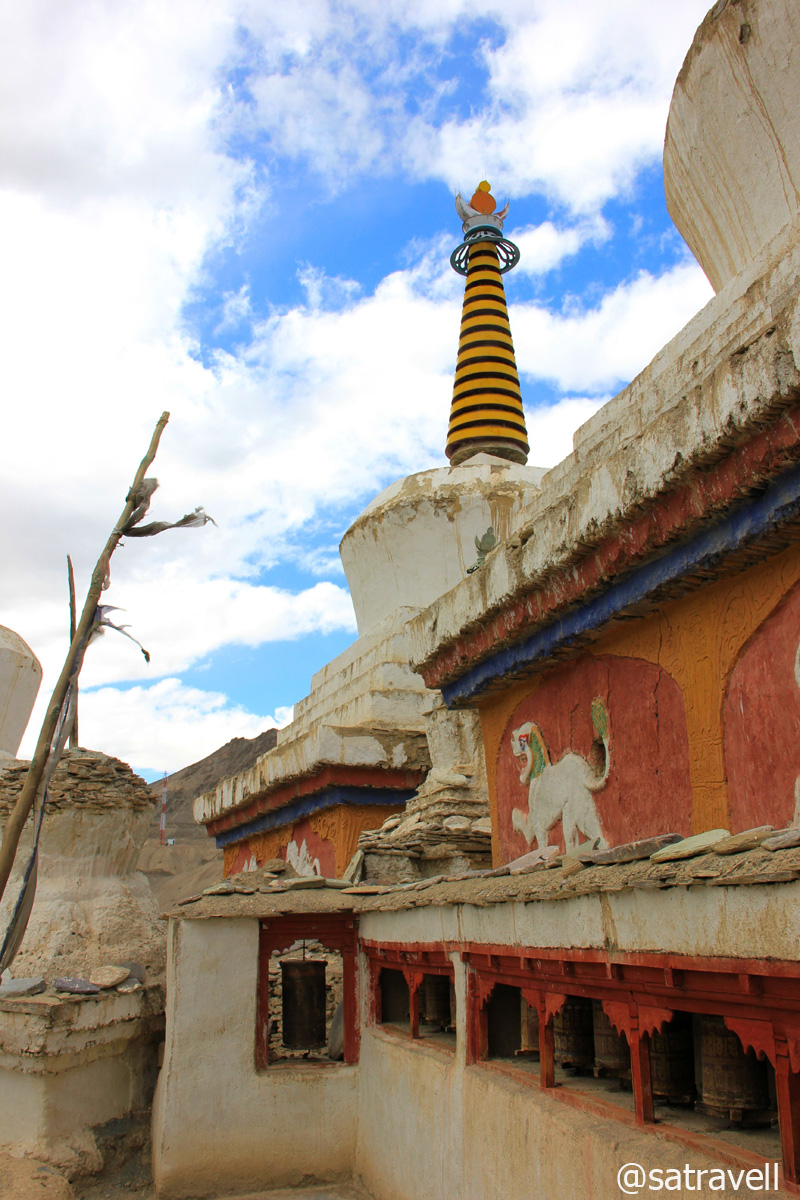
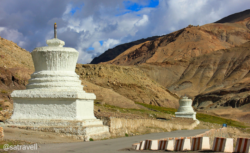
Ancient chortens and prayer wheels at Lamayuru

View towards Fotu La from the terrace of the Monastery. More from the region at Flickr Photoset

View towards Lamayuru captured en-route to Fotu La
From Lamayuru, the spectacular 15km ascent to the highest point of The Treaty Road, the Fotu La (4108m) coils up through a barren terrain of plump mountains and rocky outgrowths. Both Lamayuru and pass are visible in opposite directions from the neatly tarred highway. Atop the pass, there is a Prasar Bharati television relay station as well as fluttering prayer flags tied from the BRO board. The ranges observable from the pass on both sides are the forerunners of the Zanskar Range.
Southwards view from the Pass. More of the region at Flickr Photoset of Ladakh
Bearing witness to numerous clashes between Baltis and Ladakhis, the Northwards view from Fotu La. Visit Flickr
The highway on the other side leads past a beautiful gorge into the cultivated valley of the Kanji River or Sangeluma Chu. The 38km stretch of the NH 1D between the Fotu La and the Namika La passes through the village Hiniskut (3654m), Bodh Kharbu (3458m) and Khangral (3489m) alongside the Kanji. Apart from the views, the ruins of an ancient fort spread over a cliff while descending the pass are worth noticing.

Not to be missed, the motivating BRO signboards. More of the region at Flickr Photoset
Reflective of cultural transition, all through this valley the differing faces point towards divergent ethnic groups including the slender, bearded, hazel-eyed Kashmiris and the shorter, broader cheek-boned Ladakhis. The all-in-one expression Jullay feels unexpectedly out of place and it is around here when Islam starts gaining an upper hand in terms of follower-count. Not only that even the architecture point towards the same as most homes are bare instead of whitewashed mud brick and Urdu is often noticed scribbled on walls. Often misleading, the road-signs are a luxury to source information from. Don’t be surprised if you get chased by children asking for toffee or pens.

Landscape near village Bodh Kharbu in the Kanji Valley. More information of the region at Flickr Photoset
Literally meaning Pillar of the Sky Pass, the Namika La (3828m) lies at a distance of 10km from Khangral past the police check post. Although, the potholed stretch near the top posed some minor troubles, the climb was as serene as the drive through the valley. Noticeable from the top, the landscape all around comprises smooth-edged plump hills marked by rivulet-linings as well as a random mild coat of vegetation contrasted by the jagged peaks and spires of the Zanskar Range immediately behind. Moving ahead, the descent into the Wakha Valley was a smooth affair as the neatly tarred highway snaked on the slopes of rippling sub-ranges.
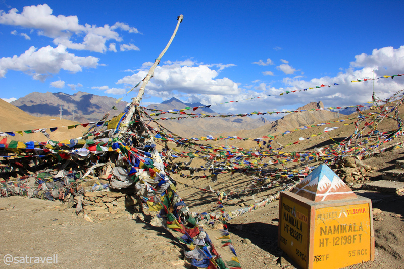
Fluttering prayer flags atop the 3828 m Namika La. For more pics and info of the region, please visit Flickr Photoset
Descending into the Wakha Valley from Namika La; notice Zanskar outliers. For more pics, please visit Flickr
Descending the pass, we reached the tail-end of the Buddhism on the road to Kashmir valley from Leh. Famous for its eighth-century rock-carved Maitreya Buddha, the historical village Mulbekh (3304m), 16km from the top, marks the cultural boundary after which the Islam is the predominant religion. The ancient rock – carved Buddha is located alongside the highway marked by poplar greenery and tea shops, restaurants and guesthouses. Reached by a steep footpath 200m up from the highway are the twin-gompas – Serdung of the Drugpa Kargyud order and Gadentse of the Gelugpa order; both situated in the Palace compound of the erstwhile rulers of Mulbekh.
The view from the monastery comprises the Wakha River zigzagging through the fields against a backdrop of russet mountains crowned by rock-structures. The village houses are located a few metre ahead of the statue. However, in the recent times, Mulbekh has gained popularity for its Maitreya Buddha, rock-carved in the pre-Tibetan Buddhist style prevalent in the region during those times.

The Maitreya Buddha at Mulbekh

Coming from Leh, Mulbekh also serves as the tail-end of Buddhism on The Treaty Road. More at Flickr Photoset
Ahead, the 40 km stretch of the highway descends alongside the pretty vegetation-rich narrowing Wakha valley to reach the main-market of Kargil (2728m) past the village Shargole, Pashkum (2903m), voluminous army encampments as well as crossing Suru River. Located 5km ahead of Mulbekh, a small but ancient Gelugpa-monastery – Shargole is visible from the highway itself. Tucked in an alkaline-sedimentary mountain-face, the monastery houses some interesting frescoes, an icon of Avalokiteswara as well as three images of Tara. The cantilever architectural quirk makes it an object of curiosity among natives too.

The Monastery of Shargole. More at Flickr Photoset
The mountains rising 10 km to the North, as the crow flies, also known as Kargil Heights are the site of the 1999 Kargil War with Pakistan. While the people on streets talked of Islam, the surroundings and the mountains boasted of a Buddhist background. It took some effort to fix an accommodation for the night as most of the available options either appeared fishy or were overpriced. Immediately after checking into a hotel, which exceeded our budget, I headed out to explore the market. Marked by a huge military presence, crowded streets, women with headscarves walking in groups and fumes emitted by vehicles amidst minaret’s muezzin-call, the market comprises tea, bakery, kiryana, meat, vegetable, fake-electronics shops, etc. manned by owners sitting cross-legged and watching the world go past. Even though Kargil is the region’s second-largest settlement, it is clearly far poorer than Leh and offers very limited and most basic tourism facilities. The state-owned Jammu & Kashmir Tourism Development Corporation (JKTDC) is often a shoddy affair giving out signs of distrust.

The second-largest settlement of Ladakh region: Kargil. More of the region at Flickr Photoset
After dinner, I headed towards the market to enquire about the status of the route ahead to our next destination – Padum, the headquarters of Zanskar Valley. With only a trekking map in hand and lacking any catalogued tourist/ traveller-information, taxi-stand, I thought, would be the best source to procure information. As I began chatting with a mature-looking taxi-guy, a few taxi-union guys instantly popped up and surrounded me. Each had his own opinion to present. A hired-taxi would charge almost Rs 11,000 for a return trip from Padum. A few suggested me to carry a minimum of 30L extra fuel for a rounded trip to Padum, as the only fuel-station in the area was in Kargil. Connected with an unmetalled and rocky motorway, the distance between the two stations is 237km. Some of them advised not to go in an Innova, because of its low ground clearance, and hire some other vehicle instead. As per the Union’s directive, a Leh taxi is not allowed to venture into Zanskar valley and similarly a Kargil taxi is not allowed to roam into the areas beyond Leh. I patiently listened to what they had to say and analysed each of the viewpoints later on before going to bed. Up there, factors like road conditions, distance as well as time depend on whom you talk to and the only way to find out is to go and physically examine.
The modern and military township of Kargil. More pics and info of the region at Flickr Photoset
Likewise, it is quite likely that at some point in the trans-Himalayan region, you may come across rumours related to landslides, washed-out bridges, closure of the road ahead, etc. Similarly, you may bump into teams blasting the mountainside to carve or widen the road. Such team-members usually carry a red or white piece of cloth tied on a stick to communicate across a distance. Always make it a point to double-check and get reassured before believing in them. Unskilled as they are, somebody might just be waving a wrong coloured flag.
In the meantime, the cousin carried on with his routine affairs in the room. Excited as we were about the next day’s journey through the copper land, sleep was hard to come. The room here was equipped with a TV and by way of news we did not miss the opportunity to catch up with the world that seemed even more materialistic and greedy.
View and read more on the area at the Ladakh Region Photoset on Flickr
You may also like to subscribe to the email updates, of the remaining chapters, by entering your email id in the sidebar.
The oldest surviving Monastery of Ladakh
The following is a page entry from On Road through the trans-Himalayan Region. To read complete travel memoirs and trip report, please visit here.
Chapter 13 of 22
…Returning from the market, we almost got lost in the narrow lanes in trying to retrace the path to Dorje’s home. The remainder of the late-evening was well utilised in dining and whining with Dorje, his family as well as Pullu, his pet cat…

The Namgyal Tsemo Fort against the backdrop of the imposing Stok Range. More pics of the region at Flickr

The 13.7m high statue of Maitreya Buddha
At breakfast the following day, I was astounded to notice the butter-shift in even the butter tea, chief constituent of their daily routine. Continuing our discussions from the previous night, we lounged in the traditional multipurpose-room of Dorje’s home and consumed rich home-cooked breakfast.

With Dorje at his home in Yurtung, Leh. More from the region at Ladakh Photoset Flickr
Although included in the original itinerary, explorations in the nearby regions including Nubra, Shyok, Rupshu, Chushul, Changthang, etc. were now identified for next visit. For now, keeping Zanskar in mind, we left Dorje’s place and headed to the main market to enquire about the route status ahead as well as visit another bookshop. In the meantime, the cousin got himself in action to recharge the supplies and also got a few doughnuts packed for the journey ahead.

Green Leh; interspersed with Poplars and Willows. More pics and info from the region at Flickr Photoset
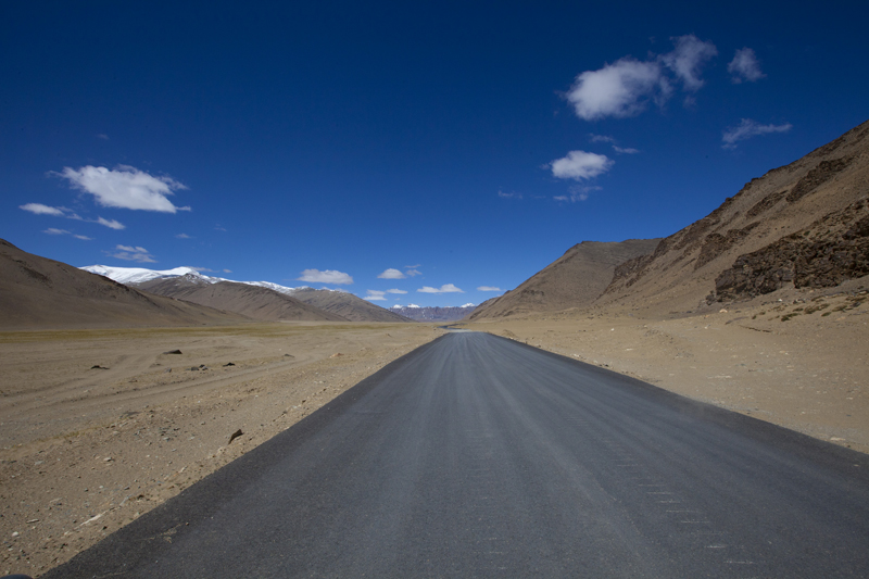
Having got the fuel-tank topped up, we left for the next stage of the journey on National Highway 1D. Not surprising though, the fuel costs marginally more in Leh than fuel stations located elsewhere in Jammu & Kashmir. The neatly tarred road to Kargil passes through stunning landscape of glacial rivers, barren mountainsides and ancient gompas. From time immemorial the pathway connecting Srinagar with Leh used to be among the most favoured trading routes to Central Asia. After 1870 when the British and Maharaja of Kashmir signed a treaty to make the road free of taxes for commercial movement, the road came to be known as The Treaty Road.
Leaving Leh; Greenscape towards Choglamsar. More pics and info of the region at Flickr Photoset
The Srinagar-Leh highway now offers a major military connect with the most troublesome of areas in the country and is rechristened as National Highway No. 1D by the National Highway Authority of India (NHAI). Similar to the Khab – Sumdo and Rohtang – Leh stretches, the current highway is maintained by the BRO. Whereas, the Rohtang – Leh stretches comes under project Himank, the Leh – Zoji La comes under project Vijayak of the BRO. Jammu to Zoji La, the highway is maintained under project Beacon of the BRO.
Immediately after we left the fuel station, the highway crossed the airstrip and the Hall of Fame on its left. The war museum of Leh, popularly known as Hall of Fame is an absorbing place which exhibits the effort and sacrifice of the Indian Army in various wars against Pakistan. The items on display include photos of Indian soldiers who sacrificed their lives, miniatures of war terrains, archives of war documents, battle gear seized from enemies as well as a section dedicated to the Siachen battlefield.
A little ahead of the war museum, a narrow bumpy road branched – off the main highway to reach the Spituk Monastery (3284m) perched on top of a hillock. Founded in eleventh century as a red – hat institution (Drukpa sect), the monastery was taken over by the yellow – hat sect (Gelugpa) in the fifteenth century.

The 11th century Spituk Monastery. More pics and info of the region at Flickr Photoset
The initial section of the NH 1D snakes through some real dry terrain along the right bank of the Indus splitting the Stok Range on its left and Ladakh Range on its right. On the way crossing another diversion to village Phyang as well as the Gurudwara Pathar Sahib and the fancy called Magnetic Hill, the highway sharply curves above the confluence of the Indus and the Zanskar river short-way before the village Nimmu (3190m). Marked by a BRO-board, the Magnetic Hill stretch is famed to possess extra gravity and is known to pull vehicles towards it. It was hard for the cousin to digest the actual reason behind it; the layout of the terrain creates an optical-illusion that what appears to be an uphill slope is in reality the very opposite. Having crossed the Umleh and Nimu nalas ahead of the bend, the peculiarity of various hues of grey and purple on the mountain edges as well as the settlement of Nimmu, surrounded by fields of barley, alfalfa and poplars, appears as splashes of green in the middle of barren landscape.

Magnetic Hill; an optical-illusion that what appears to be an uphill slope is in reality the very opposite

Village Nimmu with splashes of green in the middle of barren landscape. More pics of the region at Flickr Photoset
Thereafter, the road slightly climbs over the next few kilometre to reach a historical, political as well as cultural centre of the region, village Basgo (3210m). The village now houses the Basgo Monastery and historical ruins of the Fort, currently under renovation. Basgo was the capital of Ladakh from 1445 to 1650 and although there isn’t much to locate from the ruins but the temples and the superb landscape. Having crossed the Bazgo Tokpo, the highway steeply climbs taking hairpins to reach the top of an alluvial flat terrain – Ronga La – at 3571m.

Fort ruins and the monastery at Basgo
The settlement of village Basgo surrounded by barley fields, alfalfa and poplars. More pics of the region at Flickr
As the highway begins to drop off the plateau, the turnoff to Likir (3630m) village and gompa comes into view. Part of the ancient trade route, Likir is today famous for its eleventh-century Gelugpa Gompa housing a 25ft Buddha statue. After the diversion, the highway slopes downhill into a grassy valley all the way to village Saspol (3151m) crossing Likir Tokpo on the way. The village presents a few decent-looking guesthouses, gompa, meditation caves as well as a State Bank of India branch. After crossing the Saspol nalah, we took the narrow diversion to the ancient village Alchi (3170m) located a few kilometres on the other side of the Indus.

The monastic caves and temple-ruins of Saspol. More pics of the region at Flickr Photoset of Ladakh
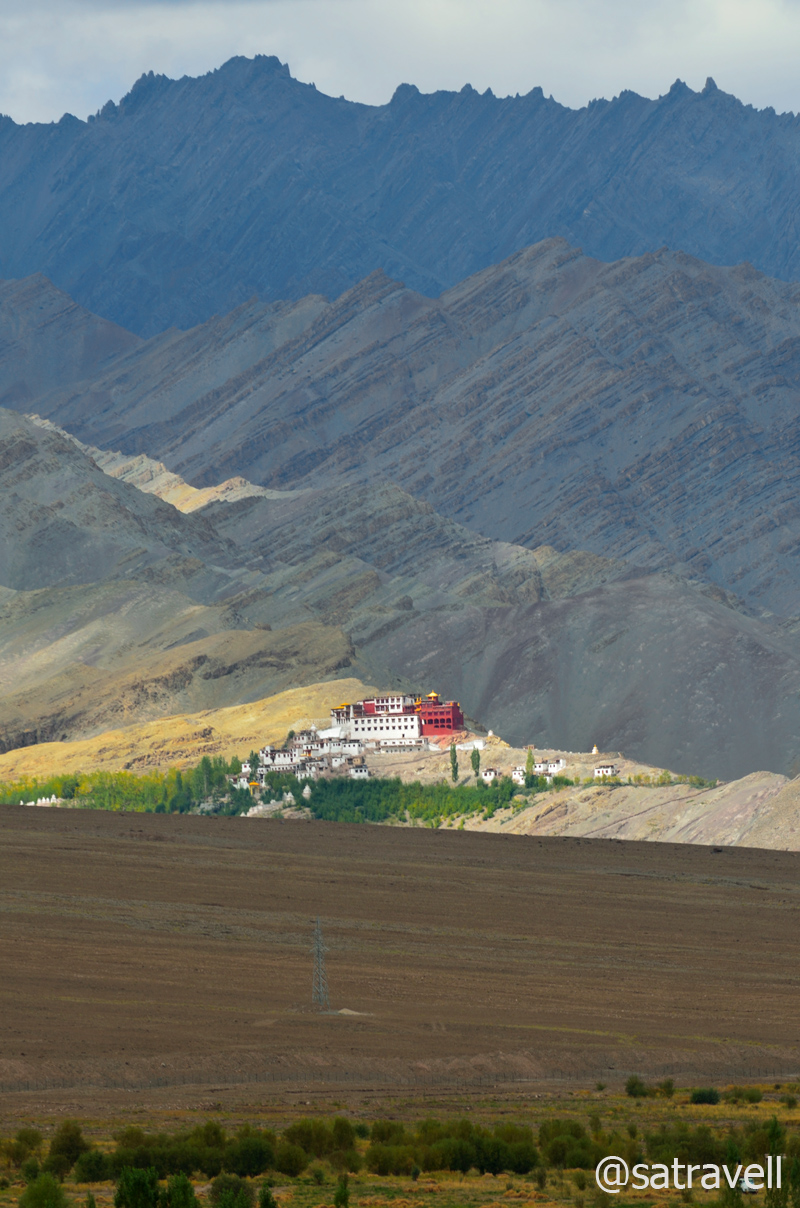
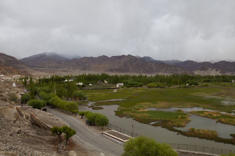
Spread on the bottom of the Zanskar Range, by the left bank of the Indus, overlooking the Ladakh Range, the historical Alchi monastery complex comprises four distinct settlements in the village. Of the four hamlets dated to different periods, the tenth – century Alchi monastery is said to be the oldest and is among the most famous. Like other monasteries of the region, Alchi too followed the most common code of architecture – Indian Buddhism – prevalent at that time in the region. The interior is divided into several halls meant for different purposes including prayer, dwelling cells, library and a courtyard where dances or other ceremonies are performed. Of these, the Dukhang, the main prayer hall is more capacious. Housing 1000 years old thangkas and frescos, the entry to the complex is priced at Rs 20.

Ancient roofed chortens inside the Alchi complex
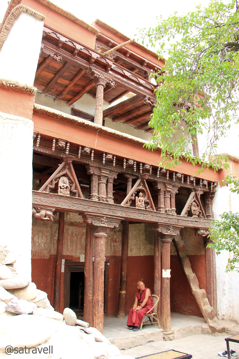
A monk guarding the Sumtseg
The Alchi Monastery complex
Alchi is the only remaining significant evidence in Ladakh representing the spread of early Indian Buddhism. The stunningly beautiful murals of the Gompa, predating the Tibetan style, are of extremely great historical as well as artistic importance. Not much could ascertained about the sequence of events from the available evidence in the entire region. Why and when Alchi was abandoned is not really known but it is quite remarkable that such treasures remained cutoff and unknown to the outside world including tourists till about five decades back.

The settlement of the village and a part of the ancient Alchi Monastery (photography was prohibited inside the complex). More pics and information about the region at a dedicated Flickr Photoset
The village offers a few excellent guesthouses, heritage-homestays, restaurants, cafés, shops and even a small beach on the Indus, located just beneath the monastery. This certainly was the place where we preferred to call a halt to spend the night. Past the green fields a few kilometres ahead, the authorities are in the process of constructing a hydropower generation plant. Intoxicated with happiness and yearning, the remaining part of the day was spent along the icy waters of the mighty Indus.

Om Mane Padme Hum
View and read more on the area at the Ladakh Region Photoset on Flickr
You may also like to subscribe to the email updates, of the remaining chapters, by entering your email id in the sidebar.
Jullay! Junction of ancient highroads
The following is a page entry from On Road through the trans-Himalayan Region. To read complete travel memoirs and trip report, please visit here.
Chapter 12 of 22

Landscape captured near Hemis flats. Please visit Flickr Photoset for more pics and info on the region
…Past the bridge, the road rises and falls along the right bank of the Indus to reach villageKaru (3450m), primarily a military settlement now. At a roundabout after the military station, the right one goes to the Taktok Gompa, Wari La as well as Pangong Tso and the straight towards Leh. We took the left one to cross the Indus and climb up to the Hemis Monastery (3778m) located at a distance of seven km from the bridge…
Intriguing mountainface resembling Lord Ganesha
सर्व धर्म समभाव More at Flickr Photoset
Situated in the lap of the Masho Mountains and overlooking the Ladakh Range – the largest monastic institution of Ladakh, the Hemis Monastery, has more than 200 branches in the Himalayas and more than 1000 monks under its tutelage. Re-established in 1630, the historic Monastery, belonging to the Drukpa Lineage houses some of the most invaluable cultural as well as religious artefacts including images, scriptures, etc. The entry ticket for the monastery-cum-museum was priced at Rs 50. It may, however, appear a little strange to pay for entering a temple but the claimed-fact is that every bit of the money thus collected funds the welfare of monks and the monastery. The Hemis also happens to be the most famous monastery of Ladakh mostly because unlike most other Gompas that hold their annual festivals in winter, the yearly festival of Hemis is held in summers, a peaking tourist season. Having spent a little more than couple of hours at the monastery, we got down, crossed the Indus again through the same pathway and headed towards Leh from the intersection at Karu.

Hemis Monastery is the largest, richest and most famous Gompa of Ladakh. More pics at Flickr Photoset
Young monks enjoying their routine-break inside the courtyard of Hemis. More of Hemis at Flickr
Just as Hemis, the Stakna Monastery is located on the left bank of the Indus on the 21 km road-stretch connecting Karu and Thikse (3450m). The Stakna Gompa belongs to the Drukpa lineage and is perched on top of a tiger-nose-shaped hillock surrounded by poplars and willows. Offering some pleasant options to stay, the iconic Thikse monastery is still a few convenient kilometer away (on the Manali – Leh highway).

The landscape and the highway ahead. More pics and info on the region at Flickr Photoset

Following the Drukpa order, the 17th century Stakna Gompa by the Indus River. More pics at Flickr
Belonging to the Gelugpa lineage, the 15th – century Thikse Gompa resembles the Potala Palace in Lhasa, Tibet and is among the largest gompas in central Ladakh. Typically perched on top of a hummock, the 12-storey complex houses a 15m high statue of Maitreya, future Buddha. Commanding a beautiful landscape from the terrace at 3590m, apart from humans other visitors to the monastery include Eurasian Magpies and House Sparrows. The Thikse Gompa houses over 100 resident lamas as well as maintain one of the biggest libraries of Ladakh.

Established in 15th century, the Thikse Gompa observes Gelugpa sect. More at Flickr
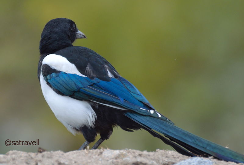
Locally called Katang-putit, the Eurasian Magpie is known to recognise humans. More birds at Flickr
The Stok Palace at 3420 m
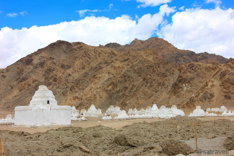
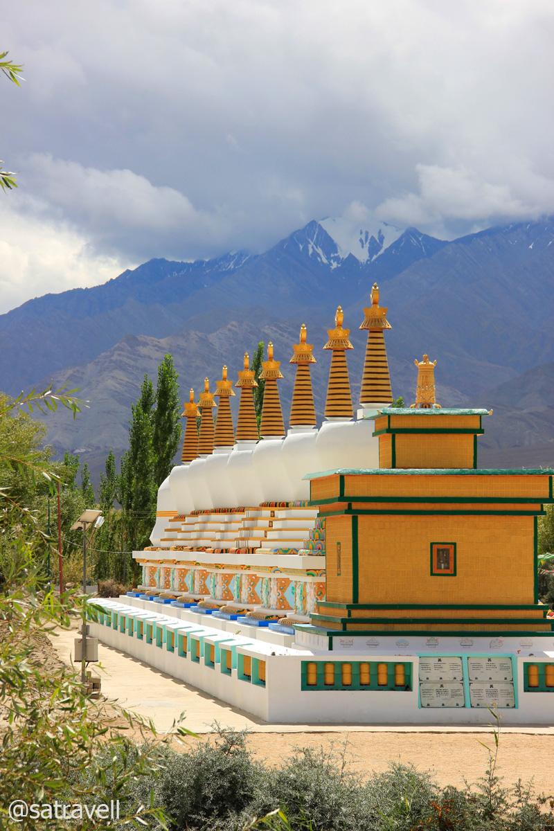
As Leh was just at a few minutes distance from the monastery, we covered the remaining distance quite leisurely. A little ahead on the same highway, after crossing the Stakna River, was our next halt Shey Palace and Monastery complex which was currently under renovation. The mid-seventeenth century palace complex was used as a summer retreat by the royal Namgyal family of Ladakh until the 1842-invasion of Ladakh by the Dogras when the family abandoned the complex and fled to Stok to set up a permanent residence there. The monastery is noted for its giant copper – gilded – gold statue of a seated Shakyamuni Buddha. Spread between the highway and mountain-face along the right bank of the Indus was the largest chorten-field of Ladakh comprising hundreds of whitewashed reliquaries of varying sizes scattered across the desert landscape. Just past the village is a huge eighth-century rock carving of Tathagata Buddhas. On the same bank by the highway is the venue for annual Sindhu Darshan Festival as well as the open amphitheatre. A brainchild of the then home minister, Sh LK Advani, the first edition of the festival was held in 1997 and with increasing popularity has been an annual affair since.
Ancient chortens belonging to different periods. More pics and info of the region at Flickr Photoset

The Shey Monastery compound situated on a spur of the Ladakh Range. More pics of the region at Flickr Photoset
Shey wetlands captured from the Gompa. Photo Sarabjit Lehal

The Shakyamuni Buddha inside the main assembly hall. Built in first half of the 17th century, by King Deldan Namgyal as funerary memorial of his father, King Sengge Namgyal. Photo and caption Sarabjit Lehal

Sariputra, one of the two chief disciples of Buddha Photo Sarabjit Lehal
Ahead the road crosses Sobu River and passes through the village Choglamsar (3235m), spot where maximum devastation had occurred during the 2010 Leh floods, and climbs to reach Leh (3557m) one of the most important junctions of ancient trading routes to reach Central Asia. On the dusty climb, just before Leh, lies the highest golf course in the world which is nothing more than a vast dusty bunker that often doubles up as a training ground for the defence forces.
A group of recently constructed chortens near the Sindhu Darshan Festival ground. More pics at Flickr
A few kilometres ahead is the main roundabout of the Leh town. The town offers umpteen options to shop, dine and stay. We headed straight to my old pal Dorje’s home-cum-guest house located in village Yurtung, now part of Leh town just like Sankhar and Changspa which are always abuzz with tourist activities including relaxing in street-side garden cafés, sauntering nearby the poplar-outlined barley fields, exploring the town’s ancient marvels or setting out to explore further afield.

Busy streets of Leh market. More pics and information on the region at Flickr Photoset
Being a perfect base to explore the region by way of trekking or bike rides, Leh is a busy tourist destination reaching its peak every summer. The Yak trains that once dotted the dusty lanes may have been replaced by army trucks or tourist jeeps but the headquarters of Ladakh will always be a fascinating destination. The souring relations with neighbours after the Sino – Indian 1962 war brought ever increasing military presence to the area. Ever since 1974 when Ladakh was declared open to foreign tourists, the economy of Ladakh has received a major cash boost that has transformed the cultural as well as occupational lives of residents of the area.

A colourful chorten built to ward-off the evil spirits of 2010 flash floods. More pics at Flickr Photoset
Intending to transit-halt at Leh, we had budgeted only a single day to visit the sites as well as market lying within close proximity of the town. The chief attractions within the vicinity of the town include Shanti Stupa, Leh Palace, War Museum, Chamba Temple, Jama Masjid, Gurdwara Pathar Sahib, Stok Palace, Victory Tower and Zorawar Fort, etc. Having grabbed a quick bite at a popular street café, we set out to visit some of the popular destinations which included Shanti Stupa, Leh Palace, Namgyal Tsemo Gompa and Fort, Jama Masjid and the local market.
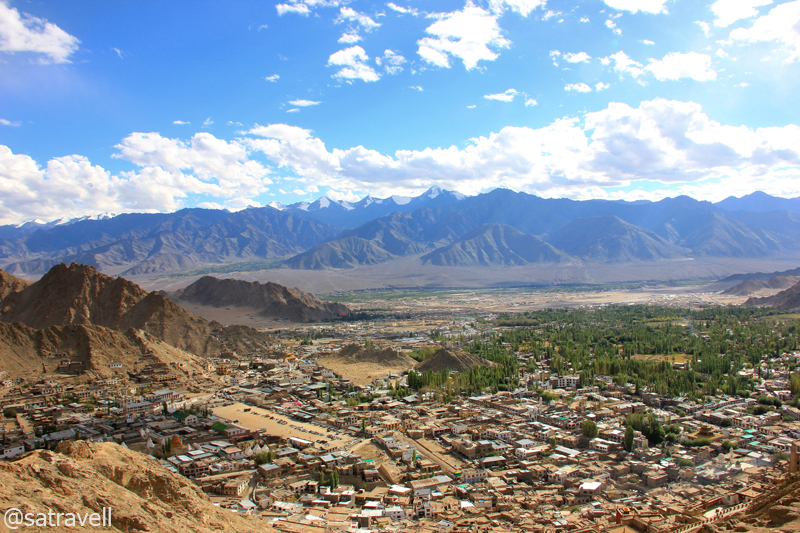
A panoramic view of Leh town with the Stok Range in the backdrop. More pics of the region at Flickr Photoset
Built in 1991 by a Japanese Buddhist on a hillock of village Chanspa, in the lap of Ladakh Range, the Shanti Stupa holds the relics of the Buddha at its base. Offering panoramic views of the entire landscape including the Stok Range and the Leh city, the white-domed Chorten could be reached by either taking 500 steps or the narrow road. Across a vast expanse of poplars in the city, the historical Leh Palace complex is spread on the facing Namgyal Hill.
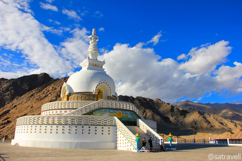
The Temple attached to the Shanti Stupa was inaugurated by His Holiness the Dalai Lama in 1985. More at Flickr
Perched on top of the Namgyal Hill overlooking the Leh city, the fifteenth-century Namgyal Tsemo Gompa or Leh gompa houses a 13.7m high gold-coloured statue of Maitreya Buddha as well as ancient manuscripts and frescoes. According to the Lamas, this splendid statue or Chamba, as locals call it, is the future Buddha. On the right of Chamba stands the statue of Avalokitesvara and on its left the statue of Manjushree. Part of the same complex, there is another monastery located at the foothill, below the Palace. On a mound of the same hill, marked by the fluttering prayer flags, stands the Victory Tower that was built to commemorate Ladakh’s victory over the Balti Kashmir armies in the early sixteenth-century.
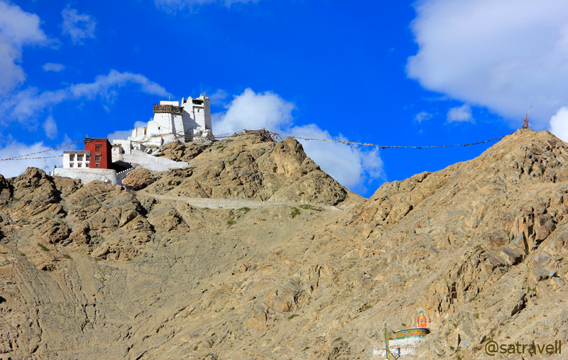
The Namgyal Tsemo Gompa, Fort and Victory Tower to the right. More pics of the region at Flickr Photoset
Situated a few metres below the Namgyal Tsemo Fort and occupying a major portion of the hill-slope is the nine-storeyed Leh Palace. Currently being renovated by the Archaeological Survey of India (ASI), the construction of the Palace was started in 1553AD by the royal Namgyal family of Ladakh. Often claimed to be the inspiration behind the design of Potala Palace, Lhasa (Tibet), the Leh Palace was once the uppermost building of the world. The complex was later abandoned in the mid-nineteenth century when Dogra armies took control of Ladakh. The main attraction of the Palace today is the museum that displays ancient collection of jewellery, ornaments, thangkas, ceremonial wears, crowns, old paintings, stones, etc.
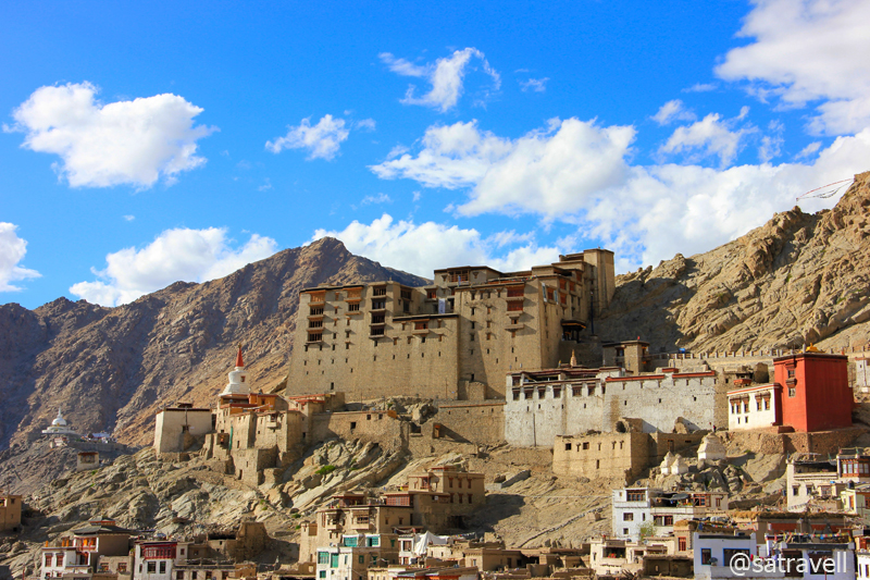
The renovated nine-storey Leh Palace built in mid 17th century overlooks the medieval old settlement of Leh. More pics and information at Flickr Photoset of Ladakh Region
Passing through the labyrinth of dusty streets in old Leh, immediately below the hill, we looked for the Jama Masjid which was in fact positioned just in the middle of the main market. The Jama Masjid of Leh can accommodate up to 500 worshippers at a time and most of its followers, Sunni Muslims, are located nearby the mosque area. The predominant religion of the town is Buddhism closely trailed by Islam. Only a marginal population follows Hinduism while just a handful follows Christianity.
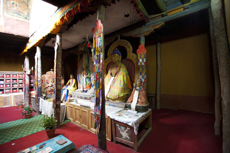
Inside the Leh Palace museum. Photo Sarabjit Lehal

Wall paintings inside the Leh Palace. Photo Sarabjit Lehal
Spread along both sides of lanes in the middle of the Leh city, the market is an assortment of shops selling products across all categories including books, pashmina shawls, baked foods, handicrafts, etc. Evenings see vegetable sellers descend to the streets from the nearby villages. Looking for an authentic map of Zanskar in a book shop, I bumped into Valmik Thapar who had just returned to the base from a popular trail.
Lost in the narrow sandy lanes of the old town are a few ancient rock carvings on slim stone steles (rdo-ring) that constitute an important evidence of the early Buddhist artistic heritage of Ladakh. We located one such rock-carved slab, recently-shifted, just next to the entrance of Lala’s Café near the Leh mosque. Now transformed into a gallery-cum-café, the old monastery complex Labrang in the old town offers budding artists and photographers a small platform to exhibit their works.
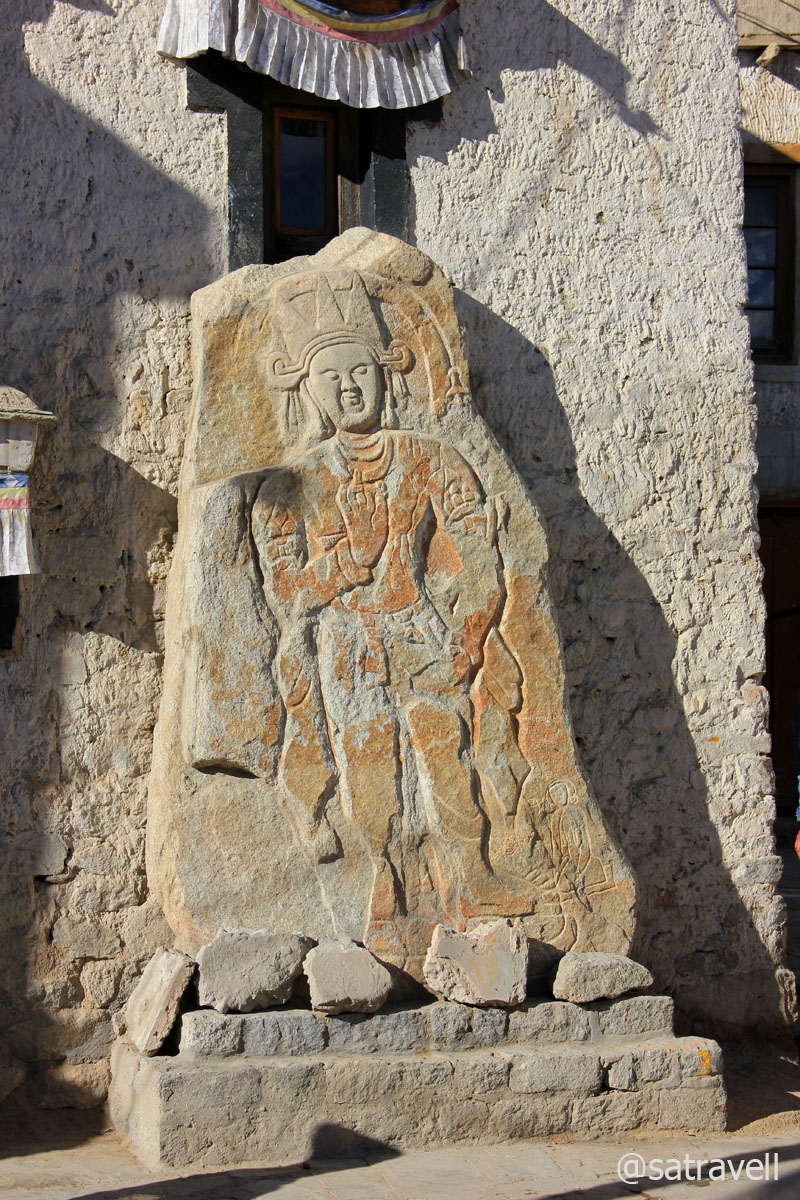
Ancient rock-carving on rdoring
Today, the old town reflects the confused transition of itself from the olden silk route days to tourism-driven sustenance achieved at the cost of customs as well as traditions across all categories. The Land of High-Mountain Passes, influenced by increasing tourism-traffic as well as opening up of more occupational-avenues, is undergoing continuous change pertaining to its rich traditional and cultural heritage. While a majority of the age old practices have lost their essence, a few of them, mostly related to religion, have withstood the test of time and remained intact.
The 17th century Leh Mosque; the Palace and Gompa are also visible in the frame. More pics of the region at Flickr
The acceptance of Amul butter instead of the traditionally preferred Yak-butter in kitchens worried even the management of the Dairy Cooperative from Gujarat. Initially attributed to smuggling out, the management had to commission a special team to the region to understand the reason behind ever-increasing demand of its pasteurised butter. With the passage of time, the traditional attires and peraks have become ceremonial objects. Chaang has been restricted to only the remote or isolated villages. I intend to delve more into this but a serious effort would require a closer interface with all accessible regions.
Returning from the market, we almost got lost in the narrow lanes in trying to retrace the path to Dorje’s home. The remainder of the late-evening was well utilised in dining and whining with Dorje, his family as well as Pullu, his pet cat.
View and read more on the area at the Ladakh Region Photoset on Flickr
You may also like to subscribe to the email updates, of the remaining chapters, by entering your email id in the sidebar.
Early morning on the rugged terrain
The following is a page entry from On Road through the trans-Himalayan Region. To read complete travel memoirs and trip report, please visit here.

Om Mane Padme Hum! Photo credit Sarabjit Lehal
Chapter 11 of 22
…At the crack of dawn at Pang, I stepped outside to attend nature’s call in the open at freezing point. The vehicle was covered with 3-4mm thick layer of soft ice and needed to be treated with some lukewarm water for it to liquefy. The cousin got the owner’s family to do the necessary morning chores for us including providing the lukewarm water, tea, supplies for the day as well as settlement of bills. Up here, the supplies are costlier by up to 20 per cent of the original price. Soon we were on the narrow ascending road, over a few switchbacks, to reach the Morei Plains…

Leaving Pang. Pk 5866 m Longlichi in sight. Captured later by Sarabjit Lehal
Ascending by the Sumakhel Lungpa. Captured later by Sarabjit Lehal
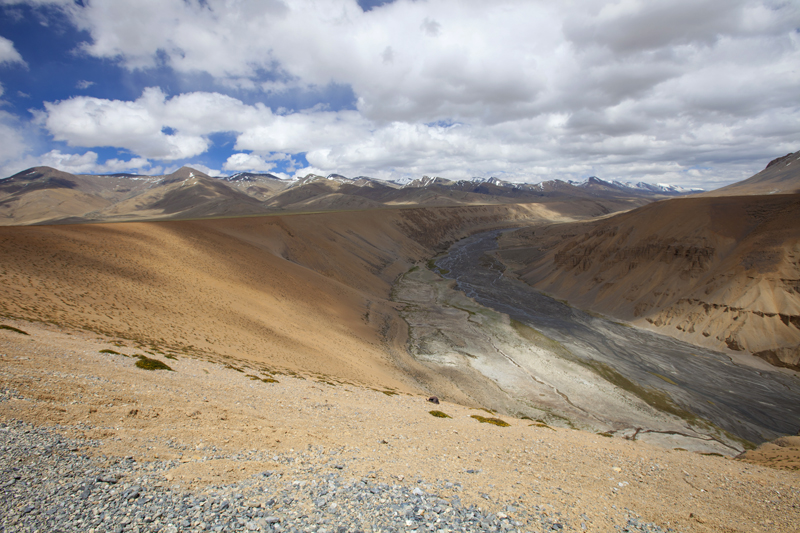
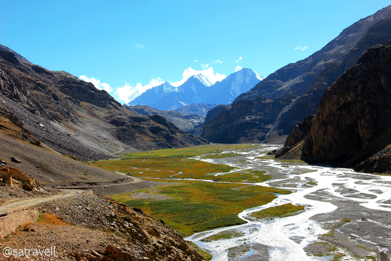
With an average elevation of 4500m, the Morei Plains (More, Moray, Mare) are a 40km plain-stretch, fringed by snow-capped mountains on both sides, which lay between Pang and the slopes of Tanglang La. Initially for a few kilometre (seven) the road wanders through a terrain by the Sumakhel Lungpa featuring some fabulous sand and rock formations. As the authorities are in the final stages of constructing a two-way road through this plateau-like terrain, travelling on the current pathway through the plains is no-longer an adventure it earlier used to be. Traversing the Moray Plains should not take long as the newly constructed road is on a flat terrain all the way till the final ascent to the Tanglang La begins. Tso Kar, one of the salt lakes of the trans-Himalayan region is at a distance of about seven km from the plains (take diversion towards right a little before Debring).
Early morning airbrushing. For more pics of the region, please visit Ladakh Region on Flickr

Daybreak at More Plains. For more pics, please visit bNomadic on Flickr
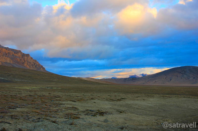
Spread between the slopes of Pang La (4800 m) and camping grounds by the Zara River at Debring, the uninhabited alluvial plateau is peppered with shrubbery often roamed by Larks, Ravens, Snow Pigeons, Kiangs and Marmots. Set at the western corner of the Changthang plateau, the Morei plains, part of the trading arteries of the ancient Silk Route, are frequently tramped by Changpa nomads. Others who venture in to the region include road workers (mostly from Bihar), road-construction engineers, trekkers, road-trippers, tourists and travellers. The drive through this stretch may seem monotonous but look for the nomadic settlements on this terrain.
Welcome to Moray Plains! Captured later by Sarabjit Lehal
The freshly tarred Manali-Leh Highway through Moray Plains. Photo-credit Sarabjit Lehal
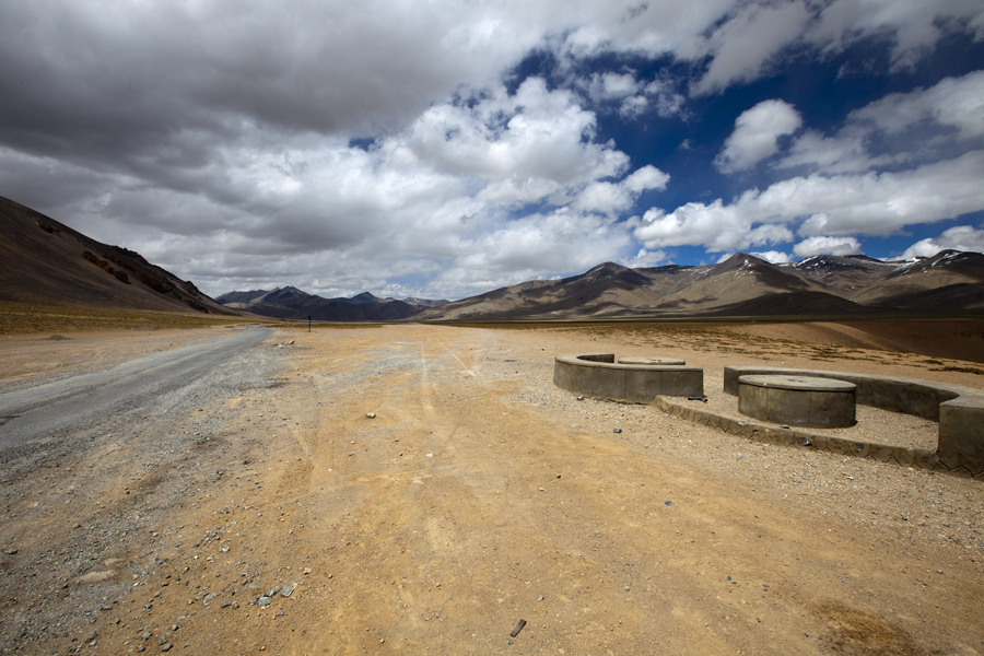
The encampments of PWD workers at Debring. The motorway to Tso Kar is to the left of the frame. Photo-credit: Sarabjit Lehal. For more pics of the region, please visit Flickr Photoset
The declaration of the region as a protected wildlife sanctuary (Rupshu) meant little human intervention and, therefore, rendered the Changpas totally homeless. Hailing from the Changthang plateau-region, the Changpas, along with their Yak-hair tents as well as Yaks are always on the move in search for greener pastures during summer. Raised in such a harsh climate, the goats of these nomads are well-known for their warm underbelly fur, also known as pashm, which is used in making the world-famous Pashmina wool or shawls, something which is often credited to Kashmir’s favour.

Final Climb, to the Tanlang La (visible in the frame), on the Manali-Leh begins. Photo-credit Sarabjit Lehal
Another rarity of the region is the critically endangered Chiru or Tibetan Antelope. Threatening the species’ survival, the antelope are killed for their fur which is woven to produce the luxury fabric Shahtoosh. Production of a fine shawl that could fetch up to USD 20,000 requires up to twenty skinned Chiru.

Spot the nomadic settlements as the climb begins. For more pics of the region, please visit Flickr Photoset
The aftereffect of the previous oxygen-less night was clearly showing. Still consuming water at regular short-intervals, we wanted to get down and reach a lower altitude at the earliest. In addition to that the cousin was feeling feverish. The very thought of last-night’s affairs gave us jitters.

The motorway to Tanglang La. Snow-capped Pk 5836m visible in the frame. Photo-credit Sarabjit Lehal

Moray Plains and snow-capped Zanskar Range from the slopes of Tanglang La. Photo-credit Sarabjit Lehal
Ahead of Debring, the gradual ascent to the pass on a tarred road is dominated by a landscape encompassing Zara village, grassy pasture-like area, Debring stream, Zanskar range as well as the Tso Kar to the southeast. The road condition deteriorated as we neared the top. Ascending the bumpy road we crossed several hutments of road workers who were yet to start their morning chores. The Tanglang La (5328m) is marked by a BRO board that read, “You are passing through second highest pass of the world. Unbelievable is not it?” We would, however, dissect this claim later.
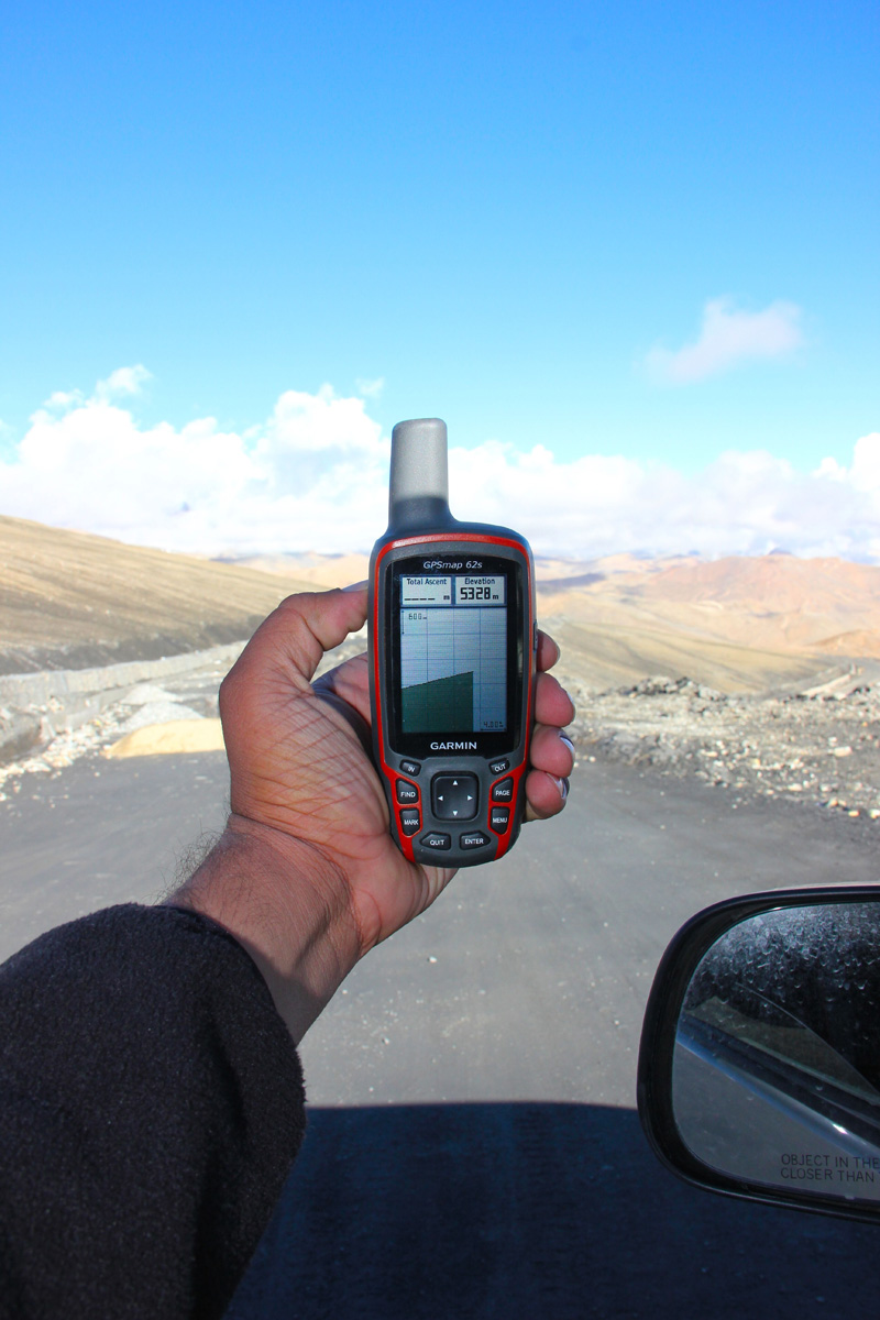
Atop the Tanglang La at 5328 m

Southwards view from Tanglang La comprising distantly visible Tso Kar. More from the region at Flickr
The weather at the summit often acts up but the views are fascinating. Northwards the splendid barren landscape of endless mountain ranges towards Karakoram rippling into distance was outstanding. Southwards the view encompassed the Morei plains edged by snow-capped mountains in the widening valley thronged by hundreds of sheep-flocks that appeared like tiny dots in a pastureland just below the pass.

The crest of the pass is typically marked by a Chorten and fluttering prayer flags. Photo Sarabjit Lehal

Northwards landscape from the Pass. Please visit Flickr Photoset for more pics of the region
Although, we were now at an altitude far higher than Pang, the AMS symptoms had withered away. We spent about half an hour at the top capturing myriad perspectives the moment had to offer. I spotted one eagle-sized crow near the flagged roundabout and a closer inspection revealed its actual identity; a Northern Raven, earlier a subspecies of a Common Raven.
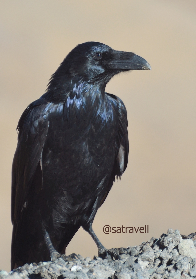
Locally called Phoro, a Northern Raven atop Tanglang La. More birds at Flickr Photoset
Approaching Rumtse. For more pics and info of the region, please visit Flickr Photoset
The descent to the other side of the pass in switchbacks was smooth as well as curvy. Offering the Manali-Leh menu outside the tents, the first settlement on this side of the pass was Rumtse (4230m). Past the Police Check Post, the road now narrows down and runs by the azure Gya River (formed after the confluence of Khyammar Lungpa and Ryam Lungpa a little before Rumtse), a tributary to the Indus River. Passing through the tiny white-washed villages of Sasoma (4172m) and Gya (4111m), we reached the small camping grounds, by the barley fields, of village Lato (4033m). On the way Polong Nakma, Kundanma Chu, Rabat and Shaglak streams join the Gya on its true left bank. Originally white-coloured, the ancient chortens in varied sizes dotted both sides of the road near villages.

The settlement of Rumtse. For more pics and info of the region, please visit Flickr Photoset
Between Sasoma and Gya. For more pics of the region, please visit Flickr Photoset
From Lato guesthouse the road constricts through a striking deep red-coloured as well as weather-beaten canyon battered with lots of captivating crannies and peaks beseeching to be explored. On the left bank of the blue Gya slicing the mountains, the narrow bumpy road passes through a terrain comprising various shades of greens and ready-to-be harvested barley. Passing through the village Miru (3720m), the road exits the multi-coloured gorge to reach village Upshi (3399m) located by the mighty Indus River at the junction of motorway to Tso Moriri as well as Leh.
An amusing BRO cautionary board in the red Gya Gorge ahead of Lato (or Late). More at Flickr Photoset
A colourful landscape in the intriguingly beautiful Gya Gorge. More pics of the region at Flickr Photoset

The settlement at the ancient village Upshi. For more pics of the region, please visit Flickr Photoset
Originating from the Lake Mansarovar, the 3180 km-long Indus River runs a course through the Ladakh, Gilgit, Baltistan and flows through Pakistan in a southerly direction to merge into the Arabian Sea near Karachi in Sindh. Positioned on its left bank is the roaming ground of the endangered Snow Leopard – Hemis National Park – the largest as well as highest national park of India.

The mighty Indus River near Upshi. More of the region at Flickr Photoset
Past the bridge, the road rises and falls along the right bank of the Indus to reach village Karu (3450m), primarily a military settlement now. At a roundabout after the military station, the right one goes to the Taktok Gompa, Wari La as well as Pangong Tso and the straight towards Leh. We took the left one to cross the Indus and climb up to the Hemis Monastery (3778m) located at a distance of seven km from the bridge.
View and read more on the region at the Ladakh Region on Flickr
You may also like to subscribe to the email updates, of the remaining chapters, by entering your email id in the sidebar.
The majestic Bara Shigri and night-drive by the Chandra River
The following is a page entry from On Road through the trans-Himalayas. To read complete travel memoirs and trip report, please visit here.

The 5148 m Gammo Peak in the Losar Valley
Chapter 9 of 22
The following morning, weather Gods clearly supported our plans. Having spent a week in Spiti, we were now geared up to enter the Lahaul Valley over the notorious Kunzum La (4595m), a godforsaken passage through rock, stream and strong wind. Registering ourselves at the Losar checkpost, without any precise idea of the condition of the road ahead, we started the ascent a little late in the morning. The soul-filling journey through the Spiti Valley beneath an ageless blue sky at a minimum 3000m altitude was finally coming to an end.
Six-thousanders in the Losar Valley. There are about fourteen peaks, above 5900 m, around the watershed of Suvita nalla. For more pics, please visit Flickr Photostream
Peak 5193 m in the Losar Valley

Leaving Losar

Peak 5255 m Shilatakar. Please visit Flickr Photoset for more pics of the region
The ascent through the ‘road-less’ narrow road full of dust warranted a final view of the Spiti valley. A little ahead of Losar, in the middle of the vast and sandy flats of Leh Thanga, three streams descending from Kunzum Range meet to form the Spiti River. The inexplicable and magnificent topography reminded of Nicholas Roerich’s shades of canvas portrayed in a gallery dedicated to him at Naggar, Manali. Sloping through a pasture-like country, the road narrowed down to climb steadily over hairpin turns and switchbacks over a glacial moraine terrain laden with shining slates all around.
Climbing the Kunzum La
By the infant Spiti River. For more pics of the region, please visit Flickr Photoset
Chandra-Bhaga group of peaks on the other side of the Kunzum La. Find out more on Flickr Photoset
To make it less prone to traffic obstructions, the authorities are in the process of constructing parallel roads on both the sides of the pass. Managed by the state administration (PWD), a blockade here may take days to clear unlike the Manali – Leh – Srinagar highway maintained by the Border Roads Organisation (BRO).
The State Highway No. 30; the slopes of the Kunzum La as well as the 4525 m Balhamo La in the shadow of CB peaks. For more pics of the region, please visit Lahaul & Spiti Photoset on Flickr

Lungba Tokpo. For more pics, please visit Flickr Photoset

A shrine dedicated to Shiva near the pass top. For more pics, visit Flickr Photoset
Colourful vistas from the pass. For more pics, please visit Flickr Photoset

View towards the Spiti Valley. For more pics of the region, please visit Flickr Photoset
Literally meaning a meeting place of Ibexes, the Kunzum La certainly deserves the distinction of being one of the most striking passes in the Himalayas. On clear weather days, the view, dominated by the Chandra Bhaga peaks, Batal as well as Karcha Valley, is worth every inch of the hike. Lodged between the Chandrabhaga group of peaks, the Dakka Glacier was the site at which the wreckage of India Air Force AN12 crash, in which more than 100 lives were lost, was recently discovered.

Mighty Kunzum La; wedged between CB peaks, the Dakka Glacier in the backdrop. Visit Flickr for more pics
From the pass, the view towards the Lahaul Valley encompassed lofty barren mountains, rocky massifs, hanging glaciers, numerous cwms and several six-thousand-ers soaring high above the Chandra River. The crest of the pass is marked by the fluttering colourful prayer flags, chortens and rhyming wind chimes as well as a small shrine dedicated to Kali Devi or Kunzum Devi. Just next to the shrine, a recently built foot track descends to the Chandrataal via the Balhamo La.

Wind-chimes did produce theatrical effect! Visit Flickr Photoset for more pics and peaks
Having performed the quora around the shrines, we spent some leisure time at the top. While I got myself to click the birds, the cousin occupied himself with his own usual stuff. Rambling around and facing what could really be the fiercest of winds, we spent a couple of hours at the top. Taking full advantage of a clear weather day, I tried capturing the vivid landscape highlighting the known natural formations and landmarks.
Locally called Rizit, a Horned Lark atop the pass. Please visit Flickr Photoset for more pics of the region
Downhill, the steep and scary road descends over 22 switchbacks to reach the junction for road to Chandertaal and Batal. For the current visit we decided to drop the idea of going to the Chandertaal and proceeded on to reach Batal (3950m), a settlement housing a few shops, dhabas and a PWD Rest House. Busy capturing the varied landscape and wildlife, we unhurriedly descended to reach Batal in about three hours. Downhill, we keenly anticipated the road-condition to improve after Batal, positioned at the base of the pass, in the arid landscape. To add to the horror, the condition of the road kept getting worse until we reached Gramphoo on the slopes of the fearsome Rohtang La.

The narrow motorway takes you to Chandartaal. Visit Flickr Photoset for more pics
Descending towards Batal in the Chandra Valley of Lahaul. Please visit Flickr Photoset for more pics
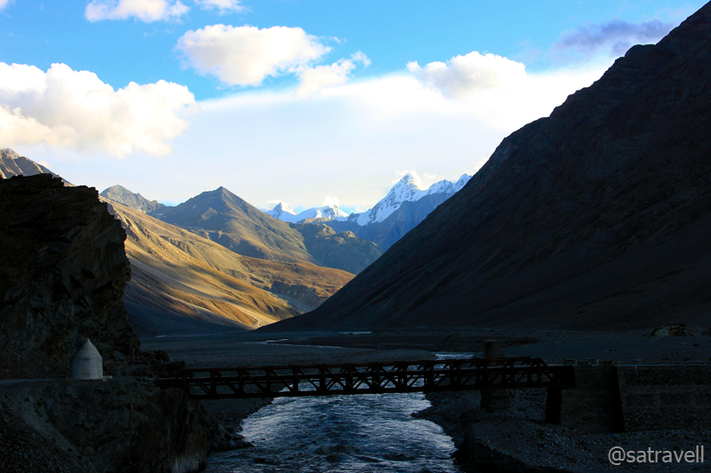
The bridge over River Chandra at Batal. Visit Flickr Photoset for more pics of the region
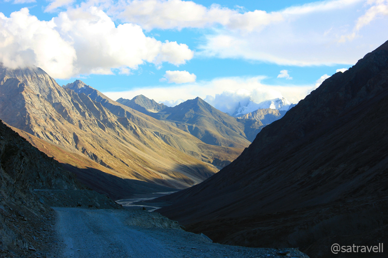
A little ahead of Batal towards Keylong on the left of energetic as well as voluminous Chandra River stood the magnificent Bara Shigri Glacier. More than 10 km in length and over a kilometre wide, the Bara Shigri is Himachal Pradesh‘s largest glacier. The other fascinating landmarks visible from the road includes Papsura (6451 m), Dharmasura (6446 m), Devachan, Lalana, Mahura, Pinnacle, Baldor, CB 13, 14, 16, 17 peaks, Sara Umga Glacier, Chota Shigri Glacier, etc. The entire road-length from here onward till Gramphoo is strewn with boulders on both sides.
Marking the junction between the monsoon-influenced southern edge of the Pir Panjal (Lesser Himalayas) and the Great Himalayan Range, Lahaul provides one of the best preservation evidence of glaciation within the western Himalayas. The dominant vegetation north of Pir Panjal is grassland which decreases in cover northwards making the upper Chandra and Bhaga valleys totally devoid of vegetation.
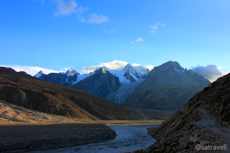
The Lower Bara Shigri Glacier and the narrow motorway. Visit Flickr Photoset for more pics and peaks

Dharamsura and Papsura above Lower Bara Shigri Glacier; also notice the motorway
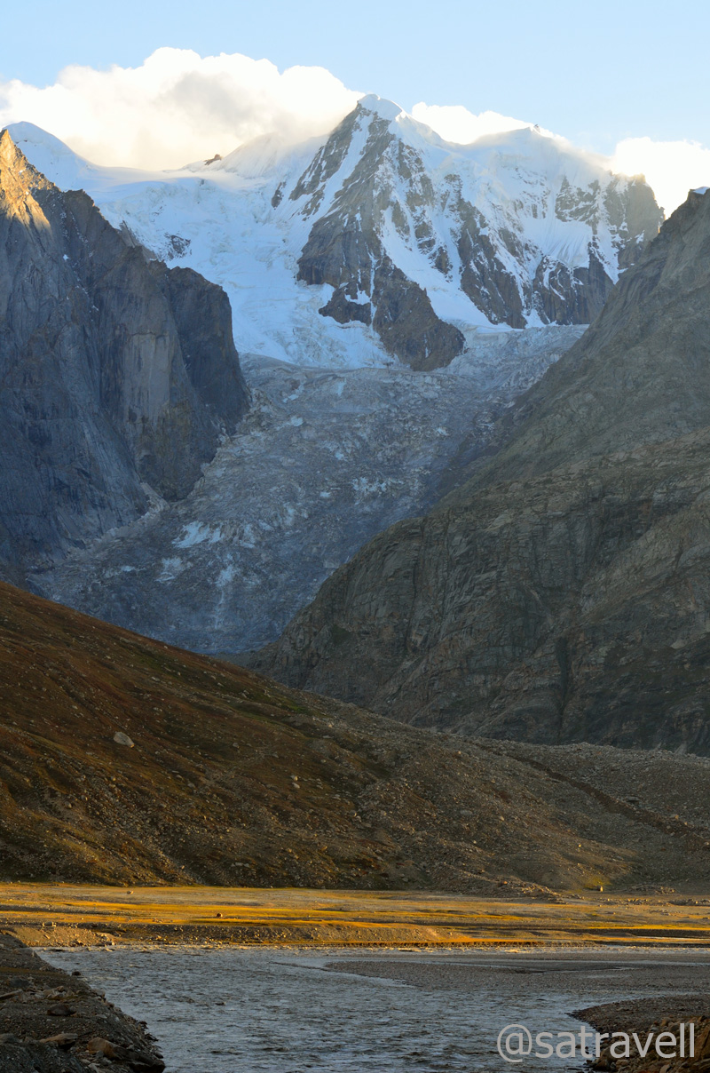
Lalana at 6265 m above Lower Bara Shigri Glacier
By the time we reached the forlorn huts that serve as the Chota Dhara PWD Rest House (3800m), the daylight started to weaken. It took us more than two hours to cover the 32km distance from Batal. Driving on the worst section of the road till now and eventually of the entire journey, for the first time I thought of a 4×4 fitted with larger-radius tyres. But the reliable Innova didn’t frustrate much. The only issue was its lower ground-clearance for which we had to be extra-cautious in saving the fuel tank, located underneath, from any damage by the stones. I’d often get down before negotiating a treacherous stretch and observe the terrain very carefully to safely guide the vehicle out of it.
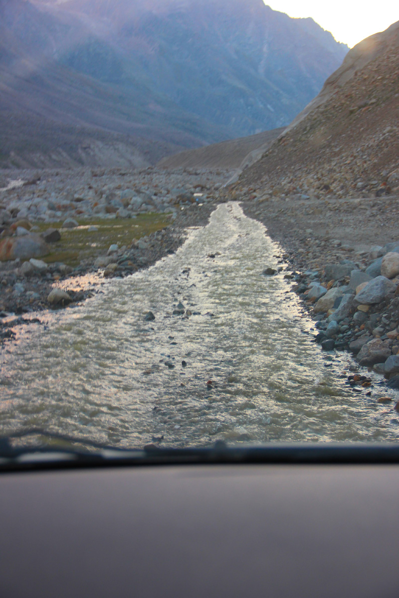
Not a stream but the motorway
In the expectation of a better road ahead, we continued our journey with no further breaks. Crossing rivulets on the way, we took nearly an hour and a half to descend and reach Chhatru (3350m) in the dark. Since morning we had only crossed two taxi-vehicles, a bus and two cyclists. The limited traffic movement added to our worries but on reaching Chhatru, a popular base for many treks in the region, we got a sigh of relief. The place comprised a few road-side dhabas and a PWD Rest House which were all occupied by trekkers and tourists.
Prepared to call it a day, I joined the hubbub of the tent-camps only to find the momentary relief quickly turning into misery for the night. The limited camps at the site had no place left to accommodate us. As advised by a Sardarji operating one of the parachute-tents, we proceeded towards Gramphoo to finally reach the district headquarter Keylong (3080m). As per him we were still three-hours away from our destination for the night. Accordingly we had to replenish our supplies for the remaining journey.
Just as we left Chhatru in the dark starscaped night, the rattle of the iron-bridge coupled with the boisterous Chandra added the thrill that surely harmonised with the terrain. The road ahead on the slopes of Pirpanjal was no better than the previous stretch. A typical Rohtang-like narrow motorway comprising loose rocks and nalahs flowing through, the 16km-stretch gradually climbed to Gramphoo (3420). Although it was stark dark, the grazing horses and sheep as well as shepherds’ tents illuminated on the changing terrain from rocky wasteland to soft and muddy green territory. Compared to Spiti, Lahaul valley is located at a lower altitude and is greener. The pasture-like vegetation of Lahaul receives little rainfall which in fact is more than Spiti
The road after Gramphoo was a luxury after the day’s drive. Based at the junction of Manali-Leh highway and Batal – Rohtang link road, Gramphoo is just a couple of dhabas thing. I had been on this road before, which boosted our confidence to drive up to Keylong at this time of the night. Another consolation was that we were now entering a territory increasingly dominated by adventure lovers, mountain-bikers, enfielders, etc. Having lost the BSNL signal after Losar, the connectivity of Airtel as well as BSNL improved after Gramphoo and reached its peak at Keylong after which it vanished again. We took another couple of hours from Gramphoo to reach village Beeling, just before Keylong where we preferred to call a halt.
Upper Keylong captured from Karding Monastery. Captured later by Sarabjit Lehal
The administrative headquarters of Lahaul & Spiti, Keylong is positioned on the right bank of Bhaga River. Apart from the renowned Karding following the Drukpa or red-hat sect, the other monasteries of the region include Shasur, Tayul and Gondhla, etc. Divided into parts comprising Lower and Upper Keylong, the town provides all possible facilities to continue the journey including guesthouses, hotels, shops, tea shops, etc. The 12th century Karding Gompa is located on the slope of the 4580m-Rangcha Peak on the left bank. Connected both by a trek and metalled road (from Tandi), the monastery was renovated in 1912 after a devastating earthquake that damaged the building. Based on my previous visits, a separate blog on the area shall be uploaded soon.
On the way to Keylong, we passed through the villages of Khoksar (3170m), Sissu (3100m), Khanglas (3180m), Gondhla (3250m) and Tandi (2960m). A few kilometres before Sissu, a village with decent options to spend the night, just along the river is the site for the Lahaul-terminal of the under-construction Rohtang tunnel. The construction-related activities at the drilling site have lead the locals taking up the business of guesthouses and hotels. The settlement of Tandi is located at the confluence of Chandra and Bhaga rivers originating from either sides of the Baralacha La. The Chandrabhaga, or Chenab in Jammu & Kashmir, is the most voluminous river originating in India.
Confluence of Chandra and Bhaga rivers at Tandi. Captured later by Sarabjit Lehal
Lahaul and Spiti valleys combine to form among the largest and least inhabited districts of India. As per the official website, the district has achieved impressive sex ratio as well as literacy rate while the population density is just 5 inhabitants per km sq. Sharing a common culture, both the valleys are quite different in character physically as well as geologically. During British days, the independent entities Lahul and Spiti were part of Kangra district of Punjab. Now imagine that!
View and read more on the region at the Lahaul & Spiti Photoset on Flickr
You may also like to subscribe to the email updates, of the remaining chapters, by entering your email id in the sidebar.


