 bNomadic
Lost Temples and Castles of Kangra Foothills

Known for the mellow splendour of its landscape, the Kangra Valley is located south of the imposing snowy Dhauladhars in the Himalayan state of Himachal Pradesh. Contrasting with the wooded beauty of the low ridges and valleys studded with charming hamlets, the mighty Dhauladhars never fails to cast a spell over a traveller. Not only for its attractive landscape, the Valley assumes a special place in a travel calendar because of its people, culture and heritage.
The Dhauladhars; captured near Dehra Gopipur. Please visit Flickr for more images of the region
Every winter, the mysterious forests of the Valley are thronged by Gaddis who descend from the Dhauladhars in search of greener pastures for their herd. The numerous hamlets and villages of the valley are dotted with hardworking but shy Rajputs and Brahmins. A symbol of its rich cultural heritage, the famous Kangra paintings – known for their ageless beauty – also prospered in this Valley. The ancient temples and fortifications at several spots are but a sign of prosperity and rich history. The River Beas along with its network of numerous tributaries waters the terraced fields forming a closely knitted network of wavelike embankments throughout the valley. Plenty of Palaeolithic hand tools have been reportedly discovered from these river terraces.
Nagrota Surian; Much of the railway line is laid along the old trade route. More images at Flickr
It was late afternoon when we reached Guler, a nondescript town on the narrow road connecting the town of Dehra Gopipur with Nagrota Surian on northern shore of the Pong Dam Lake. The wooded greens, grazing cattle herd and the tolling of temple bells assured us that we were in a culturally-rich part of the valley. I could easily relate to the Himalayan peace and harmony in the village-sound of the foothills. Close by, a railway track runs parallel to the road. Much of the railway line is laid along the old trade route which was also used by the Mughal and Sikh armies to march into the interiors of the Valley from the seventeenth to early nineteenth centuries. Around here are the terraced fields or orchards flanked by low ridges that were once the abode of the Ice-Age men.

The Banganga, a monsoon torrent with hardly a trickle of water in its bed that was strewn with rounded pebbles.
Passing the unpretentious town of Guler through its wooded groves, we reached the Banganga, a monsoon torrent with hardly a trickle of water in its bed that was strewn with rounded pebbles. Built on a precipitous ridge, across the torrent, a fort-like structure of Haripur comes into view. Although dilapidated, the fort still dominates the landscape and testifies its hold as an impression of power in its heydays. The road briefly ascends to reach the marketplace of Haripur, an olden settlement built on giant boulders flanked by an arc-like ridge capped by the fort in the north and a temple of Durga in the south. All through the road one would notice expansive spread of ficuses; at the base of which are platforms on which wayfarers could rest. Painted white, the houses and temples nestle in the shade of such giant banyan and pipal trees. We drove through the narrow lanes of the bazaar; arousing some basic curiosity among the residents and shopkeepers of Haripur. On the way, we came across several ruined structures, temples and neglected tanks.
The chaura maidan where the royal families used to play polo. More images from the region at Flickr
BC Hugel, who saw Haripur Guler in 1835, was impressed by the culture and lifestyle of locals. He writes that the houses were clean and in front of them was usually a small garden stocked with lilies, balsam, rose and jasmine. Men wore trousers and black turbans and invariably had dark, long beards. Women wore blue petticoats with deep red borders and pink veils on their heads. The typical beards and black turbans, in general, are no longer popular with men. Even the colour schemes popular with women has changed and so is the costume. The houses are still clean but with no specifically maintained plantains.
Passing through the main bazaar we reached a chaura maidan. It was here, where the royal families used to play polo, a game of Persian origin that was introduced into India by Akbar. Marking the boundaries of the polo ground are several ruined temples and similar structures. We could still not have a close-view of the fort from the ground.

The Haripur Guler Fort; Much damaged by the earthquake of 1905, and shattered by the tentacle-like roots of the pipal trees which had grown in the cracks in the walls, the fort is still impressive.

One of the olden temples adjacent to the Royal Polo Ground. More images from the region at Flickr
We decided to spend the night in the PWD bungalow just adjacent to the polo ground. Next morning, we roamed around and gathered some more dope and lore from the locals. The princely state of Guler is a pretty old one and has an interesting story behind its formation. It was founded in 1405 by the then ruler of Kangra Raja Hari Chand after he was rescued from a forest in which he got lost while on a hunting expedition. Guler was later annexed by Ranjit Singh in 1813. The state of undivided Punjab made an exceptional contribution to the art of India by producing marvellous art pieces popularly known as Kangra paintings. And it was this very place – Haripur Guler – from where this new art cult originated in the eighteenth century.

Morning at Pong Dam Lake. Please visit Flickr Photoset for more images of the region
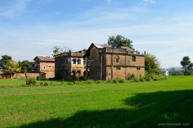
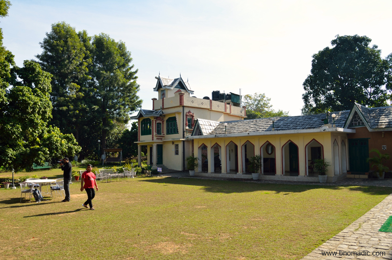
Ensuing day, in search of some permanence by the Pong, we stumbled upon the royal castle of Nandpur – part of the Guler state – and located at just a 30 mins of driving time from Haripur. Even though, the castle is within a walker’s distance from the village railway station, reaching it is a task nevertheless. A descendant of the royal family of Guler, Raja Shamsher Singh got the Nandpur hillock as a jagir from the Sikh rulers in 1826. Claimed to be built in 1870s, the red-brick castle must have witnessed many a royal functions or events. The overall structure still appears to be the same but the building is in serious need of renovation.
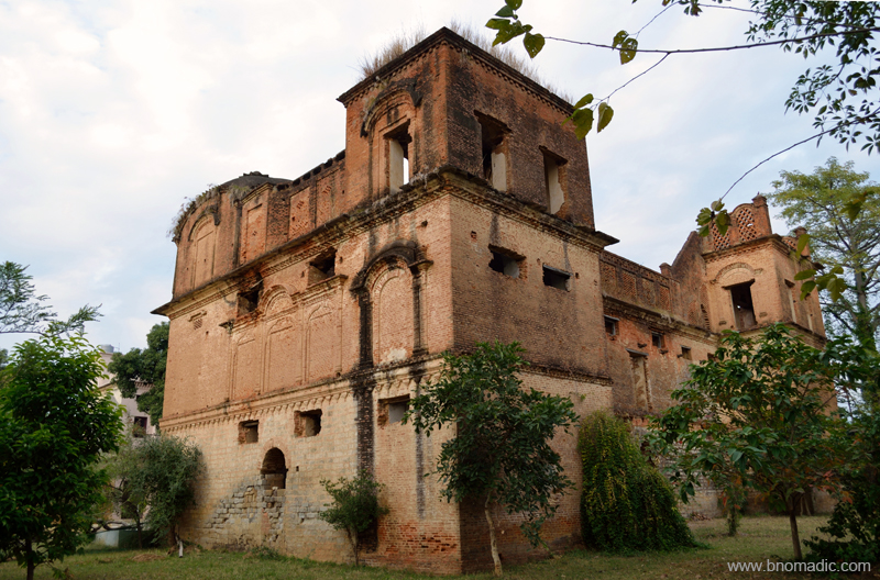
The Castle of Nandpur Guler (now in ruins). Please visit Flickr for more images of the region
Next day we decided to go to the Tatwani hot sulphur springs located not very far from Nagrota Surian. Admiring the snowy wall of Dhauladhars we crossed the Gaj Khad and found ourselves in the village of Tatwani flanked by orchards and fields. The village is approachable through a tarred motor-road as well. Inside the simple compound of the temple, we came across the deep stone bath of Tatwani in which the warm outpouring of sulphur water trickles down from an ornately sculpted faucet. Just around the site, I spotted numerous smaller shrines dedicated to Shiva.

The Gaj Khad and the snowy wall of the Dhauladhars. More imagery from the region at Flickr
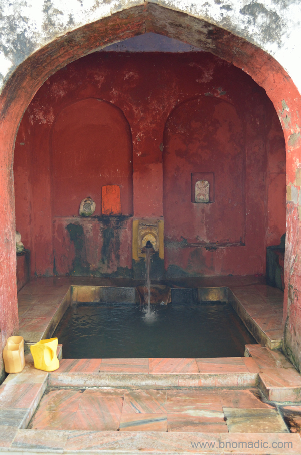
Legend has it that the hot sulphur springs were discovered by the King of Chamba who later got a temple constructed here. More at Flickr

Tatwani; Everything else including the boundary wall is a recent addition. More images at Flickr
Our curiosity next led us to the heritage villages of Paragpur and Garli near Dehra Gopipur. The villages came into touristy limelight after being declared as a “heritage zone” by the state government in 1997. The region was once under the chiefdom of Jaswan. Legend has it that the Chief appointed Kuthiala Soods to find an appropriate place in his territory using ancient Indian texts where he could commemorate Princess Prag Devi’s victory against certain marauding bands in the area. The village of Pragpur is in the reflective shadow of the Dhauladhars and is said to receive the primordial astral energies of prayers being offered at the temples of Bajreswari, Jwalamukhi and Chintpurni.
The heritage village of Pragpur. Please visit Flickr for more images of the region
Built before 1868, the Taal is said to form the core of Pragpur village. It was constructed by the village Nehar Committee that still continues to be responsible for its upkeep. The pond is surrounded by several olden structures like the Nehar Bhawan, Naun, Dhunichand Bhardial Serai and Radha Krishna Temple.
The compound of The Judge’s Court at Pragpur. More images from the region at Flickr
We took a stroll in the cobbled lanes connecting the architecturally fascinating buildings of the charming hamlet of Pragpur. It was intriguing to notice the houses built in varied architectural styles ranging from local to colonial and even Portuguese. Locals say that after the prosperous Kuthiala Soods arrived in the early nineteenth century, they brought in these typical architectural styles from abroad. Subsequently, some of these fascinating structures were abandoned as their owners shifted elsewhere. The grandest and most famous of such structures is The Judge’s Court, a three century old residential complex that has now been converted into a resort.

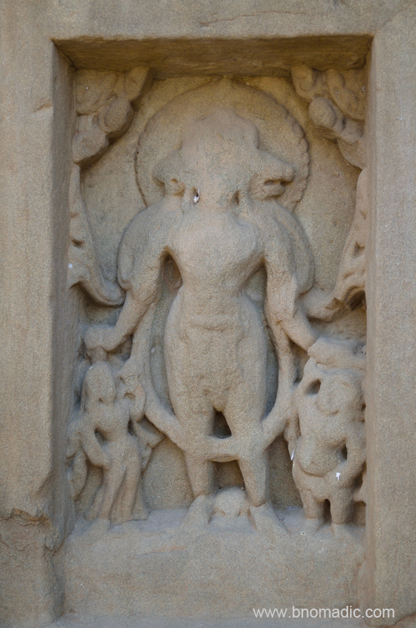
The rock-cut Masroor temples and lake. Please visit Flickr Photoset for more images of the region
Another architectural marvel from the medieval era– the rock cut temples of Masroor is located at an hour’s drive from Nagrota Surian. The following morning, we reached the sandstone ridge, above the village Masroor, where the set of fifteen monolithic temples are hewed out of rock in the Indo-Aryan style. With the absence of any epigraphic or literary record that might throw some historical light on the temple of Masroor, only an approximation has been made to say that it might have originated in somewhere around eighth century. However, the existence of this temple was noticed as early as 1875 but its rock-cut character was not appreciated until ASI visited it in the year 1913.

The original image of the sanctum went missing; currently the main shrine has stone images of Ram, Lakshman and Sita. Please visit Flickr Photoset for more images of the region

A substantial part of the temple was damaged in the earthquake of 1905. More at Flickr Photoset
Vaikuntha; More images at Flickr
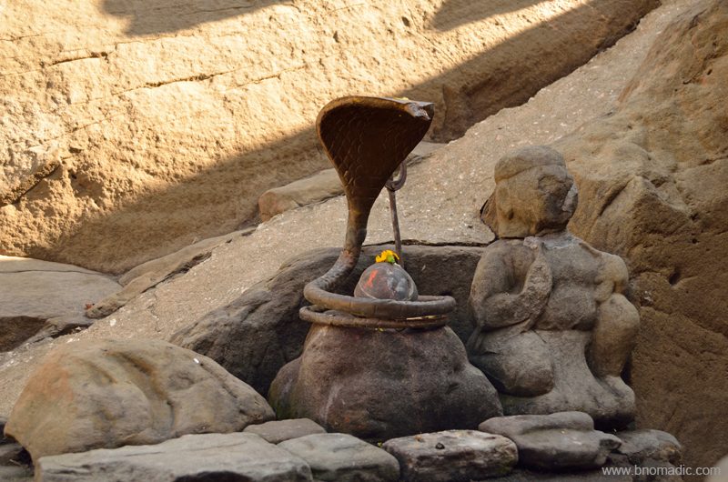
Obviously a later addition; जय भोले नाथ! ॐ नमः शिवाय!. More images from the region at Flickr Photoset
Notwithstanding the deadly earthquake of 1905 that nearly ruined the complex, the exquisite rock carving of the temples portrays a rich past. The original image of the sanctum went missing and currently the main shrine has stone images of Ram, Lakshman and Sita. The presence of the figures of Shiva in the centre of the lintel of the main shrine is a strong presumption for historians that the temple was originally dedicated to Mahadeva, the presiding deity of the Himalayas. From the top of the sandstone ridge that has many caves and dwellings; one can look down into the valley on either side. Towards the front of the complex there is a tank that has also been hewn out of the sandstone. Locals relate this small pond that is supposed to retain water throughout the year, with Pandvas and Draupadi.
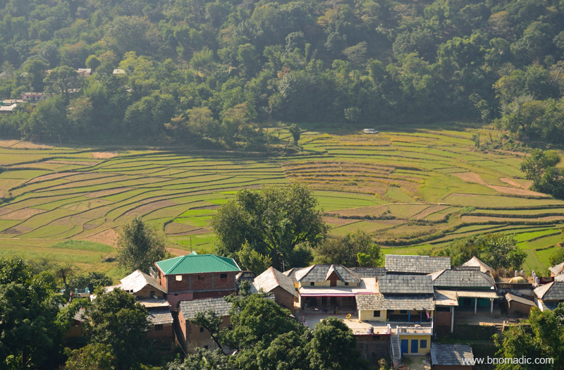
Terraced fields and the village from the Masroor ridge. More images from the region at Flickr Photoset
Birding at Pong Dam Lake

Straddling the Beas River as it emerges out of the confines of the Himalayas, the Pong Lake lay limitlessly spread in Kangra district of Himachal Pradesh marking the state border with Punjab. Early this winter season in December 2015, I travelled to this – one of the most popular – winter migratory birdwatching destinations of north India. Starting from Chandigarh and taking pretty country roads through Punjab, I approached the lake from Talwara side. As one drives through the barrage, a wide-ranging view of the vast lake emerges. From here, the north-end of the lake is partially blocked by its prized island curiously called Rancer. Far in the distance, the snow-capped Dhauladhars announce their presence through a faint profile.
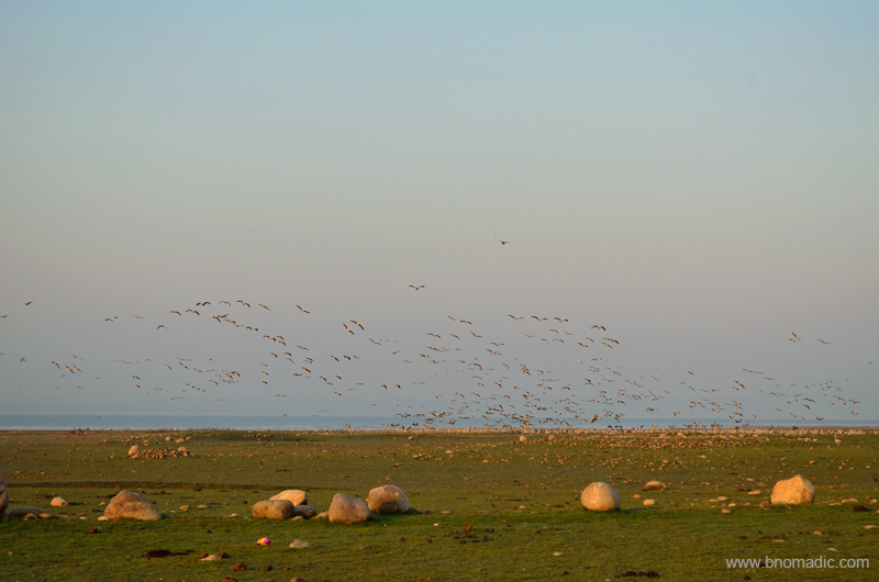
Morning at Pong flats; a skein of Bar-headed Geese. Please visit Flickr for more images of the region
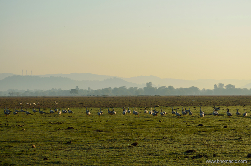
View towards Nagrota with Shivaliks in the backdrop; A gaggle of Geese marching towards the fields.

Over the years, the Pong wetland has become the largest single congregation destination for Bar-headed Geese not only in India but also in the world. More images from the region at Flickr

The Pong has been gathering international eyeballs after being declared a Ramsar Site in 2002.
Just next to the check post of the barrage, after the state fisheries department office lays the water sports and training facility run by the adventure institute ABVIMAS. I had my accommodation reserved at the state forest department rest house at Nagrota Surian, a sleepy village situated at the north-end of the lake, popular for its birding flats and trails. Driving at a leisurely pace, it took me almost two hours to cover the distance between the barrage and Nagrota Surian via Dhameta and Jawali. The Pong flats must hardly be four “vehicle-able” kilometre from the rest house.
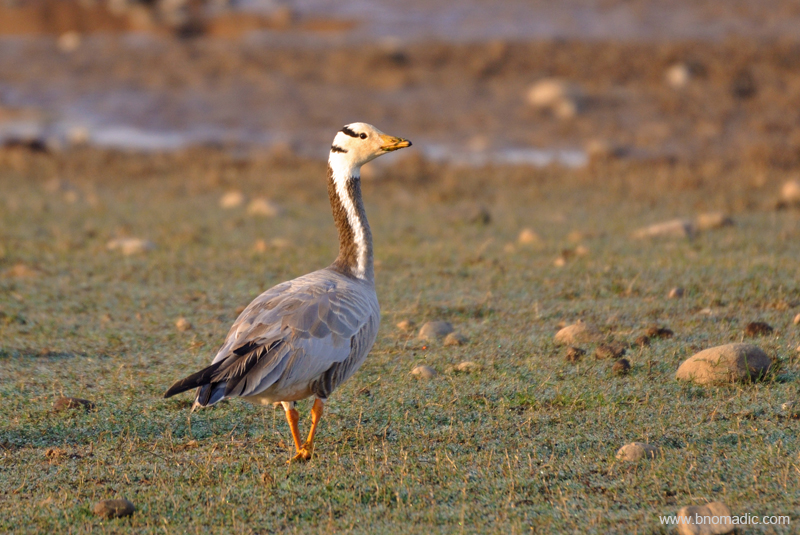
Bar-headed Goose, a hardy bird that has been observed flying over Everest. More at Flickr

A Woolly-necked Stork; also called Bishop Stork or White-necked Stork. More at Flickr
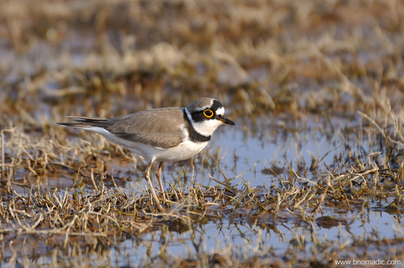
A Little Ringed Plover. Please visit Flickr Photoset for more images of the region

A Kentish Plover; It is smaller, paler, longer-legged and thinner-billed than Ringed Plover. More at Flickr
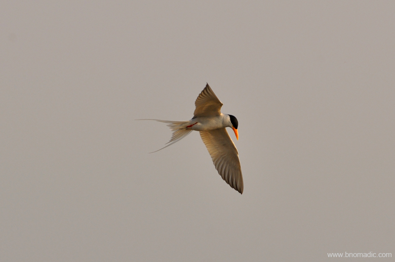
A River Tern; this guy feeds by plunge-diving for fish or aquatic insects in rivers or lakes. Its numbers are decreasing due to the pollution of their habitat. More images from the region at Flickr
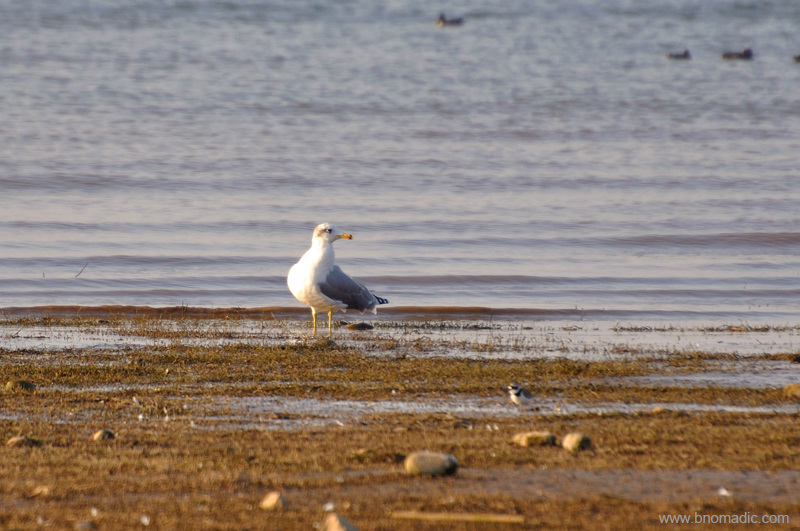
A Pallas’s Gull; This species breeds in marshes of southern Russia to Mongolia. More images at Flickr
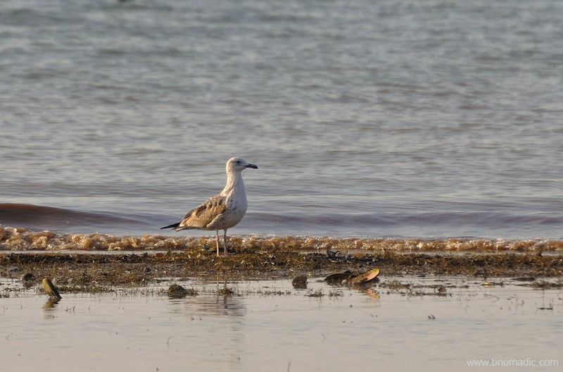
A Caspian Gull; This bird breeds around the Black and Caspian Seas extending across Central Asia to north-west China. Please visit Flickr Photoset for more images of the region.

A Black Kite. More images at Flickr
Insofar as birding is concerned, for the next one week or so, I’d get up early morning to reach the Pong flats before fishermen would. Having spent some good bird-full hours by the shoreline of the lake, I’d head back to the rest house for breakfast only to return to the shoreline by early evening. The route would take me through the bustling market and residential colonies of Nagrota Surian, an erstwhile trading base of Kangra region. The scenic prettiness of the landscape climaxes towards evening; with the vast stretches of the lake against the backdrop of setting sun on one side and snowy outposts of the Dhauladhar Range glittering in the evening light on the other.
As the waters of the trans-Himalayan region along with wetlands of Europe, North and Central Asia gets frozen every winters, flocks of waterfowls that breed in those areas in summers migrate to plains located south of the Himalayas. Also called Maharana Pratap Sagar, this vast reservoir that was primarily constructed in 1974 as a check dam to store water for irrigation as well as to generate power, is thronged by no less than 1,50,000 avian visitors on average (2010 two-day bird count). The emerging wetlands gathered international eyeballs after it was declared a Ramsar Site in 2002. Every winter, the shoreline of the lake could be seen abuzz with flapping wings and cackling sounds of varieties of waterfowls including Bar-headed Geese, lake’s most regular date. The stagnant fresh water adds to the concentration of organic matter, worms, insects or molluscs and other tiny creatures that make this wetland most popular among winged visitors particularly Bar-headed Geese whose visiting population at the lake constitute more than 40 per cent of its population in the world. Not only this but rare species like Indian Skimmer, Whooper Swan, Red-necked Grebes, White-fronted Geese along with many others of vultures, falcons and waders, etcetera have been recorded.

A faint profile of Rancer island from the shoreline. More from the region at Flickr Photoset

View from the Meenu Khad at sundown. More images from the region at Flickr Photoset
With winters setting in, the receding shoreline of the lake near the villages of Jawali, Dhameta, Dada-Siba, Haripur, Guglara, Harsar, and Nandpur as also of Nagrota-Surian provide ample opportunities to a birdwatcher. Full of life, the nutrient-rich mudflats along the shore-line attract birds such as lapwings, waders, egrets and herons, etc. even as the open waters prove to be a heaven for ducks, grebes, geese or cormorants. The drier sand banks and waterside vegetation and shrubbery attract curlews, warblers, babblers, munias, kingfishers, moorhens and predators, etc.
Back at the rest house, the caretaker tells me that when the waters begin to recede, the villagers seasonally farm the land in the periphery of the lake. This along with commercial fishing and the grazing by nomadic herds of cattle is reasonably effective in attracting birds as long as everything is done below a tolerable level. The villagers are increasingly becoming more aware of conservation.

Lakeview from a partially exposed Bangoli Chook. More images from the region at Flickr
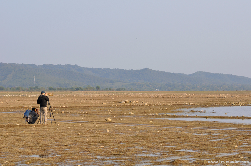
Advisable to carry Binoculars or Spotting scopes and a telephoto (if interested in photography)
Also, just if you thought that Pong’s travel charm is limited to birding, there are a number of places of cultural and mythological importance within the vicinity of the lake. And although I didn’t partake in activities like boating, angling or water sports but the caretaker mentioned that such activities not only require permissions through official channels but some expertise as well. The popular islands of the lake Rancer, Karu, Rajeli, Jattan Da Kuwal, Dhanderh that are good and reclusive for birding, offer equally good prospects for boating.

Magical Pong; possibly one of the best lakeside sunscapes. More images from the region at Flickr

Landscape northfaced in an overcast weather; a faintly glittering profile of the Dhauladhars.
The official checklist of the Pong mentions close to 415 species of birds in addition to many animals, reptiles and fishes. Here is a list of birds I saw at Pong: Northern Lapwing (a lifer for me!), Bar headed Geese, Ruddy Shelduck, Sarus Crane, Coots, Wagtails, Pied-Kingfisher, Black Kite, Brown Headed Gull, River Terns, Purple Swamphen, Eurasian Wigeon, Northern Shoveler, Cormorants, Greater Coucal, White-breasted Waterhen, Little Grebe, Northern Pintail, Common Pochard, Gadwall, Spot-billed Duck, Common Teal, Bank Mynas, House Crows, Pipits, Larks, Sandpiper, Cattle Egret, Snipe, Red-wattled Lapwing, Little Egret, Great Egret, Black Kite, Black-shoulder Kite and plus some Herons.

Nomadics! :-). Please visit Flickr Photoset for more images of the region
Postlude

The following post is a part of the “Kailash Mansarovar Yatra” Blog Series Into the Sacred Space. To read complete travel memoirs and trip report, please visit here.
As we were being ushered out of the plane through to the corridors and lobby area of the Terminal three of the New Delhi airport, I firmly hoped that the journey to the Kailash Mansarovar must have madly induced the Himalayan addiction in at least a few of us. Loyally encompassing the majestic powers of nature, the Himalayas are spiritually safe passages crafted by nature for us to support our Journey of Life. Readers of bNomadic would discover corroborative evidences sprinkled in various posts of the blog to this inspirational belief related to the Himalayas.
Walking through the corridors of the airport; carrying my feebly packed untidy backpack smeared with the trans-Himalayan dust, I felt a pure contentment of having completed a journey that I always dreamed of. Compared to the previous century explorers and travellers, ours was of course a modern (and comfortable) way of undertaking this journey. I almost felt that there is nothing else left on this planet where I needed to reach but then there are other hidden gems and corners waiting to be explored in the Himalayas.

Glittering Gurla Range towering above Barkha Plains. This and the featured image (from Barkha) of this post by Rita Willaert. I wish to express my most sincere gratitude to the noted photographers Rita Willaert and Jen Reurink who kindly shared and consented their photographs to be used on bNomadic.
Minutes later, as everyone waited for their bag to bounce along on the conveyor belt, I noticed a massive poster on the wall adorned with a quote from Aitareya Brahmana, an ancient Hindu text, “There is no happiness for him who does not travel…” Now this was a religious conformity to the fact that to travel is to realise the love with inner self. We need the Kailash type serene and calm refuges in a world of storm that we go though in our routine mundane city life. Withdrawal to a natural and Godly retreat in the Himalayas with such a purpose in mind is nothing but a sign of absolute wisdom and strength.
The writings of the famous spiritual explorers of the Himalayas; from Swami Pranavananda to Paul Brunton reflected that if we purposefully withdraw ourselves to a Himalayan sojourn for a while so as to reconsider our desires and survey our courses and if we use the leisurely opportunity to address our internal agitations as well as refine our instincts, we cannot be doing wrong. And with this very thought in mind, I continue to explore and reach more hidden corners of the Himalayas located further afar.
Not only my inner self but as I write this last post of the Kailash Mansarovar Yatra blog series, almost eight months after the yatra happened, I see a lot of aesthetic changes around me at home. From my workstation to lounging area or my bedroom, living room or drawing room, the walls, shelves and tables are now adorned with photo frames or souvenirs from this yatra.
On a concluding note, I’d admit that our yatra through the forbidden country – the land of snows and monks – had all the “elements” of Himalayan travel. And as Heinrich Harrer would recall, “For romantics, there was even the attraction of the blue poppy that flowered in secret beyond the mountains!” No wonder missionaries, intellectuals, adventurers, travellers and scientists were always keen to explore the secrets and mysteries of that country. With this thought, I’d request each one of you to constructively devour Himalayan adventure, discovery and knowledge in your own ways.
Here follows a recap of the yatra in this small video. The background score belongs to Sahil Jagtiani.
Thanks. Happy travelling.
Back to the Plains

The following post is a part of the “Kailash Mansarovar Yatra” Blog Series Into the Sacred Space. To read complete travel memoirs and trip report, please visit here.
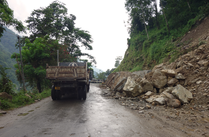
The weather was indeed very bad that day. As we left the Governor’s House at Gangtok, our driver informed us that the road ahead of Teesta has been blocked since morning because of multiple landslides. The last minute plan was to take a diversion to Darjeeling from Teesta and reach Siligudi via the touristy hill station famed for its tea cultivation. The diverted route was of course a tad lengthier but was more scenic and greener. Crisscrossing the narrow (but safe) roads passing through tea estates, we reached our guesthouse at Siligudi just before dinner time. On the way down from Gangtok, the highway-bound fun was limited to occasional tea or refreshment stops.
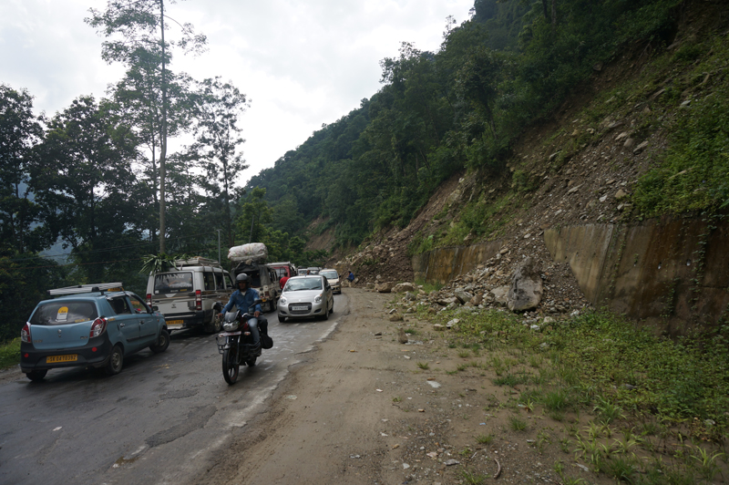
Traffic Jams because of landslides triggered by incessant rains
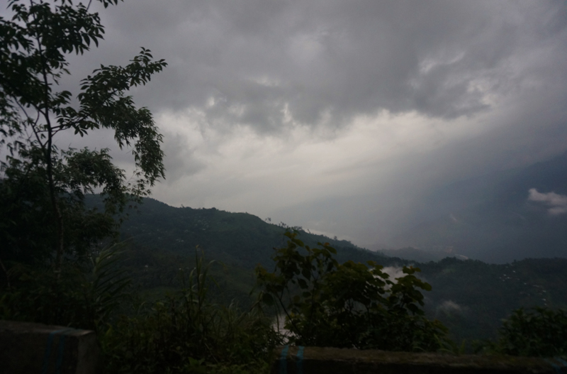
Overcast weather
A little before Teesta
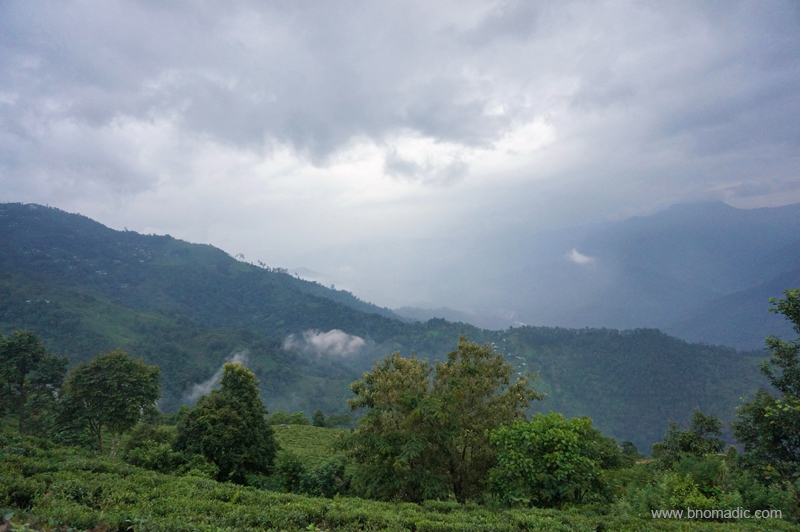
The verdant Tea Estates of Darjeeling
The narrow highway to Darjeeling

Tea plantation workers with their cane baskets
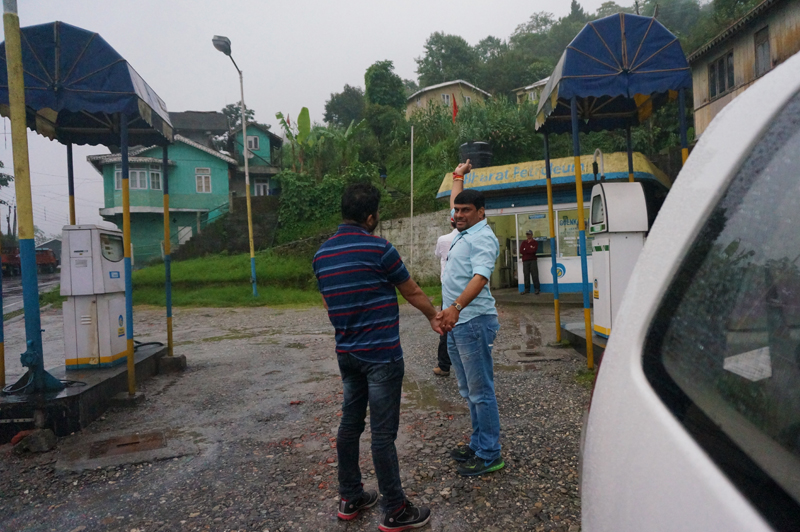
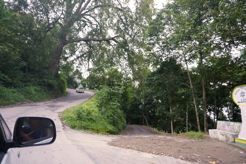
A little before Siligudi; at a fuel station
The Bagdogra civil airport was hardly 10km from the guesthouse we were staying in at Siligudi in W Bengal. The plan of the host Sikkim Tourism Development Corporation (STDC) to put us up so near the airport seemed to make sense as the decision was expected to save some precious time. We unhurriedly reached the airport and were still hours ahead of the scheduled departure time. Outside, the luggage committee honouring its commitment one last time made a final count of the bags. The yatra had come to a close sooner than we had expected it to be.
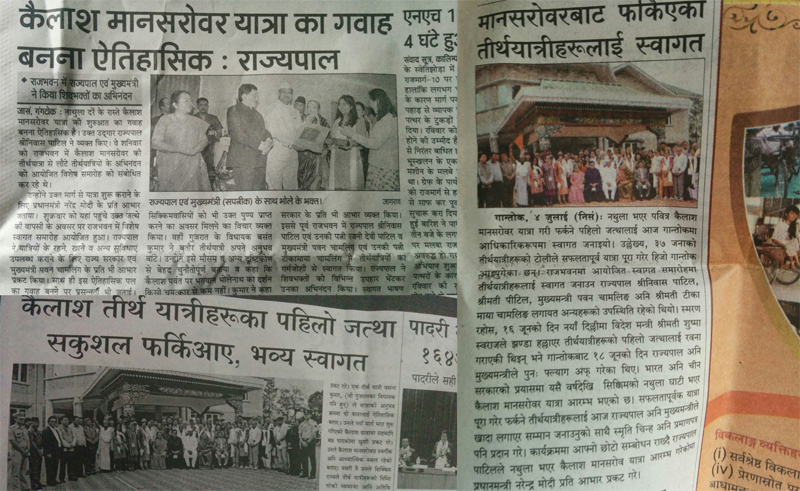
Media reportage next day in vernaculars
The flight journey from Bagdogra to New Delhi takes about 90 minutes in the air. The weather outside was free of any turbulence. Inside the aftereffects of the KM Yatra emerged in various colours and forms. From spiritual talks to backbiting-related gossips, the air-travel had it all. Plans were made and discussed for frequent get-togethers, social gatherings as well as to make another journey to the Holy Land. I was already planning upcoming excursions as the flight began to hover over the NCR region. Down below, the matchbox apartments and other skyscrapers sounded a sort of warning bell. Our ingression into the real world seemed inevitable now. This was supposed to be the figurative end of our dream journey.
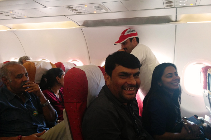
Inside the Air India flight
As the flight prepared to touch down, Babaji raised the final holy cry of Om Namah Shivaya. Enthusiastically, the group joined. Already intrigued, a few of the passengers welcomed the war-like cry with folded hands. As a group, we had paid our obeisance to the Holiest of Lands and travelled some great distance. I hoped that we all are going to travel and live this yatra forever. Once you have travelled and made a journey as epic as this one, the voyage definitely is never going to end. This journey was going to play out over and over again in our peaceful inner spaces. Both mind and heart could never get detached from such a journey.
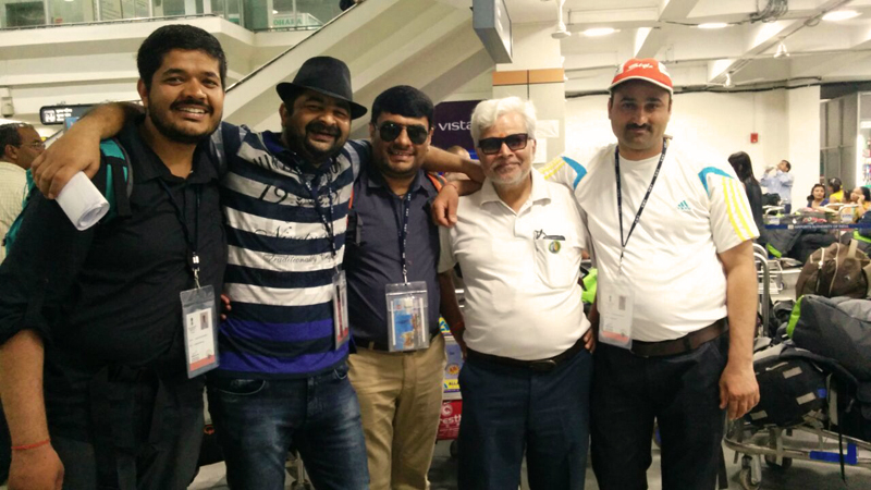
Mandatory KMY Groupfie at the airport
As we were being ushered out of the plane through to the corridors and lobby area of the Terminal three of the airport, I hoped that the journey to the Kailash Mansarovar must have madly induced the Himalayan addiction in at least a few of the groupies. Slowly the group lumped around in the newly designed luggage gallery of the airport. All of us huddled one last time and recorded groupfies. Quickly enough, one by one everyone left for their home after exchanging due formalities of parting. Outside our families awaited to receive us.
The Festivities Around

The following post is a part of the “Kailash Mansarovar Yatra” Blog Series Into the Sacred Space. To read complete travel memoirs and trip report, please visit here.
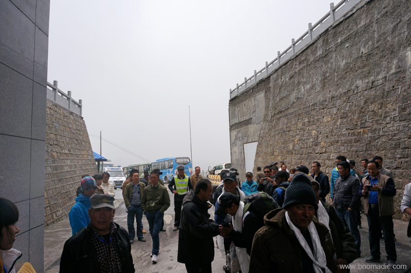
Having completed the Tibet part of the Yatra, we arrived at the Nathula quite late in the morning; with our Liaison Officer recording in her journal, “Nathula again! O! the joy.” Quite surprisingly, the customs related checks and formalities didn’t take much time. A light shower of rains greeted us as we once again assembled on the no man’s land. Over the duration of the trip to Kailash Mansarovar region from the Nathula in Sikkim and back, our group and the entourage travelled nearly 3,500 km. After exchanging some pleasantries, the Tibetan and Chinese staff gleefully waved us off one final time.

The upper Chumbi Valley; just before the crest of the Nathula

As we lined up on the no man’s land, a light drizzle came and spattered the crest of the pass; not more than 40 m in length. Please visit Flickr Photoset for more images of the region
The Tibetan side from the no man’s land. More images from the region at Flickr Photoset
“We all bid you adieu” from the lovely Tibetans and Chinese. More images at Flickr Photoset
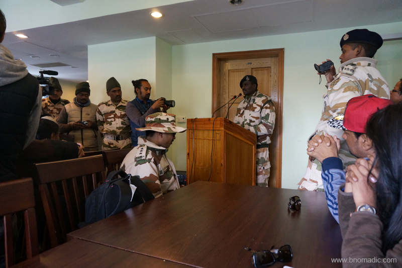
On the India side of the border, in the windy chill of the high-altitude mountain pass, the ITBP had hosted a high tea for us. The young officers of the Police Force keenly listened to our stories of the yatra. After some more formalities, we proceeded towards the Seventeenth Mile, Sherathang, where the ITBP had organised a formal function for us. The atmosphere was euphoric as we arrived at the acclimatisation centre at Sherathang. More stories from the yatra emerged; many of which even I wasn’t aware of. As if this wasn’t enough, the STDC guys briefed us that the Government of Sikkim has organised a formal reception for us next day at the Governor’s House Gangtok; as a tribute to mark the success of the first batch through this newly opened route. Almost all of the group members received that news with much interest and excitement. I rued the chance of exploring the hilly estate of Gangtok. Anyhow I was still hopeful about the evening.
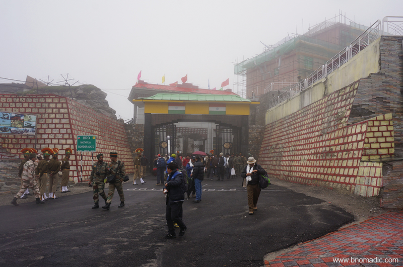
Getting “back to the country”. More images from the region at Flickr Photoset

The Sentinels of Nathula. Please visit Flickr Photoset for more images of the region
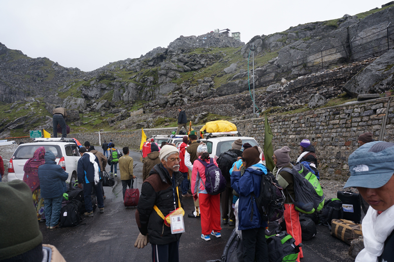
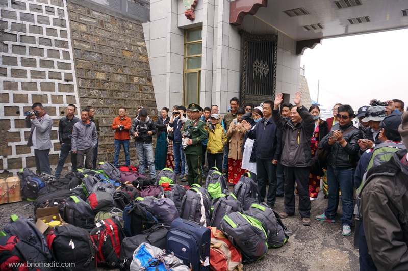
Sorting out luggage before proceeding to Gangtok. More images from the region at Flickr
At Sherathang; exchanging wishes. More images from the yatra at Flickr Photoset

Just Tanned! (yours truly; not the officer). More images from the region at Flickr Photoset
Given the bad weather, the STDC arranged smaller vehicles for us to facilitate our transport to Gangtok from the pass. Our driver gave us the news of multiple landslides in the terrain but mercifully none obstructed our movement. With Kishore Da’s numbers playing in the car, our descent to the state’s capital was awesomely engaging for reasons more than one. The vibrant rain-washed hillside on the way looked even more natural and pristine. The celebrations wouldn’t just get over even till late evening that day as the locals kept thronging our guesthouse to greet us and get some first-hand information about our experiences. There was a sort of success and rejoicing throughout the hilly town.
The road ahead. More images from the yatra/ region at Flickr Photoset
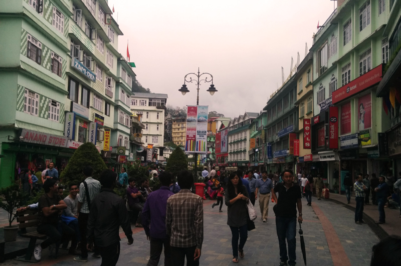
The MG Road market of Gangtok
Later that evening, we took a stroll in the market of MG Road. The famed market offers typical hill touristy stuff primarily comprising articles related to cold weather along with an extraordinary variety of home grown tea as well as articles related to Buddhist culture. Running short of time, I couldn’t reach much of the Lal market. I did not splurge much on anything except some copious amount and varieties of tea. My groupies seemingly bought everything under the roof; at least their swollen bags reflected that. The market square has some nice cafés looked after by locals. For those interested in nightlife, there are options too; frequented by local celebrities foot-tapping on hip-hop or techno or even college classics. I’d say that some of the best nights out happen spontaneously! *wink

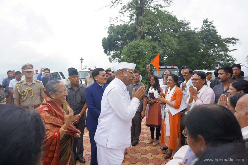
The Governor of Sikkim, Sh Shriniwas Patil addressing the gathering at Raj Bhawan Of the many activities at the function, the best was the Jan Gan Man, the National Anthem played by the Sikkim Police band.
After the Group Photo. Please visit Flickr Photoset for more images of the region
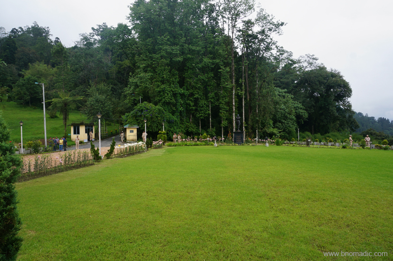
The sprawling greens of Raj Bhawan. More images at Flickr Photoset

Some more photo-ops with tanned and happy faces. More images at Flickr Photoset
Confused. Three subjects. Many cameras. More images at Flickr Photoset
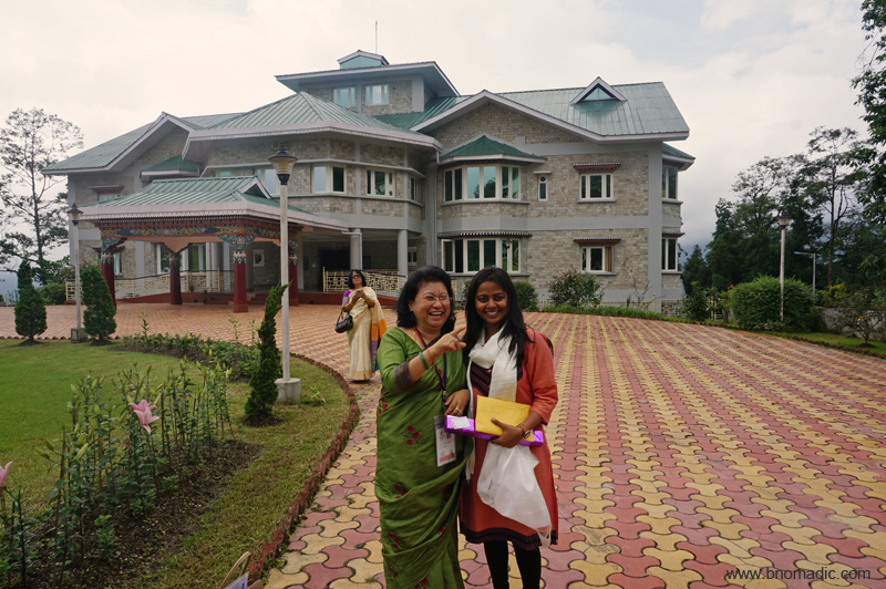
Following morning, the first batch was accorded an unprecedented welcome at Gangtok. It had the honour of being attended by the Governor, the Chief Minister along with the entire cabinet and state top machinery at the Governor’s House, the historic White’s Residency that has silently been observing the changing political landscape of Sikkim for over hundred years. After the speeches and a bara luncheon, the participants were presented with a souvenir by the Government of Sikkim. Another group photo with the chieftains; the final one, and we were packed off to the plains to board our flight to New Delhi.

Like a family; elated faces at the Raj Bhawan, Gangtok, Sikkim


