 bNomadic
Retracing the Trade Route to Nathula

The following post is a part of the “Kailash Mansarovar Yatra” Blog Series Into the Sacred Space. To read complete travel memoirs and trip report, please visit here.
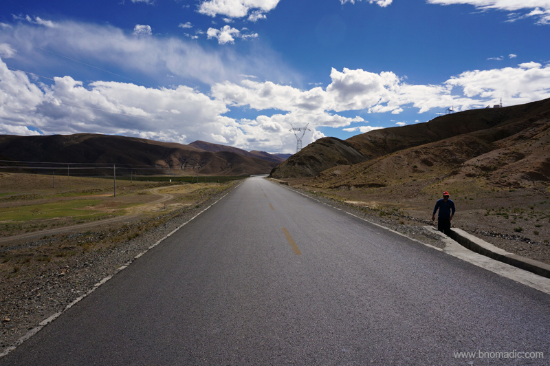
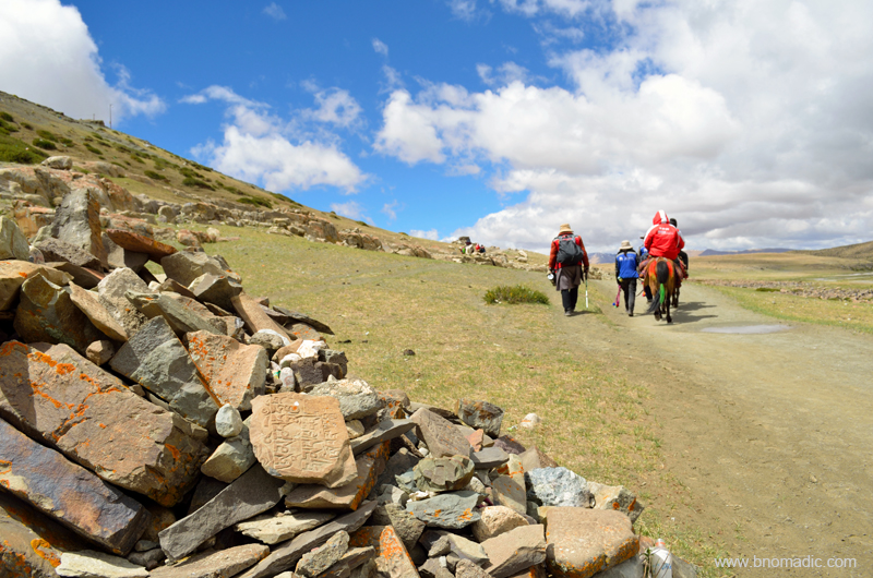
Deeply elated and enriched with the experience of the divine Kailash Mansarovar, we left the geological wonder and began our journey back home. Even though, physically we had left the holy land but mentally we were forever initiated into inspirational and secure realms of the Sacred Space. The serenity of the landscape we saw on our return journey was overshadowed by the calmness of the holy region. On our journey back home to reach the Nathula, we followed precisely the same route as well as same fuel stops and campsites as we had initially. The journey seemed less rough but even more stimulating than our previous tête-à-tête with it.

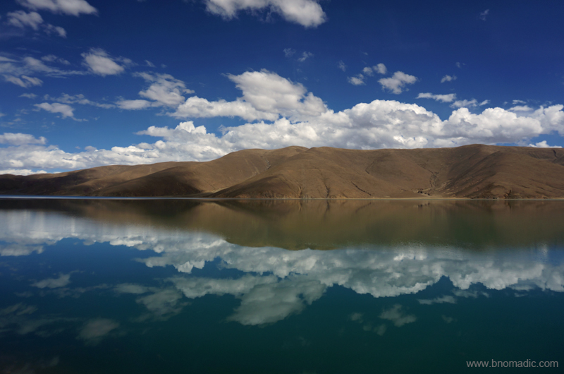
The glittering Gurla Mandhata. Photo by Rita Willaert

The ancient Chiu Monastery by the Mansarovar. Photo by Rita Willaert
A different take from the same place, Chiu Monastery. Photo by Rita Willaert
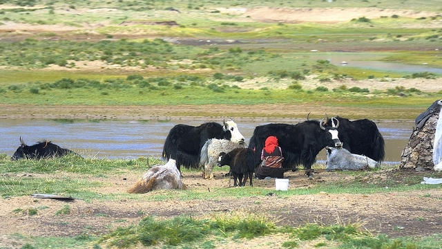
Modern Nomads at Barkha; in the shadow of Gurla Mandhata. Photo by Rita Willaert

Approaching the Mayum La. Please visit Flickr for more images of the region/ yatra

Steppes!; near Paryang. Please find more images from the region at Flickr Photoset
Semi-desert!; near Zhongba. More images from the region at Flickr Photoset

Greener Pastures!; near Saga. Please visit Flickr Photoset for more images of the region/ yatra

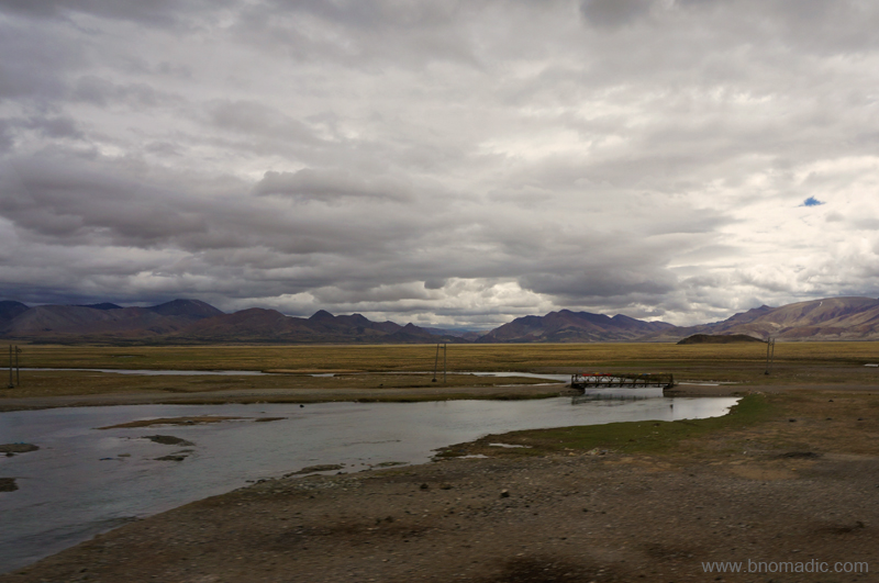
Desert!; Yarlung Tsangpo Chu also in the frame. More images from the region at Flickr
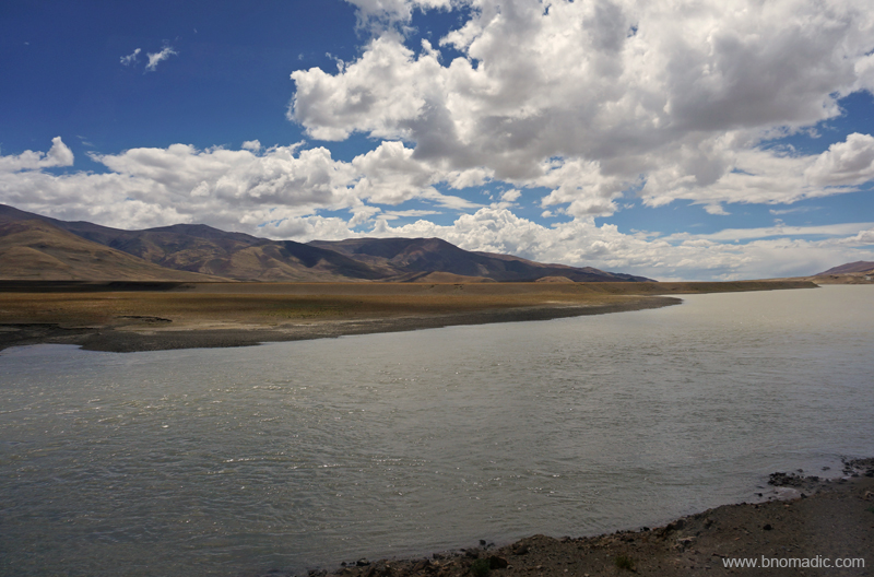
The Yarlung Tsangpo Chu (still infant); Please visit Flickr Photoset for more images from the region
A large part of the highway we were following had yet another historical context; trade economics. Depending upon the article to be traded, portions of the highway were popular as Silk Route, Tea Route of Horse Caravan Route. Life supporter for many communities, such routes continue to be sacred for many traders, even though, modernisation has undermined its commercial significance. After Lhasa; Yadong, Kangma, Gyantse, Shigatse, Lazi and Saga were the important trading centres in Tibet while in India; Almora and Kalimpong used to be the entrepôt of the Indo-Tibetan trade. With time because of the emerging politics, the focus too shifted.

High-altitude desert; Photo by Jen Reurink

An ancient religious site (forcefully ruined and restructured later). More images at Flickr Photoset

Wide open high-altitude plains. More images from the region at Flickr

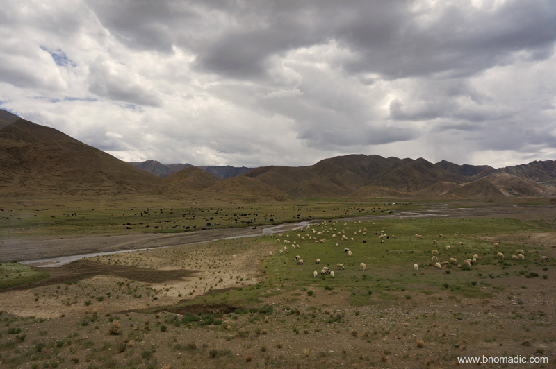
Occasional shrubbery; feast for sheep. More images from the region at Flickr Photoset
Even though, the Tibetan civilisation is quite young than the Indian society flanking it from south as well as the Chinese empire spread along its north and eastern boundaries, yet it continues to have one of the most intriguing and fascinating cultures on the globe. Their mental complexity is second to none. Despite them being a peaceable race, the later part of previous century delivered a cruel fate to these hard-working people. Before the Chinese intrusion, this mysterious land of snows preferred to lock itself among the Himalayas; capturing the imagination of the west during all this while. For surveyors, explorers, traders or imperialists, it was a forbidden land of treasure. Those eyeing a spiritual quest advocated about a lost Shangri-La.

More grazing grounds; miles apart. More images from the region at Flickr Photoset

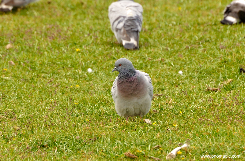
Some more Wild Asses, Kiangs on the Tibetan plateau. Photo by Rita Willaert
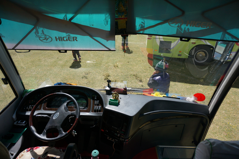
Left-hand drive. Please visit Flickr Photoset for more images of the region

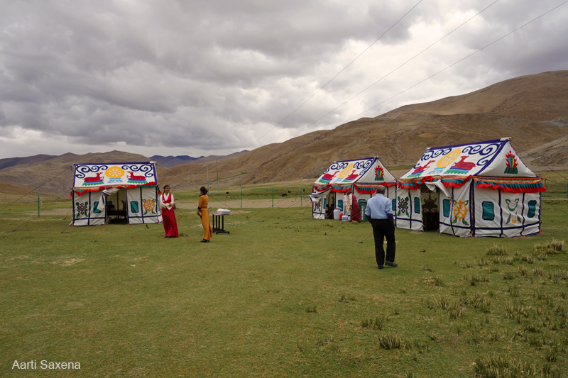
One of the campsites for lunch. More images at Flickr Photoset

A typical fuel pump at a hard-to-imagine location. More images at Flickr Photoset

Photo by Rita Willaert
In his book Freedom in Exile, His Holiness the Dalai Lama writes, “Go to Tibet and see many places, as much as you can; then tell the world.” I couldn’t agree more with the fact that Tibet truly is one of the most remarkable natural wonders to visit on the planet. Apart from the stunning views and breath-taking high-altitude treks, the highland has intriguing monasteries, habits and a unique culture. Our expedition took us across glittering mountains and turquoise lakes over high mountain passes typically adorned with colourful prayer flags. Whether for meditation and prayer; monasteries or ruins of forts and hermitages; casual to professional mountaineering; or just for an overland road trip, the scope for adventure up here is limitless.

The mighty Yarlung Tsangpo Chu. More images from the region at Flickr Photoset

View from a high-altitude pass near Saga. More images from the region at Flickr Photoset
Another scarce pastureland near Sangsang. More images from the region at Flickr Photoset
Somewhere in the Yarlung Tsangpo Valley. Photo by Jen Reurink
Figuratively speaking, our Tibetan sojourn was in the reverse mode. Travelling through Tibet, I am persistently thinking of the political situation of the country. Geographically the region commands a very large area but has always been sparsely populated. Today, the area is commanded by Chinese military with its control centre located at Beijing, almost 3,700 km from its capital at Lhasa. The Tibetans have been forced to become a minority in their own homeland. Although, the Chinese have conferred the country with the label of Tibet Autonomous Region (TAR); independence here is only imaginary with even minute dissent against the administration being unfeelingly supressed.
G219, a little before Lazi. More images from the region at Flickr Photoset
Through the Sakya Territory. More images from the region at Flickr Photoset
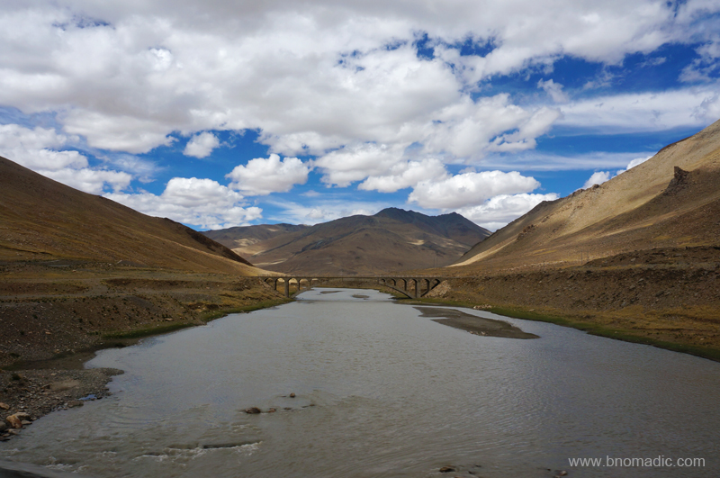
A tributary to the Brahmaputra (Yarlung Tsangpo Chu). More images at Flickr Photoset

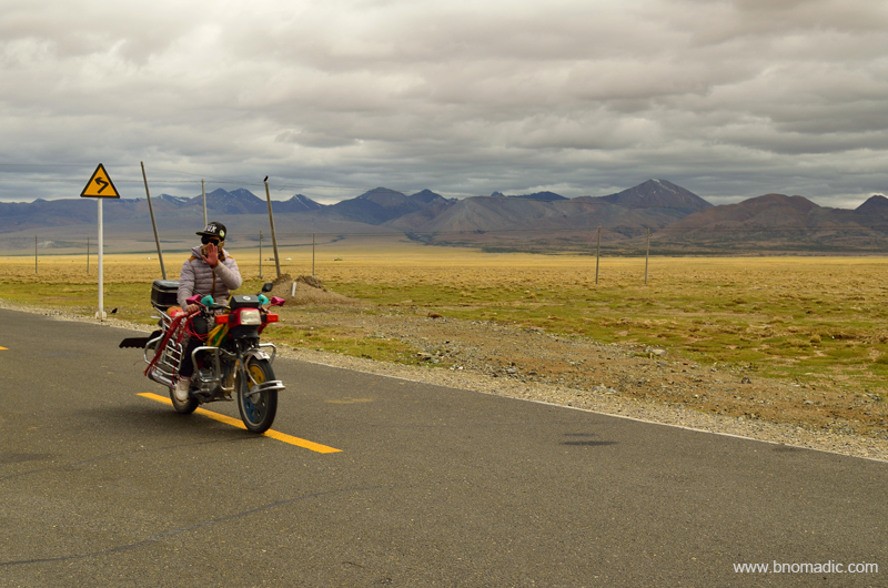
Bike accessory headgear put to multiple use. More images at Flickr Photoset
A typical Police Station. Please visit Flickr Photoset for more images of the region
As momentary travellers, we had limited window to observe the social and cultural undercurrents of Tibet. Nevertheless, with their concrete colonies typically bedecked by the flag of China instead of usual prayer flags and police or army installations springing up out of nowhere, the villages and townships along the highway offered some evidence of ongoing changes. The labour force engaged along the highway or in such settlements comprised mostly Tibetans; their superiors mostly Chinese. Taking a walk in the streets, one would smell enough indication of invasive control by a rather dictatorial regime that often governs with arrogance, insensitivity or even stupidity.
Much of the devastation happened between 1950 and 1970 when the Chinese seized control of the plateau and in the process drove the Dalai Lama along with nearly 100,000 Tibetans into exile. It was around this time when the new regime steadily pulled apart a majority of the cultural as well as historical heritage of Tibet under the garb of a revolution. The political leader of the newer rule, Chairman Mao replaced the images of the traditional deities with his portrait. However, with the onset of some global sense coupled with increasing tourism interest and the doors to Tibet for outsiders were opened in the mid-1980s but by that time everything presentable was in ruins.
The calm Lang Tso; just before Lazi or Lhatse as administration would call it. More images at Flickr

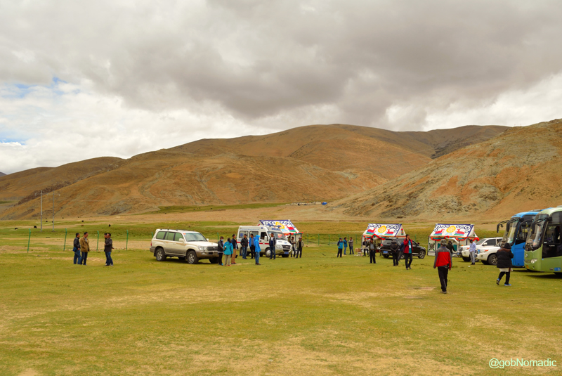
Batch One Yatris with Chinese and Tibetan staff. More images at Flickr Photoset
Getting emotional and all…Please visit Flickr Photoset for more images
Some cultural extravaganza. Please visit Flickr Photoset for more images
With time business interests of the Chinese diversified and the investment came. But as predicted, development happened on China’s terms. With a slew of infrastructural projects, new hotels, mushrooming restaurants or bars mostly looked after by Chinese benefitting the Chinese; keen observers called it the second invasion. Lhasa is booming, modernised or rebuilt and so are many of the earlier trade junctions spread across the highland. Most multi-storied apartments, I noticed, remains unoccupied. Once a remote sanctuary of hardy travellers, it is now the Chinese tourists who throng the Potala or wildest of treks. With every passing month Tibet is changing fast; looks less and less like itself. Someway, the Tibetan pilgrims across the land are once again picking up the rhythm, chanting mantras and swinging their prayer wheels in isolation. Led by dollar hungry tourism initiatives, many monasteries have been restored across the highland and a limited religious freedom too has been granted.
The underlying genuineness of the situation is that Tibet continues to be a spirited country fortified by a unique culture and rocklike faith. It is a sort of place that might change the way you see or travel the world and that will remain with you for years to come. And that’s certainly the meaning of the very best of travel!
Marshy tract near Kangmar county border. More images at Flickr Photoset
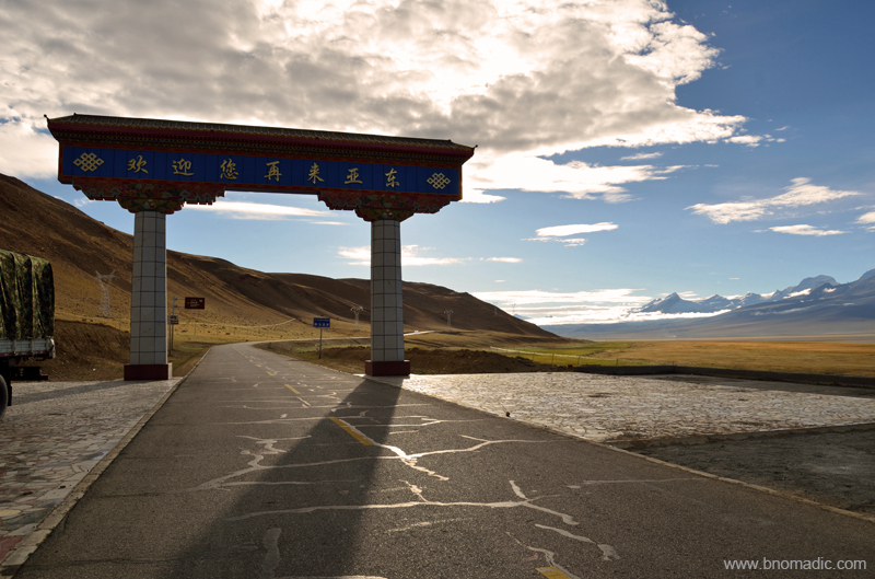
The welcome gate to the Kangma county of Shigatse Prefecture. More images at Flickr Photoset

Snowy peaks near the border of Kangma county. More images from the region at Flickr Photoset

The Chomolhari; Its sheer north-face rises over 2,700 m above the barren plains just before Yadong Valley. More images from the region at Flickr Photoset

The infant Amo River before Chumbi Valley. More images from the region at Flickr Photoset

The Amo Valley. Please visit Flickr Photoset for more images of the region/ yatra

The green Chumbi Valley and the road to the Nathula. More images at Flickr Photoset

Negotiating a landslide just before Nathula. More images at Flickr Photoset
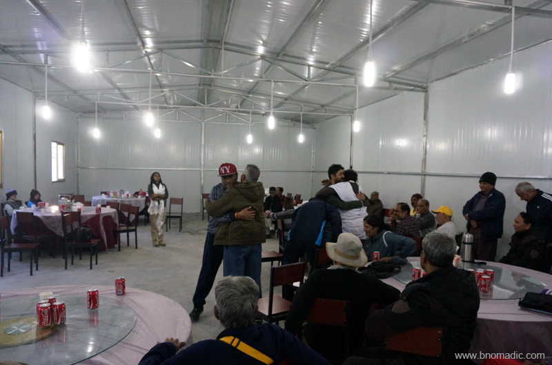
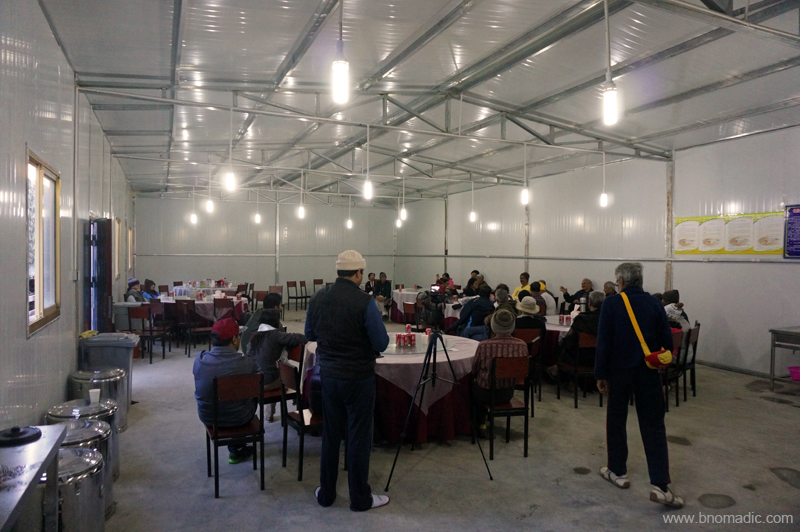
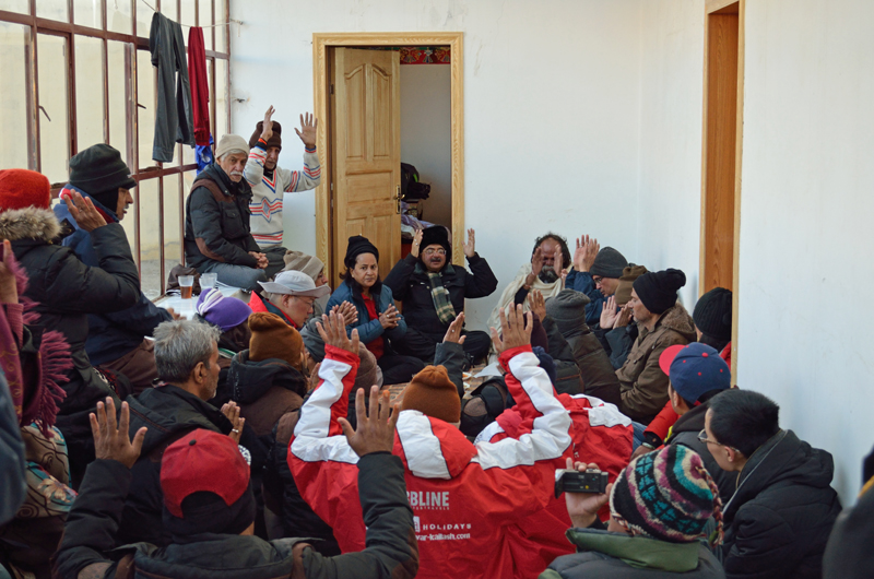
In about four days we were back at our first station in Tibet, Kangma township. A mind stirring fortnight-long excursion into the trans-Himalayan region was coming to an end. By the time we reached the Tibetan end of the yatra at Kangma, our groupies were overjoyed to have undertaken the trip. At Kangma, our Liaison Officer organised a small thanksgiving event for the Chinese management who travelled with us and helped us in organising this yatra. Even though I joined this program very late but from what I remember I saw yatris embracing each other in acknowledgement of having completed the most sacred pilgrimage. They hold each other as brothers and close friends, though most of them would never meet again.
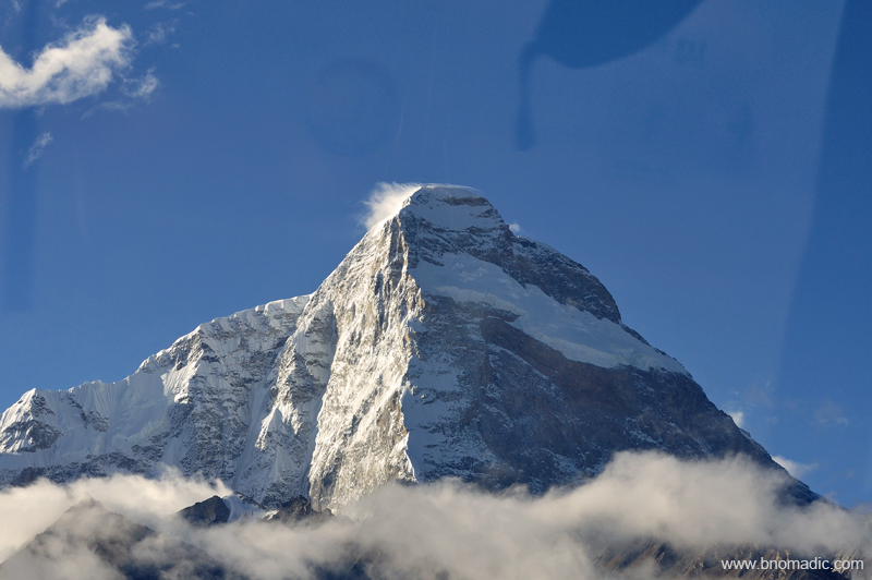
The 7326m Mt Chomolhari. More images from the region at Flickr Photoset
A Glimpse of Eternity by Mansarovar

The following post is a part of the “Kailash Mansarovar Yatra” Blog Series Into the Sacred Space. To read complete travel memoirs and trip report, please visit here.
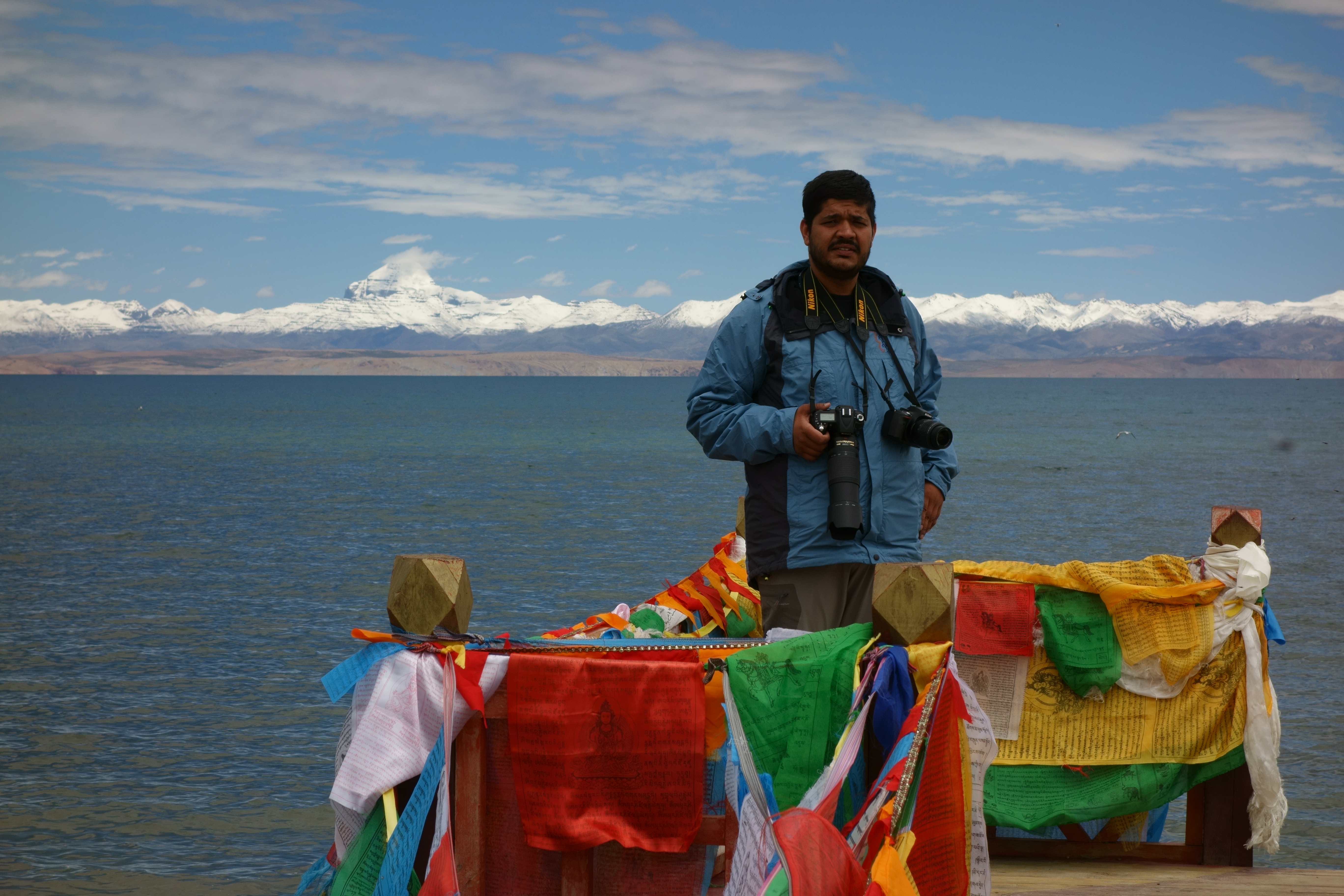
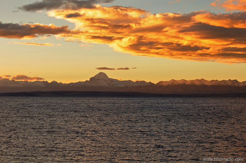
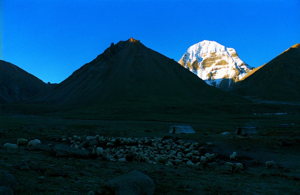
After returning to the camp house at Darchen, I headed out in search of a hot water bath. The emerging village of Darchen has quite a few such setups, run on solar energy by enterprising locals, where hot water shower bath is actually a possibility. The lady charged 10 RMB for a nearly unlimited bath; a thing of luxury I’d say. The weather had totally cleared up. From a distance, the waters of Rakshastal appeared like a turquoise tray beneath the gigantic Gurla.

The Kailash beyond the waves of brown-purple foothills; up here, the distances are greater than they seem. Landmarks look closer and smaller than they actually are. More images at Flickr
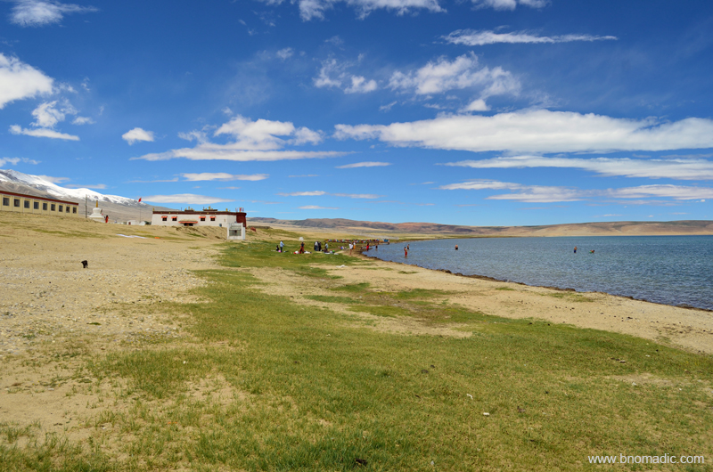
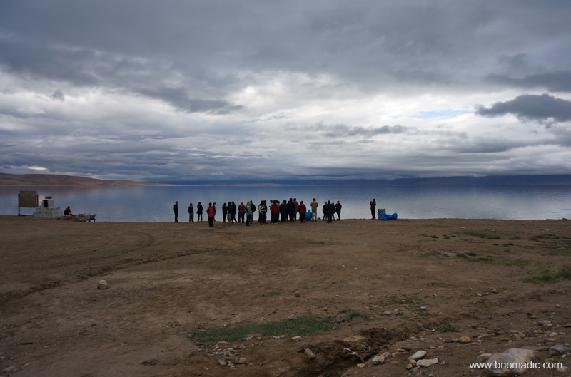
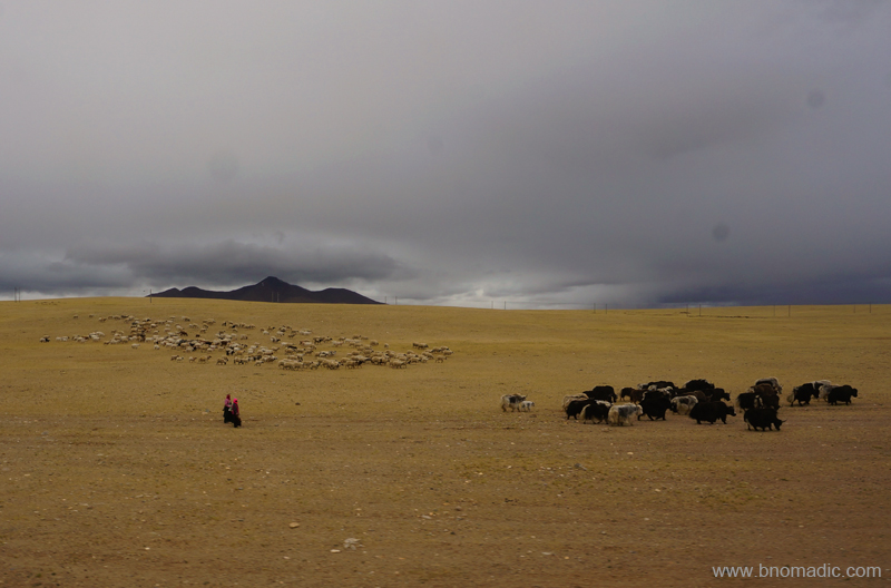
Our next halt, an hour’s drive from Darchen, was at Qugu monastery, also known by Trugo or Chugu, located by the Southern shore of Mansarovar. After days of travelling and trekking, we were finally going to be at the serene Mansarovar. The weather advantage was on our side as we left Darchen. Cruising on the highway, our vehicles briefly halted at Barkha where we topped up our rations and veggies. A few of us bought large-sized plastic bottles to carry the sacred water back home. Prayer flags were festooned in all directions; ancient chortens, mane stones, flagpoles et alia. Modern nomadic herders dotted the eastern shoreline. Completing a clockwise circuit of the flagpole at Hor Qu reception centre, we reached the Qugu monastery built on a raised level-ground by the sacred lake.
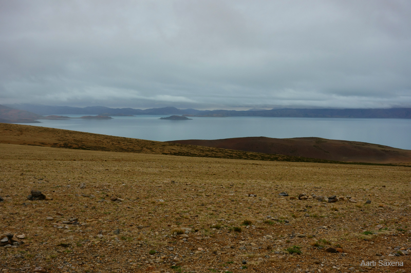
Miles away from the eastern shore, the Gurla Mandhata silvers the water. For more images, visit Flickr
Western Tibet is remote, rugged, windy, and cold. It is much more rural than Central and Eastern Tibet. Photo and Caption by Rita Willaert

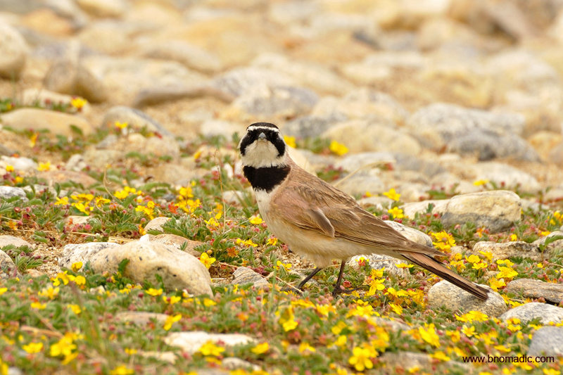
The rare Black-necked Crane; had spotted many such couples near Barkha village. Photo by Jen Reurink

The eastern shore is curiously streaked with polished pebbles. Photo by Aarti Saxena
The guesthouse compound at Qugu. More pics from the region/ yatra at Flickr Photoset
It was comfortably warm inside the dormitory of the Qugu camp house where the room had the most iconic vistas – the Kailash Mansarovar – right from the windowpanes itself. Outside, it was cold with the temperature dropping further; every time a cloud passed overhead. Grabbing a cup of hot tea and later having reassembled my luggage, I headed out for a walk along the shoreline. The lake is far wider and larger than I had imagined it to be from the photographs and numerous descriptions. The lake turns turquoise from dark blue as the drifting clouds make way for the sun. Shining fifty miles away in solitude, the Kailash is clearly visible. From a distance, its chiselled south face creates the illusion of a long, vertical stairway, as if for Gods to climb by. Although void of any life, as if carrying the marks of some sacred prehistory, the Mansarovar with its sapphire-blue waters, sandy shoreline against a backdrop of snow-capped mountains is wholly appealing. We seemed to have entered the holy land.
As I sit by the lake watching flocks of geese, crested grebes, mergansers, gulls and some other waders bobbing on the blue waters; in smaller groups, yatris huddle together after having completed the ritual bath; performing yagya and group poojas along the shoreline and bursting into loud holy cries. The lake contains several varieties of fish, carp and scale-less loaches on which these birds that winters in Indian plains, feed. The mythology equates these birds to Shiva’s swan that is said to nest on its shores. I revered in deep respect for the earlier travellers and adventurers who explored and surveyed this region; including the eminent ornithologist Dr Salim Ali who took a first of its kind expedition in 1945 to Mansarovar and behaviourally studied different species of this region.

The Kailash and the still Manasarovar; the quietness itself seems to freeze the water. More images at Flickr

A Brown-headed Gull in its breeding plumage; their solitary notes only accentuate the silence. More at Flickr
The Qugu monastery and the guesthouse; the same spot where the legendary explorer Sven Hedin had camped more than a century before. Please visit Flickr for more images of the region or yatra

Elated yatris after the pooja. Photo by Aarti Saxena

A Tibetan pilgrim collecting pebbles. Please visit Flickr Photoset for more images of the region

A Lesser Sand Plover in its breeding plumage. More images from the region at Flickr Photoset
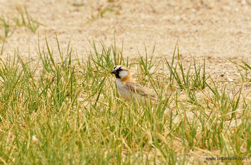
A Blanford’s Snowfinch or Plain-backed Snowfinch. More images from the region at Flickr Photoset
Taking a stroll along the shoreline and collecting pebbles. More images at Flickr Photoset
The shoreline glittering in the evening sun; all along the shore, between the blues and the greens, waders thrive in fullness. More at Flickr
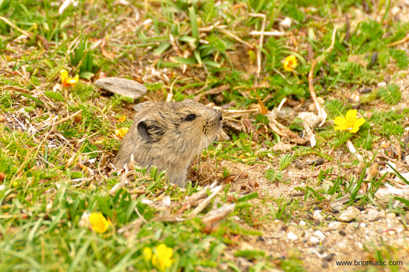
A Stoliczka’s Mountain Vole. Please visit Flickr Photoset for more images from the region and yatra
Apart from its spiritual significance, the region has also been famous for its yield of gold and turquoise; though most of the mines in the surrounding hills now stand abandoned. The region brought many curious western explorers; including game lovers William Moorcraft, Hyder Hearsey, explorers Sven Hedin and the pundit surveyors. Its most famous pilgrim Swami Pranavananda visited the region more than ten times and carried out scientific surveys as well as collected data and penned multiple guidebooks. The clear blue waters of the Mansarovar, highest freshwater lake of this sheer size in the world have been associated with mythologies of different faiths and religions. Tibetans, who call it Mapam Tso, commemorate the lake to Milarepa’s victory over a Bon shaman. The followers of Buddhism are also of the view that Buddha’s mother Maya bathed in this lake before conceiving him. Hindus believe that Mansarovar was the divine imagination of Brahma; before it became a geographical reality. As also is the belief that those who bathe in the sacred waters of the lake, where Gods dip; get cleansed of all sins from past as well as future life.
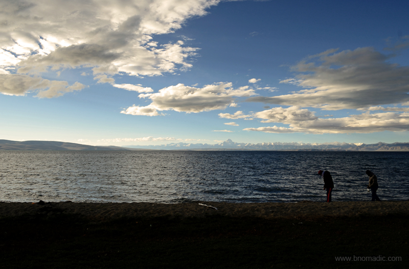
I wade in about 10m from the shore and as the water reaches my knees, I take five dips. The glacial melt of Mansarovar is not as cold as I expect it to be. Not sure if it cleansed my body but it calmed my soul for sure; giving it the warmth it needed. Faith argues that there exist hot springs inside the lake, even though; it remains frozen for more than eight months of the year. For the next couple of days, our activities were simple yet most fulfilling in this quiet natural sanctuary; sky gazing, long walks, collecting pebbles, clicking photographs, counting birds, meditating and performing poojas of course.
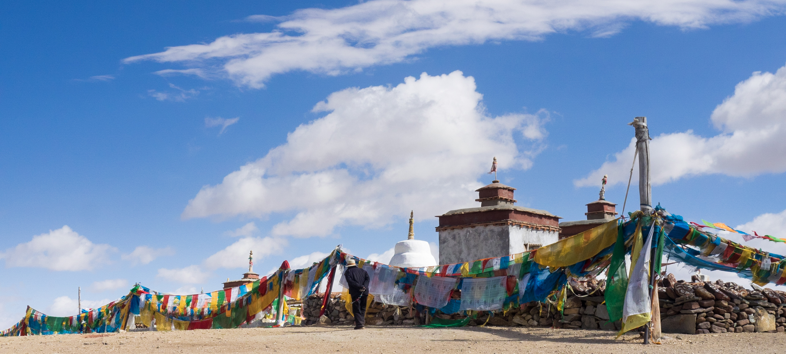
Picking up a handful of pebbles from the shore to take home as sacred mementoes, I make for the Qugu monastery (4590m), the traditional bathing place for Hindus before 1959. Being traditional overnight halt on the Mansarovar circuit as also for the basic guesthouses built adjacently; Qugu along with Chiu gompa still continue to be the most active pilgrimage sites around the lake. Just as the seven other monasteries built equidistant around the lake, symbolising a spoke of Buddhist Wheel of Life; Qugu was also gutted in the Cultural Revolution. Even though, with the onset of international tourism, a few of these devastated monasteries have been restored but they could never be as populous.
In this beauteous air I felt oddly exhilarated. Please visit Flickr Photoset for more images of the region

Qugu gompa (4590m) is the largest of the monastic sites around Mansarovar and was originally founded as a site for Drukpa Kargyupa mediators. More images at Flickr Photoset

Inside the monastery that was earlier handed over to Shepeling, a large Gelukpa monastery now in ruins on a ridge above Purang (Taklakot). More images at Flickr
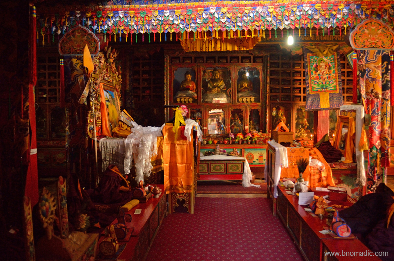
The central three figures in the assembly hall are Dusum Sangye – the Buddhas of the Three Times. Many of the smaller statues here were brought from Shepeling. More images at Flickr

The rare natural colours that matter here are brown-earth, snowy white, sky and its reflection plus some occasional patches of greens. Everything else, including those of the prayer flags are a creation of mankind.
A Horned Lark. Please visit Flickr Photoset for more images of the region or yatra
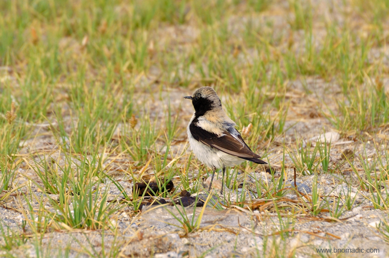
A Desert Wheatear. Please visit Flickr Photoset for more images of the region or yatra
For two days, irrespective of the weather I ramble on along the shore; with a camera in hand resting only at night or for meals. At over 4500m, with the air being light, my heart beats faster but my feet are aware where they are stepping. Up there, the sun burns with a cleansing brilliance. The sands are whitish and soft underfoot. As the cold wind would rise every now and then, the miniature waves too would respond proportionately. Fenced by snowy range, the holiest of the earth’s lakes – the Mansarovar – with its two hundred square miles of water, stretches endlessly with unfathomable azure. The rare natural colours that matter here are brown-earth, snowy white, sky and its reflection plus some occasional patches of greens. Everything else, including those of the prayer flags are a creation of mankind.
Lunching at the guesthouse. Please visit Flickr for more images of the region

Chinese military encampment behind the monastery. More images at Flickr Photoset

Evening pooja at Qugu. Please visit Flickr Photoset for more images from the region or yatra
MP Tarun Vijay and his wife joins for the evening aarti at the guesthouse. More images at Flickr Photoset
The sacred view in the evening; the region has an intriguing geology for Mansarovar is a stranded fragment of the Tethys Sea, almost drained by the upthrust of the Himalayas. More images at Flickr
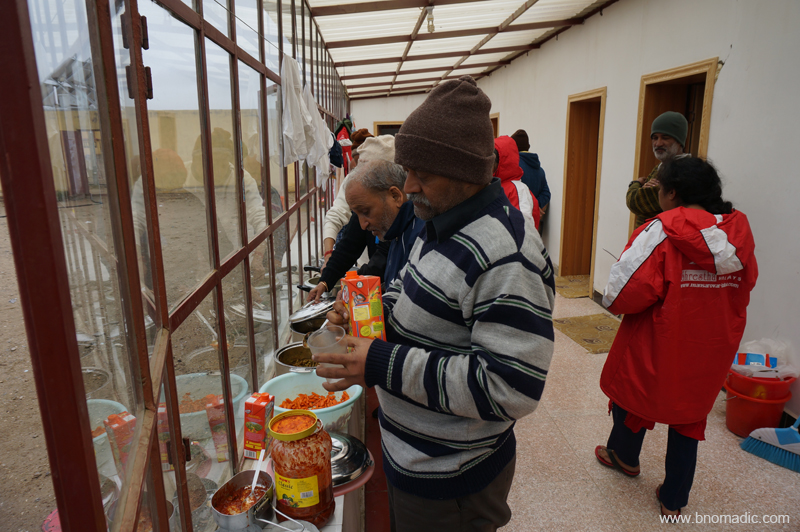
We are not bothered by the timing and quality of the food that is being served to us by the cooks. The excitement of staying so close to the sacred spectacle doesn’t let us sleep. Our gazes are ceaselessly fixed in the northern direction. At night when the clouds disperse, we are treated to the most spectacular display of stars. Many of us step outside of the dormitory to see the sky more clearly in a widest of high-altitude theatres. The faint profile of the snow-laden peaks is very much comprehensible in a moonless night. A few of us claim to have seen lights descending from the sky into the waters. Someone from the group asserts that these are deities in the form of light who descend to bathe in the lake, which is why it is sacred. Almost all of us agree with full devotion. Now whether it is St Elmo’s fire or something else, pilgrims are delighted to have seen it. I got up early in anticipation of another extraordinary view but was greeted with murky dawn and overcast sky on both mornings.
Early morning at the Mansarovar. Please visit Flickr Photoset for more images of the region or yatra
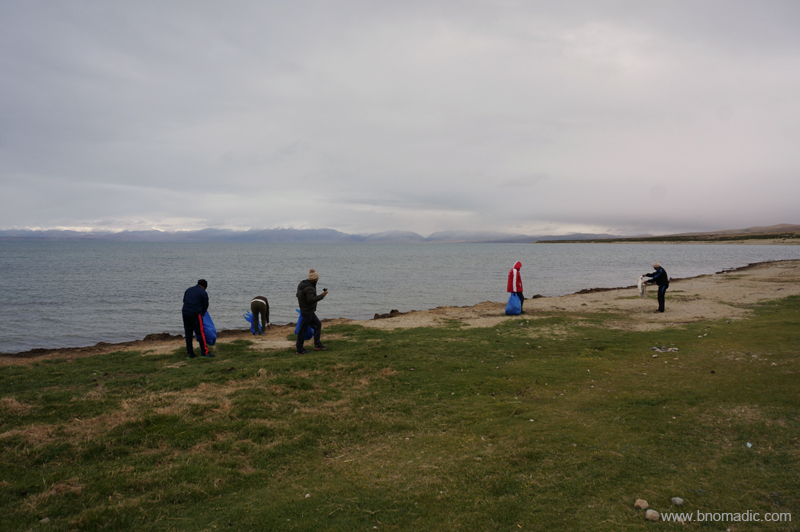
We took advantage of the time and cleaned up the shore. More images at Flickr Photoset
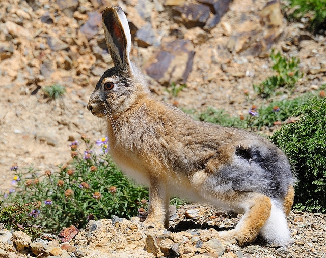
A Tibetan Woolly Hare; Descriptions recall that visitors encountered bands of wild animals in the region – I too glimpsed many particularly shy marmots and hares. Photo by Jen Reurink
A Hill Pigeon. Please visit Flickr Photoset for more images from the region
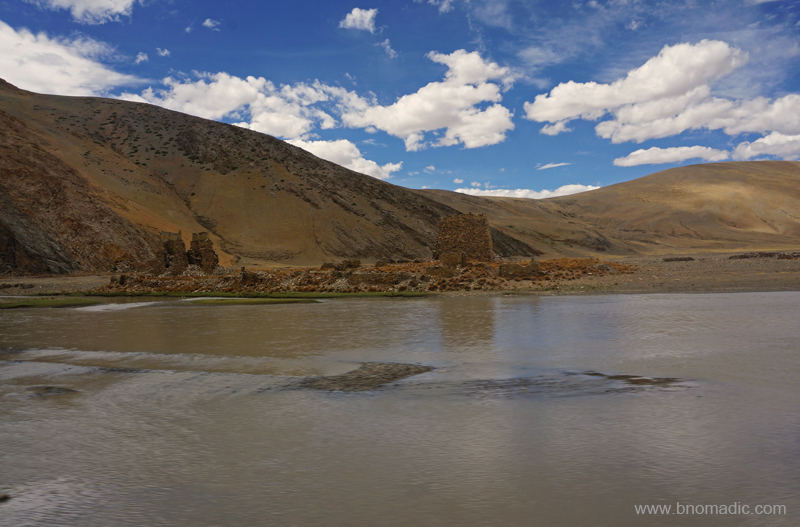
Ruined and deserted structures by the Mansarovar as observed from the bluff. More images at Flickr
The irregularly shaped Rakshastal is about 15m lower in altitude than Mansarovar. “Rakshas” means demon and this lake is associated with evil forces as per Hindu mythology. Photo by Aarti Saxena
Having spent two days at the site, as per the itinerary, we wrapped up our Mansarovar yatra by completing a parikrama of the lake in a clockwise direction. As we continue circling the lake passing a few deserted monasteries or shelters, we climb a ridge and reassemble by a cairn of rocks from where a near dramatic view of the Manasarovar as well as the Rakshastal, on the other side, could be obtained. Ahead, we crossed the historic Chiu Gompa as well as the channel that connects Mansarovar with Rakshastal before we assemble at the reception centre at Hor Qu to board our buses.
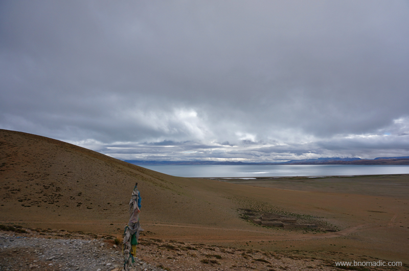
The flagpole at Hor Qu. Photo by Aarti Saxena
The Kailash and the Yam Dwar

The following post is a part of the “Kailash Mansarovar Yatra” Blog Series Into the Sacred Space. To read complete travel memoirs and trip report, please visit here.
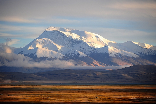
Next morning I got ready for the day earlier than usual and rushed to the street from where an unobstructed view towards the Barkha could be obtained. Out there a cloudy dawn splattered the trans-Himalayan landscape with gold and purple hues. By now, mind was quite used to seeing the Himalayas to the south. With the massive block of tilted snowy rock of Gurla Mandhata (7,694m) rising unchallenged from the plains, the mountains and glaciers of Zaskar range that feed the twin lakes were partially visible. The quiet of the terrain devoid of any vegetation was cracked only by the ruffles of the prayer flags in a relatively low intensity wind. Everything stood frozen except for the dark grey clouds. The golden light quickly faded into nothingness once the moisture laden clouds took over the sky.

The glittering whale-backed snowy rock of Gurla Mandhata (7694m) as observed from Darchen street. The peak has been climbed many a time since the first unsuccessful attempt by TG Longstaff in 1905. Please visit Flickr Photoset for more images of the region and yatra
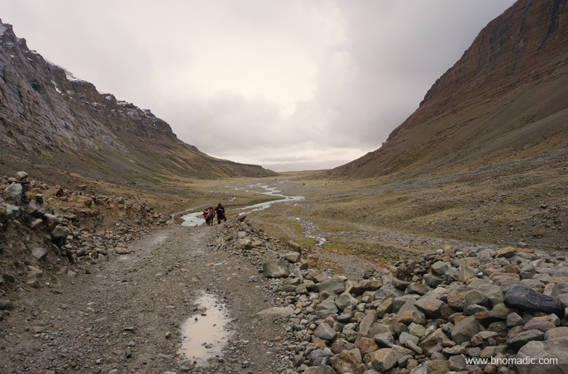
The Kora around Mount Kailash starts and finishes at Darchen only. Following a heavy morning meal, we packed up our trekking gear and left for the Yam Dwar at Tarboche (4730m); modern day start of the trek. Owing to altitude sickness and other ailments, three of the group members decided to stay behind in Darchen and give the parikrama attempt a miss. Our guide briefed us that the medical facilities throughout the route, including that at Darchen, are next to nothing even as more than a dozen Indian pilgrims are reported to die on the Kora every year. The most effective treatment for altitude sickness is to immediately take the patient down as many feet as possible. The issue here is that there is just no place to escape in this endlessly vast high altitude territory. Even the nearest airlift facilities are located at more than five days journey from Darchen.

Tarboche, flagpole with prayer flags, is the modern day start of the Kora. More images at Flickr

The head porter and Guru (our guide) engaged in a lottery draw. Photo by Aarti Saxena

A stone artist mechanically carving Om Mani Padme Hum in Tibetan script. More images at Flickr
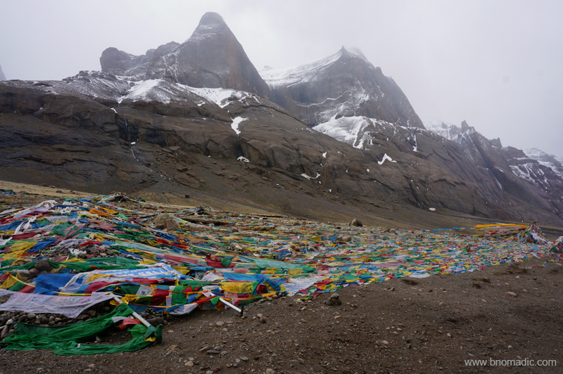
Inside the bus, a few of the yatris begin to chant Shiva bhajan in chorus; filming each other with mobile-cams at the same time. Facing northwards, some of us are praying fervently with folded hands. The holy summit was still hidden behind a dark cover of clouds. Located at a distance of 5km westwards from Darchen, Tarboche is the site of the popular Saga Dawa festival organised every year in late spring. Just next to it is a sky burial site where, as per tradition of the last ritual, the mortal remains of eighty-four Buddhist saints were fed to the birds of prey. When we arrive at Tarboche, the trailhead is deserted but soon enough a team of porters and pony herders assemble. Light drizzle starts. I pull out my poncho from the backpack and wear it over my backpack and trekking gear. I step out of the mêlée created by the lottery draw proceedings among the herders and porters who seem to be in no hurry to start for the trek. The yatris were allotted porters and ponies through a lottery draw. We have been intimated by the guide that nobody is allowed to share a pony and the backpack cannot be carried while riding; requiring the task of a porter. Although, the summit of Kailash was hidden behind dark clouds, the lower bands of the rock were quite visible. Skulls of wild yak and sheep are stacked on mani walls. At the site stands a recently renovated ancient chorten Kangnyi – Yamdwar – that has a passage through its middle.

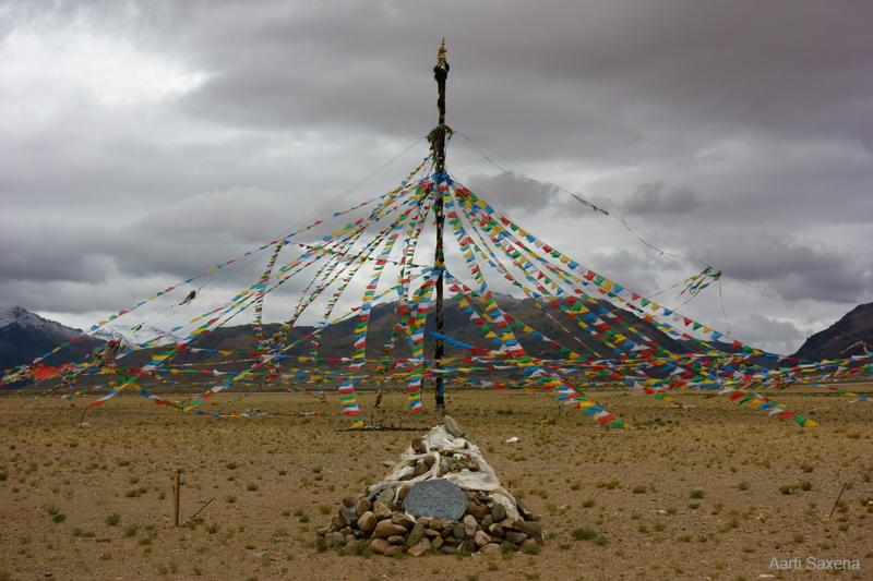
Kangnyi chorten or Yamdwar. More images from the region at Flickr Photoset

The sky burial site (not used anymore) at Tarboche. The south face of the Kailash is partially visible above the site. For more images of the region, please visit Flickr Photoset
Part of their religious tradition, the Hindus and Buddhists circumambulate the Kailash in a clockwise direction whereas Bonpas do it in the opposite way. As soon as a porter and pony were allotted to me, I set off up the trek leaving behind the chaos of ponies and porters. Stooping to enter the doorframe, I crossed the Yamdwar. Inside, a mummified sheep was tied to its ceiling. From this point onwards, most of the group members preferred to ride on ponies with porters carrying their belongings and stuff. Only four – five of us opted to attempt the kora on foot.

The trek begins in a bad weather. Please visit Flickr Photoset for more images of the region

Walking the Kora. Please visit Flickr Photoset for more images of the region
Ahead, the valley of Lha Chu narrows dramatically at an area called Sershong. Flowing through the valley of Gods, the Lha Chu is almost 10 metre wide carrying the snowmelt of holy rocks. On either side, spectacular cliffs of granite rise above; with mineral rich water cascading down to the valley floor. Wearing cowboy-like floppy hats, a few ponymen outpace me; their ponies adorned with embroidered saddles and brass bells tied around their necks. Soon enough a few motorcyclists overtake all of us. After about an hour or so, I find myself below the Chuku (or Nyenri) Gompa, the thirteenth century monastery perched high above the valley floor in a mountain-wall on its right bank. During the Cultural Revolution all the monasteries of the Kailash region were wrecked down and this happened to be the first one to be rebuilt.

Rebuilt after the cultural revolution, the thirteenth century Nyenri Gompa. More pics at Flickr

“भोले की जटाएं” someone from the group expressed in emotional excitement. More images at Flickr
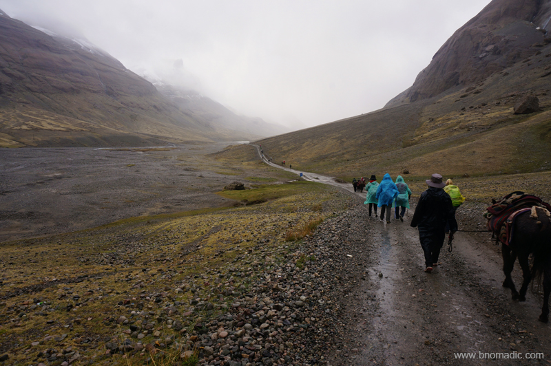
The initial stretch of the trail is in fact a dusty footpath spread on a gradual gradient. The weather has gone from bad to worse as I stutter ahead on the holy trail. Showers of rain are possibly the last thing one would expect in this already freezing and windy high-altitude terrain. Snowfields and tonguing glaciers are visible up on the mountain wall wherever the fading visibility allows. Even though I am walking in a rarefied air, my breathing is not strained; partly due to the ascent being gradual but mostly due to being alone. Moving at my own pace, I feel exhilarated. Clouds keep getting darker. Inside a three layer of cloths, I am sweating as I trudge ahead. Outside its mind numbingly cold as the intensity of drizzle increases.
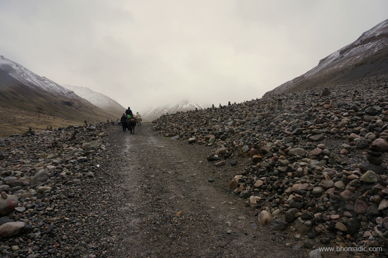
Looking back: It would have been impossible to get lost on this trek; trails separate but re-converge along the left bank of the Lha Chu. More images from the region at Flickr Photoset

Mountain walls, rocks and boulders take on magical shapes that create an optical illusion. More at Flickr
As I trek around Kailash, following timeless paths and footsteps of millions who have walked this mile before, I muse over its ever intriguing geology. At just about every turn of the trek numerous cairns and piles of mani stones stand a witness to millions of pilgrims who have treaded the same path before us. The terrain in this barren valley indubitably possesses a hypnotic charm. Mountain walls, rocks and boulders take on magical shapes that create an optical illusion. The infinite variety of rock here comprise every tinge ranging from crystal to creamy, amber, tawny, yellow, orange, pink and red, etc. The Kailash itself is blacker granite.

Quite high above a livable altitude, the ascent was gradual. More images at Flickr Photoset
From a distance, the ridges around me appear a darker shade of reddish brown as a dense patch of fog engulfs the western face of Kailash. Unlike other faces, the western side looks imposing and almost menacing when viewed from an angle just below it. A notice board marks it to be a landslide zone. The abundant cairns and fluttering prayer flags testifies it to be a sacred site. The wind eroded and chiselled rocks speak of the threatening forces and laws of nature. Climbing a winding trail ahead, long pent up emotions inside of me unexpectedly become irrepressible as I feel divinity guiding my feet and carrying me aloft. Speechless and with teary eyes, I get a feeling of having arrived as I accomplish the long cherished goal of being in the presence of Kailash. Pilgrims are greeting each other with repeated holy cries of “Om Namah Shivaya!” Soon I find myself standing by a cluster of a few tented teashops where I stop to take some rest and get some relief from the drizzle.
The west face of Kailash engulfed in fog. Unlike other faces, the western side looks imposing and almost menacing when viewed from an angle just below it. More images from the region at Flickr
Trudging ahead. Please visit Flickr Photoset for more images of the region
The teashops are large canvas tents, set up during the pilgrimage season, selling freshly brewed yak butter tea, basic supplies, noodles, coke, red bull and even beer. Tables and benches are arranged along with some emergency bedding as warmth is provided by smouldering yak-dung in a cast-iron stove used for brewing tea. I consume three cupful of butter tea before starting again. The rest of the yatris ramble in on uncomfortable ponybacks. Many of their porters and ponymen are women who wear ankle length bright costumes and cover their faces with surgical masks to protect against the dust. Truly hardworking lot they are!
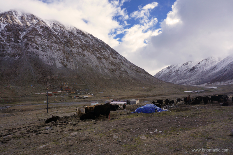
Nearly four – five hours after Nyenri, covering the most scenic stretch of the kora, we reached our campsite for the day at Deraphuk. Many visitors including locals and foreigners were camping in the vicinity of our guesthouse as well as the ancient monastery that was rebuilt in 1985 at the same site facing the striking north face of Mt Kailash. New concrete structures were being constructed including a few at the Deraphuk monastery located on the other side of the Lha stream. The guesthouse we were allotted seemed recently fabricated. Although, my body didn’t show any signs of altitude sickness but cannot stomach even a thought of any food in this below freezing temperature. Hanging my shoes and clothing to dry, I tucked myself in a layer of blankets and quilts. I vainly hoped to catch a glimpse of the north face in the evening light.

Just before Deraphuk; Cairns and rocks festooned with prayer flags are an indication to a sacred shrine
Deraphuk monastery as viewed from the left bank of Lha Chu. More images at Flickr Photoset
In the evening I stepped out to explore the tract above our guesthouse and reached a mani wall. Ahead of me is a stream that leads to the deceptively close looking foot of the Kailash. As I decide not to venture any further, I thought of the adventures of Sven Hedin who more than a century ago in 1907 went through a similar experience. To cross the 5640 m Dolma La and reach our next campsite at Zutulpuk, we have been instructed that we must start by 4am. The persistently bad weather thought otherwise.
North face of the holy Kailash as observed from Deraphuk. Photo by Jen Reurink
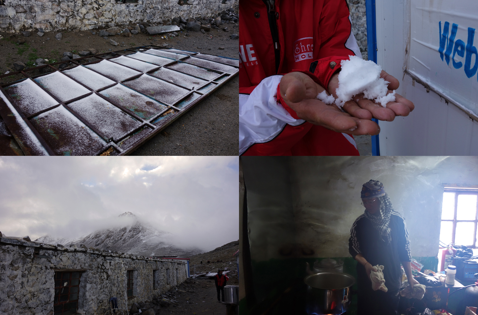
Clockwise from top: 1 & 2) It had snowed in the wee hours of that morning, 3) Head cook in the kitchen and 4) Olden cells of a guesthouse. Photos by Aarti Saxena
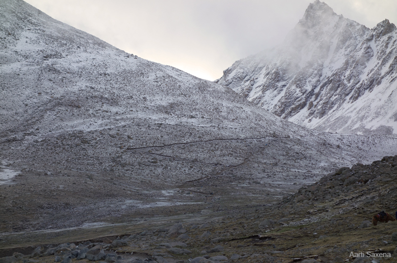
The trail ahead of Deraphuk. Photo by Aarti Saxena
Notice the innumerable cairns. More images from the region at Flickr Photoset

Like most groups from India, we spent a night in Deraphuk; hardy locals circle Kailash in a single day to cover a total of 56 km. Some determined souls prostrate with every step. Photo by Jen Reurink
It had snowed all through the previous night. Next morning before we started the day’s activities, a few yatris scrambled up the slope and collected chunks of ice to show the others. As the group prepares to leave for Darchen, endpoint of the circuit, one of the yatris made a round excursion to Kangkyam glacier that descends from the north face of Kailash. Regular kora walkers cross the Lha Chu and ascend up the Dolma Chu valley on a trail strewn with moraine and boulders. The trail forks at Jarok Donkhang (5210m) to a shorter one and less frequented route through Khando Sanglam La. The rocky expanse called Shivasthal, a pind-daan site is located at about three hours distance from Deraphuk on the route through Dolma La. Ahead the trail flattens a bit to reach the pass. The crest of the pass could be reached in about couple of hours from this site. The sacred lake Gauri Kund (5608m) appears as the steep descent begins. The grassy banks of Lham Chu Khir are reached in a tough hour-long descent. From here a rather easy descent takes you to the monastery of Zutulpuk (4790m). The pick-up point for – a bus ride to Darchen – is at an easy distance of five km from here.

The terrain in this barren valley indubitably possesses a hypnotic charm. More images at Flickr
Wish our itinerary allowed us to stay around Darchen for at least five days. More images at Flickr

A Himalayan Marmot outside its burrow. More images from the region at Flickr Photoset
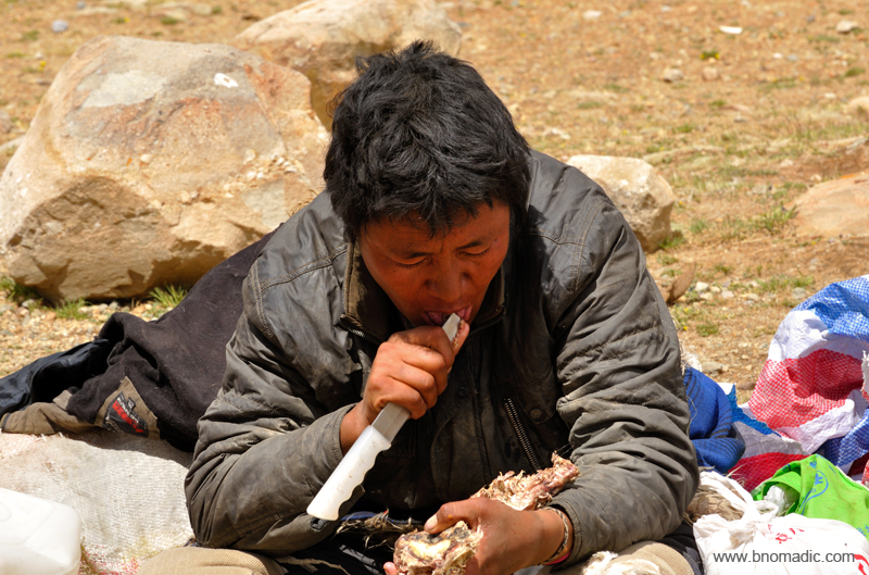
A Tibetan feasting on a dried meat at the end of the Kora. More images from the region at Flickr
At just about every turn of the trek numerous cairns and piles of mani stones stand a witness to millions of pilgrims who have treaded the same path before us. More images at Flickr

Ready to board the blue buses. More images from the region at Flickr Photoset

The road through Barkha plains appears leading to the base of Gurla Mandhata above Rakshas Tal. The weather opened up as we reassembled at our guesthouse at Darchen. Please visit Flickr Photoset for more images of the region/ yatra

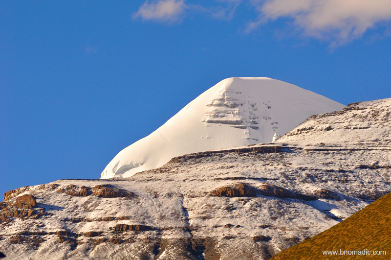
The summit of Kailash as observed from Darchen street in a clear weather. Please visit Flickr Photoset for more images of the region/ yatra
A closeup of the south face of the Kailash from Darchen street square. More images at Flickr
Traversing the Barkha Plains

The following post is a part of the “Kailash Mansarovar Yatra” Blog Series Into the Sacred Space. To read complete travel memoirs and trip report, please visit here.
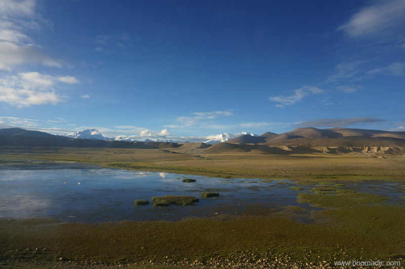
As per our itinerary, our day’s destination – Darchen, an emerging village at the base of the holy Kailash – was 477km away from Zhongba. The road ahead after Zhongba seemed recently carpeted. Till about a few years ago, the stretch of the road immediately after the town used to be frequently invaded by sand dunes on either side of the road. However, with new road we did not face any problem. Within an hour of leaving Zhongba, we passed through a picture-perfect terrain of dunes, river and mountains. The first pass we crested after leaving Zhongba was 4650m Mayum La. Ahead, the road climbs another pass at 4725m and descends through even more dunes to reach Paryang. Photos taken along this stretch got us steppe, streams, desert dunes, azure blue sky and snow-capped mountains all in the same frame.

Photos taken along this stretch got us steppe, streams, sand dunes and snowy mountains all in the same frame; waters of Dangquezangbu visible in the frame. Photo by Aarti Saxena

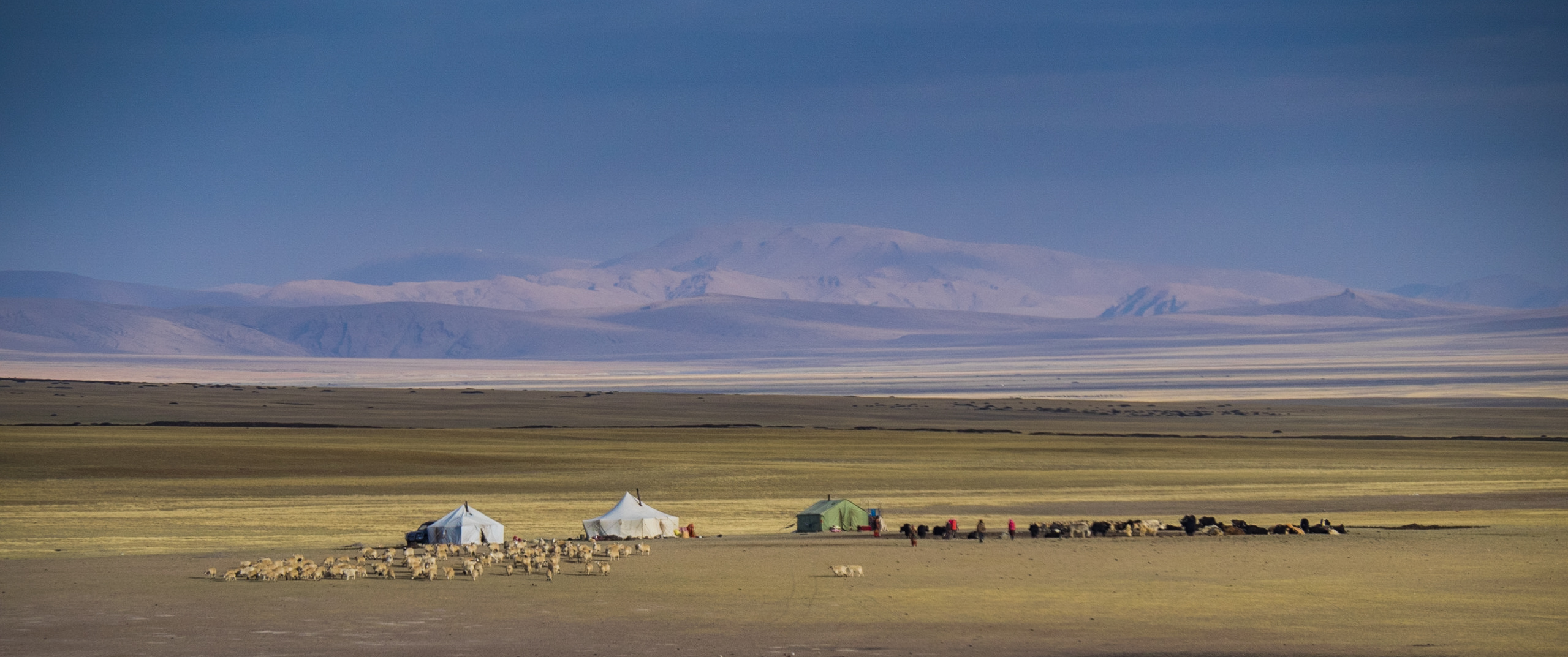
Grazing grounds for Yaks in the Yarlung Tsangpo watershed near Zhongba. Photo by Jen Reurink
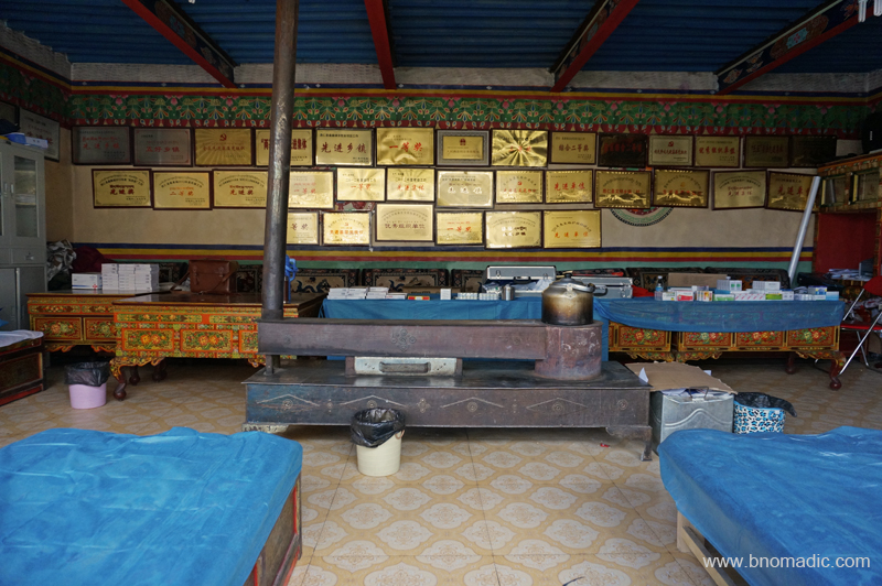
For those travelling in the Kailash Mansarovar circuit, Paryang has always been a popular stoppage point. The main settlement of Paryang, last one on way to the Kailash Mansarovar region, is not more than a typical Tibetan village we had been crossing on the way so far. The dusty village of Paryang is typically spread around a gompa. A majority of the residents comprise migrant nomads from neighbouring villages or labourers on engagement. Among the many houses are a few shops and some family homes that can double up as restaurants. The layout and description of the village, nevertheless, is expected to change in the coming years. Mostly led by the administration, a fairly large number of buildings, cells and compounds were being constructed. I was particularly intrigued by the construction of a massive granary as our fleet of vehicles briefly halted to get fuelled up for the journey ahead.

The marshes of Paryang (also called Baryang or Payangzhen). Photo by Aarti Saxena

The Laiwu Zangbo, a tributary of Yarlung Tsangpo. Please visit Flickr Photoset for more images
With last traces of organised human life now behind us, we marched ahead in full excitement of finally being able to touch and feel the Sacred Space. Marching in the northern side of the Great Himalayan Range in a westerly direction, we descended into a level valley twenty to thirty kilometre wide. At our left we had the icy peaks with tonguing glaciers and another mighty range of the trans-Himalayan region towards the right; with sand dunes and turquoise water bodies on both sides of the highway. Finally we had reached the crown territory of the Tibetan highlands. I mused in awe as we crossed the routes taken, a few decades back, by some of the greatest travellers or explorers on earth.

The marshes of Laiwu Tsangpo. More images from the region at Flickr Photoset
The Dangque Tsangpo. More images from the region at Flickr

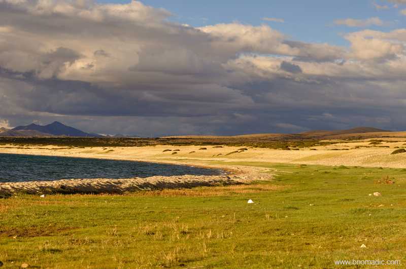
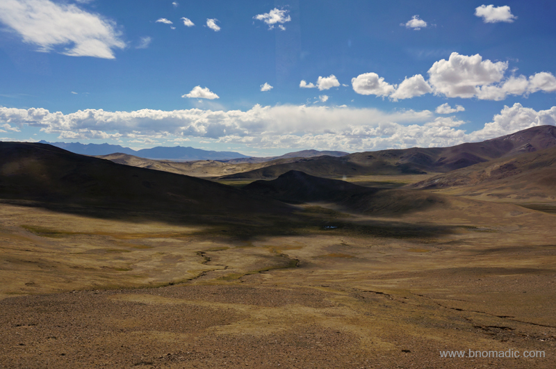
Endless expanse of high-altitude terrain; a common sight
Here in this thin and clean air the rounded mountains were adorned in pure changing colours obliterated only by the intensity or angle of light; often at the mercy of the onrushing storms with their impenetrable masses of cloud in this season. On high peaks and ridges the permanent snow expanded in silvery white and in the depressions, on the valley bed, water bodies glittered like turquoises in a vast sea of mud and gravel. In such a calm splendid environment one would experience the same harmony with inner spirit as in entering the holy of holies area in a temple.
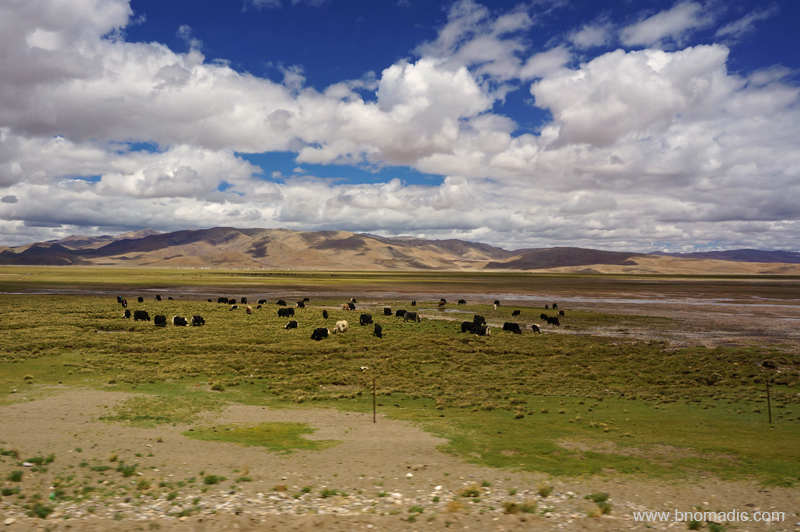
It is not as if living creatures are entirely non-existent on this naked, sterile, desolate wilderness of mud and rock. Contrary to the popular belief, a wild life corresponding to the grandeur of the landscape thrives and flourishes here. The scant, stiff and short grass iced by almost fictional shrubbery that grows here on the valley floor may have never contained sufficient nutrients for the caravan animals but for antelopes, wild sheep or wild asses, called kiangs; it appears to meet the need. Wild yaks sustain themselves on the mosses and lichens on the mountain slopes and among the moraines. Given an option I would impulsively follow the wildlife through my camera and record their nimble elastic leaps and rapid flights as they roamed on the mountain slopes in their habitat. But for the structure of the itinerary of this organised yatra!
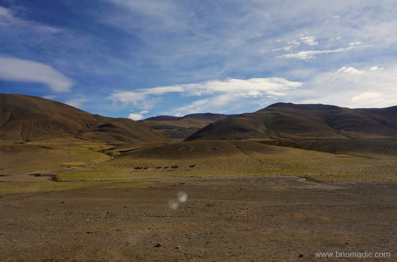
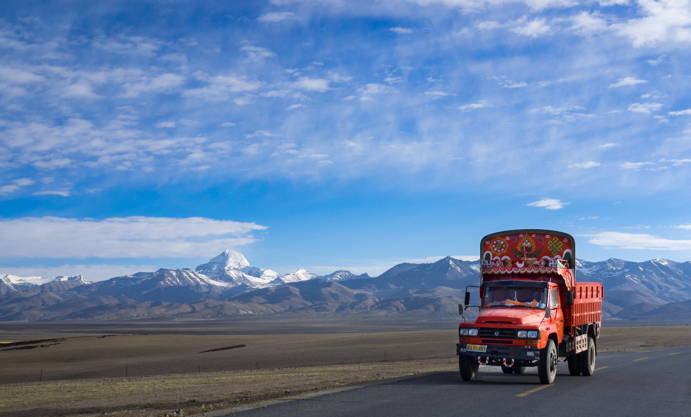
The second of the numerous herds of Wild Asses we came across in Tibet. More at Flickr
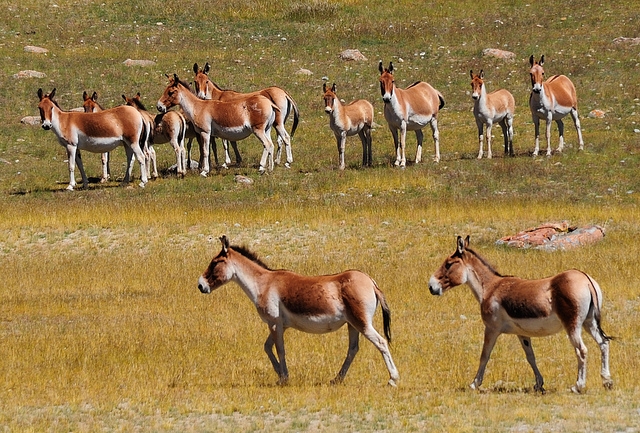
A herd of wild asses, called Kiangs. Photo by Jen Reurink
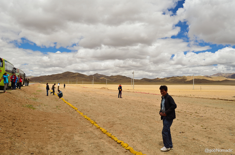
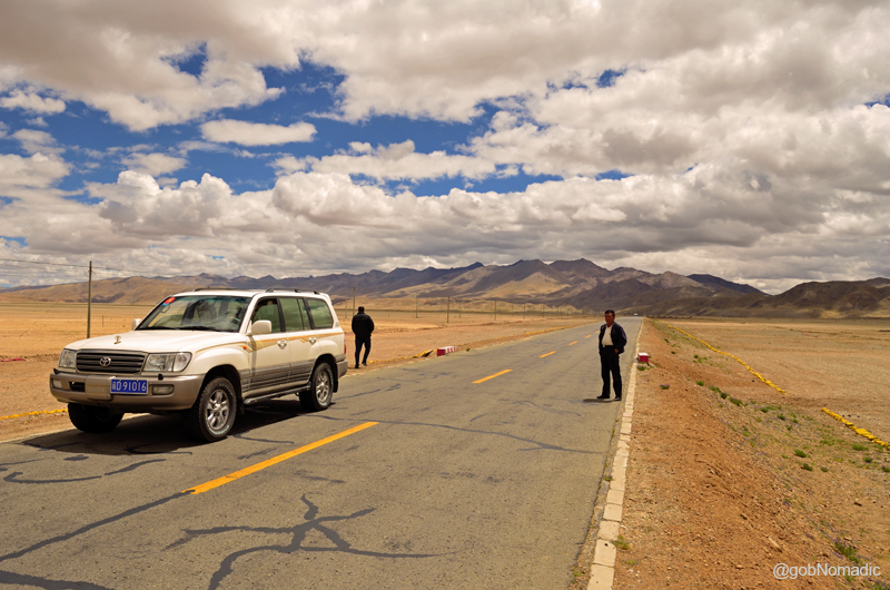
We stopped for camp lunch by the highway, near Satsang, after a couple of hours drive from Paryang. Our cooking team had hesitatingly prepared poori aloo subzi for packed lunch. I had a hearty meal after which I made a few snap records of the marshy highland around our campsite. The route ahead passes through a yellow steppe zone. Wherever the weather was clear the craggy snow-capped Himalayan peaks were visible to the south. Soon we were encircled by red rocky barrenness in a valley full of icy streams. Winter ice by the streams was yet to melt completely. As if out of nowhere, a check post, manned by Chinese police and excise officials, emerged where our documents were once again checked and verified. The inspector in-charge specifically announced, “No photography is allowed”. “Please”, he added later. Suddenly everyone inside the bus was staring at me. I decided to give my camera some rest.
Forever adventurous, truly nomadic. More images from the region at Flickr Photoset

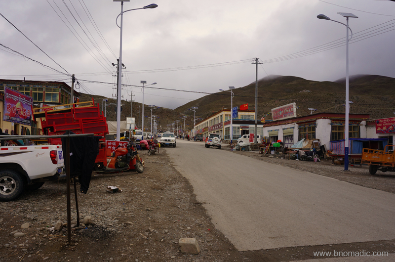
The G219 near Satsang in Tibet. Please visit Flickr Photoset for more images of the region or yatra

Our lunch campsite for the day near Satsang. More images at Flickr Photoset

Lunching inside the bus. More images from the yatra at Flickr Photoset
The G219 near our lunch campsite. More images from the yatra at Flickr Photoset
Soon afterwards, we begun the climb to the 5280m Mayum La, made famous by the legendary explorers and travellers. After Mayum La, the road widens a bit as we crossed the Shigatse prefecture to enter the Ngari prefecture. A rather long turquoise lake called Gung Gyu Tso comes into view to the left. A few of the passengers confused it with the Rakshastal. I was particularly focused on to find the holy rocky height of the Kailash in a total overcast weather. The blueness of the magical Mansarovar comes into view just before the village of Hor Qu (4620m). Robbed off its traditional charm; the village of Hor Qu wore a deserted look. A Chinese army encampment was installed at the village when we entered. The 7728m Gurla Mandhata is to the southwest and the lake was still actually a long hike away. Our convoy briefly halted at the newly constructed tourist reception centre at Hor Qu. I immediately got down from the bus to catch a glimpse of the Manasarovar (4580m). I felt the bone chilling fiercest of winds, the Kailash Mansarovar region has been famous for. Only a near view of the lake was possible in such a bad weather.

Icy stream before Mayum La. Please visit Flickr for more images of the region
Below the Mayum La; towards the Ngari side. More images from the region at Flickr Photoset

The long Gung Gyu Tso after Mayum La and before Hor Qu. Please visit Flickr for more images
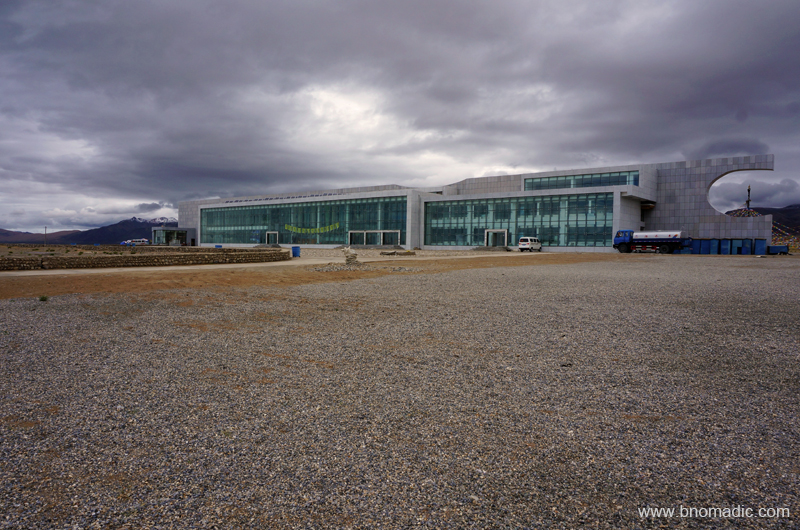
The newly built Tourist Reception Centre by the Mansarovar in Tibet. More images at Flickr
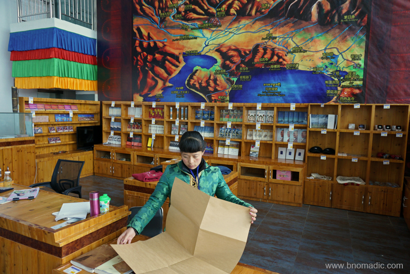
Inside the complex; apart from a cafe, it had a information-shopping centre as well. More at Flickr

Statue of a policeman guarding the streets of village Hor in Tibet. Photo by Aarti Saxena
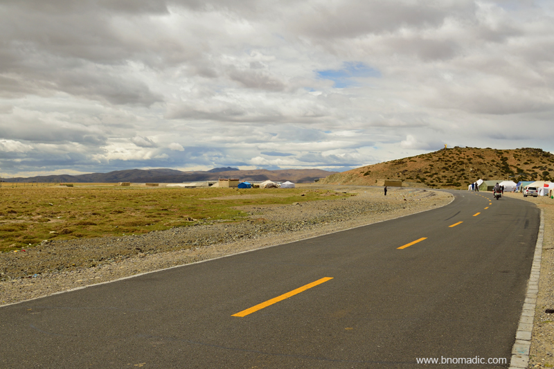
From here, it was mandatory for all group travellers to proceed further to Darchen in the buses specifically allocated for the purpose. Still, in view of the bad weather, the authorities at the reception kindly agreed for us to travel in our own fleet of vehicles. Ahead, it is 22km to the crossroads of the settlement of Barkha (or Barga) after which we continued west to reach Darchen. Unlike what I had read about this key junction from the diaries of the travellers, Barkha is an emerging touristy village from all aspects. Many shops selling basic needs and supplies, small restaurants, etc. have sprung up alongside the streets of this village square. Our convoy cruised and quickly made its way to the settlement of Darchen, where our permits were once again verified. This time we all were handed a packaged mineral water bottle along with a group entry ticket. “The water inside this bottle is sourced from the Kailash,” we were told. I consumed its contents in one gulp and packed the bottle inside my backpack. By now the weather had improved a bit to the south and we could see right up to the snowy heights of the Gurla Mandhata above the azure waters of Rakshastal. The guesthouse, our shelter for the night, was still a few kilometres away from this checkpoint.
View towards the Barkha plains from Darchen square. More images from the region at Flickr
The Gurla Mandhata above Rakshastal and Barkha plains; as viewed from Darchen. Photo by Jen Reurink
View towards the Kailash. Please visit Flickr Photoset for more images of the region/ yatra

Billiards and snooker have become an addiction in Tibet, especially the southwest part. More at Flickr
As I recall the accounts of travellers I have been following, calling Darchen (4580m) even a settlement would have been an exaggeration till about a decade ago. That will be so untrue now. From just a seasonal ramshackle collection of tents and camps, Darchen (or Taqin or Lhara) has expanded into a two street settlement comprising houses, a few multi-storeyed buildings, guesthouses, grocery stores, restaurants and hot-shower cafes, etcetera. Having arranged my stuff into the room allocated to me, I went for a stroll in the market. Bargaining is very much a possibility and I bought an aluminium walking stick, at a reasonable price, for the kora trek the next day.
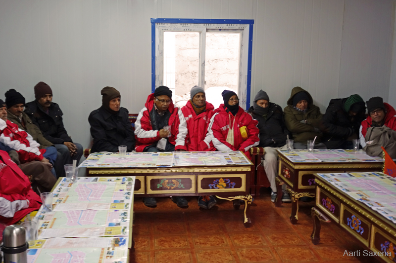
Yatris during the evening briefing at Darchen. Photo by Aarti Saxena

Portrait of an old man. Photo by Rita Willaert

Local kids at Darchen. Photo by Aarti Saxena
I wish we had a couple of more days to spend at Darchen, the starting point of the Kailash kora. Apart from a better acclimatisation, the place offers many interesting short hikes and walks from where even finer and closer views of both the Kailash and the Mansarovar could be obtained. Dense clouds drew over the Barkha plains blocking our view towards the lakes. The wind did not abate until late in the night. I headed back to the guesthouse for yet another briefing session. This time we were joined by the MP Sh Tarun Vijay. Darkness had fallen over the earth. I continued with my strict regimen of extra liquid intake; and headed to the room for an early light out after dinner. Bhatol bhai had uncurtained the window before sleeping. The weather looked dicey outside. Blue-white lightning flashed in the south as the moon rose over the mountains. Far in the distance, Gurla Mandhata rose like a spectre in white sheets. I thought of Longstaff’s unsuccessful attempt to climb the peak more than a century ago. The peak has so far been climbed more than six times since then.

The cell allotted to the two of us at Darchen; Bhatol bhai sorting out his backpack for the kora
By the Yarlung Tsangpo Chu in Tibet

The following post is a part of the “Kailash Mansarovar Yatra” Blog Series Into the Sacred Space. To read complete travel memoirs and trip report, please visit here.
Next morning, I hastily packed my stuff before moving out of the room to join the rest of the gang to board the bus for next leg of the journey. I had missed the morning meal. Mercifully, the nuts and energy bars I carried came to my rescue. As the engine of the bus cranked to life, I began to munch the nuts. Our day’s drive involved highland travel of over 475 km to cover the distance between Lhatse and Zhongba (4728m) through the truly nomadic countryside of Tibet.

Within an hour of leaving Lhatse, we passed by the azure blue Lang Tso (or Ox Lake), a bone of contention between the natives and the Chinese because of difference in views over sport fishing being popularised by the authorities. Please visit Flickr for more images of the region

The reflection of such solitary landscapes has been etched forever on the mind. More at Flickr
The 4500m Ngamring La. Please visit more images from the region at Flickr

View from the Ngamring Pass. Please visit Flickr Photoset for more images of the region.
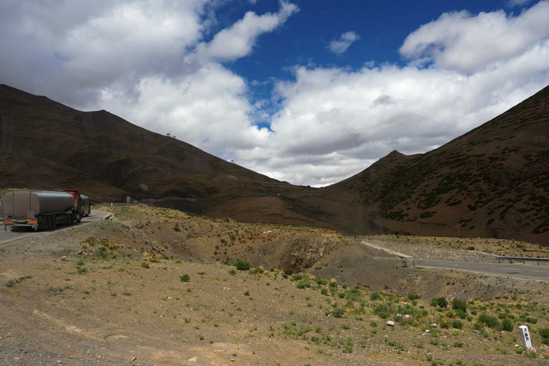
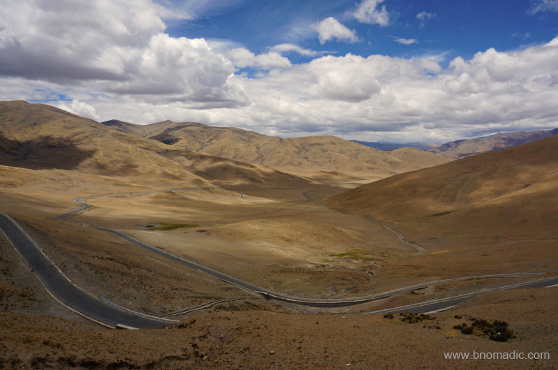
To our utter curiosity, for our journey ahead, we were to travel on the China National Highway 219 (G219), the contentious thread of asphalt from Lhatse in the Tibet Autonomous Region (TAR) to Yecheng in the Xinjiang Uyghur Autonomous Region; both claimed by the People’s Republic of China. It was this 2086 km of highland motorway – running not only adjacent to the Indian Territory but passing through the Aksai Chin area of Ladakh – the construction of which along with some other factors triggered the Indo-China war of 1962. Considered to be one of the highest motorable highways in the world, the G219 traverses many extended valleys most of which are often flat providing a habitable camping ground to nomadic settlements along with their herd.

Descending from the Kar La on the G219. Please visit Flickr for more images of the region
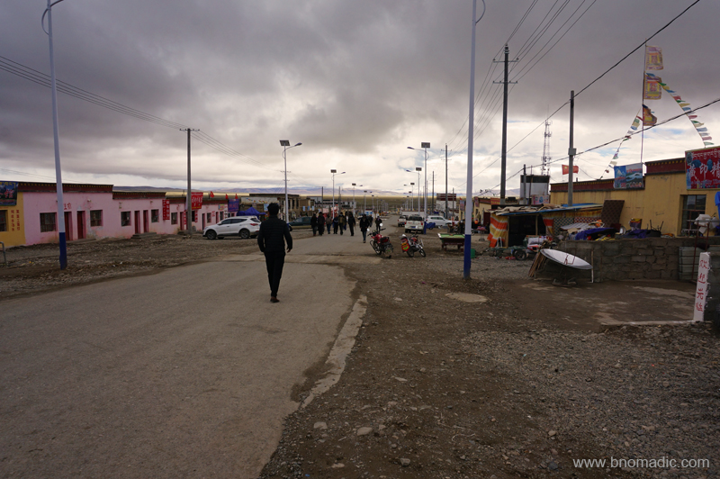
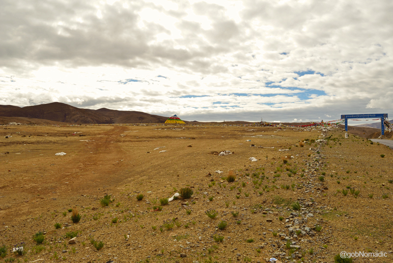
The single street township of Sangsang at 4676m asl. More images from the region at Flickr
A short break at Sangsang. You may like to visit Flickr for more images of the region

A common sight on the streets, this “jugaad”makes use of solar energy to cook. Photo by Dennis Jarvis
Inside the infirmary at Sangsang. Please visit Flickr Photoset for more images of the region
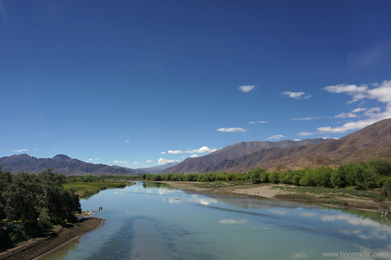
The chief highlight of the day’s drive was a tête-à-tête with the 2,840 km long voluminous Yarlung Tsangpo River which has its origin in the holy Kailash region where we were heading with all our enthusiasm. In the years gone by a great debate as well as a few controversies raged about the actual source of the river along with its course down to Indian mainland. With the technical advancements and much interest, however, the source and the journey were traced to accuracy; still the gorge of the highest river in the world continues to be an intriguing exploration prize. Originating from the Angsi Glacier southeast of the Kailash Mansarovar region, the Tsangpo or Brahmaputra (in India) flows past the settlements of Zhongba, Saga, Lhatse and Shigatse. The G219, however, does not follow the Tsangpo (also called Zangbo) for a larger part of the route; instead it parallelly meanders through its side valley and tributaries. As with the altering course of the river, the road network too is course-corrected as more easily passable stretches are discovered.

A small settlement on a greenish patch. More images from the region and yatra at Flickr Photoset
A typical scene by a nomadic settlement. Photo by Jen Reurink

Dogxung Tsangpo, a tributary of Yarlung Tsangpo. More images from the region at Flickr Photoset
The turn-off to the Kailash Mansarovar region is a few kilometres south of Lhatse; marked by a check post where Aliens’ Travel Permit along with visa and passports are verified. While collecting our passports, the guide reiterated, “no photography, please” as the bus halted briefly. A few kilometres ahead, our nomadic caravan stopped again to tank up. The fuel pumps were located at most major townships we came across during our journey. The first section of the G219 to Saga (310km) passes through a pleasant country with occasional scattered settlements and frequent camping spots wherever water is plentiful. The highway G219 takes off from the Friendship Highway a little ahead of the check post and bears northwest direction afterwards. Ahead the highway crosses the Yarlung Tsangpo and runs through barren canyons and sporadic meadowland with scattered nomadic settlements or small villages. Within an hour of leaving the hotel at Lhatse, we passed by the photogenic azure blue Lang Tso (or Ox Lake), a bone of contention between the natives and the Chinese because of difference in views over sport fishing being popularised by the authorities. Past the lake, the highway climbs up to the crest of the Ngamring La (4500m), our first of the seven passes we climbed on the route that day. Our caravan briefly halted at the pass. In complete awe of the view, I got down from the bus. The morning chill had hided even the insects; besides us there was no trace of any living thing, animal or vegetable.
The chocolatey barren terrain was mesmeric to the core. All life doubts began to fade and all fears reshaped; before us stretched immortality and purification in the form of an act of nature, a revelation of the world as God sees it. For a moment I forgot I was carrying a camera. As far as our eyes could see, gleaming in the morning sun; rippled the rounded mud-frozen waves of the trans-Himalayan region of Tibet. Range after range, furrow upon furrow, stretched the brown hills so clear-cut and distinct from each other. I hurriedly made a few photo records before getting on the bus. The reflection of this stern, sombre and solitary scene was etched forever on the mind.
The road ahead passes through Kaga, by the muddy Ngamring Tso; after which the already limited traces of organised vegetation becomes totally rare. The settlement of Ngamring, an army base, is visible across the lake from the highway. With the last traces of trees now passed, the road enters a flood-ridden flat surrounded by broken rusty hills of brown purple hues climbing on each other and contented with having touched the skies. Passing through Yak country and interspersed with nomadic settlements, the road climbs two more passes – the Sang La (4742m) and the 4800m Kar La – before dropping down to Sangsang. Over the past few years, the Chinese have appreciably improved the road infrastructure. Without going into the harm such a one-sided lipstick development would have caused to the locals, I would say that the roadside facilities too improved alongside. Fuel pumps, ATMs, banks, small eateries and restaurants have sprung up by the highway at popular townships. Even though, almost nobody understands English, locals are more welcoming to foreigners than ever.
Climbing the Tse La (visible in the frame). More images from the journey at Flickr Photoset
View on the other side of Tse La. Photo Credit: Aarti Saxena. More images at Flickr
The Gongdou Co. Please visit Flickr Photoset for more images of the region
The highway passed through a prime wild yak country. More images from the region at Flickr Photoset
A short break near Gyedo by the G219 highway. More images from the region at Flickr Photoset
Near Gyedo between Tse La and Gye La. More images from the region at Flickr Photoset
The highway crosses scenic wide alleys to enter a gorge of Dogxung Tsangpo flanked by dark craggy rocks. Emerging from the spectacular ravines, the road skirts Quzhen Tso to enter the flood plains of the Raka Tsangpo. The route then climbs Tse La and Gye La (4954m) before dropping down again to reach the small settlement of Raka (4900m), just before the junction of Northern and Southern routes. The settlement of Saga, by the Yarlung Tsangpo, is another 60 km from this popular junction. Until recently, the circuitous Northern route (1942km from Lhatse) used to be the preferred alternative over the much shorter Southern route (1219 km from Lhatse) to reach the Kailash during floods. The recent upgradation of road infrastructure on the Southern route has effectively put an end to the Northern vs Southern route dilemma as the latter one could now be travelled any season except for snows. We obviously took the shorter one where usually a stream flows alongside; so most sections of the road are not too far from water. A slightly raised level of the paved road ensures trouble-free movement of traffic. The road to Saga now passes through a stretch that is really a series of high valleys and ridges rather than an open plain. Purple, brown and amber rocks flamed against the darkened velvet curtain of the sky. And what a wildlife full countryside it turned out to be where I spotted a lot of birds of prey, marmots, blue sheep, wild asses and antelopes, etcetera.

View from the Gye La. You may like to visit Flickr Photoset for more images of the region
View from a pass, before Saga, marked 4894m. Visit Flickr for more images of the region

Six-thousanders stretching above a barren highland. More images from the region at Flickr
Lunch campsite by the highway G219 before Kyakyaru (Saga). More images from the region at Flickr
Another one from the lunch campsite. Photo by Aarti Saxena. More images from the region at Flickr
Saga Chakzam Bridge. Please visit Flickr Photoset for more images of the region
The road from Lhatse enters the fast expanding township of Saga from its south and leaves it off from north towards Zhongba. With a fairly large army base, the sprawling township of Saga, a junction of roads from Nepal, Zhangmu, Lhatse and Kailash, is possibly the last practical chance to buy supplies before Darchen. With almost 150 km still remaining to reach Zhongba, the highway passes through a wild countryside inhabited by infrequent seminomadic settlements where flooding is a frequent natural event. The climb to another pass (Torkyo La) begins soon after leaving Saga. There are several ruined structures and monasteries, including the slightly preserved Dargyeling Monastery, alongside this route. The road ahead climbs to a pass marked by hundreds of miniature chortens before dropping to reach Old Zhongba, still 23 km away.
An olden monastery in ruins. Please visit Flickr Photoset for more images of the region

A short break before climbing the Torkyo La. More images from the region at Flickr Photoset

Yours truly!

Wildflowers among boulders. Please visit Flickr Photoset for more images from the journey

Climbing the Torkyo La. Please visit Flickr Photoset for more images of the region

The Torkyo La. Notice the prayer flags, small rock cairns and the solar setup for mobile phone connectivity. A major part of the entire road travel was connected with mobile; roaming for Indian consumers was very costly.
View on the other side of the Torkyo La. More images from the region at Flickr Photoset
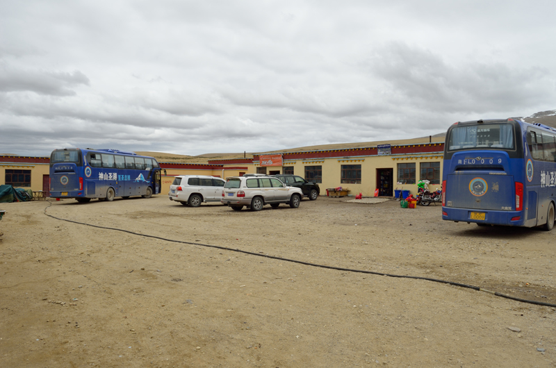
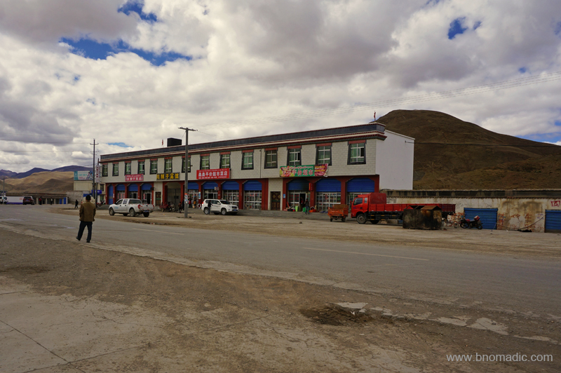
The rehabilitated settlement of Zhongba, musingly called New Zhongba, is still a few kilometres northwest from the olden Zhongba that bears the brunt of Cultural Revolution. Save for traditional entrance kani and a few compound huts meant for road workers, there isn’t much in the dusty olden settlement; not that the newer settlement has anything better to offer. Situated on the edge of the vast Thang Kiang Naga, or plain of the wild donkey and grass, New Zhongba is a typical settlement that you might simply just want to pass by. However, we were comfortably arranged in a renovated monastery-turned-guesthouse compound where the already basic facilities became even further basic.
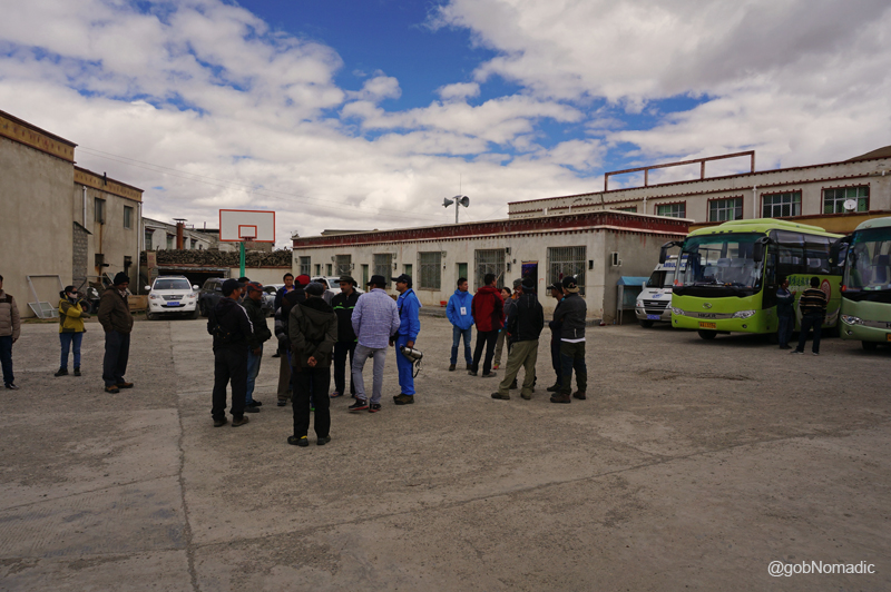
The accommodation at Zhongba had excellent dining hall, comfortable rooms with clean sheets and a TV that only played Chinese channels. It was the lack of availability of hot water, limited supply of normal water and the squat variety Tibetan toilets, figuratively just a deep hole in the ground, which bothered most yatris. The dinner was typically preceded by a briefing from the head guide. By now almost all group members had decided to opt for pony and porter for the Kailash kora. The head guide accordingly proceeded to make the required arrangements. Outside in the compound, the starry nightscape allowed a view in to the depth of the universe. The bright stars looked so near as if they were part of the landscape. The universe was no more a mere abstraction but a matter of direct experience.

By the Yarlung Tsangpo Chu in Tibet, called Brahmaputra River in India. Photo by Jen Reurink

Inside our room at Zhongba. Please visit Flickr Photoset for more images of the region

The compound of the Zhongba accommodation center. More images at Flickr Photoset


