 bNomadic
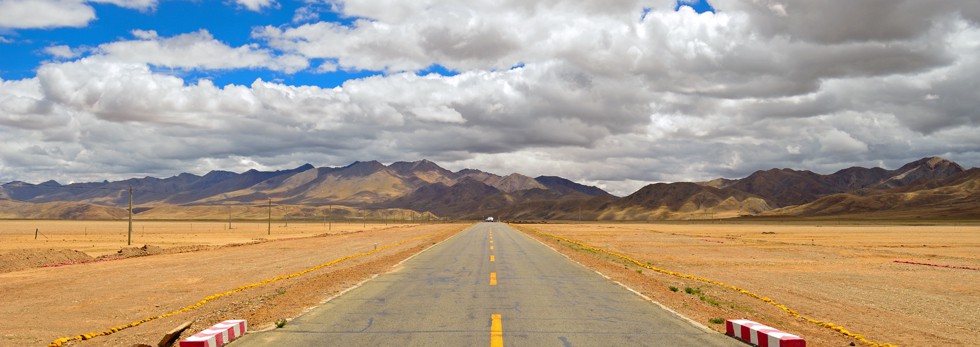
Getting Shepherded through Tibet

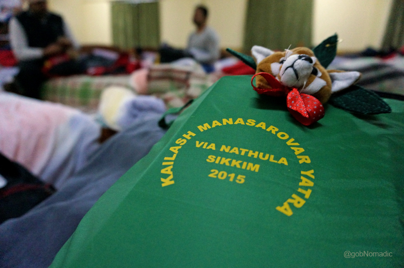
The following post is a part of the “Kailash Mansarovar Yatra” Blog Series Into the Sacred Space. To read complete travel memoirs and trip report, please visit here.
In spite of being mindful of the fact that we were now in China time zone, which was two hours and thirty minutes ahead of the Indian Standard Time (IST); stubbornly, my body was still not adjusted to cope with it. My android-enabled phone had already shifted to the latest time zone. I woke up much earlier than my usual rising time. It was seven in the morning as per the China Standard Time (CST). The previous evening, I had slept well past midnight according to the IST. In fact, to be honest, there was a certain degree of uncertainty about time for the entire journey right from day one. Up there, the clock and day seemed meaningless. Appreciation of the value of time on this journey to the Sacred Space was completely nonessential and counterproductive.
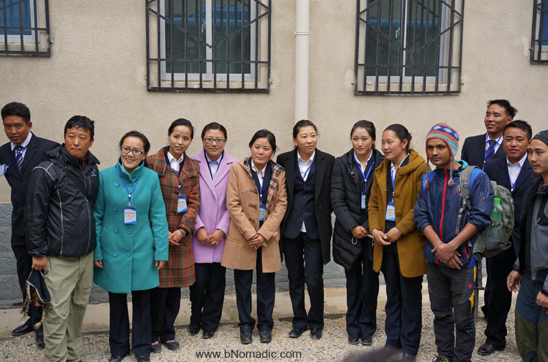
The “ever helpful, always smiling” Tibetan support staff at Kangmar residential complex. More at Flickr
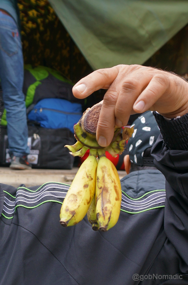
Chinese bananas! Not all fruits were costly up there. More images at Flickr
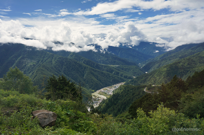
I felt refreshed even though I had slept very briefly. We had only covered 200 km out of more than 1500 km we needed to reach the Kailash Mansarovar region located westwards from the Indo-Tibetan border at Nathu La in Sikkim. Our next night halt was at Lazi, also known as Lhatse, located 295 km in central Tibet from our current location at Kangma, better known as Kangmar. The variance in culturally and administratively adopted nomenclature of towns or cities appeared a bit confusing initially. In Tibet, almost every town is known by multiple names ranging from Tibetan to Chinese, Roman and even Mongolian name. Common sense prevailed later.
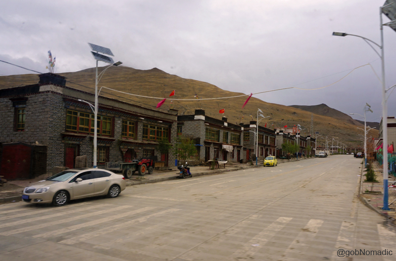
The main street of Kangmar; notice the Flag of China atop almost every building. More at Flickr
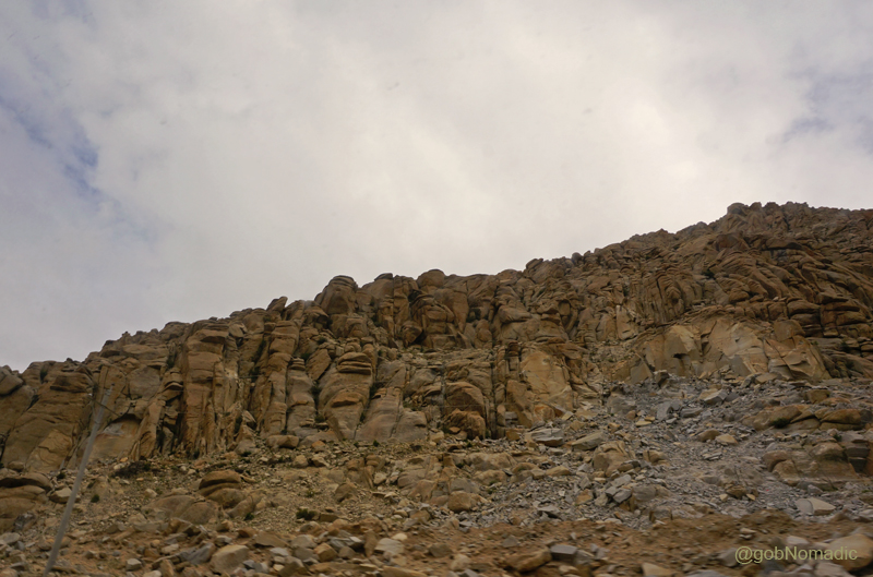
Intriguing rock formations on a mountainface. Please visit Flickr for more images of the region
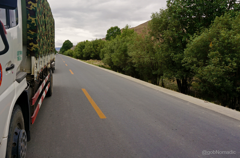
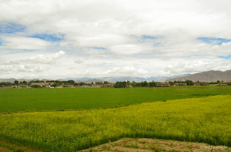
As the group gathered in the dining hall for breakfast, a few announcements pertaining to the day’s routine were made by the Tibetan guide. “No photography”, the language translator mumbled. Grabbing a quick bite, I headed towards our truck where the group’s luggage was being collected. Being the younger most, I had volunteered myself to help with the group’s luggage. A few snap-records followed and we were on our way to Lhatse through the provincial highway number 204. The highway follows the age-old wood and wool trade route to reach Gyantse after which it becomes a part of the Southern Friendship Highway between Lhasa and Kathmandu. Ahead it merges with the highway number 318 at Shigatse. Both Kangmar and Lhatse are part of the traditional Tsang province, which is one of the most popular as well as prosperous regions of Tibet. Apart from a richer agriculture than elsewhere on the plateau, this province has the popular adventure-rich Everest region, Friendship Highway, Gyantse Kumbum, and many of the country’s most important monasteries.
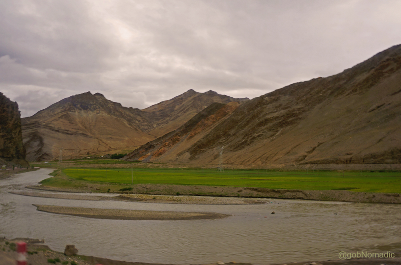
A cultivated stretch of land by the Nyang Chu. More images from the region at Flickr Photoset
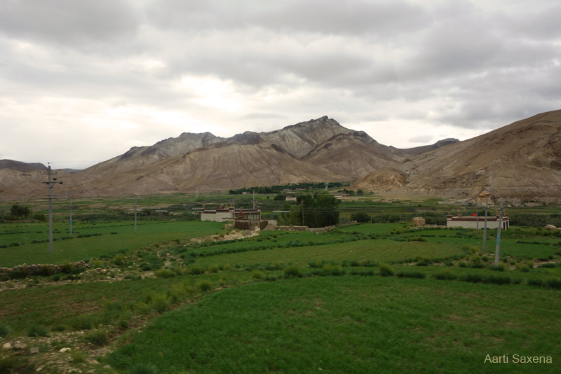
A greener settlement by the highway. Photo Credit: Aarti Saxena
Approaching the olden trade junction of Gyantse. Photo Credit: Aarti Saxena
Travelling by the Nyang Chu in its greener valley, soon we were at the historical town of Gyantse, famed for the fourteenth century Gyantse Kumbum, the largest chorten in Tibet and the Gyantse Dzong that dominates the local skyline. The fifteenth century compound of red-walled Pelkhor Chode monastery next to the dzong overlooks the town on a high hill. Once an important trade centre between India and Tibet, Gyantse was yet another site of a major battle between the confused Tibetan warriors and the organised troops of Younghusband. Carrying on the advance from Jelep La in Sikkim, the British spent nearly two months on the outskirts of Gyantse before seizing the dzong in just a day. The next misfortune came when a considerable number of structures of the dzong and nearby monasteries were destroyed in the Cultural Revolution. As a repercussion of which, seeking freedom from Chinese, today, wishing for the lesser devil many Tibetan communities have marked the Younghusband’s Lhasa mission with red letter. Recollecting my thoughts from the previous evening I mused on the fact that we had retraced a major part of the route of 1904-Younghusband’s march to Lhasa from Sikkim.

The Gyantse Dzong; Interestingly, the Chinese have built a small museum here to highlight the excesses of the Younghusband expedition. More images from the region at Flickr Photoset

The ninth century Pelkor Chode Monastery and Kumbum, said to be the largest chorten in Tibet
The fourteenth century Tsechen monastery near Gyantse. More images from the region at Flickr
Hello Provincial Highway 204! Please visit Flickr Photoset for more images of the region
Landscape near Gyantse; captured from a point near the Highway. Photo Credit: Jan Reurink
With its red-white coloured buildings surrounded by green fields that are outlined by tall poplars, the settlement of Gyantse (3950 m) radiates the traditional charm of Tibet when viewed from the highway. Built atop a hillock, the dzong towers above the valley; and would sure command an extensive view from its top. Just a few kilometres ahead, another historical wonder – a ruined fortress – towers above the monastery of village Tsechen. The fortress is said to have been built in the fourteenth century and was even used as a shelter by the British during their 1904 military mission. Half an hour later our caravan stopped near Panam by the highway at a memorial built to commemorate the traditional dance Xie of Tibet. The memorial had a small museum-cum-craft shop.

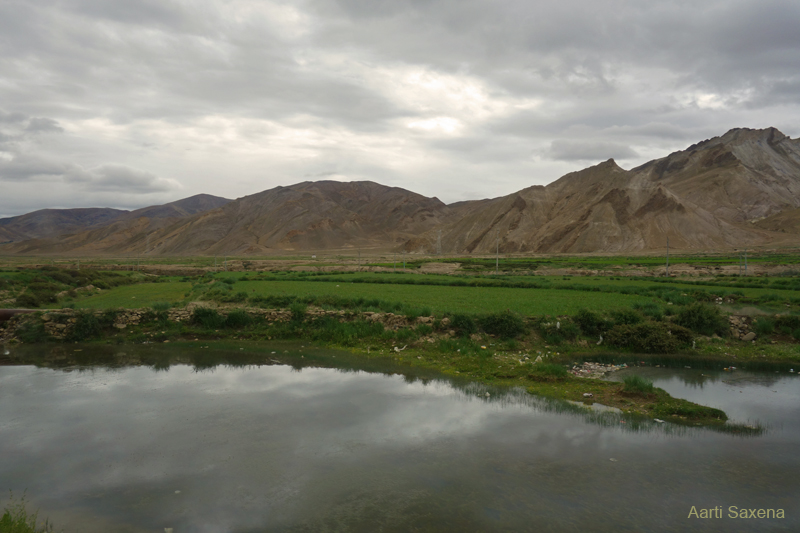
The fertile Nyang Valley; at Gyantse. Photo Credit: Jan Reurink
The Xie memorial by the Southern Friendship Highway. More images from the region at Flickr
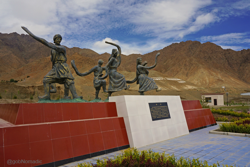
The Xie memorial. The traditional dance Xie of Tibet is performed with stringed instruments. More at Flickr
A fertile tract ahead. Please visit Flickr Photoset for more images of the region
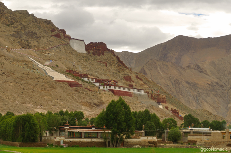
Almost 90 km ahead from Gyantse lays the traditional capital of Tsang and Tibet’s second-largest as well as culturally, administratively and commercially important town Shigatse (3850 m), also known as Rikaze. As we entered the Shigatse city, we could not help but wonder if we were still in Tibet at all! There were tall multi-storey buildings and apartments all around. A modern railway track enters the city from its north-eastern side. Our caravan crossed the railway-track overbridge as we hurriedly bypassed the city. Wide planned streets, large glass-windowed grocery stores, restaurants, shops, offices dotted both sides of the street. The traffic smoothly managed itself with the help of traffic lights. The modern city gave just a little hint of the traditional Tibetan lifestyle. Spread near the confluence of Nyang Chu and the Tsangpo, the city nevertheless continues to be a hotbed of Panchen Lama and Chinese politics; taking shape from the monastic complex of Tashilhunpo, destroyed and rebuilt.
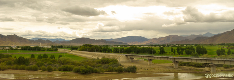
The 251 km long railway starts from Lhasa and terminates at Shigatse. The modern railway line became operational in August 2014. More images from the region at Flickr Photoset

Some km ahead of Nartang, the Kangchen Monastery is a short distance off the Friendship Highway
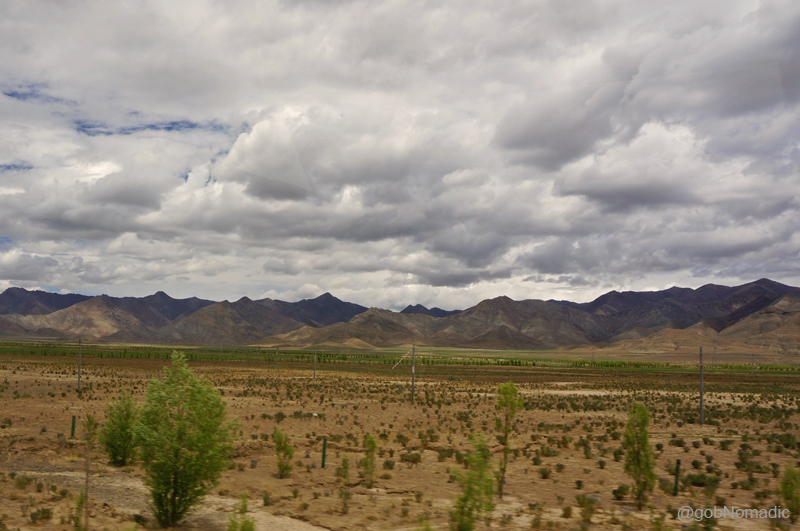
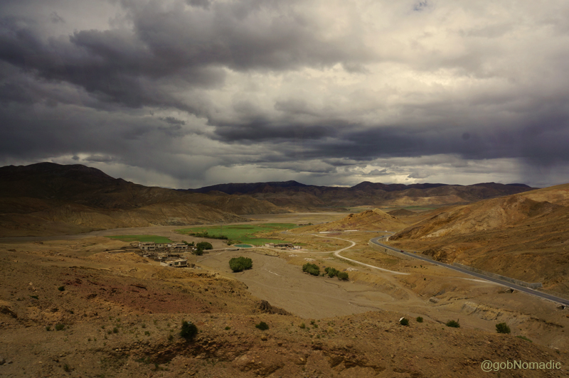
Inside the bus, yatris were equally thrilled to see Shigatse-locals waving at them. The opening of the Nathu La for the Kailash Mansarovar Yatra was surely welcomed by the Tibetans. Lhatse (or Lazi), a popular pit-stop or overnight halting point for both Everest or Nepal and Kailash Mansarovar bound travellers, was still over 150 km from Shigatse market. Driving across central Tibet, somewhere between Qumig and Gangchen, we approached the crest of a lower pass, Tra La roughly 4,000 m above sea level. The terrain opened up as it became devoid of wide green fields. Far in the distance a low canopy of clouds dissolved into rain. The rainfall looked to be highly focused on just a small stretch. It was a rare moment of precipitation in this arid landscape. Our fleet of vehicles halted for lunch at a prearranged stretch near Shab Geding by the highway. A series of small yet modern Tibetan tents were pitched to accommodate the travellers as well as the support staff. We all routinely carried our packed meals with us. Usually, a few group members would volunteer to assist with everything from serving food to bussing tables as well as handing out utensils or fruits.
Landscape near Shab Geding. Please visit Flickr Photoset for more images of the region

Lunch halt by the Friendship Highway. Please visit Flickr Photoset for more images

Modern Tibetan tentage or Maikhan. Photo Credit: Aarti Saxena
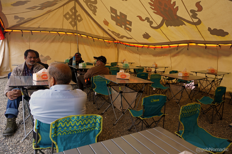
Arrangement inside the tent. Please visit Flickr Photoset for more images of the region
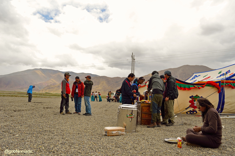
Arrangement of activities at the campsite. Please visit Flickr Photoset for more images
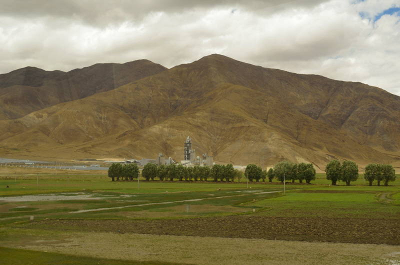
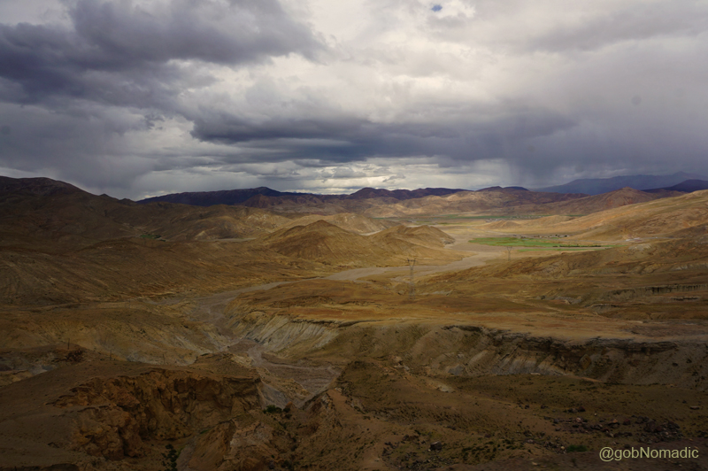
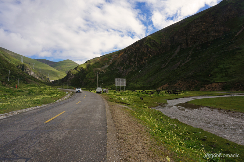
In less than an hour we were again on the Friendship Highway. Moving ahead, after a few stone crushing sites by the highway, the landscape became even more chocolatey and barren. During the bus ride post lunch, most of the passengers dozed off in their seats as I found myself engaged in the changing landscape. Emerging from the green Chumbi valley, the rolling hills that seemed green quickly changed to colourless but as we travelled over the Tibetan highland, changing landscape presented a range of mineral hues in the alluvial soil; from rust to ochre, amber and gold as well as the whiteness of salt. Deposited soil was aglow like polished copper. Carrying the testament of natural changes, in the form of bruises and dents, the barren hillocks as well as surrounding ridges changed from varying hues of purple and brown with the shifting sunlight. Taking energy from moisture in the soil, wherever it existed, shrubbery and succulents popped up within the valleys on the plateau.

A stretch of the Friendship Hwy ahead. Please visit Flickr Photoset for more images

A common sight between Kangmar and Lhatse, agriculturally productive area
A stone crusher sight, a usual occurrence on this stretch. More images from the region at Flickr
A green settlement by the highway before the Lagpa La. More images from the region at Flickr
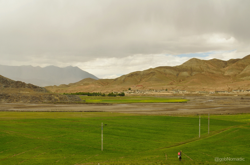
Without knowing much about the destinations, I kept taking notes from whatever I could observe to be noteworthy. The bus began a smooth climb to the Lagpa La at 4465m. Such was the beauty of the road infrastructure that even a 20 wheeled loaded truck climbed such passes without showing any signs of trouble. From the slopes of the pass, I made a few snap records of the landscape we had just travelled through. A green patch of a settlement appeared like an icing on the enormously vast barren highland. The visible human intervention on the plateau, right or wrong, appeared very small in the vastness and grandiosity of the mountainscape. Even though fully aware that the survival of human life depended entirely on the temper of weather as well as availability of food, fuel and water; I felt the sense of freedom and spiritual independence deeper than possible elsewhere.
View from the slopes of Lagpa La, also called Chong La. The green patch of settlement looked like an oasis in the enormously vast barren highland. More images at Flickr Photoset
The visible human intervention on the plateau, right or wrong, appeared very small in the vastness and grandiosity of the mountainscape. Please visit Flickr for more images of the region

View towards the other side of Lagpa La. The reflection of light on the road in the rain-washed cloudy valley gave a silvery effect to the highway. More images from the region at Flickr Photoset
On the other side of the pass, the road descending from its slopes made its way through a desolate valley devoid of any vegetation. Far in the distance, a green patch encircled a few settlements on the valley floor. The reflection of light on the road in the rain-washed cloudy valley gave a silvery effect to the highway. Around here, with vegetation reduced to a minimum, the terrain seems like an expression of primeval forces of nature. Bare rounded ridges bear witness to the continuous action of wind, water and weather. Climbing down in loops and curves, I imagined the legendary pandit explorers on a barren terrain like this trying to get their things together. I would rate Nain Singh Rawat to be among the topmost adventurers of the entire Himalayan region. Disguising themselves as Ladakhi traders, the maps they produced and the information they collated were later found to be remarkably accurate.

With vegetation reduced to a minimum, the terrain seemed like an expression of primeval forces of nature. Bare rounded ridges bear witness to the continuous action of wind, water and weather

A typical house in a village; notice the Flag of China. More images from the region at Flickr Photoset
An hour later, passing through the territory of ancient Sakya kingdom we reached Lhatse 4050 m. The township of Lazi is an affair of not more than a few streets. The Friendship Highway now bypasses the town to reach Kathmandu. We checked into a multi-storeyed accommodation which had all the features of a business hotel. Even though, the disco lights fixed inside the rooms were absolutely not expected, I was particularly delighted to find wi-fi service. Most of the signboards including on the temperature control unit were either in Tibetan script or Chinese. The only issue being that to regulate the room temperature or even to turn that thing off, we had to call up the helpdesk and involve the language translators. The issue at hand was that most of us realised the need to get in touch with the helpdesk well past midnight.

Dark cover of clouds stretching till horizon on the northern side of Lhatse. More images at Flickr

The Rainbow street! Please visit Flickr Photoset for more images of the region

Bhatol Saab checking out stuff at a grocery store. Please visit Flickr for more images

Main street leading to the junction of Lhatse market. More images at Flickr Photoset

Headgear of a Tibetan lady from Lhatse. Photo Credit: Rita Willaert
Having arranged our stuff in the rooms allotted to each one of us, we headed towards the market to take a stroll. Shops selling veggies, basic necessities, garments, restaurants, costumes, groceries, etcetera dotted both sides of the main street. Traffic lights beamed on the main junction. A dark cover of clouds stretched till horizon on the northern side of the town. As I position myself in the middle of the street to make a photo record, I notice a rainbow. The street passed directly beneath this otherworldly arch of primary colours hanging like strings of prayer flags; as if a gateway built to celebrate our arrival. Rainbow has a special mention in the Tibetan mythology. The folklore explains that rainbows represent the teachings and traits of saints who have passed away; calling it a doorway that leads to the Promised Land. Only the blessed ones can have an access to such unseen gateways that lead us into the idyllic country comprising buried treasures.
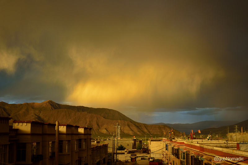
Evening sky at Lhatse aglow with setting sunshine. More images from the region at Flickr Photoset
On the face of it, I do not believe in mythological expressions but there is a part of me that is forever curious to dig up such mysteries and question their authenticity. I slept quite early that evening only to awake in the night. I called up the helpdesk! 🙂
Sirmaur Diary: The Orchard Valley of Rajgarh

Centred around the exuberant hillside of Rajgarh tehsil (1580m) in Sirmaur district of the Himalayan state of Himachal Pradesh, where many of the finest fruits of European orchards are cultivated, my latest spontaneous escapade combined all the indispensable ingredients of hillside travelling – views, heritage, culture, spirituality, wildlife, food, lounge, treks and trails.

The Peach Bowl of Asia – Rajgarh. More images from the region at Flickr Photoset
Coming from Chandigarh; the state highway to Rajgarh via Ochhghat and Giripul branches off the NH 22 at Solan. The market of Rajgarh is about 100 km from Chandigarh and nearly 40 km from Solan. Thanks to my birder friend, Sarabjit Singh who has been a regular into the area, the information I needed for Rajgarh valley was organised easily. The hilly tract of Sirmaur spread from Shimla-Solan in the north-west to Garhwal-Dun Valley in the east and located north of the Ganges has always been historically significant. Over the past thousand years, the administration of Sirmaur changed hands several times among the local chieftains, Thakurs, Rajputs, Mughals, Gurkhas, Sikhs as well as the British; leaving tales and a rich history behind. During the freedom movement, the region also figured in the popular Pachhota movement. A place of note, the fort of Raja Sirmaur at Rajgarh unfortunately got destroyed in an accident in 1960. As of now, a majority of the residents are from the Khash Rajput Clan of Rajasthan and are occupied with cultivation of fruits and vegetables.

Now selling modern products, the olden market of Rajgarh. More images from the region at Flickr Photoset
Popularly known as the Peach Bowl of Asia, the credit for which largely goes to the first government of the state led by Dr YS Parmar, the valley of Rajgarh is nevertheless still struggling to find a permanent place in the circuitry of “tourism”. The fruit cultivation in the valley did necessitate the state government to construct a network of metalled roads connecting the major settlements. However, to me, the only downside of venturing into the area was to deal with potholed (although wider) roads. Curving on the wooded mountain faces, the motorway looked pretty to eyes but only from a distance.

A traditional slate-roofed hut in the fruit-countryside of Rajgarh. More images at Flickr
Leave aside the bumpy roads and look for apricots and peaches which are abundant round every inhabited spot; or plethora of cultivated berries, pears, mulberries and a variety of nuts often the only occupation of local populace. The wooded crags are the favourite haunt of birds of prey while other species nestle on the tall trees; and at the slightest panic, myriads of small fowls rush out of the shrubbery adding to the animation of the scene by their hurried flight. The traditional slate-roofed hutments, a highly picturesque traditional architecture, heighten the beauty of the landscape. As we climb higher towards Nohradhar, pines give way to deodar as the Himalayan shrubbery dot the hillside.
The lush green valley is not only visually appealing but also serves to be a good place for trekking and ridgetop camping. The stretch of the Giri River near Giripul, a little before Rajgarh, is popular for angling activities. A few enterprising locals have recently set up paragliding as well as rock climbing craft and services in the valley. Of late, several excellent camps and properties have come up in the vicinity of the settlement of Rajgarh cashing in the growing accommodation needs. Unlike the northern Himachal, the valley is accessible throughout the year. Nonetheless, visiting Rajgarh after the monsoon season has its own visual charm when the valley adorns a vibrant cover with the forests getting thicker and greener. Moreover by that time the maddening traffic driven by the seasonal peach season gets off the road; as also the marketplace hustling with hullabaloo of traders and cranking sound of diesel engines.
It was late-evening already when we reached the market of Rajgarh before last week. A cool darkness had descended upon the street as I asked for directions to the Forest Department Rest House, a two-room basic affair. Apart from a plan to climb the Churdhar Peak, the highest peak of lower Himalayas, we had not figured out what to do with our time in the valley. We had already visited the Dolanji Menri monastery on the way from Solan and planned to go to an all women enterprise at village Bhuira the coming morning.

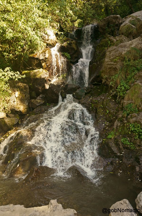
Locals call it “Kanda Falls“; a secluded spot
The FRH is a couple of kilometre away from the market. Next morning, we again descended to the market for fruits-breakfast. Like elsewhere in the Himalayas, the material impact of globalisation was well appercipient. Next to a matchbox-shaped fruit-shop, menfolk dressed in kurta pyjamas sipping their morning teas stood chatting with each other; womenfolk in salwar-suits that looked inspired from Punjab while the younger ones wore jeans casuals as their eyes remained glued to flashy mobile screens. Collecting some more fruits in a newspaper-packet, we left for Noradhar; intending to visit a popular fruit processing unit at village Bhuira on the way.
What started as a kitchen experiment in her modest farm house at village Bhuira, today Linnet Mushran’s small-scale food processing unit successfully sells more than 27 varieties of Jams, Chutneys, Preserves, Jellies as well as Marmalades and employs over 100 women. Hugged by a wooded cover of tall deodars, her humble acre-large orchard that spills with a riot of flowers and at the same time commanding a sweeping view rippling up to Chail mountains was truly an idyllic setting for an enterprise like hers.

Chail ridge at the far end. More images from the region at Flickr Photoset
At Bhuira in Rajgarh. For more images from the region, please visit Flickr Photoset

Hugged by a cover of deodars, Bhuira Jam‘s humble cottage-orchard spills with a riot of flowers and foliage

The labeling and packing section at Bhuira Jams. More images from the region at Flickr Photoset
Linnet was out of town when we reached the manufacturing unit of “Bhuira Jams” but her staff took complete ownership of the operations and more than made up for her absence. Donning white hair caps along with plain colourful jackets, her staff was devoted to the roles assigned to them by Linnet when we reached there. The lady in charge showed us around. The campus was well maintained and flawlessly clean. We were allowed to take a look at the processes of jam making through a large windowpane. Available at most leading grocery stores pan India including the likes of retail brands such as Fab India, appreciatively the Bhuira products are available at a discount where they are born. I bought a carton full of available varieties.
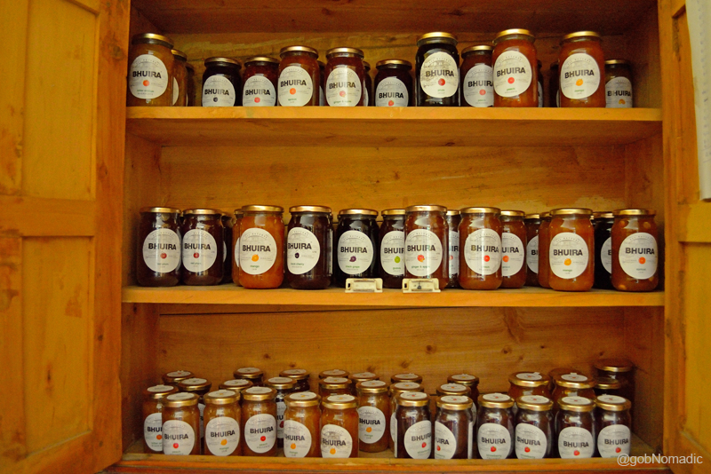
An all women enterprise, the Bhuira Jam sells more than 27 varieties of Jams, Chutneys, Preserves, Jellies as well as Marmalades. More images from the visit at Flickr Photoset
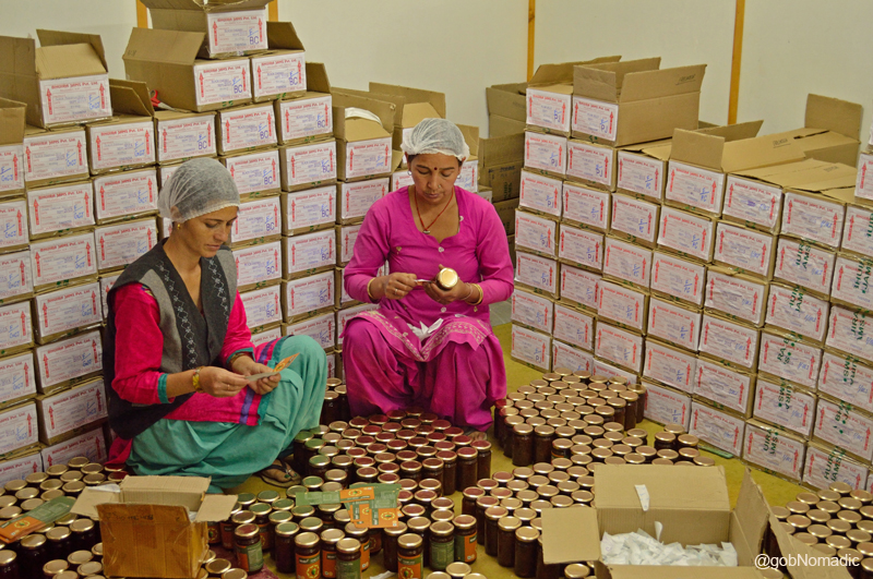
The small-scale fruit processing set up engages over 100 local “Happy Mountain Women”
Down below towards the left, an olden temple-like structure caught our attention. We decided to make a visit to the tiny settlement where the temple was prominently noticeable. Driving through a wooded cover, we turn up on a dirt track which led to the settlement. A few minutes later, we were inside the courtyard of the stone and wood temple that was dedicated to Shirgul devta, the lord of Churdhar and the chief deity of the valley. The tower-styled main temple was built, employing the traditional Khasha architecture, on a raised platform. The doorway had numerous coins nailed on its frame; said to be signifying the answered prayers. The residence of priest, who was out of station that day, was at the back of the temple.
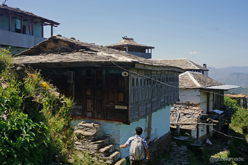
At the small settlement of Thanoga. More images from the region at Flickr Photoset
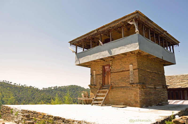
A temple dedicated to Shirgul Devta, an incarnation of lord Shiva, chief deity of Churdhar region. Every region in Himalayas has its own distinct deity. More images at Flickr Photoset
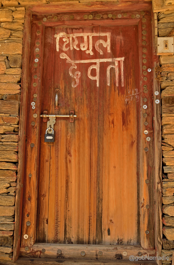
The doorway had numerous coins nailed on its frame; said to be signifying the answered prayers.
गन्दगी फ़ैलाने पर 200 रूपए जुर्माना होगा! More images from the region at Flickr Photoset
An hour later we were on our way to Noradhar, the base to climb the Churdhar peak. On the way we drove through some real lush green terraced fields. The bumpy ride to the base took about an hour at a leisurely pace.
Mountainscape en route to Noradhar. For more images from the region, please visit Flickr

Terraced fields near Kanda in Rajgarh, Sirmaur. More images at Flickr Photoset

“Beyond what we wish and what we fear may happen, we have another life…More images at Flickr
…As clear and free as a mountain stream” — Rumi; within an hour we were at Noradhar. More at Flickr
Average Altitude: 1600 m
Best time to visit: Autumn to Spring
Travel Lure: Bird-life, Wooded trails and other similar soft adventures
Accommodation: Limited but usually available
Crossing Nathu La to enter Tibet

The following post is a part of the “Kailash Mansarovar Yatra” Blog Series Into the Sacred Space. To read complete travel memoirs and trip report, please visit here.
I woke up to a sound of thunder in the middle of my sleep. I reached for my watch. It was still three am in the morning. I could hardly complete four hours of sleep. The lack of it was mostly due to the excitement regarding today’s schedule of activities – of finally crossing the Nathu La (4310m). By the time the mobile alarm announced four o’clock; I was up and about and was already packing my luggage. It was chilly outside. The water inside the thermos was still steaming. With the last remaining tea-pouch from the stock I had so fondly bought from Gangtok, I made myself some tea.
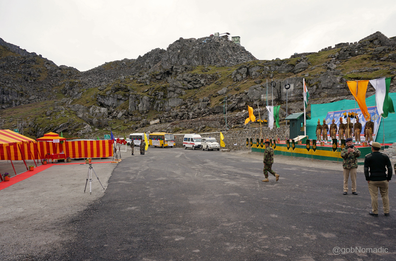
After completion of some more formalities at the customs check post, we had to report at the border gate at 0700hrs IST. At the break of dawn the group gathered at the parking lot. The luggage committee dutifully made a recheck of the entire individual as well as group luggage. Everything looked to be in order. A loud holy cry of Har Har Mahadeo was raised by Babaji after which we all got on the bus and occupied our respective seats. As incipient rays of the morning sun filtered in through the windowpanes of the bus; we left for the Nathu La.
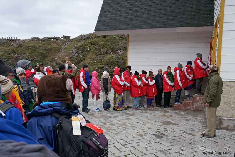
Queued up at the customs check post to complete the final formalities before crossing the Nathu La
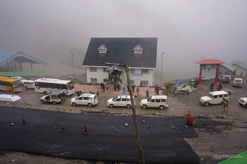
From Sherathang, the approach to the Nathu La is very gradual on a broad tarred-road. Before the road got built, the neighbouring Jelep La was always the preferred alternative to enter the Chumbi Valley located north. Within less than half-an-hour we reached the Customs check post positioned some 100 metre before the pass. Southwards; mist and clouds had masked the valley up which we had just climbed. The group members queued up in the order of their listing in the group visa. The custom officials took no time in completing the remaining formalities after which we pushed off towards the pass where the stationed unit of the Indian army had also organised a High Tea for us. In the meantime, our luggage got transported to the Tibet-side where it got loaded in a truck after initial screening. For personal exigencies, two co-travellers had to go back after the culmination of formal activities at the India-side of the pass.
At the Nathu La; Kolkata is approx 700km from the pass. More images at Flickr Photoset

A Bofors 40mm/ L60 Air Defence Gun used in the World War II on display at the Pass
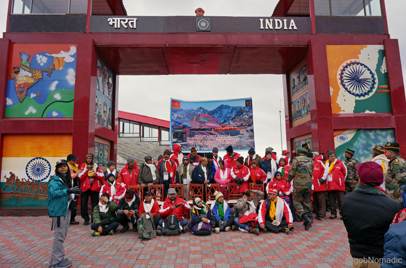
Getting ready for a Group Photo at the pass. Please visit Flickr for more images of the region

Joined by senior officers and Sh Taurn Vijay, the enthusiastic group members during the photo-shoot

And getting noticed with incredible fanfare. Please visit Flickr for more images
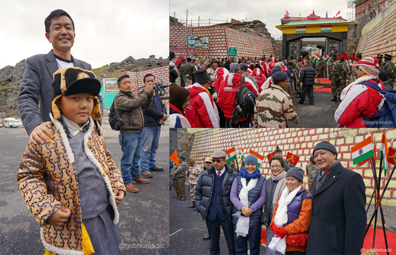
Clockwise from left: A young well-wisher who came to see us off; Lining up to cross the border; Sikkimese travellers occupied the centre-space throughout the Journey
Down the road we had just climbed; Please visit Flickr Photoset for more images of the region
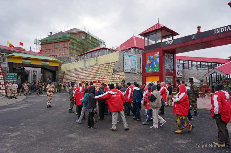
As we lined up on the no man’s land, a light drizzle came and spattered the crest of the pass; not more than 40 metre in length. The whistling wind that accompanied the light rain swept us cold, as we stood chatting with the Indian Army and ITBP soldiers. The Tibet-gate opened at 0730hrs IST sharp; equivalent to 1000hrs China Time. Another holy cry was raised and this time the response was louder and even more energetic; the soldiers had also joined. Once across the border, the formalities and quarantining procedures finically took more time to get over. Being the first batch; a whole lot of extra formalities including speeches and thanksgiving bestowed upon us. The main speakers included Chinese Ambassador to India Mr Le Yucheng, Mr Dong Ming Jun, Vice Chairperson of the Tibet Autonomous Region (TAR) and Sh Tarun Vijay, Member of Parliament who represented India viewpoint. With watery eyes due to cold; applauding whenever we needed to, we stood still as spectators for almost two hours.
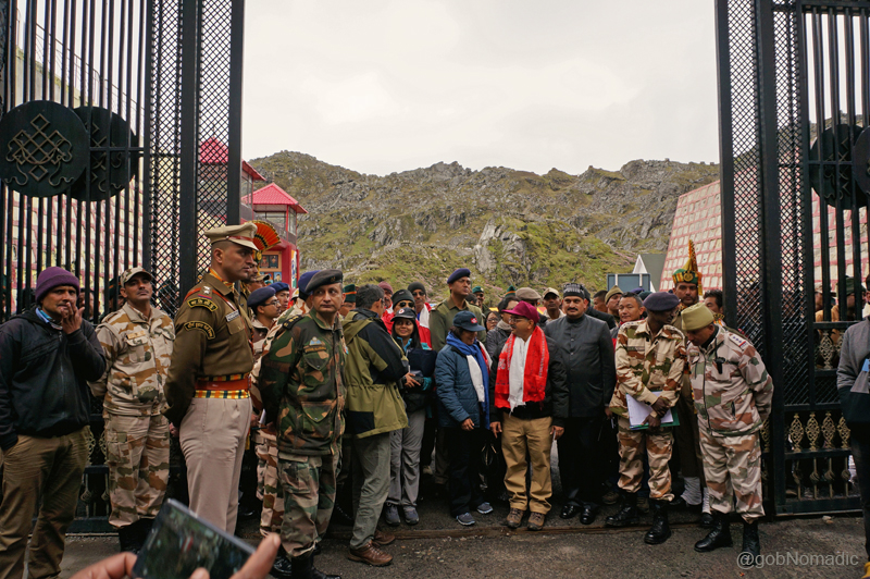
Standing upon the no man’s land of the friendly border pass Nathu La. More images at Flickr

Clockwise from top left: Yours truly awaiting his turn at the passport verification-cum-quarantining kiosk; Chinese Ambassador to India sharing China’s perspective; just before we boarded the bus; Sh Tarun Vijay, MP presenting India’s viewpoint

The lengthy proceedings at the “Nai Dui La” left the elderlies completely exhausted. More at Flickr
Before we could get acquainted with our trip-guides and language-translators, we were requested to board the buses. The view into Tibetan side from the top of the pass was remarkably much greener than most of us had possibly expected it to be. Down below, with small settlements spread on both sides of the Amo River, the pine-clad ridges of inhabited Chumbi Valley rippled one after the other; as far as the eyes could see. Called as Nai Dui La in Tibetan, the Nathula literally implies a place where the “snow is deepest and the wind strongest”. Shielded by the crags of the range through which Nathula provides a passage, around this side of the pass, the wind had reduced to just a gentle breeze. A signboard in local parlance read Lhasa is 480km from where we stood. Awestruck by the beauty of the Chumbi Valley, we started the descent into Southern Tibet in complete silence. The road ahead – as if some giant serpent had creeped along the mountain-face – was a succession of loops. Our next halt was at the customs check post-cum-trading mart of Rinchengang; just seven km below the pass. Colourful prayer flags marked the entry into the historical trade outpost of Rinchen where all our documents, passport, luggage and baggage including our body temperatures got verified and examined. The truck carrying our luggage had already reached here. After receiving a go ahead from the Chinese authorities, a few basic apprehensions had gone and everything else unheeded as we thought of the Tibetan marvel that lay ahead.
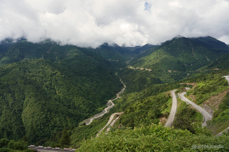
The road climbing down in loops to reach the green Chumbi Valley floor at Yadong. More images at Flickr
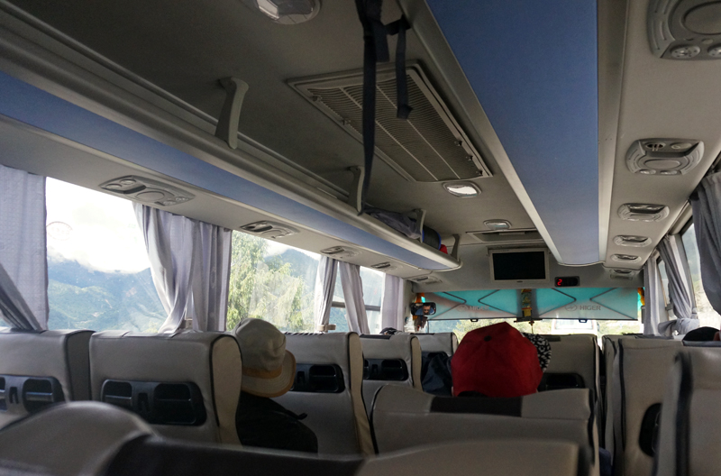
Equipped with a host of features like AC, GPS, Video, CCTV cameras, supplementary oxygen, etc., the twenty-seater tech-savvy buses were actually very comfortable
The new Yadong (referred as Shiasima in olden trade-records), the chief centre of the Chumbi Valley, was still 30 km away. Escorted by Chinese militia and authorities in their official vehicles, we began the descent with great pomp in the shape of a convoy. Sandwiched between the Himalayan watershed of Sikkim and Bhutan, the valley is one of the most fertile regions under the administration of TAR. The terrain had all the hints of a material well-being and comfort there. Apart from being a commercial, cultural as well as a Buddhist centre of note, the region possesses extraordinary natural beauty. The town of Yadong, then a village, was once a flourishing terminus on the ancient silk and tea trade route connecting the modern-day Yunnan Province with Bengal in India. It was through these established horse trails that the British military expeditions of early twentieth century overran a portion of Tibet. A few years after that, in the 1912-upheaval of Tibet, HH the thirteenth Dalai Lama is said to have been smuggled up the Jelep La, with the British assistance, through this route to meet Sikkim heads and British envoys in Kolkata for help. More recently in 1958 when trading still prospered on the Sikkim – Tibet highway, Pt Jawaharlal Nehru stayed here for a night; visiting the key monasteries on his way to Bhutan.

The renovated Gargyul or Gajiu Monastery, originally constructed in 1747; overlooks the Sikkim-Tibet highway and is the closest one to the Indo-Tibetan border. More images from the region at Flickr
The settlement of Yadong; and the Amo River visible down below towards the valley floor. More at Flickr
The locals, it seemed, were already mindful of the start of the Kailash Mansarovar Yatra through Nathula, which was once so dear and friendly to them. Descending more than 1,000 m in altitude, as we snuggled into the settlement of Yadong, spread on the valley floor, its residents, shopkeepers, pedestrians and almost whoever saw us came out on streets to greet us and wave. Meandering through the markets, streets and corners of the town, our convoy made its way to a multi-storey hotel for a prearranged lunch. The houses here were well-built with stone and cement, often multi-storeyed and surrounded by fertile patches as well as orchards. We halted at the hotel for more than an hour; where many of us got their US Dollars exchanged into the local currency of Chinese Yuan. From the lobby of the hotel a near-view of the torrential Amo Chu could be obtained. In Tibetan language, Yadong means “rushing deep valley” and now we saw its manifestation from a close range. The weather became overcast as we snacked the local vegetarian delicacies with much bemusement.
Lobby of the hotel at Yadong where we had our lunch. More images from the region at Flickr
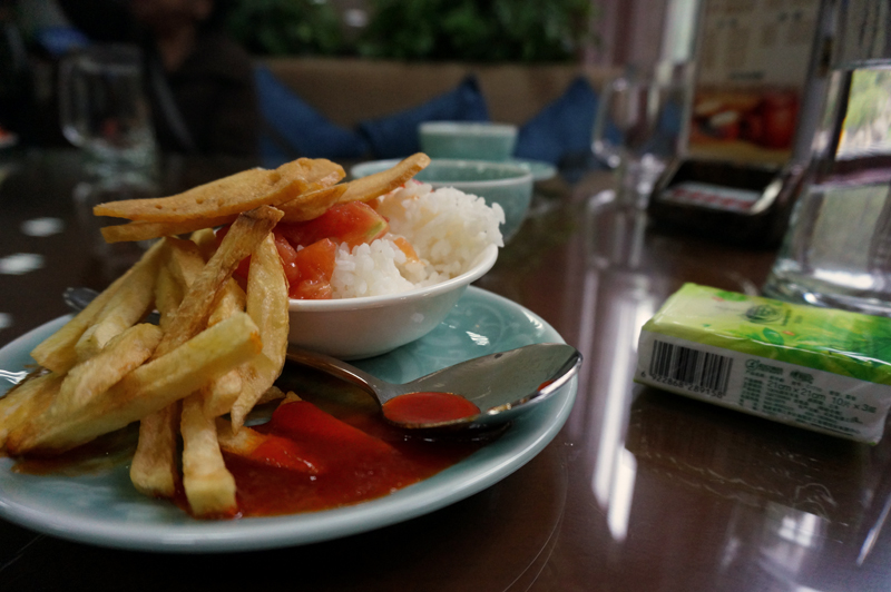
That was my meal; potato finger chips, tomato ketchup, tomato stew with some boiled rice

Surprising! Isn’t it? Ah well, that was quite normal up there

A residential complex by the tamed Amo Chu. Please visit Flickr for more images of the region
A calmer stretch of the Amo River. Enveloped by lavish primitive forests, the Yadong Valley is known to be a paradise for wildlife. Photo-Credit: L Wu. Please visit his Flickr Collection for more
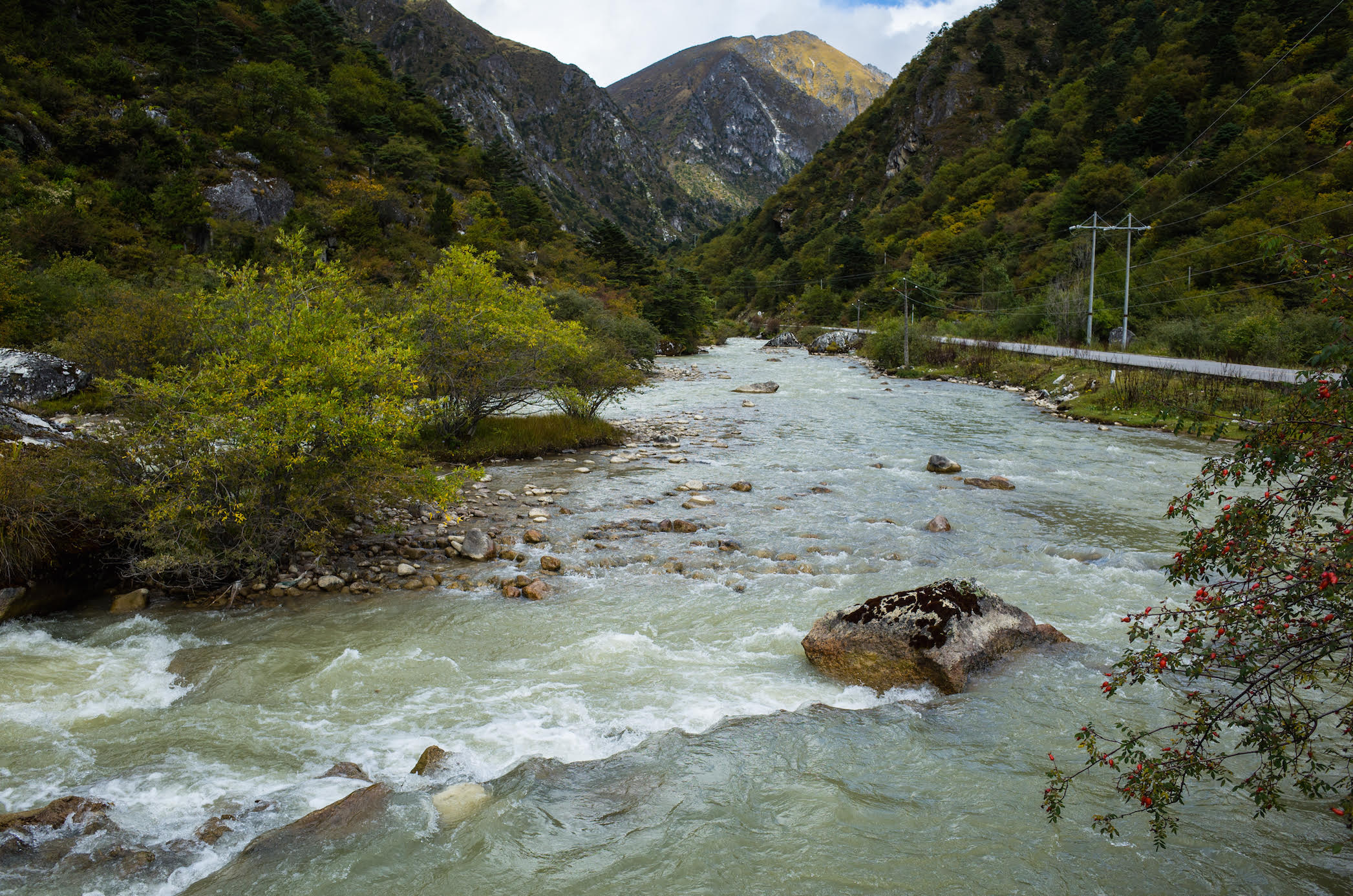
Before we left the hotel, the guide reminded everyone that it was practically the last option on the day’s journey to have filtered water filled in their bottle or a thermos. Besides leading to plastic wastage, up here packaged water is actually very costly. Ahead the road climbed steadily in loops and sharp hairpin bends following the torrent upstream for most part until we reached a treacherous terrain bare of colour, life, sound, vegetation or even rock. Such was the nature of road infrastructure that we didn’t realise the transformation of tricky nature of the terrain. A dark cover of mist enveloped the valley as the terrain changed from sylvan green hills to plain brown alluvial deposits; with barren lifeless hills shooting up on either side. From the windowpane, I could distinctively spot vibrant wildflowers smeared in a riot of early spring colours – blues, reds and pinks.
Green carpeted and intersected by the meandering infant Amo Chu greedily collecting the last traces of winter’s snow from a higher corridor that opened up to the tableland of Tibet. More at Flickr
Near the olden township of Phari. The nearest Bhutanese town is just a few kilometre from this town
The sky was almost constantly overcast. From gaps in clouds, I saw barrenness leading up to the snowy peaks; noticeably the conical shaped sacred Chomolhari (7326m), or the abode of the lady goddess; the guardian deity of Chumbi Valley and the adjoining Tibetan tableland. We were now crossing Phari settlement (4300m), 47km from Yadong, green carpeted and intersected by the meandering infant Amo Chu greedily collecting the last traces of winter’s snow. The nearest Bhutan town is only a few kilometre away from Phari. The windswept desolate plain opened out further after we crossed an even higher pass, Tang La at 4760, typically marked by cairns and fluttering prayer flags along with a board.
Landscape a little ahead of Tang La; Mt Chomolhari is only partially visible
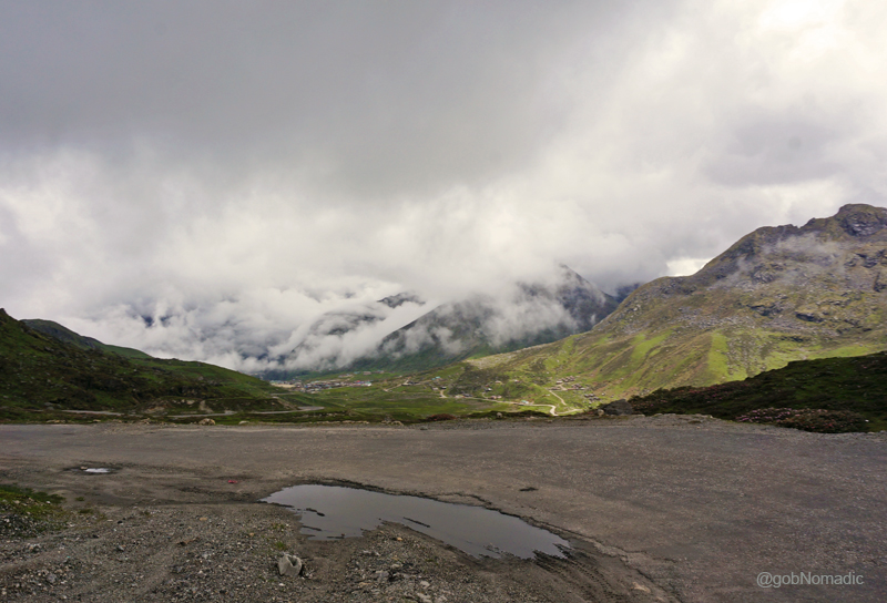
Ahead, as we descended; a broad straight road stretched up till horizon. The view was partially obscured by the clouds. With an overwhelming feeling of entering a dream, we stopped for a short break some distance ahead of Tuna; by the magnificent Dochen Tso. The weather opened a bit but distant view was still cloudy. I got down from the bus and made just a few photographs in the vague hope of finding a clear weather on my way back. Agile marmots popped up from their burrows to enquire about the disturbers of their peace; only to nip down again with disinterest. Save for the sighing of the wind or murmur of co-travellers, the quiet was unbroken. A distant looking waterbody had lost its sheen under the leaden sky. The solitude offered by the landscape was indescribable.

By the Dochen Tso; the weather opened a bit but distant view was still cloudy. More images at Flickr

The Welcome Gate to the Kangmar County. Please visit Flickr for more images of the region
Unperturbed by the desolation, the bus kept moving. Inside the bus I kept myself glued to the outside panoramic display of godly colours of the fast changing dreamscape. More wetlands emerged. More snowy peaks announced their presence. Reaching the settlement of Gala, at an altitude of 4,604 meters; another distant looking turquoise waterbody appeared on our left: Gala Tso. As the landscape changed, I mused over the sight of ruins at Qumeixiong, marked by a red-coloured board as historical; we had crossed a while back. The countryside that looked appealing to me now was once a venue to a fierce battle between the natives and the British led by Francis Younghusband more than a century ago. Situated adjacent to Dochen, the tranquillity of Qumeixiong Valley was once blown apart by the sound of British artillery and firearms. The British expedition had completely dismantled many a shrines and buildings including that of the Phari and Qumeixiong fortress. Still dotted with bullet holes, a few of such ruins retain the same state as had been left when the British had attacked them. I made a mental note of trying to make a better snap record of the sight on the way back.

Landscape near Galaxiang (Gala, Kala) in the Kyangmar County. More images from the region at Flickr

The sight of ruins at Qumeixiong; more than a century ago, the Younghusband military expedition had completely dismantled many a shrines and buildings here. Photo-Credit: L Wu
The settlement of Kangma (4175m), our stopover for the night, was still almost 100km away. We were comfortably cruising at over 60kmph; the road traffic, I observed, was habitually attentive to the prescribed speed limits and general traffic rules. The altitude had dropped to 4,000 m after which cultivated patches of agriculture land surrounded by hillocks began to appear; mainly growing highland barley, potatoes, Chinese cabbage, radishes, peas and wheat, etcetera. After the settlement of Samada, the villages of Gebai, Nabushi and the stretch from Gelong to Yuekang were particularly better in agriculture. Almost all the popular settlements had schools, ATMs or banking facilities.
At the Kangmar residential complex; our vehicles and the luggage truck. More images at Flickr
A couple of hours later we were at the settlement of Kangma. Our accommodation was situated across the other side of Nyang Chu, a tributary to Yarlung Tsangpo, the mighty Brahmaputra. The accommodation centre faced the junction of provincial Riya highway to Shigatse and the roads to Beidahuang as well as Shiongzang; near Kangmar bus station ticket office. Immediately after checking into a room allotted to me along with two others, I headed towards the river bank to take a walk. The guide had stubbornly asked me to not carry the camera along. Alongside the bank, the alpine choughs were collecting their evening meals. I lost interest to carry on any further and headed back after the guide alarmed for the evening briefing meet. Back at the complex, it was sad to see a young and active lady going back to her homeland in Sikkim from here after she showed symptoms of AMS. The night drew on, dismally cold.
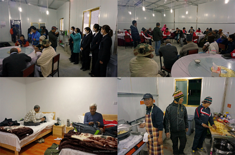
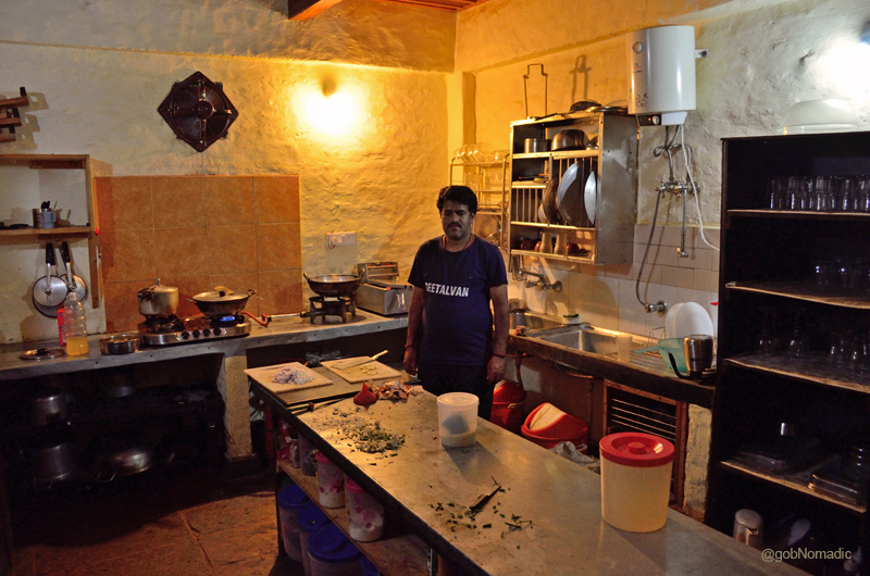
Clockwise from top left: The support staff at the residential complex; Evening briefing in progress; the accomplished mountaineers-turned-cooks inside the kitchen; at the room, Sh Noratmal a survivor from 2013 Kedarnath tragedy and Sh BK Chaturvedi from Delhi occupied with their phones
Homestay Review: Seetalvan Orchard at Kotgarh

Seetalvan Orchard is a Homestay located in a natural exquisite setting of the Kotgarh hills in Shimla district of the state of Himachal Pradesh. Looked after by an enterprising lady, who has tastefully converted her family-owned orchard into a modern-day rejuvenation centre; the Seetalvan offers an idyllic break from the humdrum of city-life. A few days ago, I stayed here for three days and this is what I have to say about them and the region.
The Seetalvan Orchards and Homestay at Kotgarh. More pics from the region at Flickr
About Kotgarh (1950m)
The Valley of Kotgarh, popularly known as the valley of Golden Apples lies at a comfortable drive of 30 minutes (16 km) from Narkanda on the Shimla-Rampur highway. The small settlement on its hillside, a historic village on the erstwhile Hindustan – Tibet highway, is enveloped by a dense forest cover of deodars, pines, spruce and oaks. In its heyday, due to its comfortable-cum-strategic location on the erstwhile trade-route, the village was no less popular than Shimla. Whereas, Shimla evolved to become the popular summer retreat and ultimately the capital of British India, Kotgarh still has been able to almost retain its alluring charm. Read more about Kotgarh and nearby areas including the activities here: The misty hillside of Kotgarh.
The Seetalvan Orchard Homestay (2174m)
The owners of the Seetalvan Orchard bill their property, a modern Homestay, to be an “ideal blend of warmth, rustic appeal and luxury” offering a beautiful view of the middle Himalayas. Enclosed by a densely wooded deodar patch, the orchard comprises basically everything that can be grown on hills of this region. Apart from seasonal vegetables, the produce includes red, golden apples, kiwis, pears, peaches and cherries, etcetera.
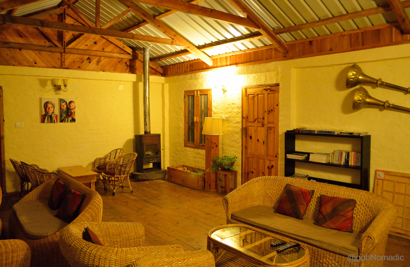
The common room; Notice the fireplace
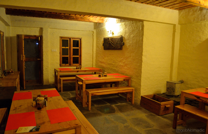
The Dining Hall; the fireplace again
The owners, a Jhina family, pride themselves with giving a personal, cultural and yet modern touch to create a semi-commercial property out of an ancestral estate. Having incorporated the basic fundamentals of modern architecture, the rooms are newly built. The kitchen-staff here has been especially trained to dish out homely north-Indian meals prepared out of locally procured ingredients. “We strive hard to serve tasty, healthy and fresh food so that it’s worth every penny you pay,” asserts the website. The owners also offer to organise sightseeing and adventure walks in the nearby area.
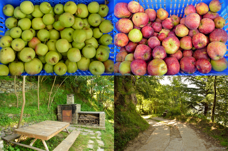
Clockwise from top: Harvested Golden, Red Apples, pathway inside the premises, wood-fired oven
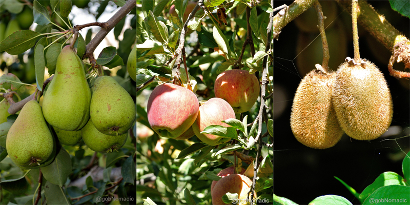
Ready to be plucked fruits: Pears, Red apple and Kiwifruit
My Experience at Seetalvan
I can never get tired of visiting the sylvan Kotgarh-Thanadhar hillside. The reason is obvious; not as much of a touristy region and a more preserved countryside for which I thank the flourishment of apple cultivation in the region. Guest houses or homestays are not plentiful in Kotgarh and finding a fully functional one is not an option; barring a couple of other possibilities. The orchard of Seetalvan is situated a little before the main settlement of Kotgarh. As I crossed Theog, a message from the owner, giving directions of the property, flashed on my phone. With much ease I located it.
The humble entrance to the Homestay; located a couple of kilometer before Kotgarh
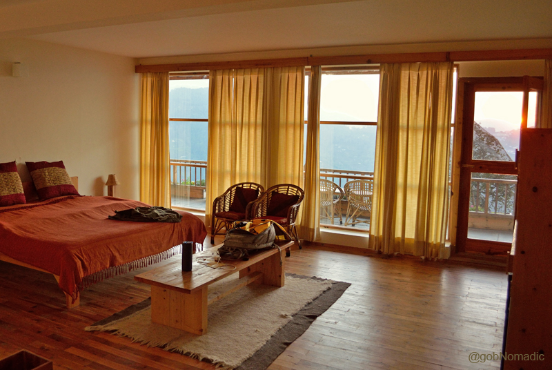
That was my room. Please visit Flickr Photoset for more images of the region
The caretaker, already waiting for me at the parking lot, escorted me to the room. The room was large and spacious for single occupancy or double, in fact, triple even. Minus a TV entertainment, intercom connectivity and Wi-Fi, the accommodation was well-appointed with almost everything one would expect at a luxuriously-billed property. I made myself a cup of tea. Polished in the typical yellow hue, much of the furniture and doorways was made out of deodar wood. The resin smell of the divine timber can actually work wonders and make you even more cheerful which is precisely what happened with me. Outside, the room opened up to a spacious balcony which had some prearranged basic furniture. The view encompassed Kullu and Mandi regions of the Himalayas. The rounded ridges endlessly rippled up far in the sky until they faded into the insipid blues on the horizon. Below me, the smell of recently plucked apples; juvenile magpies chasing each other, conversations of fellow resident-guests and the stretch of the orchard caught my attention. Further down on the valley floor, the mighty Satluj rounded to enter the Kullu region. Claimed to be the oldest organised cultivation, the lush green patch of dense deodars stood towards my left.

The spacious balcony. More images from Kotgarh-Thanadhar at Flickr Photoset

At the breakfast table; the sumptuous meal was washed down with plentiful of fresh Apple Juice
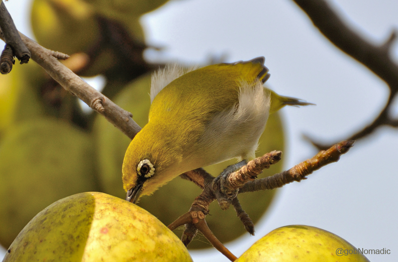
An Oriental White-eye feasting on a ripened Golden Apple
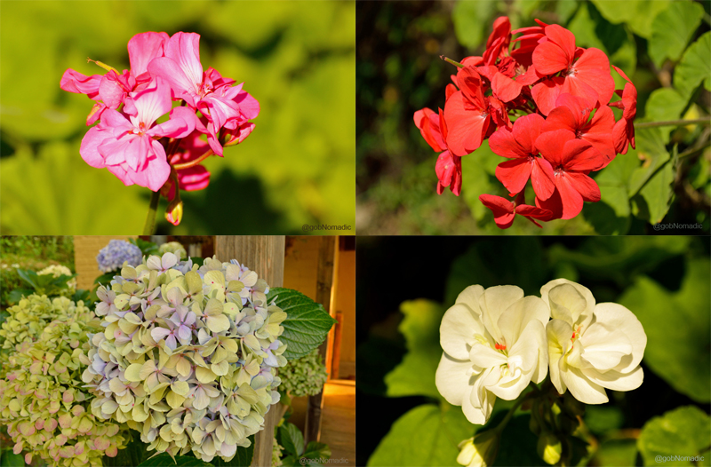
Apart from a variety of fruits and vegetables, the colourful orchard was a riot of seasonal flowers
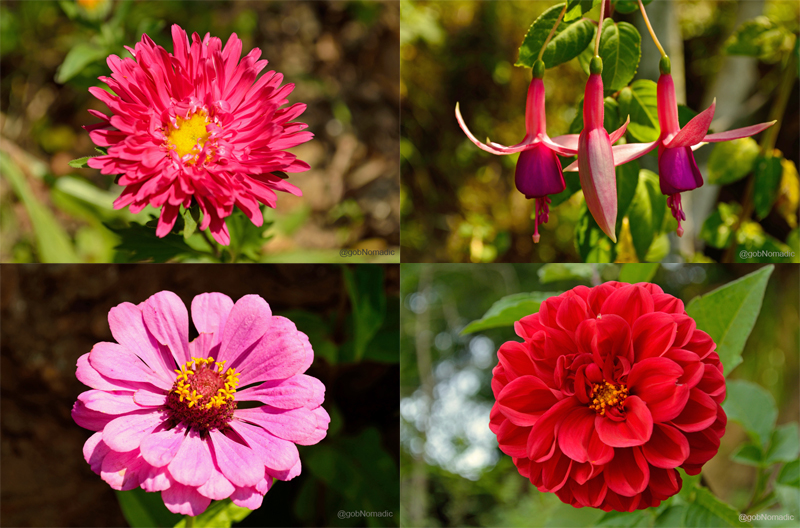
The flowers included dahlias, zinnias, geraniums, nasturtiums, bergenias, pansies, hydrangeas, fuchsias, asters, etc
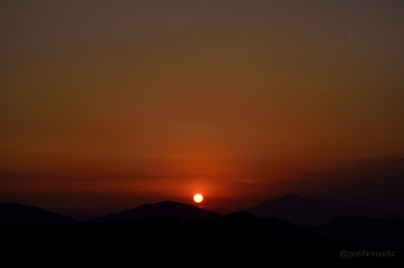
Sunset as observed from the orchard. More images from the region at Flickr Photoset
The common room was equipped with a small library comprising college literature, a couple of board games and a large screen to watch TV or play games. Reached through a stoop, the common-room opened up to a balcony on the right side. It was just an ideal place to grab a hot cuppa and pick a book or something. On one side the view commanded a sweeping Himalayanscape and the orchard on the other. I caught up with the owner Ms Minakshi Jhina, who was completely devoted to the upkeep and maintenance of the property of Seetalvan, her brainchild. With herself hailing from the Kotgarh-Thanadhar region itself; the property demands her attention and involvement all the time despite the staff being local. And she is ever willing; constantly tutoring and guiding her staff, a young, energetic and cultured team of local boys. The support-staff at Seetalvan was keen to accompany me or a walk and show me the terrain. Although, I preferred my own company but I found this willingness or service-option to be fairly useful as it would be of much help to a newcomer into the area.

Ms Meenakshi Jhina, the owner of the Seetalvan Orchards and Homestay
The Kitchen and the Cook at Seetalvan
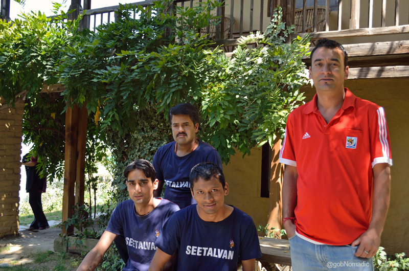
The staff at the Seetalvan Orchards
The way I saw it
Ambience and Location: 4.5/5
Accommodation and Staff: 4.5/5
Food and Dining: 4.5/5
Amenities: 4/5
Tariff: 3.5/5
If you wish to book your stay here, you can contact at +91.980.55.94069 or reach out through their website. It is listed fairly well at most travel planning portals and apps.
Disclaimer: This particular visit to Kotgarh and Thanadhar was based on an invitation from Seetalvan Orchard. The views expressed here are free of any bias and are solely based on my experience.
The Legend of Soldier Saint Baba Harbhajan Ji

The following post is a part of the “Kailash Mansarovar Yatra” Blog Series Into the Sacred Space. To read complete travel memoirs and trip report, please visit here.
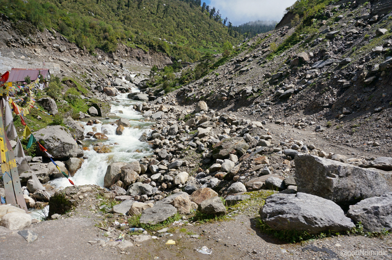
As we prepared to depart from Kyongnosla for our next acclimatisation-halt on way to the Nathula, a small herd of yak-cow crossbreeds, called dzo, trooped on the road. Their herdsman was nowhere in sight. In the excitement of spotting something new, Yaks probably, a few pilgrims started taking snapshots of the domesticated animals that appeared half-asleep and disinterested. It was late morning already.

Misty Kyongnosla, the Fifteenth Mile. Please visit Flickr for more images of the region
Meanwhile, the cooks had assumed complete control over the ration they bought a day before. The entire stock was dutifully packed and weather-proofed in a pickup van which was to transport it to the pass, still a couple of days away. Our next station was Sherathang (4120m), a recently commissioned trading post only six kilometre short of the pass. It wasn’t the best of options for acclimatisation on India side of the pass at this altitude but the infrastructure supported our accommodation and wellbeing.
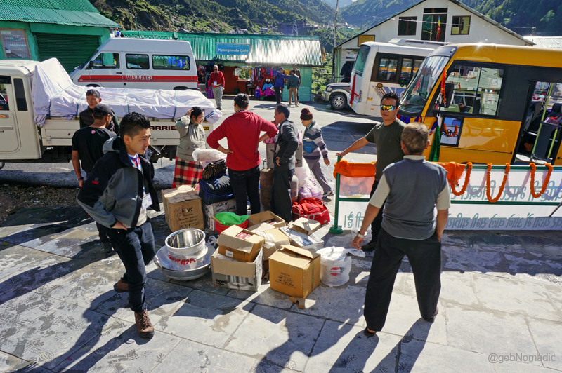
Loading rations and utensils at the Fifteenth Mile; basically whatever role the Food Committee was assigned with
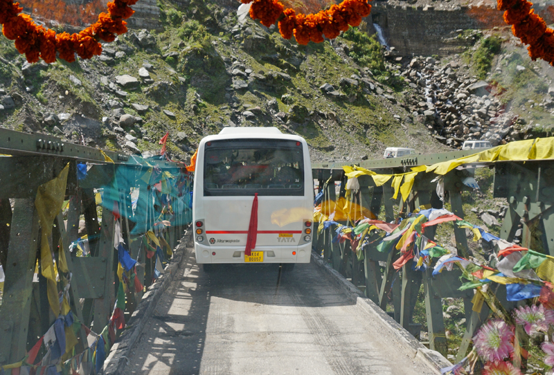
On way yet again. Please visit Flickr Photoset for more images of the region
A stream crossing the road; or vice-versa. More images from the region at Flickr Photoset
As usual babaji initiated the ritual of holy cry of Har Har Mahadeo before we started for the next leg of our journey to the Sacred Space. Located at a distance of 26 km from the Fifteenth Mile on the road to the Nathula, Sherathang is otherwise a military check post. It was identified as the site for trade formalities, on India side, between India and China after the route got opened for trading in 2006. Rinchengang is the corresponding location in Tibet. The road ahead was smoothly tarred and broader as compared to the previous stretch. The mountain crests were too close to one another for a long sweeping view besides looking decidedly grim and barren. I decided to give my snap recorder a rest.

Sherathang; the first centre against the backdrop of a lakelet. More images from the region at Flickr
Although Sherathang is positioned above the treeline, there is plenty of moisture and greenery around. The nearby hills were covered with all sorts of shrubbery and wildflowers. Wedged between the Singalila Range on the west and the Chola Range on the east, the intriguingly moist terrain of Sikkim explains it. The overall alignment – following the east-west orientation, the Great Himalayan Range still further afar to the north – traps the moisture-laden winds coming from the Bay of Bengal. Experiencing an altitude of 4120m on the southern side of the Great Himalayan Range was a first for me.
At Sherathang, ten of us were allotted a spacious dormitory for the next couple of days. The rest of the group members were put into separate rooms in the hutment located on the other side of the main road. Both the centres faced each other. The trading mart and its office were situated within a stone’s throw distance from either centre. There is no market to shop or a café to munch here. A tin-fabricated temple, looked after by the ITBP, was situated adjacent to the centre. The temple blared Krishna and Shiva bhajans almost throughout the day through its basic PA system.

The second guesthouse at Sherathang; the temple to its right. More images at Flickr

The parking and the trading mart at Sherathang. More images from the region at Flickr
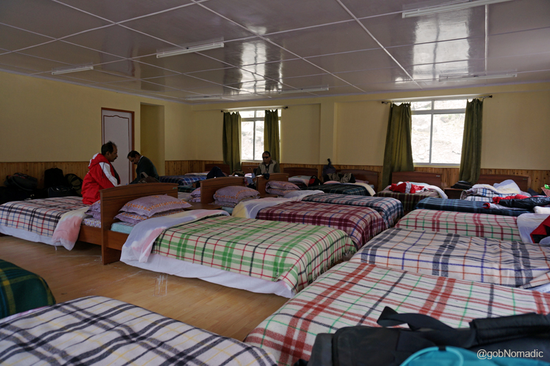
Our dormitory at Sherathang. Please visit Flickr for more images from Sikkim
Our dormitory was located on the third floor of the already higher building. The dining hall was at the third basement of the lower building. It was a task, especially for the elderlies, to move between the two locations. At lunch we were intimated that a medical session, by doctors of the ITBP, will be held in the evening. “The final medical assessment will be held the next evening”, a non-officiating doctor proclaimed even as he put an evil grin on his face. “Those of you who are found unfit will have to go back”, he added impishly. As a result of which, barring a few none looked any further interested in savouring the post-lunch dessert; usually electric-warmed tinned gulabjamuns. The helpless ones started taking an extra dose of medicine to control their fears – mostly related to blood pressure and sugar level. The alarming tone of the doctors had, in fact, amplified the upper blood pressure level in most pilgrims. Having come this far, none of us wanted to be turned back.

Medical check-up on the first day at Sherathang. Please visit Flickr for more images of the region

Our Babaji being given Supplemental Oxygen
We were advised total bodily rest at Sherathang. The pretext for immobility here was acclimatisation. Many of the pilgrims were already taking Diamox to prevent altitude sickness. Several were suffering from headaches, nausea and sleeplessness. I continued on my regimen of extra water intake, ginger and garlic to recalibrate my organs with the reduced levels of oxygen in the air.
The schedule-induced boredom and stagnancy drove me back into the dormitory at the guest house. I picked up my book again. Even though fully aware that we needed to be patient, it was getting impossible to wait for crossing over to the other side of the pass. With the sun playing hide and seek, it was getting misty outside. Inside, a few of the pilgrims had flogged themselves into a trance of chorus singing. They lined out bhajans with tuneless zealotry celebrating the cult of Lord Shiva. When prodded jocosely over and over, babaji belted out Shri Hanuman Chalisa. Almost everyone chipped in.
I was silently observing the proceedings as I updated my travel notes. A kitchen boy walked in to inform the resident-guests that the evening tea was ready along with “pakodas”. People acknowledged with enthusiasm but no one was keen to go all the way down to the dining hall. They continued with their frenzy of reciting shalokas and chants. Having waited for some time and observing that it was turtles all the way down, the kitchen staff had the tea and refreshment sent in the dormitory. Priding themselves for being “notorious” with STDC, the vocalists now gorged on the refreshment until someone reminded them about the evening medical test. I was shooed away when I tried to explain to them an even wider logic of celebrating the natural history of the Himalayas with special reference to the Kailash Mansarovar region.
That evening the results of the medical test terrified all of us. Almost all of us reportedly had a higher upper blood pressure level. Much of it was expected at a higher altitude but a lot of it had to do with the real terror, playing in our minds, of being rejected medically. The young doctor, who was in charge of the medical team of ITBP, complimented me after noticing my excellent oxygen saturation level. My BP was still a notch above the normally expected rate; I squarely blamed the anxiety created by the doctors. The medical brouhaha extended till dinner time after which I made a beeline to the ITBP-managed STD, the last practical option, on the road to the Sacred Space, to connect with the real world.
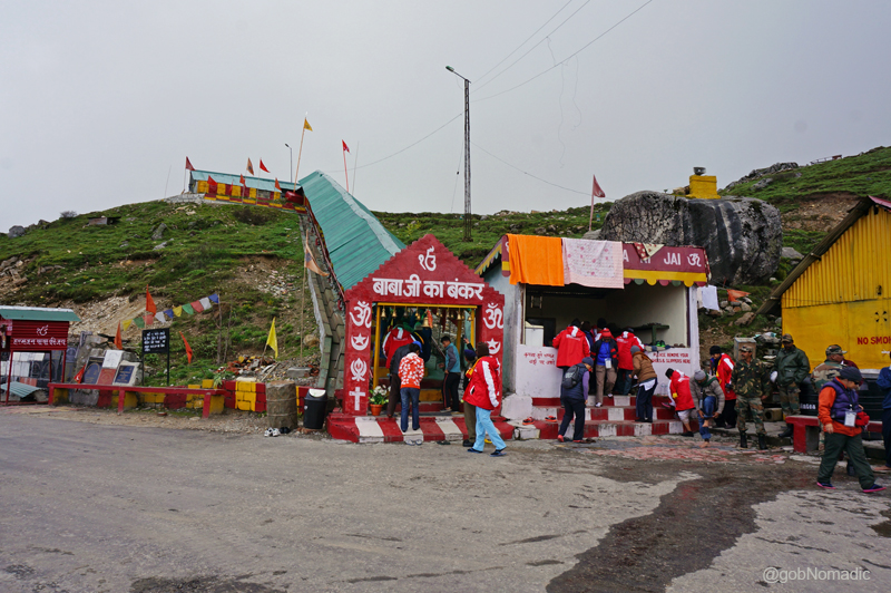
I slept peacefully that night. Some of the pilgrims who were on Diamox complained of sleepless the next morning. How could they discount intake of water I told them. Before I could grumble about boredom to the STDC, seeking some change in routine for the day, the news of visiting the terrain towards Jelepla (4267m) side and the famed Babaji ka Mandir, a shrine dedicated to the solider saint, was already doing the rounds.
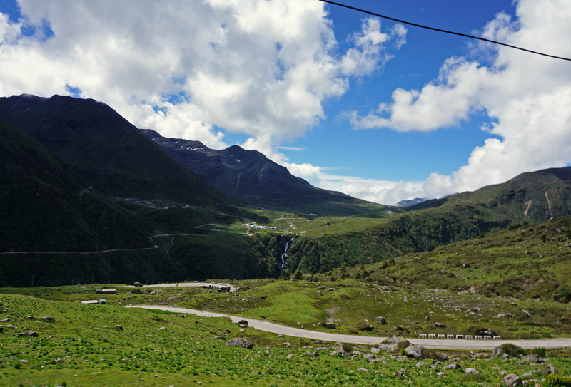
View towards the Kupup Valley. For more pics from the region, please visit Flickr Photoset
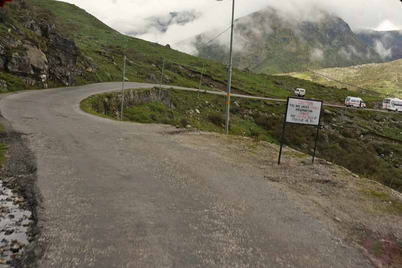
Caution: You are under Chinese Observation
Caressing slopes of the Nathula, the road led us onto a wide open pastureland of Kupup. The newer shrine- Baba Mandir – dedicated to the Baba was built at the junction of Kupup Gnathang, the black meadow, road and a trail leading to Menmecho Lake. At the mandir, a modern PA system blared out Sikh gurubanis. A uniformed Sikh soldier was stationed at the shrine to give prasad to the visitors. Nearby just below the Namnang Chho waterfalls, the Indian Army has also built a shrine dedicated to Lord Shiva. None of us had any idea about the fascinating history behind the locally revered solider saint of Sikkim until the guide initiated us into its story.
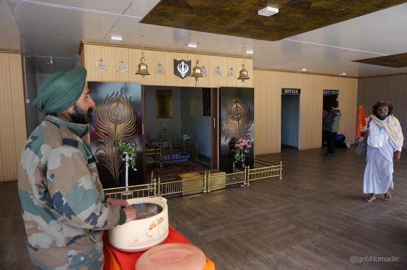
Inside the new shrine dedicated to Babaji. For more images from the region, please visit Flickr

A recently built Shiva shrine just below the Namnang Chho waterfalls. More at Flickr
Baba Harbhajan Singh Ji was an Indian army soldier who died in a weather-related accident on a remote outpost manning the treacherous Indo-Tibetan frontier. In real life, he served with full vigour and dedication. Legend has it that to this day he continues to guard the frontier and assists the soldiers stationed there. He is said to have himself led the search party to the site of his death to help them locate his body. Obliging to his request, which he apparently made in dreams of his fellow soldiers, his Samadhi and a shrine was later raised on the slopes of Tukla where his company was posted. It is claimed that the Baba visits this shrine, an army-bunker almost every night and make use of all his belongings including uniform and beddings after which he dutifully patrols the area. Still drawing his official salary, it is claimed; the departed soldier-turned-invisible-saint answers prayers of those soldiers who seek his help and look for guidance on the battlefield. Today, the legend and shrine of Babaji have become a star tourist attraction of East Sikkim.

The olden temple dedicated to Babaji. Please visit Flickr for more images from the region
Babaji ka Bunker, an underground shelter. More images from the region at Flickr
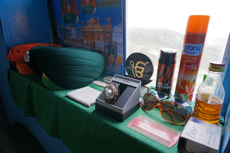
Babaji’s belongings inside the bunker. Please visit Flickr for more images from the region
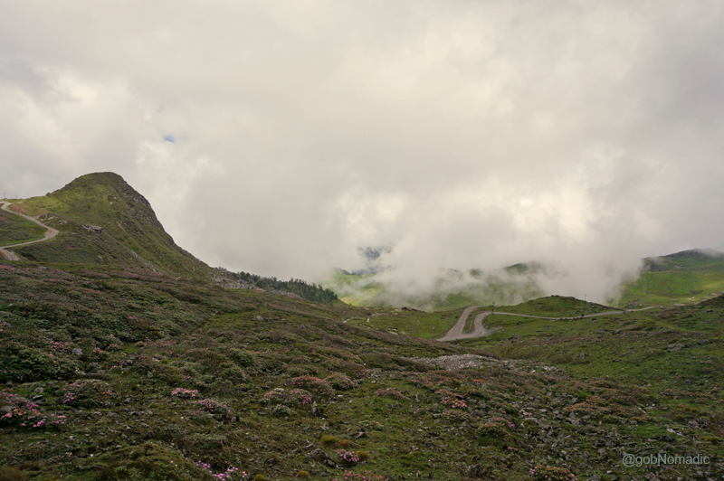
Wildflowers and the Tukla Valley. More images from the region at Flickr Photoset
View towards the Jelepla and Kupup Valley down below. More images at Flickr Photoset
Still misty, the Kupup and Tukla valley terrains were blocked by a cover of cloud. At best I could see some wildflowers and wild rhubarb on the slopes. Driven by curiosity, eyes were fixed on the Chinese army bunkers towards the Jelepla, “The Lovely Level” side where the view was still clear. The landscape encompassing the Kupup Lake, an army golf course, even higher pastureland and an upper valley that led to the Jelepla, once a popular route to crossover to Tibet, made famous by Francis Younghusband to reach Lhasa was visible now. The Kupup camping grounds used to be traders’ first preference for a camping-halt. Many small streams meander down the valley from the slopes; creating a lakelet which gave the traders and now the stationed troops with some recreational means in this otherwise a dreary terrain. Quickly enough we were transported back to Sherathang after the news of arrival of Chinese Ambassador to India trickled in.
Arrival of the Chinese Ambassador to India at Sherathang. More images from the region at Flickr

The mountaineers-turned-cooks sorting out the ration after a fresh set of instructions came from the China-side. More at Flickr

The final briefing session at Sherathang. Please visit Flickr for more images from the region/ Yatra

Sh Tarun Vijay, Member of Parliament, Rajya Sabha greeting the travellers. More images at Flickr
Back at Sherathang, after the evening tea, our LO handed us a fresh list of items that were banned for entry into Tibet by the Chinese authorities. The arrival of the list basically meant that our cooks and the foods committee had to rearrange the ration. Meanwhile, the finance committee collected dollars from everyone to deposit combined yatra fee to the Chinese authorities, the next day. The luggage committee carefully marked the individual baggage that we intended to leave behind at the acclimatisation centre. The STDC had organised currency exchange in the dining hall. Once across the border, only dollars could be used for any currency exchange. Smartly enough, the medical team of the ITBP organised the final medical check-up without any formal warning which helped curtail our anxiety. I was relieved to see that all of us were declared medically fit for the journey ahead. A final briefing session was organised which was attended by regimental heads of the stationed forces, doctors, STDC staff, customs and a surprised visitor Sh Tarun Vijay, Member of Parliament who was to led us for the journey ahead. The customs and immigration people completed most of their formalities after dinner in the dining room itself. The excitement was back in the group. The younger ones gobbled up a rich supply of gulabjamuns before calling it a day.
Happy Sleepy Panda!


